Cyclon Amphan - DLR supports with satellite images
29. May 2020
Cyclon Amphan - DLR supports with satellite images
Cyclon Amphan over the Bay of Bengal on May 18, 2020.
Credit:
NASA
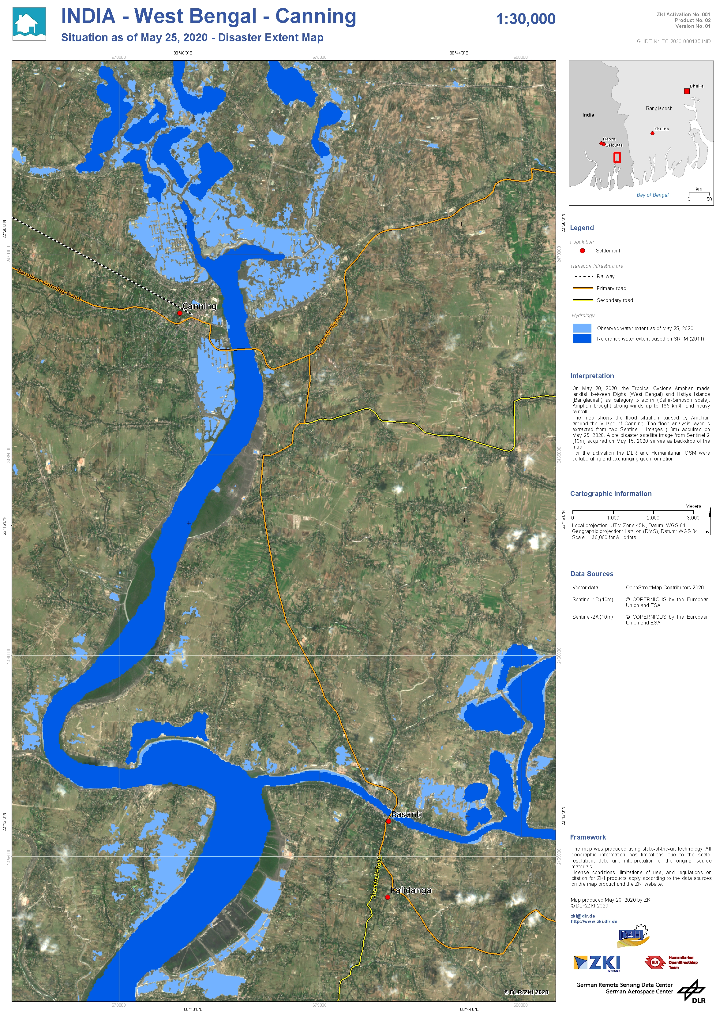
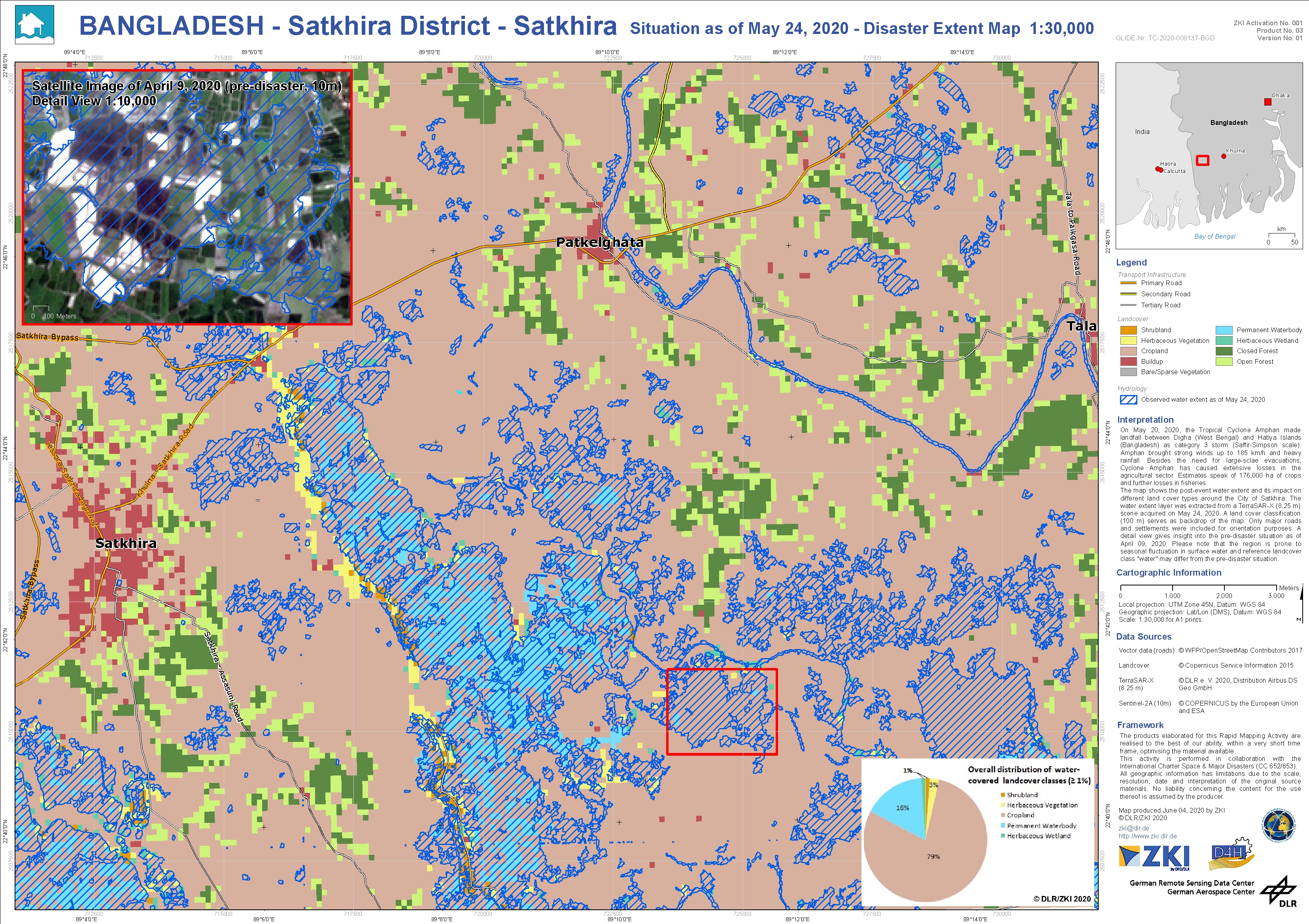
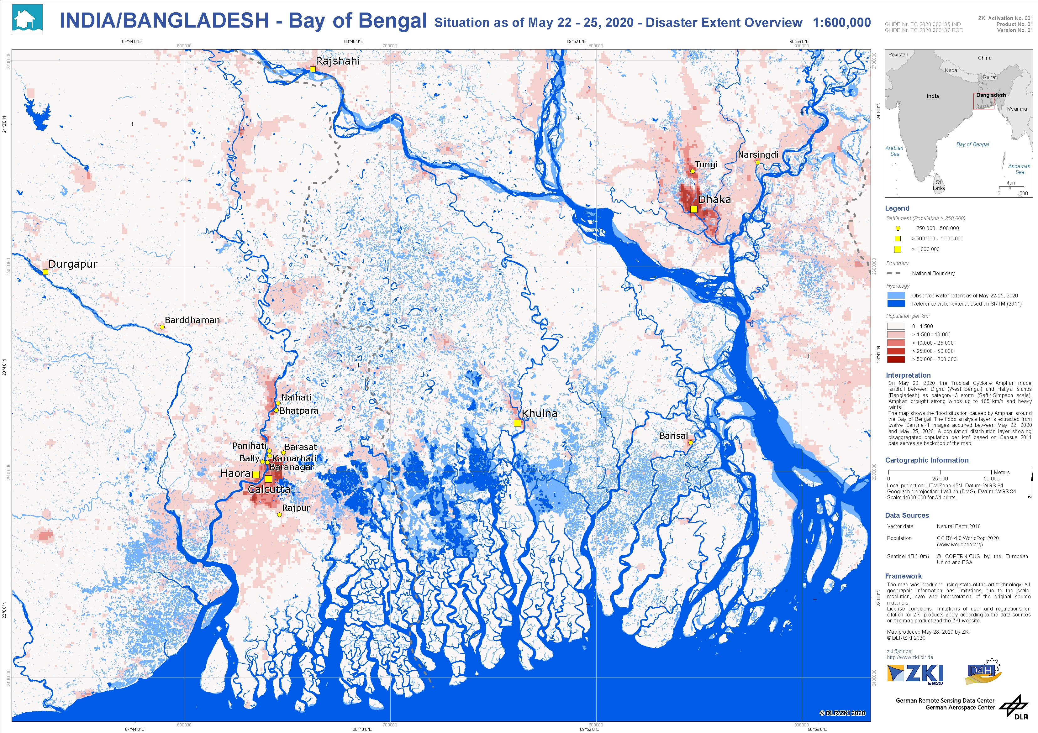
On May 20, 2020, tropical cyclone Amphan made landfall on the northeast coast of India and the south coast of Bangladesh. According to the Indian Meteorological Service, it is one of the worst storms in the region in the last 20 years. More than three million people were taken to emergency shelters. This is a particular challenge due to the corona pandemic. Especially affected are the large city of Calcutta in the northeast of India and the coastal regions there, which are characterized by simply constructed houses.
As part of the International Charter Space and Major Disasters, DLR is supporting the project by supplying TerraSAR-X data. In addition, various flood layers were generated by DLR's automated flood processors (Vectorfiles for download below), realised on a best effort basis, within a very short time frame, optimising the material available. Special hotspots are displayed by ZKI in the form of flood masks visualised on situation maps. The hotspots are also defined together with relief organisations. In this case, this is done within the framework of the "Data4Human" project.
In the project "Demand-driven Data Services for Humanitarian Aid" (Data4Human) remote sensing data and other data sources are to be analysed in order to show continuous usage possibilities in a humanitarian context. This is because in the event of a crisis, humanitarian aid organisations often do not have up-to-date situation information at the required level, which they would urgently need for many areas of operational decision-making and situation assessment. The subject areas and areas of application of the project are defined closely between DLR staff and humanitarian aid organisations and, as in the present case, adapted to current events.
Products
India – Tropical Cyclon Amphan – P02 – Situation map Canning and region showing the flood situation as May 25, 2020 – Sentinel-1