ZKI-Support for India and 6 other disaster regions
17. July 2020
ZKI-Support for India and 6 other disaster regions
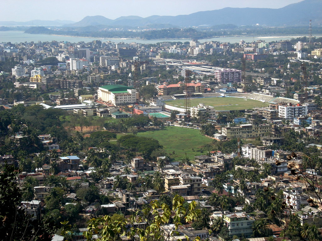
Guwahati - Metropolis in the state of Assam.
Credit:
CC BY-SA 2.0
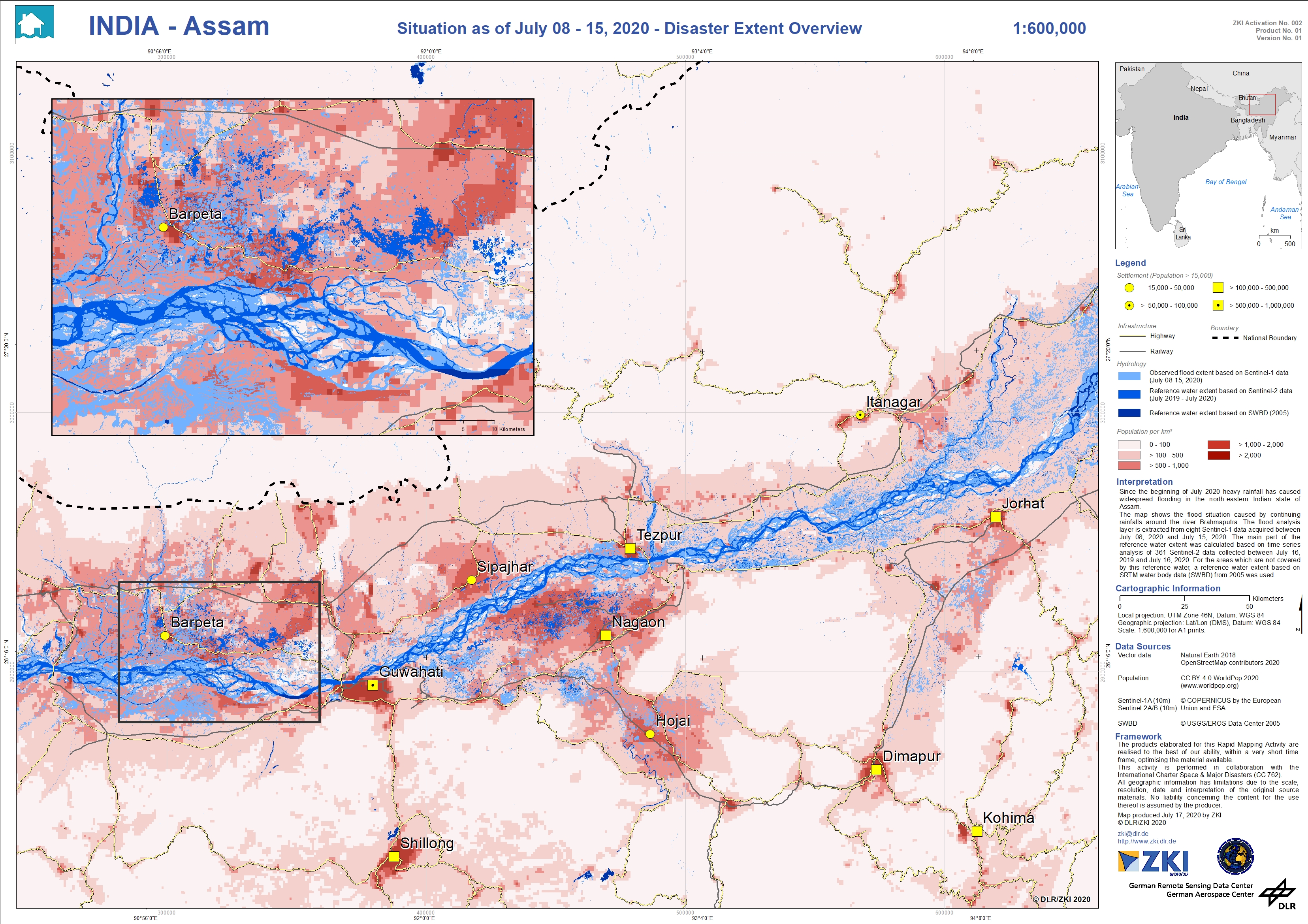
Within the framework of the International Charter 'Space and Major Disasters', DLR-ZKI has been activated seven times in the past two weeks, six of the activations being due to heavy rainfall with subsequent flooding and landslides in Asia (Indonesia, India, Bangladesh, Nepal, Japan, and Myanmar). DLR-ZKI is developing map products for the floods in India, State of Assam. The flooded areas visualized on the maps were derived from earth observation data in near real time using automatic flood processors of DLR-ZKI. In addition, DLR-ZKI provides radar data from the national satellite mission TerraSAR-X over the affected areas for all activations within the International Charter 'Space and Major Disasters'.
In India's northeastern state of Assam, heavy rainfall has been occurring for over two weeks. These have caused widespread flooding and landslides. One of the longest and most water-rich rivers in Asia, the Brahmaputra, already burst its banks at the end of June and forced many inhabitants to leave their now flooded villages. More than 2 million people are affected by the floods and there have already been at least 50 deaths. In 20 districts of the state of Assam, 480 relief camps have been set up so far, which are to provide temporary accommodation for more than 60,000 people. Although monsoon rains are common in this region, this year's situation is particularly devastating because of Covid-19, affecting relief efforts.
Products
India – Heavy rainfall in the state of Assam – P01 – Overview Map of the flood situation as of July 18 to July 19, 2020 – TerraSAR-X