07. August 2020

Explosion in Beirut, Lebanon

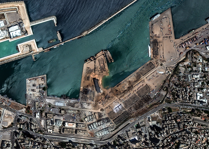
High resolution satellite image of the damaged harbour of Beirut, Lebanon.
Credit:
© 2020 European Space Imaging
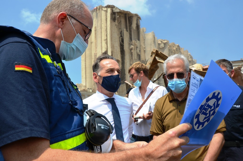
THW shows Foreign Minister Heiko Maas the current situation after the explosion in the harbour of Beirut using ZKI map products.
Credit:
THW/Georgia Pfleiderer

On August 4, 2020, a heavy explosion in Beirut, the capital city of Lebanon, killed over a hundred people and left many hundred thousand homeless. The explosion took place in the harbour area at 18:08 local time. It was probably caused by a large quantity of ammonium nitrate stored at a warehouse in the port.

The DLR/ZKI maps show the damage situation on August 5, 2020. After comparing a pre-event-scene with this post-event-image, both with a very high special resolution, it is possible to give an overview of the affected area and an estimation of the damage extent.

Products

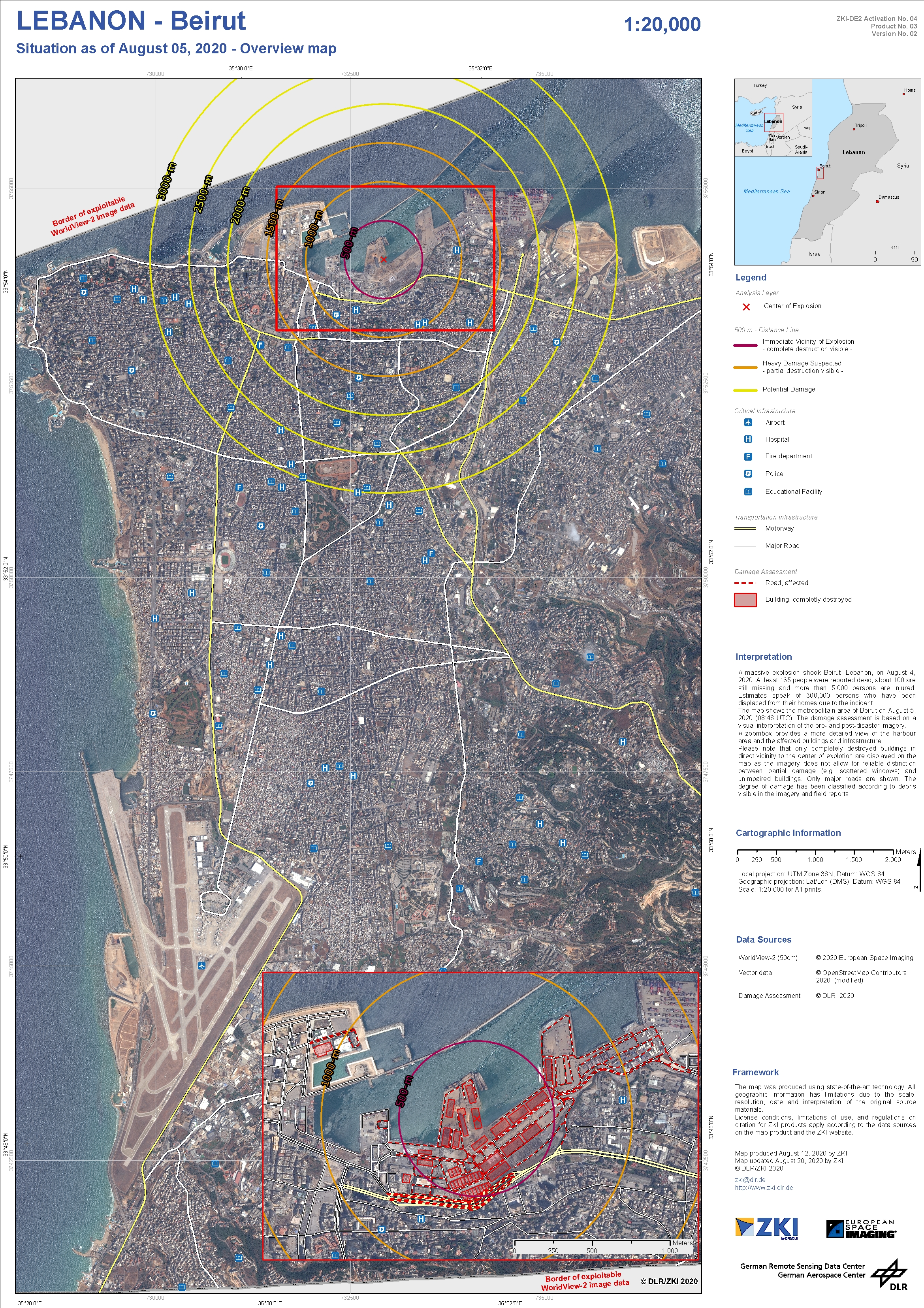
Lebanon – Industrial accident in Beirut – P03 – Overview Map

Creation Date 12. August 2020

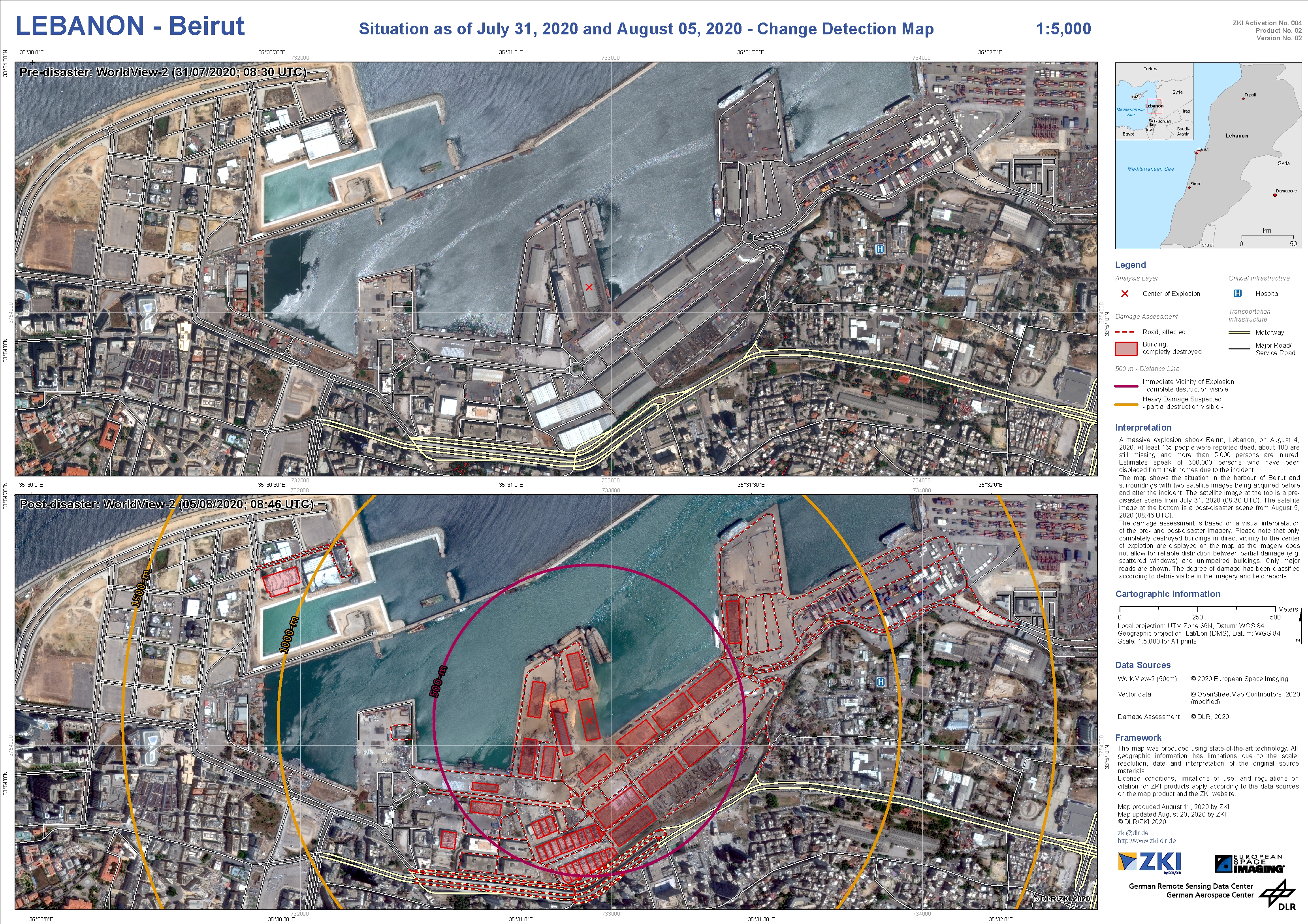
Lebanon – Industrial accident in Beirut – P02 – Change Detection Map

Creation Date 11. August 2020

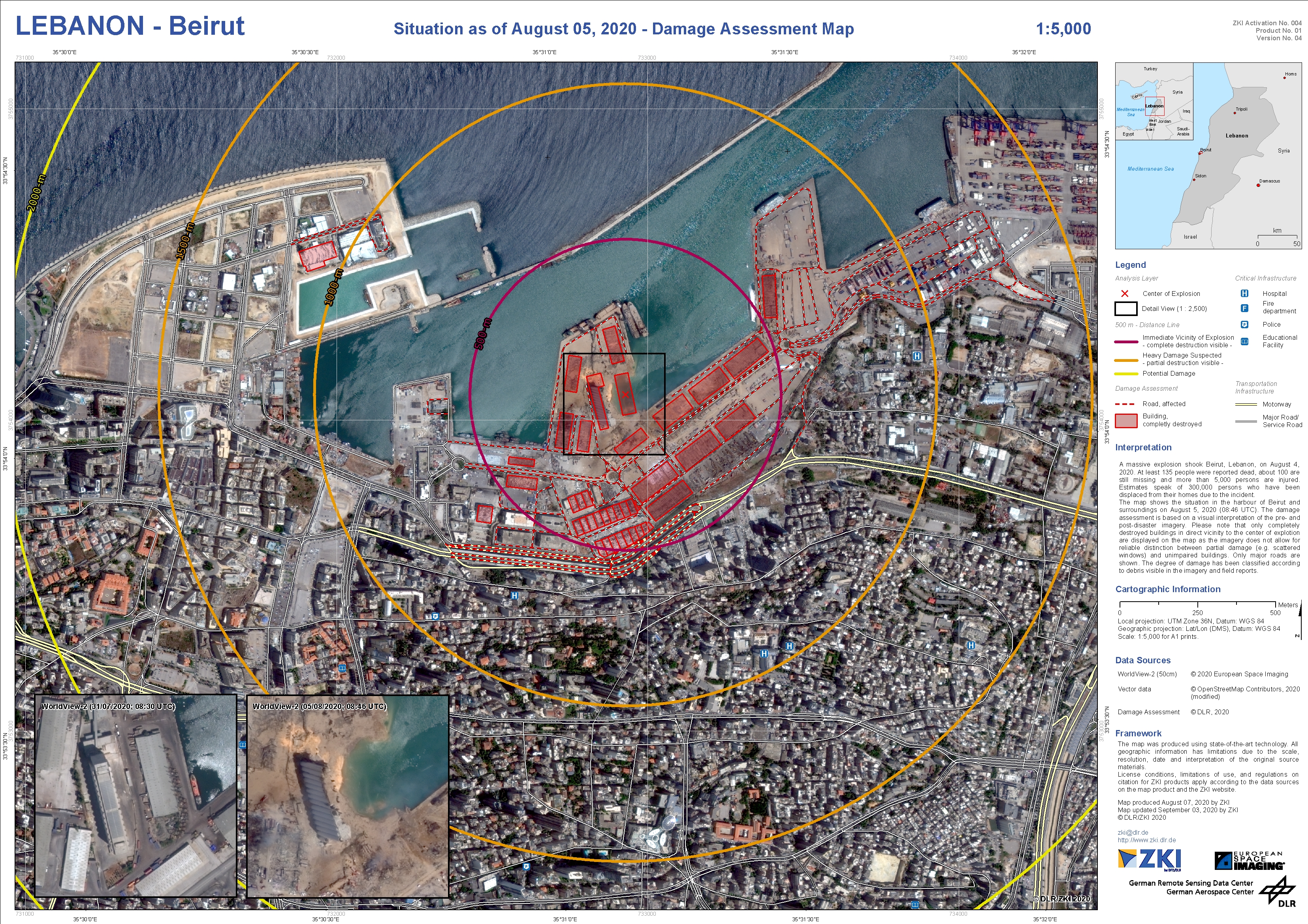
Lebanon – Industrial accident in Beirut – P01 – Damage Assessment Map

Creation Date 07. August 2020