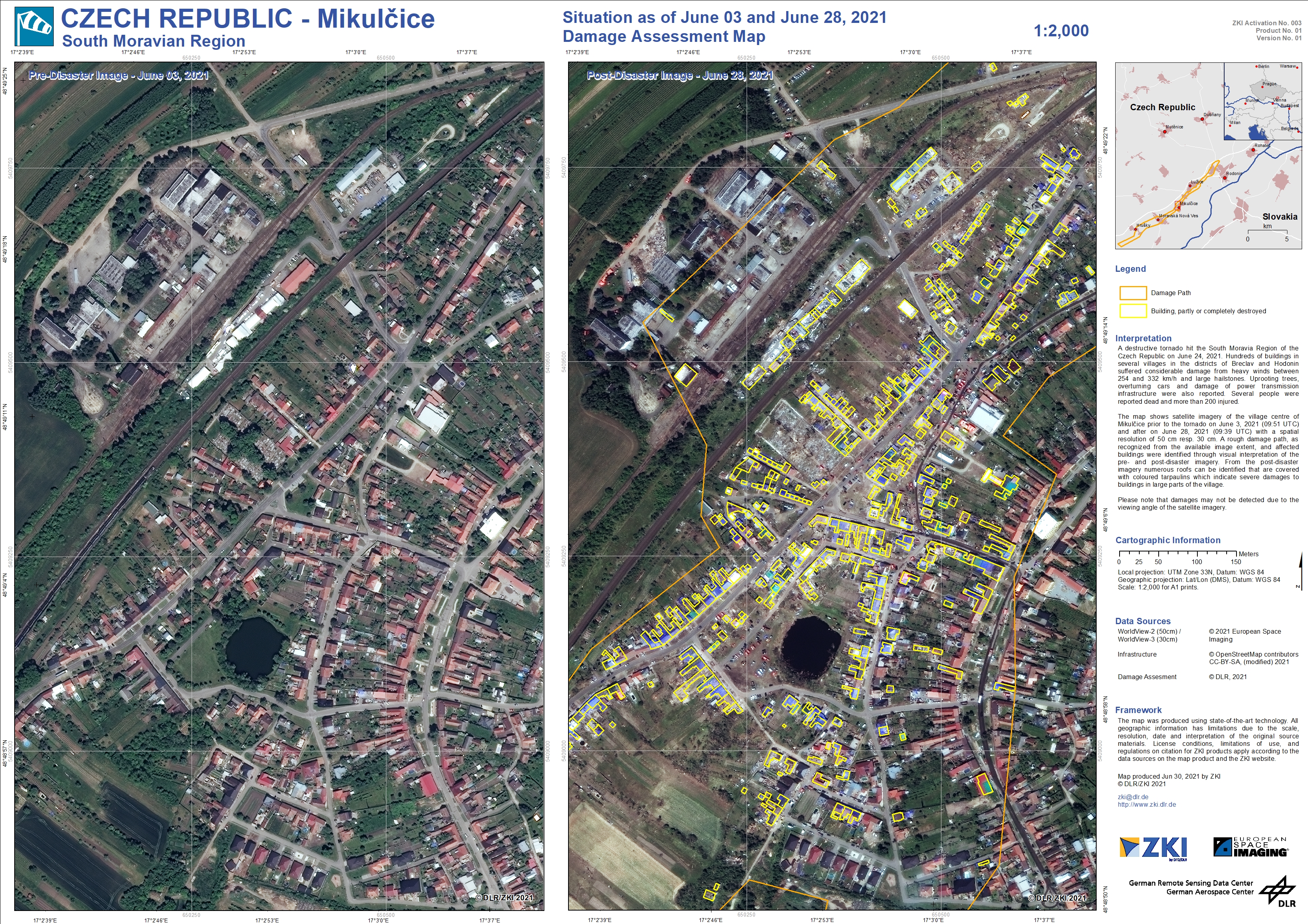
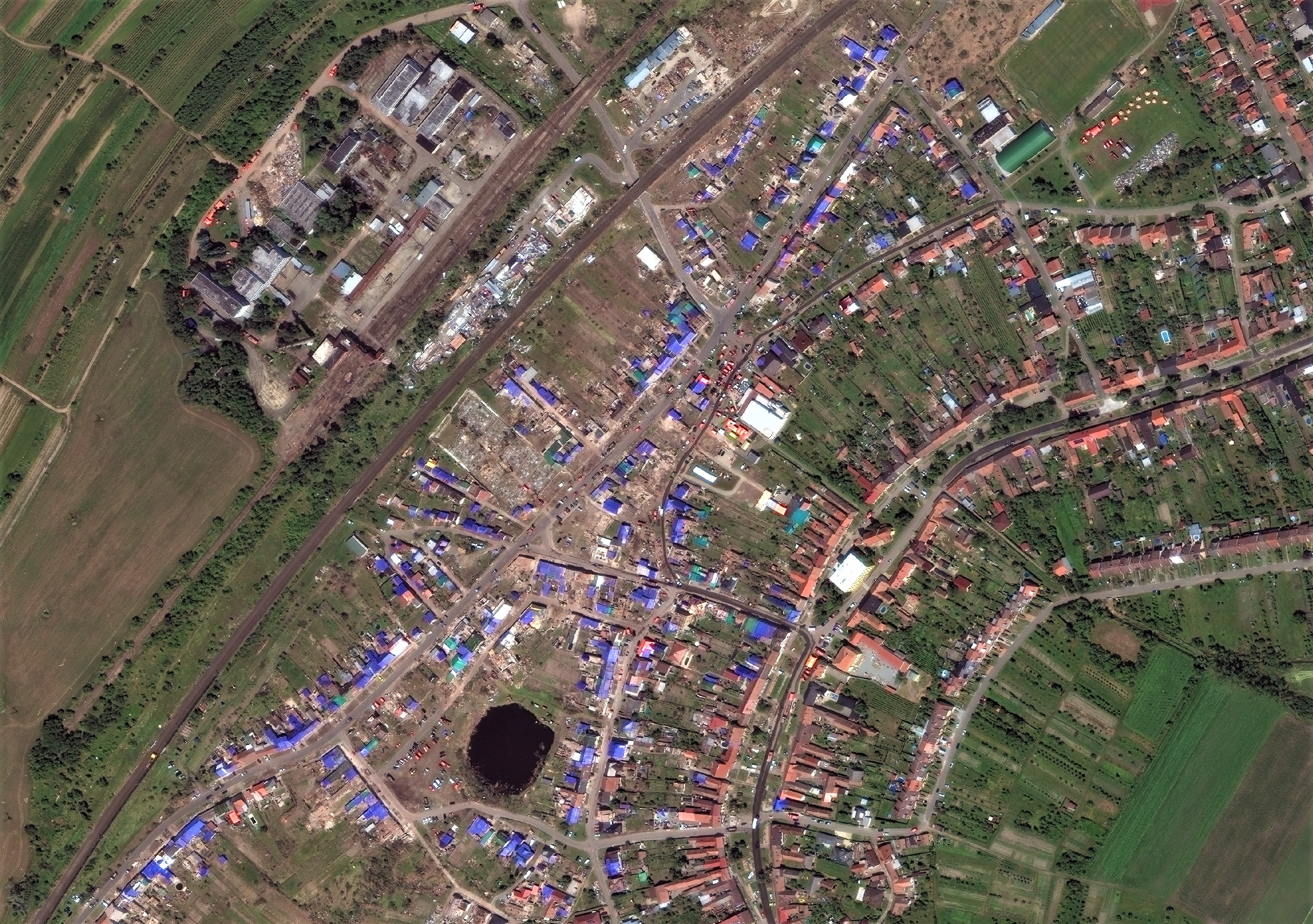
An unusually strong tornado by European Standards, reaching category F3/F4, passed through the South Moravian region of the Czech Republic on June 24, 2021. The tornado claimed several casualties and more than 200 injuries. Seven villages located between Břeclav and Hodonín were devastated by the destructive winds with speeds between 254 and 332 km/h accompanied by hailstones of above-average size. Besides severe damages to buildings, uprooting trees, overturning cars and damage of power transmission infrastructure were also reported.
The DLR/ZKI map shows the damage situation on 28 June 2021. By comparing very high-resolution satellite image scenes before and after the event, it is possible to identify the areas severely damaged by the storm.
In addition to this manual analysis by experts, the data will be used to validate and further improve new artificial intelligence algorithms developed at DLR. The AI approach has been trained to detect complete or partly destroyed buildings using real crisis scenario data. These will support rapid mapping activities in the future to accelerate the mapping process.
Products
Czech Republic - South Moravian Region - Tornado - P02 - Overview map of the damage from September 03, 2019, June 03, 2021 and June 28, 2021
