Exercise: ZKI presents new methods for situational awareness during large live exercise in Salzburg
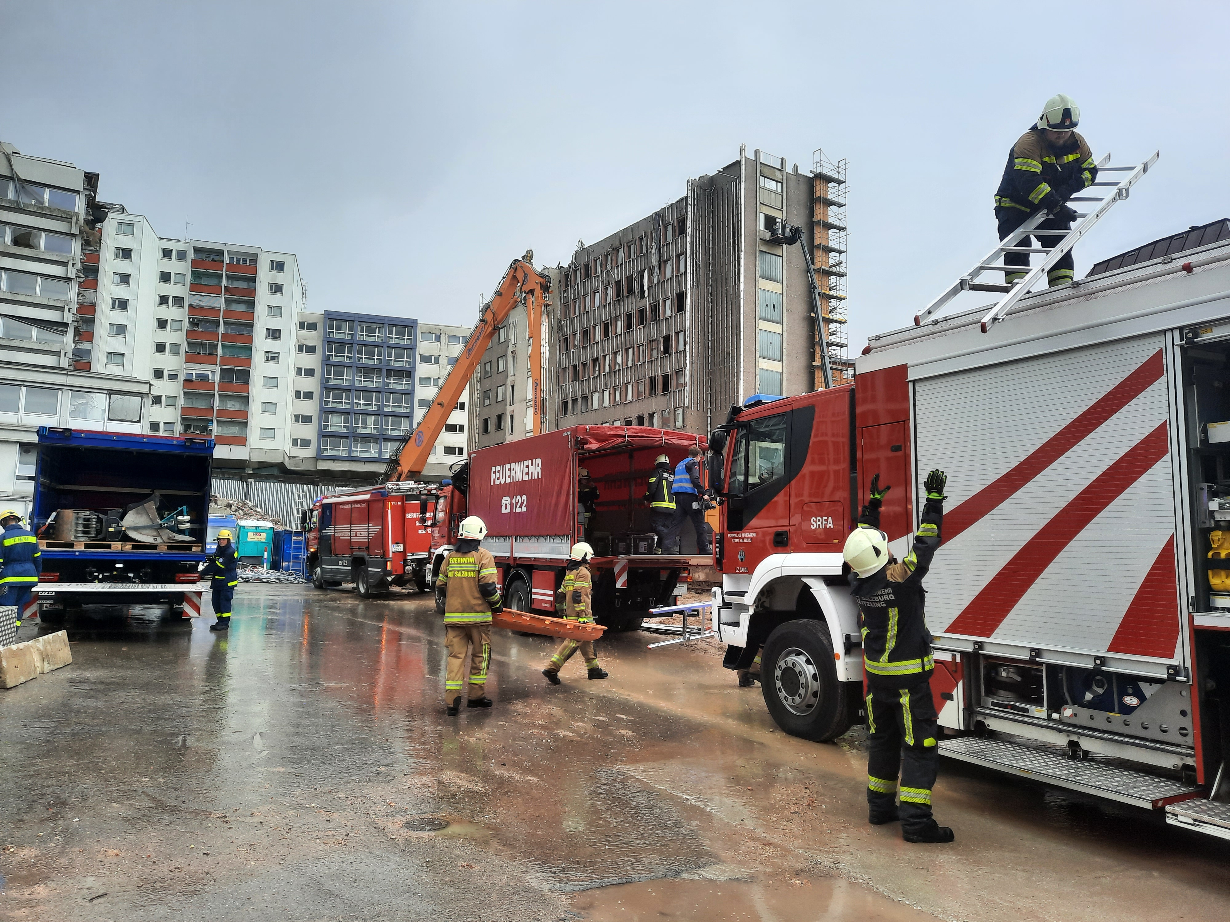
In the context of a large international civil protection exercise at the 29. April 2023 in which over 800 rescue forces from the Bavarian Red Cross (BRK), the Austrian Red Cross (ÖRK) and the Federal Agency for Technical Relief (THW) participated, the final demonstration of the AIFER project took place in Salzburg.
In a fictional scenario a flooding caused heavy damage in different areas. Among the exercise tasks were the search of multiple persons in a collapsed building or the rescue of inhabitants from floating roofs, which were specially created for this exercise. The ZKI of the DLR supported the emergency forces with up to date earth observation data and with analysis results from AIFER integrated in crisis maps and web applications.
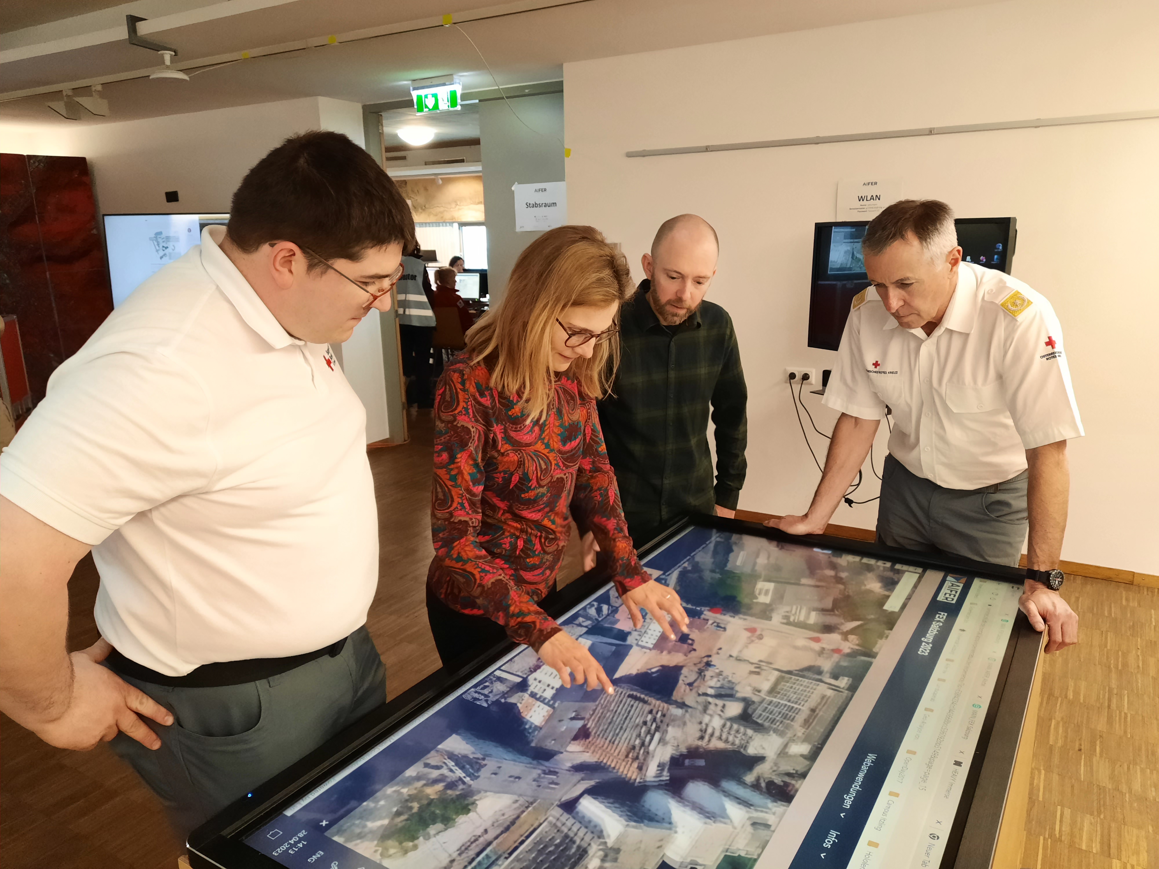
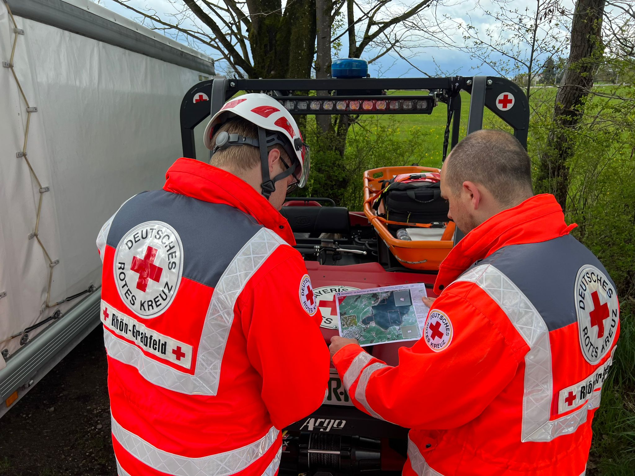
Before the exercise took place high resolution optical satellite imagery was acquired for the different scenario areas. Even floating roofs in the Wallersee near Salzburg were captured from space in order to gain realistic insights of the made-up crisis scenario. Together with local rescue forces additional drone flights were coordinated above the scenario areas. In a next step the captured drone images were processed by the ZKI to georeferenced orthophotos. These images were then used as the input for the in AIFER developed AI algorithms which detected the position of buildings and vehicles. In preparation to the live exercise the captured satellite imagery, orthophotos and object detection results were integrated in situational awareness maps and a multimodal web application. During the exercise these products were available for the central coordination center and participating emergency forces in the field. Results from the research project FOPOS made it possible to apply new methods for the 3D reconstruction and visualization in the disaster context. As an outcome, a high detailed 3D model of a collapsed building could be created with the captured drone imagery and additionally integrated in the web application. Geodata from the City of Salzburg could also be added and made it possible to compare the area before and after the crisis event in 3D.
During the large scale exercise the staff in the central coordination center could access the collected situational awareness data with printed out maps and through the web application. Especially useful was the possibility to visualize and interact with the 3D situational awareness model on a touch-table, which was made available by the University of Salzburg. The large surface of the table made an intuitive interaction with the collected geodata possible and gave a deep insight in the crisis situation. For emergency coordinators the exploration of the generated 3D model of the collapsed building in the application was a perfect tool to gain situational awareness on site. In the application the integrated tools allowed for a precise measurement of distances and areas, which can be helpful for the planning of medical infrastructure in the vicinity of the crisis site. Additional to the prepared geodata, single images which were taken on site, were also integrated and gave more insight of the current situation.

Demonstration of the 3D web application. Quelle: @DLR 2023
As example, two ZKI-maps are available here. We are happy to provide more ZKI-products and the access to the mentioned web application to civil protection authorities and organizations. Please contact us via E-Mail (zki[at]dlr.de) or call us directly.
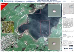
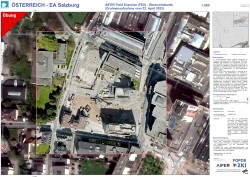
Austria - EA Seekirchen am Wallersee, AIFER Field Exercise (FEX) - Overview Map (Satellite and drone imagery from 22. April 2023)
Creation Date 24. April 2023
Austria - EA Salzburg, AIFER Field Exercise (FEX) - Overview Map (Drone imagery from 22. April 2023)
Creation Date 24. April 2023