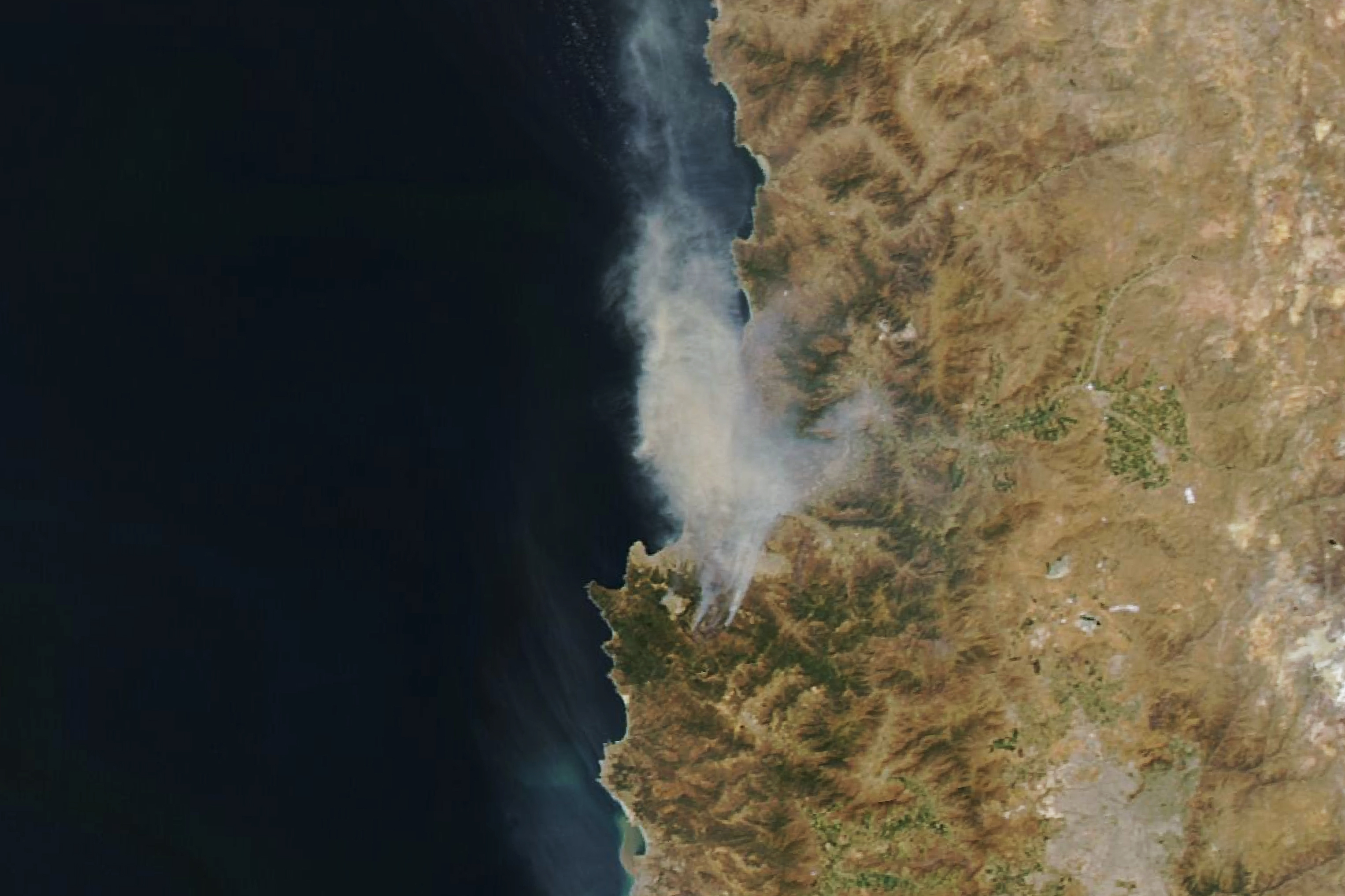
After days of intense summer heat, devastating fires broke out in the Valparaíso region of central Chile. The wildland fires destroyed thousands of homes and claimed several casualties and injuries.
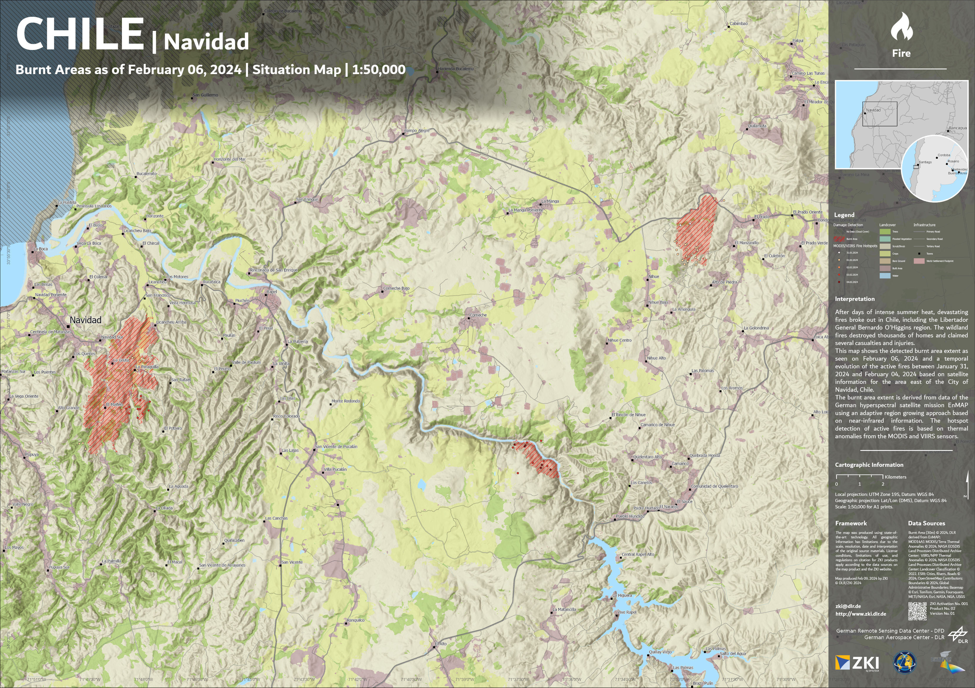
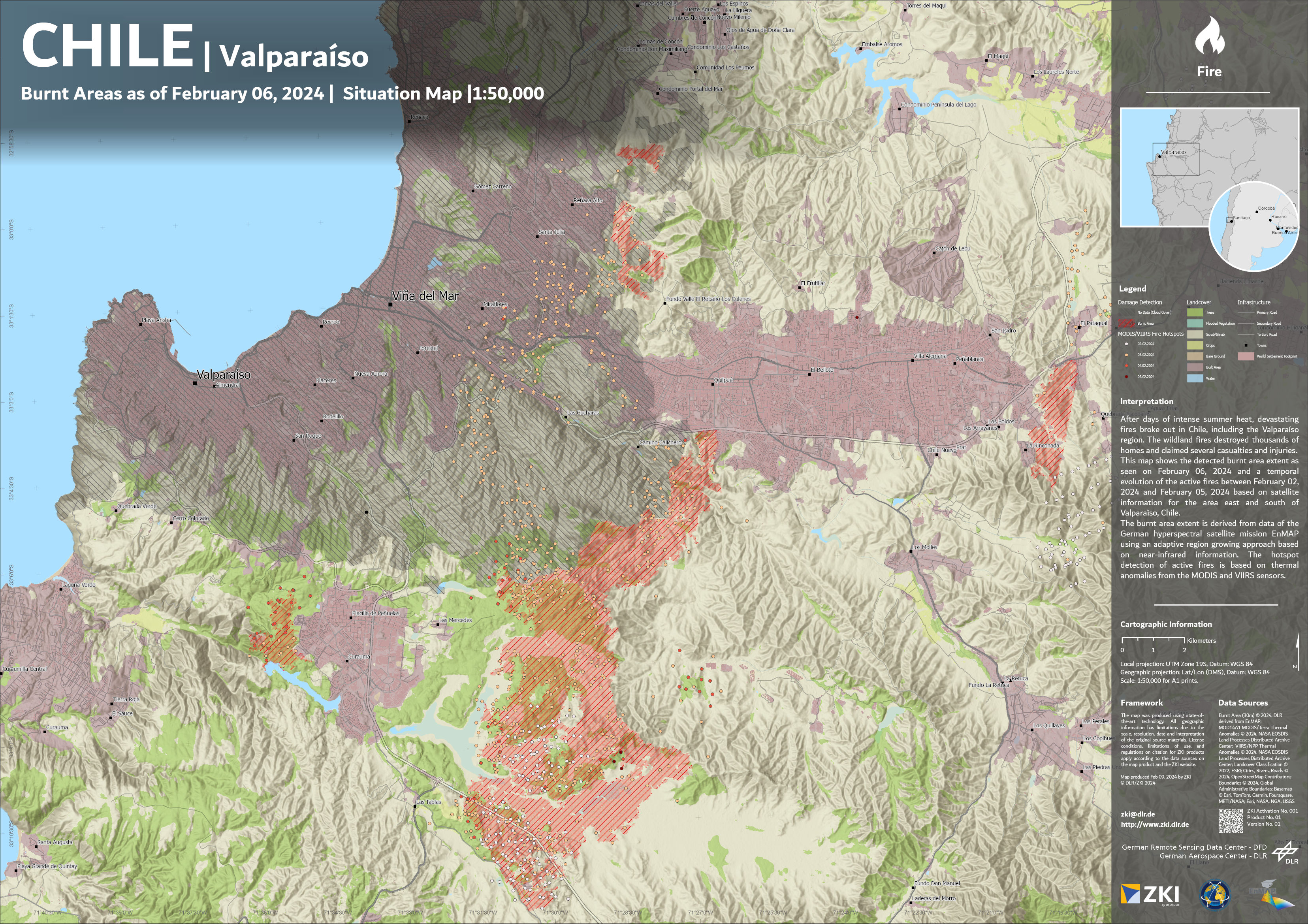
The Center for Satellite-based Crisis information (ZKI) of DLR created maps for this disaster, based on data of the German hyperspectral satellite mission EnMAP in the frame of the International Charter of Space and Major Disaster.
These map products illustrate the detected burnt area extent as seen on February 06, 2024 and a temporal evolution of the active fires between February 02, 2024 and February 06, 2024 based on satellite information for the area east and south of Valparaìso and for the area east of the City of Navidad, Chile.
The burnt area extent is derived from data of the German hyperspectral satellite mission EnMAP using an adaptive region growing approach based on near-infrared information. The hotspot detection of active fires is based on thermal anomalies from the MODIS and VIIRS sensors.
Products
Chile - Navidad - Burnt Area - P02 - Burnt Area as of February 6th 2024 - Situation Map