Flooding in Southern Germany
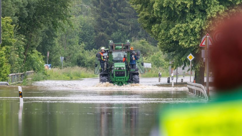
Extensive flooding in Bavaria.
Credit:
© Bayerische Staatskanzlei (StK) 2024
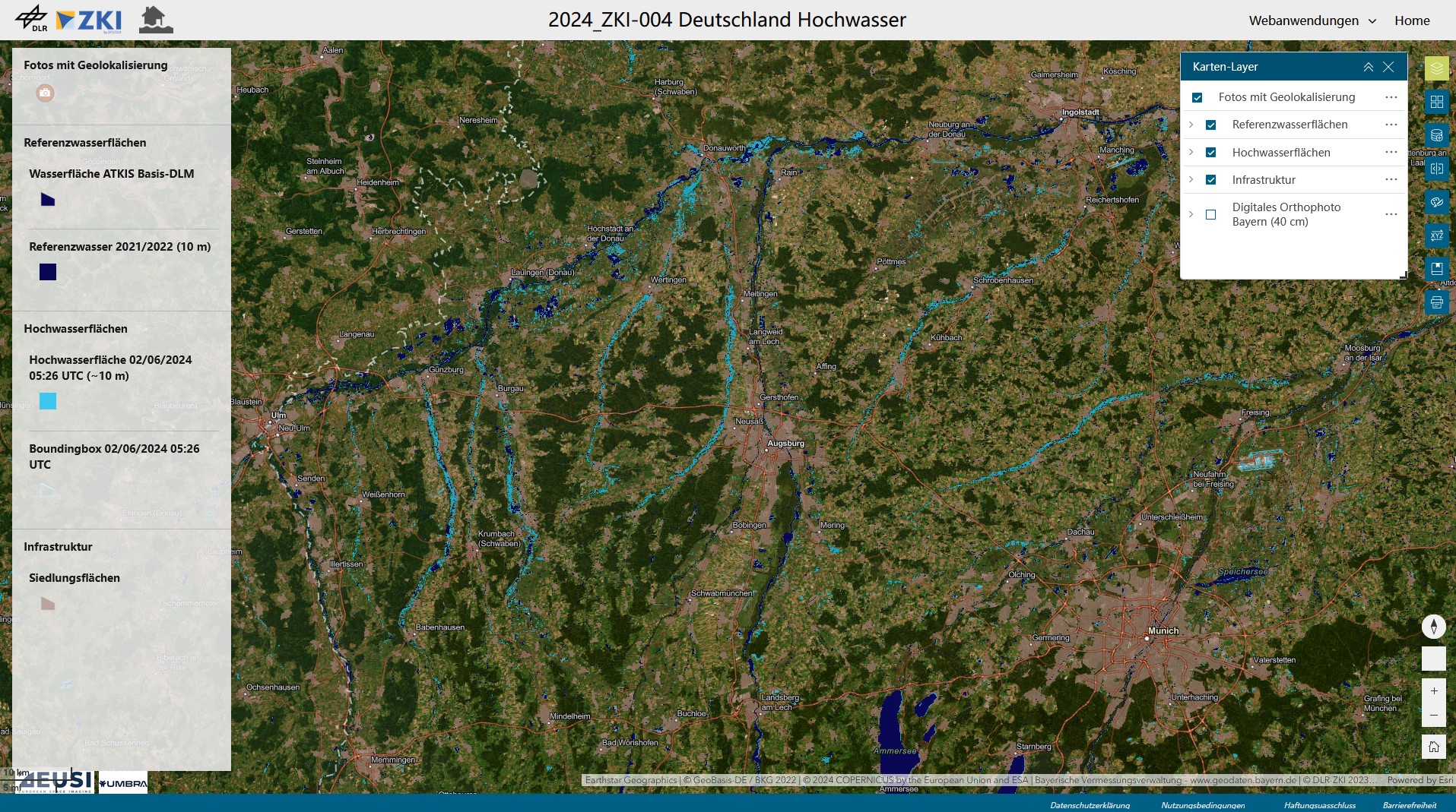
Screenshot of the ZKI web application of the flooding event. Souce: ©DLR/ZKI 2024
Credit:
DLR (CC BY-NC-ND 3.0)
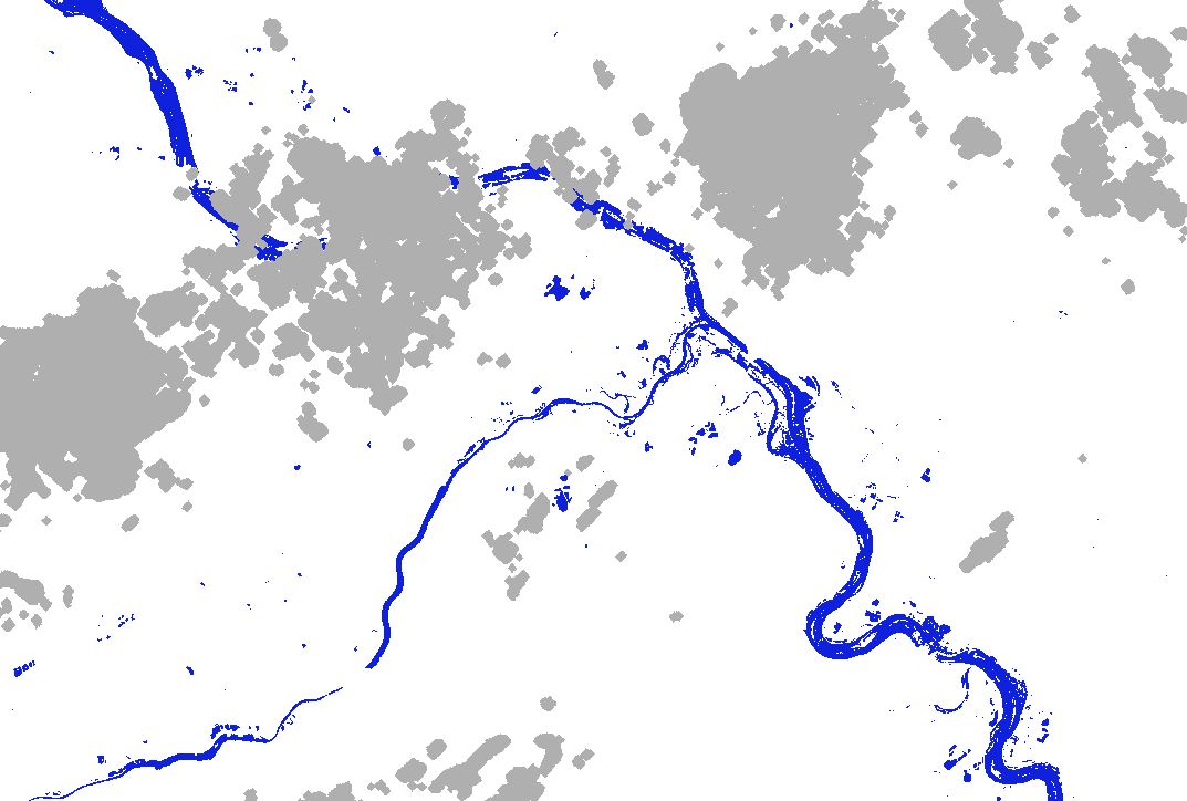
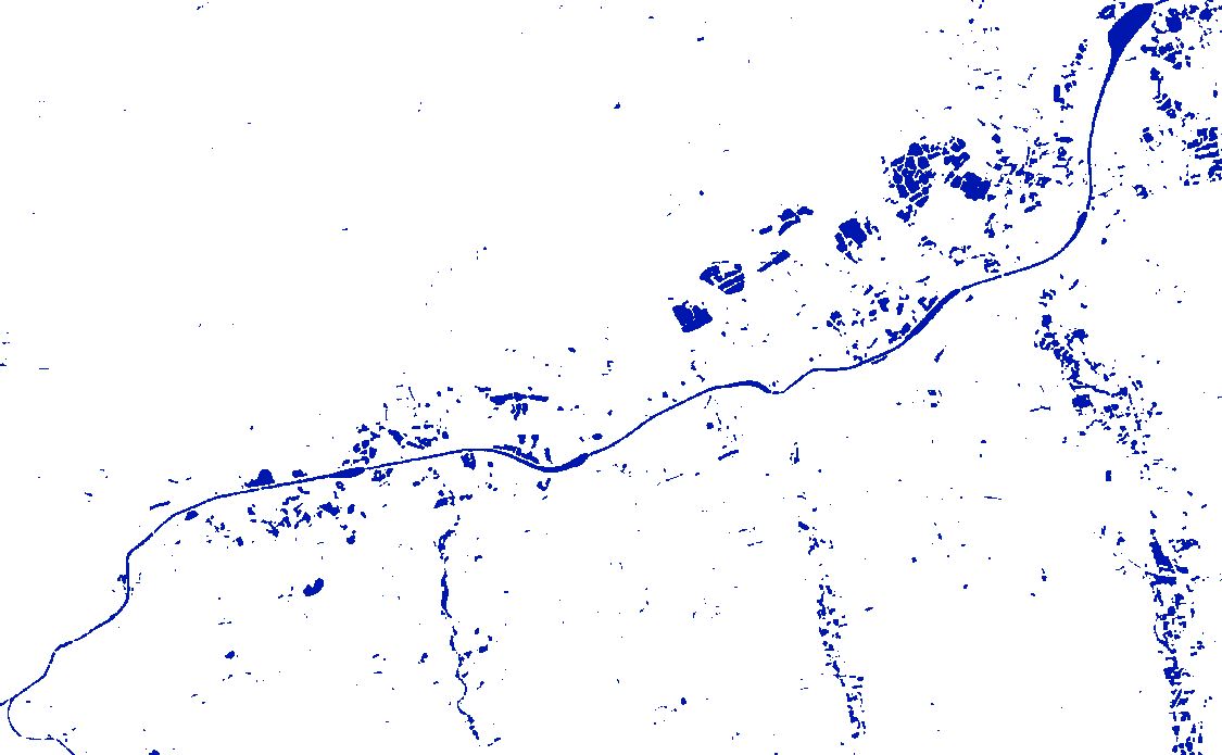
Southern Germany - Flooding – P24 - Flood masks on 10.06.2024 17:08
Creation Date 10. June 2024
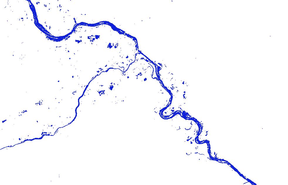
Southern Germany - Flooding – P23 - Flood masks on 09.06.2024 05:18
Creation Date 09. June 2024
Southern Germany - Flooding – P22 - Flood masks on 07.06.2024 05:27
Creation Date 07. June 2024
Southern Germany - Flooding – P21 - Flood masks on 06.06.2024 10:06
Creation Date 07. June 2024
Southern Germany - Flooding – P20 - Flood masks on 05.06.2024 17:00
Creation Date 06. June 2024
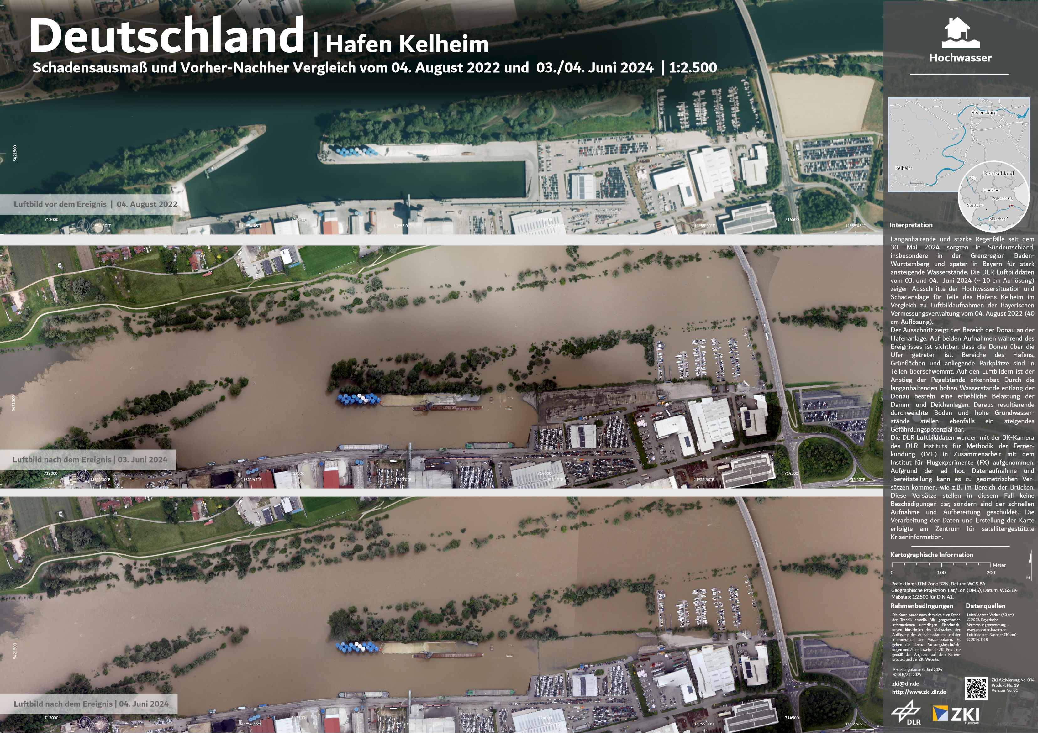
Germany - Kelheim Harbour - flood - P19 - Extent of damage and before and after comparison as of 04th of August 2022 and 03th/04th of June 2024
Creation Date 06. June 2024
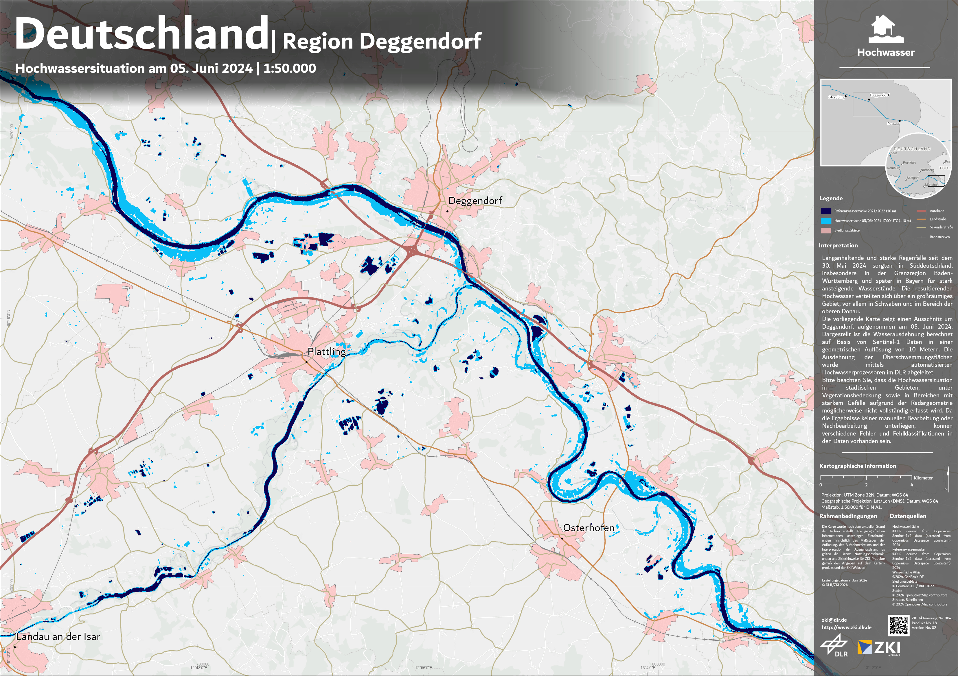
Germany - Region Deggendorf - flood extent - P18 - Situation map as of 05th of June 2024
Creation Date 06. June 2024
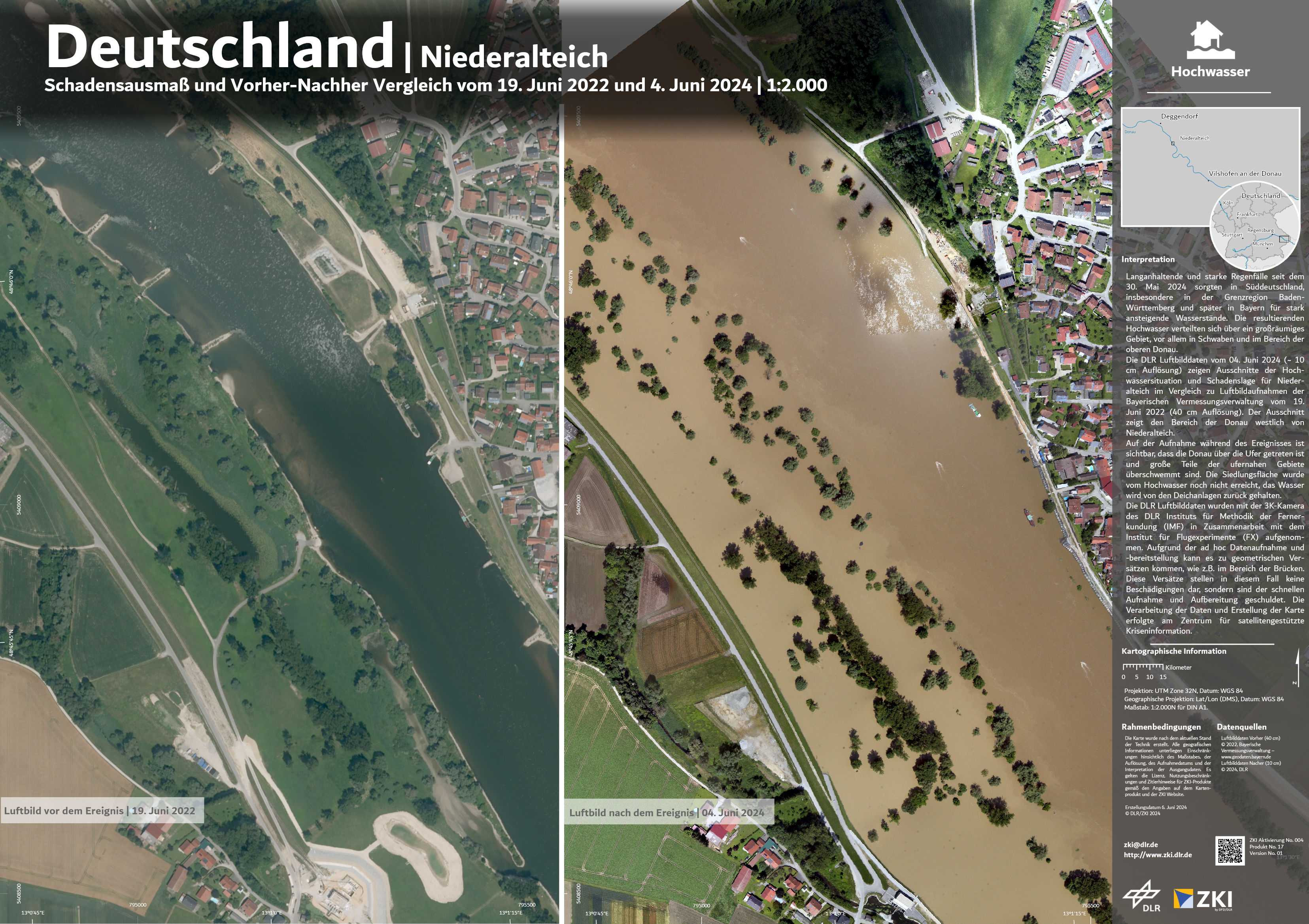
Germany - Niederalteich - flood - P17 - Extent of damage and before and after comparison as of 19th of June 2022 and 04th of June 2024
Creation Date 06. June 2024
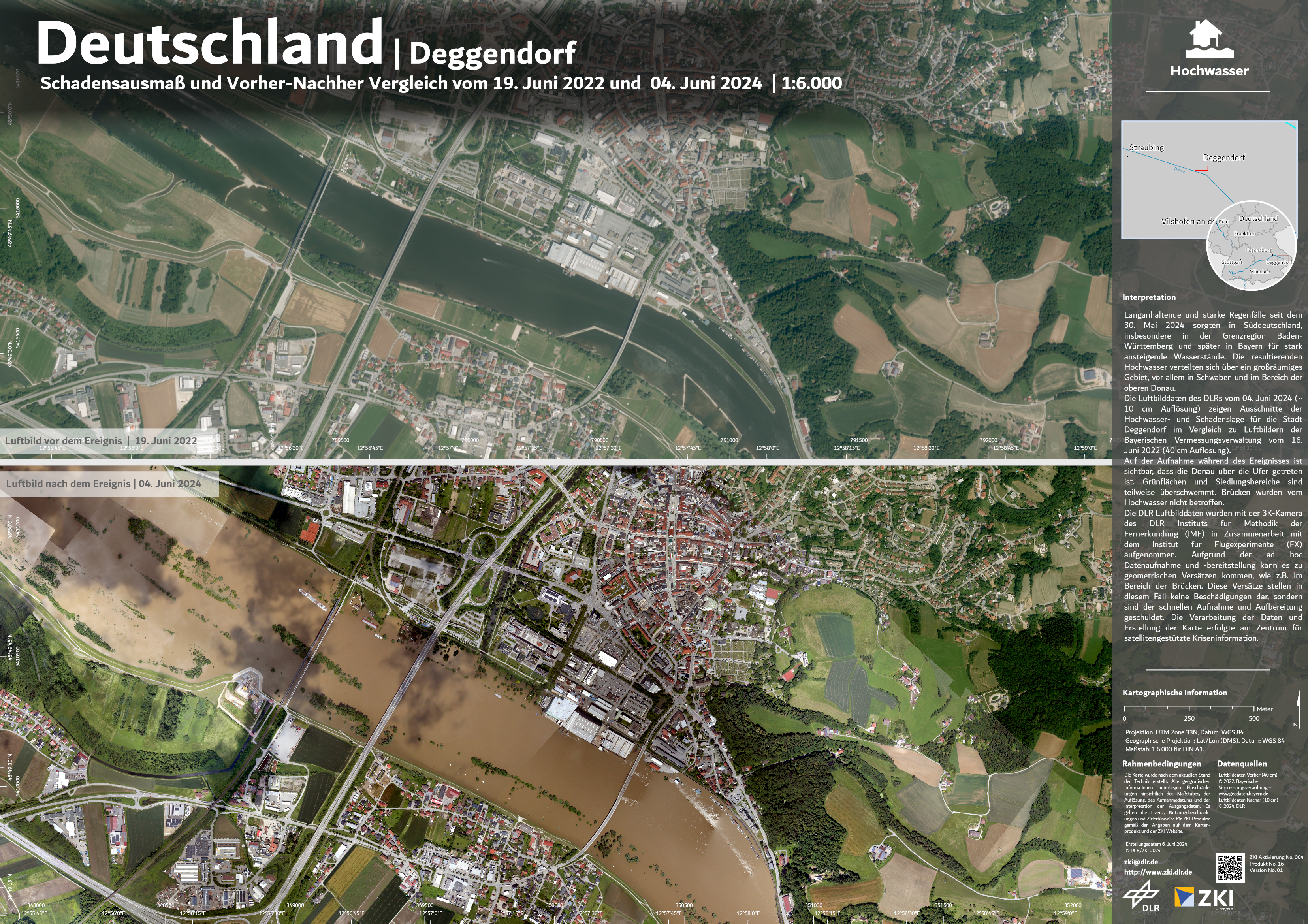
Germany - Deggendorf - flood - P16 - Extent of damage and before and after comparison as of 19th of June 2022 and 04th of June 2024
Creation Date 06. June 2024
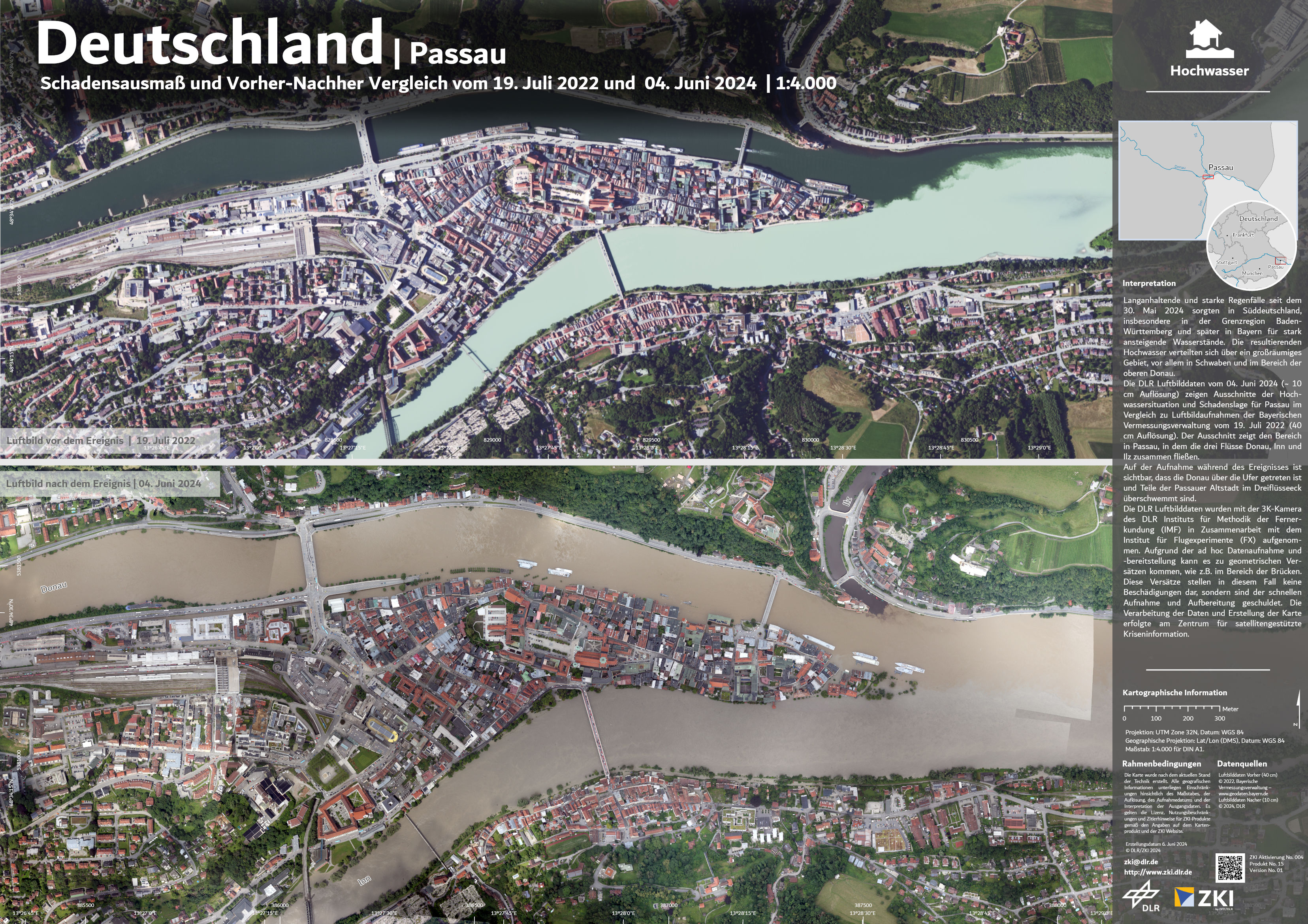
Germany - Passau - flood - P15 - Extent of damage and before and after comparison as of 19th of July 2022 and 04th of June 2024
Creation Date 06. June 2024
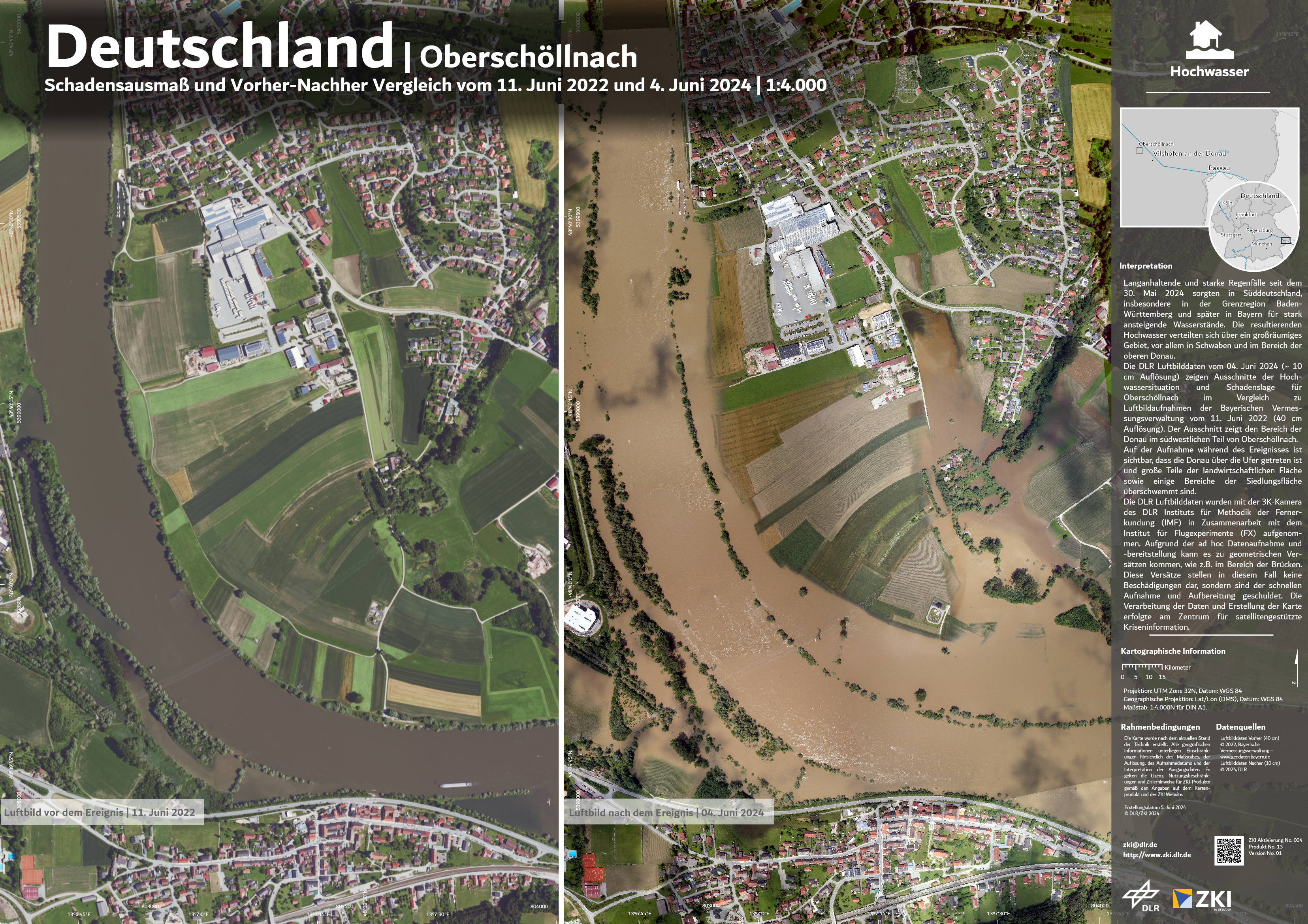
Germany - Oberschöllnach - flood - P14 - Extent of damage and before and after comparison as of 11th of June 2022 and 04th of June 2024
Creation Date 05. June 2024
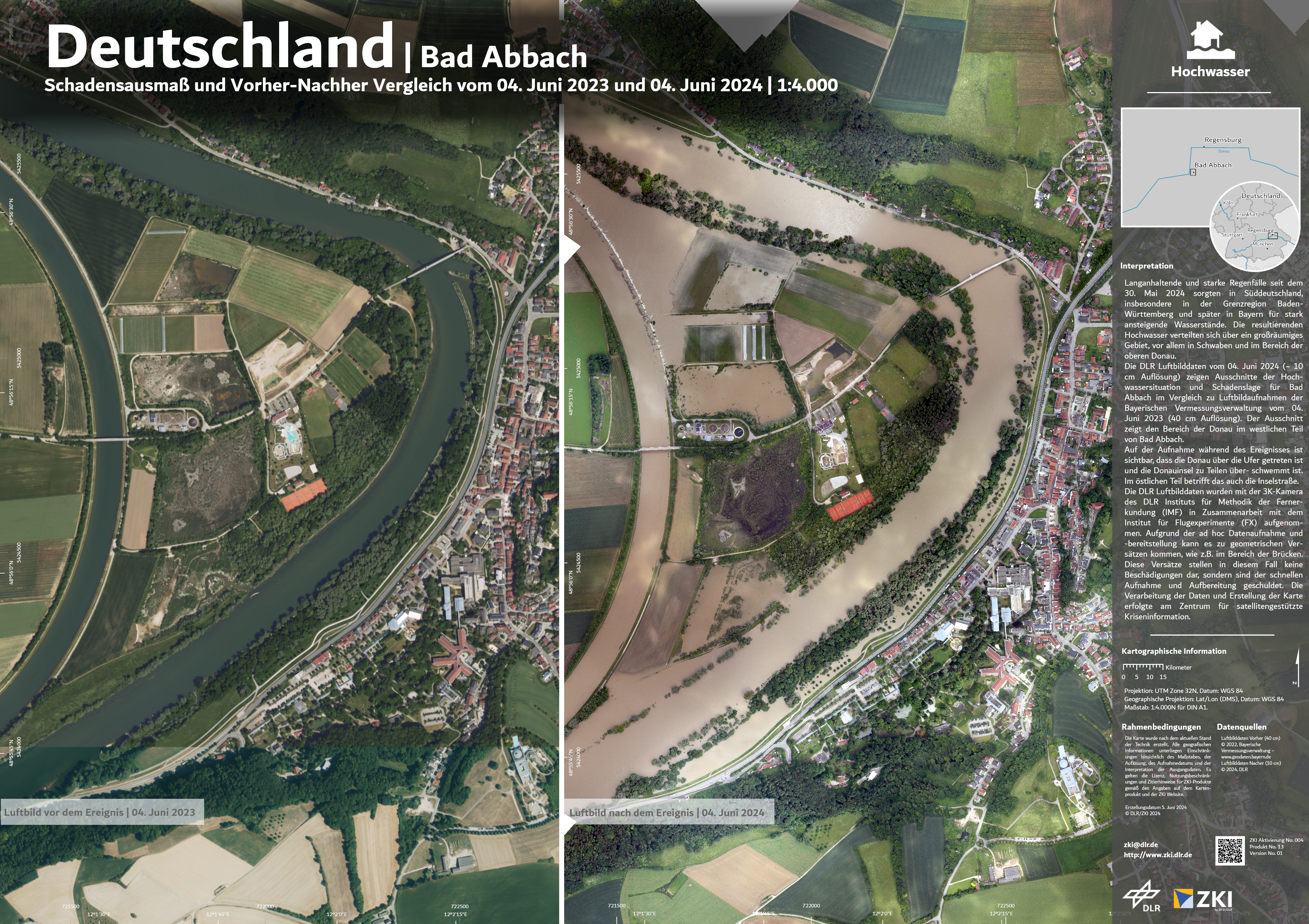
Germany - Bad Abbach - flood - P13 - Extent of damage and before and after comparison as of 04th of June 2023 and 04th of June 2024
Creation Date 05. June 2024
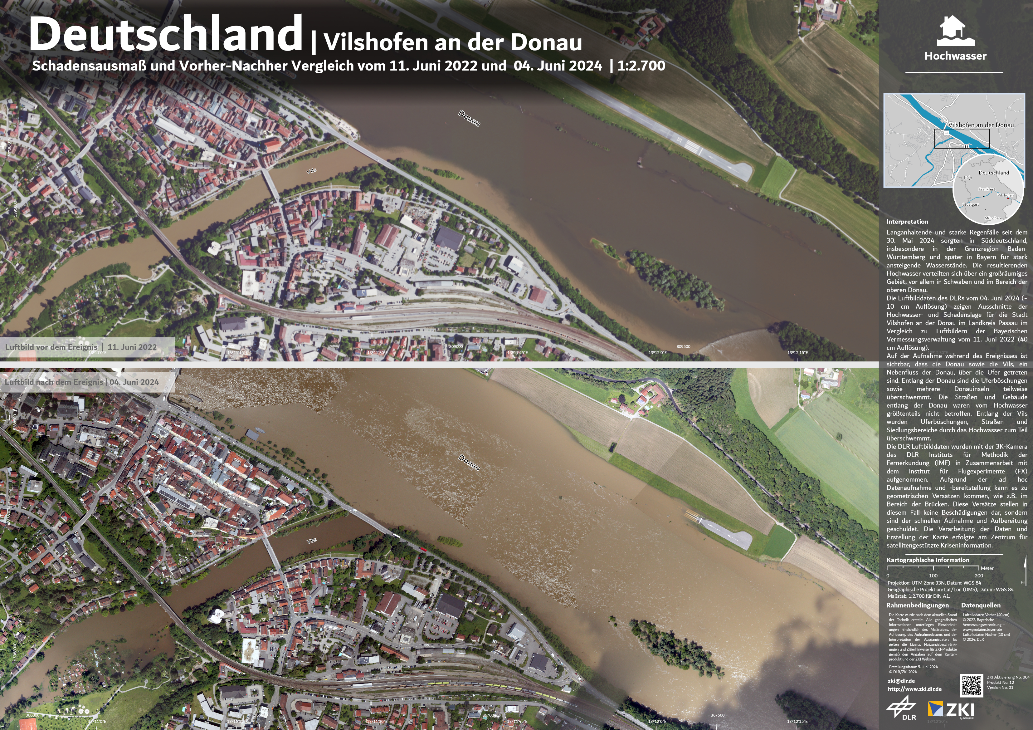
Germany - Vilshofen an der Donau - flood - P12 - Extent of damage and before and after comparison as of 11th of June 2022 and 04th of June 2024
Creation Date 05. June 2024
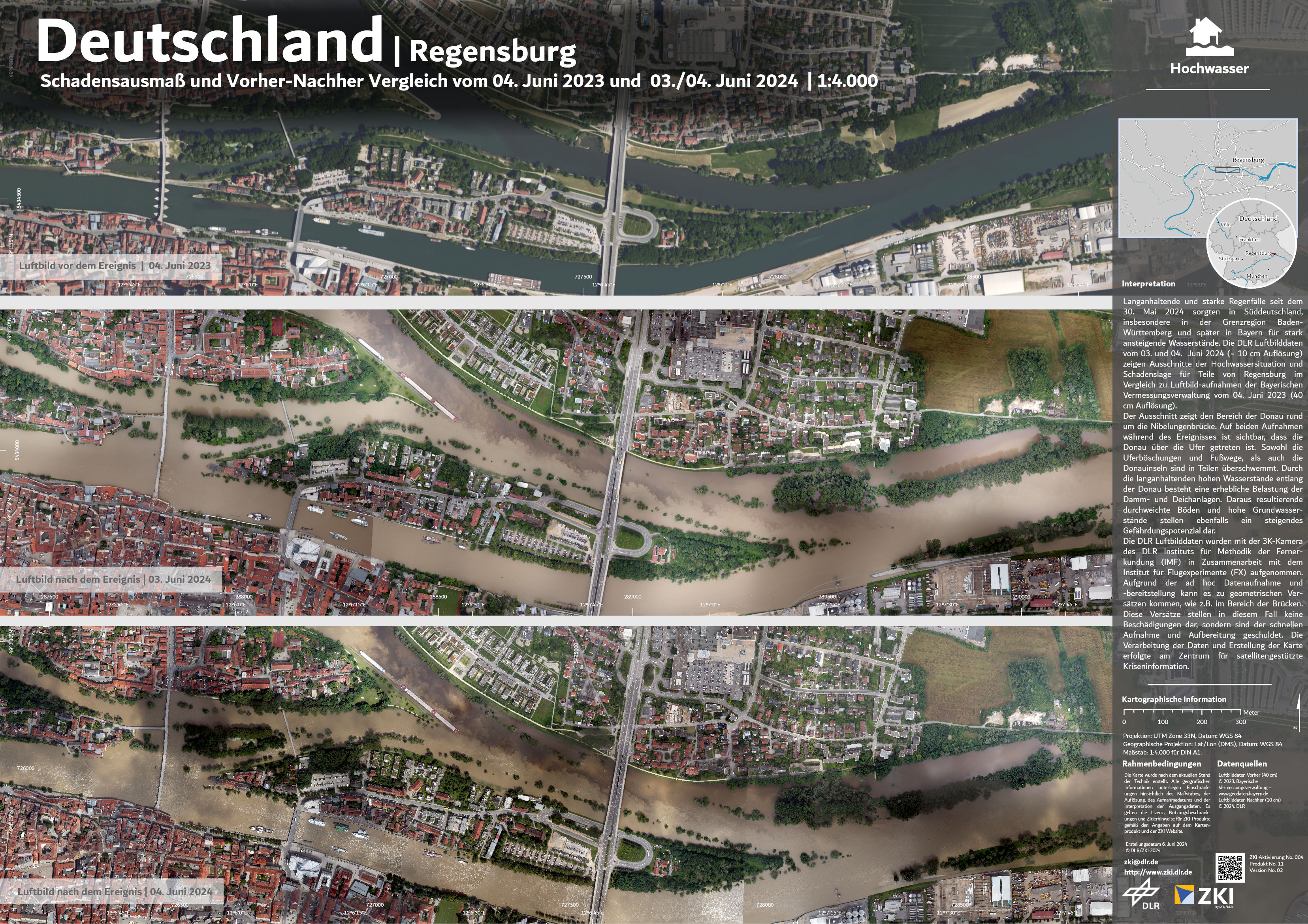
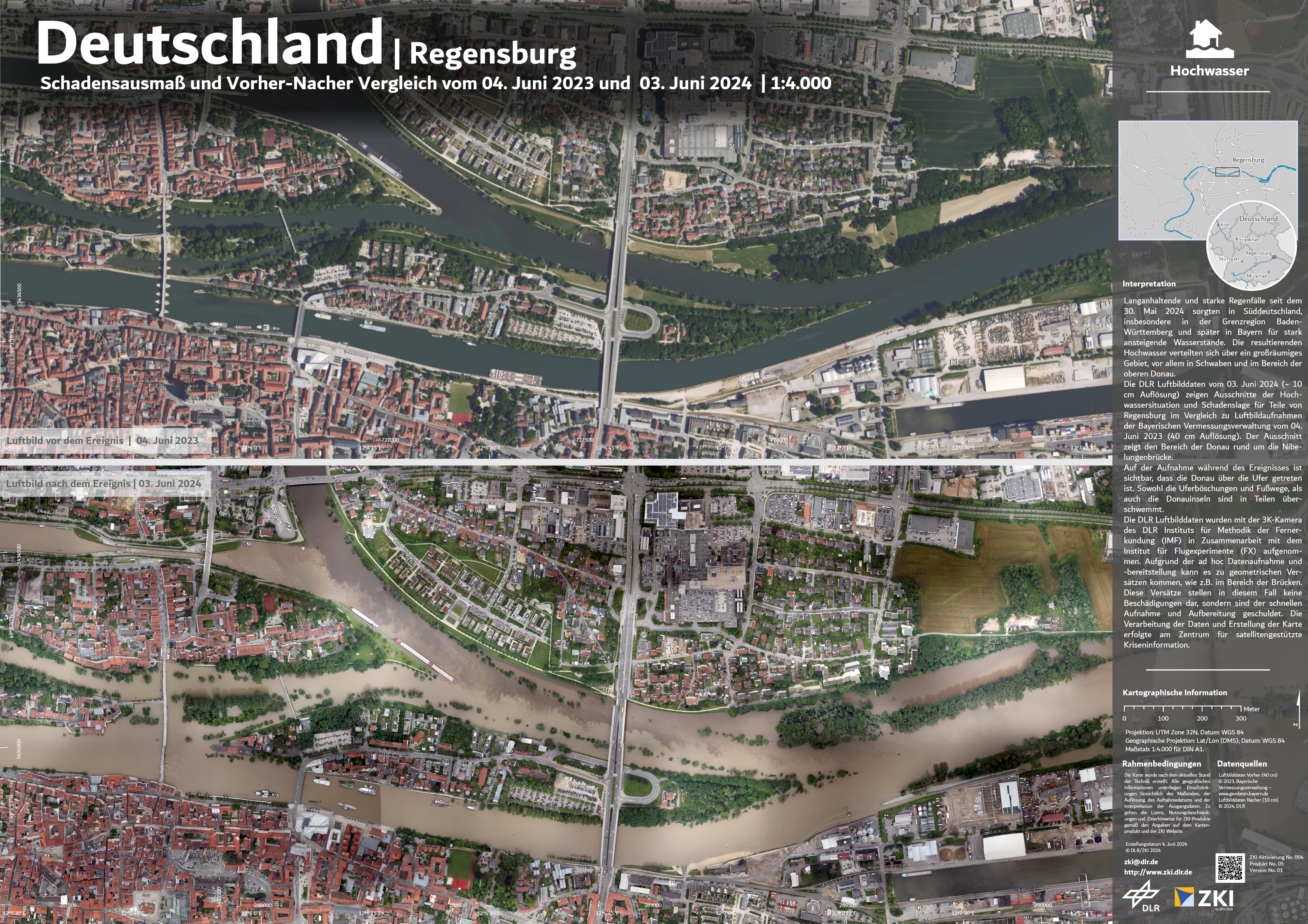
Germany - Regensburg - flood - P11 - Extent of damage and before and after comparison as of 04th of June 2023 and 03th/04th of June 2024
Creation Date 05. June 2024
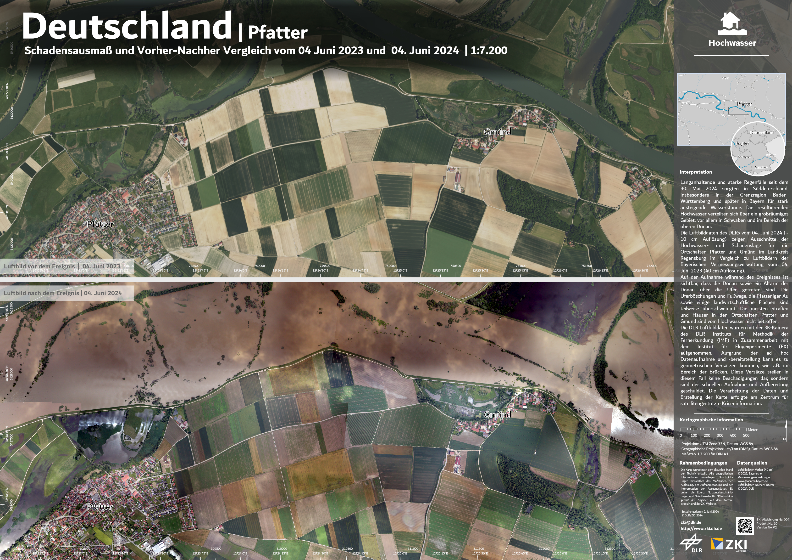
Germany - Pfatter - flood - P10 - Extent of damage and before and after comparison as of 04th of June 2023 and 04th of June 2024
Creation Date 05. June 2024
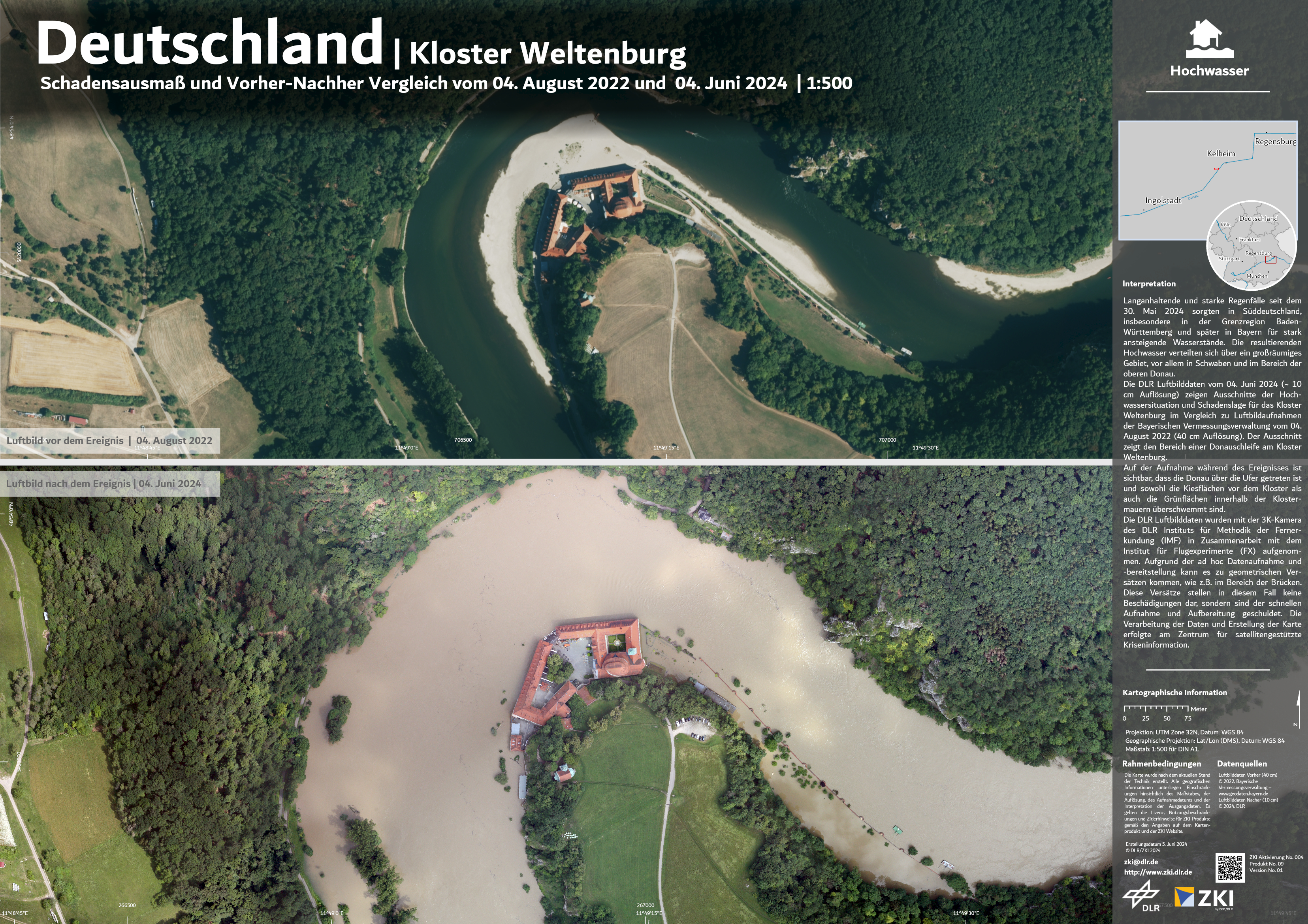
Germany - Monastery Weltenburg - flood - P09 - Extent of damage and before and after comparison as of 04th of August 2022 and 04th of June 2024
Creation Date 05. June 2024
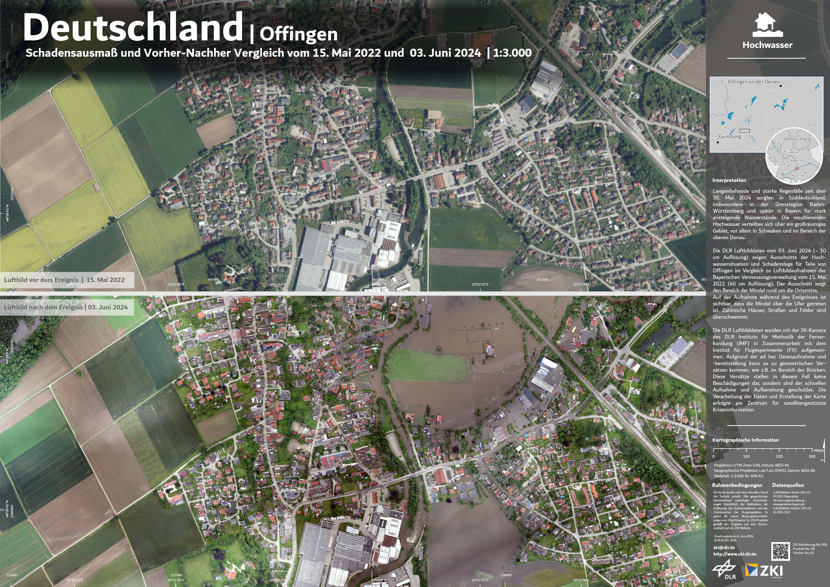
Germany - Offingen - flood - P08 - Extent of damage and before and after comparison as of 15th of May 2022 and 03th of June 2024
Creation Date 04. June 2024
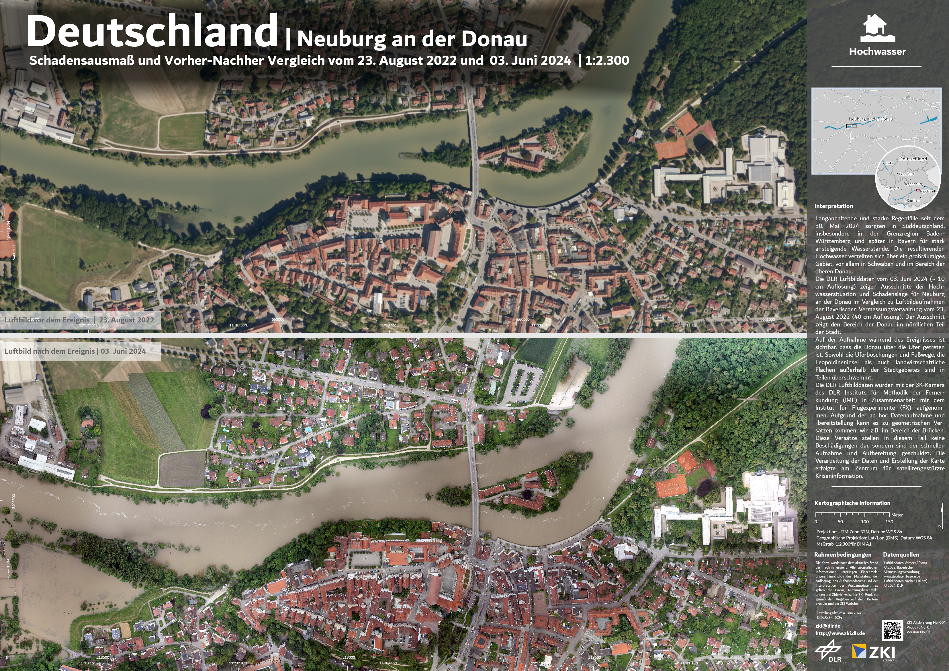
Germany - Neuburg an der Donau - flood - P07 - Extent of damage and before and after comparison as of 23th August 2022 and 03th of June 2024
Creation Date 04. June 2024
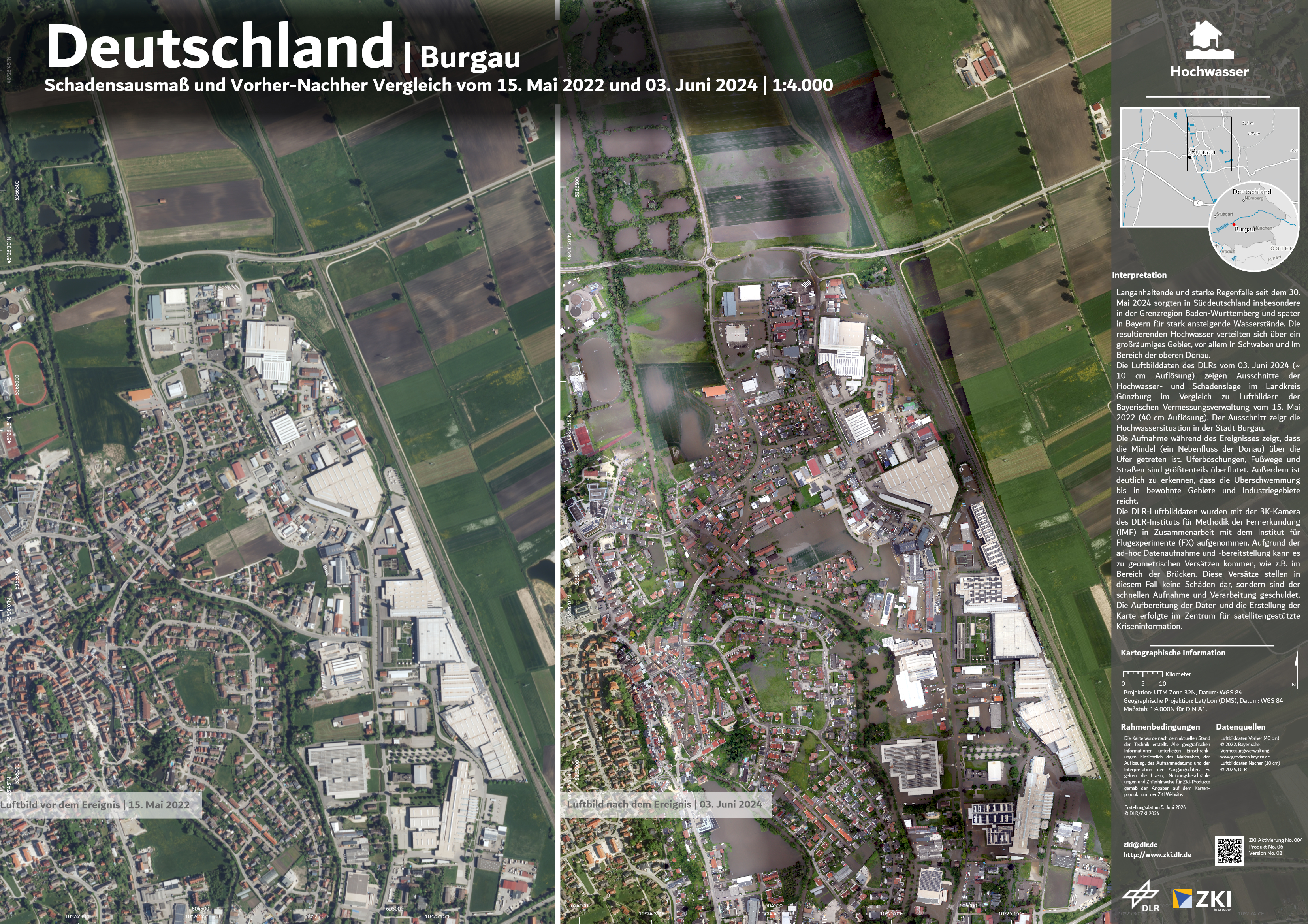
Germany - Burgau - flood - P06 - Extent of damage and before and after comparison as of 15th of May 2022 and 03th of June 2024
Creation Date 04. June 2024
Germany - Regensburg - flood - P05 - Extent of damage and before and after comparison as of 04th of June 2023 and 03th of June 2024
Creation Date 04. June 2024
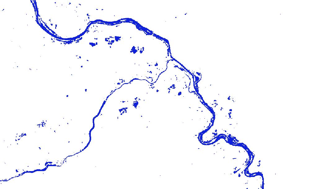
Southern Germany - Flooding – P04 - Flood masks on 03.06.2024 17:17
Creation Date 04. June 2024
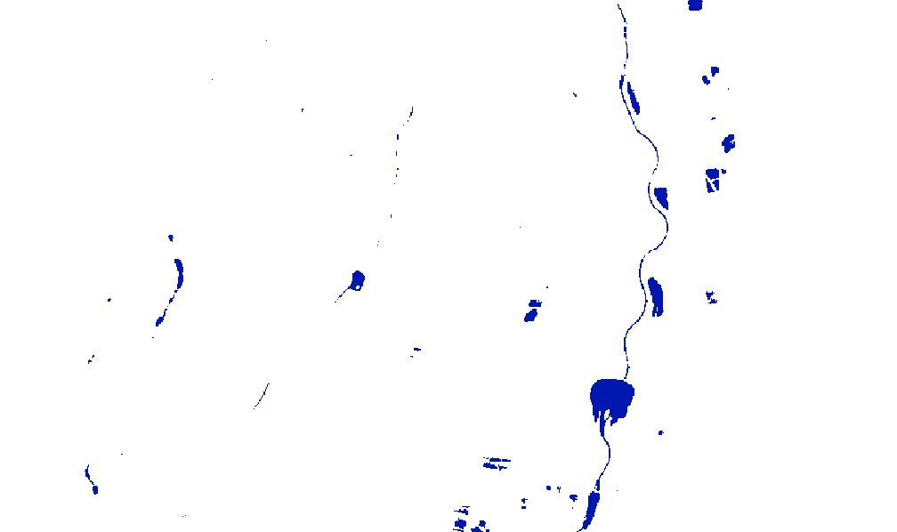
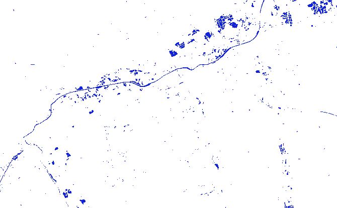
Southern Germany - Water reference mask – P03 - Sentinel-1/2 reference mask for normal water extent
Creation Date 03. June 2024
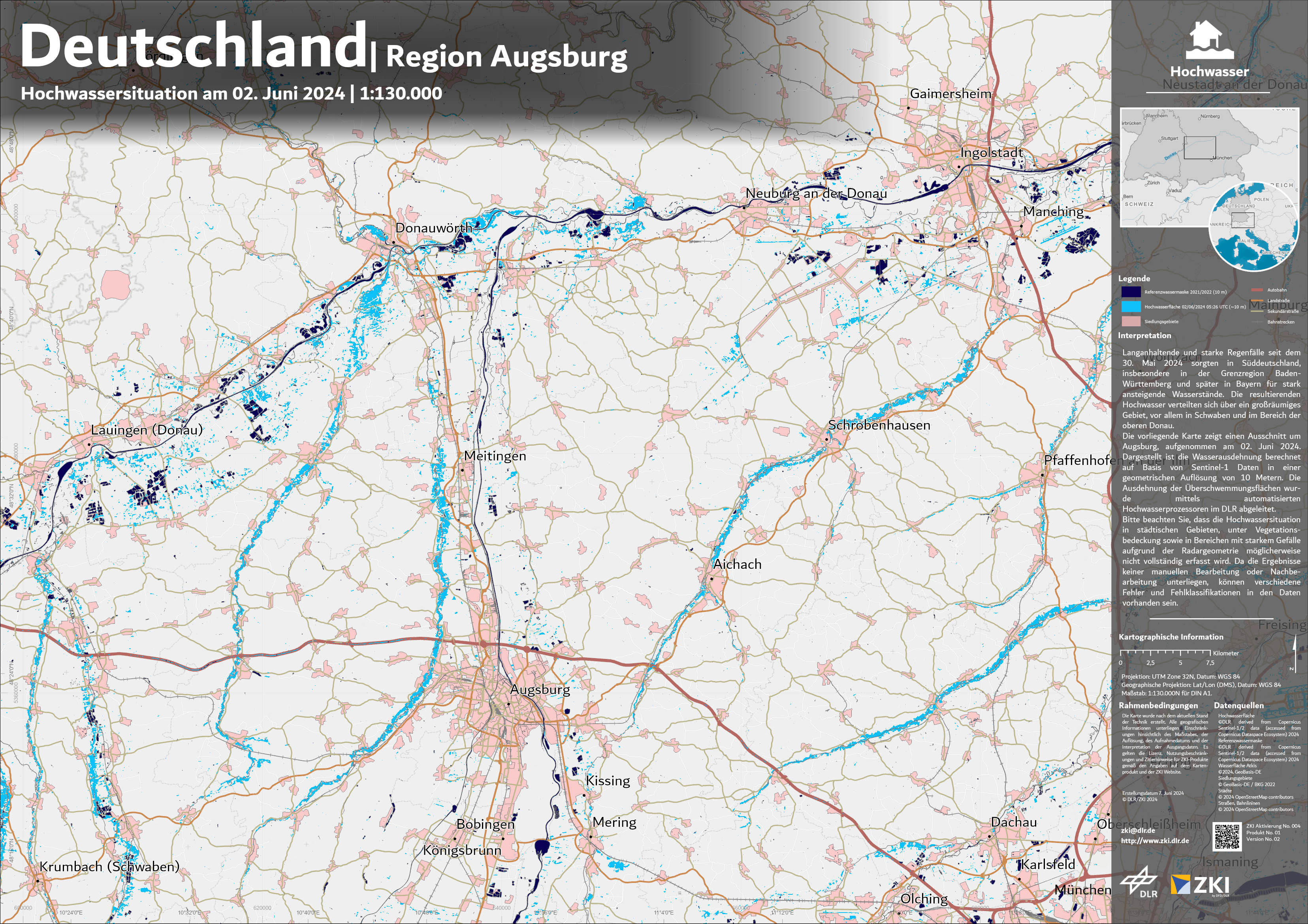
Germany - Region Augsburg - flood extent - P01 - Situation map as of 02nd June 2024
Creation Date 03. June 2024
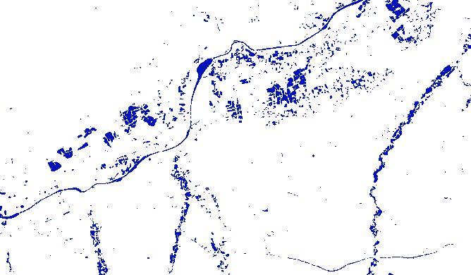
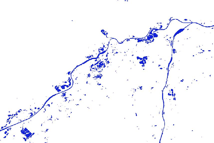
Southern Germany - Flooding – P02 - Flood masks on 02.06.2024 05:26
Creation Date 02. June 2024