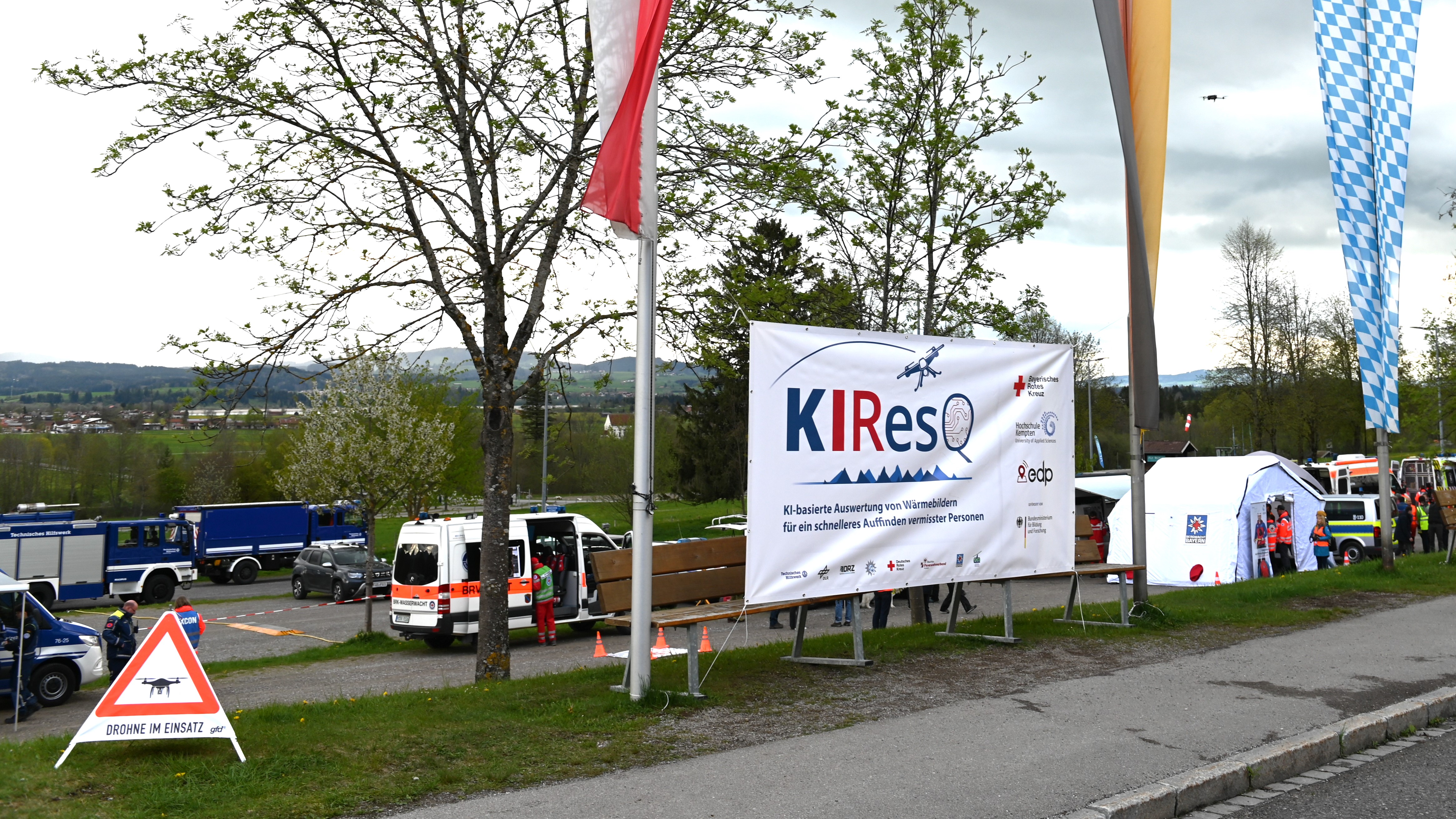
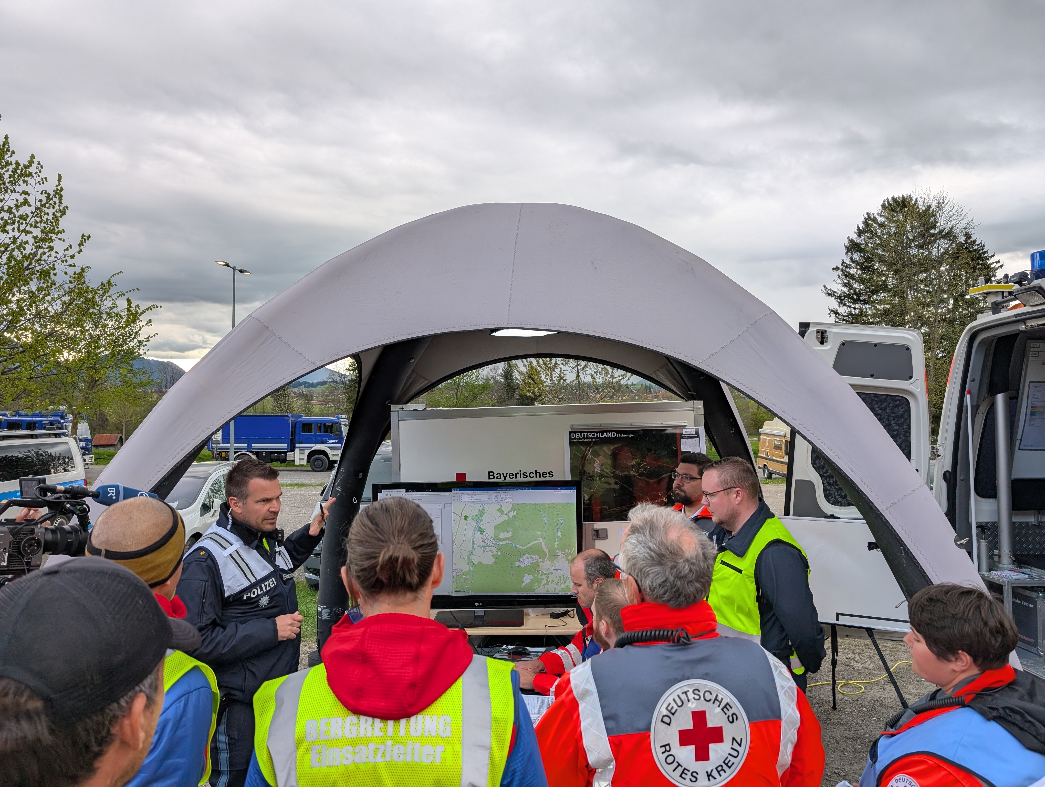
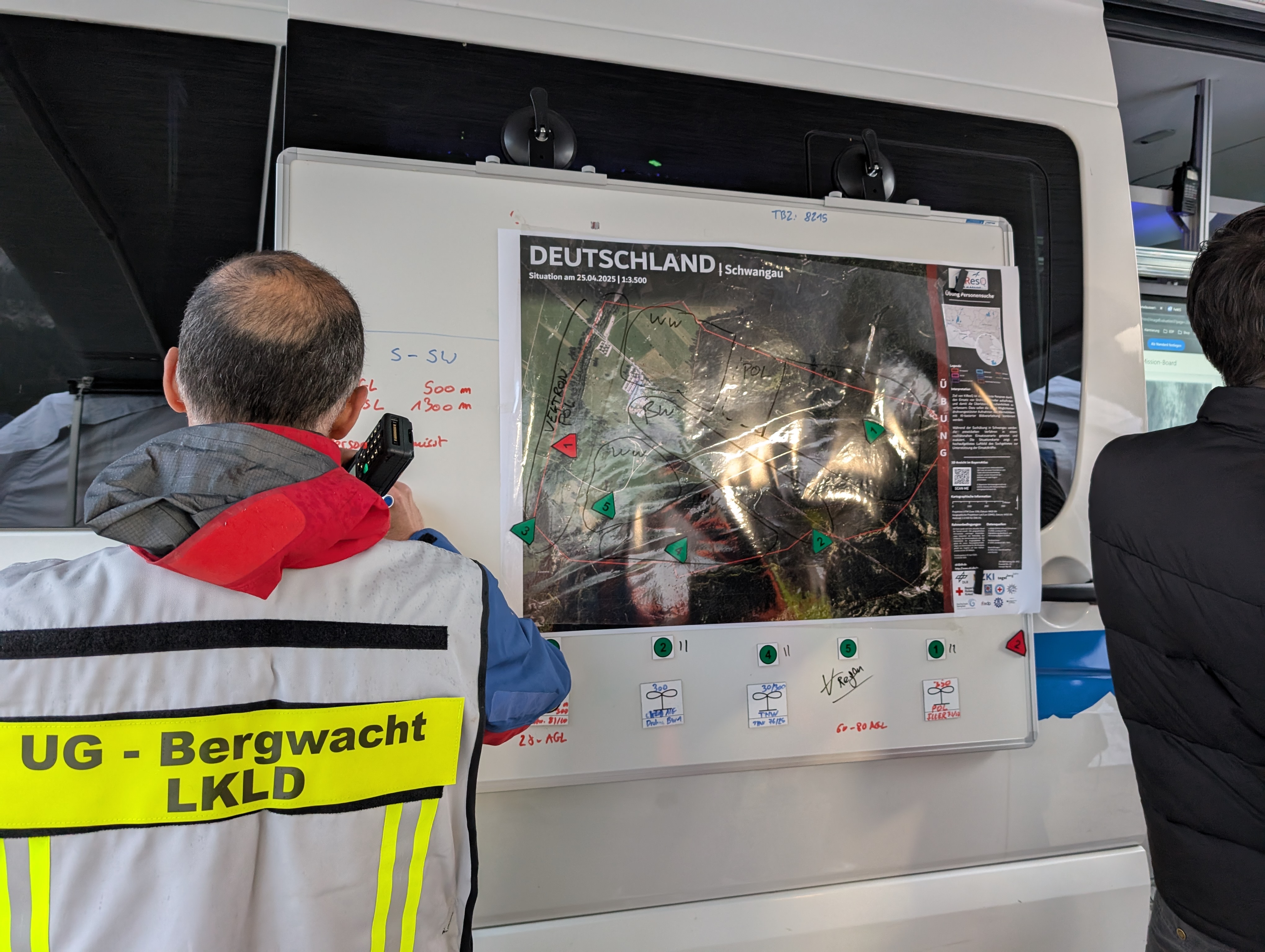
The DLR-ZKI is involved as an associated partner in the KIResQ (AI-based evaluation of thermal images for faster location of missing persons) research project and was involved in the final exercise of the project on 25th April. During the extensive exercise in Schwangau, Bavaria, more than 100 rescuers from search and rescue teams from mountain rescue, BRK emergency services, police, Technical Relief (THW) and water rescue came together to test the tools developed in the project, such as a so-called mission board with integrated AI image analysis, under real operating conditions. To this end, drones from the various organisations used thermal cameras to take images in predefined search areas, which were then scanned by the AI. In this way, a total of seven of the nine people positioned in the challenging terrain were found.
The ADRET cooperation project between DLR and the THW is also currently underway in the area of drone data analysis, in which rapid crisis mapping and automated image analysis for THW drone teams is being developed.
Products
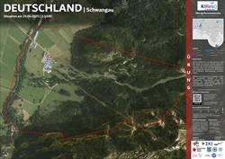
Germany - Schwangau - overview map of 25th April 2025