Wildfire on the Saurüsselkopf in Bavaria
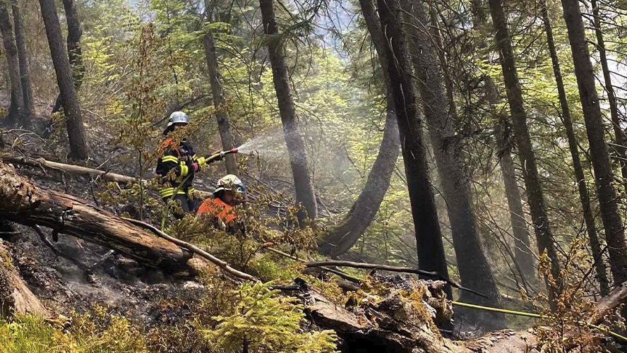
Firefighters in action at the Saurüsselkopf
Credit:
Kreisfeuerwehrverband Traunstein
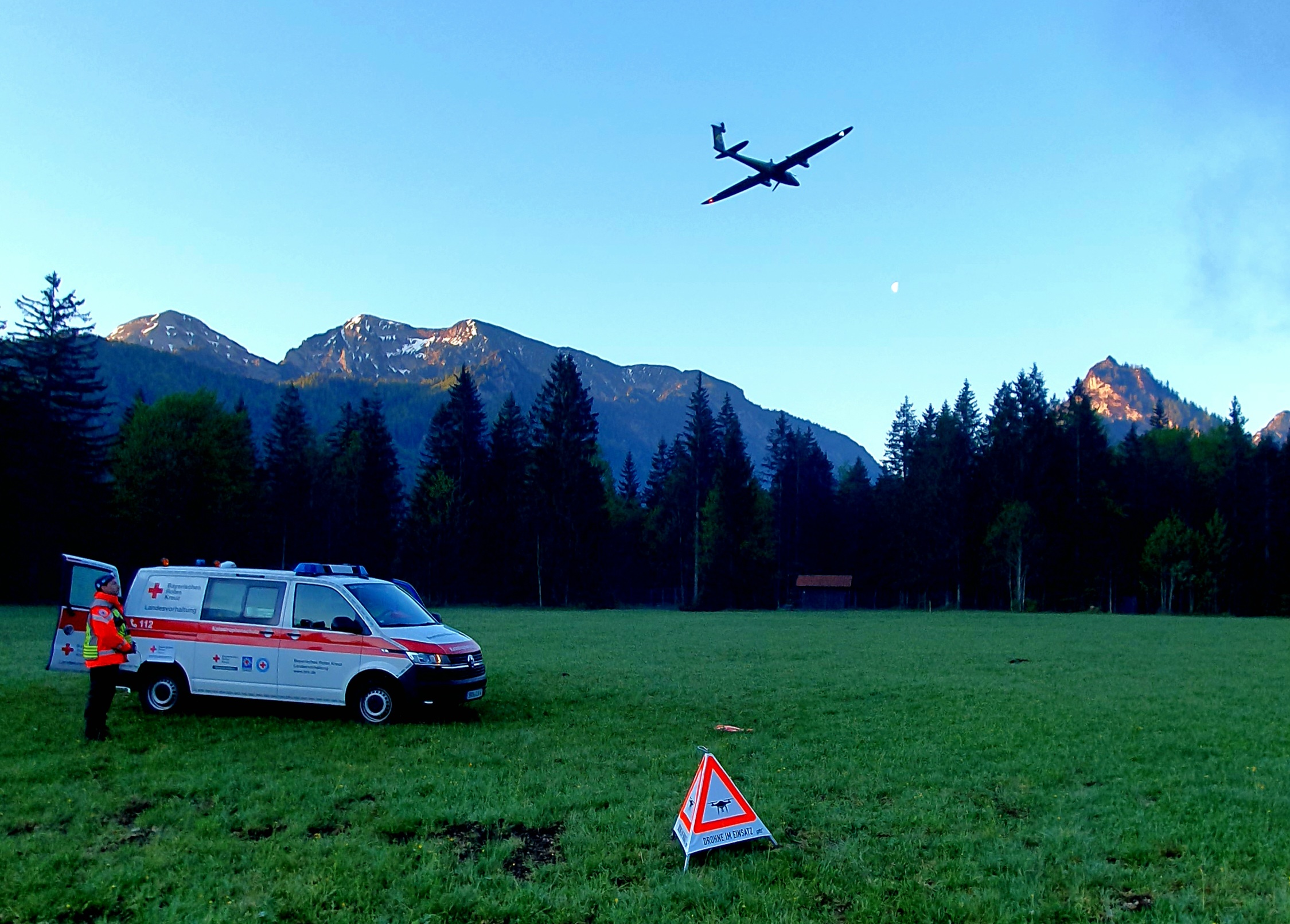
With support of the DLR, the BRK Research Unit is using a new type of drone system for situational awareness
Credit:
BRK

Germany - Ruhpolding - Wildfire - P15 - Situation on 13. May 2026 - Detail Map
Creation Date 28. May 2026

Germany - Ruhpolding - Burnt Area Severity - P14 - Situation on 22. May 2026 - Detail Map
Creation Date 28. May 2026

Germany - Ruhpolding - Wildfire - P13 - Situation from 06. to 13. May 2026 - Detail Map
Creation Date 19. May 2026

Germany - Ruhpolding - Wildfire - P12 - Situation on 13. May 2026 (9 a.m.) - Detail Map
Creation Date 13. May 2026

Germany - Ruhpolding - Wildfire - P11 - Situation on 11. May 2026 (10 p.m.) - Detail Map
Creation Date 11. May 2026

Germany - Ruhpolding - Wildfire - P10 - Situation on 11. May 2026 (6 a.m.) - Detail Map
Creation Date 11. May 2026

Germany - Ruhpolding - Wildfire - P09 - Situation on 10. May 2026 (11 p.m.) - Detail Map
Creation Date 11. May 2026

Germany - Ruhpolding - Wildfire - P08 - Situation on 10. May 2026 (5 a.m.) - Detail Map
Creation Date 10. May 2026

Germany - Ruhpolding - Wildfire - P07 - Situation on 09. May 2026 (5 a.m.) - Detail Map
Creation Date 09. May 2026

Germany - Ruhpolding - Wildfire - P06 - Situation on 08. May 2026 (6 a.m.) - Detail Map
Creation Date 08. May 2026

Germany - Ruhpolding - Wildfire - P05 - Situation on 08. May 2026 (6 a.m.) - Detail Map
Creation Date 08. May 2026

Germany - Ruhpolding - Wildfire - P04 - Situation on 07. May 2026 (6 a.m.) - Detail Map
Creation Date 08. May 2026

Germany - Ruhpolding - Wildfire - P03 - Situation from 06. to 08. May 2026 - Detail Map
Creation Date 08. May 2026

Germany - Ruhpolding - Wildfire - P02 - Situation on 06.05.2026 (11 p.m.) - Detail Map
Creation Date 07. May 2026
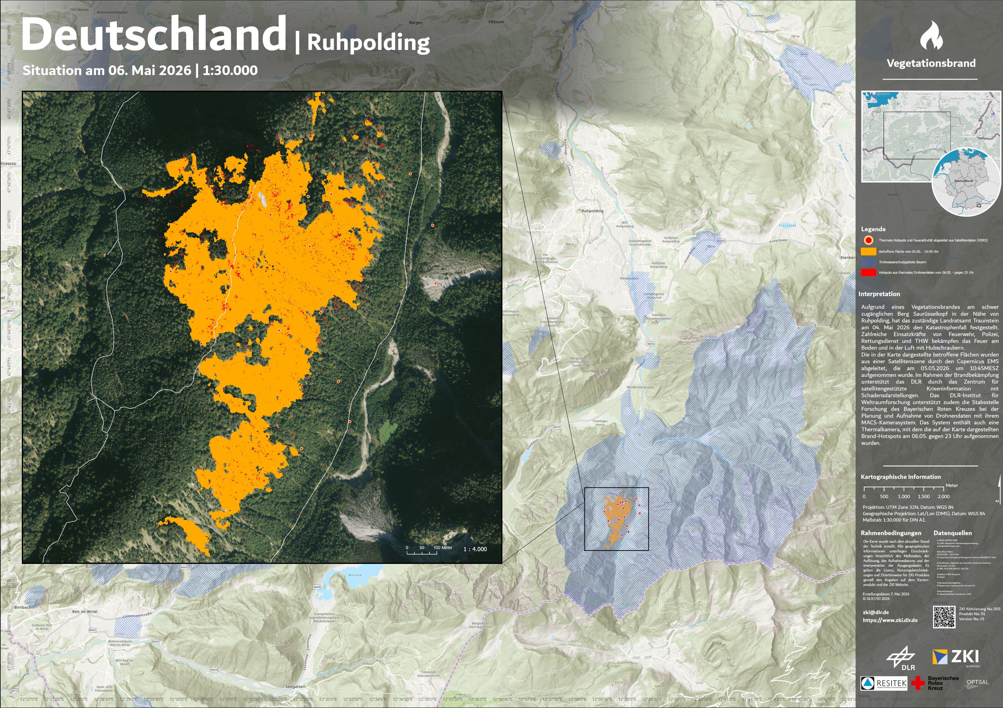
Germany - Ruhpolding - Wildfire - P01 - Situation on 06.05.2026 - Overview Map
Creation Date 07. May 2026