
FireBIRD monitors forest fires in California
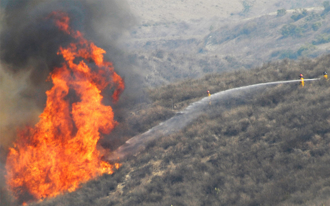
Firefighters battle a blaze in Southern California.
Credit:
Richard Smith/Wikimedia Commons
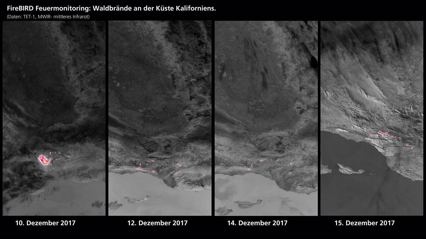
FireBIRD fire monitoring: Infrared images of wildfires at the Californian Pacific coast.
Credit:
DLR (CC-BY 3.0).
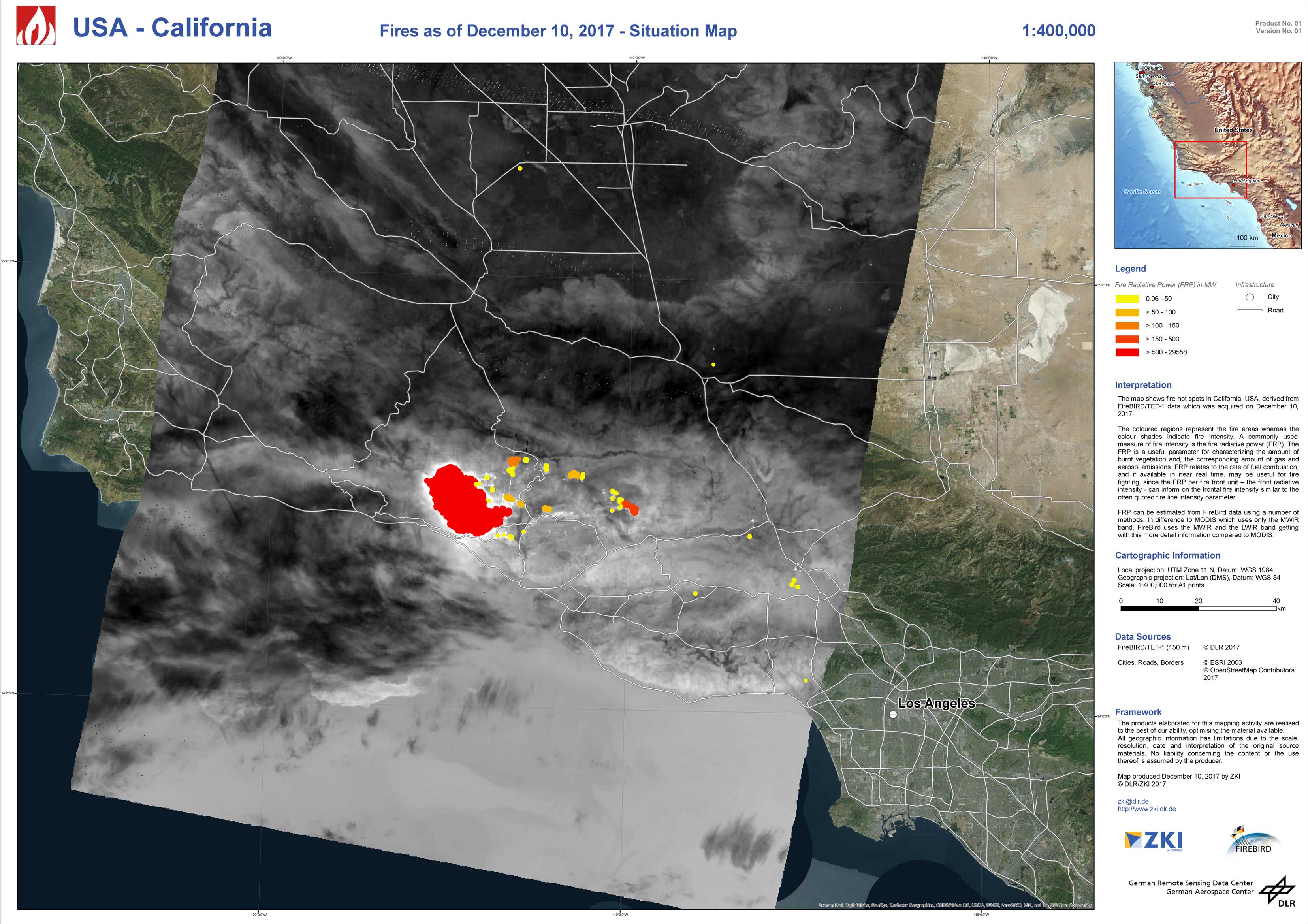
USA - California - P01 - Fires as of December 10, 2017 - Situation Map
Creation Date 18. December 2018
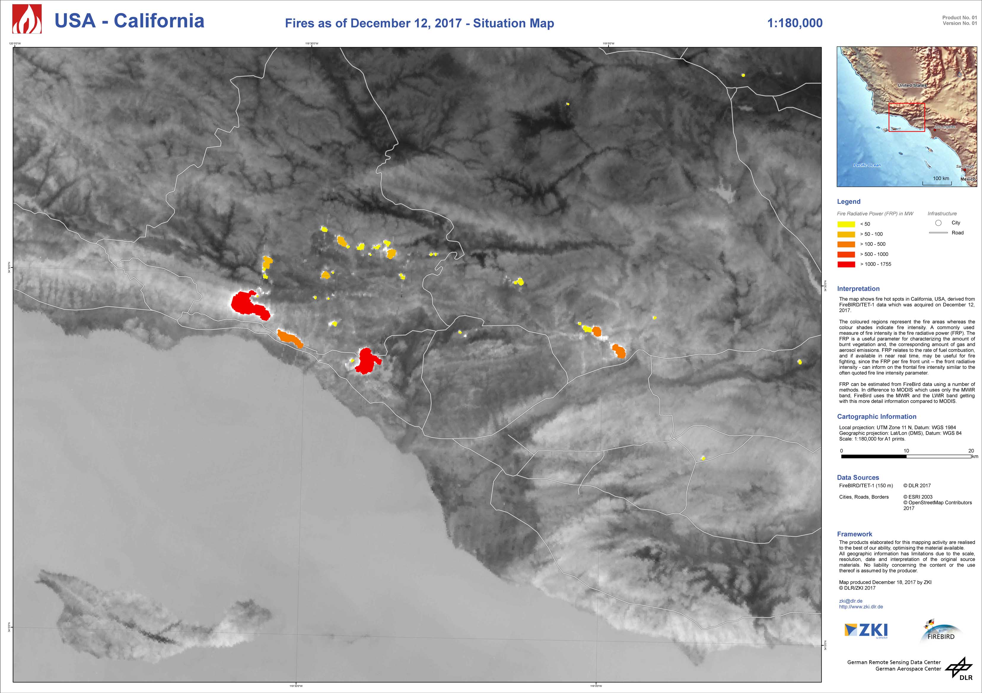
USA - California - P02 - Fires as of December 12, 2017 - Situation Map
Creation Date 13. December 2018