Flooding in Romania: ZKI maps disaster area
undefined
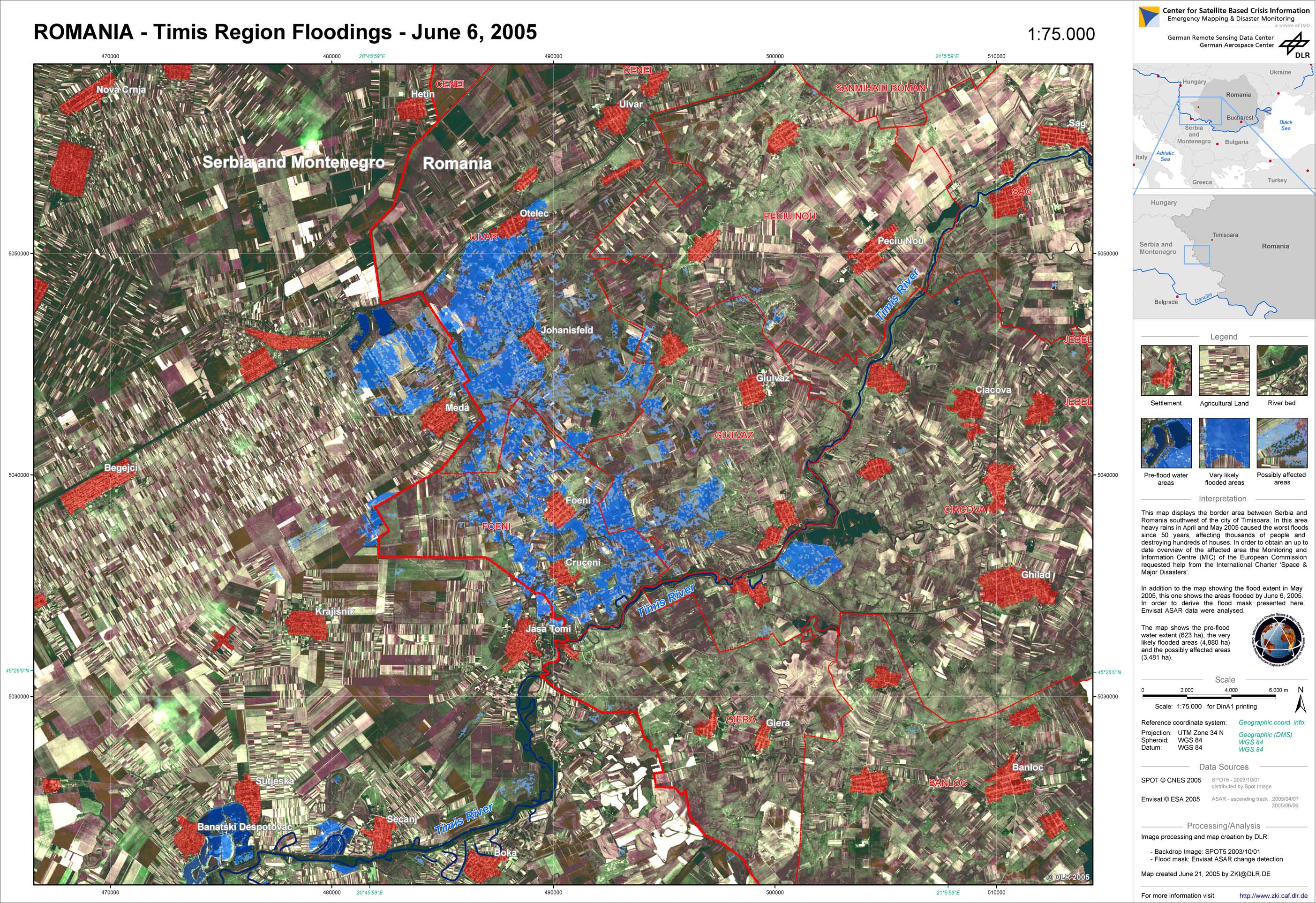
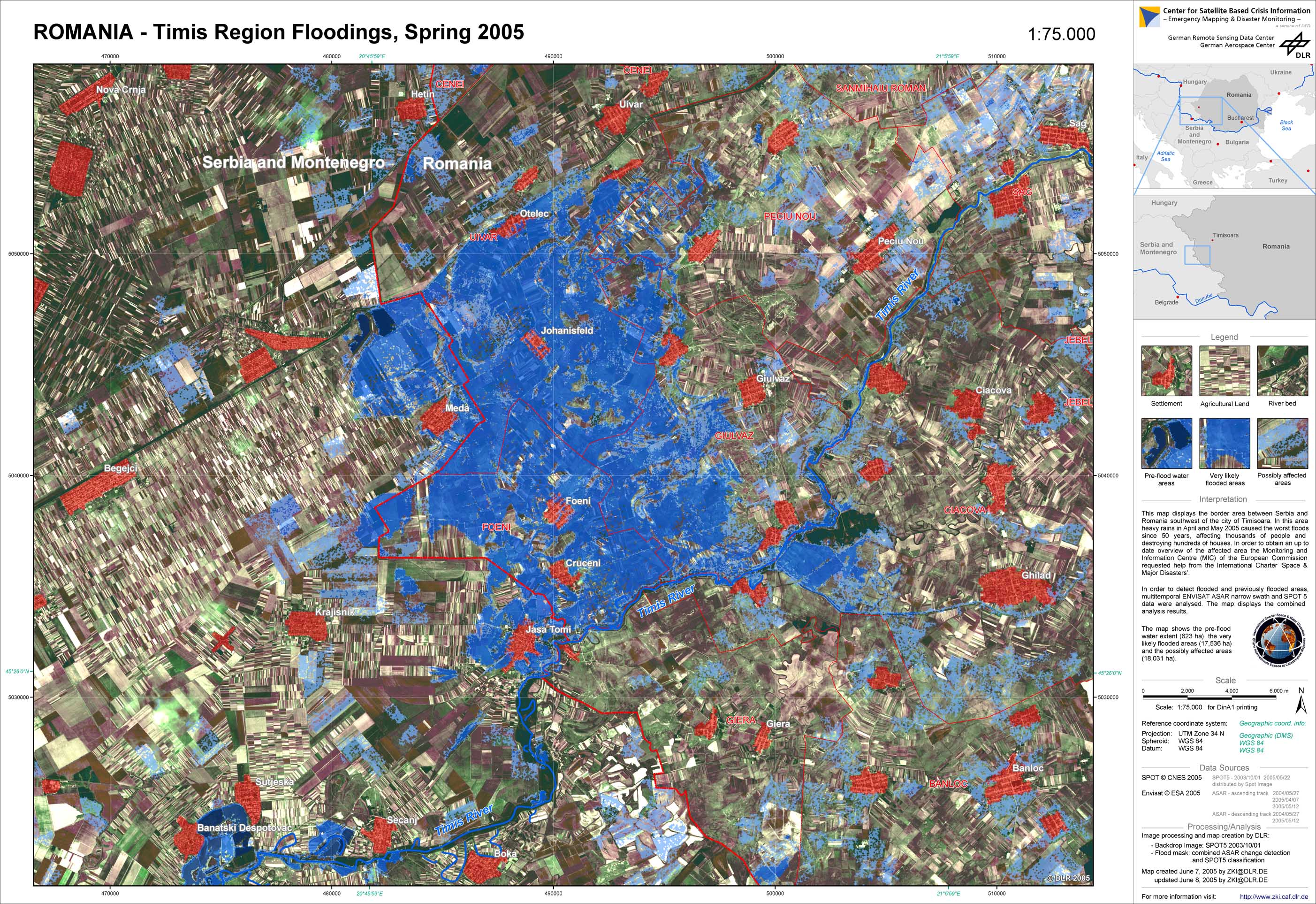
Heavy rain in April and May 2005 caused the worst floods since 50 years in Romania, affecting thousands of people and destroying hundreds of houses. The Romanian government responded on 19 May by launching an appeal for European civil protection assistance, triggering a rapid response from the Monitoring and Information Centre (MIC) of the European Commission. As a result 11 EU Member States offered their assistance. In this context the MIC triggered the International Charter 'Space and Major Disasters' to provide a synoptical overview of the affected areas. In close cooperation with the European Commission, the German Aerospace Center (DLR) took over the project management and the analysis of all available satellite imagery including ENVISAT ASAR and SPOT 5. From these data, flood maps and damage statistics were derived to support European relief. The analysis focussed on one of the most affected areas in western Romania. DLR estimates that only in the area of Timisoara, more than 40,000 hectares were flooded.
Romania - P02 - Flood situation as of June 6, 2005 (using Envisat-ASAR and SPOT5) - Timis region
Creation Date 21. June 2005
Romania - P01 - Flood situation as of May 2005 (using Envisat-ASAR and SPOT5) - Timis region
Creation Date 21. June 2005
undefined