
Earthquake in Pakistan
undefined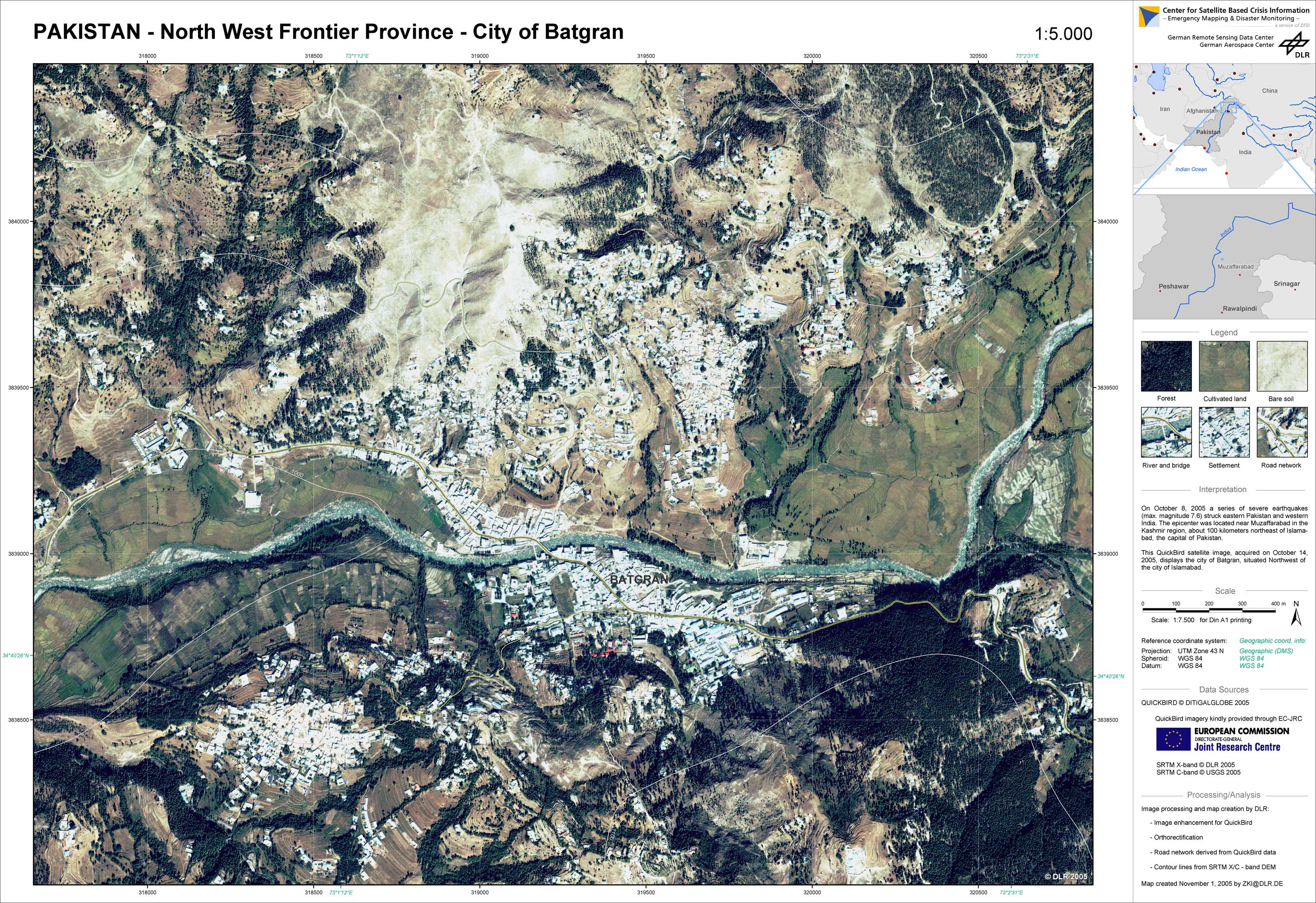
Pakistan - P17 - Satellite map - North-west frontier province - Batgran
Creation Date 01. November 2005
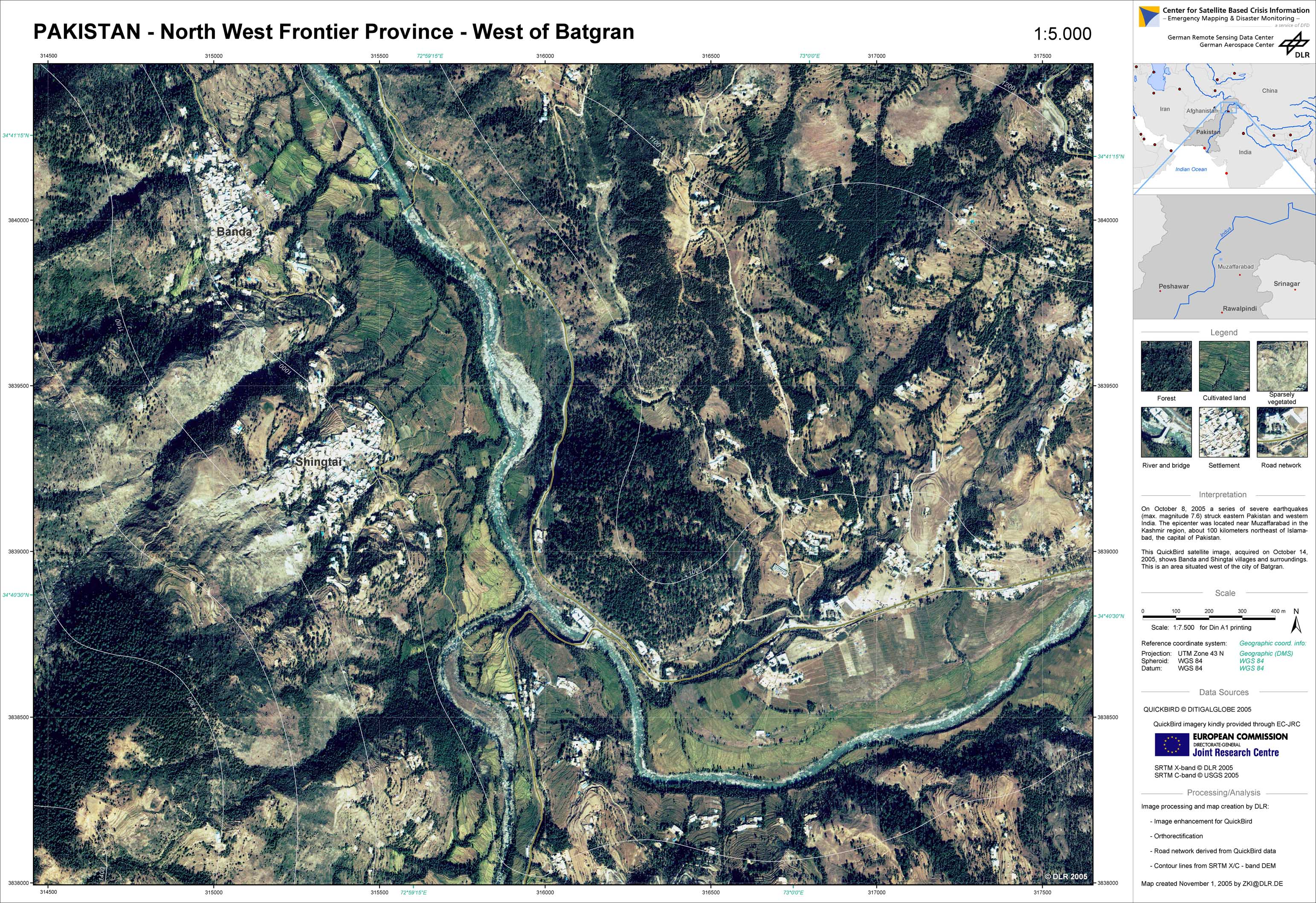
Pakistan - P16 - Satellite map - North-west frontier province - area west of Batgran
Creation Date 01. November 2005
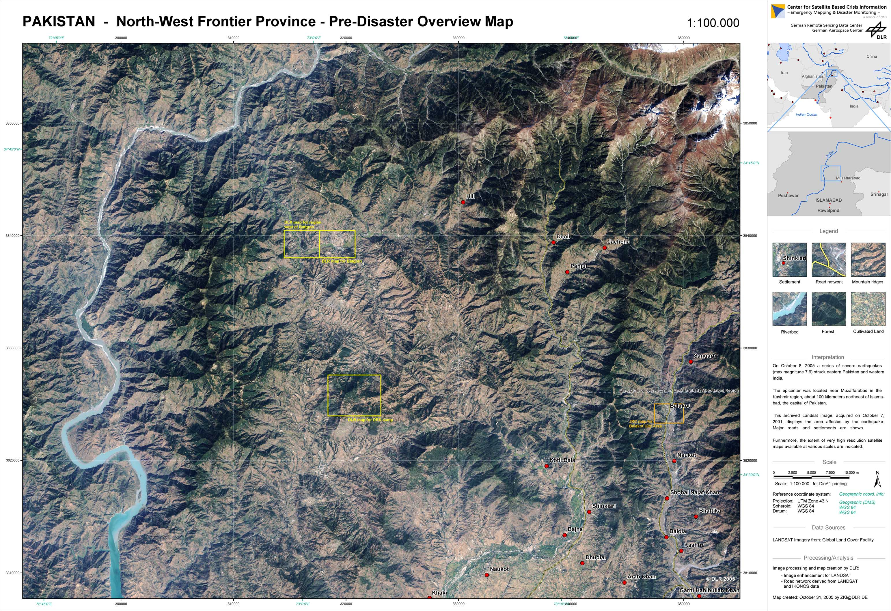
Pakistan - P15 - Pre-disaster overview map - North-west frontier province
Creation Date 31. October 2005
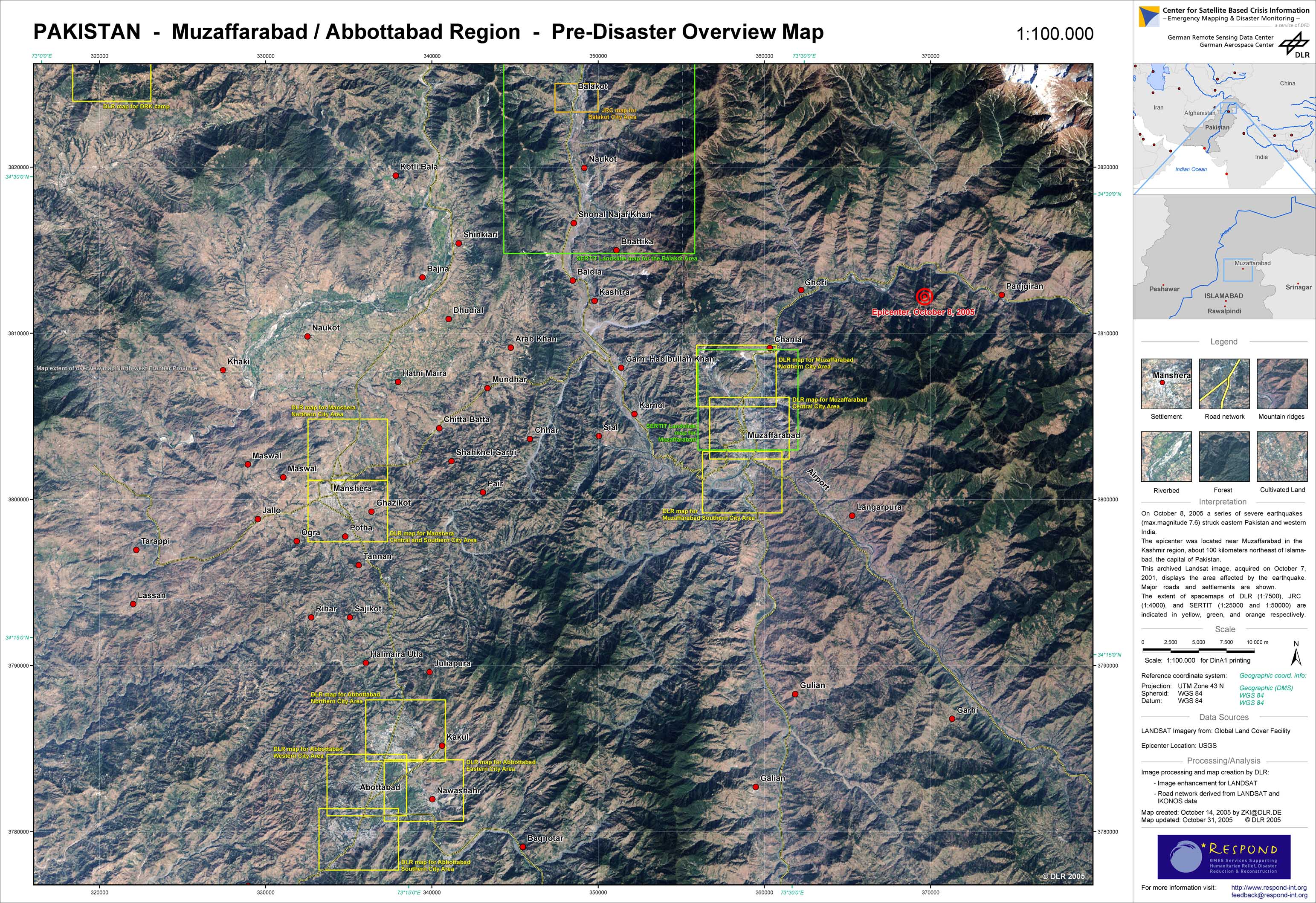
Pakistan - P14 - Pre-disaster overview map - Muzaffarabad - Abbottabad region
Creation Date 31. October 2005
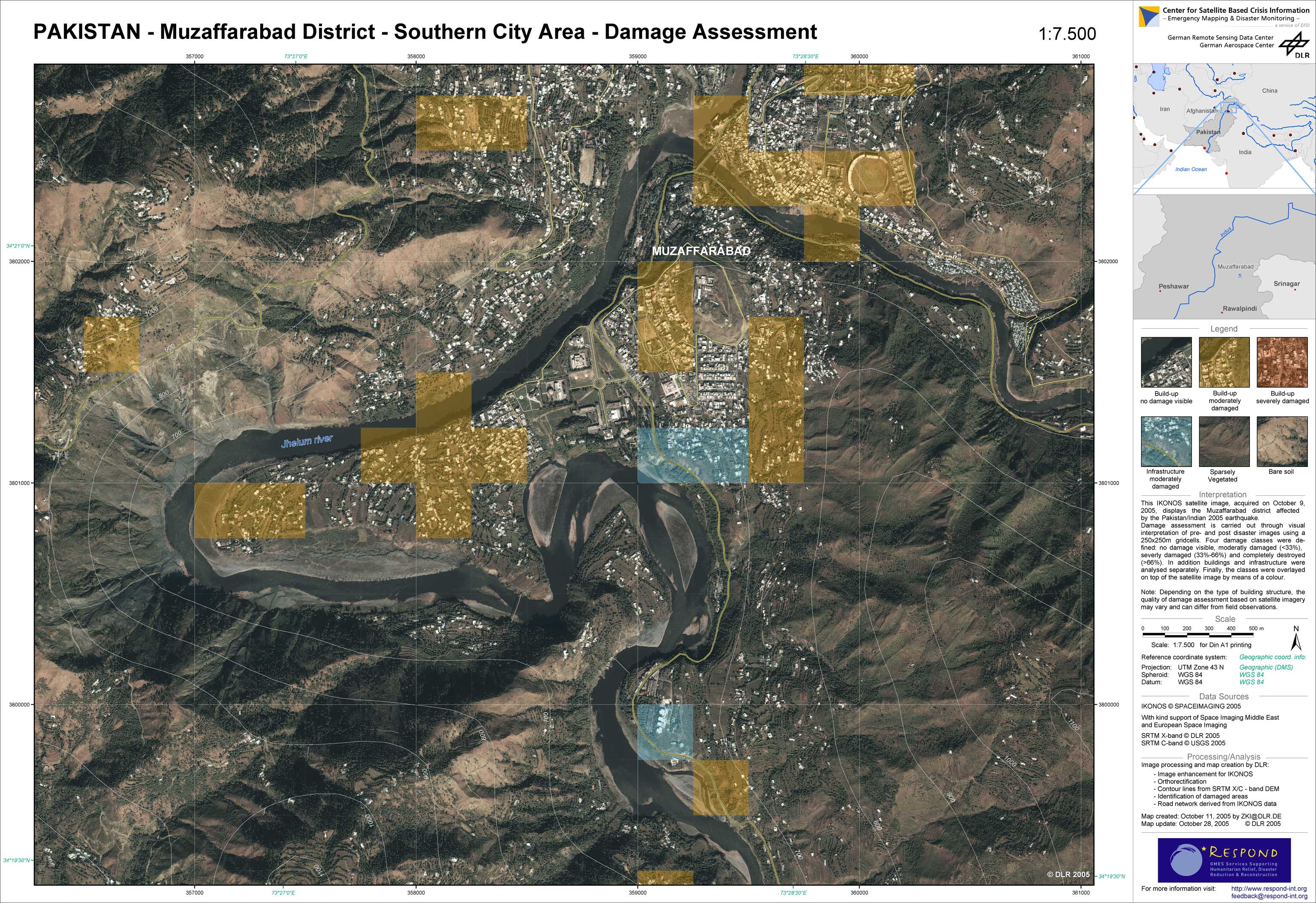
Pakistan - P06 - Damage assessment - Muzaffarabad district - Southern city area
Creation Date 28. October 2005
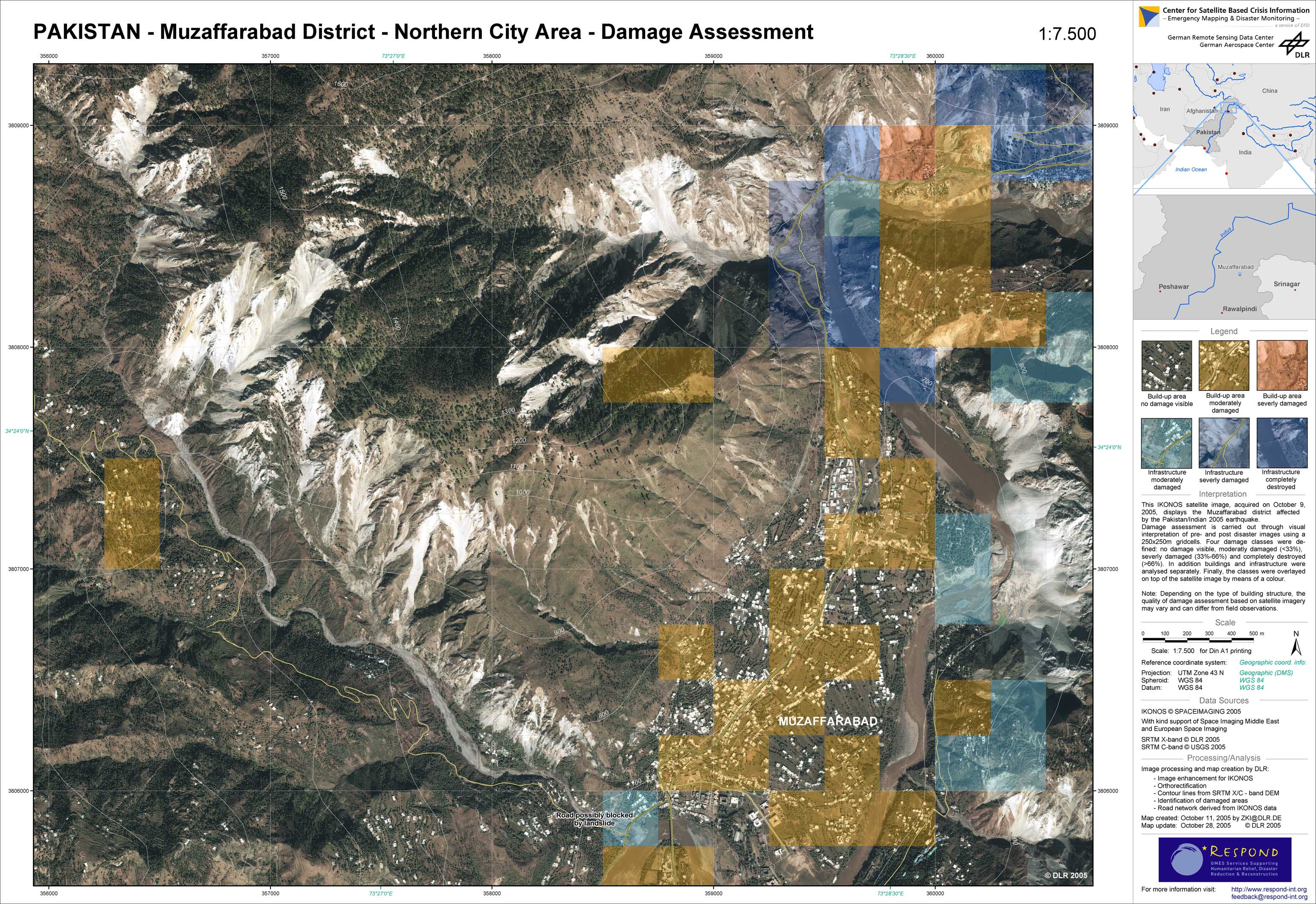
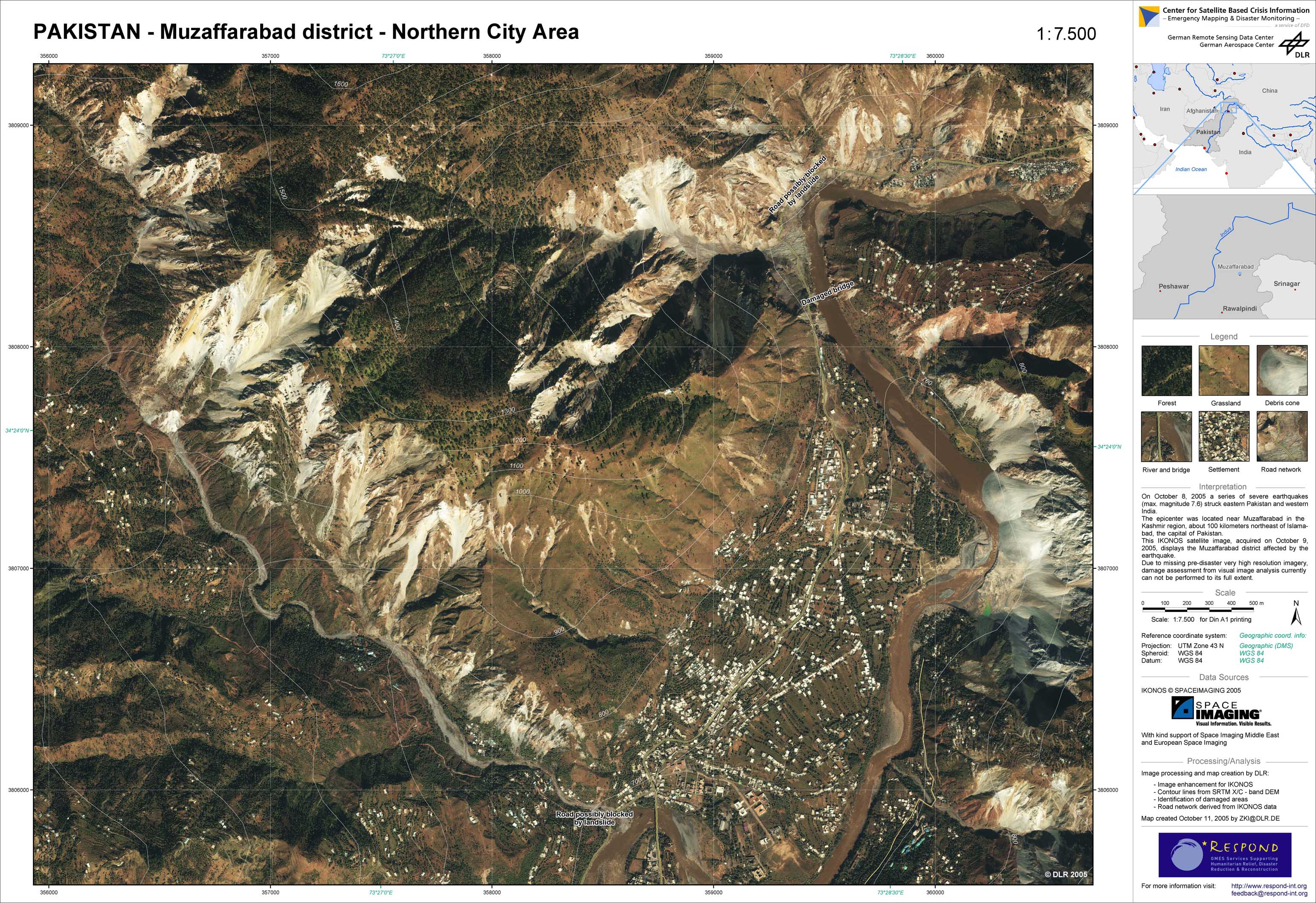
Pakistan - P04 - Damage assessment - Muzaffarabad district - Northern city area
Creation Date 28. October 2005
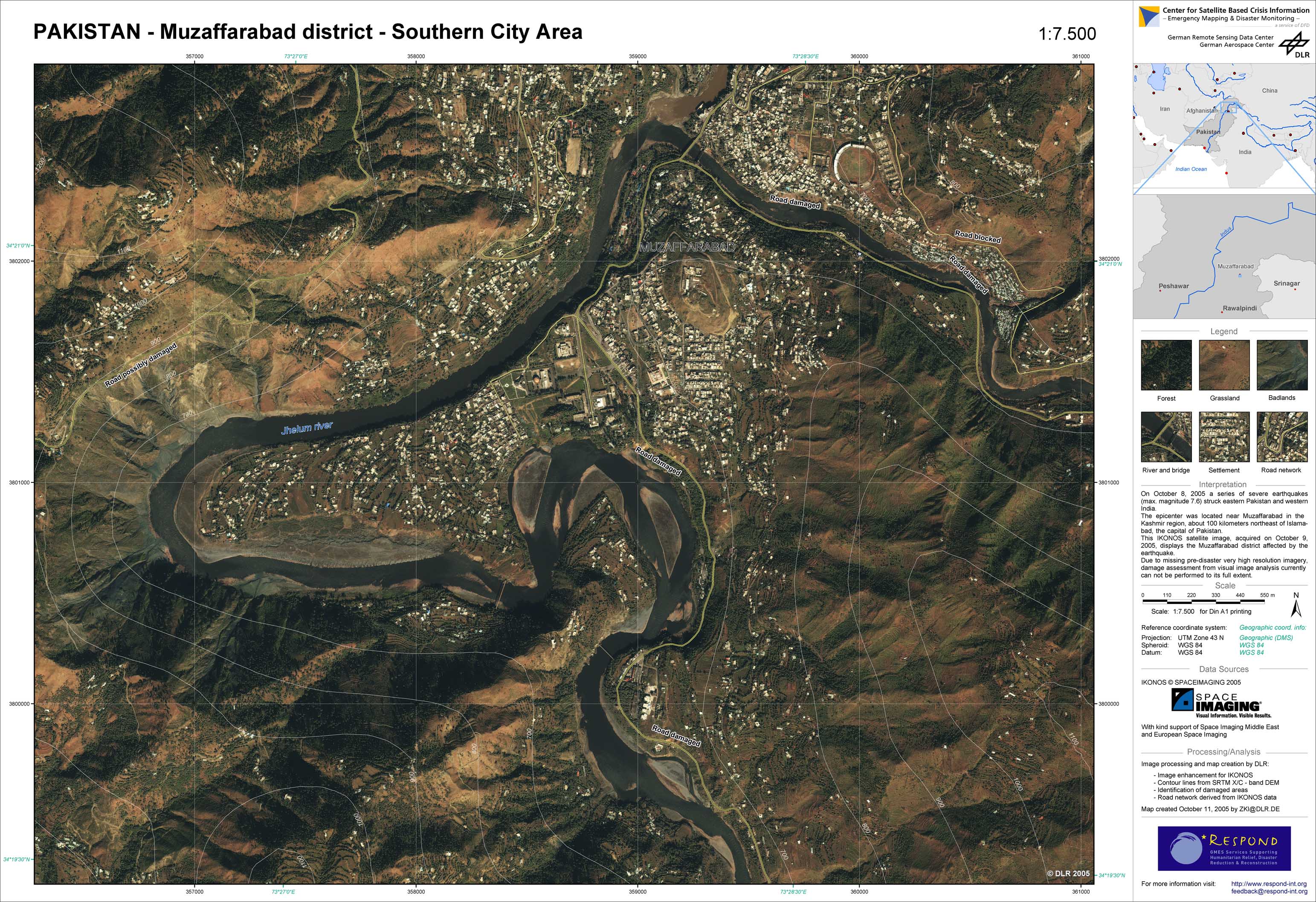
Pakistan - P03 - Satellite map - Muzaffarabad district - Southern city area
Creation Date 28. October 2005
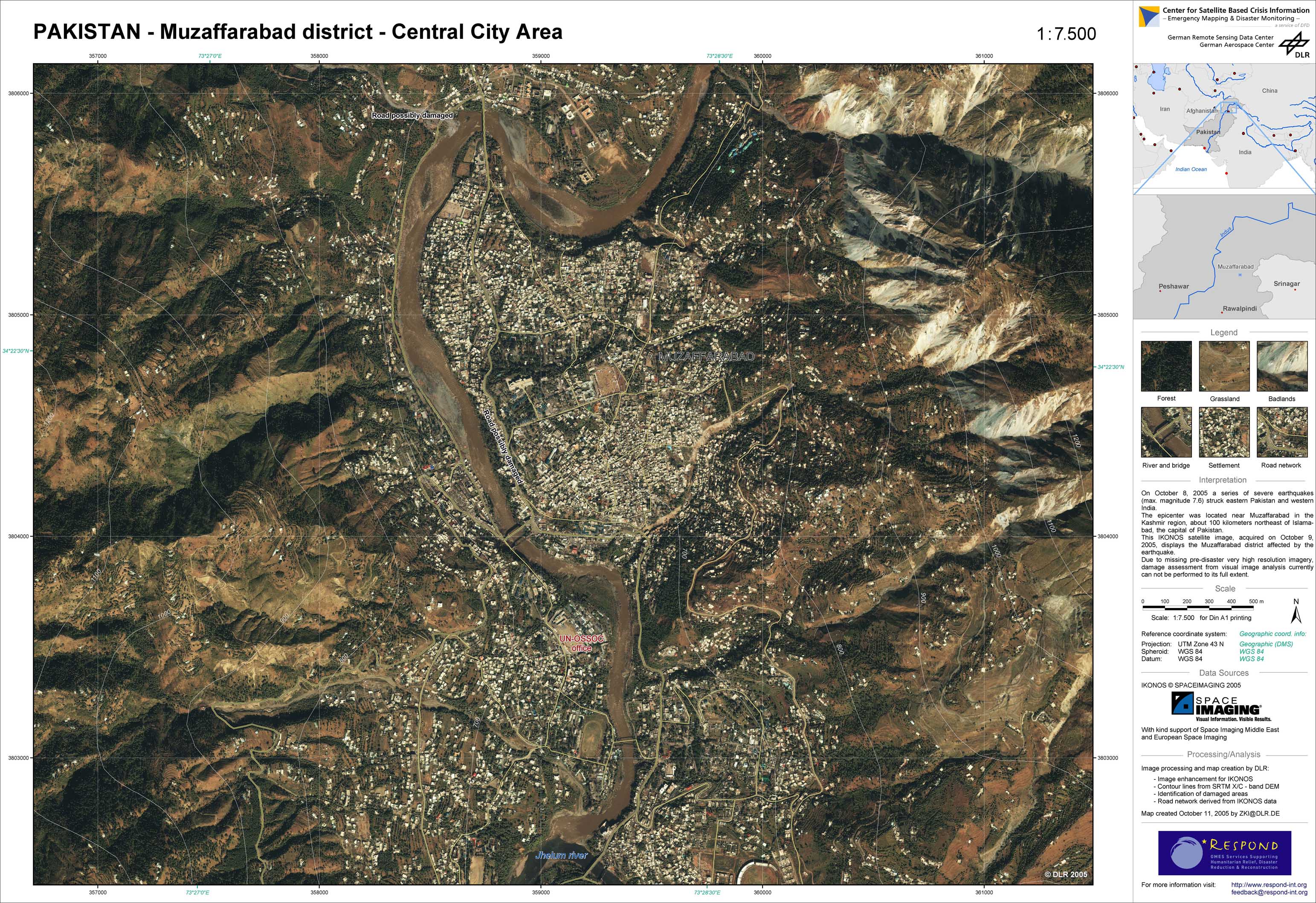
Pakistan - P02 - Satellite map - Muzaffarabad district - Central city area
Creation Date 28. October 2005
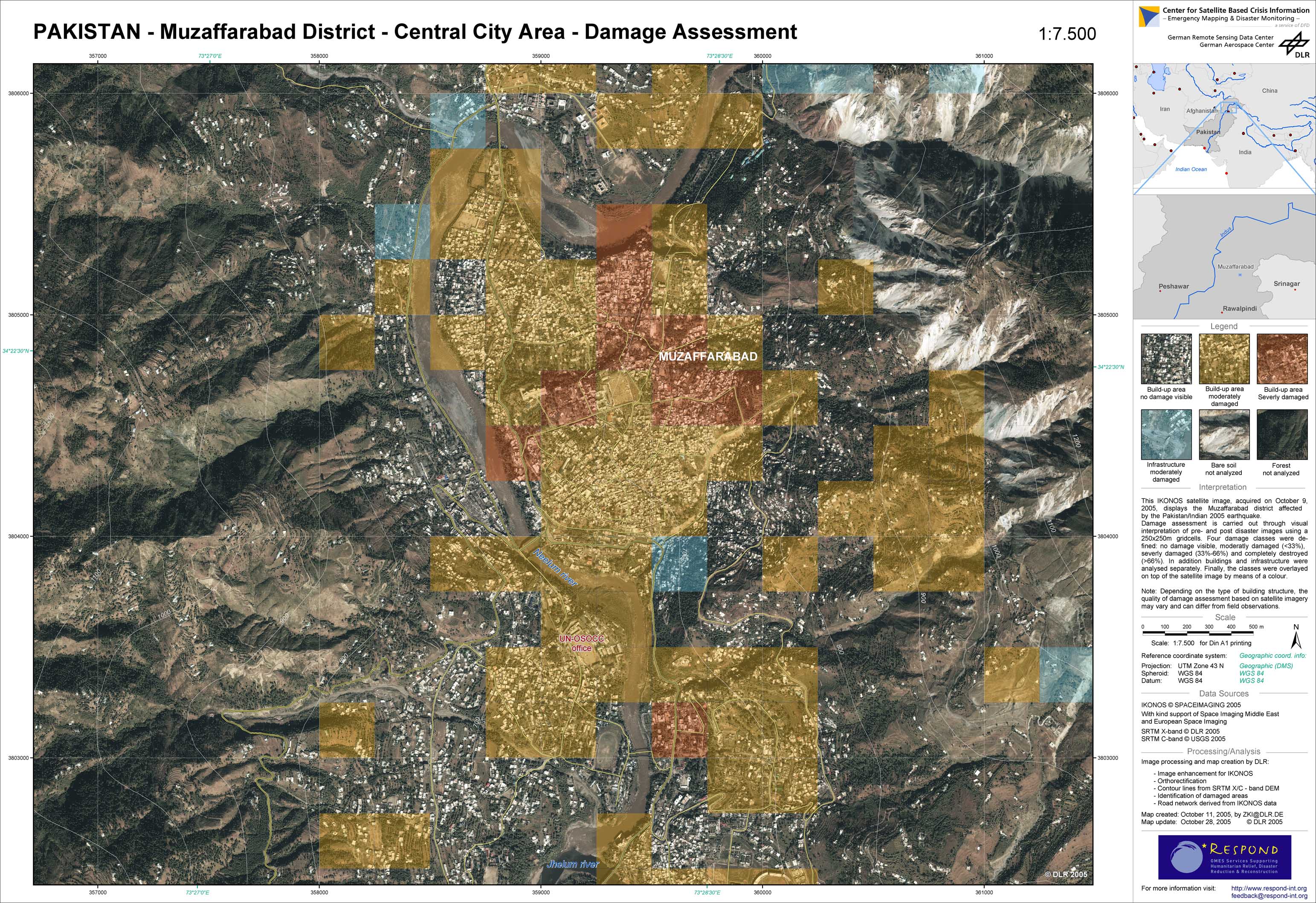
Pakistan - P05 - Damage assessment - Muzaffarabad district - Central city area
Creation Date 28. October 2005
Pakistan - P01 - Satellite map - Muzaffarabad district - Northern city area
Creation Date 28. October 2005
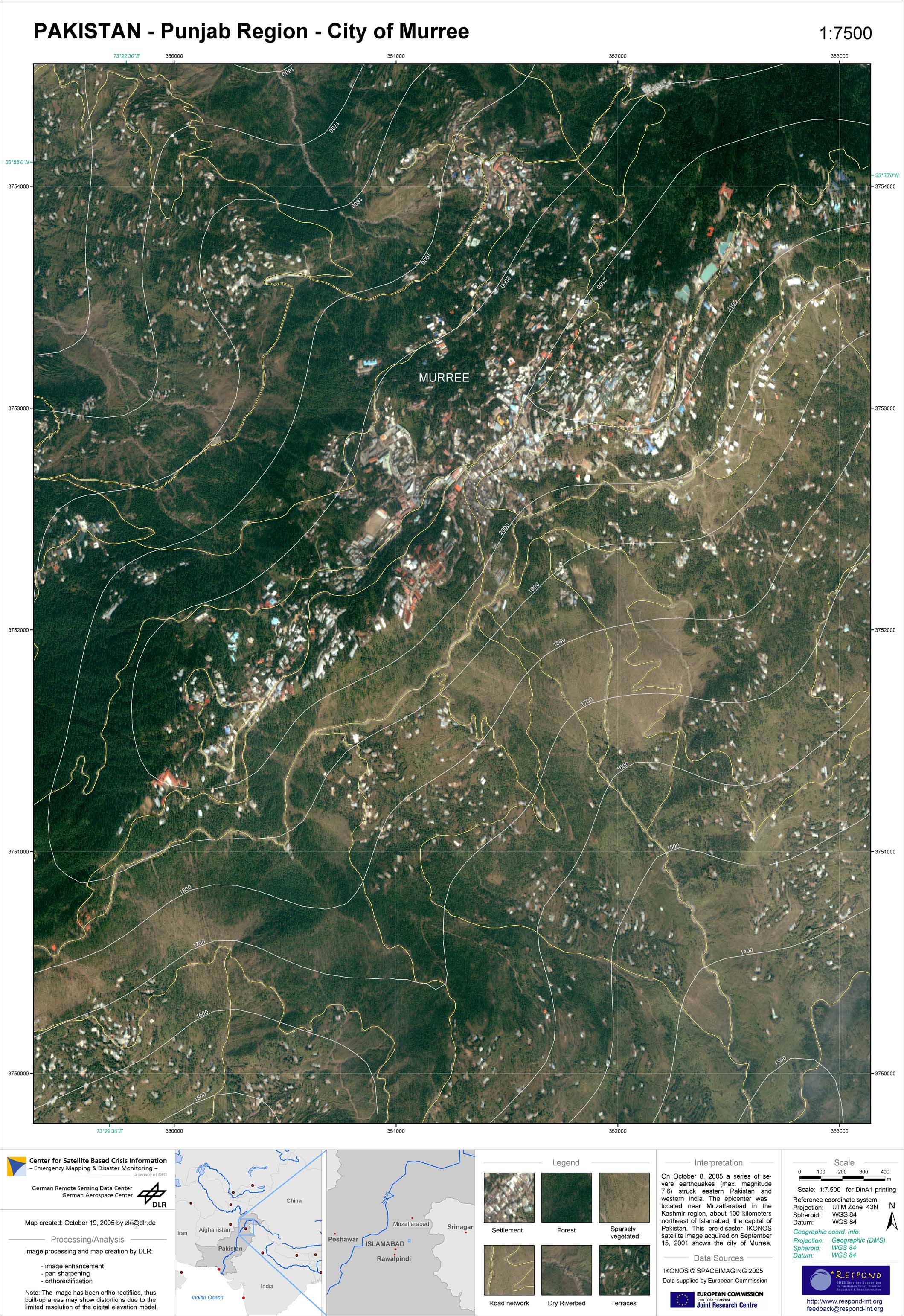
Pakistan - P13 - Satellite map - City of Murree
Creation Date 19. October 2005
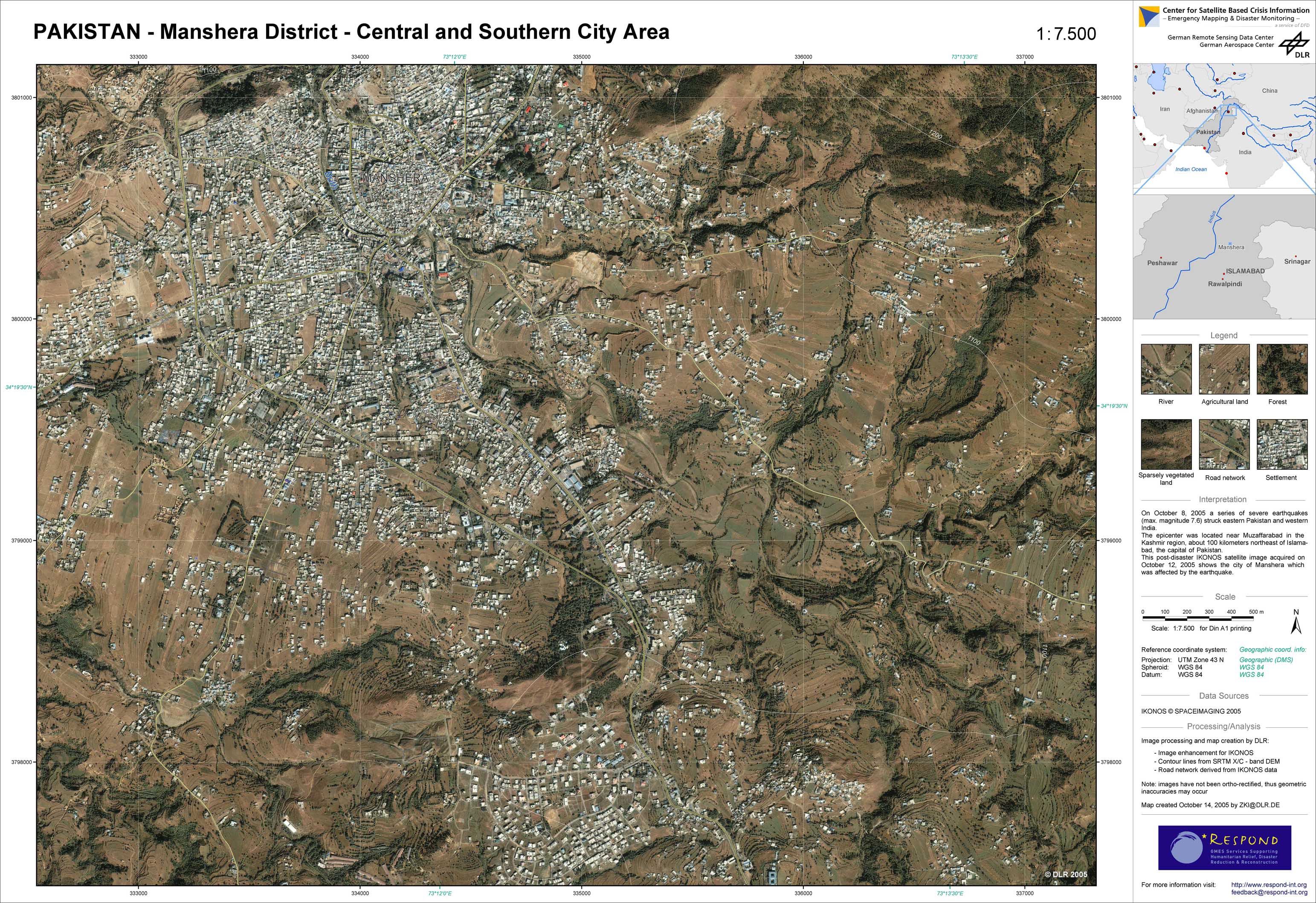
Pakistan - P12 - Satellite map - Manshera district - Central and southern city area
Creation Date 14. October 2005
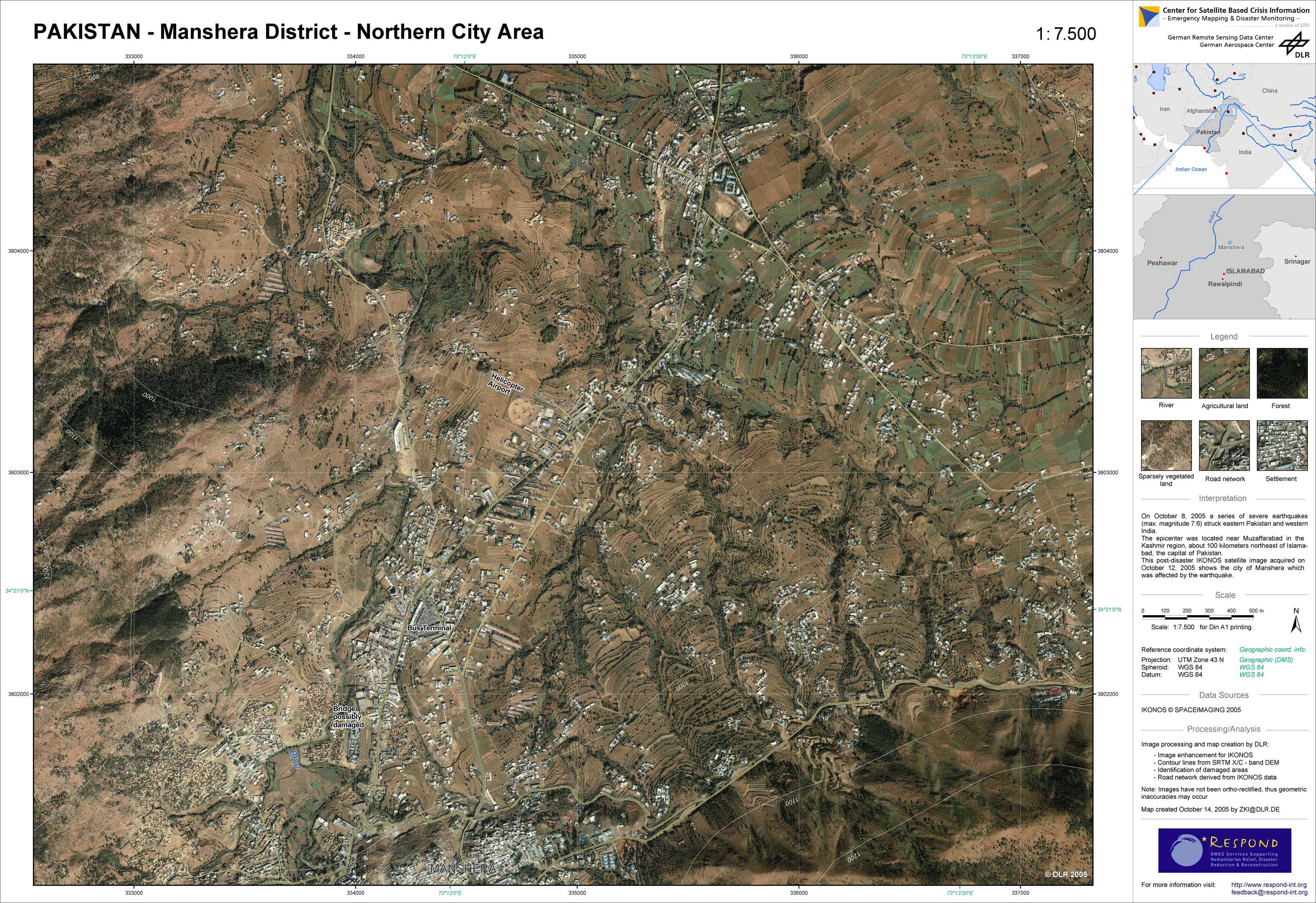
Pakistan - P11 - Satellite map - Manshera district - Northern city area
Creation Date 14. October 2005
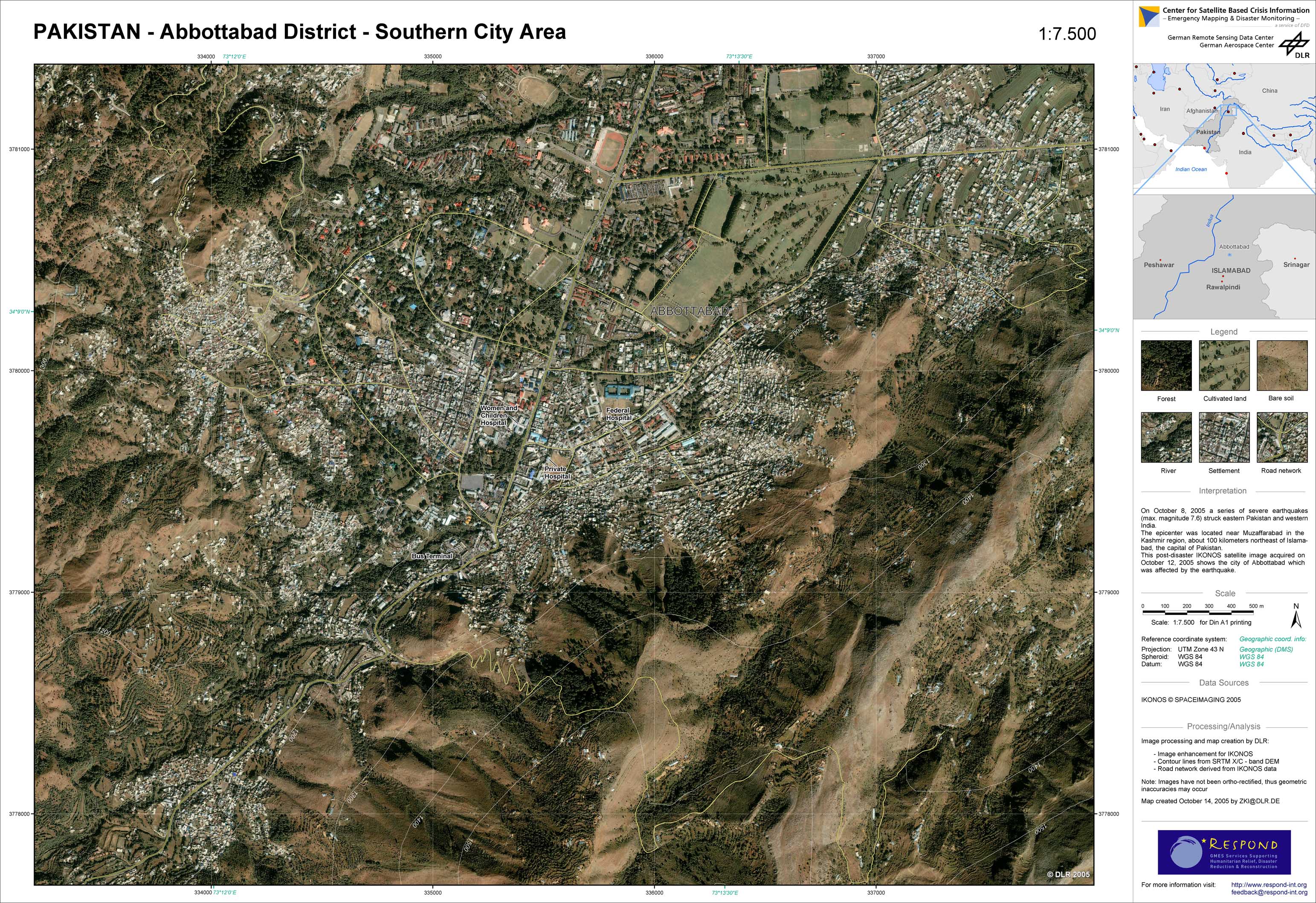
Pakistan - P10 - Satellite map - Abbottabad district - Southern city area
Creation Date 14. October 2005
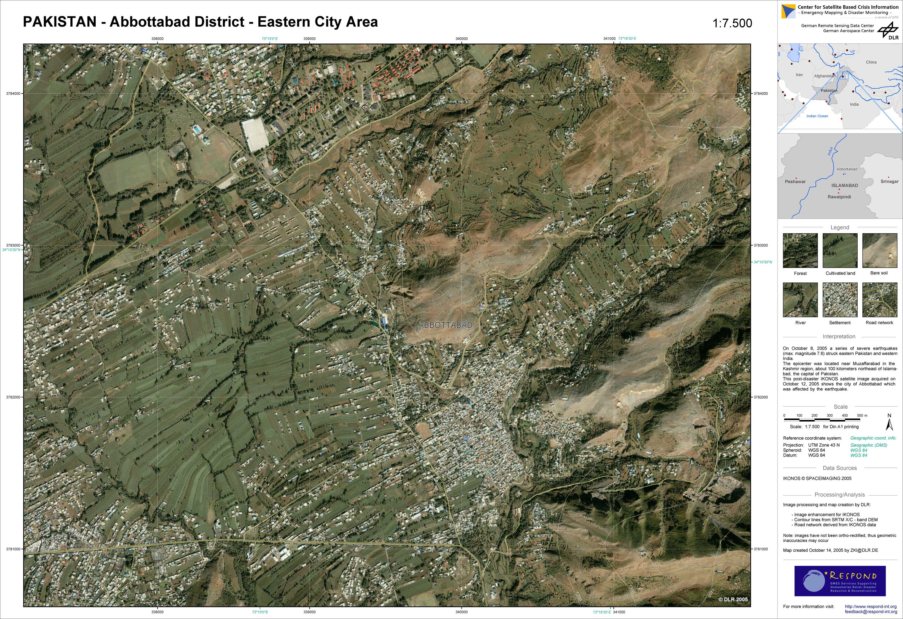
Pakistan - P09 - Satellite map - Abbottabad district - Eastern city area
Creation Date 14. October 2005
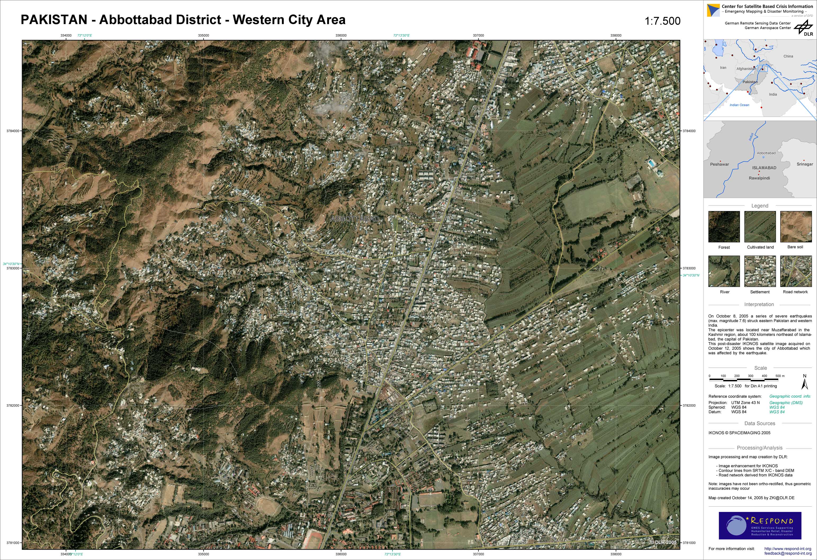
Pakistan - P08 - Satellite map - Abbottabad district - Western city area
Creation Date 14. October 2005
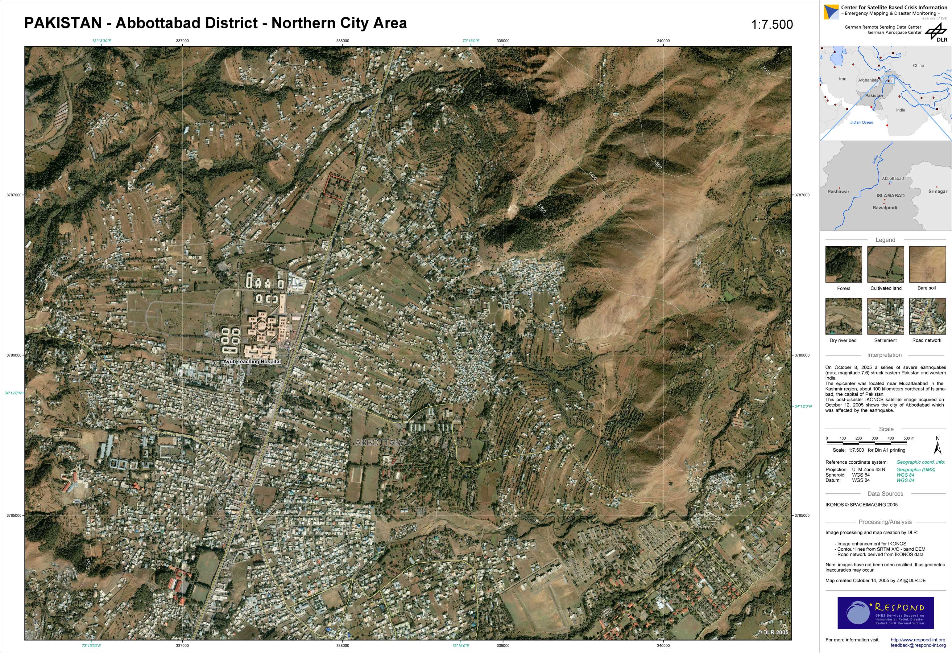
Pakistan - P07 - Satellite map - Abbottabad district - Northern city area
Creation Date 14. October 2005