Danube flood in Romania
undefined
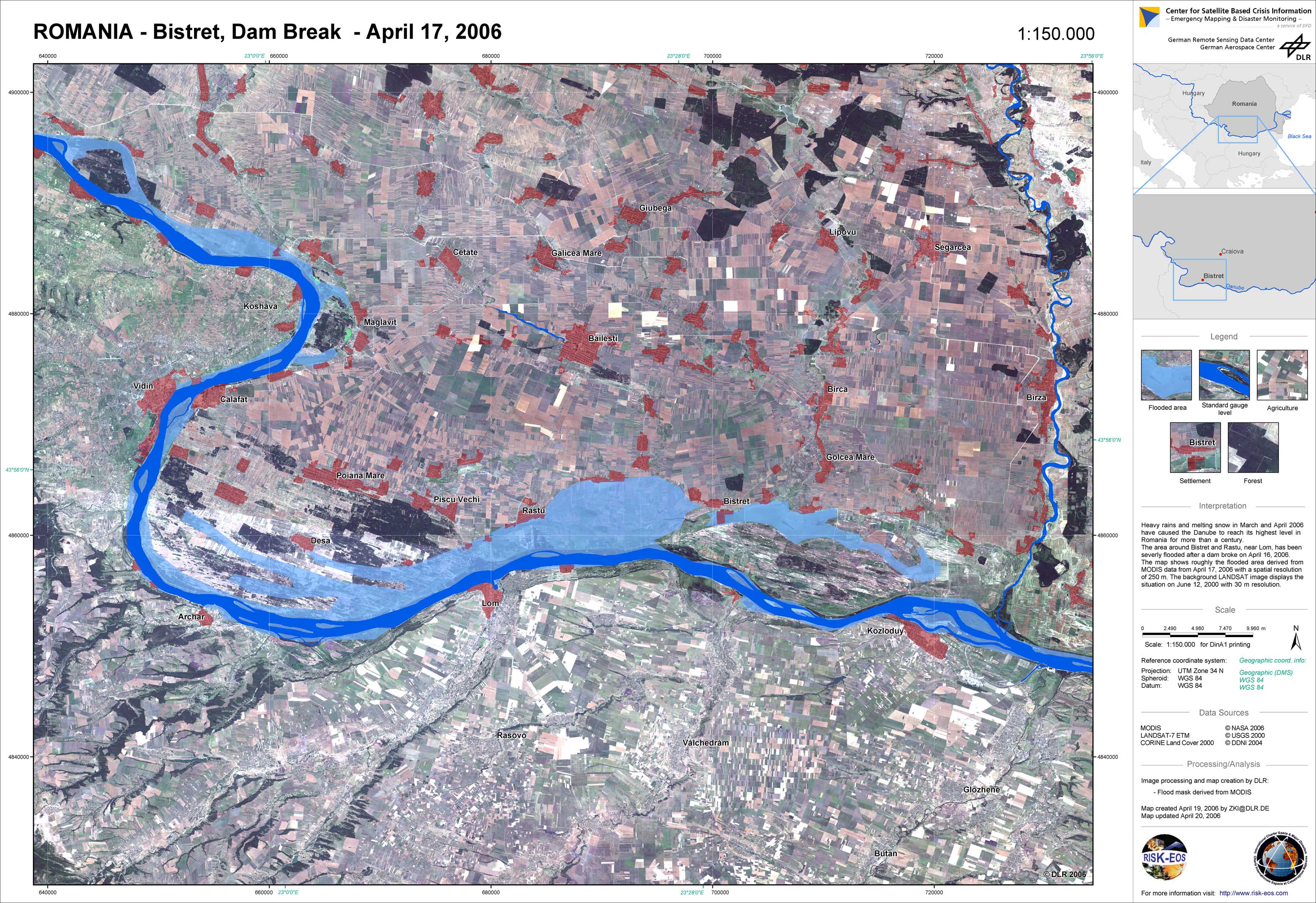
In Romania, snowmelt and long lasting rainfalls led to a dramatic increase of water levels at the Danube River to values which were never measured before. More than 4,700 people had to be evacuated from the flooded regions, 3,000 of them in the village Rast in the southwest of the country alone. After a dam could no longer withstand the pressure by the water, 600 buildings were flooded, from which 115 collapsed. 40,000 hectares of land were covered by the floodings. Due to the tough flood situation in Romania, the Monitoring and Information Centre (MIC) of the European Commission had extended Charter Call 120 (Floods at Tisza River, Hungary) to the affected regions there. The Center for Satellite Based Crisis Information (ZKI) of DLR was producing maps of the flooded areas based on up-to-date satellite data. The map production was financed through the GMES Service Element RISK-EOS.
Romania - P01 - Landsat map with flood mask derived from MODIS data from April 17, 2006 - Bistret
Creation Date 21. April 2006
undefined