08. January 2013

Refugee / IDP Camp Mapping in Jordan

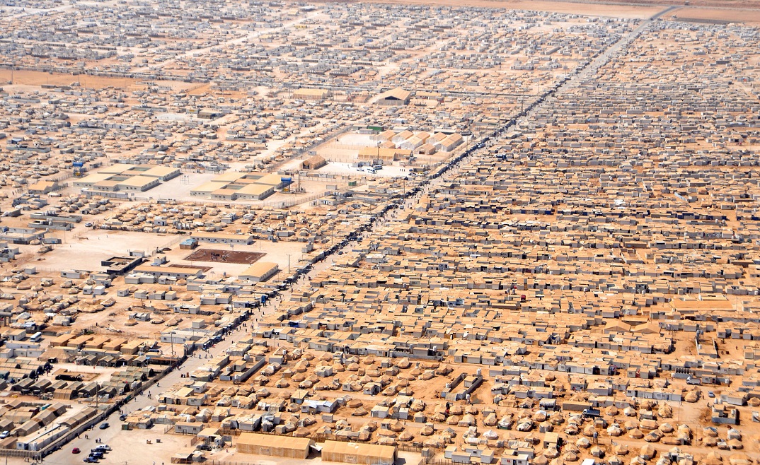
Aerial view of the jordanian refugee camp Al Zaatari.
Credit:
U.S. Department of State/Wikimedia Commons

Ongoing violence in Syria has led thousands of people to leave their country and to flee to neighbouring Jordan. More than 40,000 people have found accomodation in Al Zaatari refugee camp and even more people are expected to arrive. In addition to this tense situation heavy rainfalls have caused severe damages during the last days. This mapping activity was performed in the context of the ZKI-DE Service for Federal Agencies in Germany based on the framework contract between the German Federal Ministry of the Interior (BMI) and the German Aerospace Center (DLR).

Products

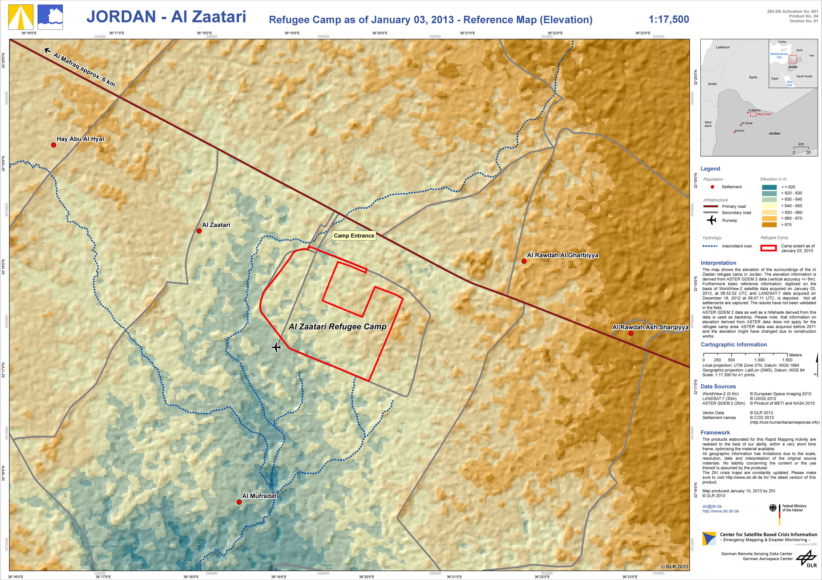
Jordan - Al Zaatari - P04 - Refugee Camp as of January 03, 2013 - Elevation Map

Creation Date 10. January 2013

Jordan - Al Zaatari - P03 - Flood as of January 10, 2013 - Disaster Extent Map

Creation Date 10. January 2013

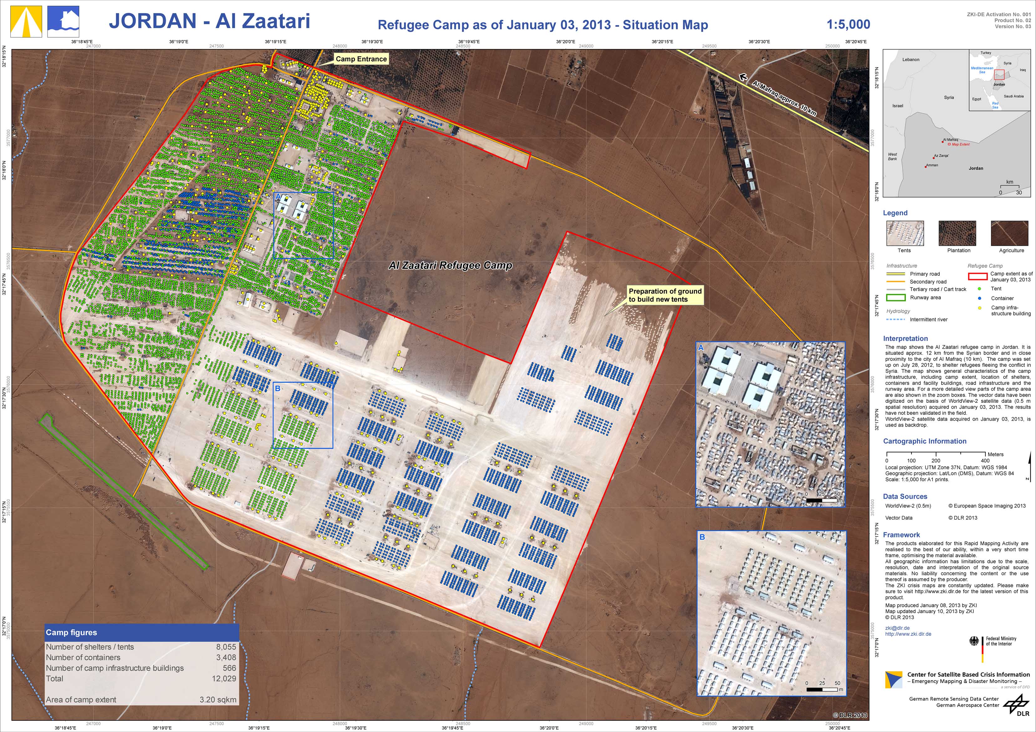
Jordan - Al Zaatari - P02 - Refugee Camp as of January 03, 2013 - Situation Map

Creation Date 10. January 2013

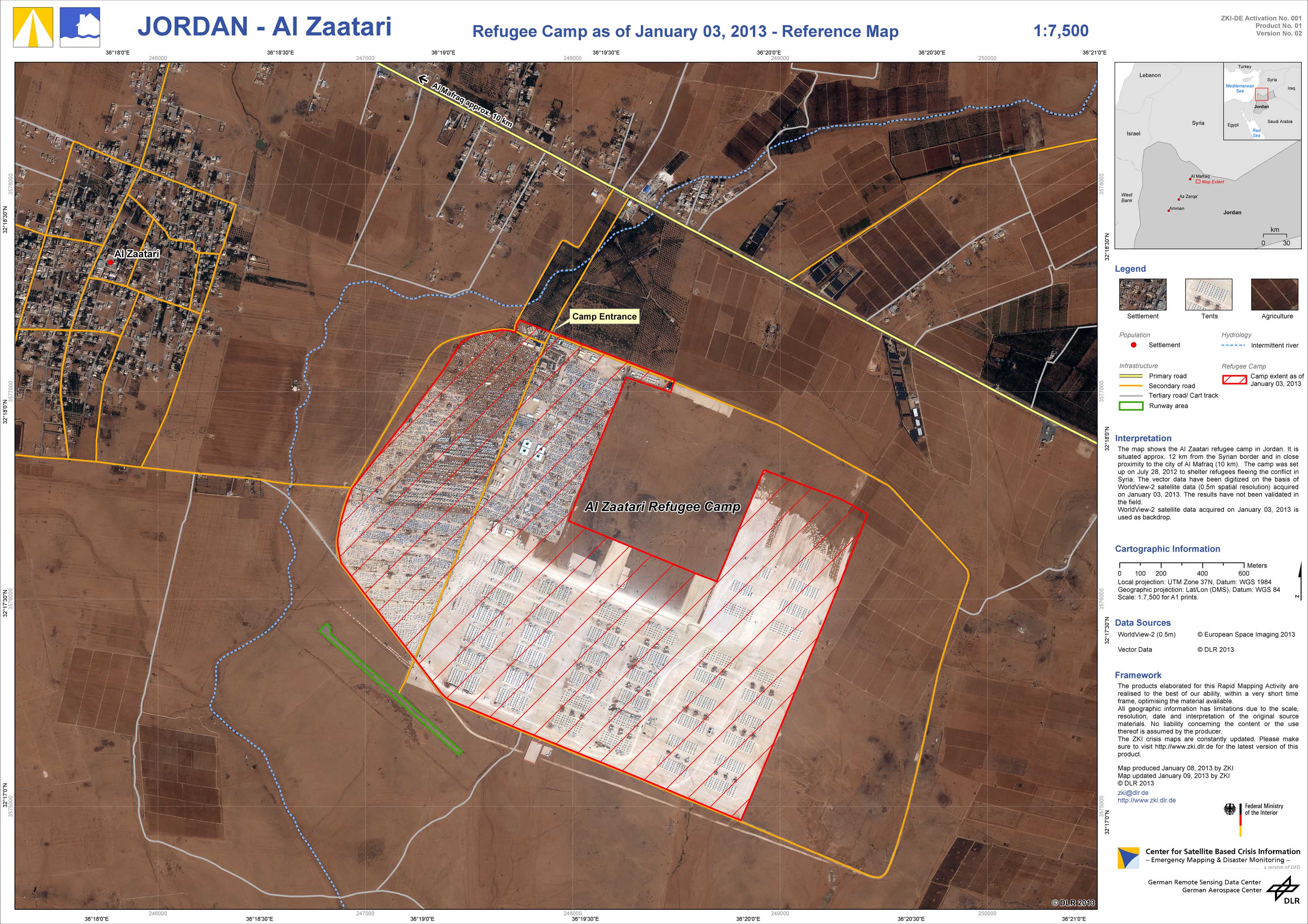
Jordan - Al Zaatari - P01 - Refugee Camp as of January 03, 2013 - Reference Map

Creation Date 09. January 2013

undefined