Hurricane Harvey - DLR supports Texas with satellite data
29. August 2017
Hurricane Harvey - DLR supports Texas with satellite data
Hurricane Harvey in the Gulf of Mexico on August 24
Credit:
DLR (CC BY-NC-ND 3.0)
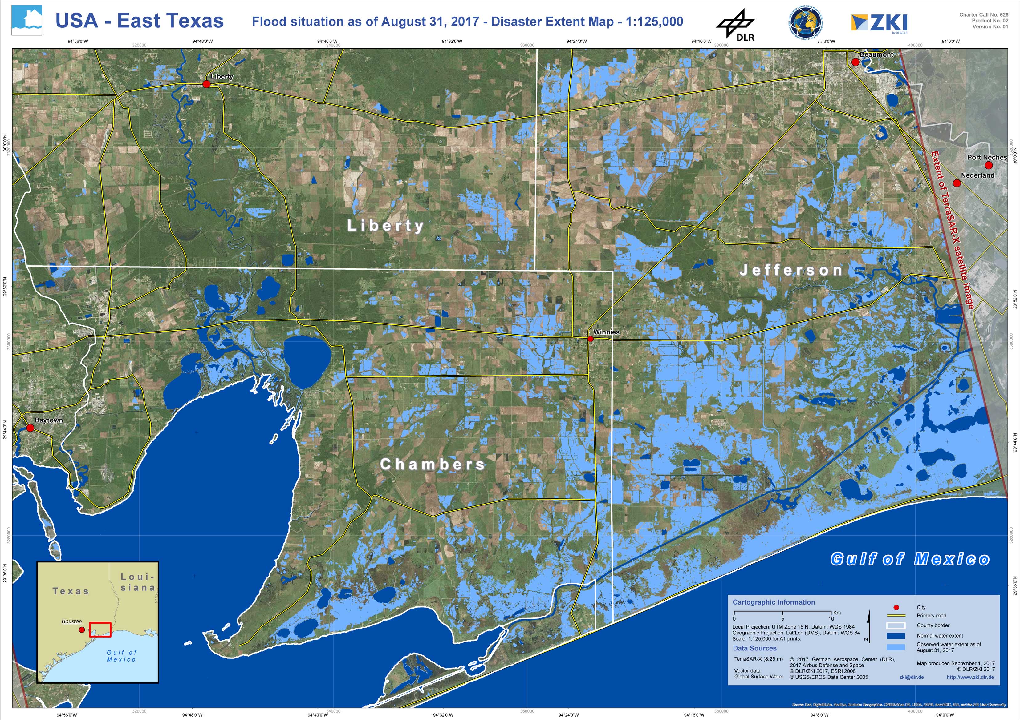
On August 26th, 2017, hurricane Harvey made landfall on the coast of Texas. Massive amounts of rain have caused extensive flooding in parts of southeastern Texas, including Fort Bend, Brazoria and Galeston Counties, as well as Harris County and wide areas of Houston. Five people have reportedly died in the storm, including at least 2 in flooding in the Houston area. President Trump has issued a Major Disaster Declaration for the state of Texas. River levels in south eastern Texas have already broken previous record heighs in at least 6 locations, with more record heighs likely to follow. In the frame of the International Charter Space and Major Disasters, DLR supports the crisis management activities.
Products
USA - East Texas - P02 - Flood situation as of August 31, 2017 - Disaster Extent Map