03. April 2020

Innovative analyses as possible triggers for a satellite-based recording - Experimental map products based on heterogeneous data streams like Twitter and media analysis tools

Credit:
DLR (CC BY-NC-ND 3.0)
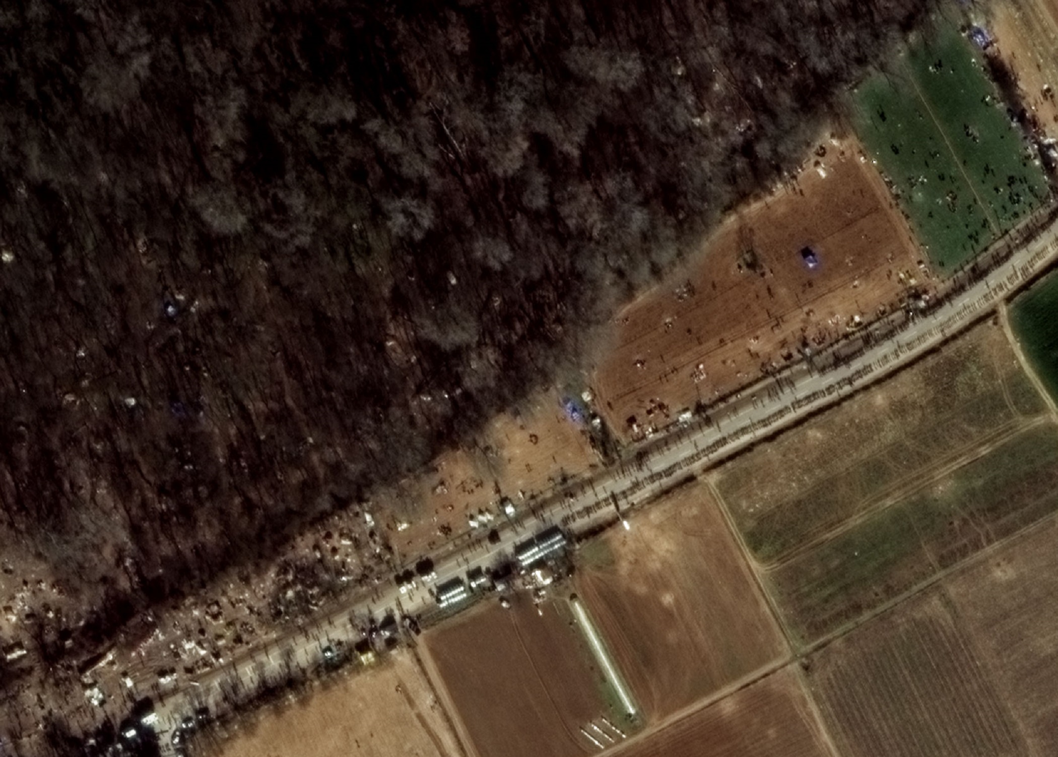
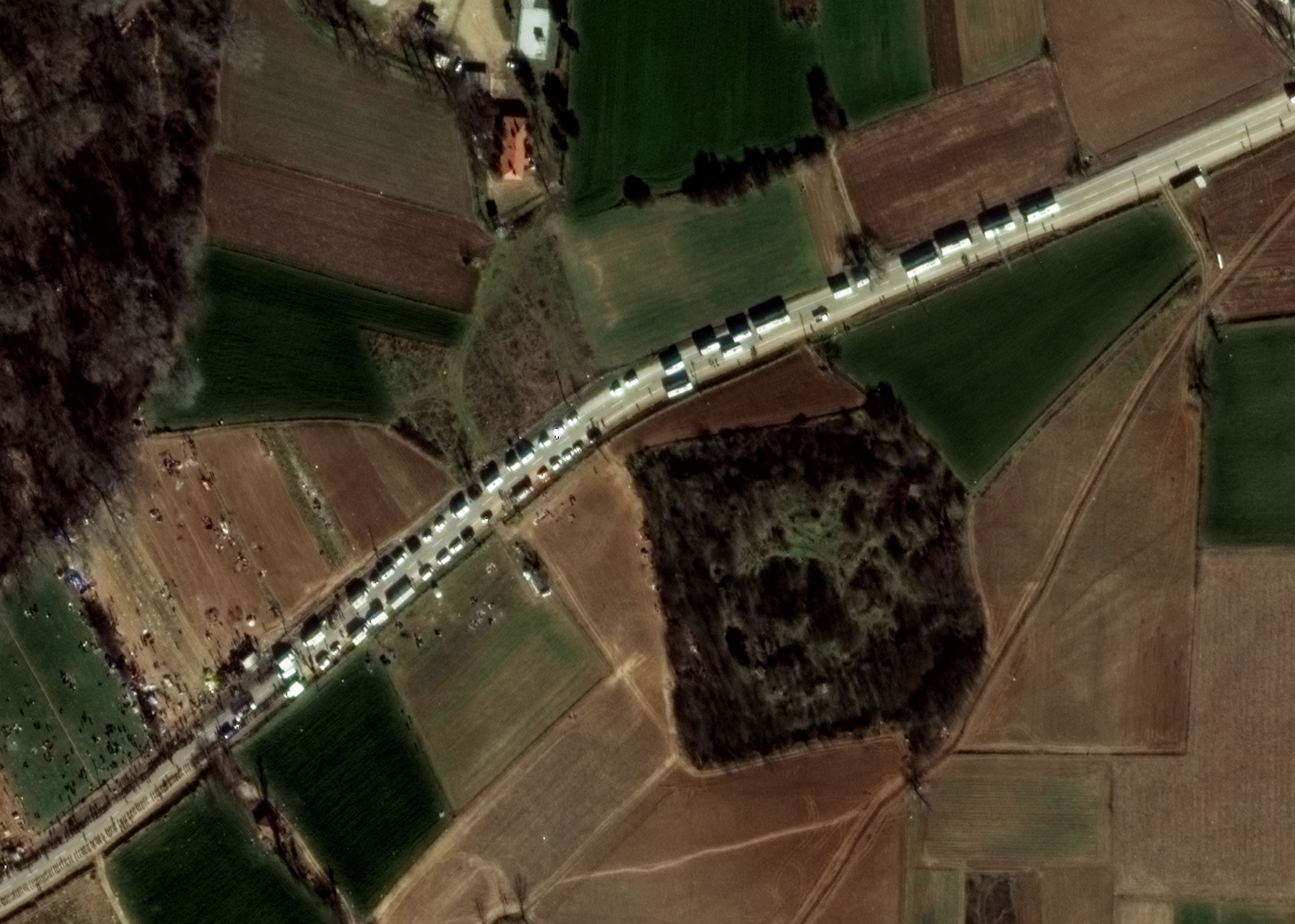
High-resolution WorldView-3 satellite data from 03 March 2020 of the Greek-Turkish border.
Credit:
Satellite Imagery © 2020 European Space Imaging.

In order to ensure a continuous improvement of satellite-based crisis information, ZKI is involved, i. a. together with the DLR project UKIS, in the research of new applied methods and the development of relevant products for the users in disaster management, humanitarian aid and civil security.

The analyses presented here are based on data from the Twitter platform and the GDELT project (Global Database of Events, Language and Tone). ZKI is investigating possibilities of how such heterogeneous data can on the one hand be meaningfully displayed spatially and on the other hand serve as possible triggers for the acquisition of very high resolution satellite information for the generation of crisis information.

The following map products are experimental products that are still under development. The maps show regions in Southeast Europe, which, in a global comparison, show a high level of Twitter activity in the particular months with regard to keywords in the context of "Refugees", or comparatively many GDELT entries in the respective month.

The analyses of the Twitter data were generated as follows: A real-time data stream available free of charge contains a subset of all currently available tweets and was first filtered according to selected keywords in the context "Refugees". Using a machine-learning based approach, these tweets were then geocoded and aggregated and summed up to administrative units for the map display.

Data from the GDELT project form the basis of the media analysis presented here. GDELT monitors media worldwide in 65 languages in real time and evaluates the content of the news item in terms of locations, sources, moods, etc. This database was searched for keywords on the topic of "Refugees" via a web interface. The coordinates used for the map display were taken from GDELT and aggregated and summed up to administrative units.

Long-term observations have highlighted anomalies that lead to assumptions of increased activity in the area of the Turkey/Greece border (mainland section and Greek islands close to the border). Within the framework of the research activities of DLR-ZKI, anomalies should continue to be detected. These can possibly be used as triggers for the acquisition of high-resolution satellite data, such as the WorldView-3 data of 03 March 2020 published by European Space Imaging on Twitter. Here it can be seen that both human and vehicle conglomerations can be detected.

Products

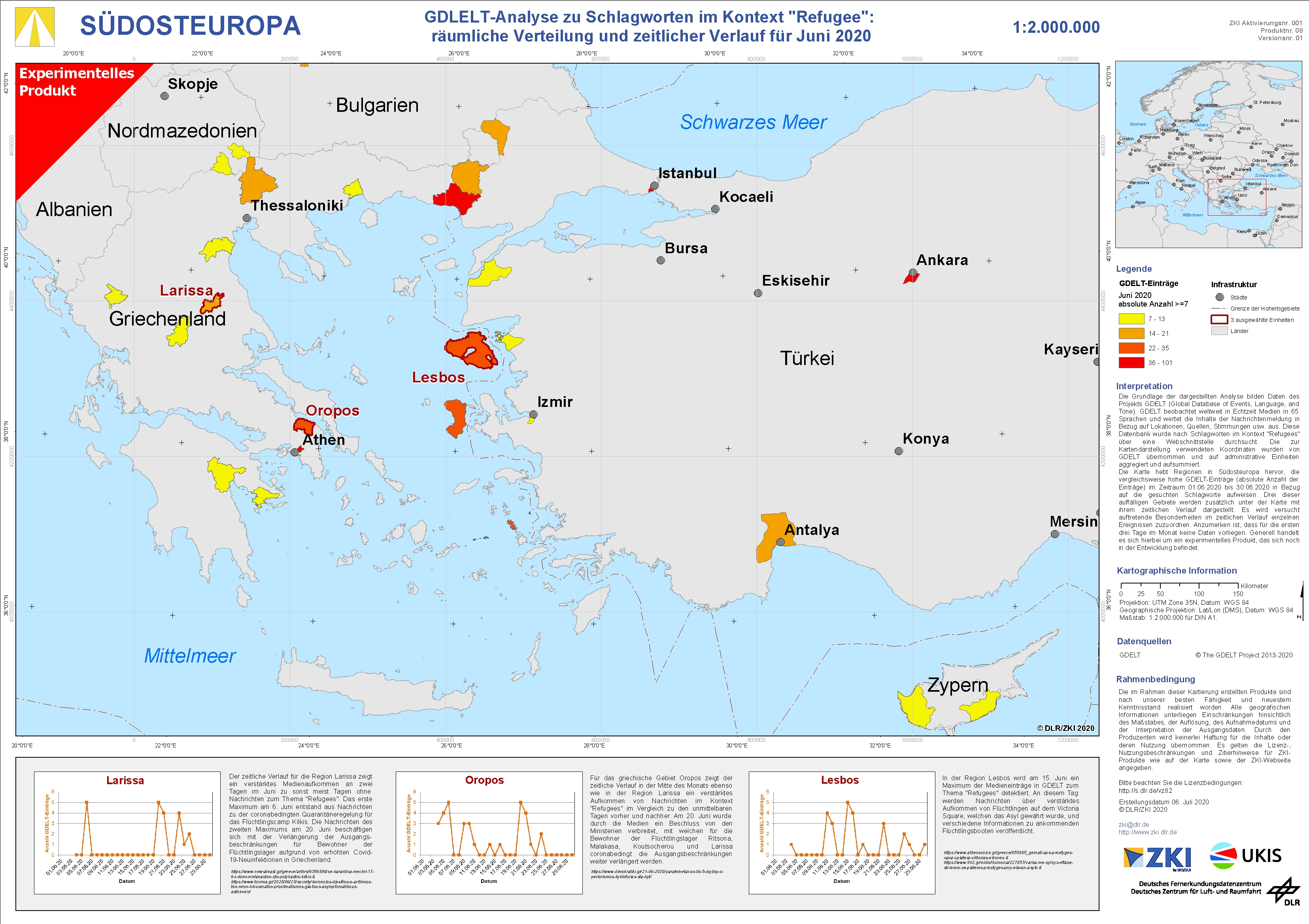
South Eastern Europe – GDELT analysis of keywords in the context of "Refugee" for June 2020 – experimental product

Creation Date 07. June 2020

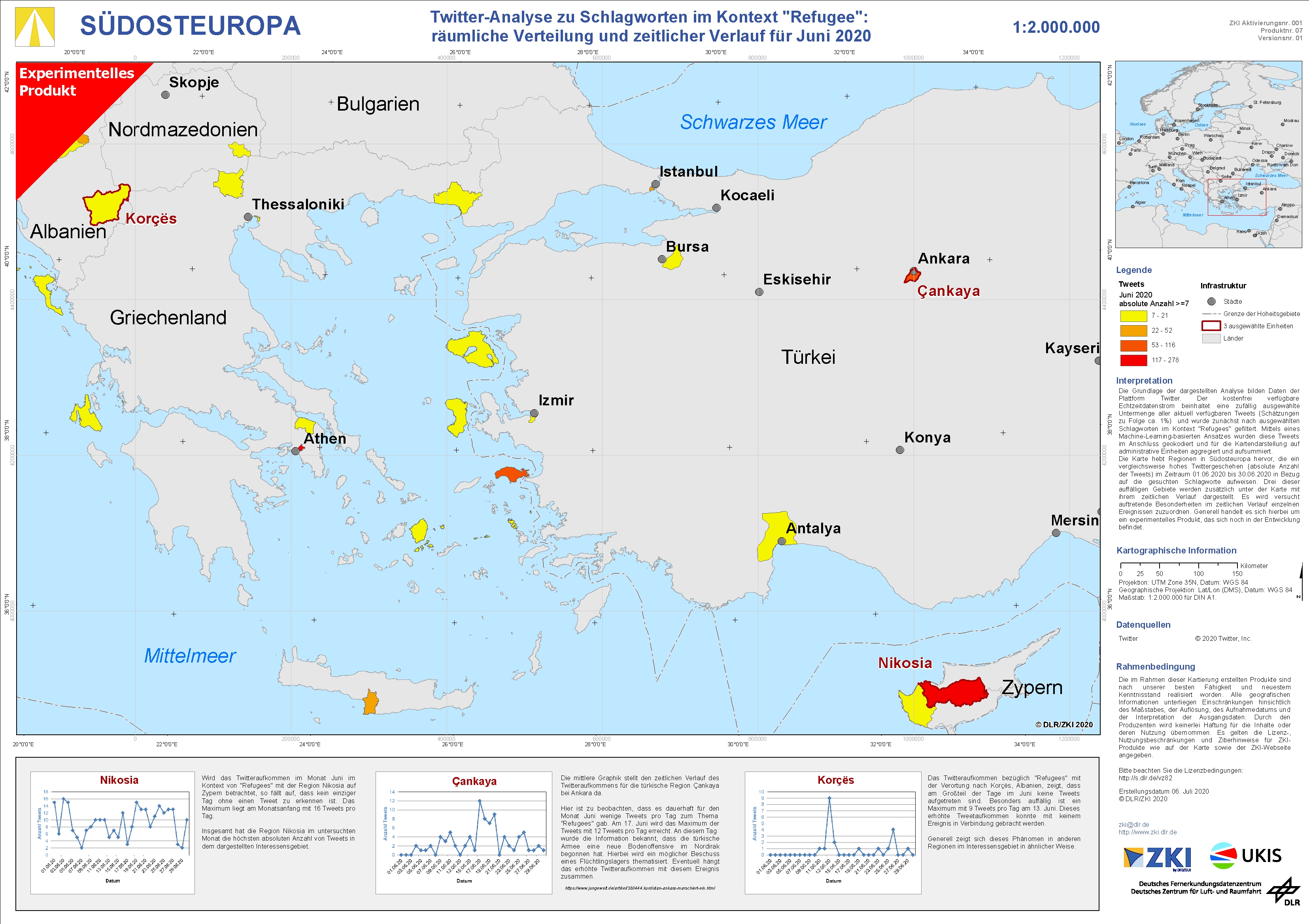
South Eastern Europe – Twitter analysis of keywords in the context of "Refugee" for June 2020 – experimental product

Creation Date 07. June 2020

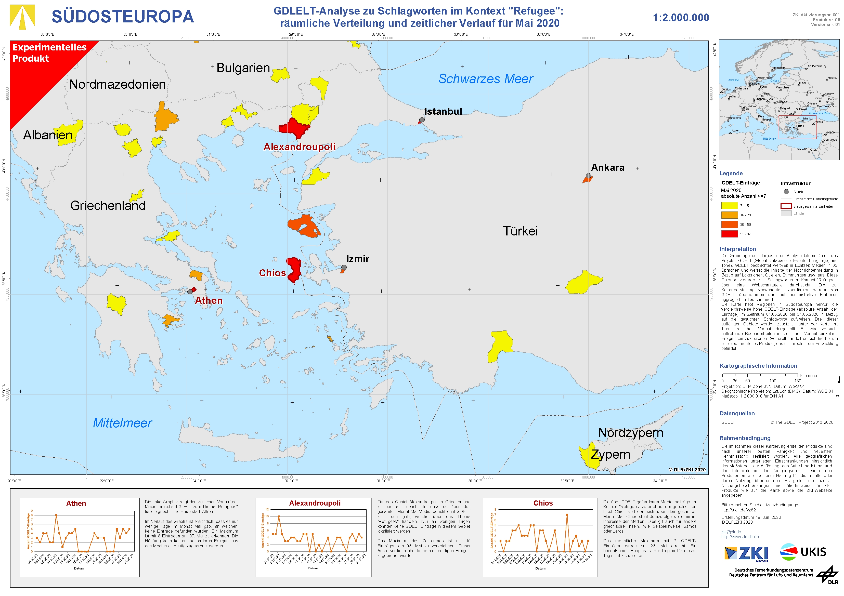
South Eastern Europe – GDELT analysis of keywords in the context of "Refugee" for May 2020 – experimental product

Creation Date 13. May 2020

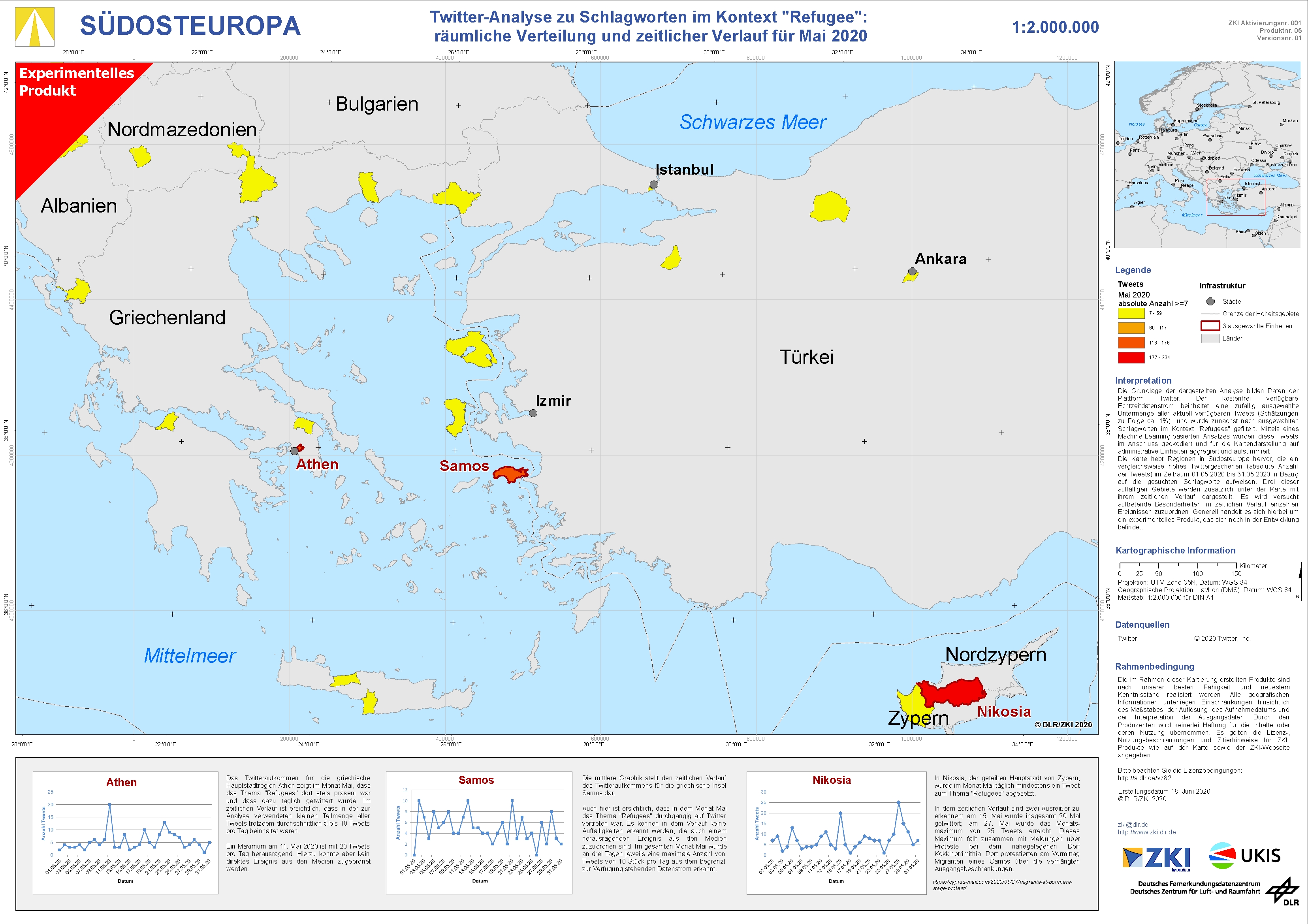
South Eastern Europe – Twitter analysis of keywords in the context of "Refugee" for May 2020 – experimental product

Creation Date 13. May 2020

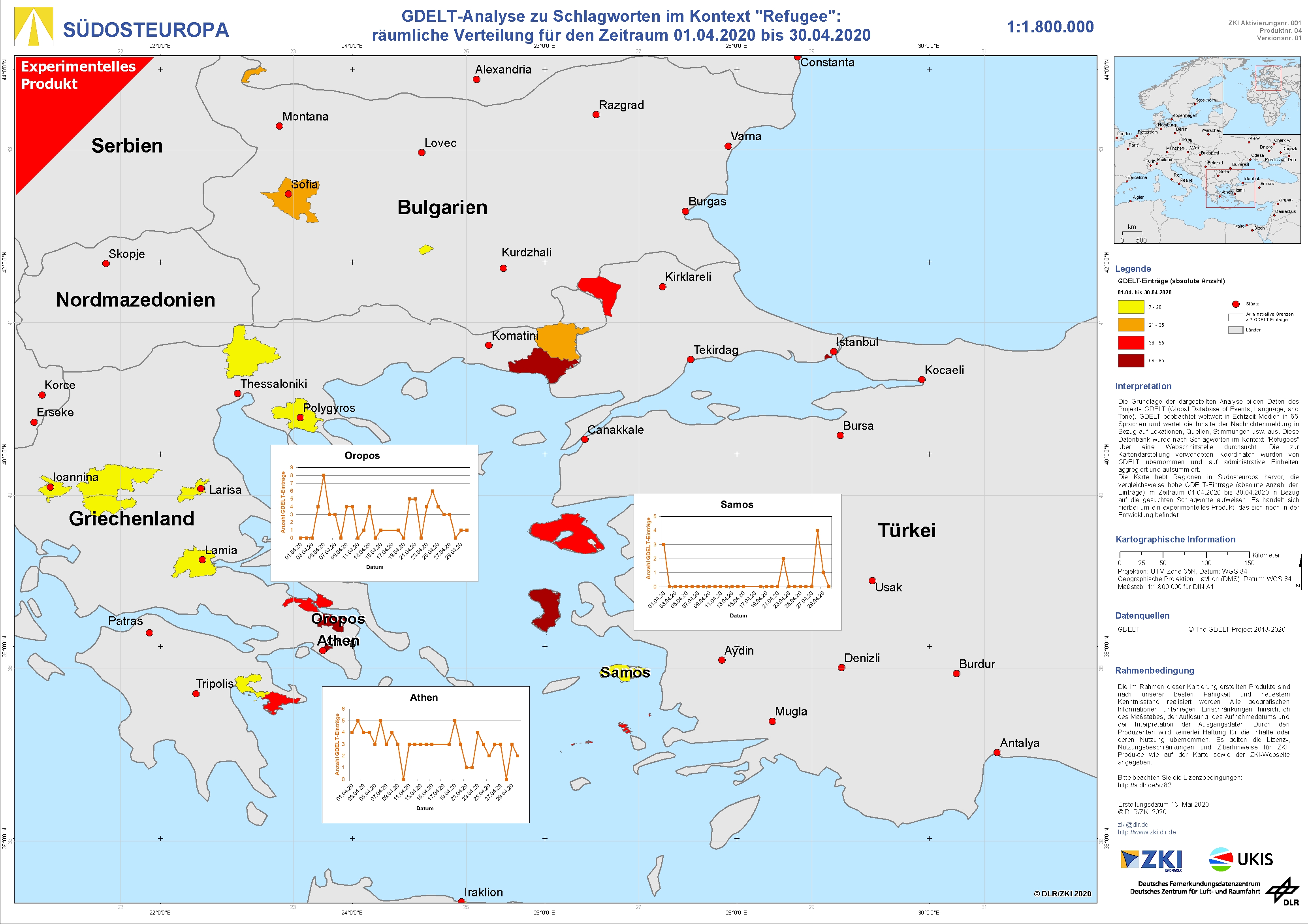
South Eastern Europe – GDELT analysis of keywords in the context of "Refugee" for April 2020 – experimental product

Creation Date 13. May 2020

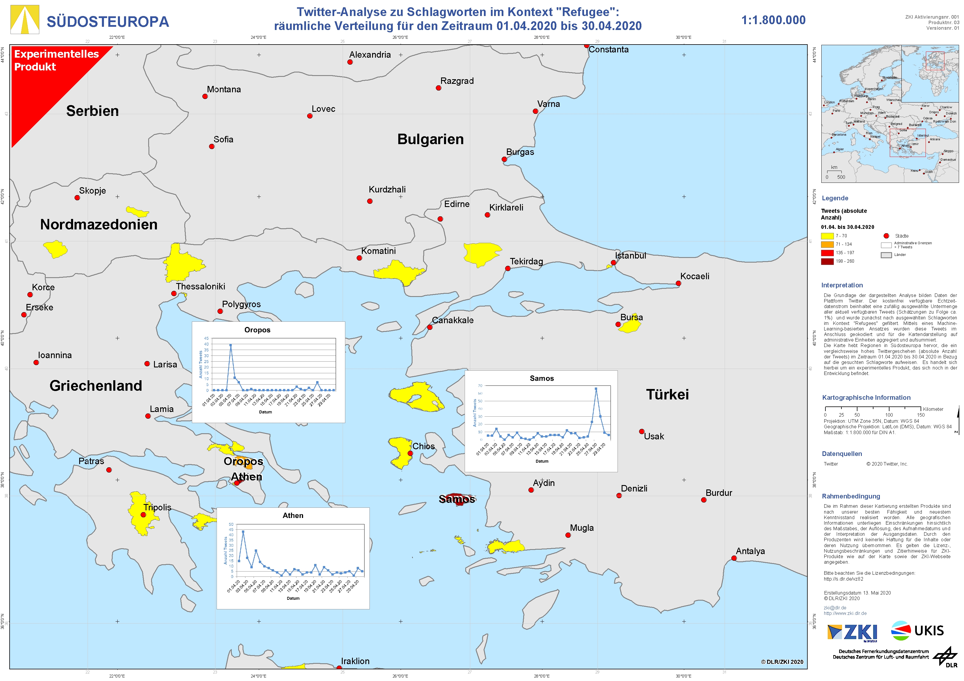
South Eastern Europe – Twitter analysis of keywords in the context of "Refugee" for April 2020 – experimental product

Creation Date 13. May 2020

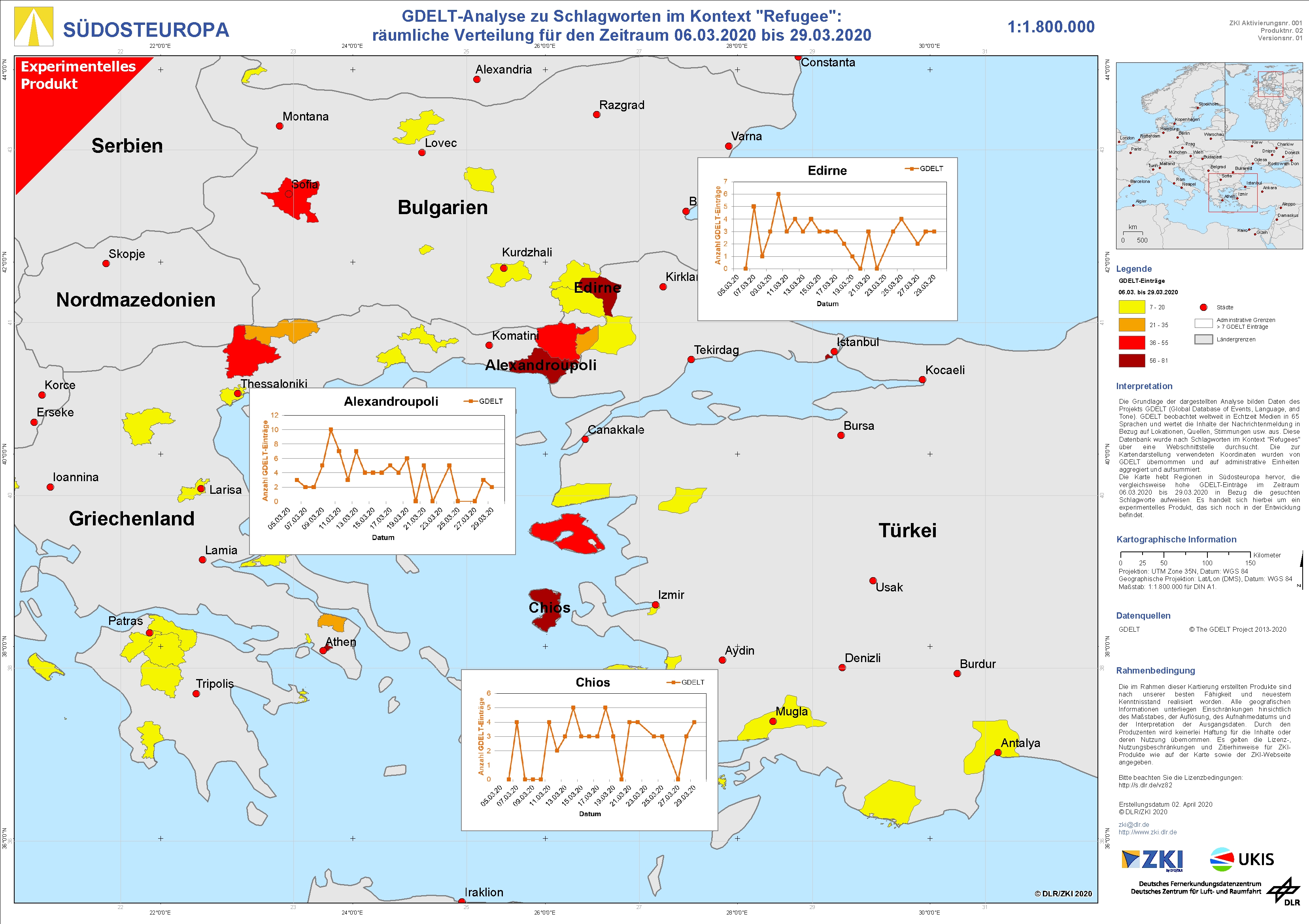
South Eastern Europe – GDELT analysis of keywords in the context of "Refugee" for March 2020 – experimental product

Creation Date 03. April 2020

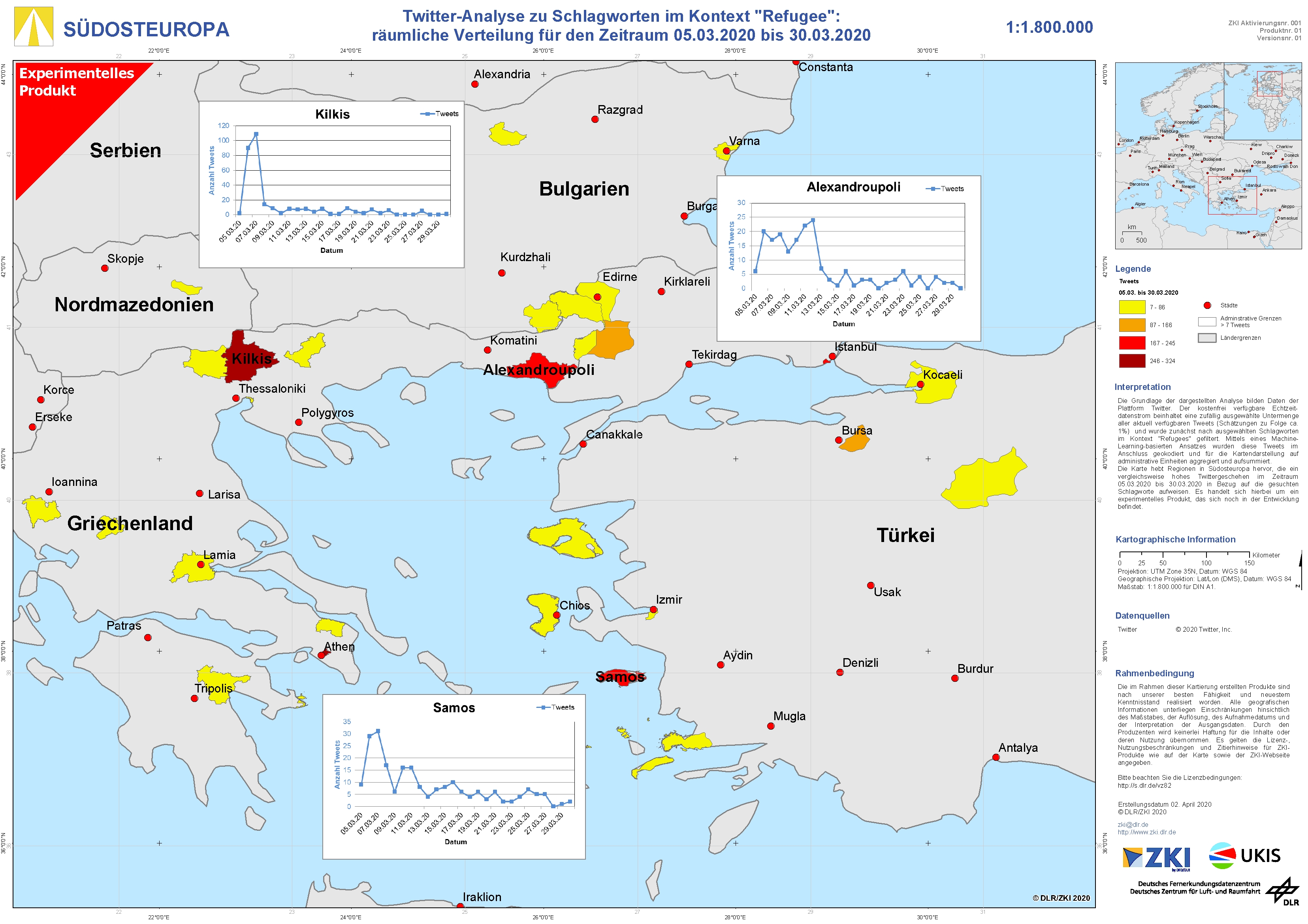
South Eastern Europe – Twitter analysis of keywords in the context of "Refugee" for March 2020 – experimental product

Creation Date 03. April 2020