On June 20, 2026, the closing demonstration of the RESITEK project ("Resiliente Technologien für den Katastrophenschutz") took place on the former soccer field in the municipality of Altenahr in the district of Ahrweiler.
The goal of the RESITEK project is to bring together the expertise and technological capabilities of the German Aerospace Center (DLR) in the fields of aviation, space, energy, transportation, and security. As part of the project, a modular and flexibly expandable data and visualization platform is being developed that enables both continuous situation monitoring and needs-based support for situation assessment, mission planning, and mission execution in the event of a disaster. This is intended to strengthen the decision-making and operational capabilities of authorities and organizations responsible for security, enabling them to manage hazardous situations more efficiently and effectively protect the public.
Scenario "Flood"
The past few weeks in western Germany have been very rainy. The ground is saturated with water, and water levels in local rivers are correspondingly high. Parts of Rhineland-Palatinate have experienced extreme rainfall, with local peaks of 200 l/m². Flooding is particularly severe along the Ahr River and has reached devastating proportions. Many emergency calls have been received. The situation is becoming increasingly unclear, and the area affected by the flooding is growing. Many municipalities have already requested assistance from outside their local area. The communications network has failed in large parts of the Ahr Valley.
The Bavarian Red Cross (BRK) has arrived and coordinated with local emergency response teams. The BRK’s Terrain/Infrastructure/Logistics/Transport (G.I.L.T.) team has already conducted a preliminary assessment on site.
The BRK’s Integrated Control Center (ILS) in Schweinfurt is requesting support from the DLR—specifically through the Center for Satellite-Based Crisis Information (ZKI) of the German Remote Sensing Data Center (DFD)—to conduct a comprehensive assessment of the situation and to assist with rescue operations.
In the field, the DLR, together with the BRK, the DRK Rhineland-Palatinate, and the Federal Agency for Technical Relief (THW), carries out various coordinated search and rescue operations. The information gathered in the field is compiled and evaluated in the DFD-ZKI situation report and communicated to the emergency response teams.
Situation overview provided by the ZKI
The ZKI’s comprehensive situational overview brings together various types of geospatial data and analyses on a single platform, presenting them clearly in the form of multiple maps and visualisations. In addition to basic situational information such as the latest aerial photographs, the overview also covers complex topics such as power infrastructure, mobile phone coverage and AI-supported analyses, for example regarding the extent of (flood) water or automated object detection. The screen video shown above demonstrates some of the functions and visualisations of the comprehensive situational overview.
From the drone images captured by the Bavarian Red Cross (BRK) shortly before the exercise on 19 June 2026, both automated object detection and AI-based water segmentation were derived on site on the day of the exercise, 20 June 2026. The use of AI-driven methods enables the rapid analysis of large image datasets and helps emergency services to provide relevant information in the shortest possible time.
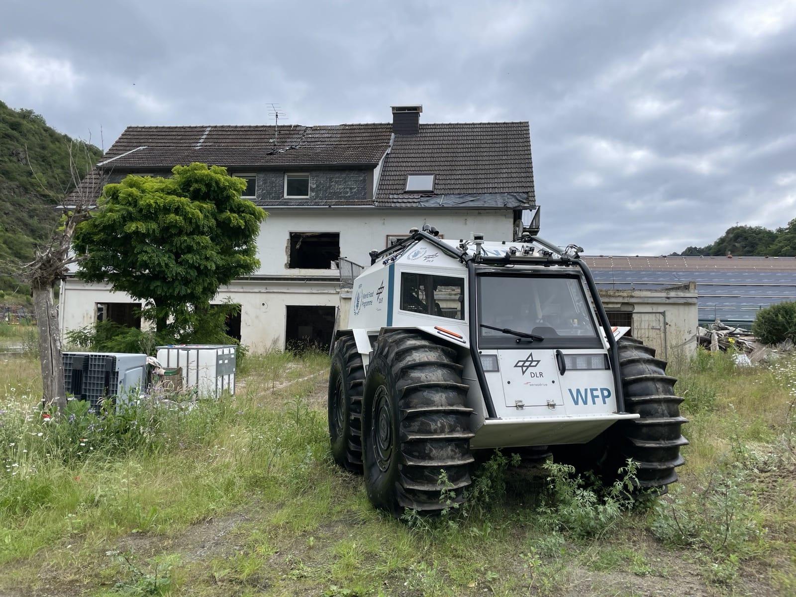
During the demonstration, the ZKI’s complex situational picture displayed the live positions of the drones from the Institute of Flight Guidance, Institute of Flight Systems and the vehicles from the Institute of Robotics and Mechatronics – including the SHERP, the Scout Rover and the ARDEA drone – in real time. In addition to the current positions, live image data recorded during the operation was also integrated directly into the situational picture and visualised on a live tracking dashboard. This made it possible to track the movements and sensor data of the various vehicles simultaneously and almost in real time.
To complement the complex situational picture, a virtual reality application was used to provide an immersive representation of the damage caused by the 2021 floods.