On October 9, 2026, the final demonstration of the RESITEK project ("Resilient Technologies for Disaster Management") took place at the training grounds of the Federal Agency for Technical Relief (THW).
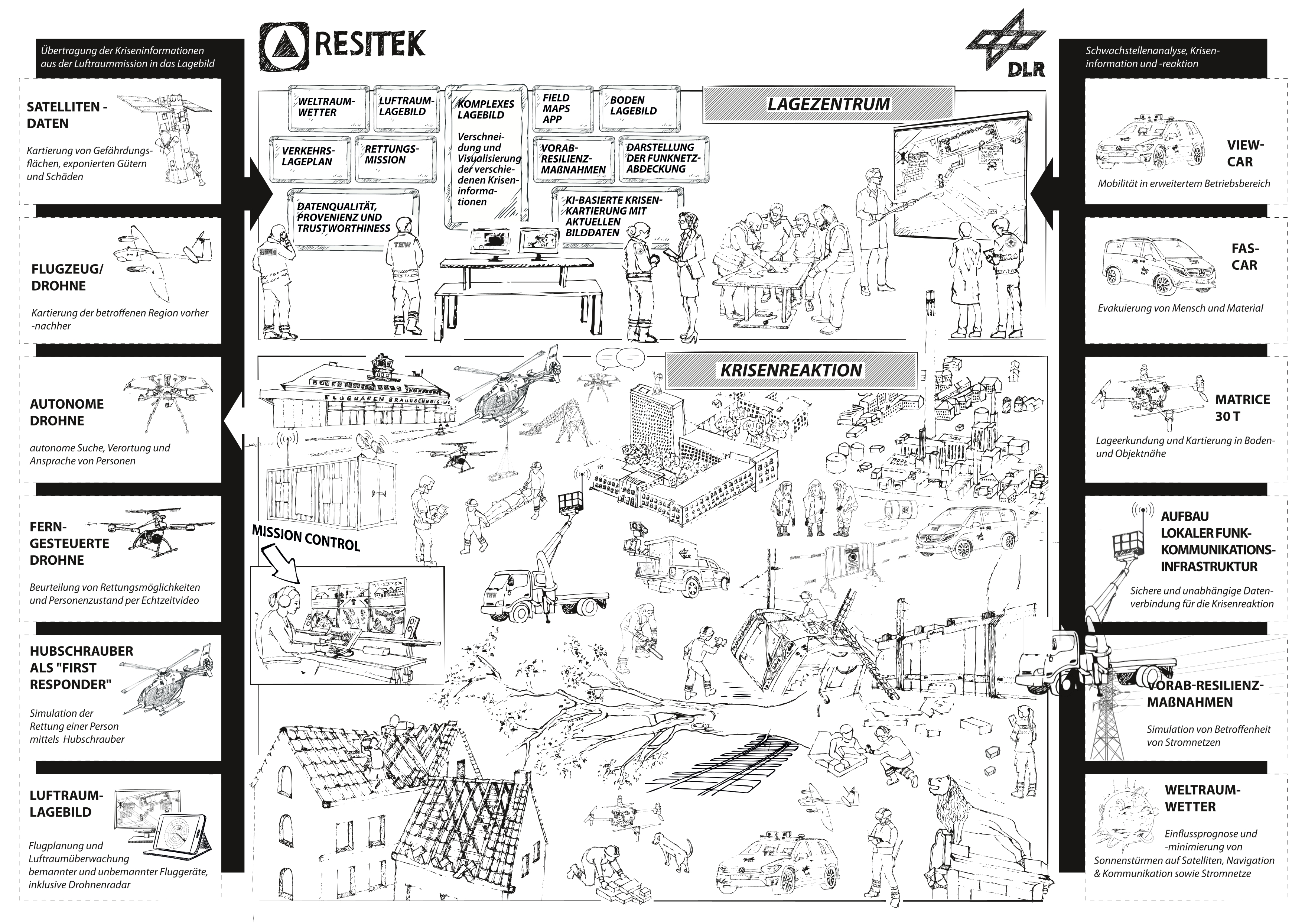
The goal of the RESITEK project is to bring together the expertise and technological capabilities of the German Aerospace Center (DLR) in the fields of aviation, space, energy, transportation, and security. As part of the project, a modular and flexibly expandable data and visualization platform is being developed that enables both continuous situation monitoring and needs-based support for situation assessment, mission planning, and mission execution in the event of a disaster. This is intended to strengthen the decision-making and operational capabilities of public safety authorities and organizations (BOS) so they can manage hazardous situations more efficiently and effectively protect the public.
"Storm" Demonstration Scenario
A severe storm has swept through the city of Brunswick. Strong gusts of wind have caused trees to fall, damaged buildings and roofs, and caused damage to the power and communications infrastructure. Roads and transportation routes are partially blocked, and some neighborhoods are temporarily without power.
The fire department, emergency medical services, and the Federal Agency for Technical Relief (THW) are on the scene to secure hazardous areas, treat the injured, and reach trapped individuals.
The incident command has requested support from the DLR to comprehensively assess the situation and assist with rescue and cleanup efforts. This includes crisis mapping via satellite, aircraft, and drones to create a comprehensive picture of the situation, search-and-rescue operations using drones in areas that are difficult to access or at risk of collapse; the automated evacuation of autonomous vehicles under enhanced technical supervision; the assessment of the resilience of critical infrastructure; and support for the deployment of resources and the routing of special-purpose vehicles on blocked roads.
Subsequently, the insights gained are consolidated in a joint situation briefing and integrated into the overall situation assessment.
ZKI Situation Overview
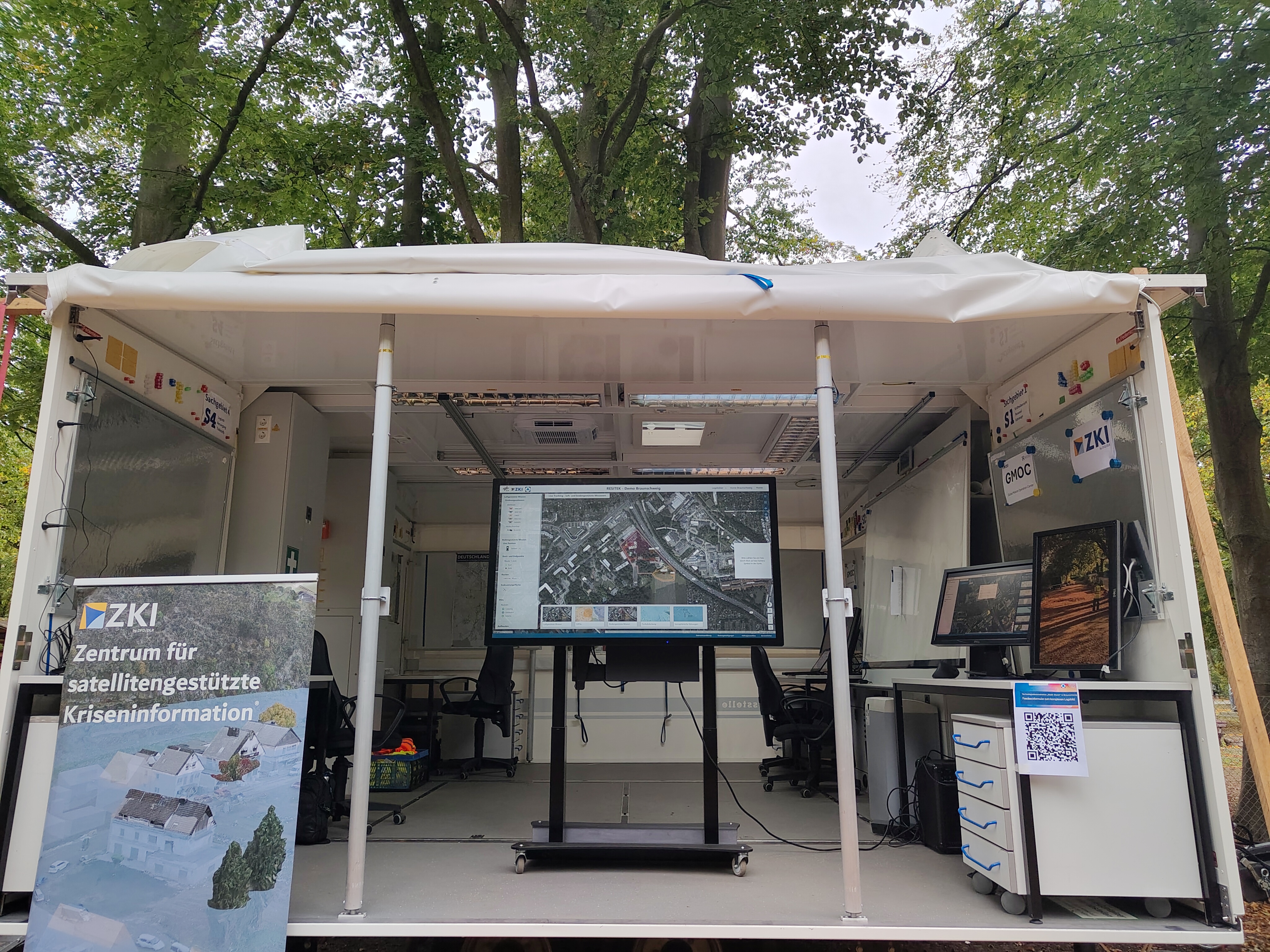
The ZKI’s comprehensive situation overview consolidates various geodata and analyses on a single platform and presents them clearly in the form of multiple maps and visualizations. In addition to basic situational information such as the latest aerial imagery, the situational overview also covers complex topics such as power infrastructure, radio coverage, and AI-supported analyses—for example, for the automated detection of objects and (road) surfaces in urban areas.
AAerial images captured by the DLR Institute of Space Research prior to the exercise on June 17, 2026, were used to perform both automated object detection and AI-based road surface classification. The use of AI-driven methods enables rapid evaluation of large image datasets and helps emergency responders provide relevant information in the shortest possible time.
During the demonstration, the ZKI’s complex situational overview displayed the live positions of the drones from the Institute of Flight Control and the Institute of Flight Systems Technology, as well as the vehicles from the Institute of Transportation Systems, in real time. This made it possible to track the movements and sensor data of the various vehicles simultaneously and nearly in real time.
In addition, various other analyses and data from the DLR institutes participating in the demonstration, as well as information on the damage situation collected live at the scene by emergency responders, are incorporated into the complex situational overview.