DLR FireBIRD mission provides data of recent fires in Portugal
undefined
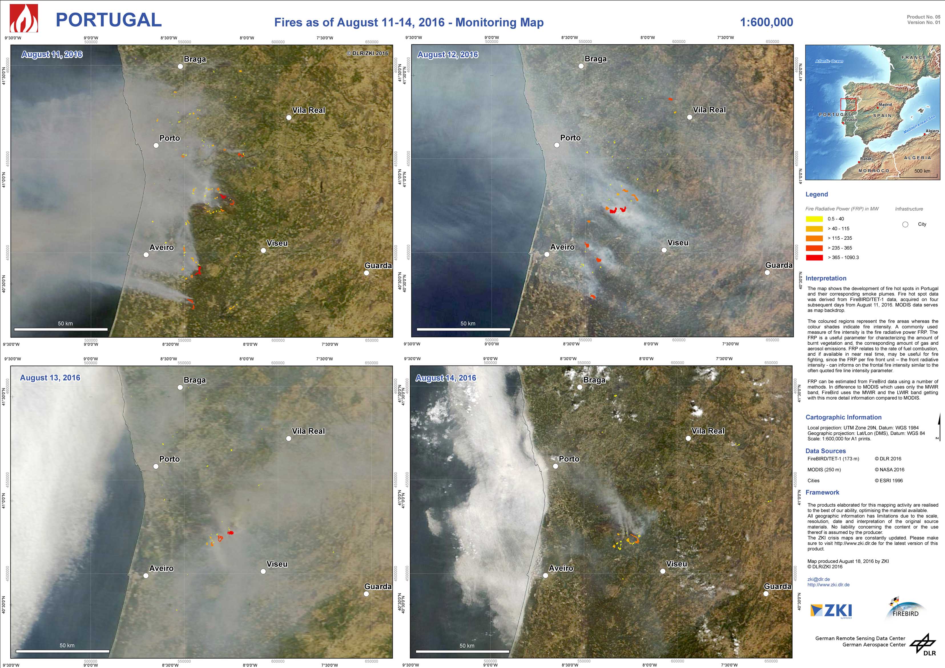
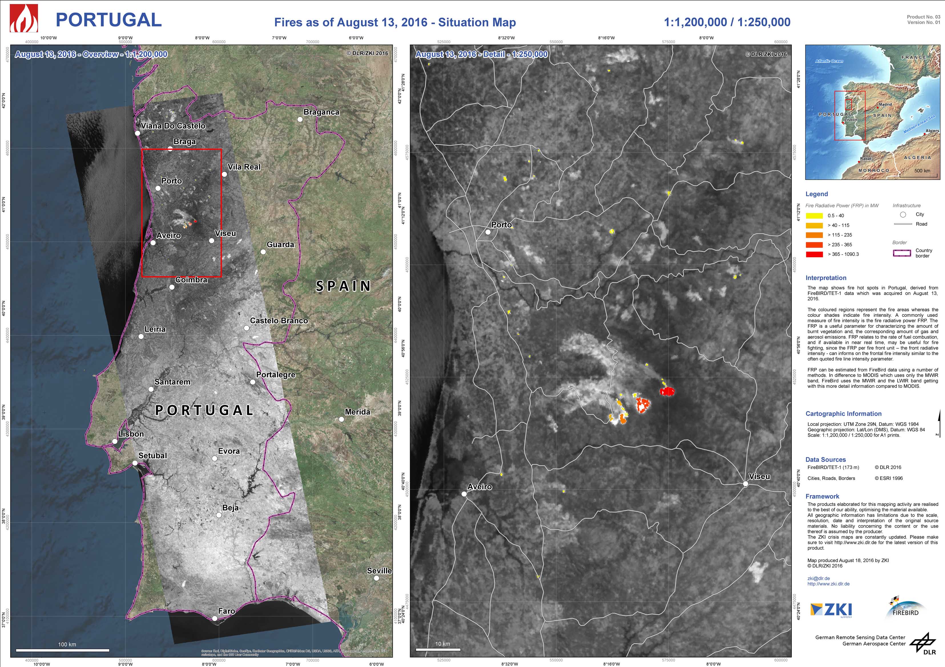
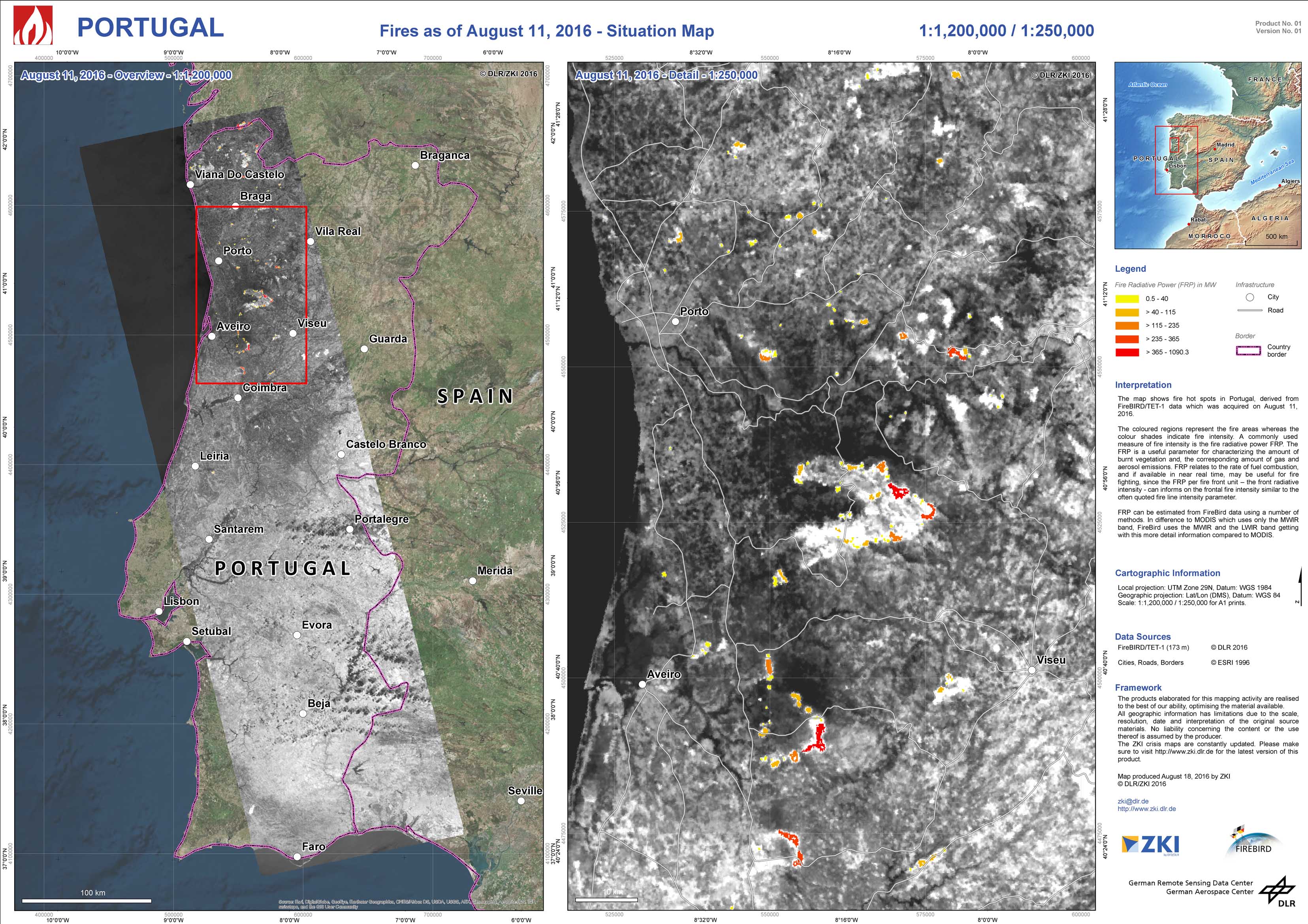
On the night from August 7 to August 8 an emergency has been declared in the Porto region of Portugal, where wildfires spread. Over several days fires burned before it was possible to get them under control. From August 11 to August 14 it was possible to monitor the fires in Portugal using DLR’s TET-1 satellite data on four consecutive days and to track, how the fires spread and how their intensity changed. TET-1 is one of the two satellites from the FireBIRD mission. With its spatial resolution of 320 m the system has a much higher spatial resolution than the standard thermal sensors from MODIS or the Sentinel 3 SLTSR (1 km). Additionally the two different bands in the midwave infrared (3.4 – 4.2 µm) and the long wave infrared (8.5-9.3 µm) allow not only the detection of hot spots but also the derivation of the fire radiative power (FRP) which is an quantitative measure for fire intensity. Thus, over the different days the decline in the area under fire can be observed as well as the decrease in fire intensity on August 14 compared to the days before.
Portugal - P05 - Fires as of August 11-14, 2016 - Monitoring Map
Creation Date 18. August 2016
Portugal - P04 - Fires as of August 14, 2016 - Situation Map
Creation Date 18. August 2016
Portugal - P03 - Fires as of August 13, 2016 - Situation Map
Creation Date 18. August 2016
Portugal - P02 - Fires as of August 12, 2016 - Situation Map
Creation Date 18. August 2016
Portugal - P01 - Fires as of August 11, 2016 - Situation Map
Creation Date 18. August 2016