Fire disaster in California – DLR supports with FireBIRD data
15. November 2018
Fire disaster in California – DLR supports with FireBIRD data
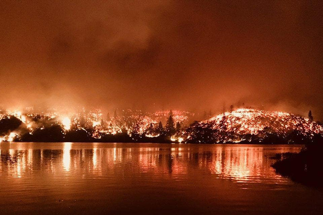
Forest fire in California 2018.
Credit:
CAL FIRE
A, for the season, unusual drought lead to devastating forest fires in California. So far several hundred thousand people were evacuated and dozen deaths were registered. Butte County, located in Northern California, is especially affected.
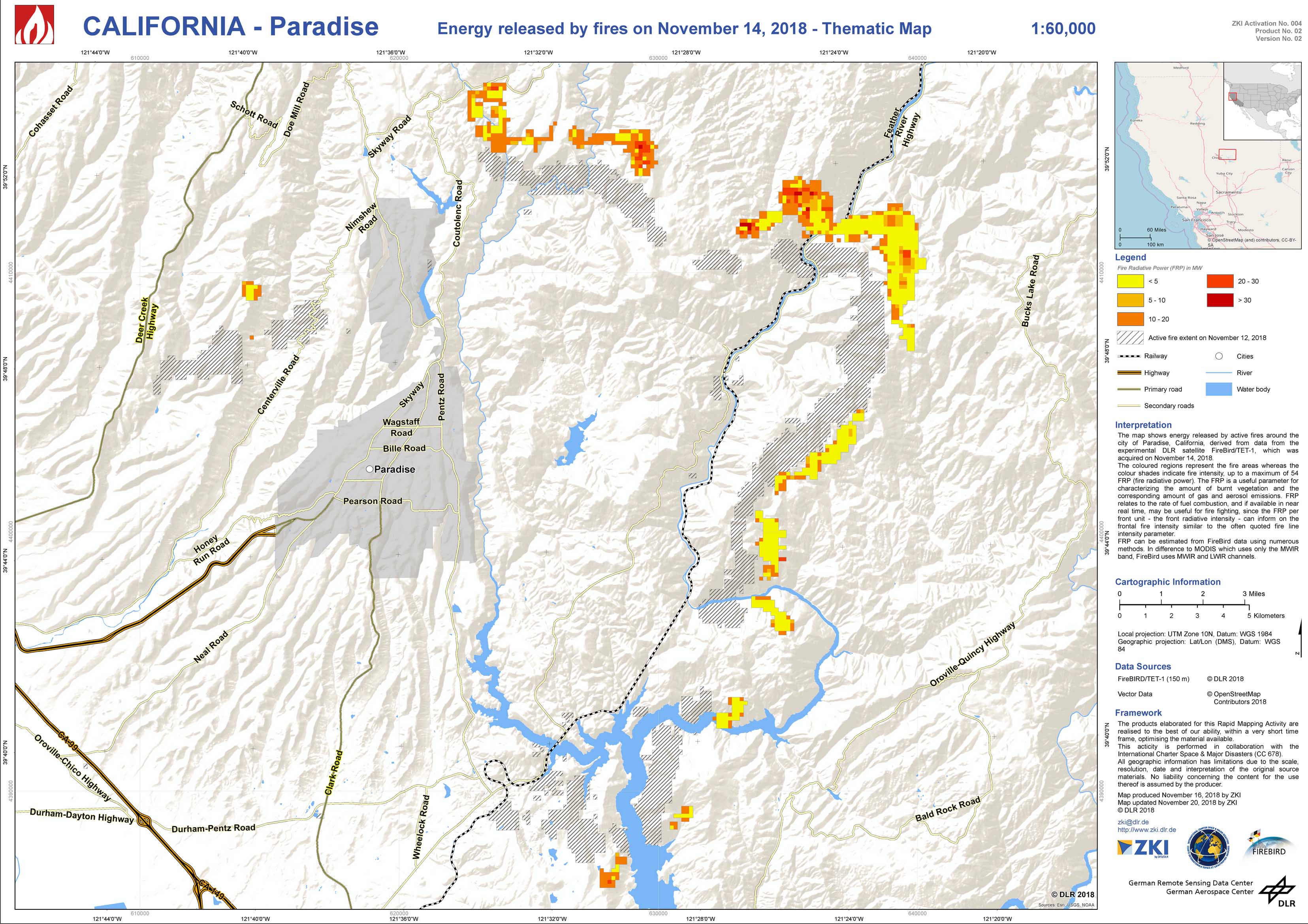
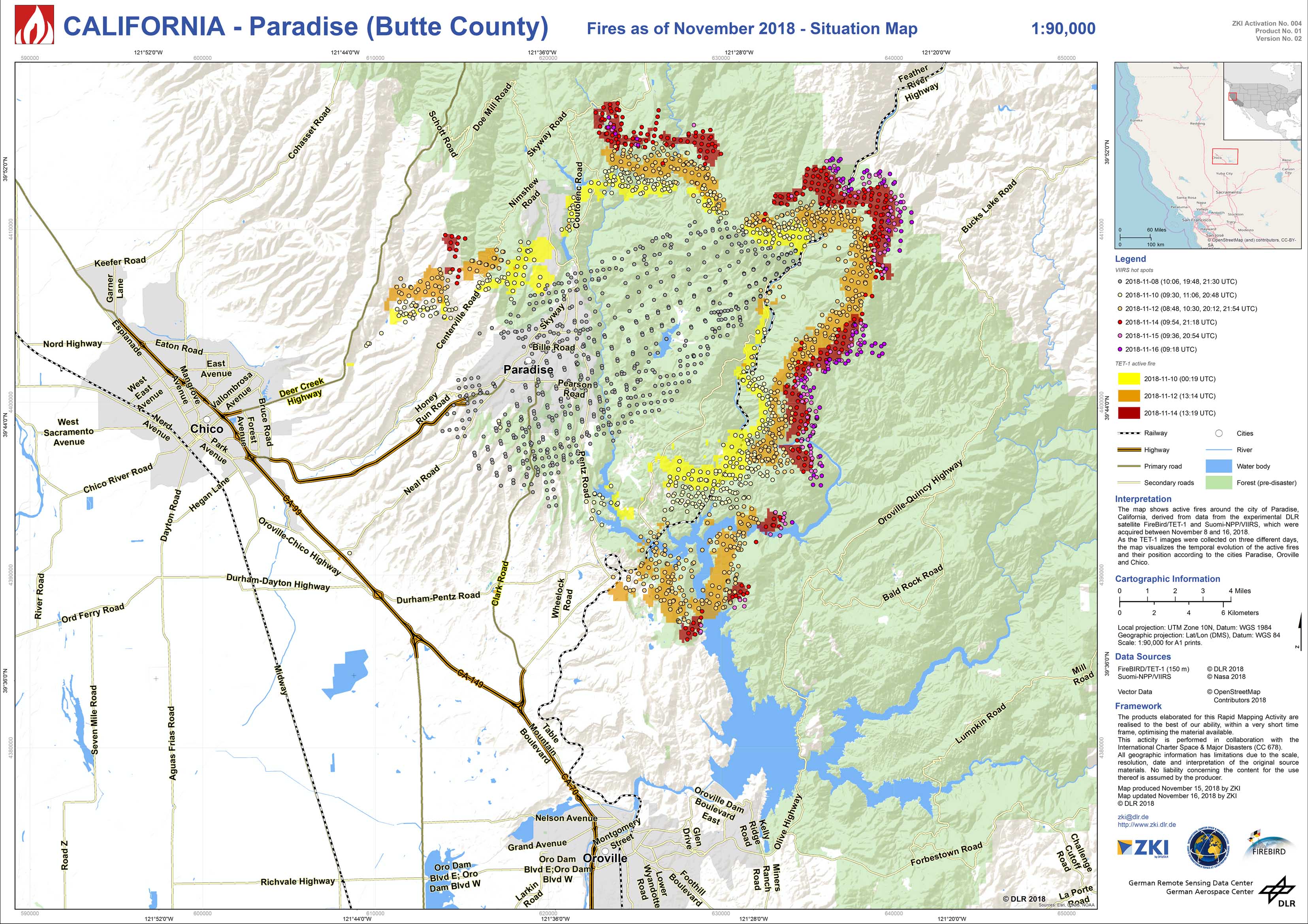
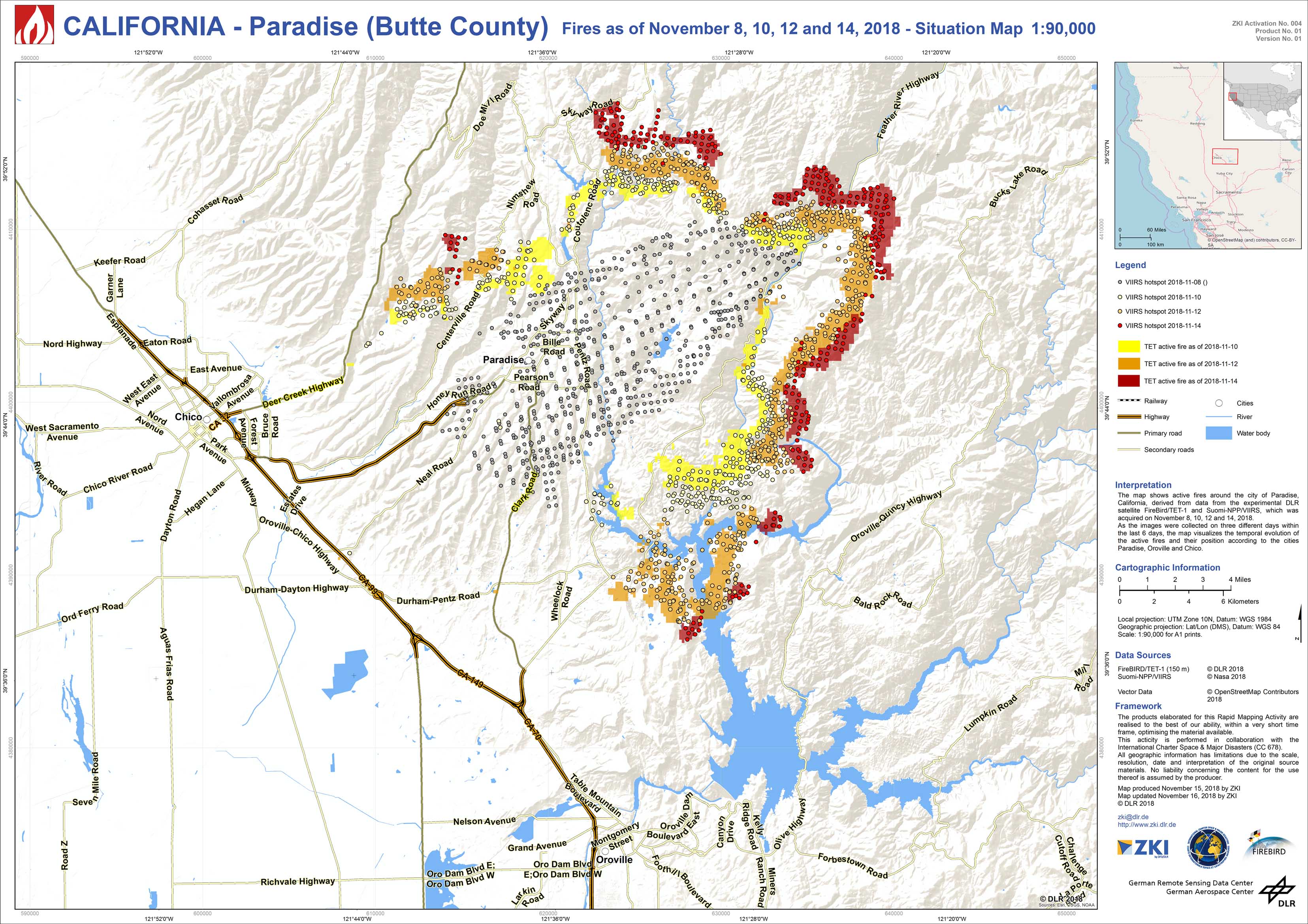
Satellite data has already been made available as part of the International Charter "Space and Major Disasters". DLR supports crisis management by providing satellite-based information of the sensor TET-1 (Technological Experiment Carrier) of the DLR mission FireBIRD (Fire Bispectral InfraRed Detector) and data of the satellite Suomi-NPP/VIIRS. TET-1 and VIIRS detect very high temperatures from space. Several images of the active fires next to the city Paradise, located 250 km northeast of San Francisco in Butte County, were collected.
The maps visualize the temporal evolution or the fire intensity of the active fires for different days mid November 2018 and its position according to the cities Paradise, Oroville and Chico.
Products
USA - California - P01 – Forest Fire Situation for November 2018 - Situation Map (updated 20.11.2018)