
Floods on the River Oder (German-Polish Border)
undefined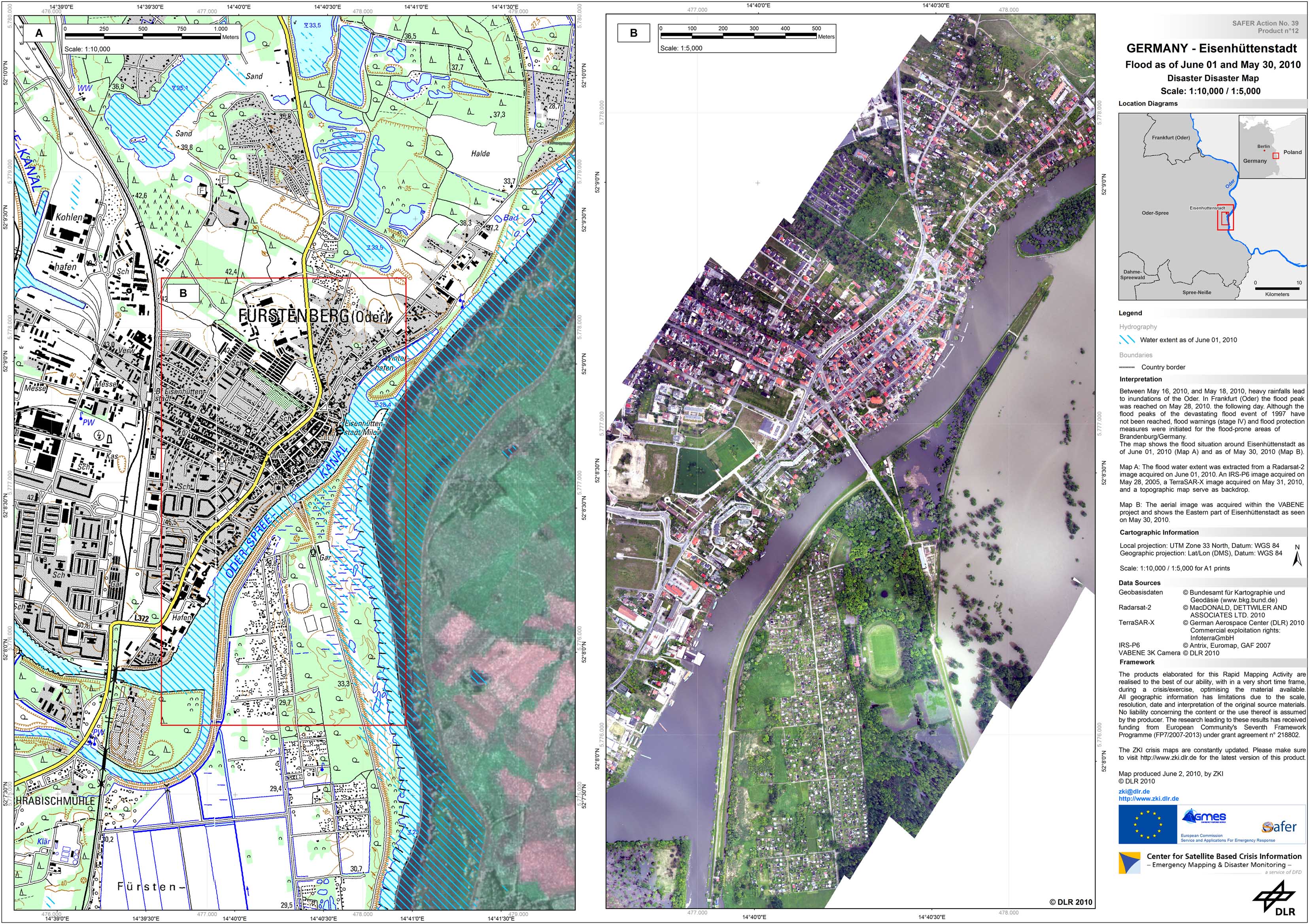
Germany - Eisenheuttenstadt - P12 - Satellite-/Aerial image map of the flooded area near Eisenhuettenstadt based on Radarsat-2 imagery of June 01, 2010 and DLR 3K Camera imagery of May 30, 2010 - Detail
Creation Date 02. June 2010
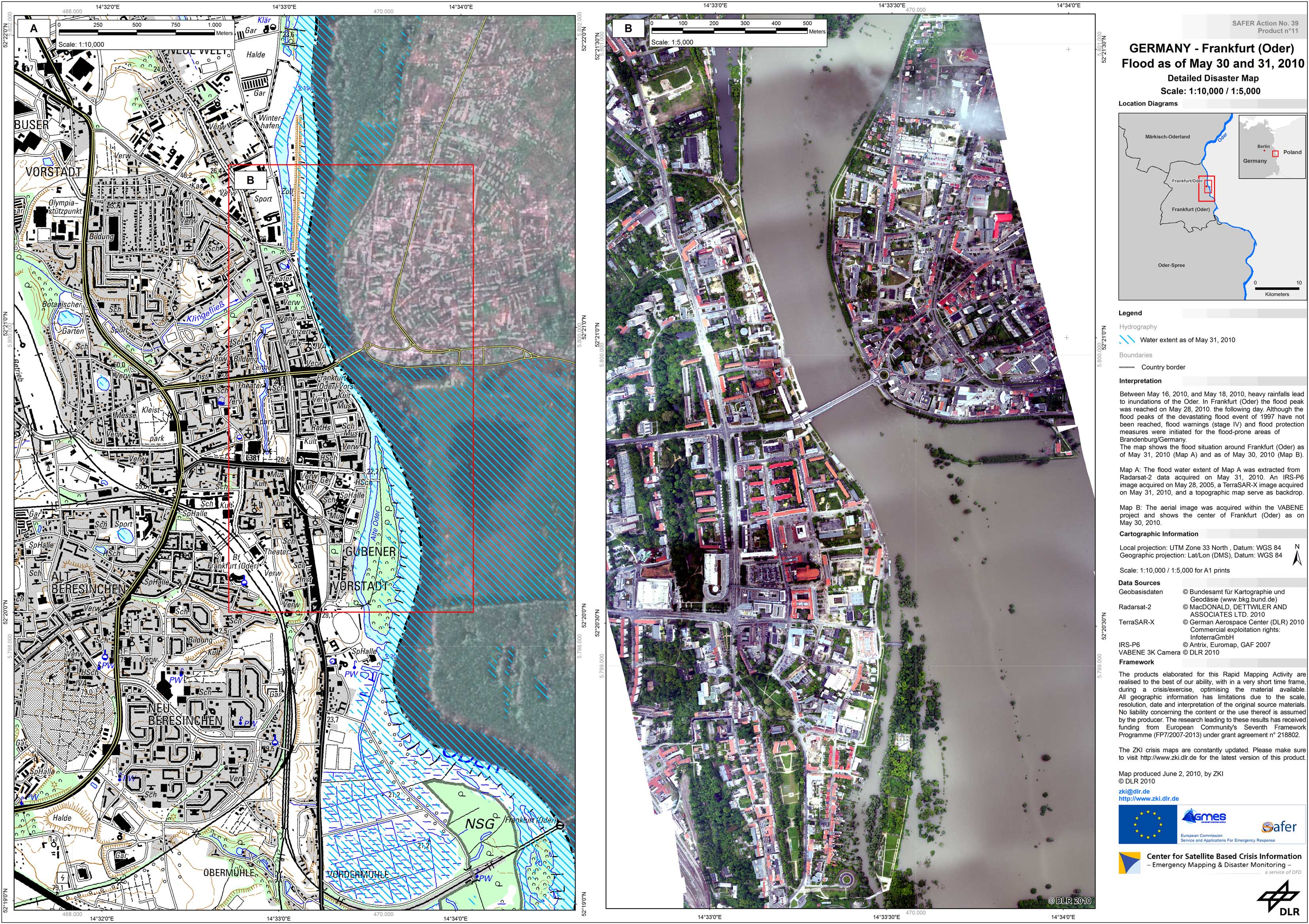
Germany - Frankfurt/Oder - P11 - Satellite-/Aerial image map of the flooded area near Frankfurt/Oder based on Radarsat-2 imagery of May 31, 2010 and DLR 3K Camera imagery of May 30, 2010 - Detail
Creation Date 02. June 2010
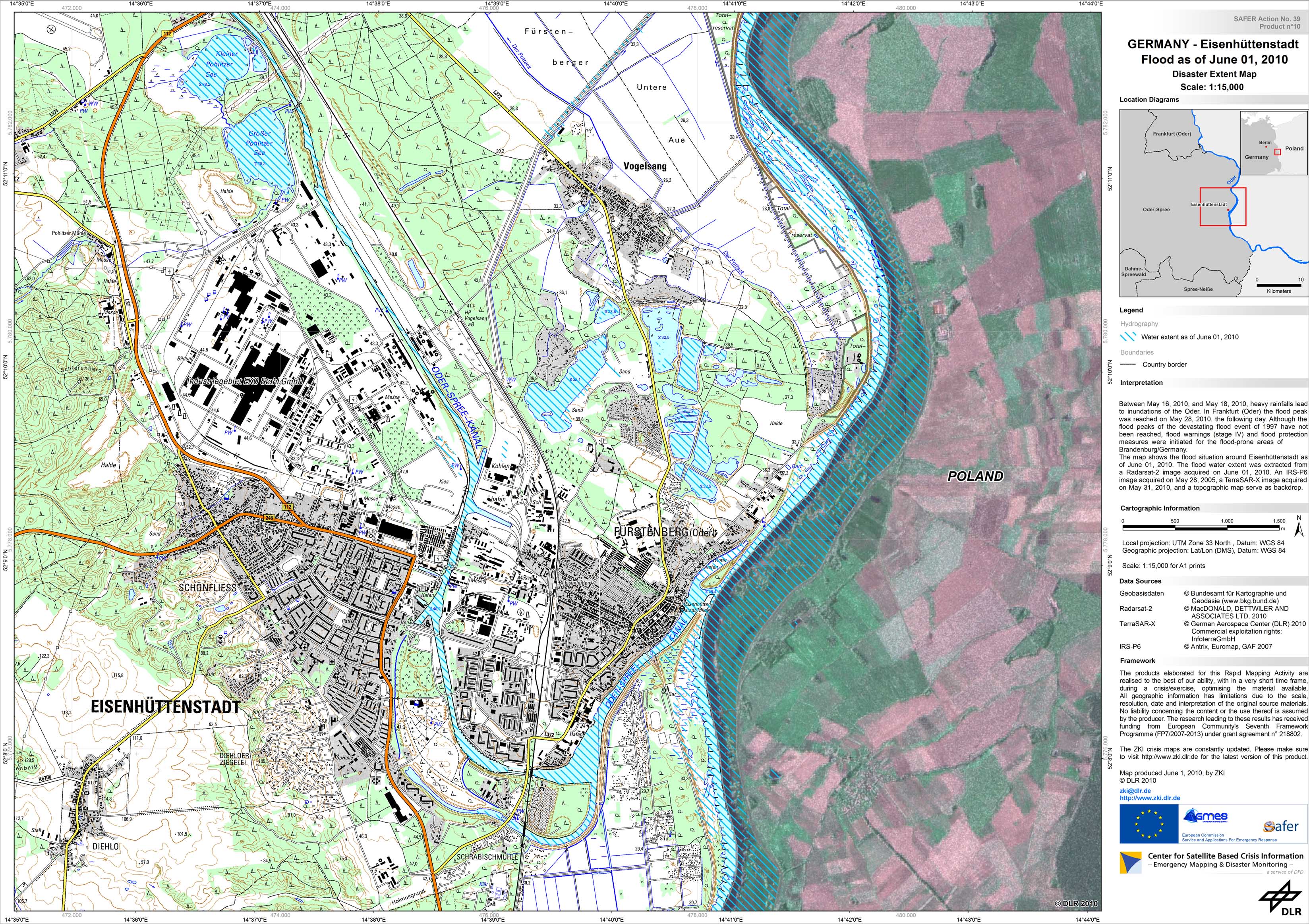
Germany - Eisenheuttenstadt - P10 - Satellite map of the flooded area near Eisenhuettenstadt based on Radarsat-2 imagery of June 01, 2010 - Detail
Creation Date 01. June 2010
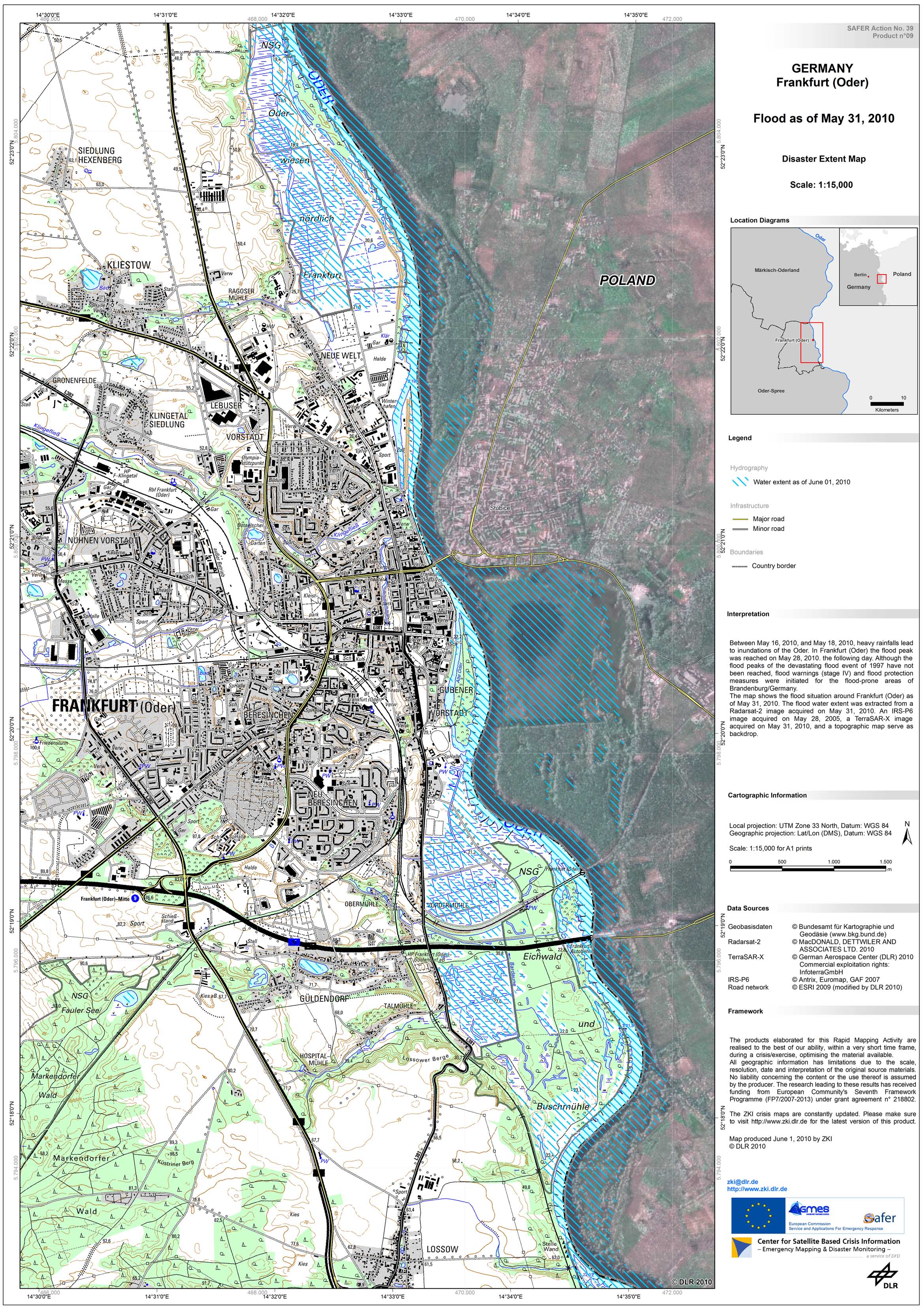
Germany - Frankfurt/Oder - P09 - Satellite map of the flooded area near Frankfurt/Oder based on Radarsat-2 imagery of May 31, 2010 - Detail
Creation Date 01. June 2010
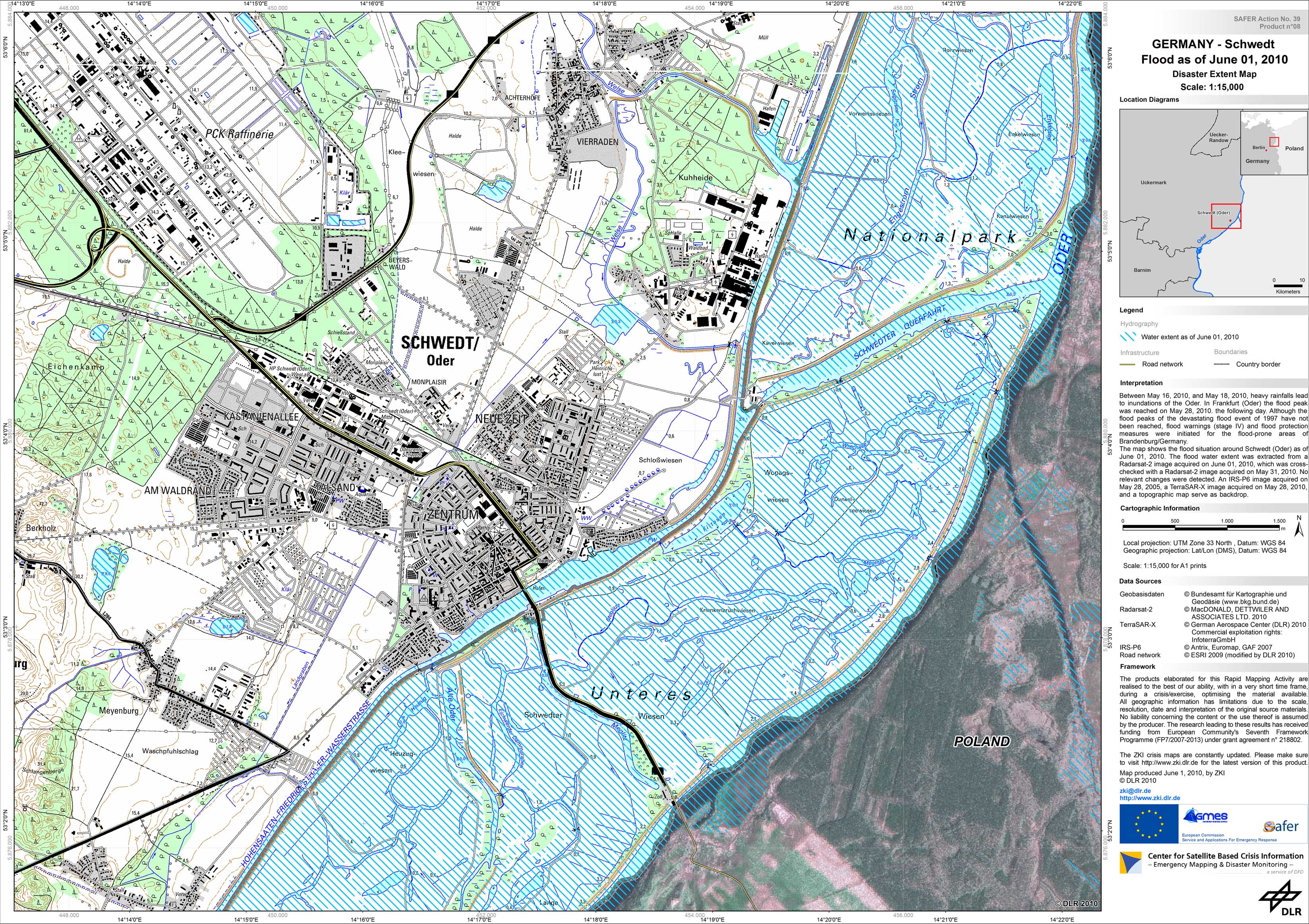
Germany - Schwedt/Oder - P08 - Satellite map of the flooded area near Schwedt/Oder based on Radarsat-2 imagery of June 01, 2010 - Detail
Creation Date 01. June 2010
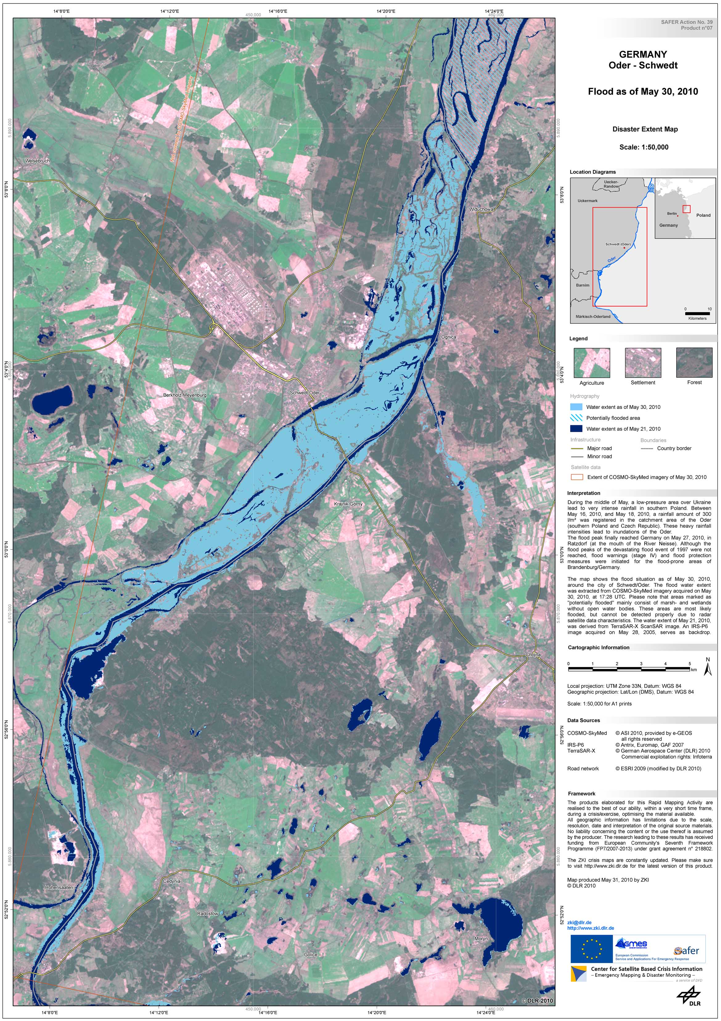
Germany - Schwedt/Oder - P07 - Satellite map of the flooded area near Schwedt/Oder based on COSMO-SkyMed data of May 30, 2010, 17:28 UTC - Overview
Creation Date 31. May 2010
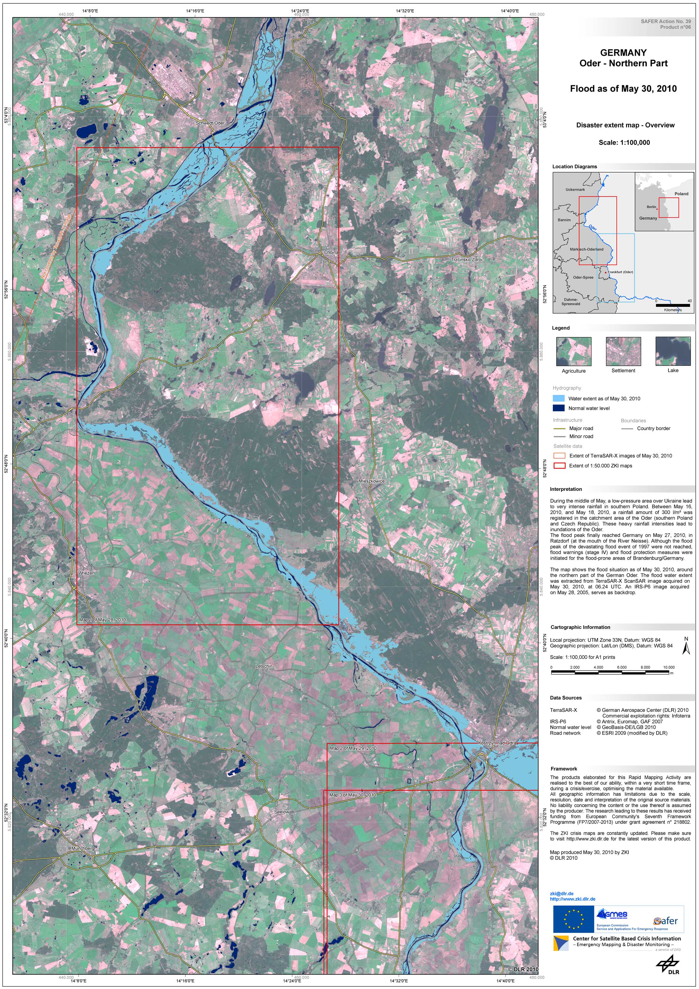
Germany - Oder Nord - P06 - Satellite map of the flooded area near the northern German part of the Oder river based on TerraSAR-X imagery of May 29, 2010, 06:24 UTC - Overview
Creation Date 30. May 2010
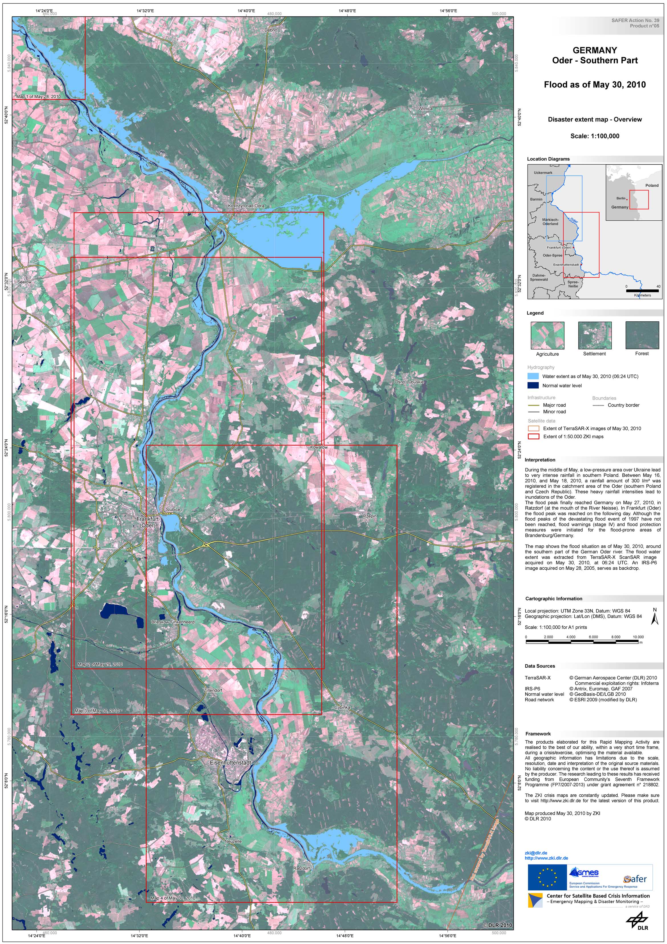
Germany - Oder Süd - P05 - Satellite map of the flooded area near the southern German part of the Oder river based on TerraSAR-X imagery of May 29, 2010, 06:24 UTC - Overview
Creation Date 30. May 2010
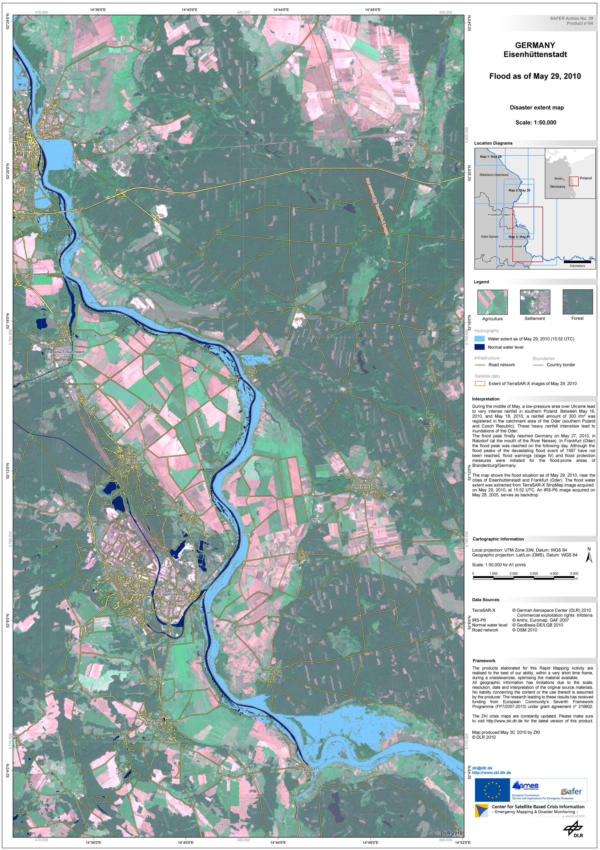
Germany - Eisenheuttenstadt - P04 - Satellite map of the flooded area near Eisenhuettenstadt based on TerraSAR-X imagery of May 29, 2010, 15:52 UTC - Overview
Creation Date 30. May 2010

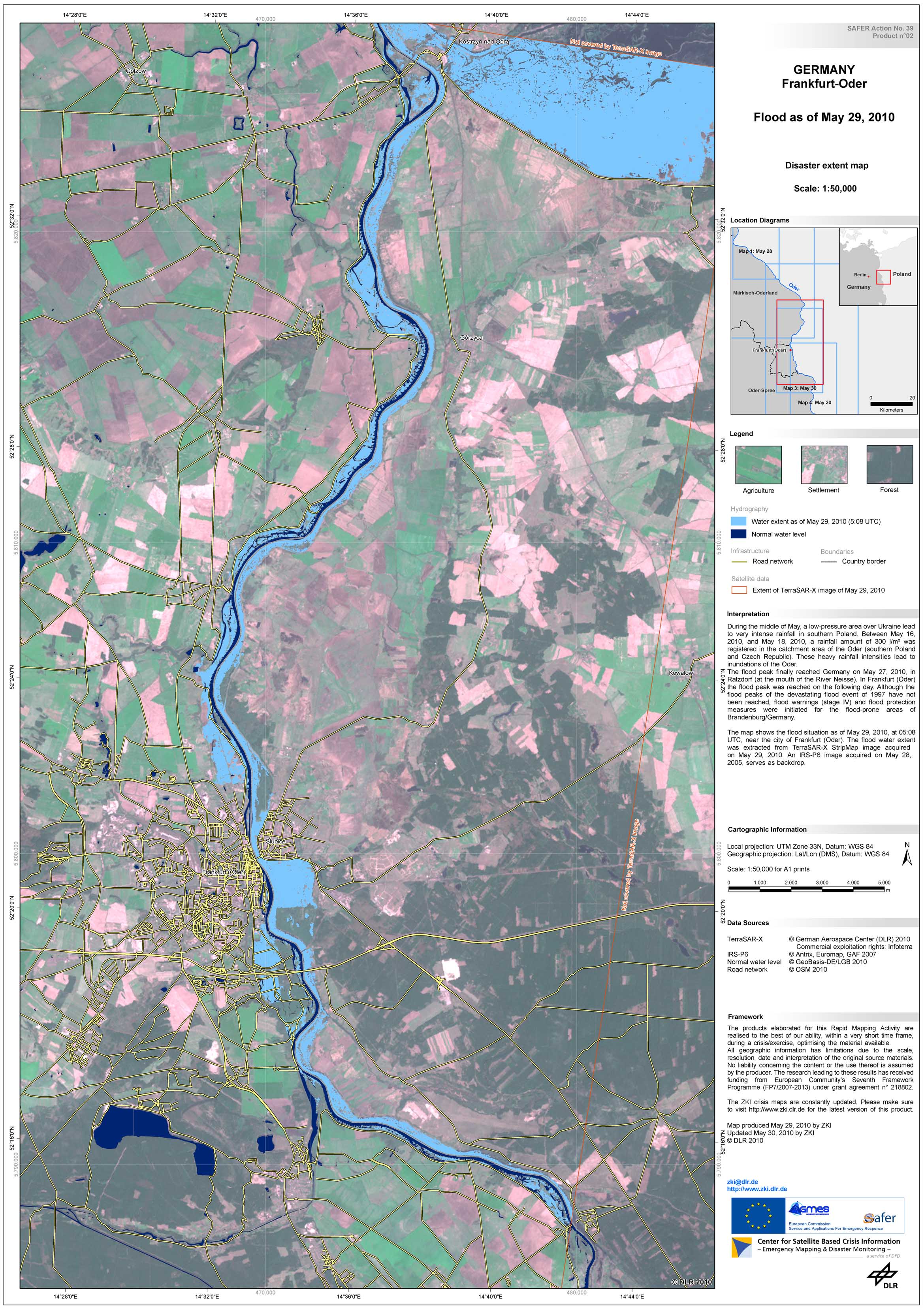
Germany - Frankfurt/Oder - P03 - Satellite map of the flooded area near Frankfurt/Oder based on TerraSAR-X imagery of May 29, 2010, 15:52 UTC - Overview
Creation Date 30. May 2010
Germany - Frankfurt/Oder - P02 - Satellite map of the flooded area near Frankfurt/Oder based on TerraSAR-X imagery of May 29, 2010, 05:08 UTC - Overview
Creation Date 29. May 2010
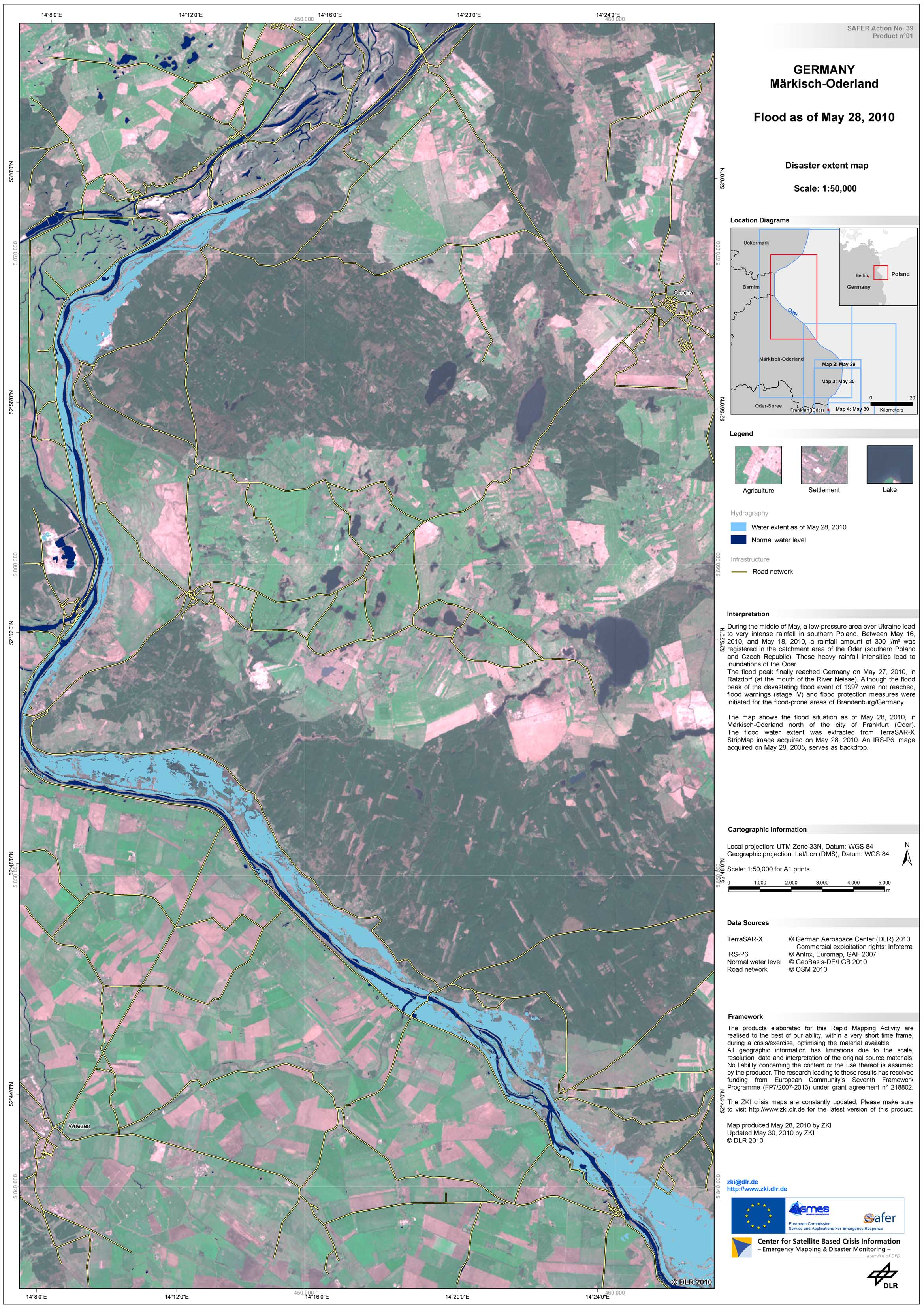
Germany - Maerkisch-Oderland - P01 - Satellite map of the flooded area in Maerkisch-Oderland based on TerraSAR-X imagery of May 28, 2010 - Overview
Creation Date 28. May 2010