
Flood in Pakistan, July and August 2010
undefined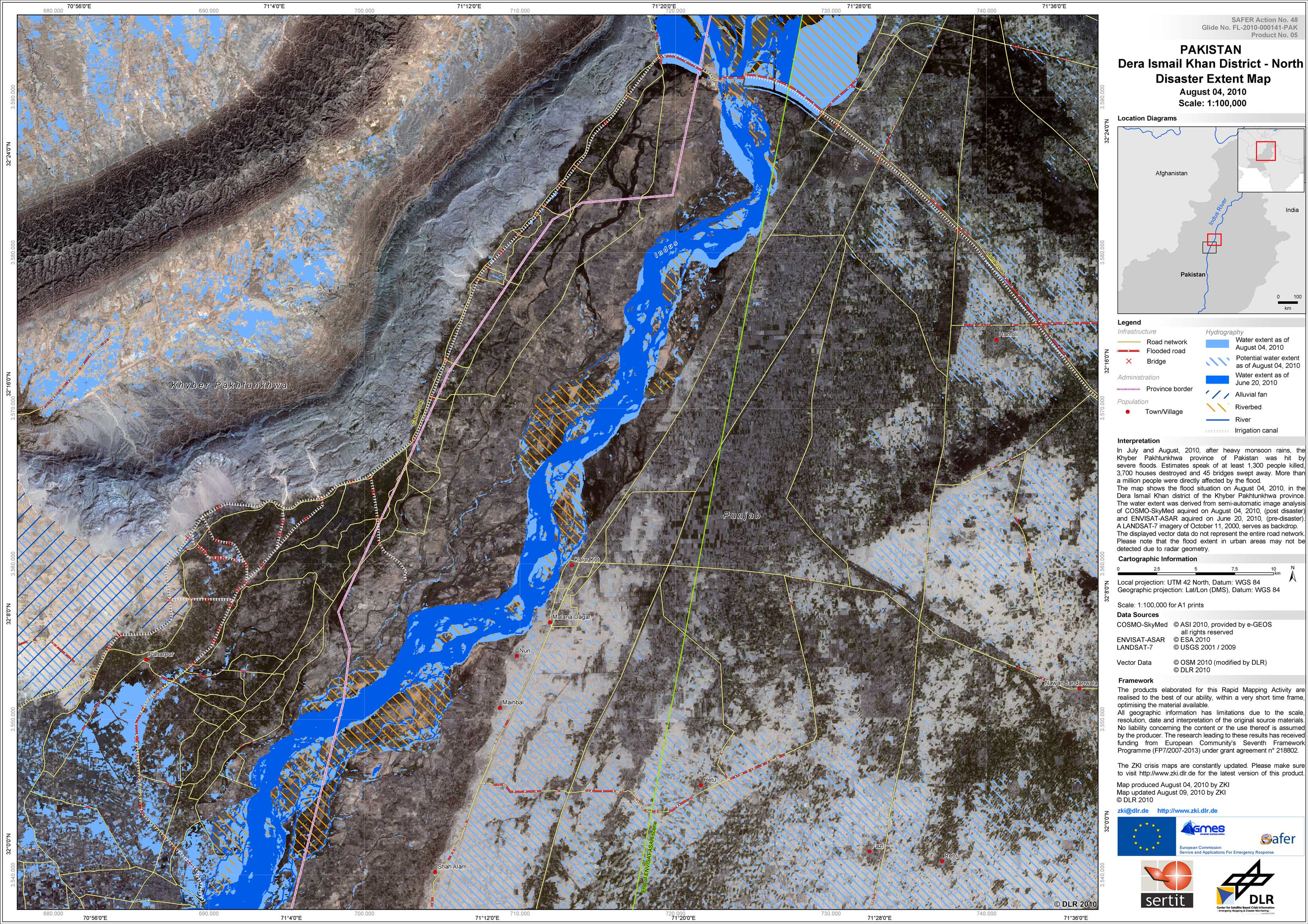
Pakistan - P05 - Dera Ismail Khan district - Northern part - Disaster Extent Map - Overview
Creation Date 09. August 2010

Pakistan - P04 - Dera Ismail Khan district - Southern part - Disaster Extent Map - Overview
Creation Date 09. August 2010
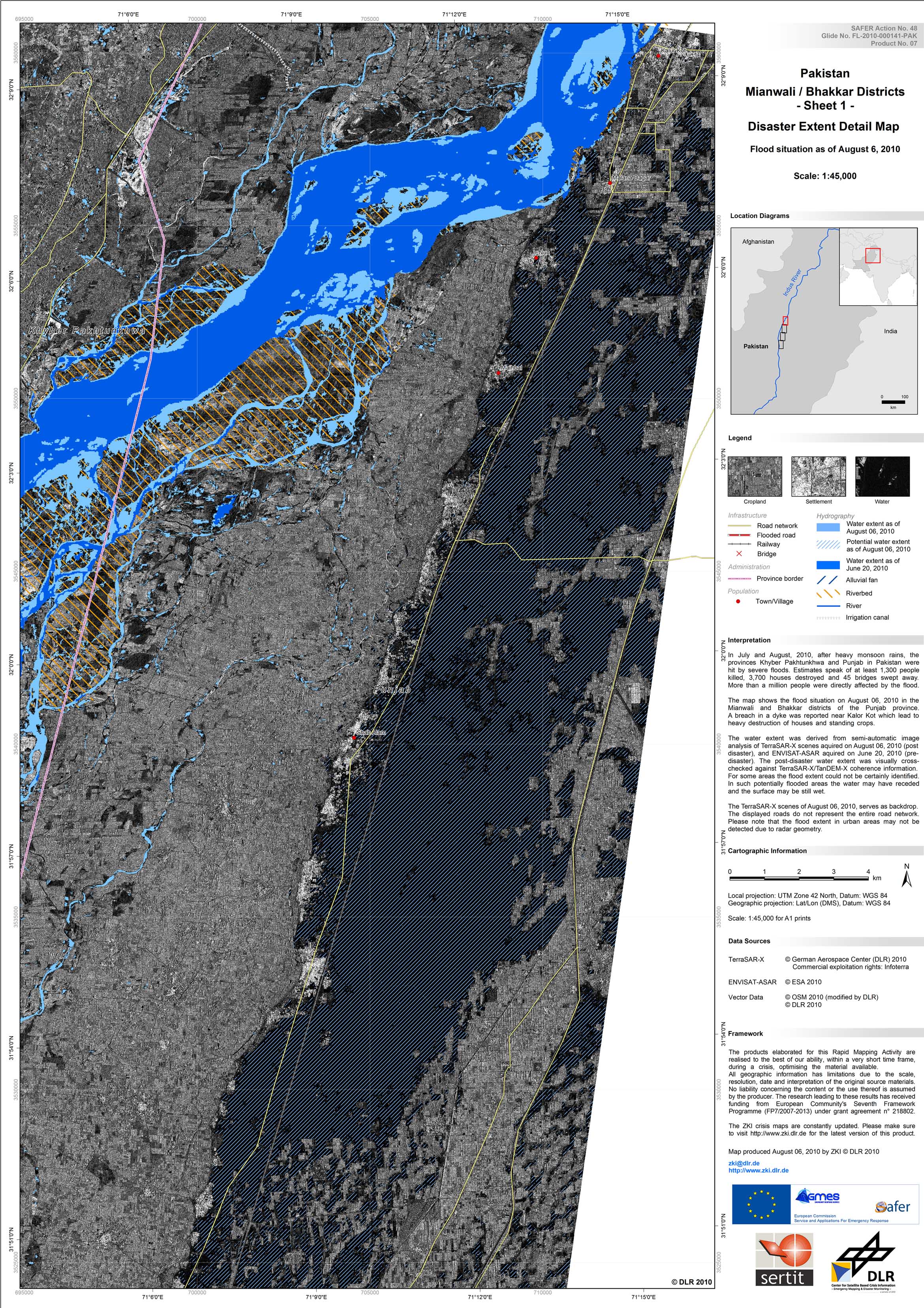
Pakistan - P07 - Mianwali / Bhakkar districts - Disaster Extent Map - Detail - Sheet 1
Creation Date 06. August 2010
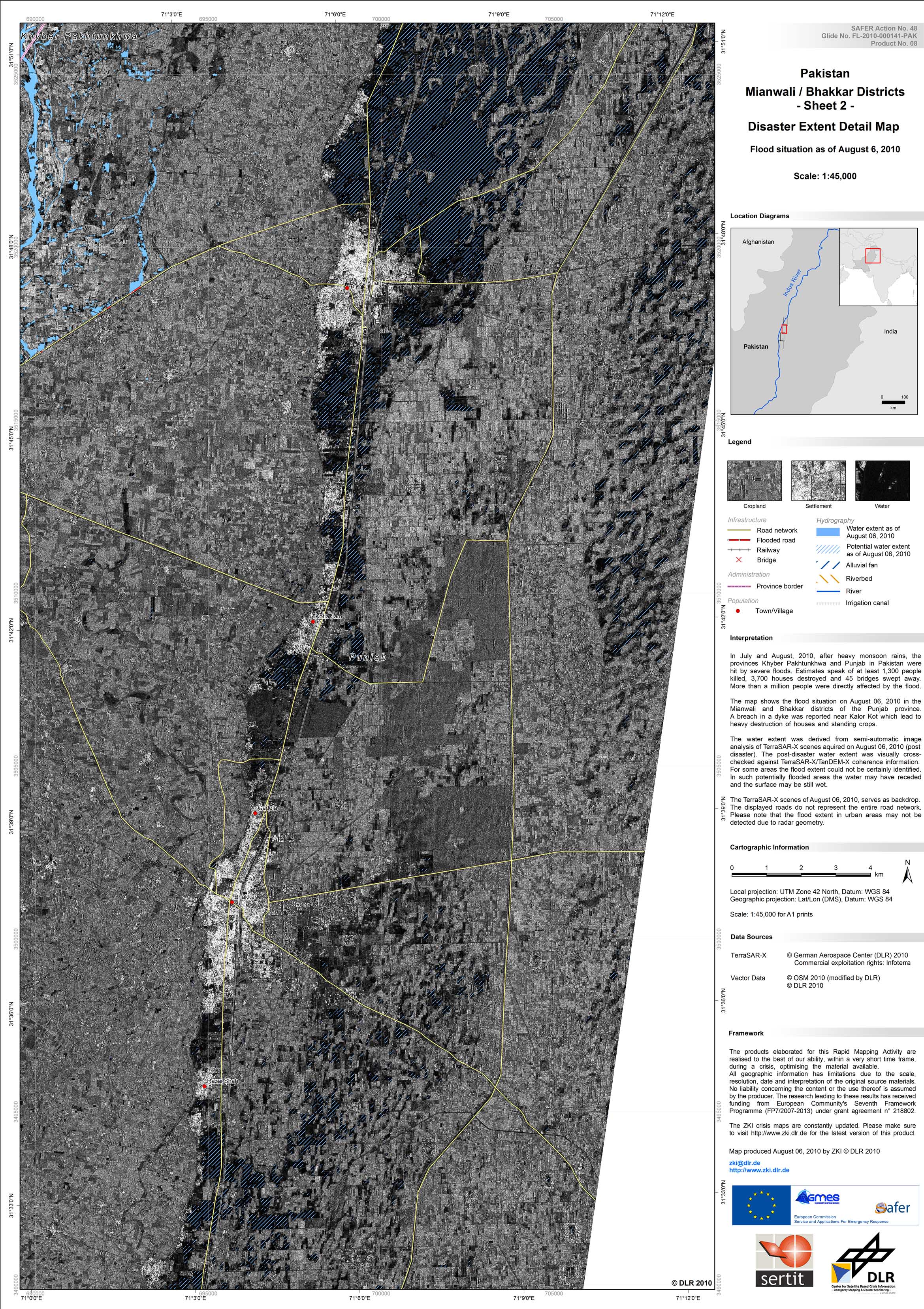
Pakistan - P08 - Mianwali / Bhakkar districts - Disaster Extent Map - Detail - Sheet 2
Creation Date 06. August 2010

Pakistan - P09 - Mianwali / Bhakkar districts - Disaster Extent Map - Detail - Sheet 3
Creation Date 06. August 2010

Pakistan - P10 - Mianwali / Bhakkar districts - Disaster Extent Map - Detail - Sheet 4
Creation Date 06. August 2010
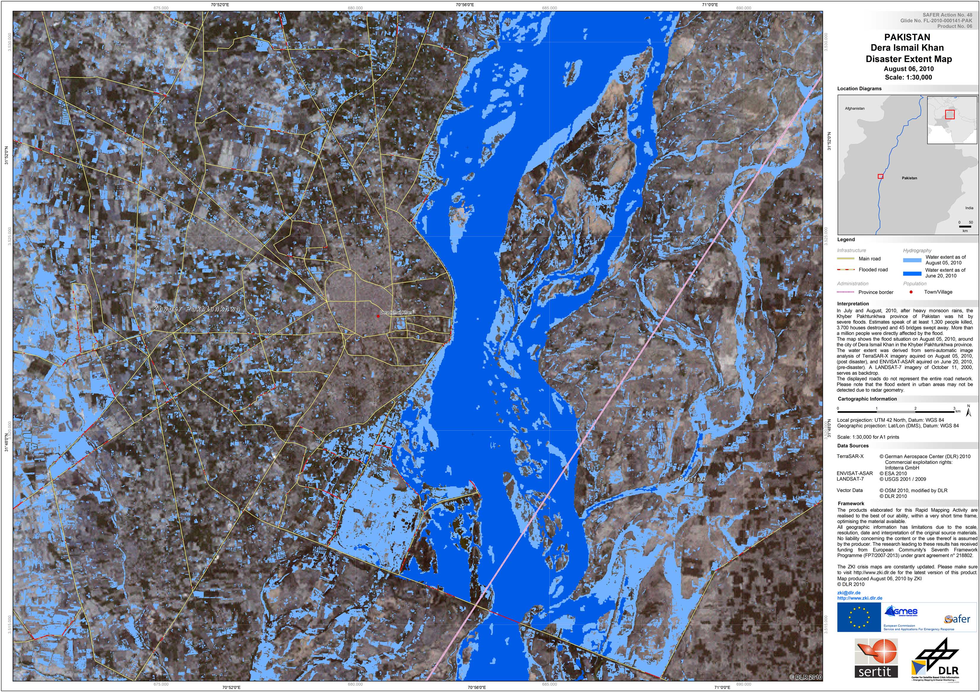
Pakistan - P06 - City of Dera Ismail Khan - Disaster Extent Map - City of Dera Ismail Khan
Creation Date 06. August 2010

Pakistan - P03 - Geographic Reference Map - City of Kalur Kot in the Punjab province
Creation Date 04. August 2010
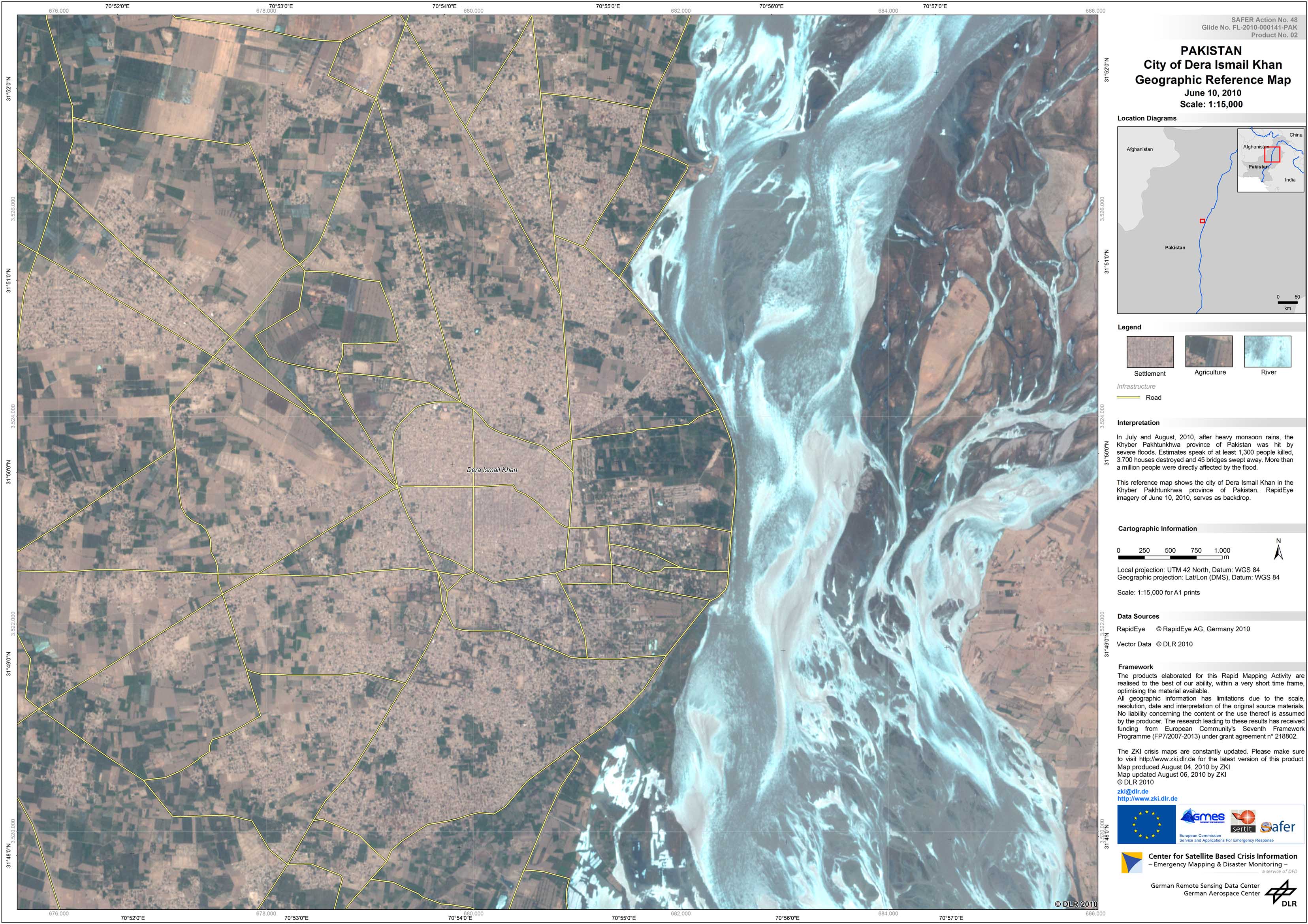
Pakistan - P02 - Geographic Reference Map - City of Dera Ismail Khan in the Khyber Pakhtunkhwa province
Creation Date 04. August 2010
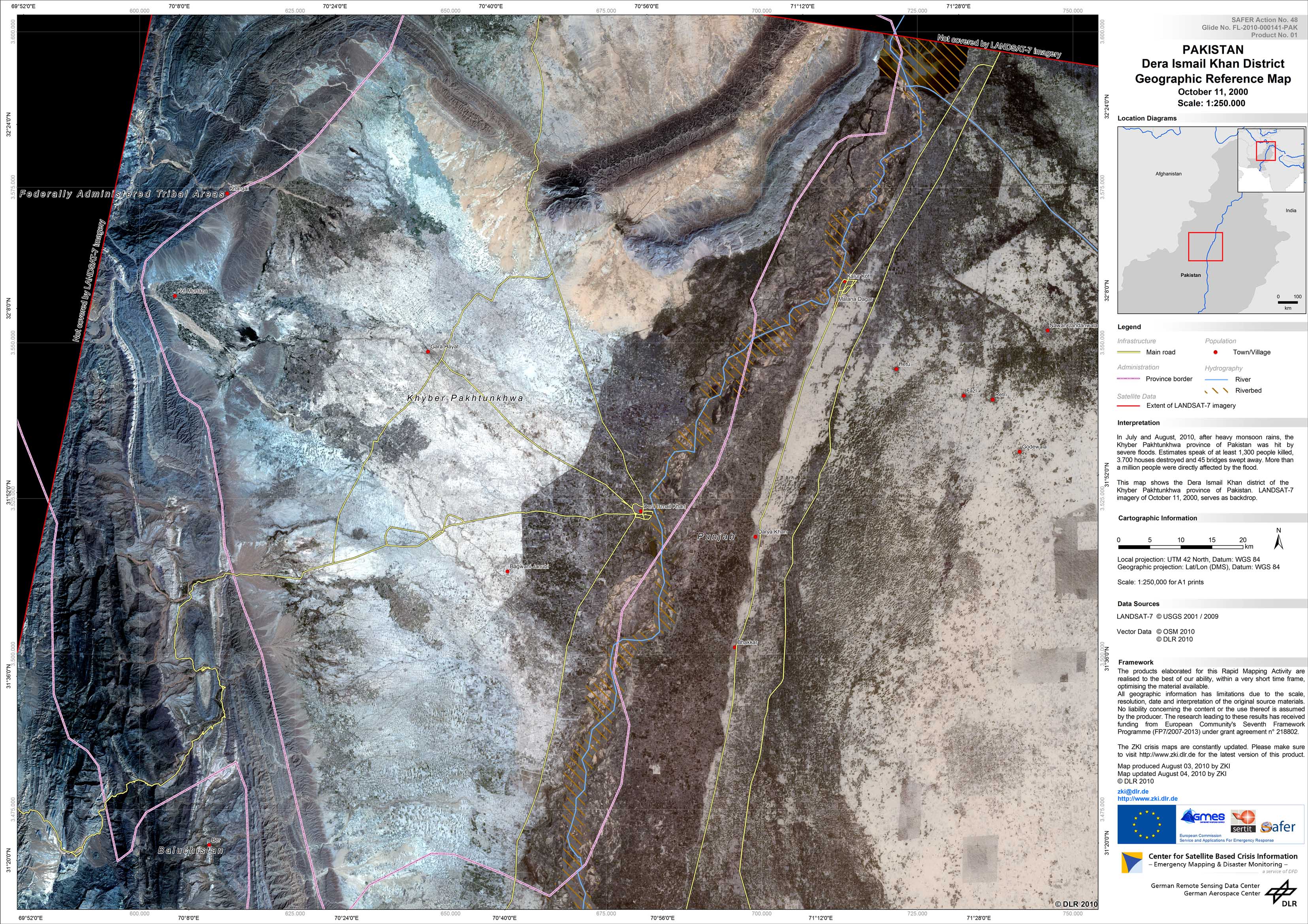
Pakistan - P01 - Geographic Reference Map - Dera Ismail Khan district of the Khyber Pakhtunkhwa province
Creation Date 03. August 2010