23. October 2011

Earthquake in Turkey on October 23, 2011

undefined

On Sunday October 23, 2011 an earthquake with a magnitude of 7.3 at 5 km depth hit the province of Van in eastern Turkey, followed by a series of powerful aftershocks of magnitudes up to 5.6. The epicentre was located at the village of Tabanli 19 km Northeast of the city of Van between the Van Lake and the Iranian border. Several municipalities around the Van Lake were affected. Especially Bitlis on the west side and and Ercis on the north side of the lake were hit severely. According to Turkish media phone lines and electricity had been cut off. Thus initial reports of damage and casualties have been hard to come by. First estimates speak of 87 deaths and about 1000 injuries. This number is expected to rise substantially.

Products

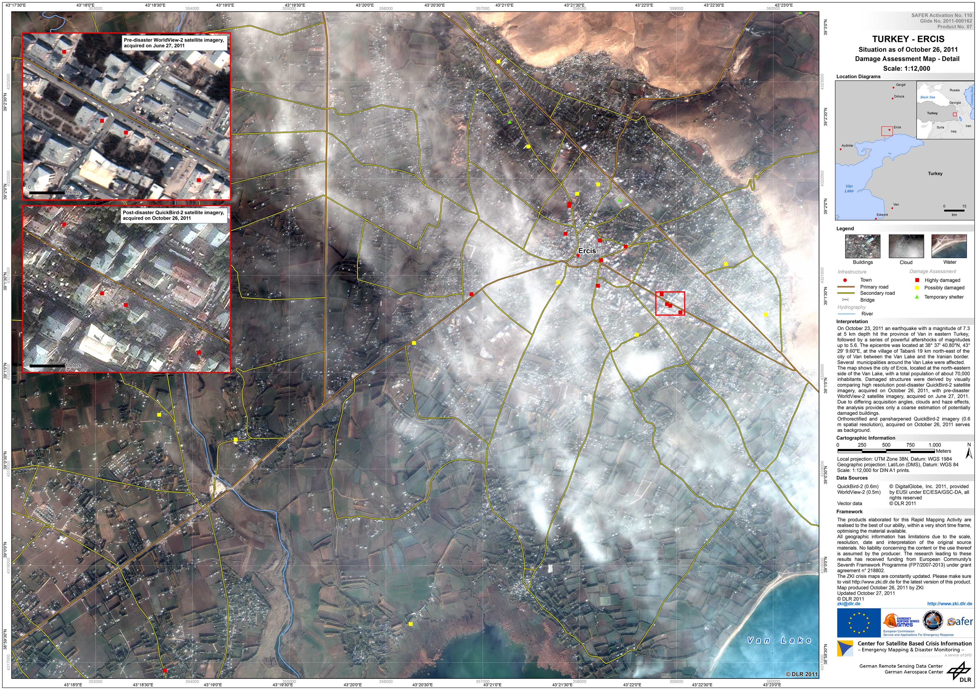
Turkey - P07 - Ercis - Damage Assessment Map - Detail

Creation Date 27. October 2011

Turkey - P08 - Ercis - Damage Assessment Map - Detail - October 28, 2011

Creation Date 26. October 2011

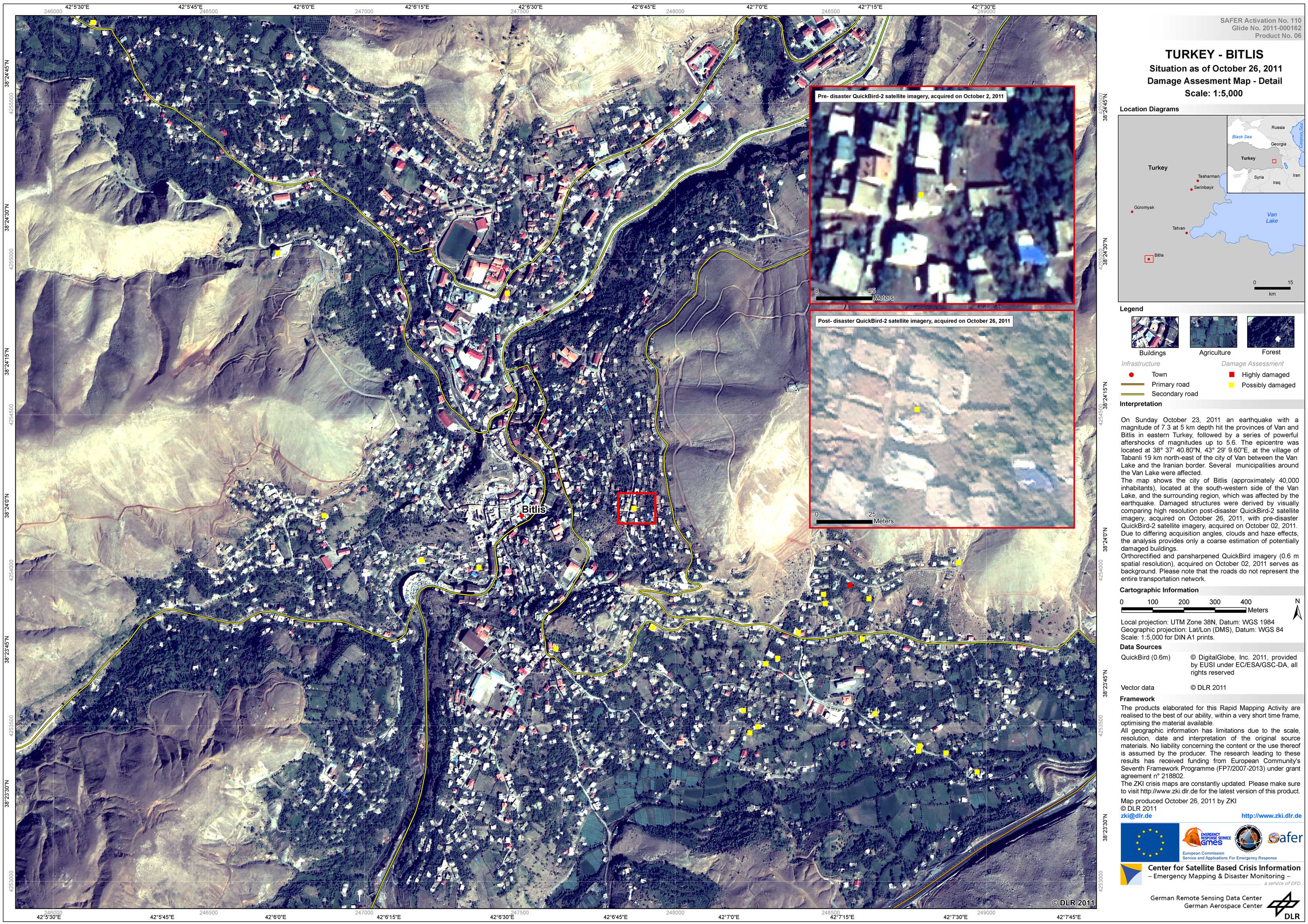
Turkey - P06 - Bitlis - Damage Assessment Map - Detail

Creation Date 26. October 2011

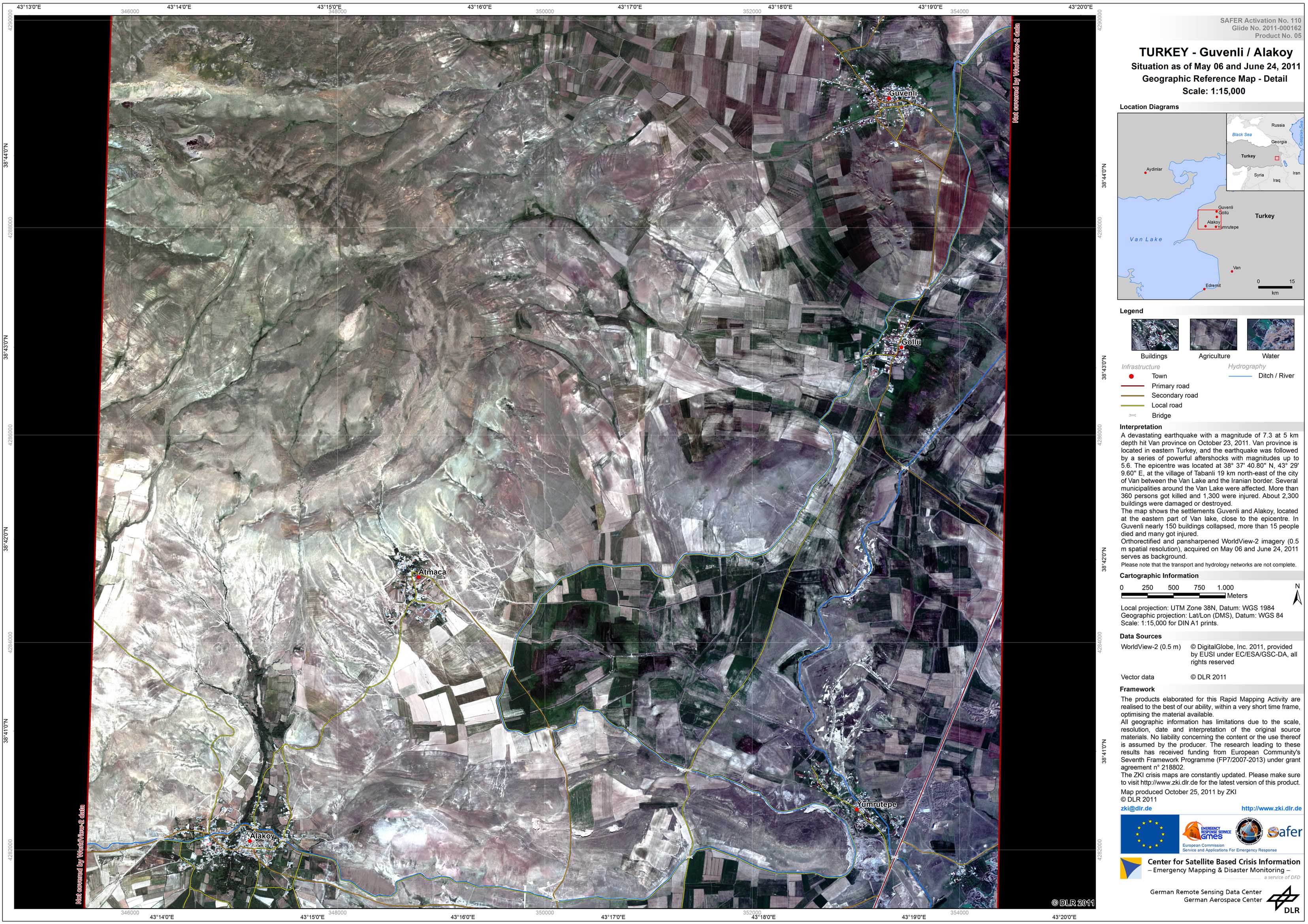
Turkey - P05 - Guvenli / Alakoy - Geographic Reference Map - Detail

Creation Date 25. October 2011

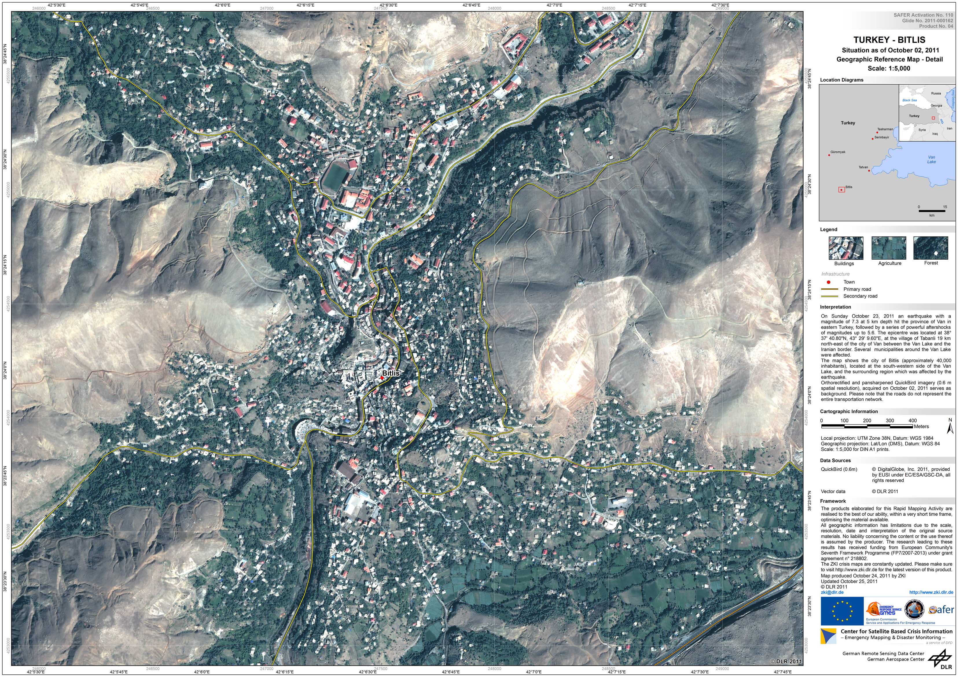
Turkey - P04 - Bitlis - Geographic Reference Map - Detail

Creation Date 25. October 2011

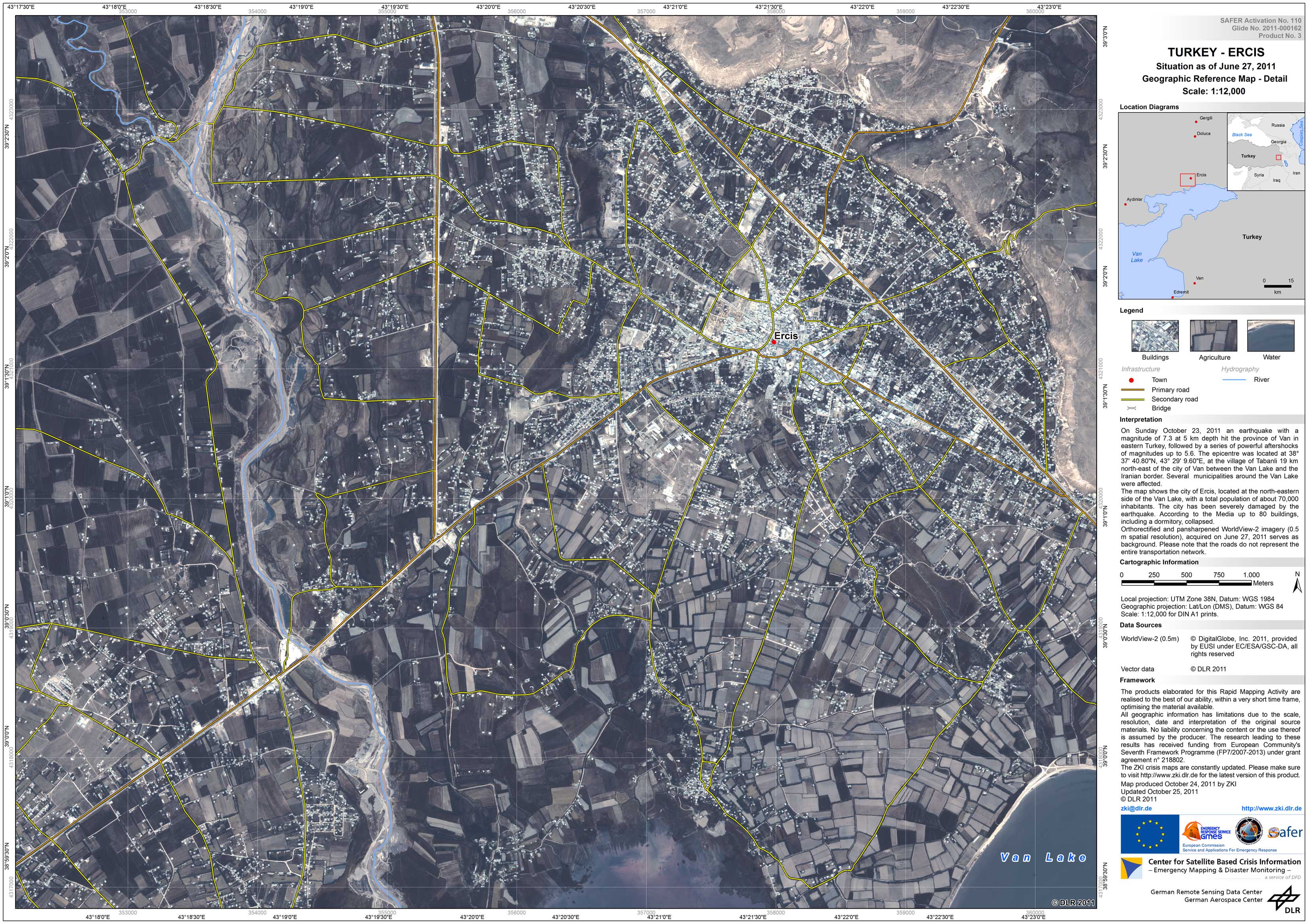
Turkey - P03 - Ercis - Geographic Reference Map - Detail

Creation Date 25. October 2011

Turkey - P02 - Van - Geographic Reference Map - Detail

Creation Date 25. October 2011

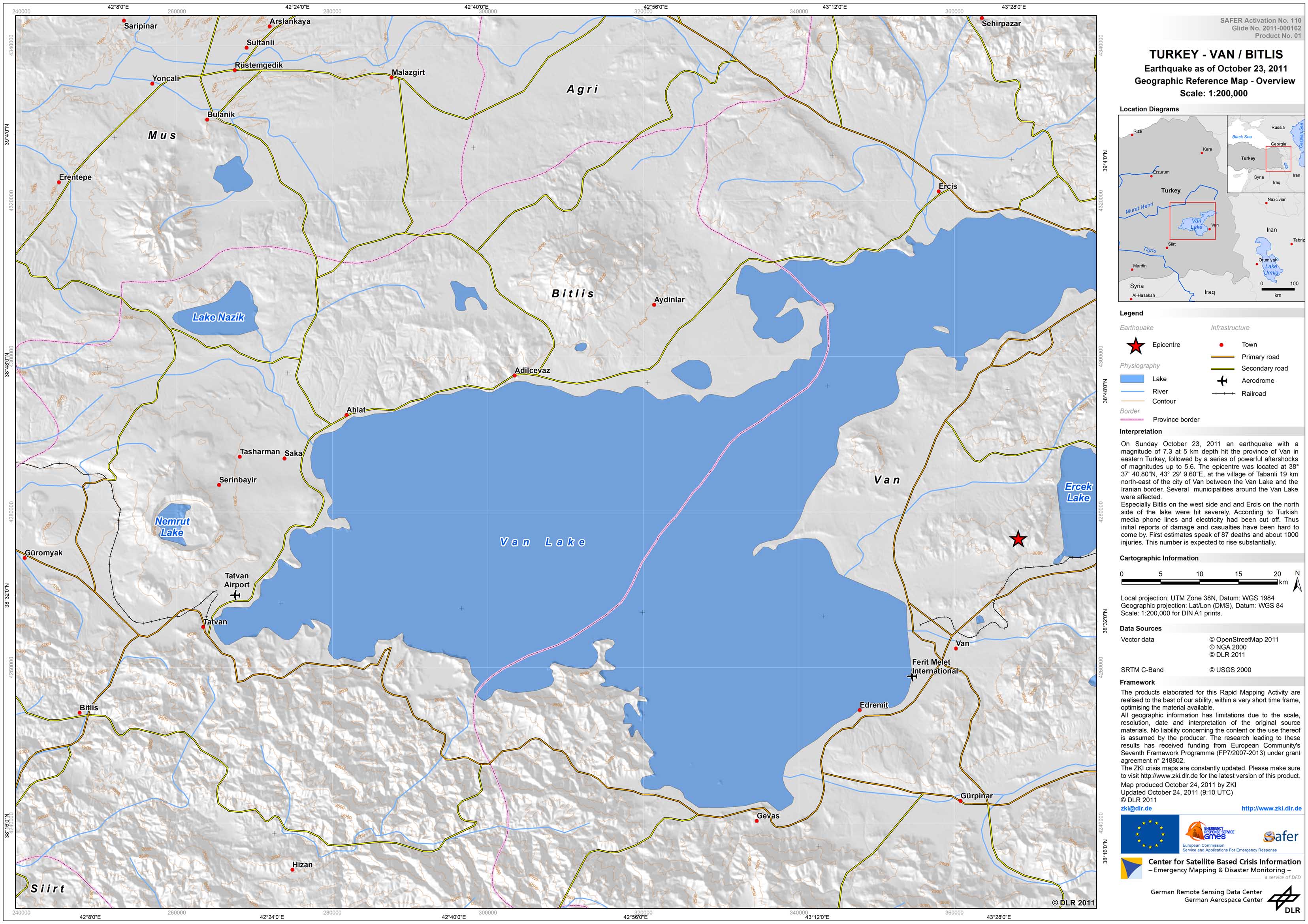
Turkey - P01 - Van / Bitlis - Geographic Reference Map

Creation Date 24. October 2011

undefined