
Earthquake in Nepal on April 25, 2015

Aerial image shows areas affected by the April 25 earthquake in Nepal.
Credit:
Staff Sgt. Jeffrey Anderson/Wikimedia Commons
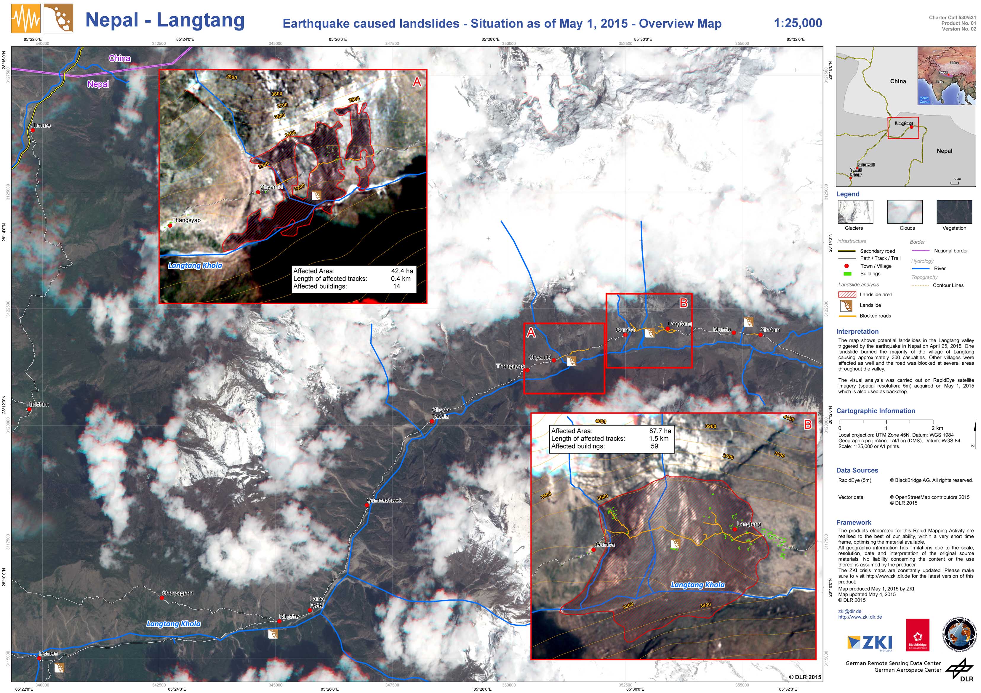
Nepal - Langtang - P05 - Earthquake caused landslides - Situation as of May 1, 2015 - Overview Map
Creation Date 04. May 2015
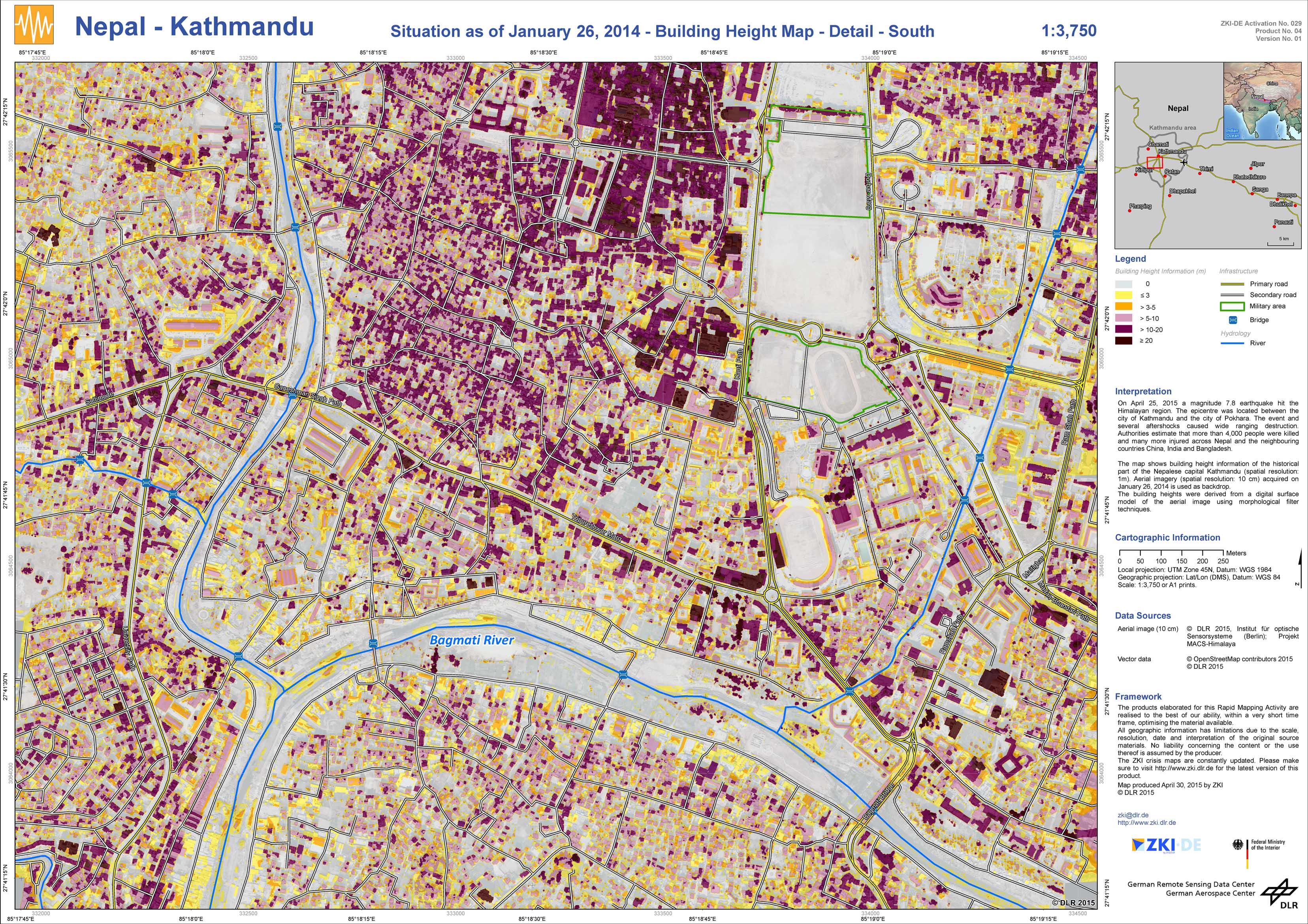
Nepal - Kathmandu - P04 - Situation as of January 26, 2014 - Building Height Map - Detail - South
Creation Date 30. April 2015
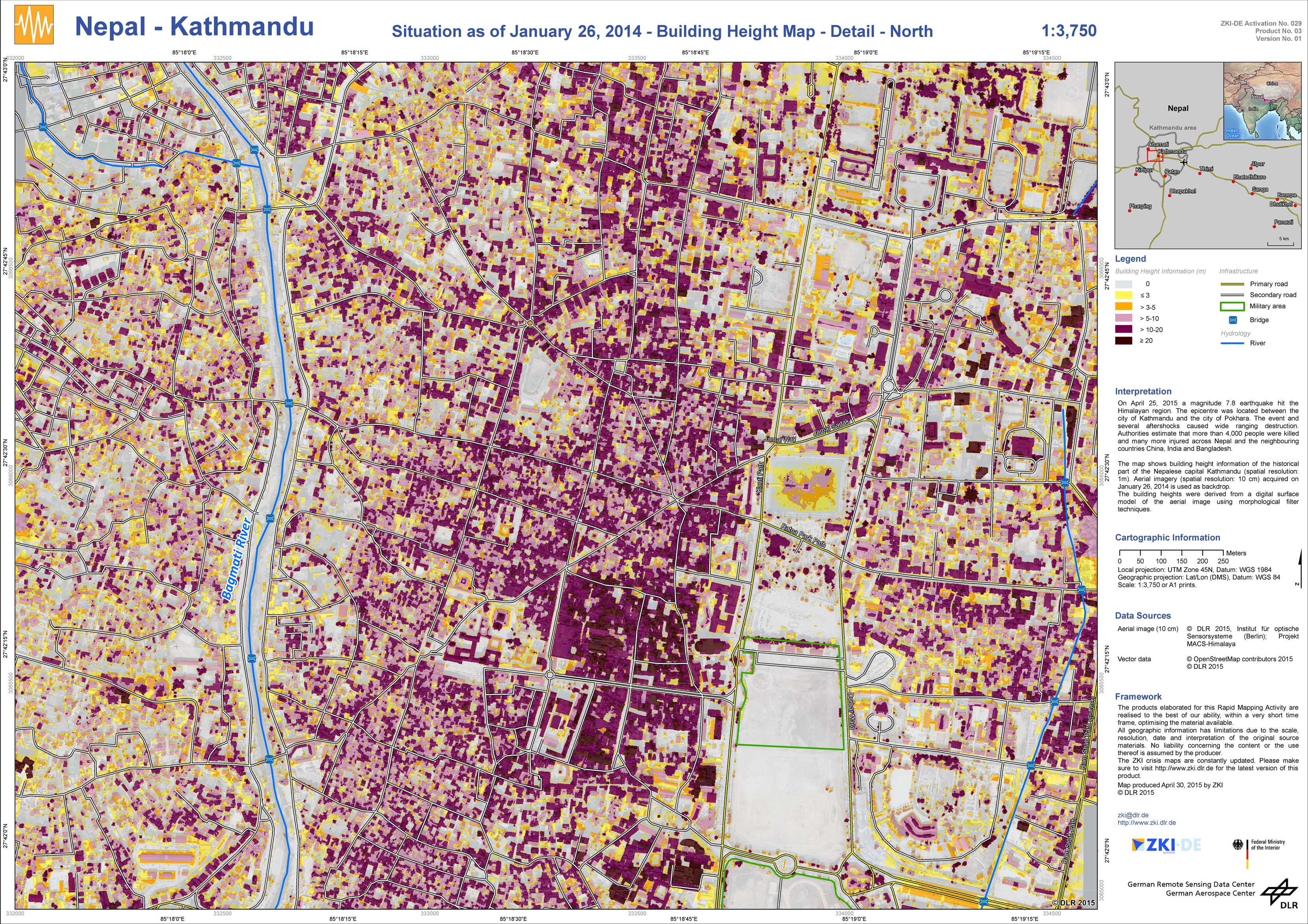
Nepal - Kathmandu - P03 - Situation as of January 26, 2014 - Building Height Map - Detail - North
Creation Date 30. April 2015
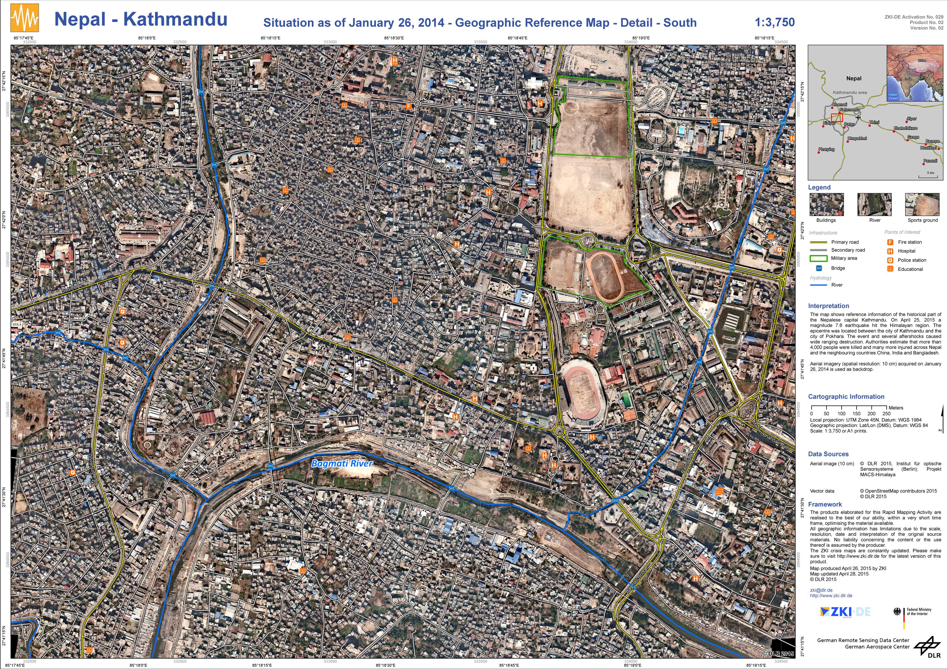
Nepal - Kathmandu - P02 - Situation as of January 26, 2014 - Geographic Reference Map - Detail - South
Creation Date 28. April 2015
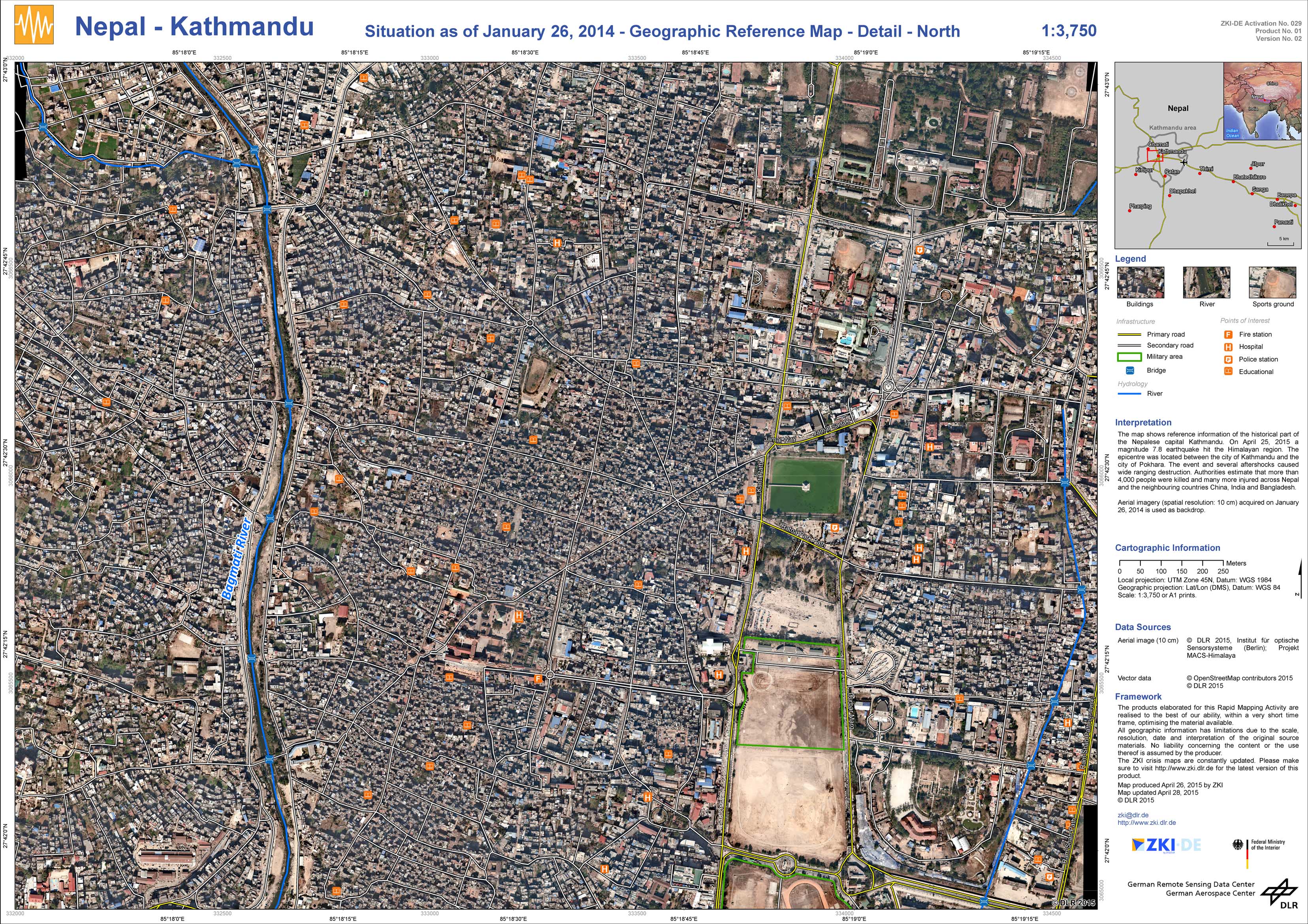
Nepal - Kathmandu - P01 - Situation as of January 26, 2014 - Geographic Reference Map - Detail - North
Creation Date 26. April 2015