
Typhoon in Philippines

Typhoon Haiyan at peak intensity and approaching the Philippines on November 7, 2013.
Credit:
NASA/Wikimedia Commons

Philippines - Cebu / Medellin - P10 - Situation as of November 14, 2013 - Damage Assessment Map
Creation Date 18. November 2013
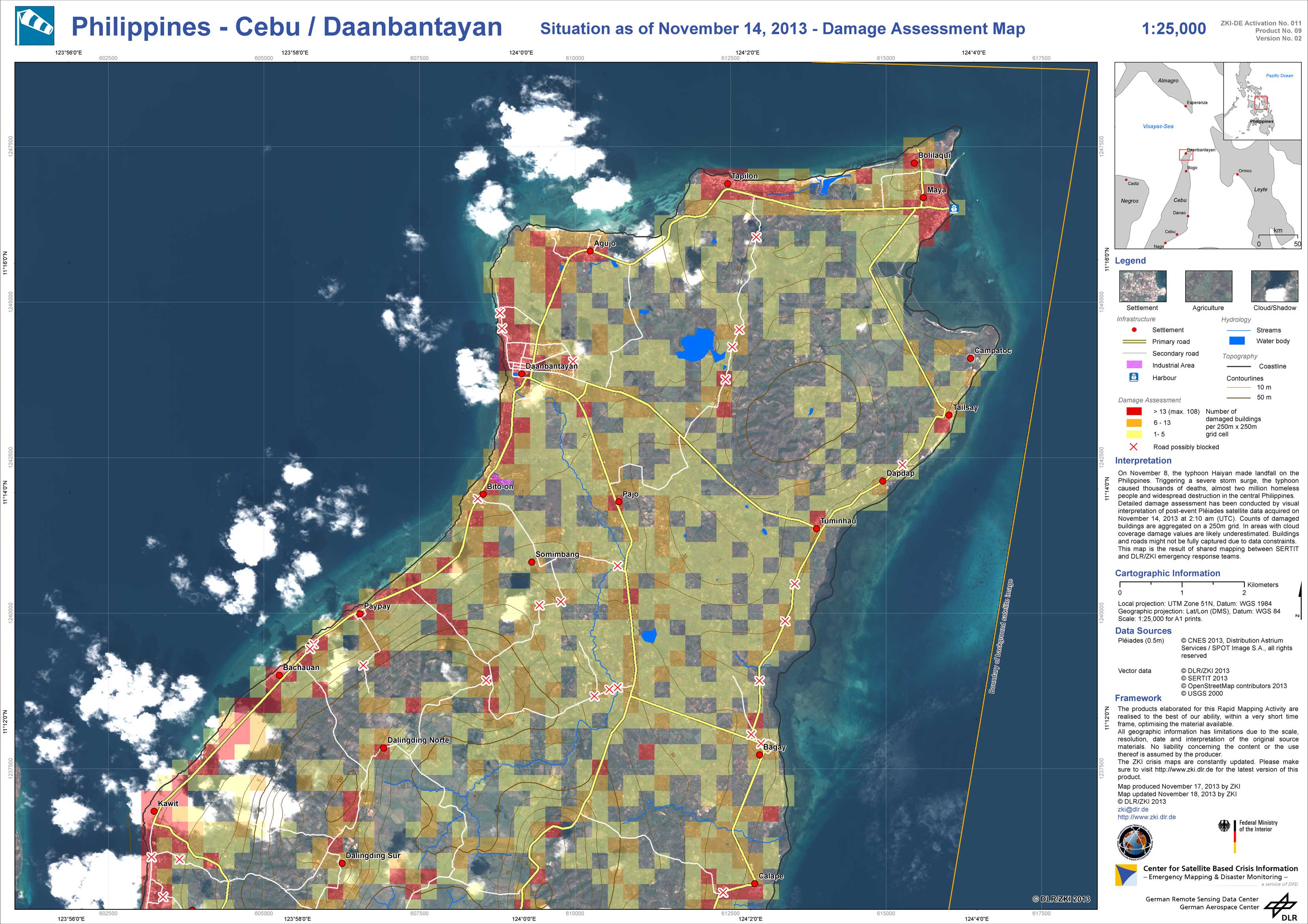
Philippines - Cebu / Daanbantayan - P09 - Situation as of November 14, 2013 - Damage Assessment Map
Creation Date 18. November 2013
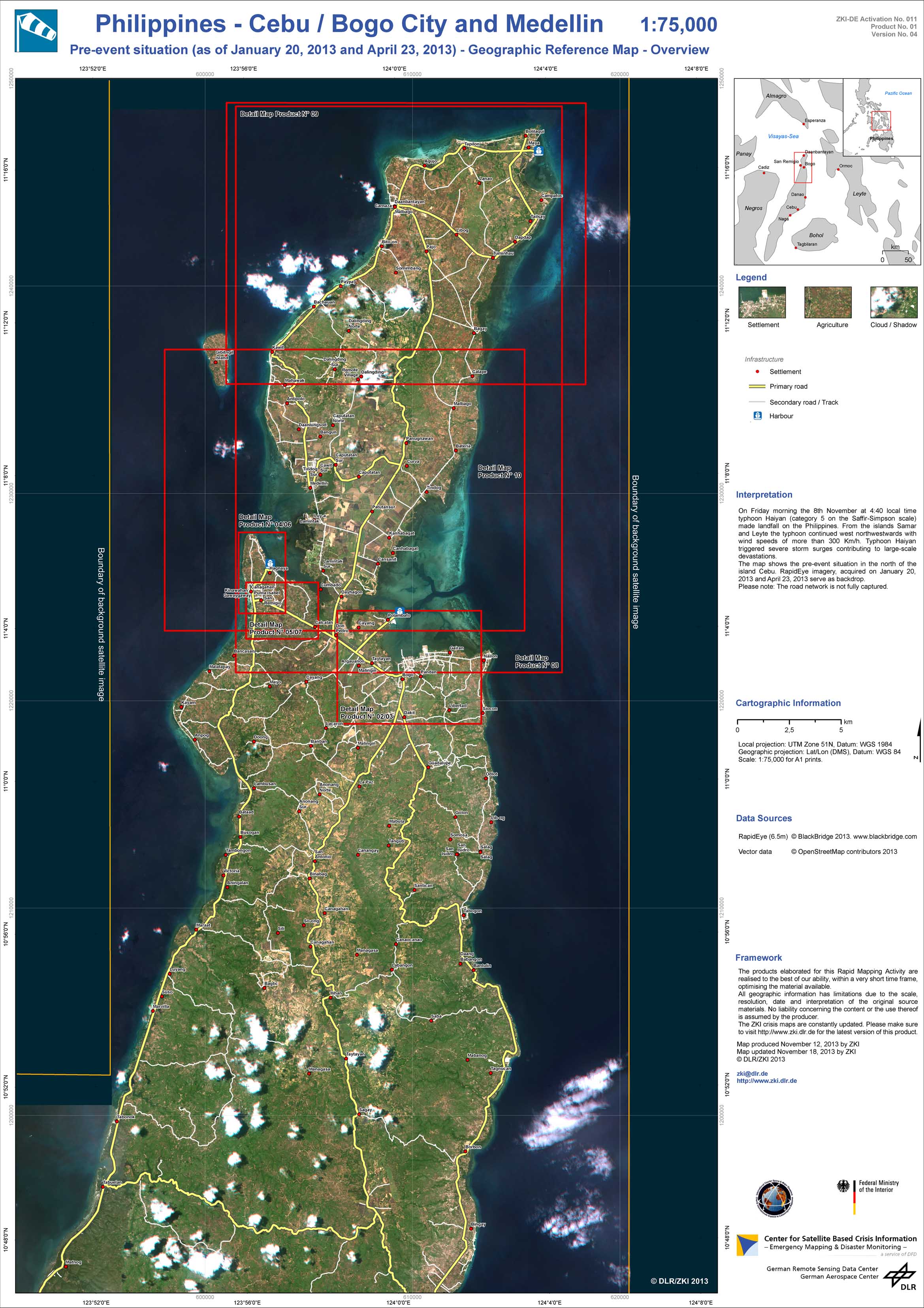
Philippines - Cebu / Bogo City And Medellin - P01 - Pre-event situation as of January 20, 2013 and April 23, 2013 - Geographic Reference Map - Overview
Creation Date 18. November 2013
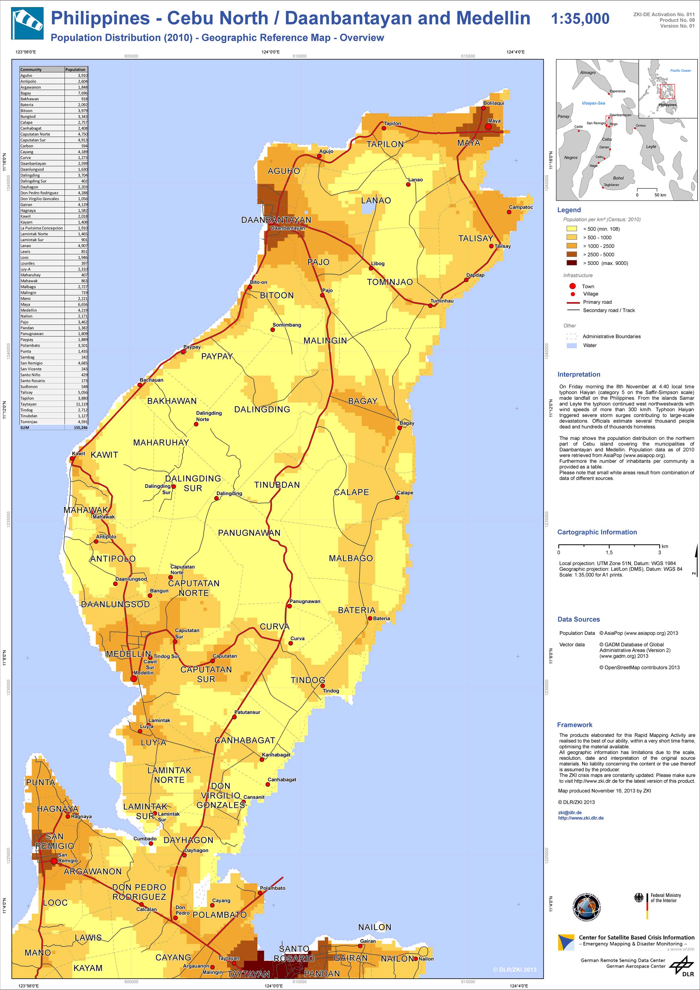
Philippines - Cebu North / Daanbantayan And Medellin - P08 - Population Distribution (2010) - Geographic Reference Map - Overview
Creation Date 16. November 2013
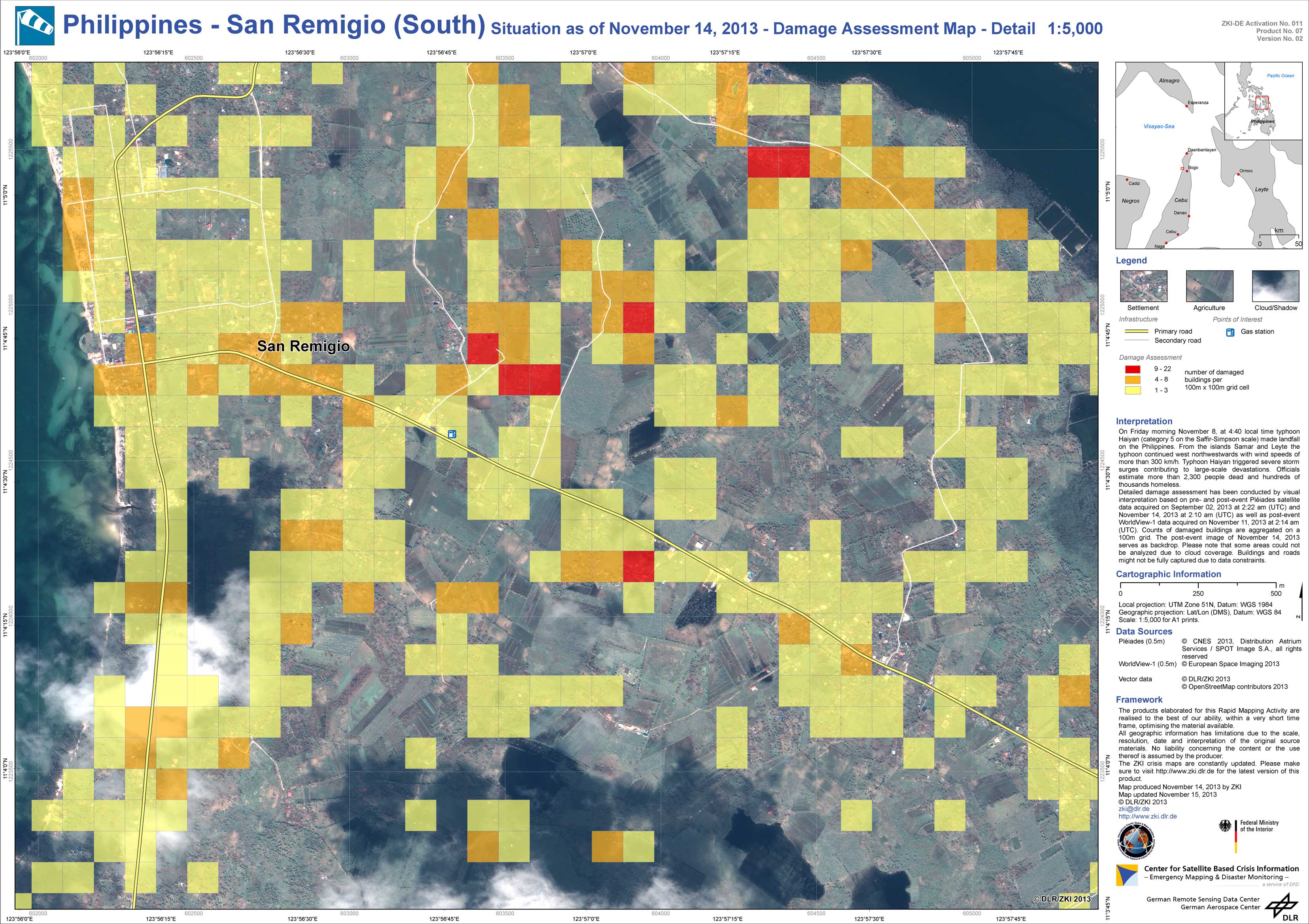
Philippines - San Remigio (South) - P07 - Situation as of November 14, 2013 - Damage Assessment Map - Detail
Creation Date 15. November 2013
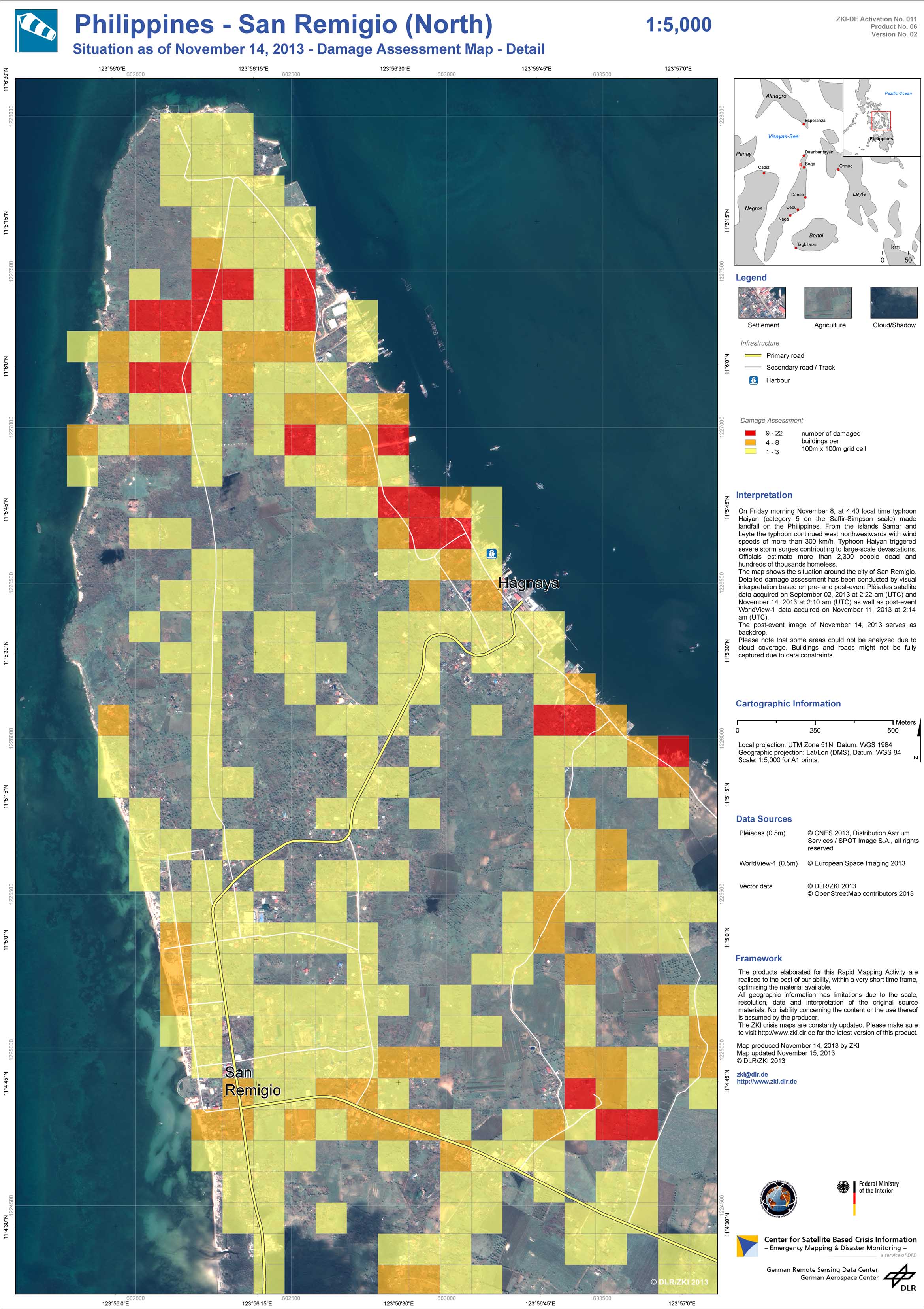
Philippines - San Remigio (North) - P06 - Situation as of November 14, 2013 - Damage Assessment Map - Detail
Creation Date 15. November 2013
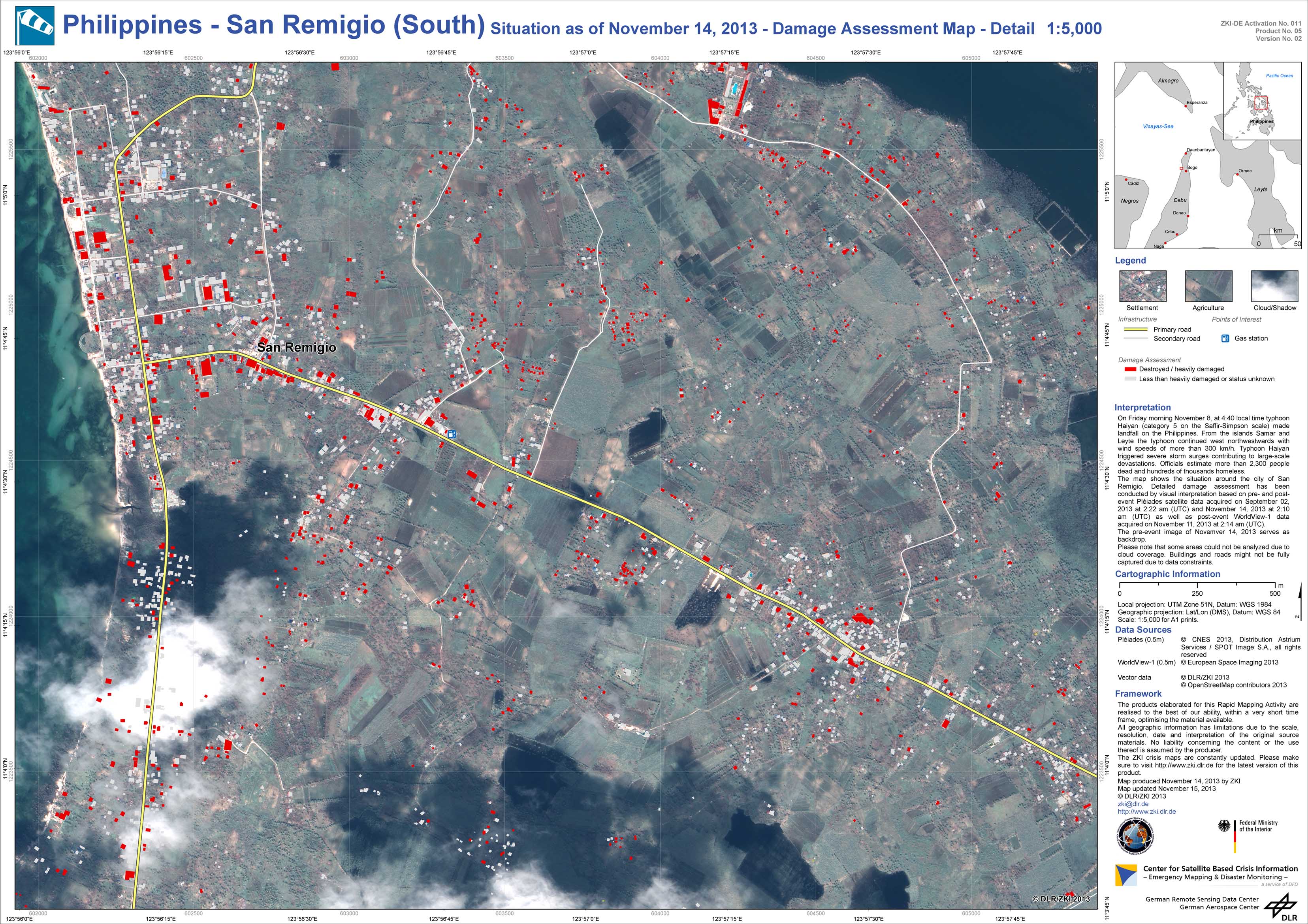
Philippines - San Remigio (South) - P05 - Situation as of November 14, 2013 - Damage Assessment Map - Detail
Creation Date 15. November 2013
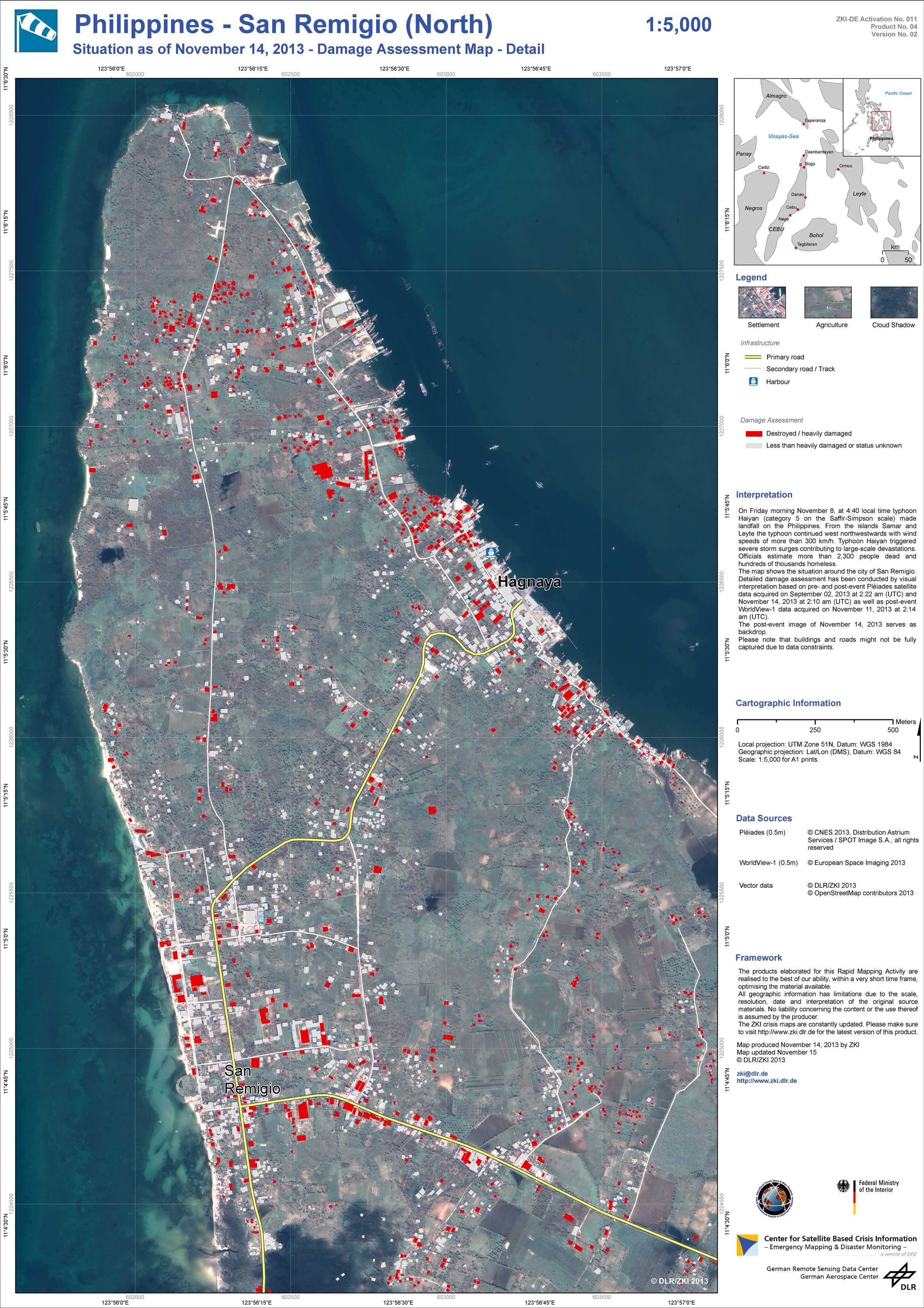
Philippines - San Remigio (North) - P04 - Situation as of November 14, 2013 - Damage Assessment Map - Detail
Creation Date 15. November 2013
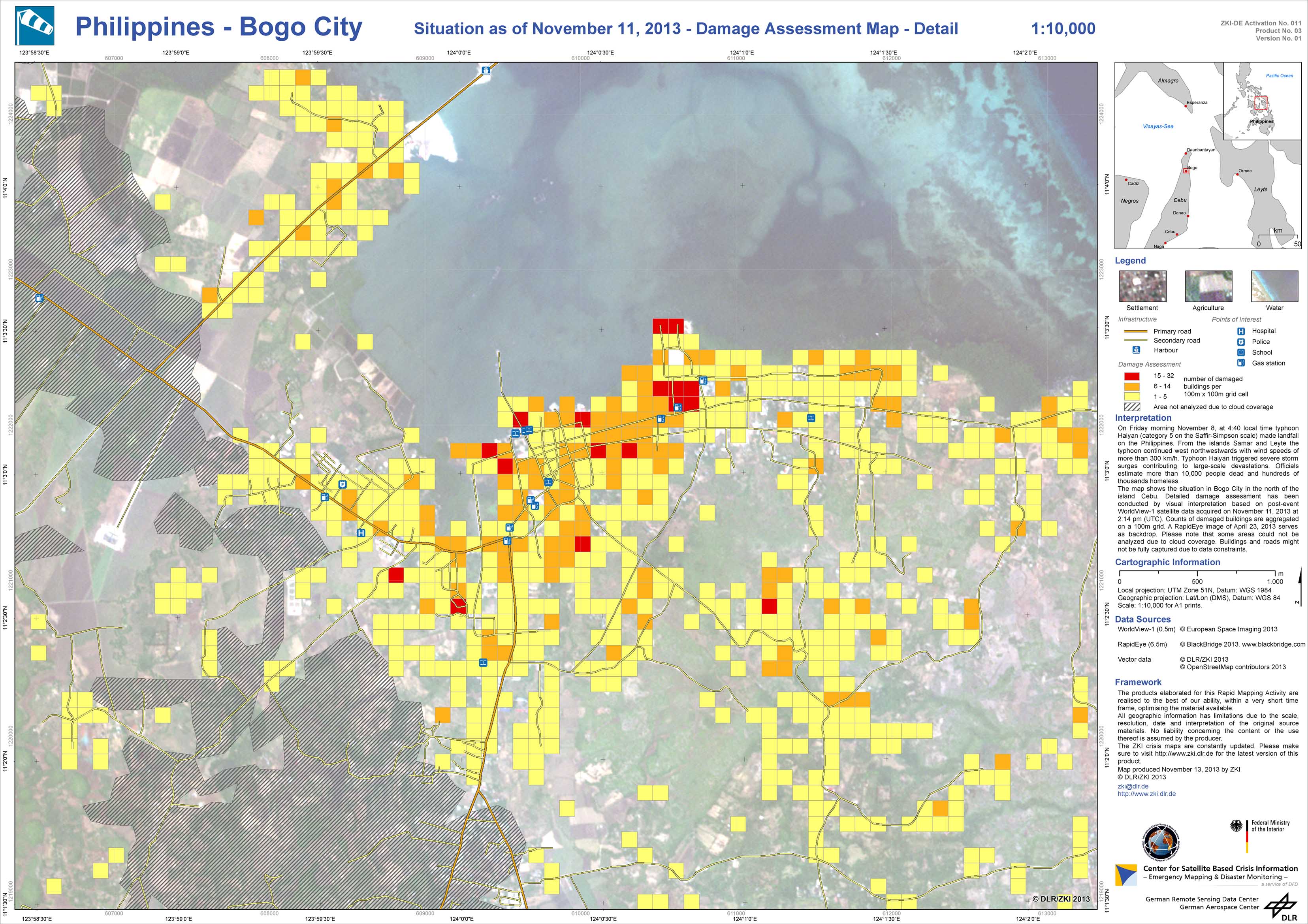
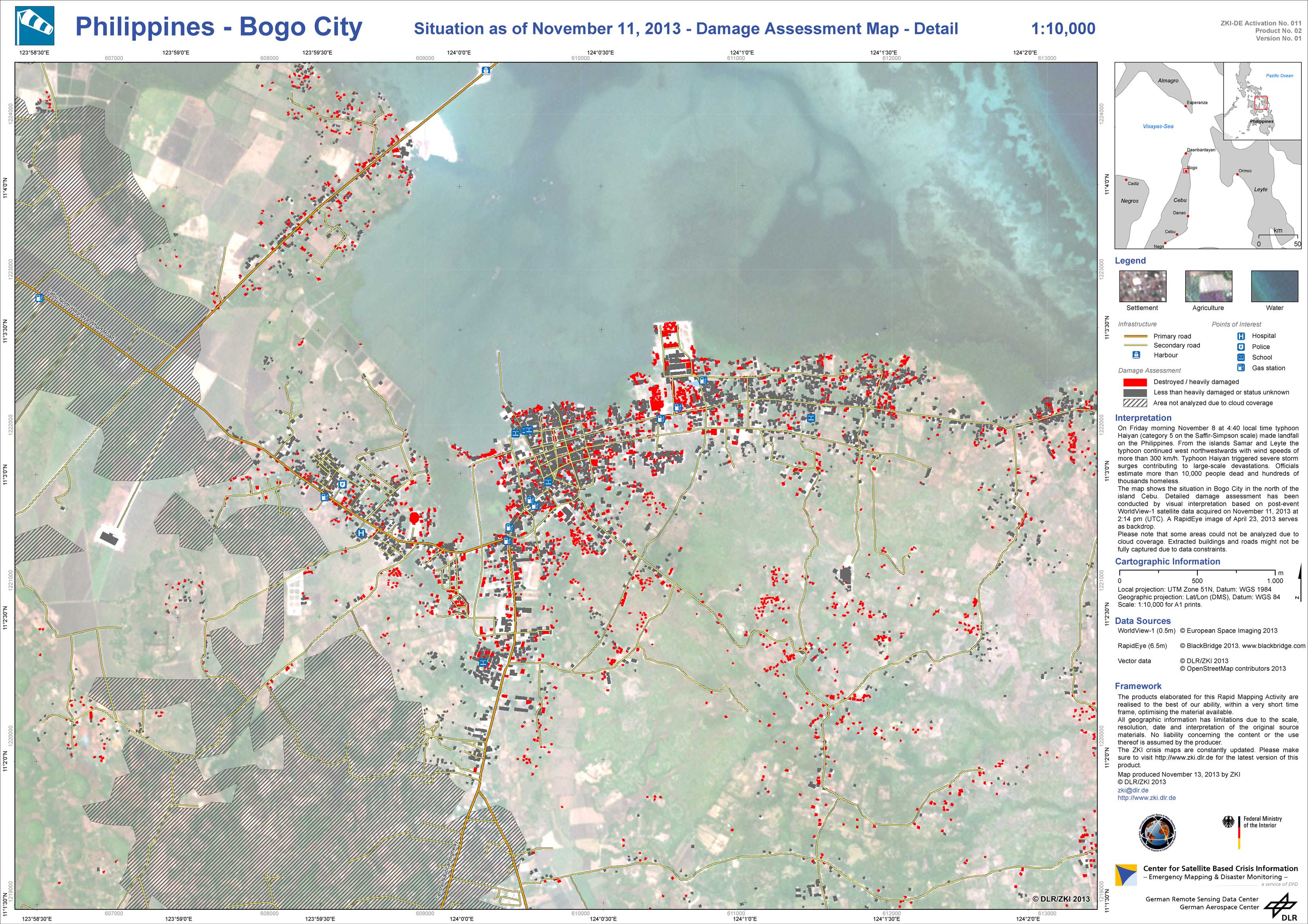
Philippines - Bogo City - P03 - Situation as of November 11, 2013 - Damage Assessment Map - Detail
Creation Date 13. November 2013
Philippines - Bogo City - P02 - Situation as of November 11, 2013 - Damage Assessment Map - Detail
Creation Date 13. November 2013