02. July 2019

Vegetation fires in Germany - ZKI supports with current situation maps based on satellite and aerial data

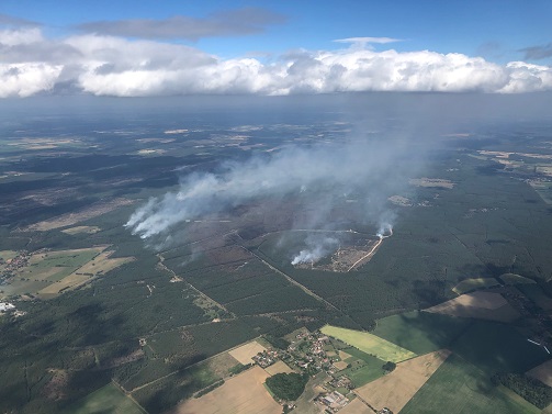
Aerial image of the fires in Lübtheen, collected on July 2, 2019.
Credit:
DLR - Institute of Optical Sensor Systems

In large parts of Germany there has been a high risk of forest fires for weeks, sometimes level 5 of 5. North-eastern Germany is particularly affected. Since 30.06.2019, outstanding vegetation fires have been fought there with cross-border support. Near Lübtheen (Mecklenburg-Western Pomerania), an area of approx. 1200 ha is affected. Already on 25.06.2019 there had been a fire at the same place, the fire was reported as extinguished on 28.06.2019, but was again ignited. In the past, the affected area was part of a military training area and is munition contaminated. This makes extinguishing the fire particularly complicated.

Also the DLR supports the action force in Mecklenburg-West Pomerania. With the help of ZKI-maps the estimation of the recent situation is assisted. Therefore different data sources are used. In addition to several satellite based sensors the Institute of Optical Sensor Systems made aerial photographs of the wild fires near Lübtheen with a special version of an „Modular Aerial Camera System“ (MACS) installed on a research aircraft of the Freie Universität Berlin. Additionally, data of the DLR-research satellite mission FireBIRD/TET is used. The ZKI collates the information of the different sensors and generates recent map products of the affected region based on the various optical and thermal data.

Products

Germany - Vegetation fires Mecklenburg Western Pomerania - P07 - Situaion Map of July 4, 2019 - aerial image

Creation Date 05. July 2019

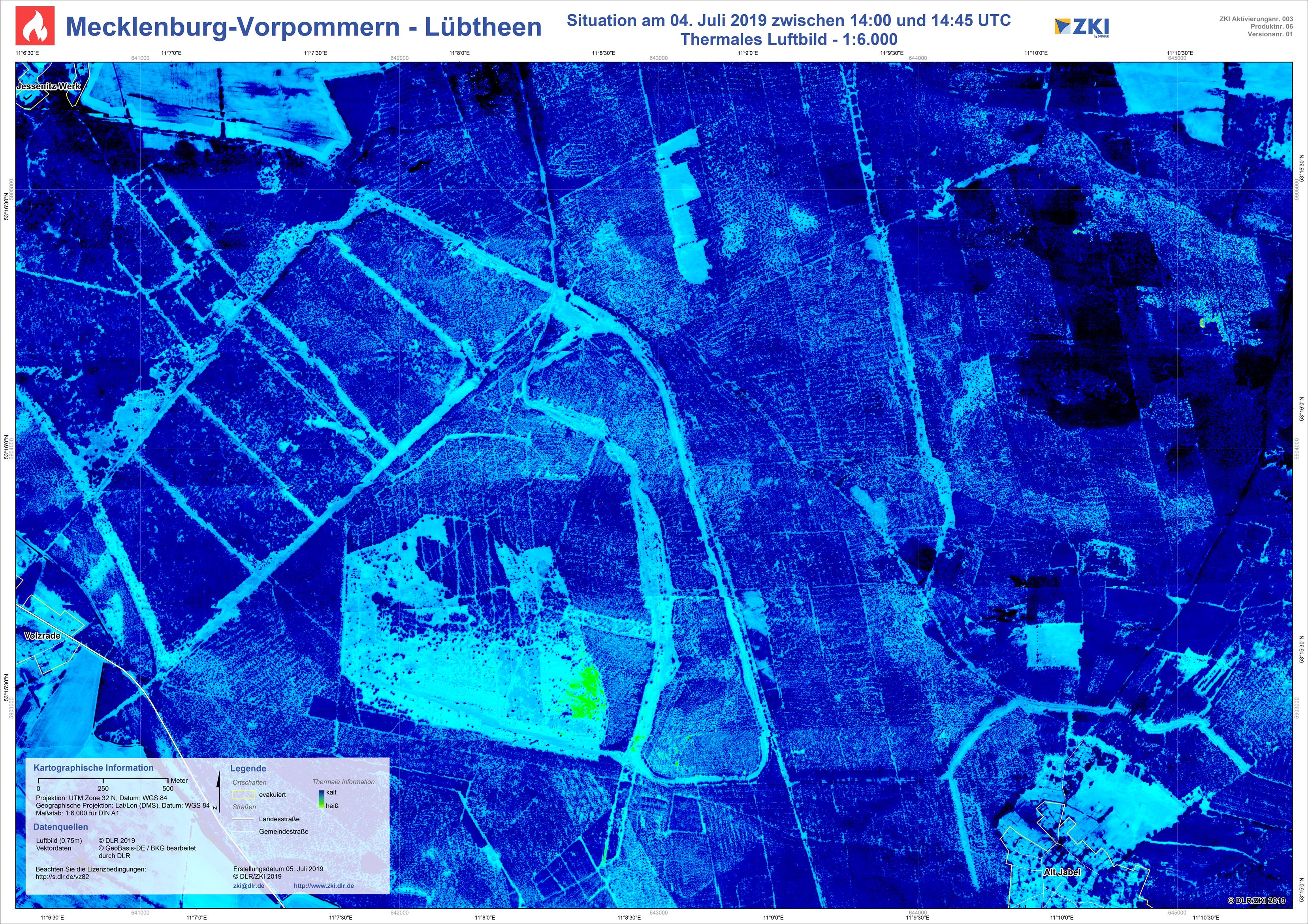
Germany - Vegetation fires Mecklenburg Western Pomerania - P06 - Situaion Map of July 4, 2019 - thermal aerial image

Creation Date 05. July 2019

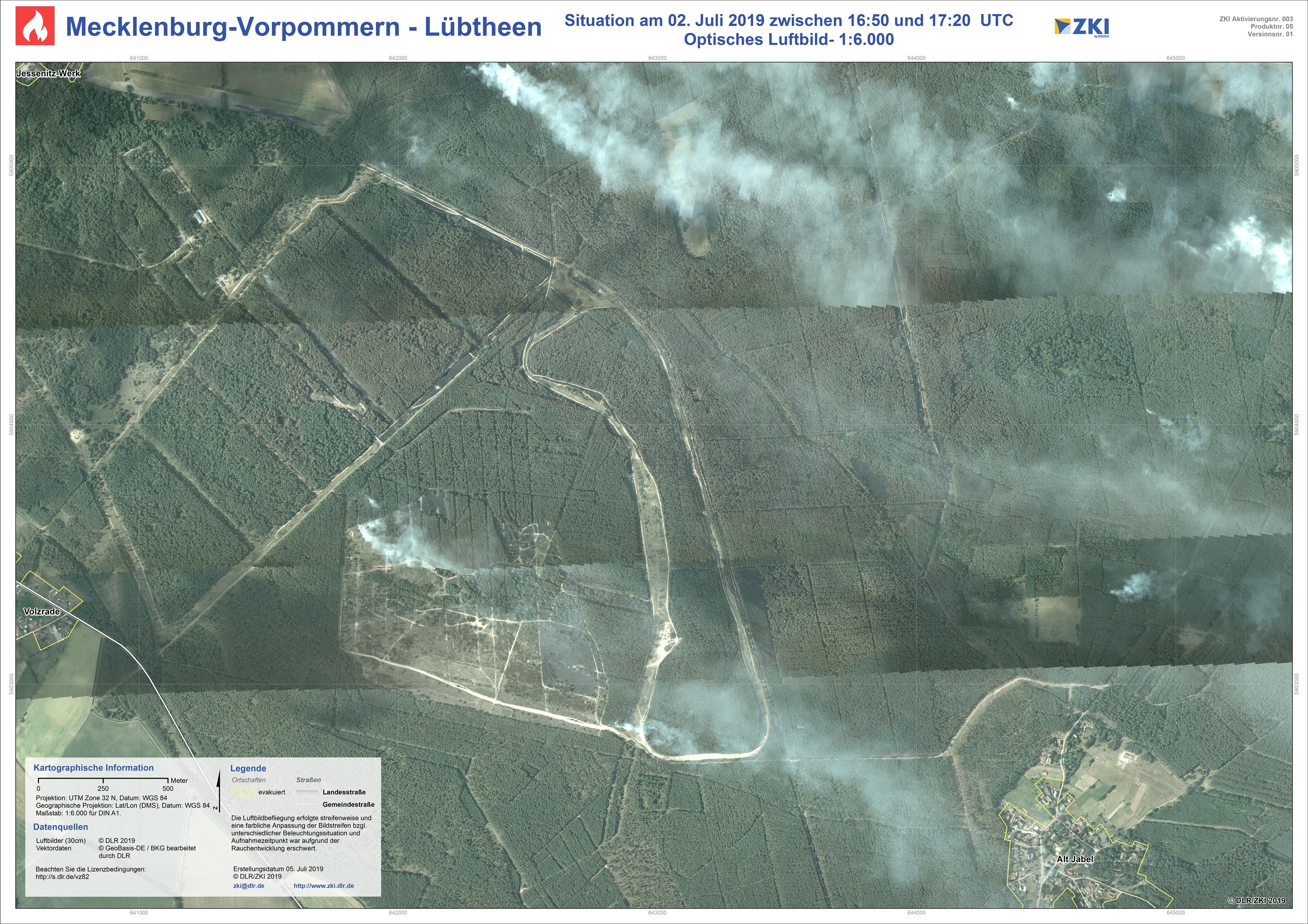
Germany - Vegetation fires Mecklenburg Western Pomerania - P05 - Situaion Map of July 2, 2019 - aerial image

Creation Date 05. July 2019

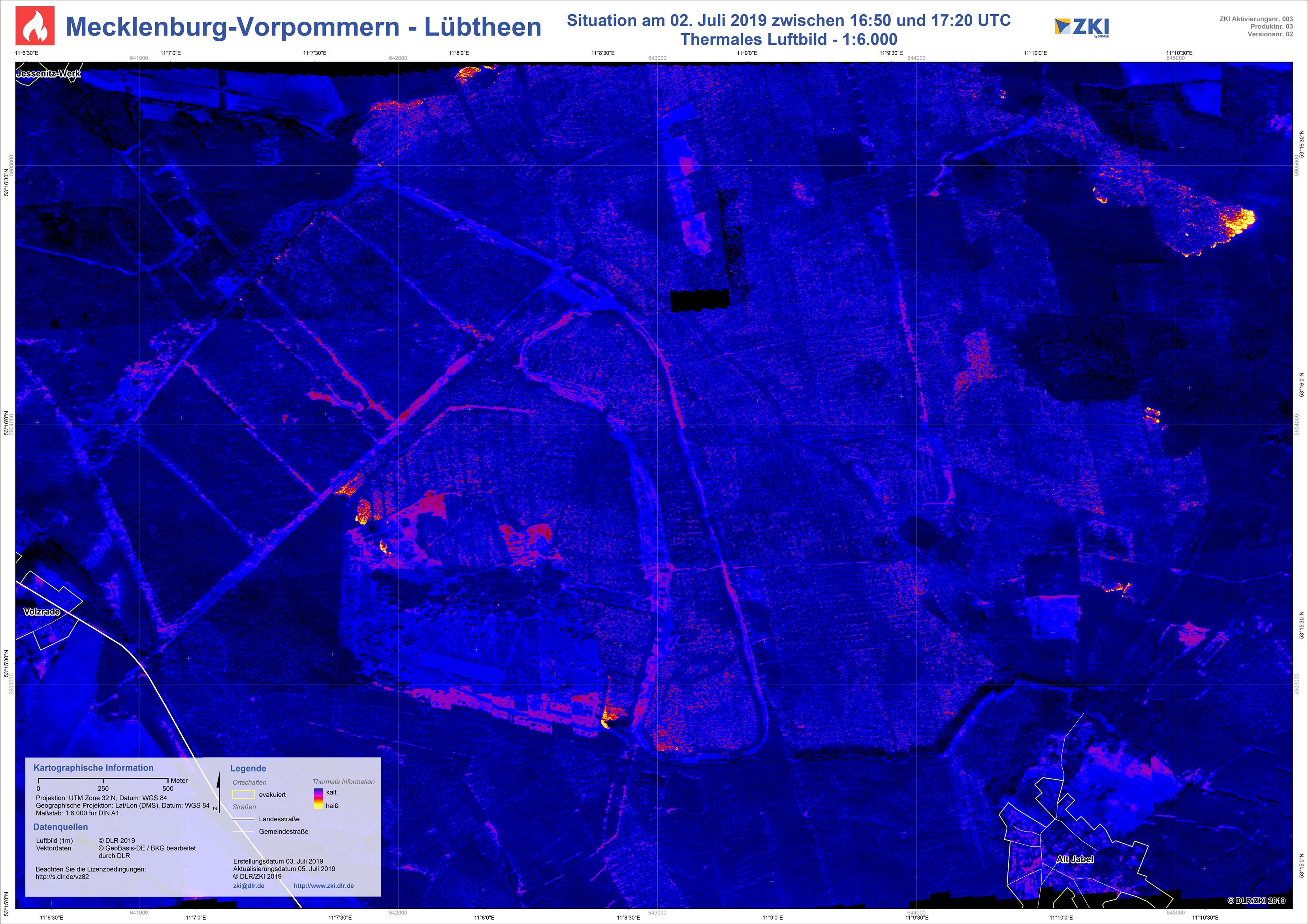
Germany - Vegetation fires Mecklenburg Western Pomerania - P05 (updated) - Situaion Map of July 2, 2019 - thermal aerial image

Creation Date 05. July 2019

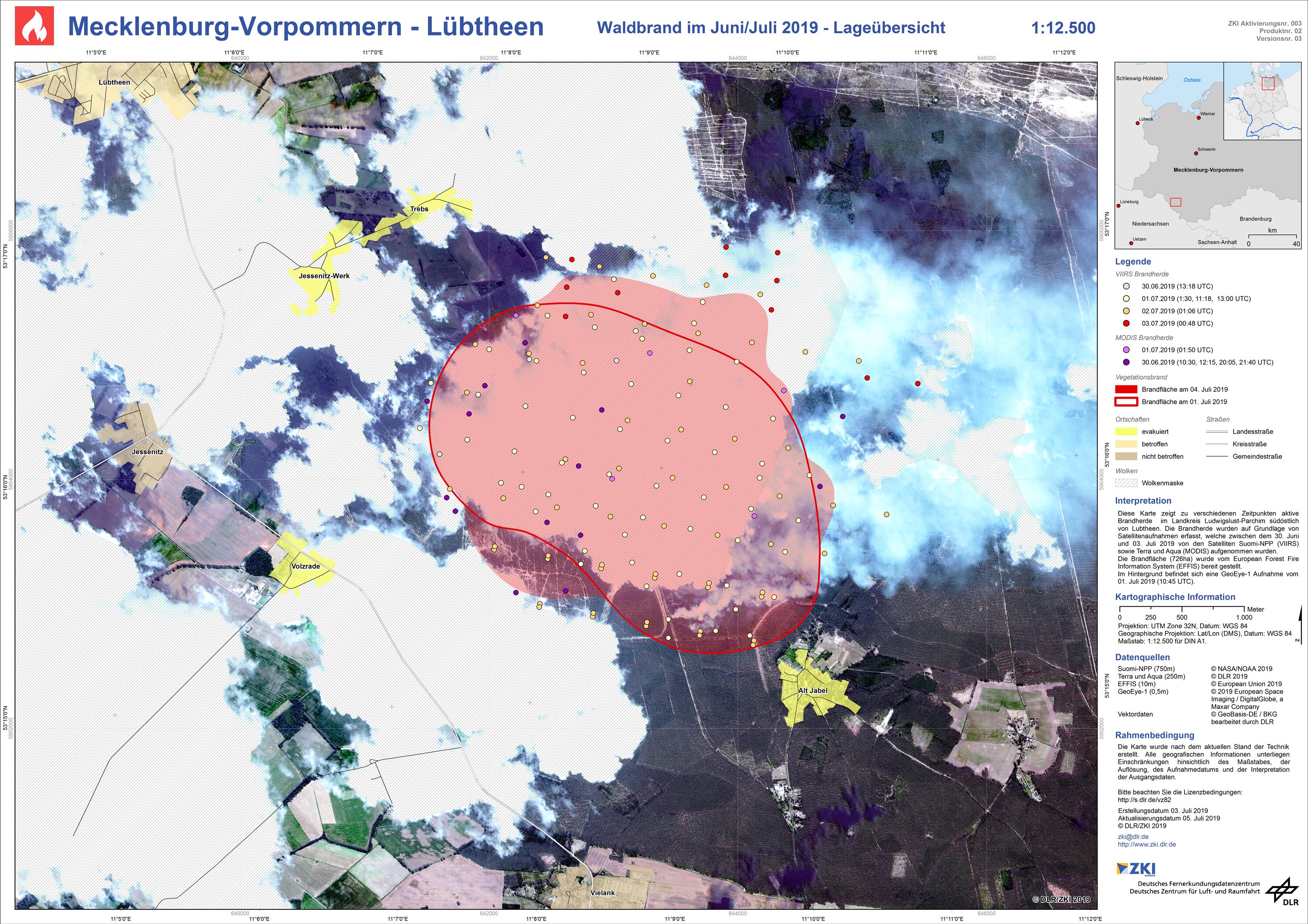
Germany - Vegetation fires Mecklenburg Western Pomerania - P02 (updated) - Situaion Map of July 1, 2019 - GeoEye-1

Creation Date 05. July 2019

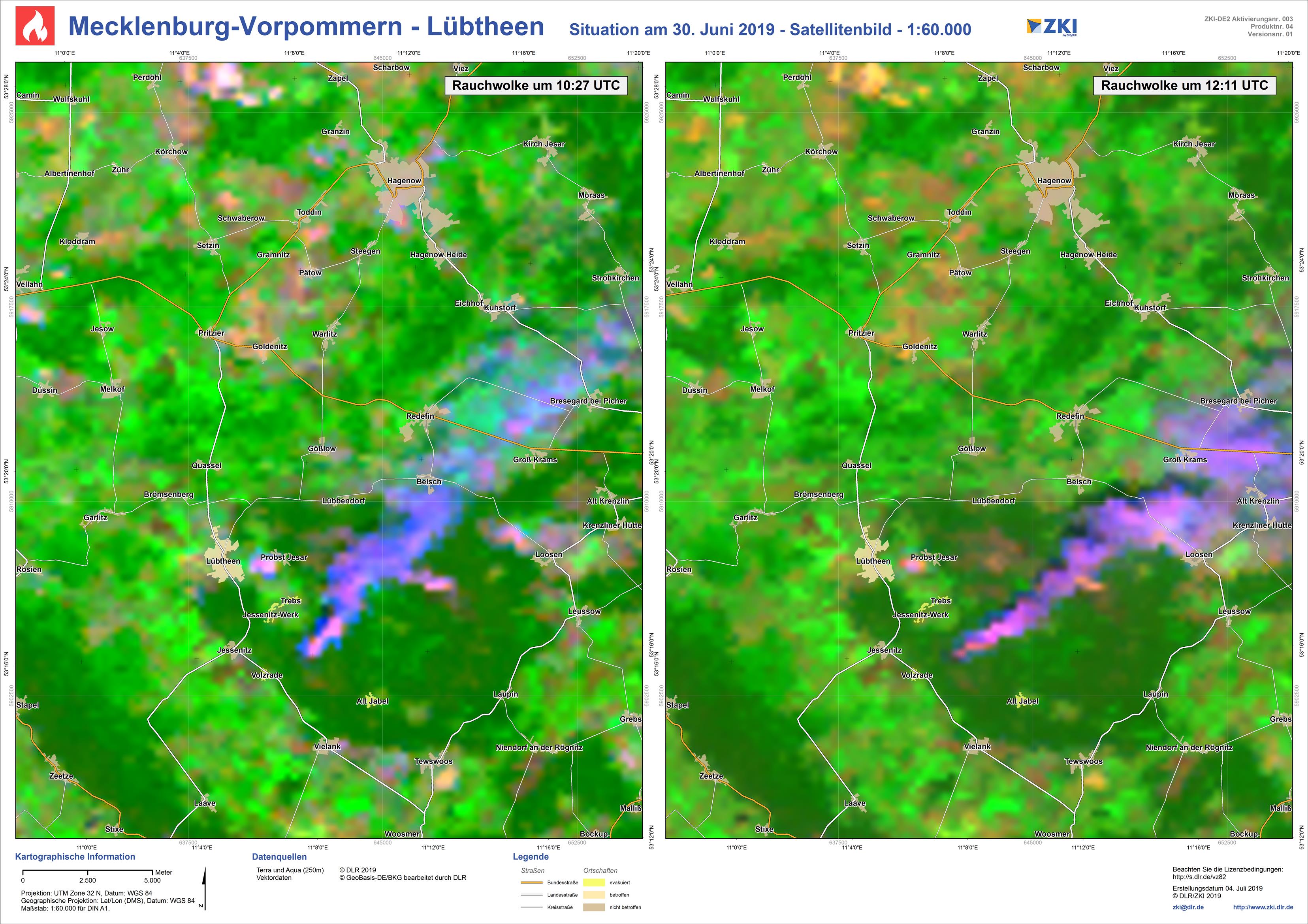
Germany - Vegetation fires Mecklenburg Western Pomerania - P04 - Situaion Map of June 30, 2019 - Terra & Aqua

Creation Date 04. July 2019

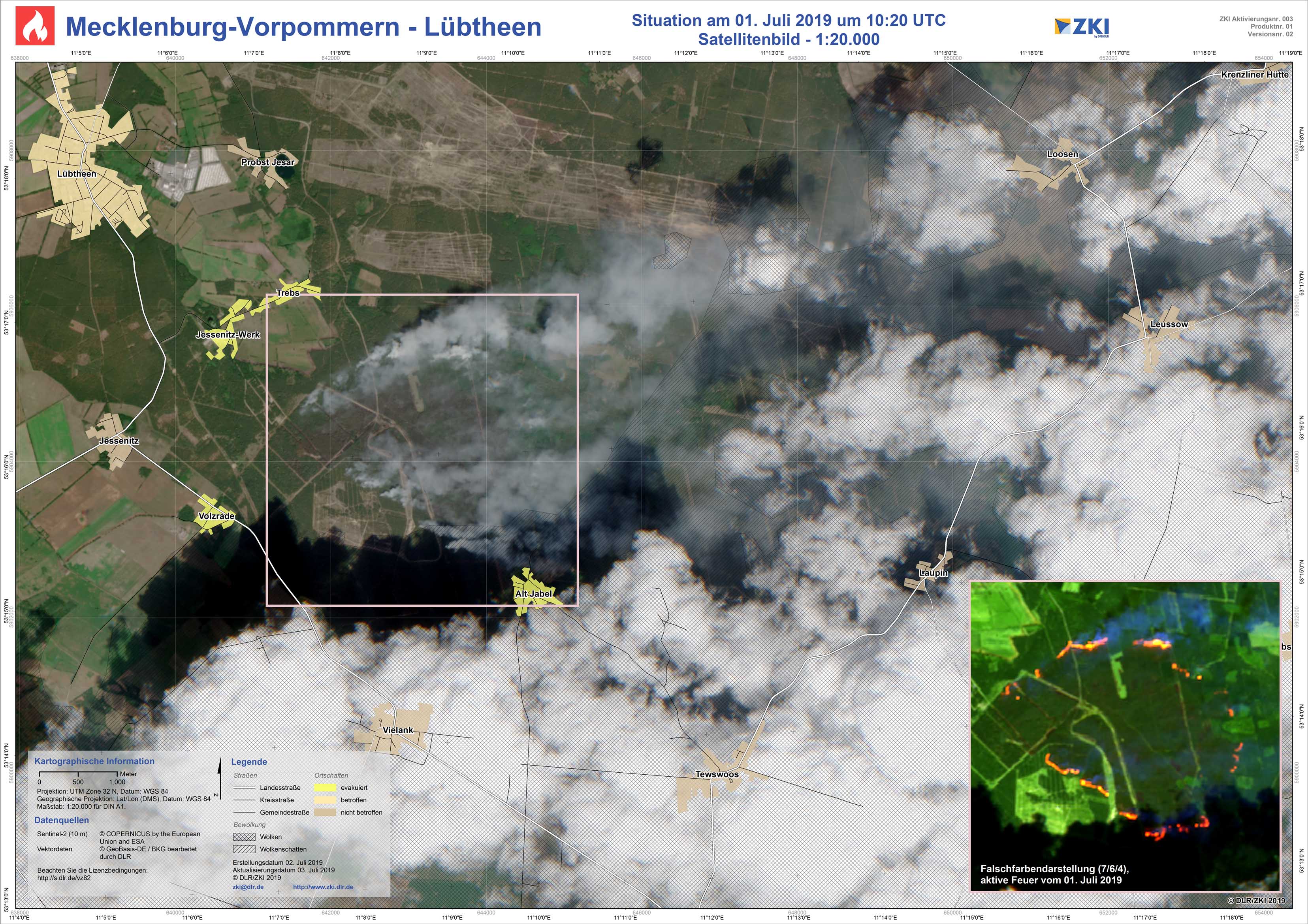
Germany - Vegetation fires Mecklenburg Western Pomerania - P01 (updated) - Situaion Map of July 1, 2019 - Sentinel-2

Creation Date 03. July 2019