
Oil spill disaster after the loss of the oil rig 'Deepwater Horizon' in the Gulf of Mexico
undefined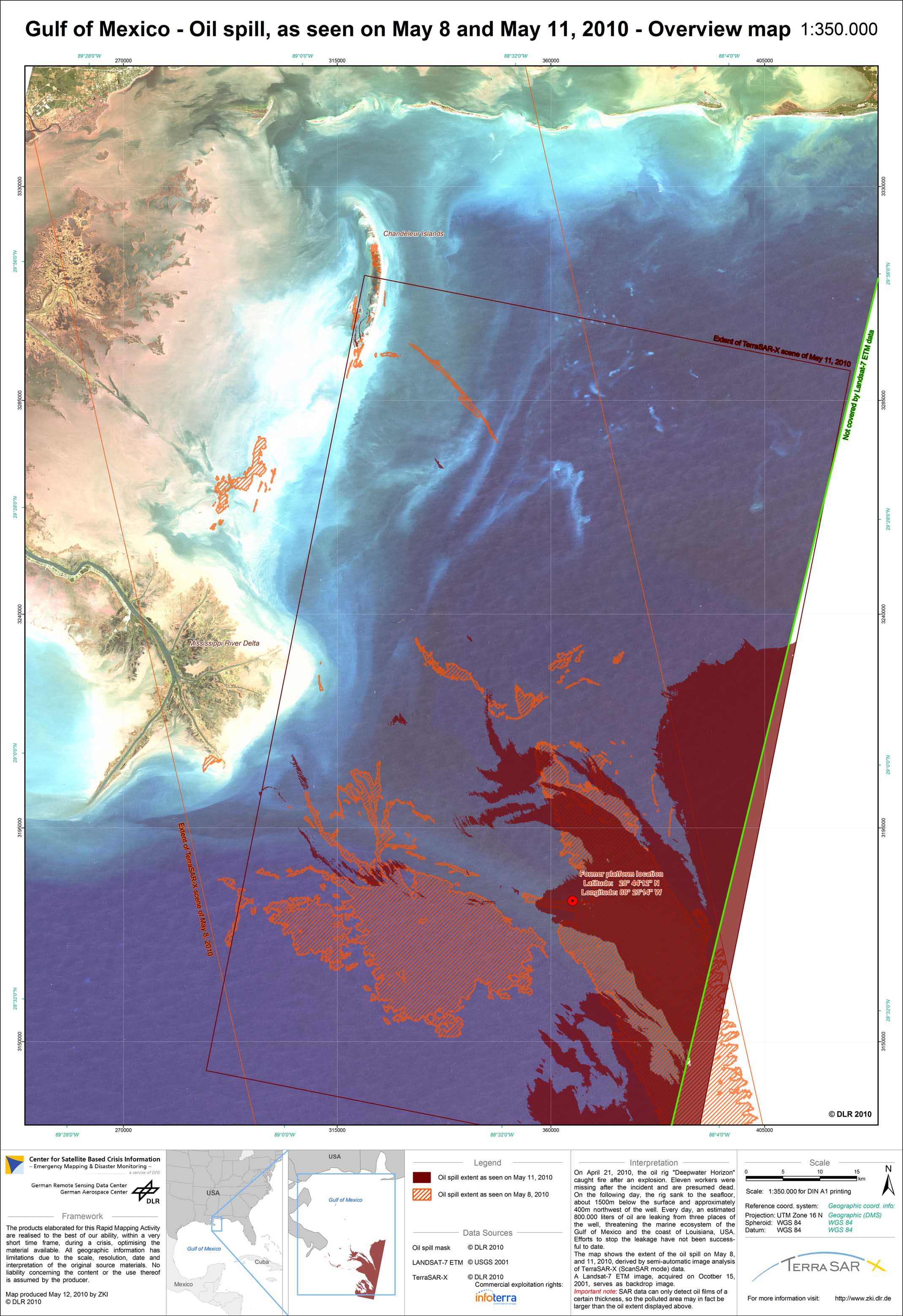
USA - Lousiana - P11 - Oil spill disaster in the Gulf of Mexico - Overview map based on TerraSAR-X scenes of May 8 and 11, 2010
Creation Date 12. May 2010
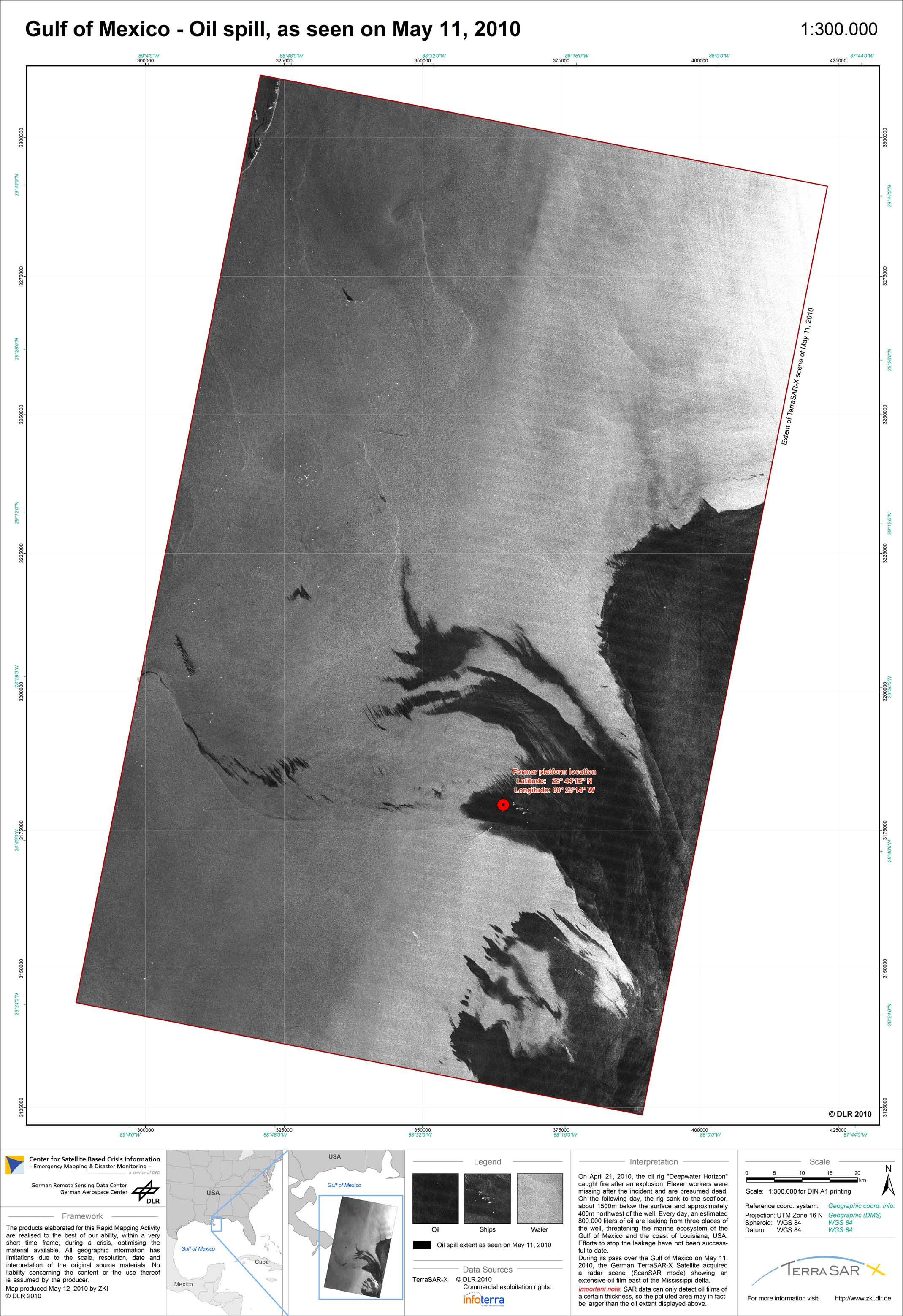
USA - Lousiana - P09 - Oil spill disaster in the Gulf of Mexico - TerraSAR-X scene of May 11, 2010
Creation Date 12. May 2010

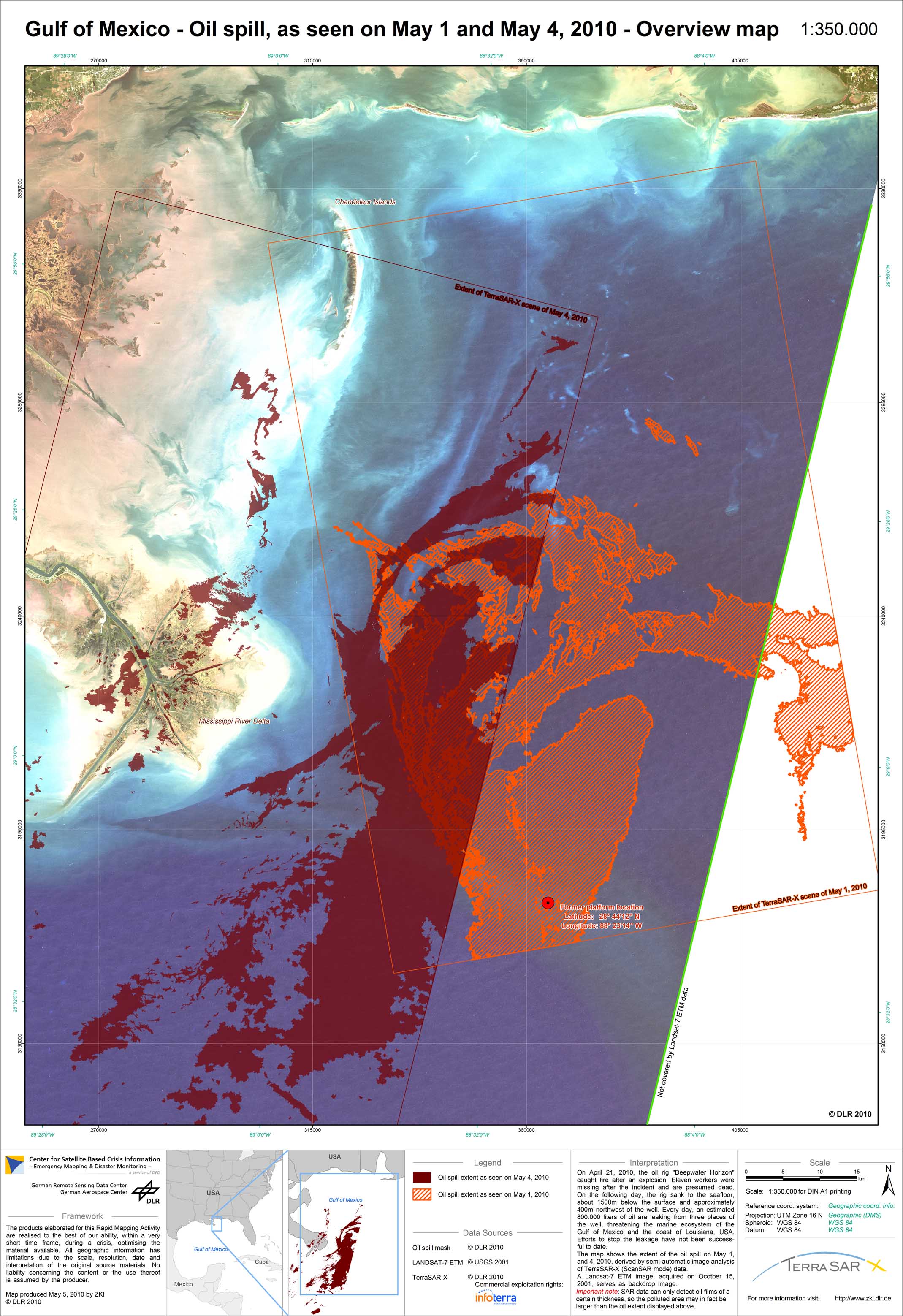
USA - Lousiana - P10 - Oil spill disaster in the Gulf of Mexico - Overview map based on TerraSAR-X scenes of May 4 and 8, 2010
Creation Date 10. May 2010

USA - Lousiana - P08 - Oil spill disaster in the Gulf of Mexico - TerraSAR-X scene of May 8, 2010
Creation Date 10. May 2010

USA - Lousiana - P07 - Oil spill disaster in the Gulf of Mexico - Overview map based on TerraSAR-X scenes of April 25 and 30 and May 1 and 4, 2010
Creation Date 05. May 2010
USA - Lousiana - P06 - Oil spill disaster in the Gulf of Mexico - Overview map
Creation Date 05. May 2010
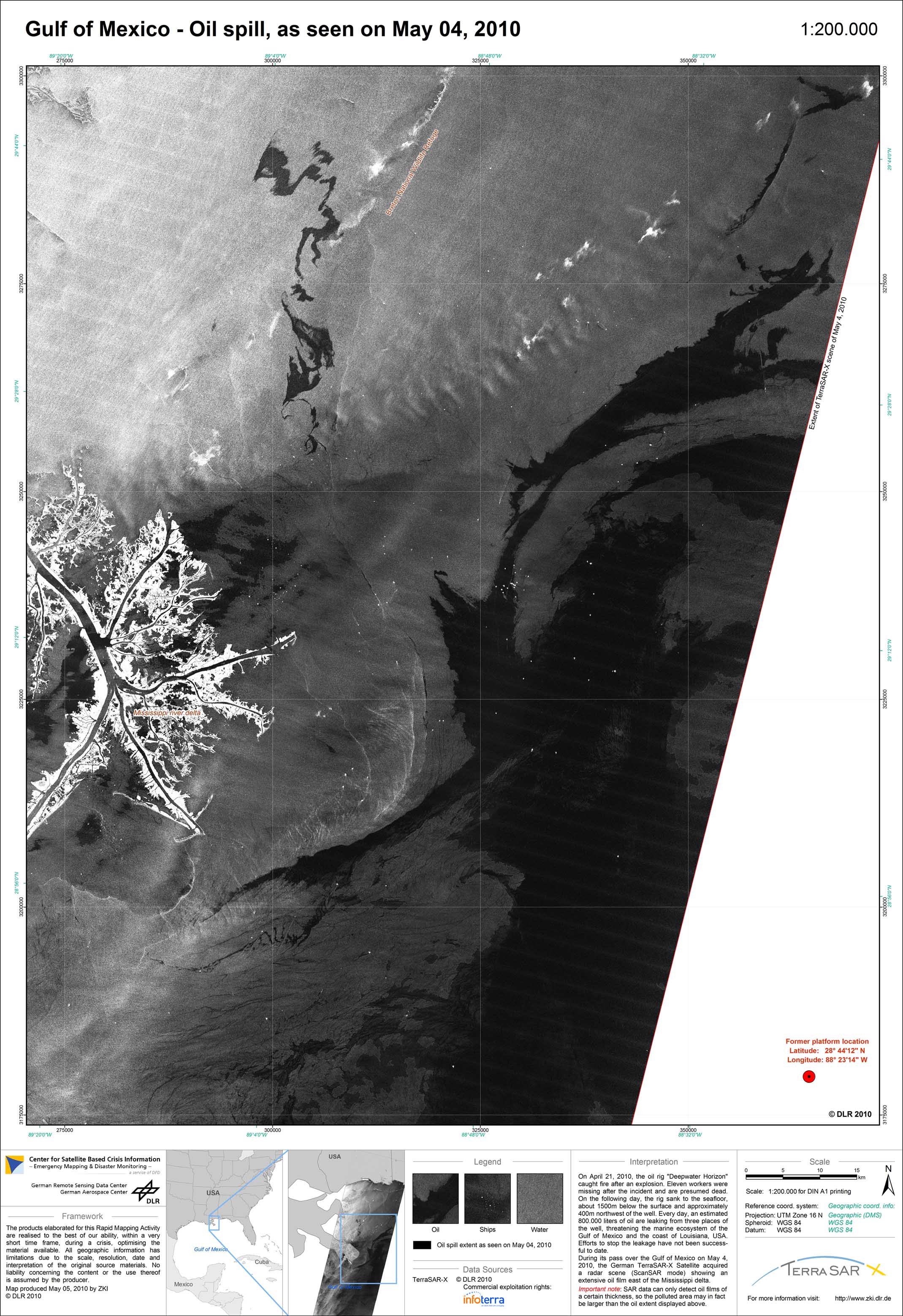
USA - Lousiana - P05 - Oil spill disaster in the Gulf of Mexico - TerraSAR-X scene of May 4, 2010
Creation Date 03. May 2010

USA - Lousiana - P03 - Oil spill disaster in the Gulf of Mexico - Overview map
Creation Date 02. May 2010
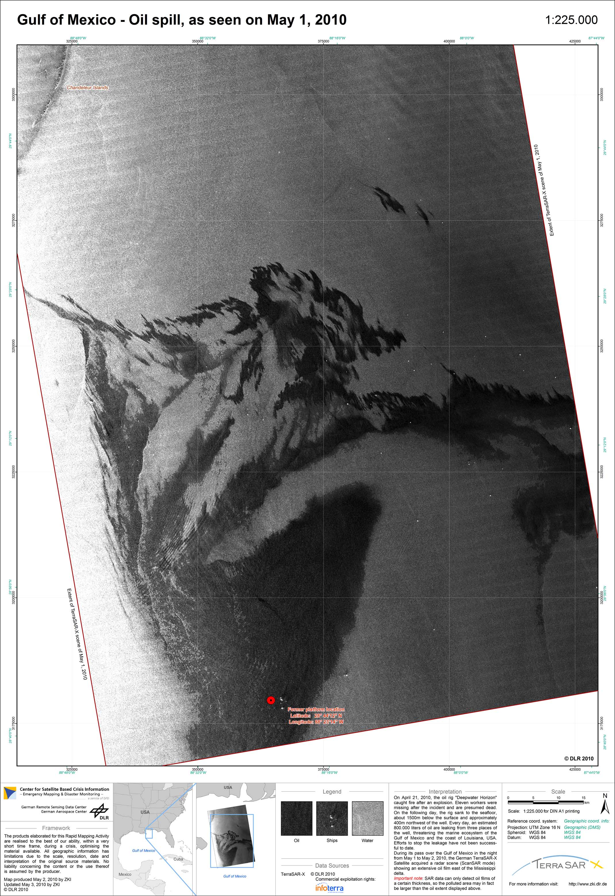
USA - Lousiana - P04 - Oil spill disaster in the Gulf of Mexico - TerraSAR-X image from May 1, 2010
Creation Date 02. May 2010
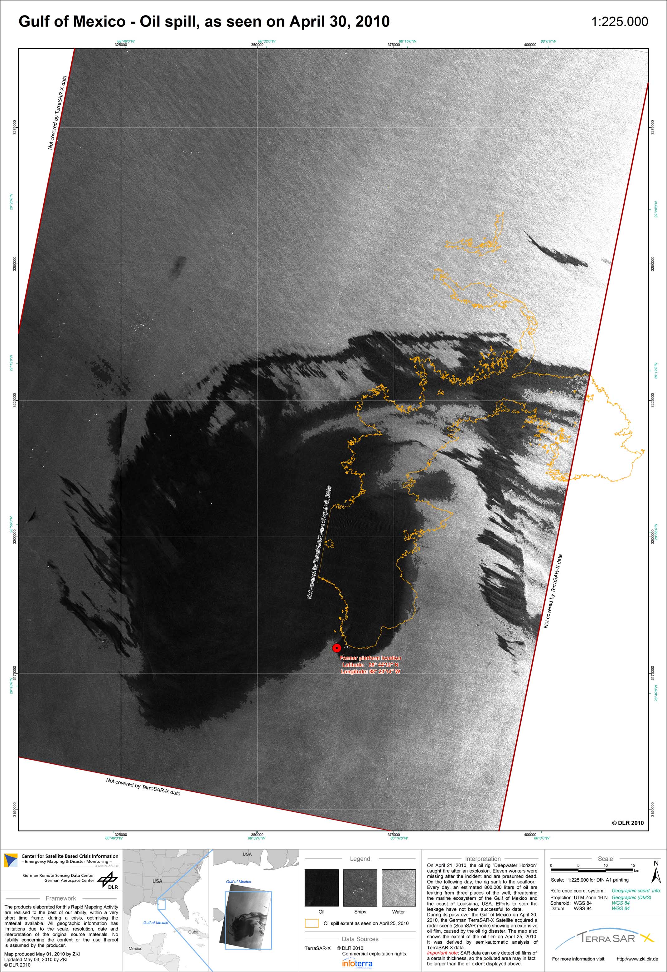
USA - Lousiana - P02 - Oil spill disaster in the Gulf of Mexico - TerraSAR-X image from April 30, 2010
Creation Date 01. May 2010
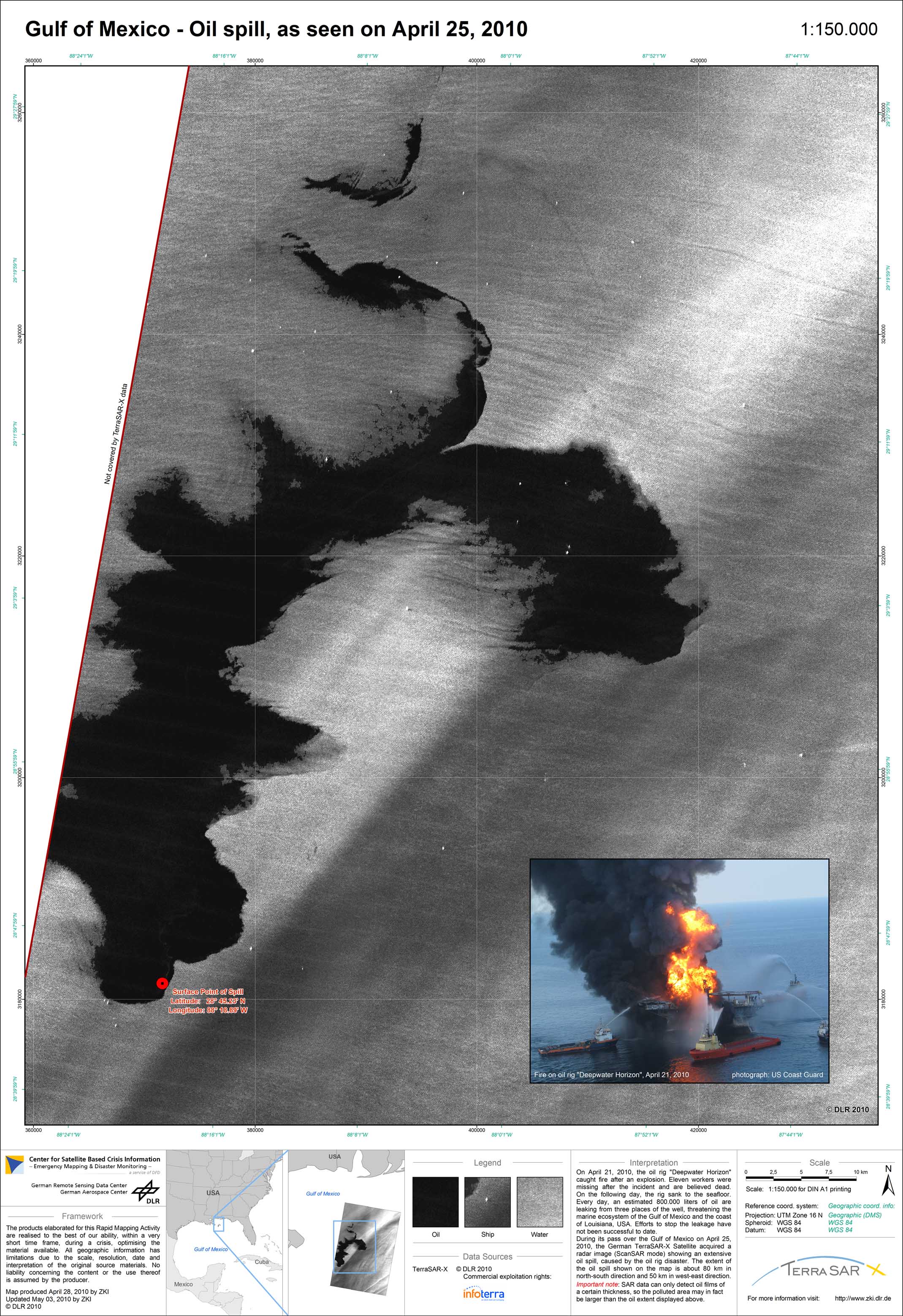
USA - Lousiana - P01 - Oil spill disaster in the Gulf of Mexico - TerraSAR-X image from April 25, 2010
Creation Date 28. April 2010