
Earthquake and Tsunami in Japan
undefined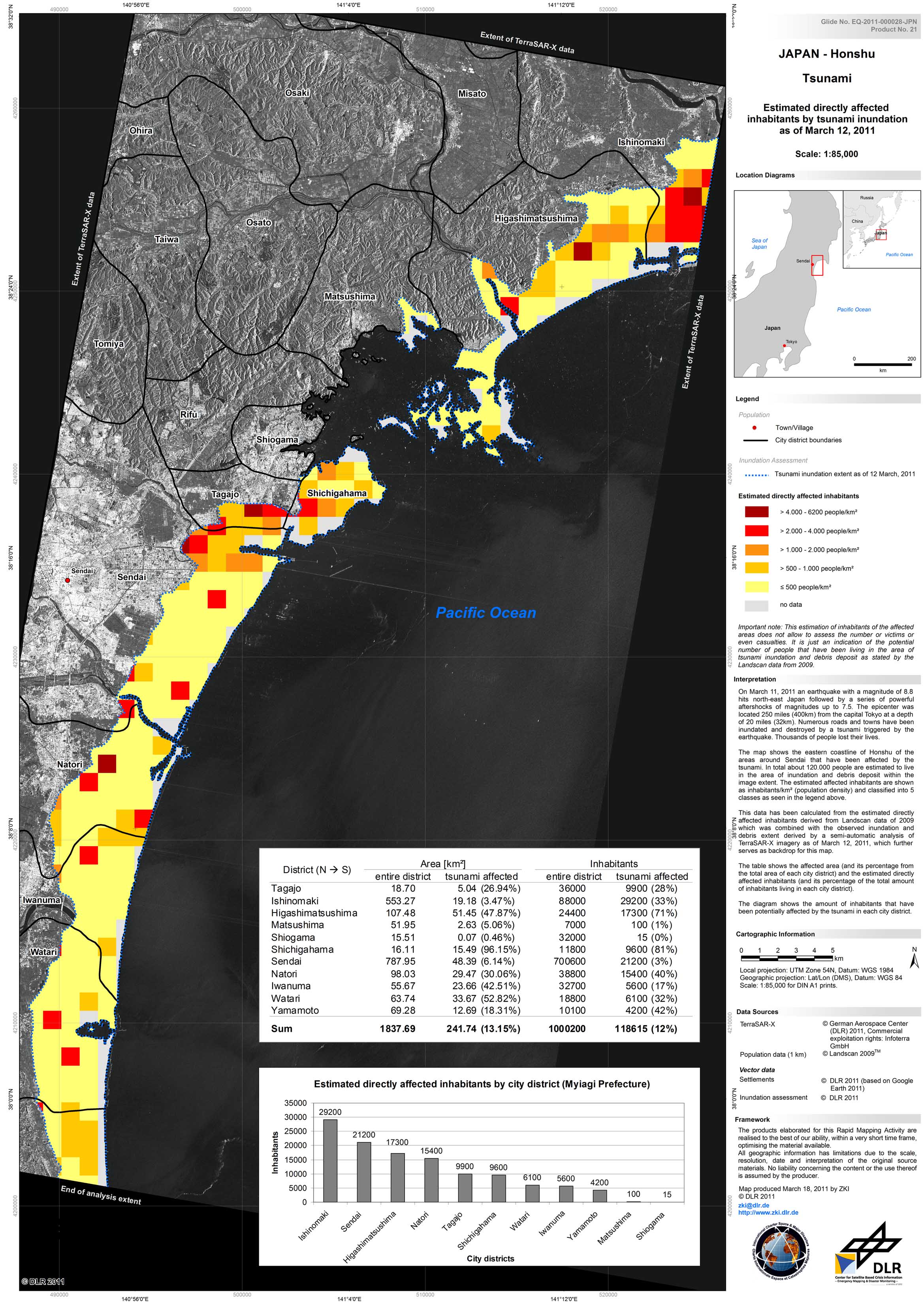
Japan - P21 - Honshu - Estimated directly affected inhabitants by tsunami inundation and debris
Creation Date 18. March 2011
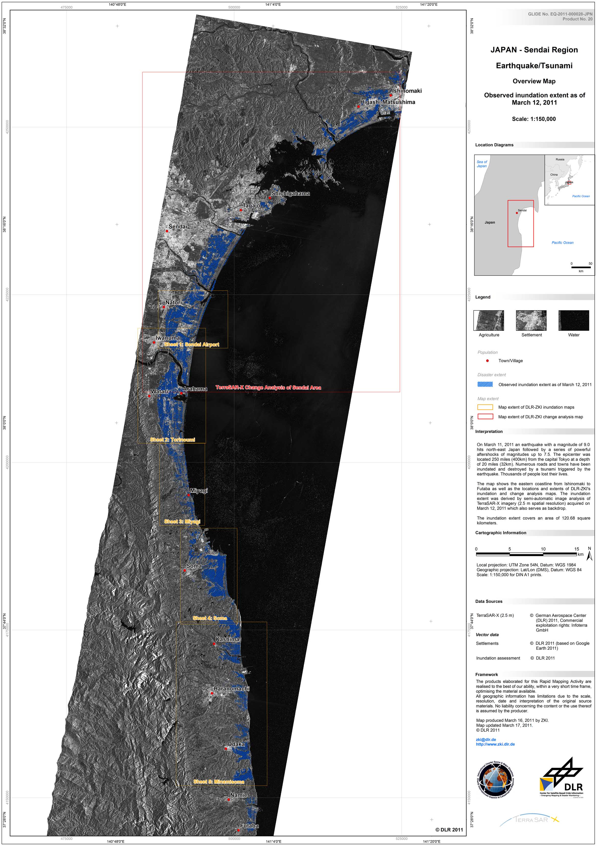
Japan - P20 - Sendai Region - Disaster Extent Map
Creation Date 16. March 2011
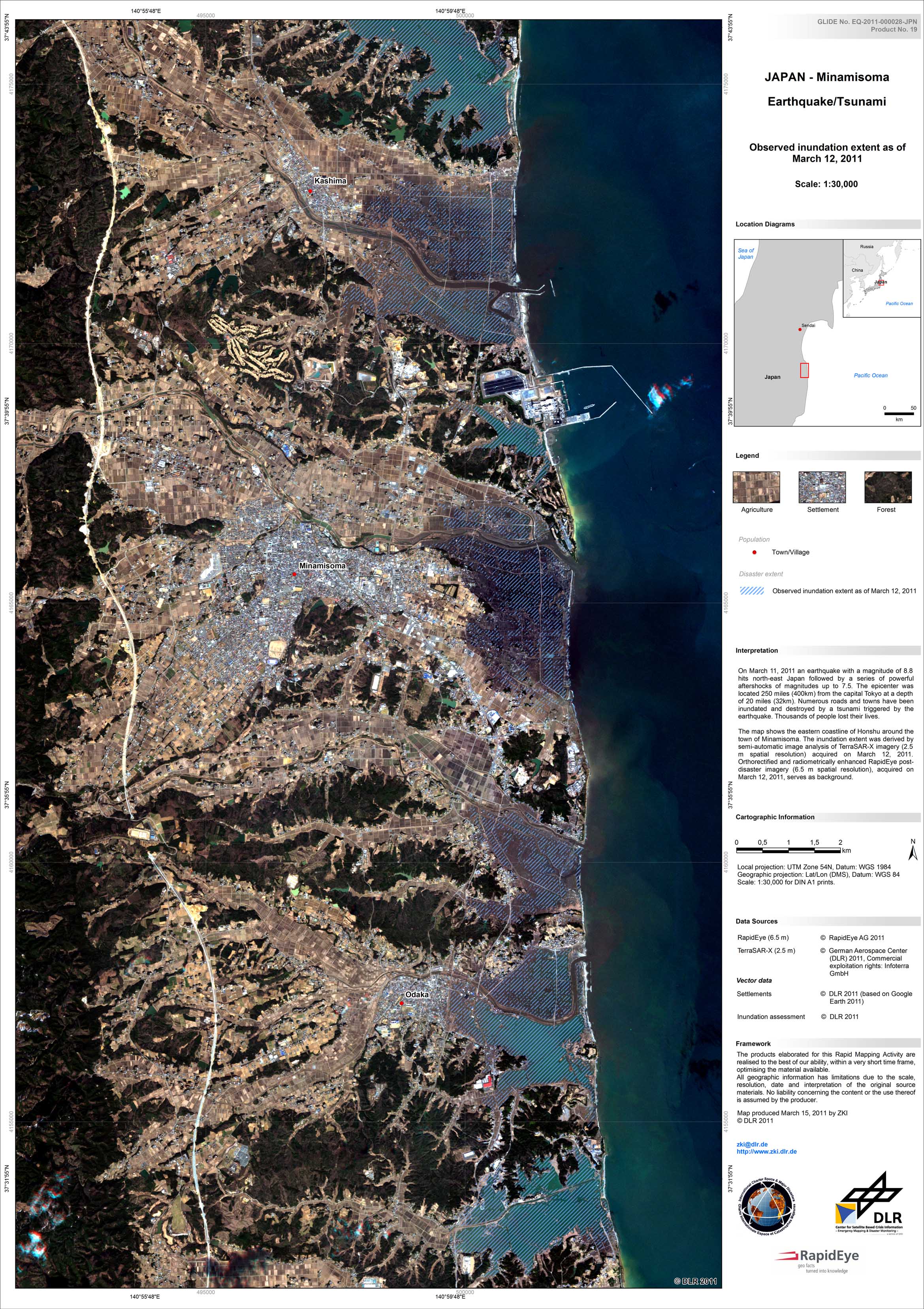
Japan - P19 - Minamisoma - Disaster Extent Map - Detail
Creation Date 15. March 2011
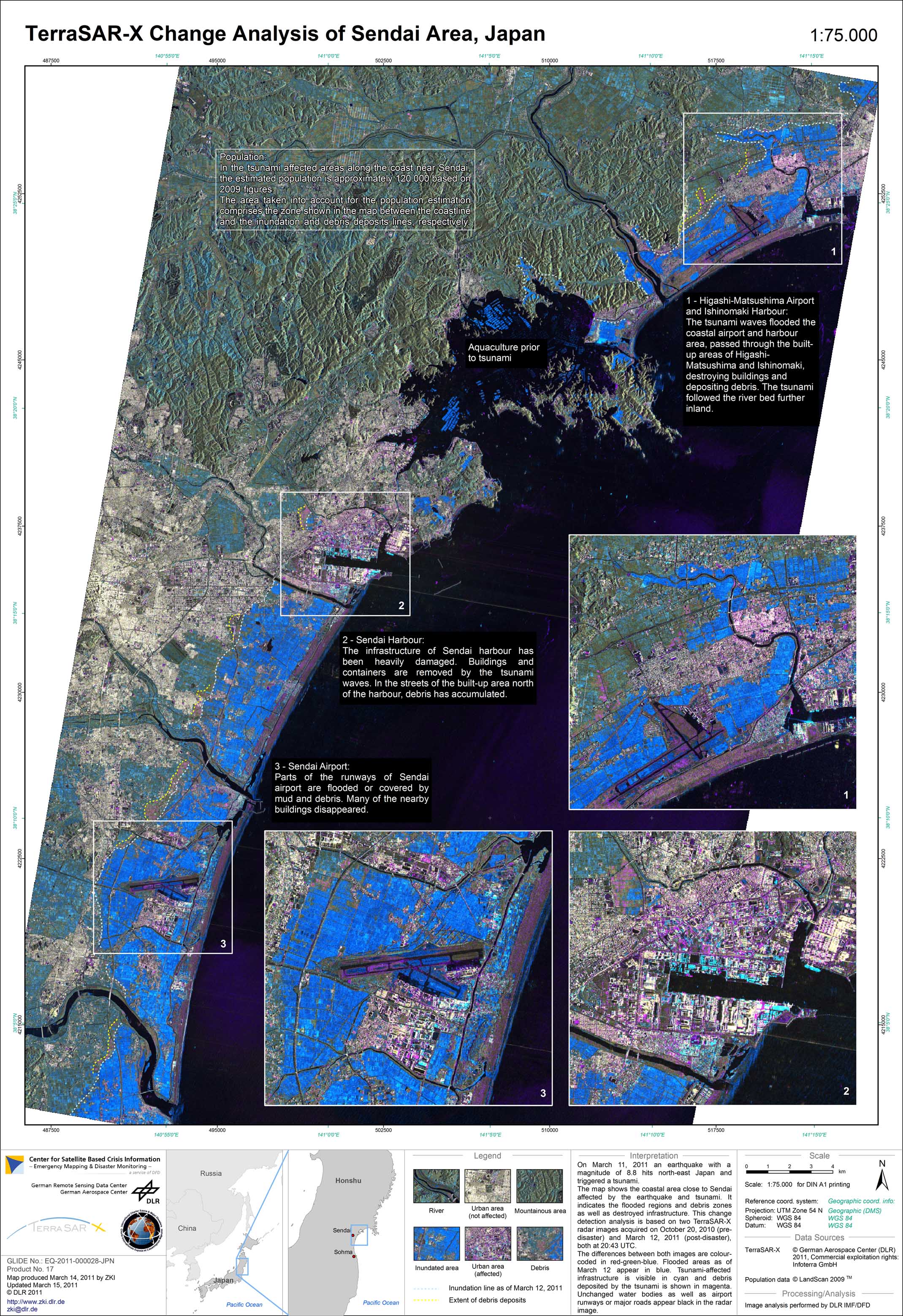
Japan - P17 - Sendai - TerraSAR-X Change Analysis
Creation Date 15. March 2011

Japan - P16 - Tome - Damage Assessment Map - Detail
Creation Date 15. March 2011
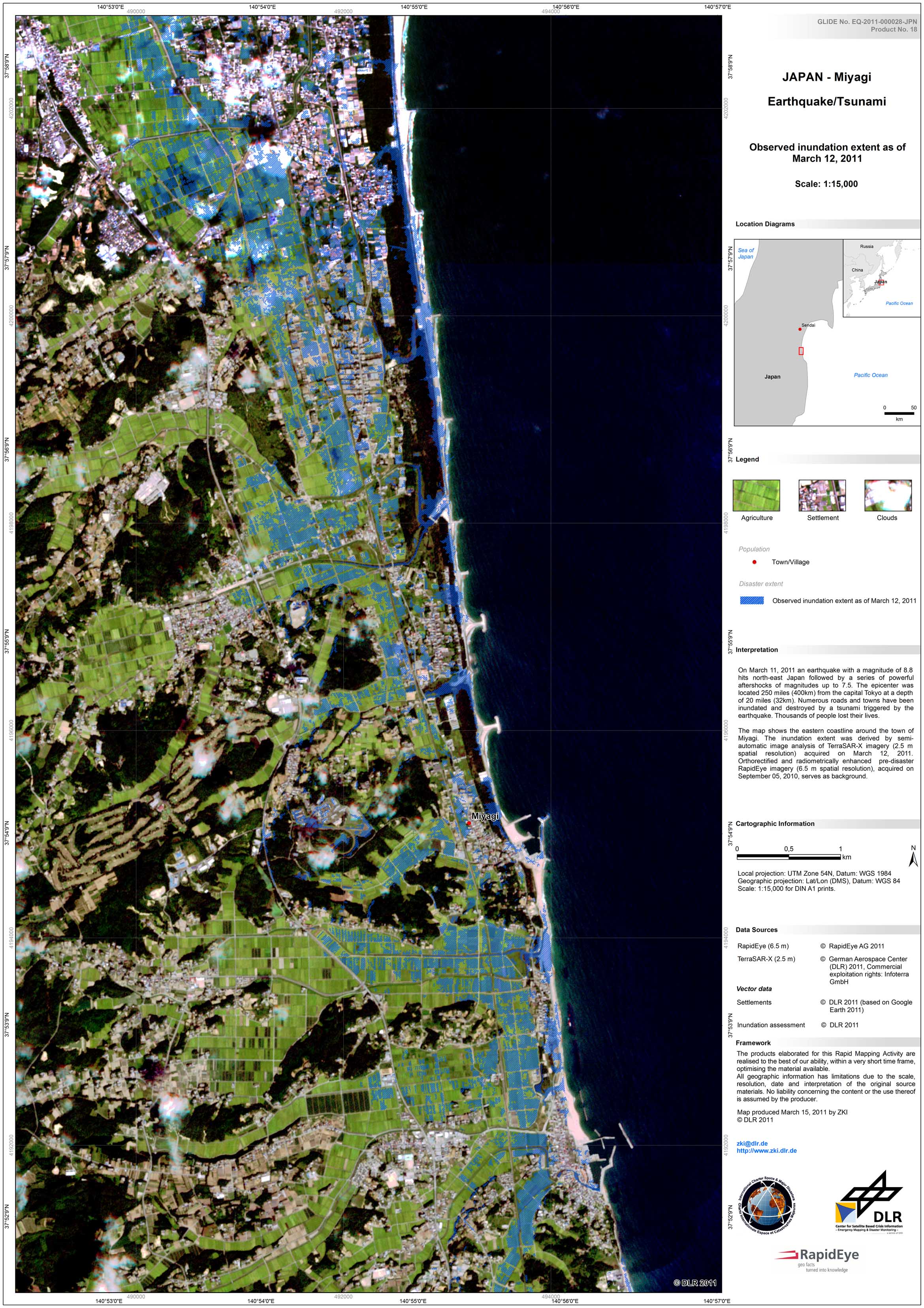
Japan - P18 - Miyagi - Disaster Extent Map - Detail
Creation Date 15. March 2011
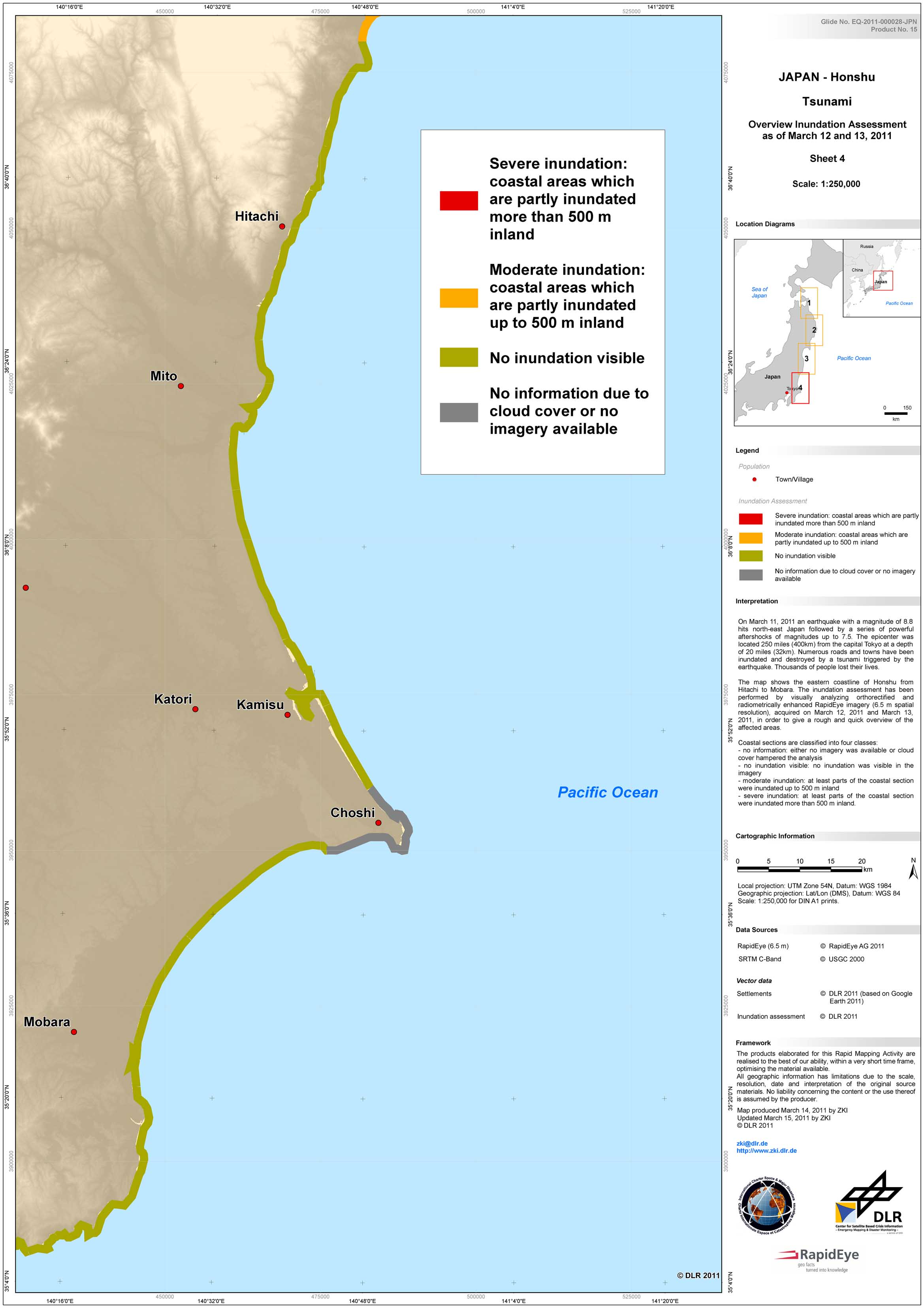
Japan - P15 - Honshu - Tsunami Inundation Assessment - Overview - Sheet 4
Creation Date 15. March 2011
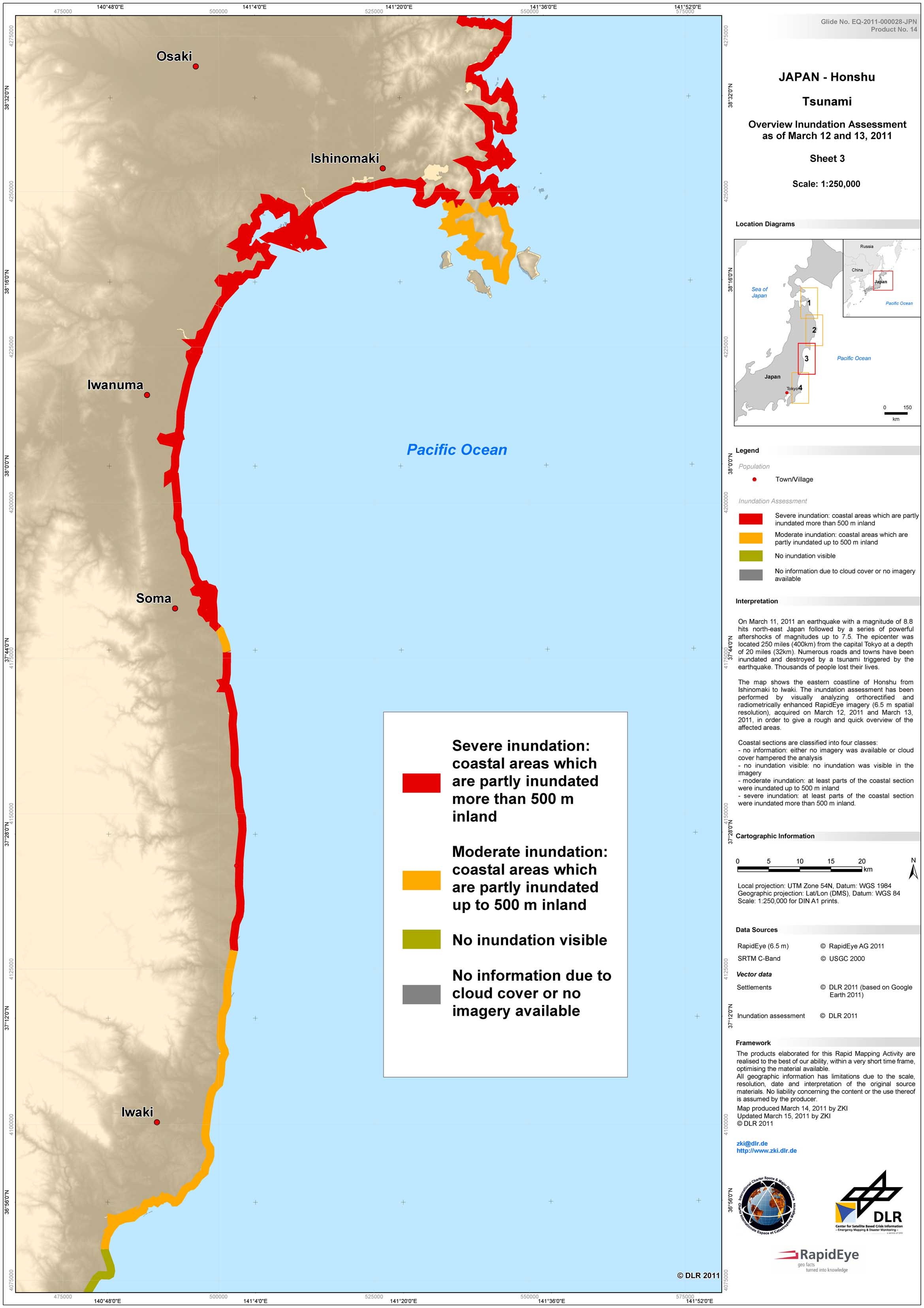
Japan - P14 - Honshu - Tsunami Inundation Assessment - Overview - Sheet 3
Creation Date 15. March 2011
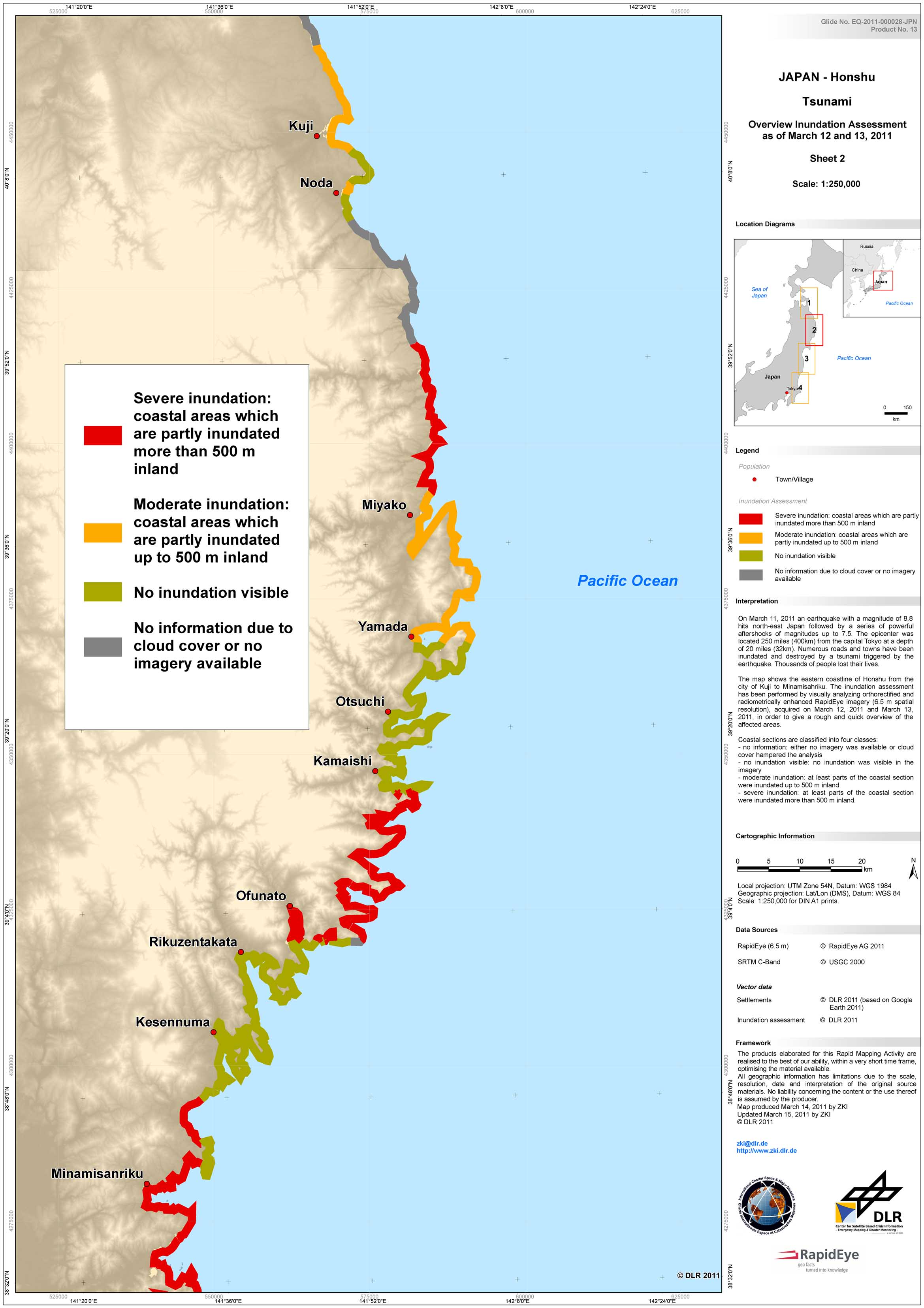
Japan - P13 - Honshu - Tsunami Inundation Assessment - Overview - Sheet 2
Creation Date 15. March 2011
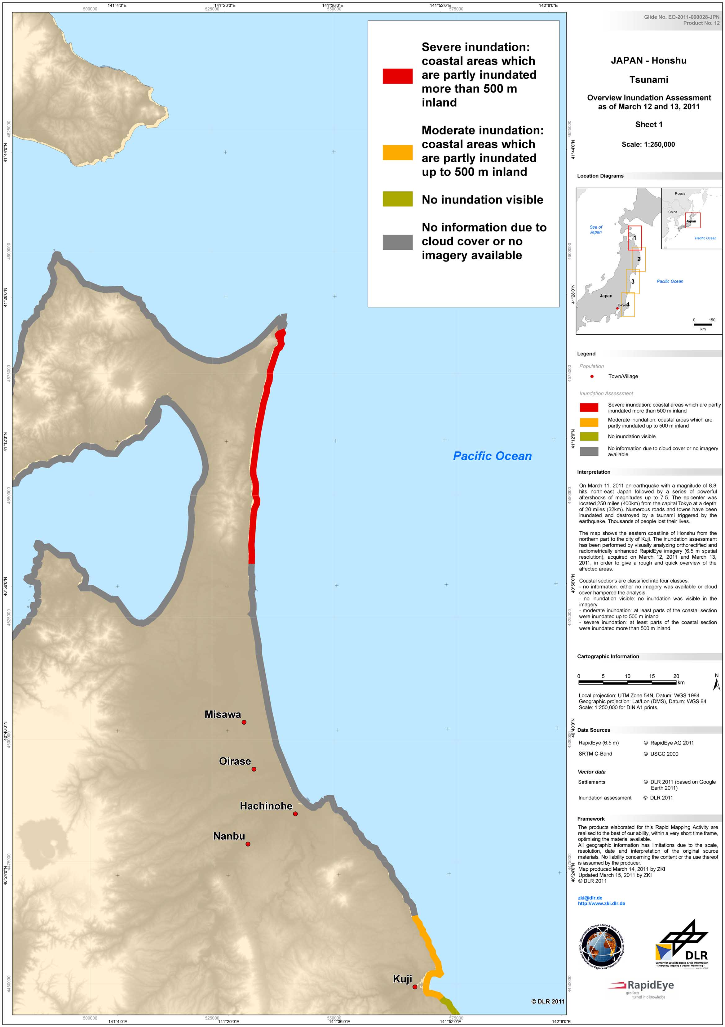
Japan - P12 - Honshu - Tsunami Inundation Assessment - Overview - Sheet 1
Creation Date 15. March 2011
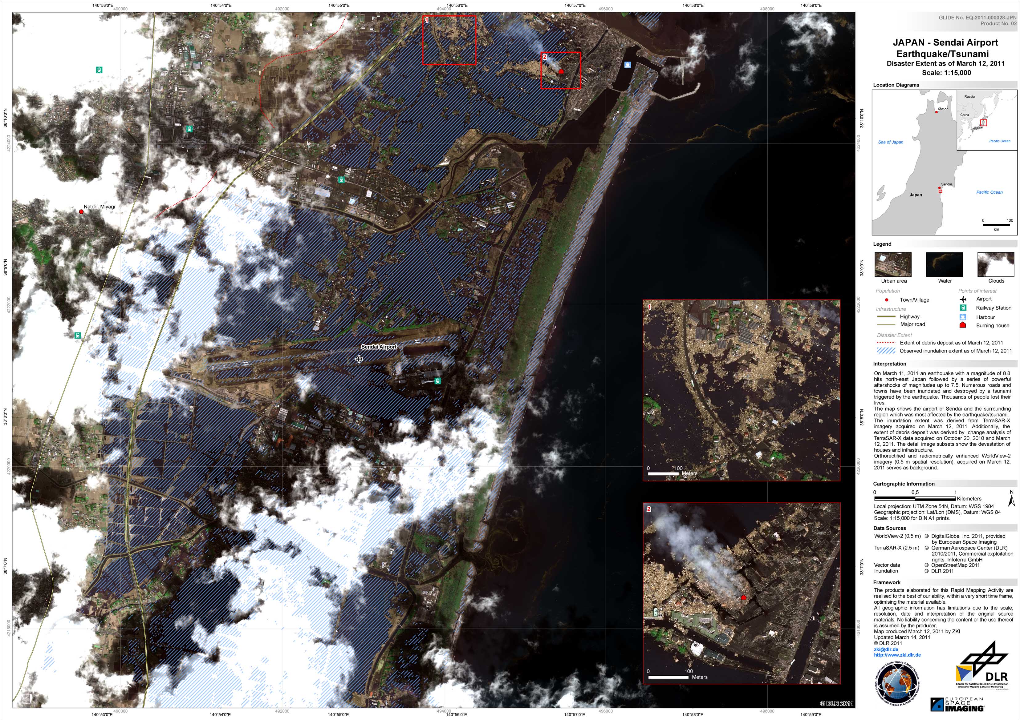
Japan - P02 - Sendai Airport - Disaster Extent Map - Detail
Creation Date 14. March 2011
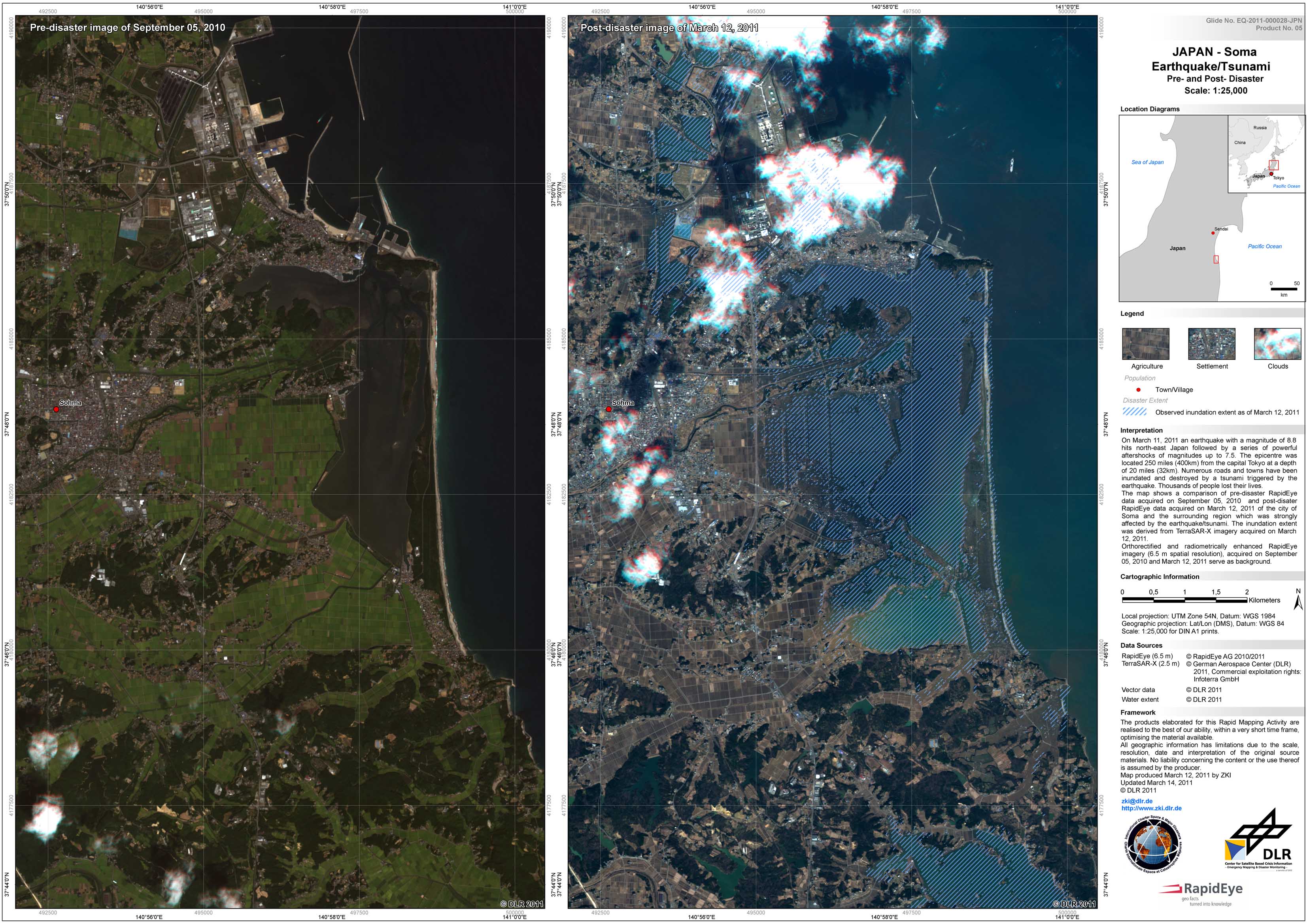
Japan - P05 - Soma - Disaster Extent Map - Detail
Creation Date 14. March 2011
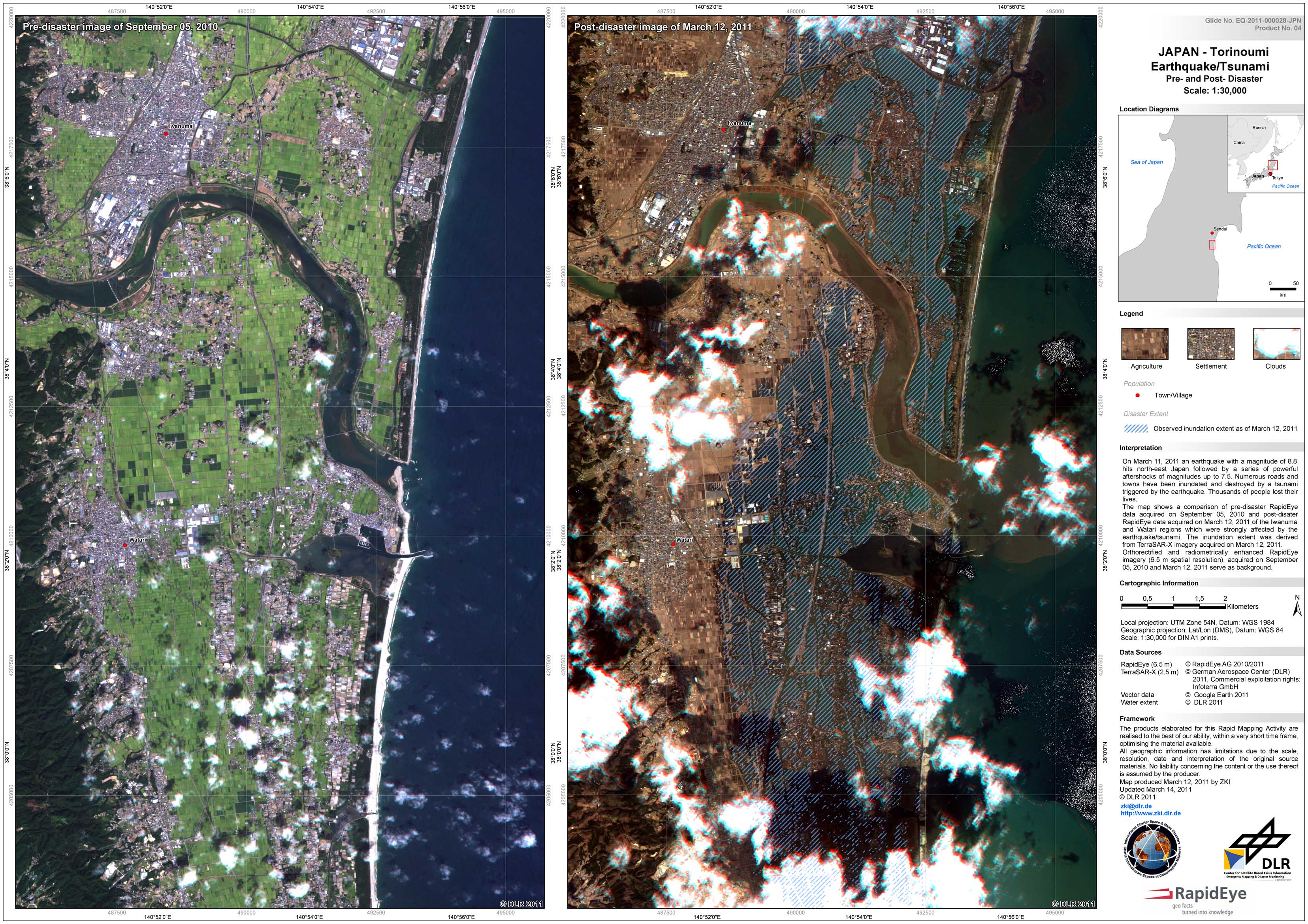
Japan - P04 - Torinoumi - Disaster Extent Map - Detail
Creation Date 14. March 2011

Japan - P11 - Oshika Peninsula - Disaster Extent Map - Detail - Sheet 5: Yagawahama
Creation Date 13. March 2011
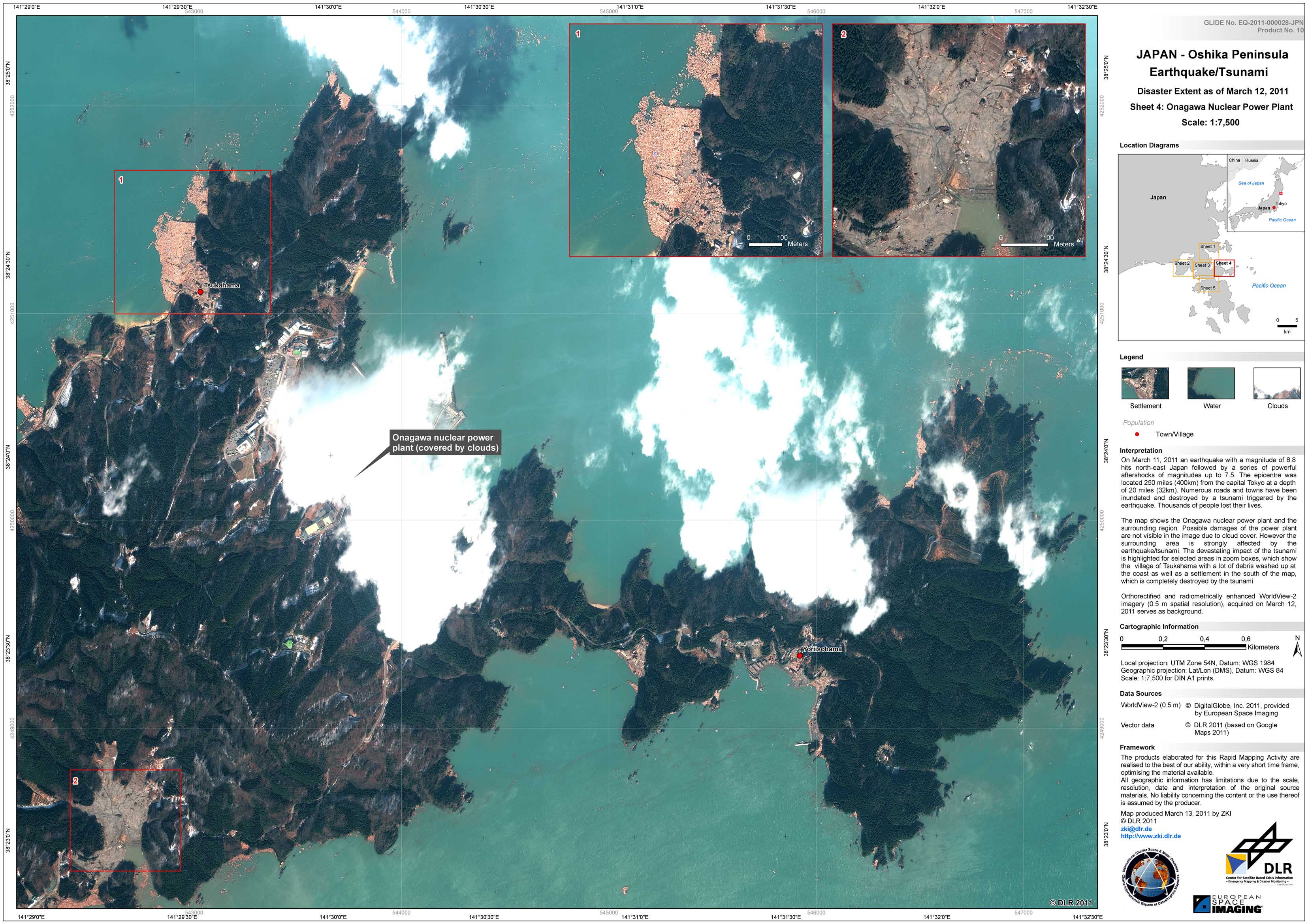
Japan - P10 - Oshika Peninsula - Disaster Extent Map - Detail - Sheet 4: Onagawa Nuclear Power Plant
Creation Date 13. March 2011
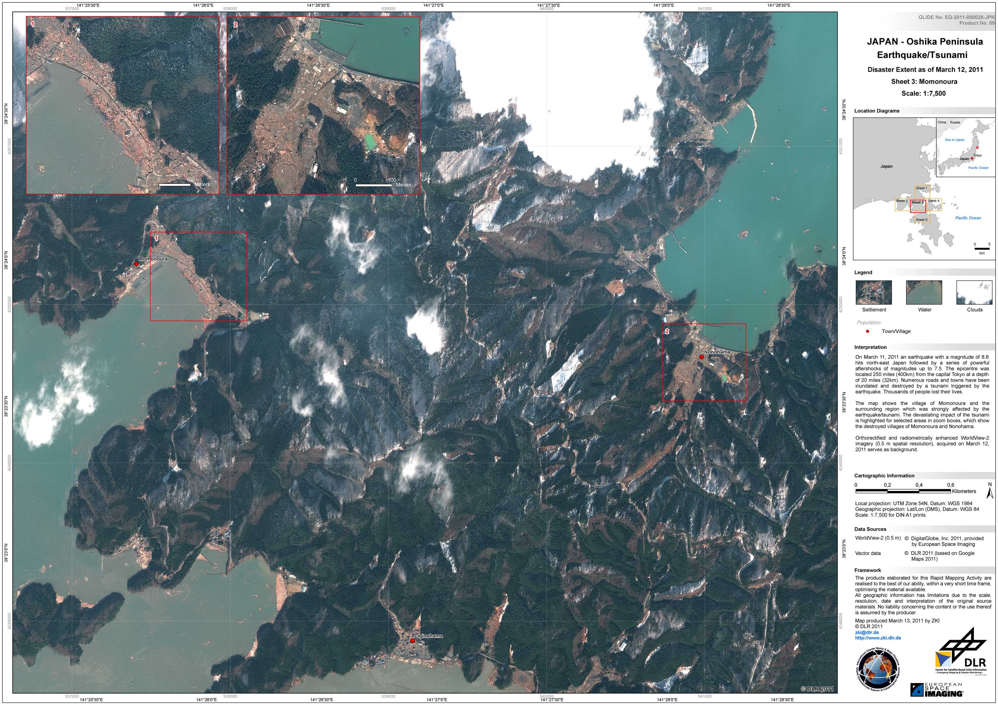
Japan - P09 - Oshika Peninsula - Disaster Extent Map - Detail - Sheet 3: Momonoura
Creation Date 13. March 2011
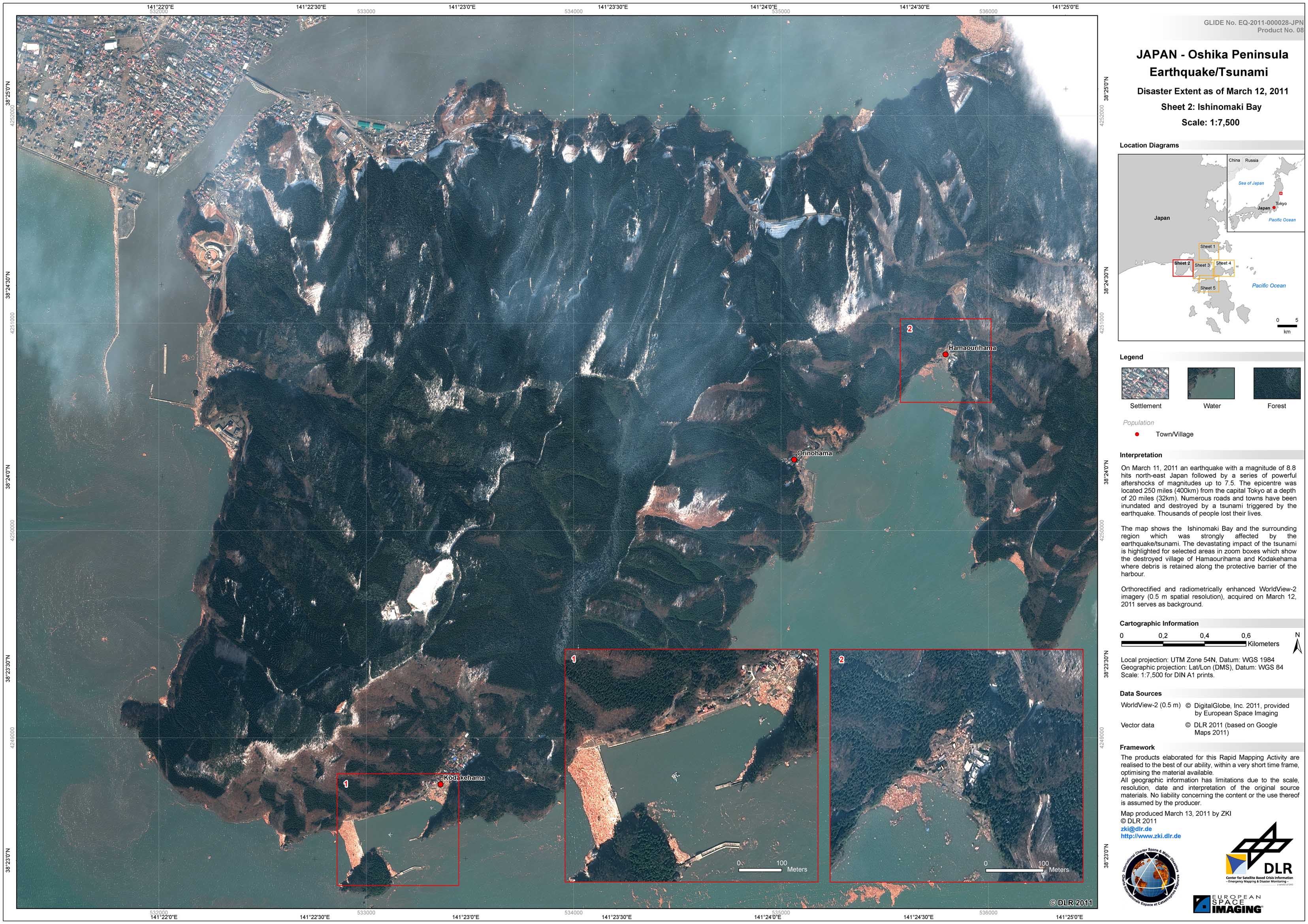
Japan - P08 - Oshika Peninsula - Disaster Extent Map - Detail - Sheet 2: Ishinomaki Bay
Creation Date 13. March 2011
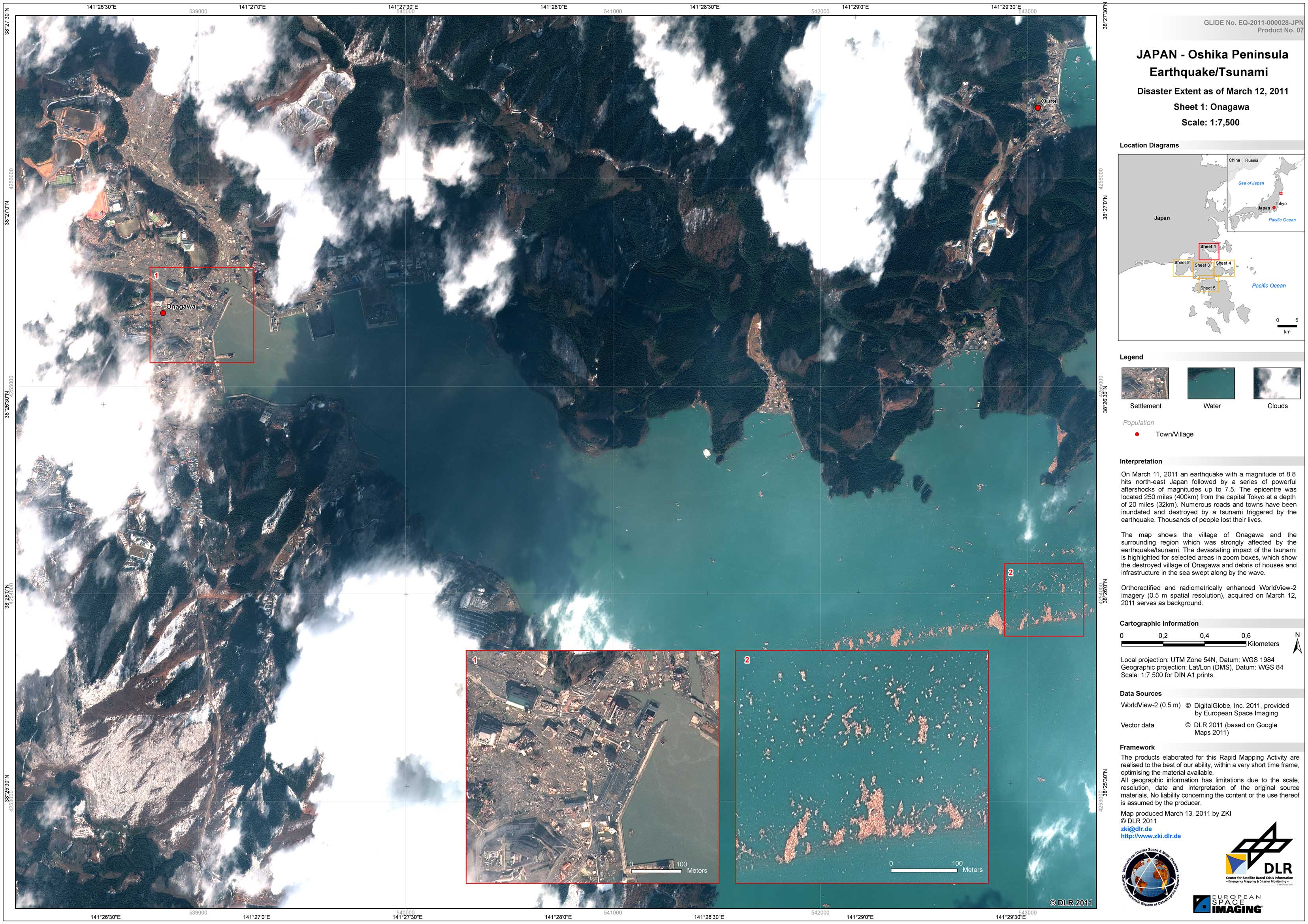
Japan - P07 - Oshika Peninsula - Disaster Extent Map - Detail - Sheet 1: Onagawa
Creation Date 13. March 2011
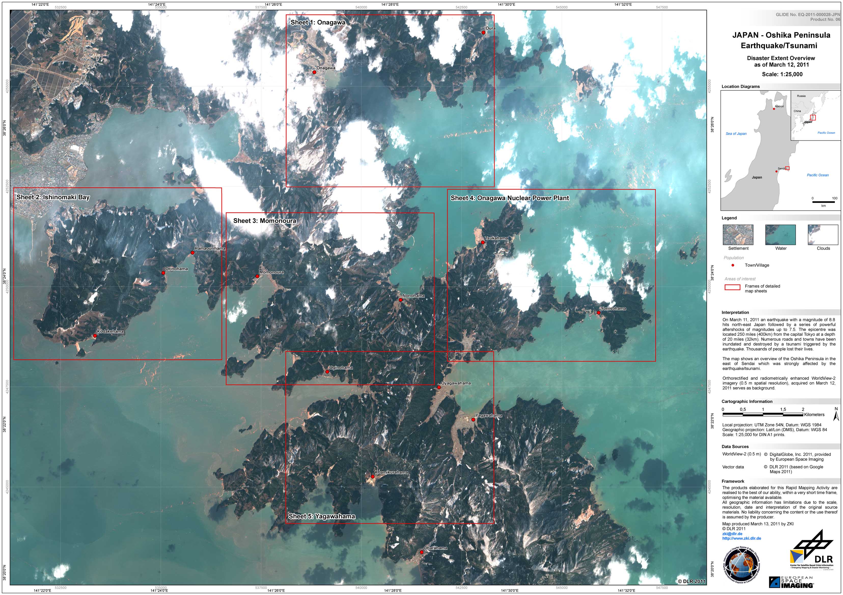
Japan - P06 - Oshika Peninsula - Disaster Extent Map - Overview
Creation Date 13. March 2011
Japan - P03 - Higashi-Matsushima - Disaster Extent Map - Detail
Creation Date 12. March 2011

Japan - P01 - Situation Map - Overview
Creation Date 11. March 2011