
Fire disaster in Chile – ZKI uses FireBIRD to deliver situational information

Burnt area in the La Pataguas area derived from RapidEye satellite data
Credit:
DLR (CC BY-NC-ND 3.0)
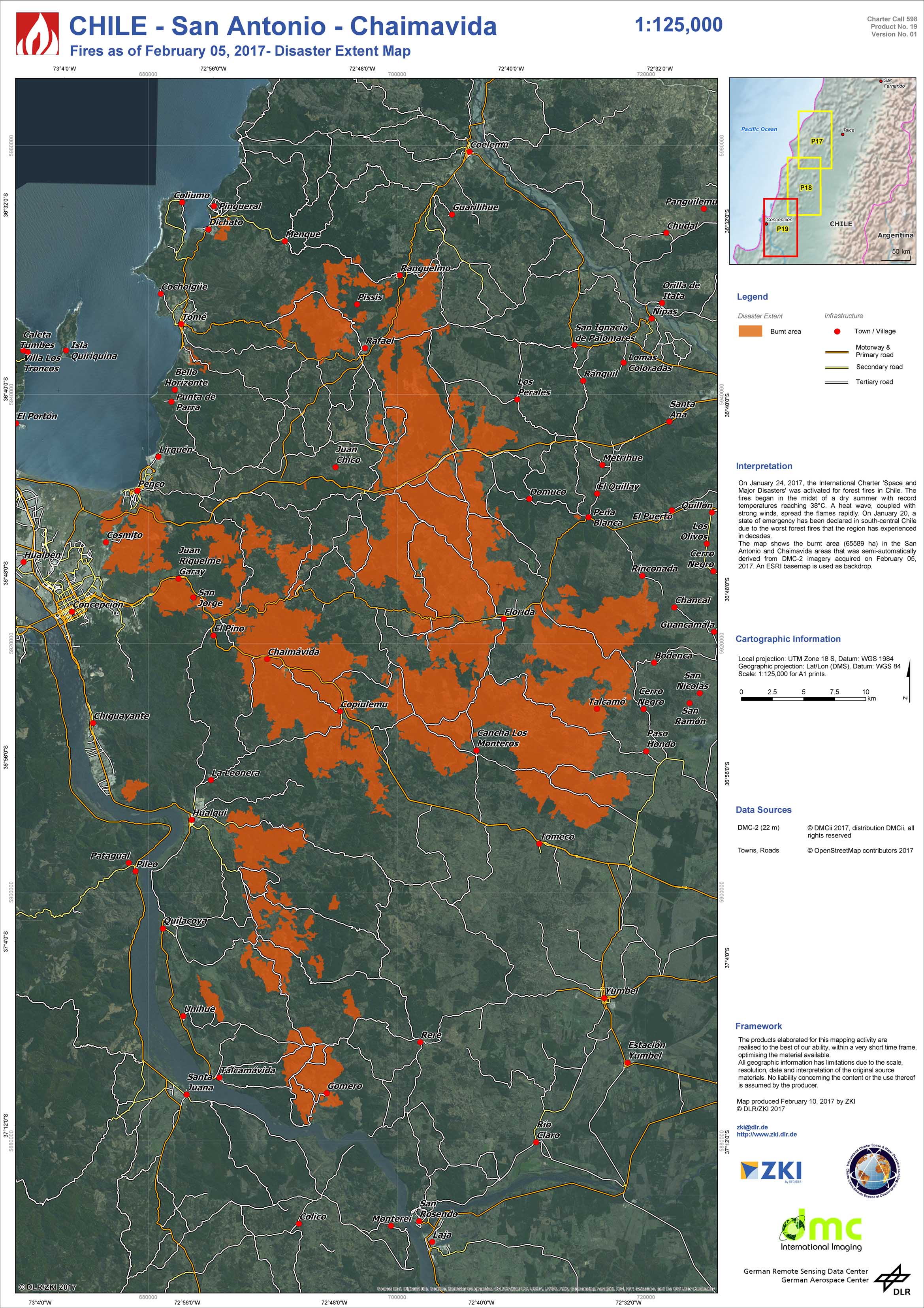
Chile - San Antonio - Chaimavida - P19 - Fires as of February 05, 2017 - Disaster Extent Map
Creation Date 09. February 2017
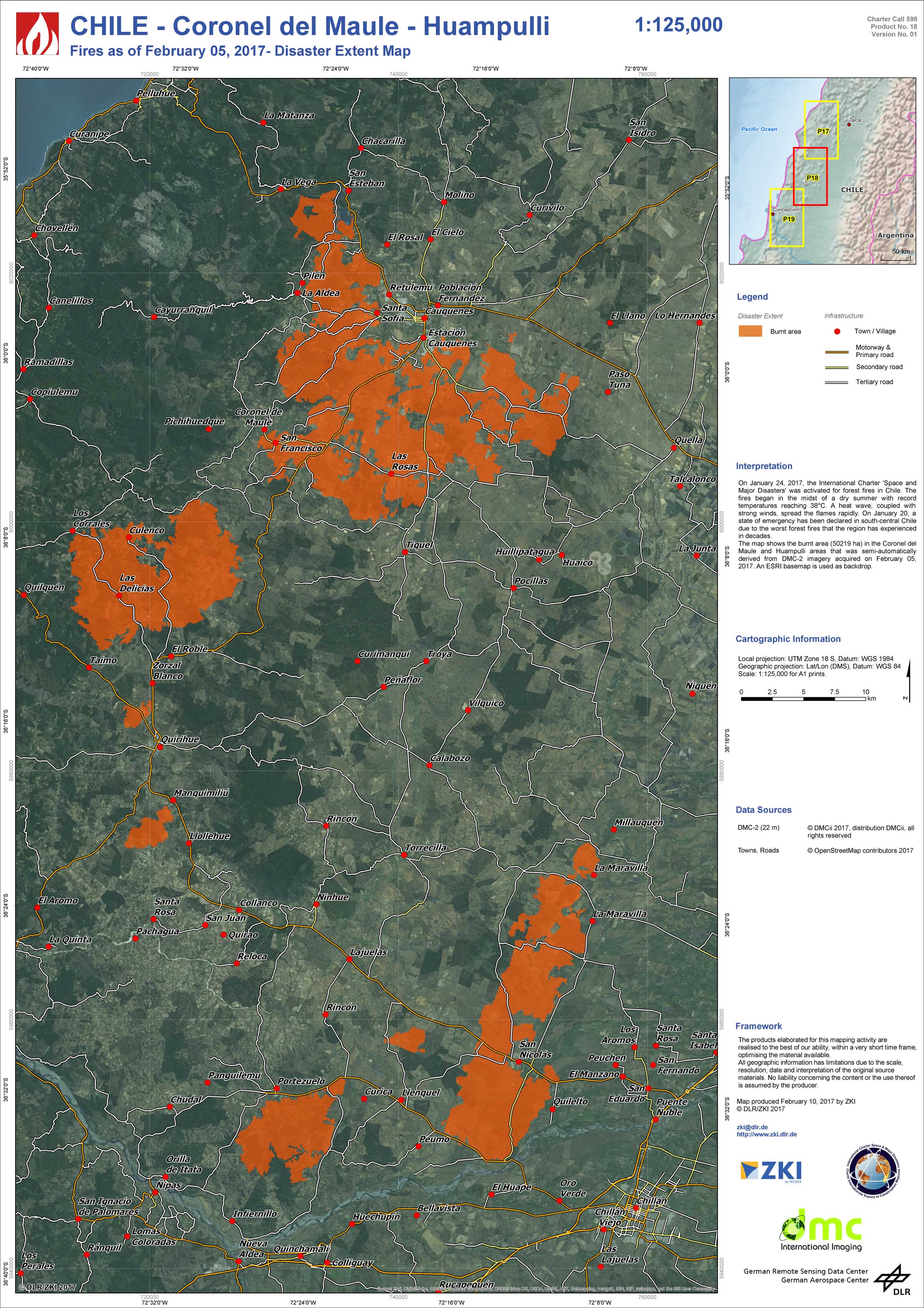
Chile - Coronel del Maule - Huampulli - P18 - Fires as of February 05, 2017 - Disaster Extent Map
Creation Date 09. February 2017
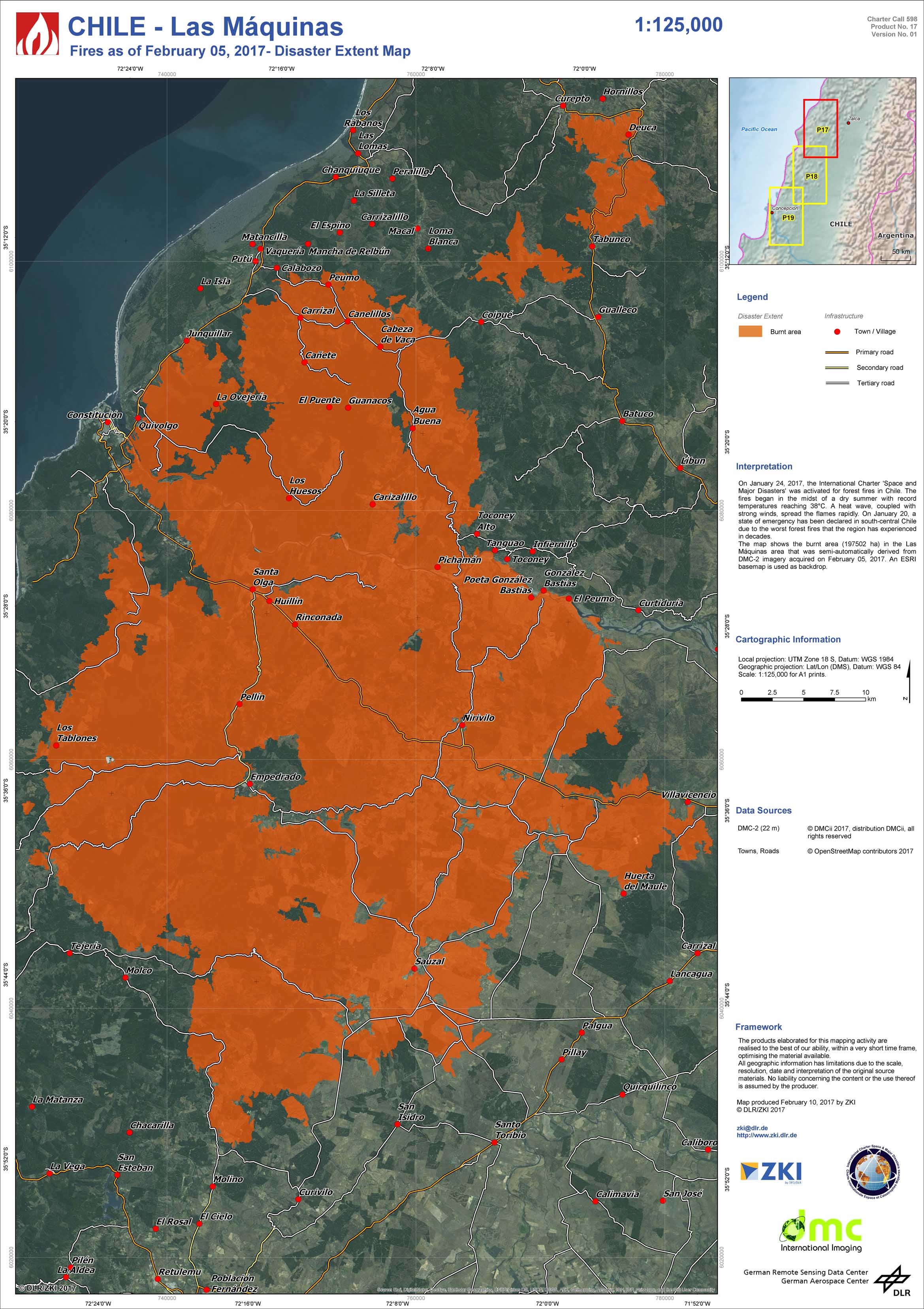
Chile - Las Máquinas - P17 - Fires as of February 05, 2017 - Disaster Extent Map
Creation Date 09. February 2017
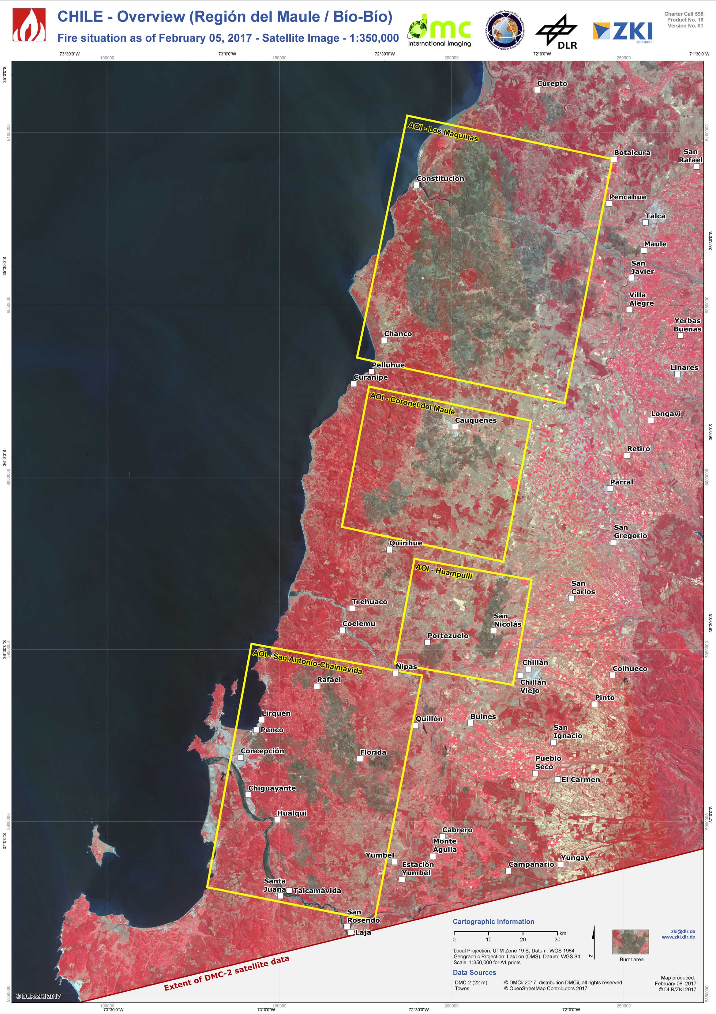
Chile - Overview (Región del Maule / Bío-Bío) - P16 - Fire situation as of February 05, 2017 - Satellite Image
Creation Date 08. February 2017
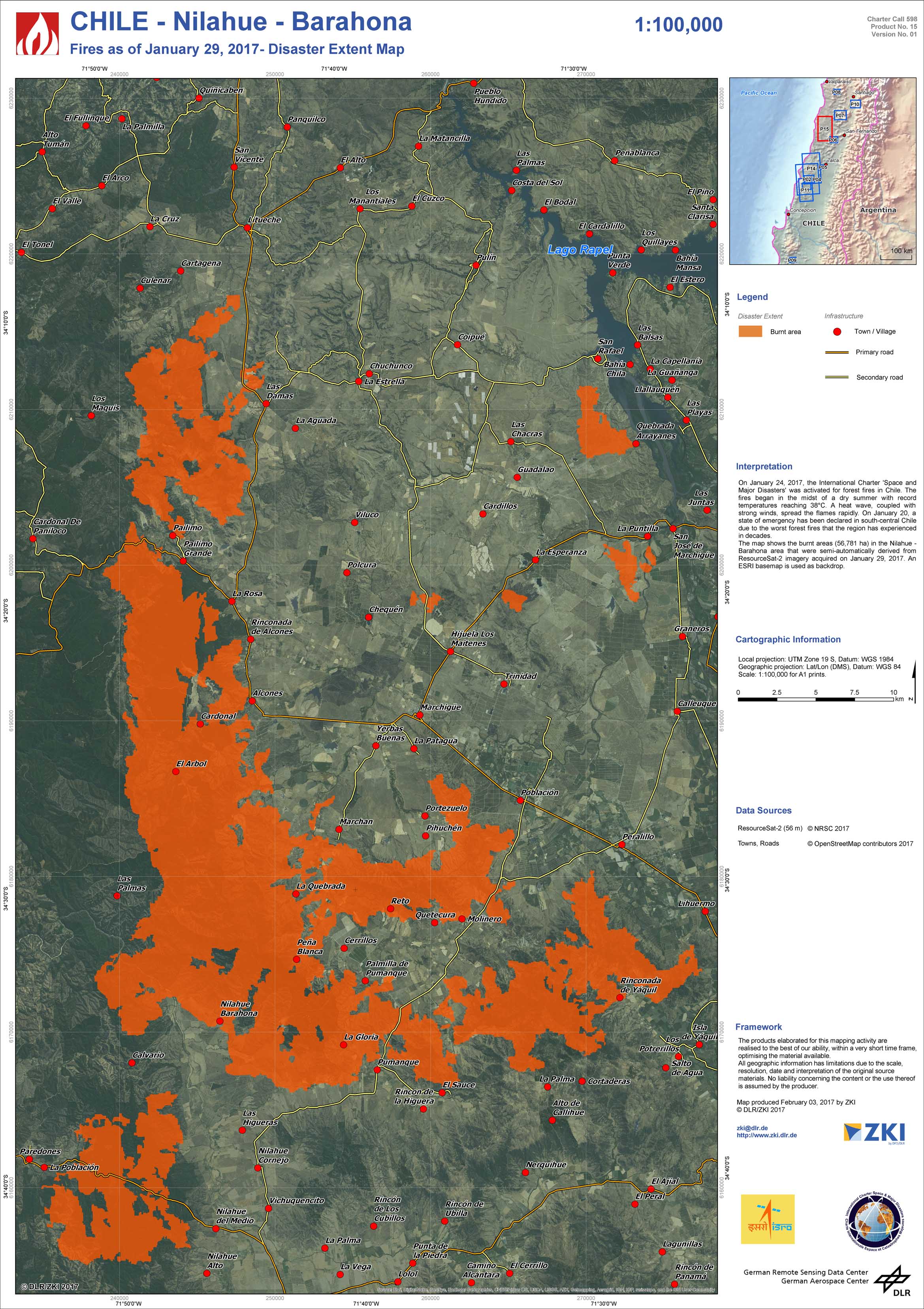
Chile - Nilahue - Barahona - P15 - Fires as of January 29, 2017 - Disaster Extent Map
Creation Date 03. February 2017

Chile - Constitución - Las Máquinas - P14 - Fires as of January 27 / 28 and 29, 2017 - Disaster Extent Map
Creation Date 01. February 2017
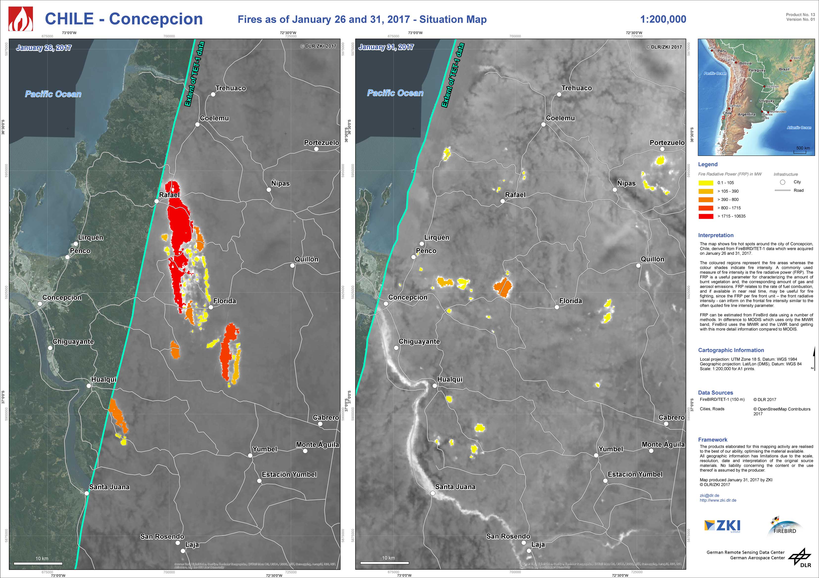
Chile - Concepcion - P13 - Fires as of January 26 and 31, 2017 - Situation Map
Creation Date 31. January 2017
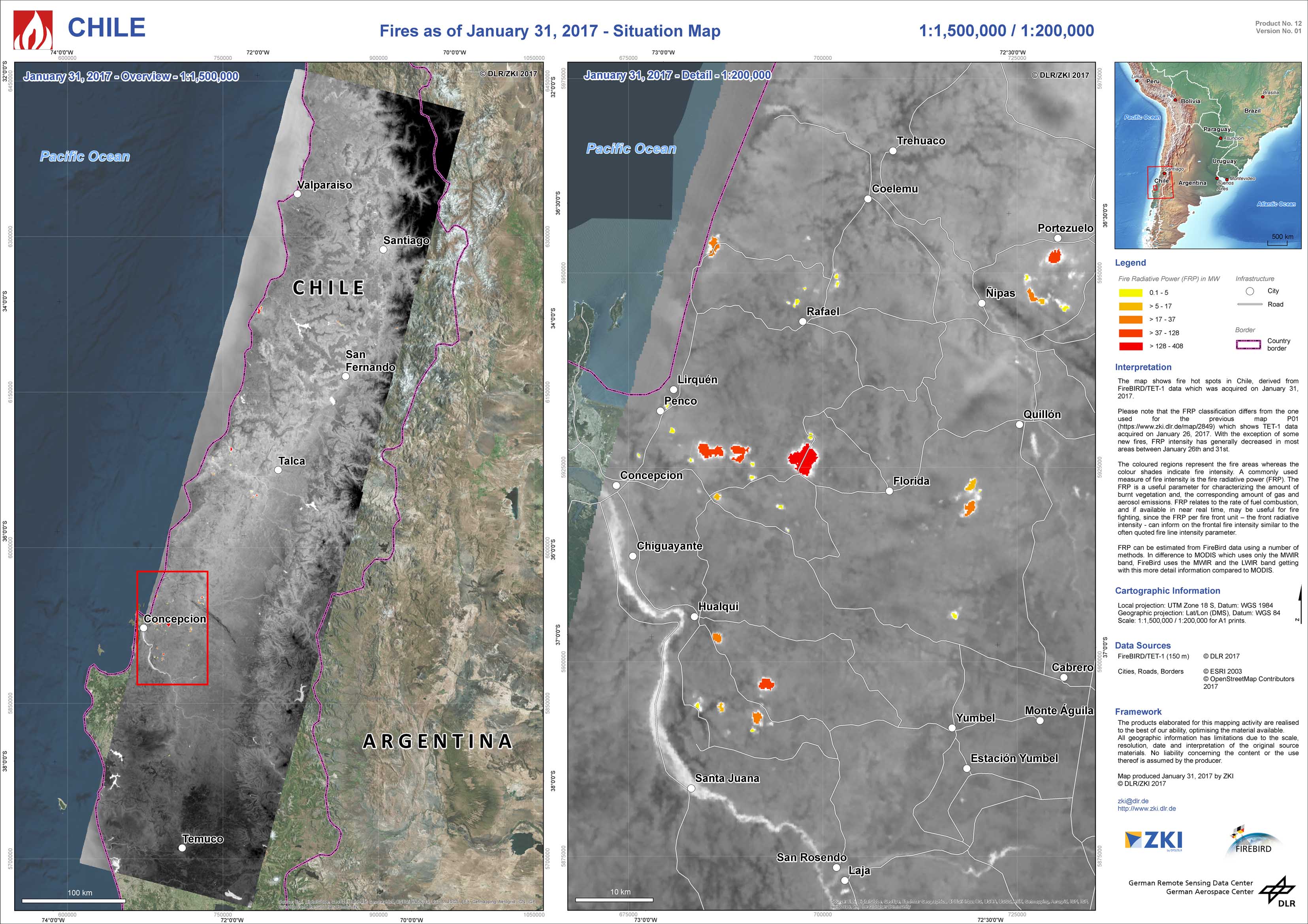
Chile - P12 - Fires as of January 31, 2017 - Situation Map
Creation Date 31. January 2017
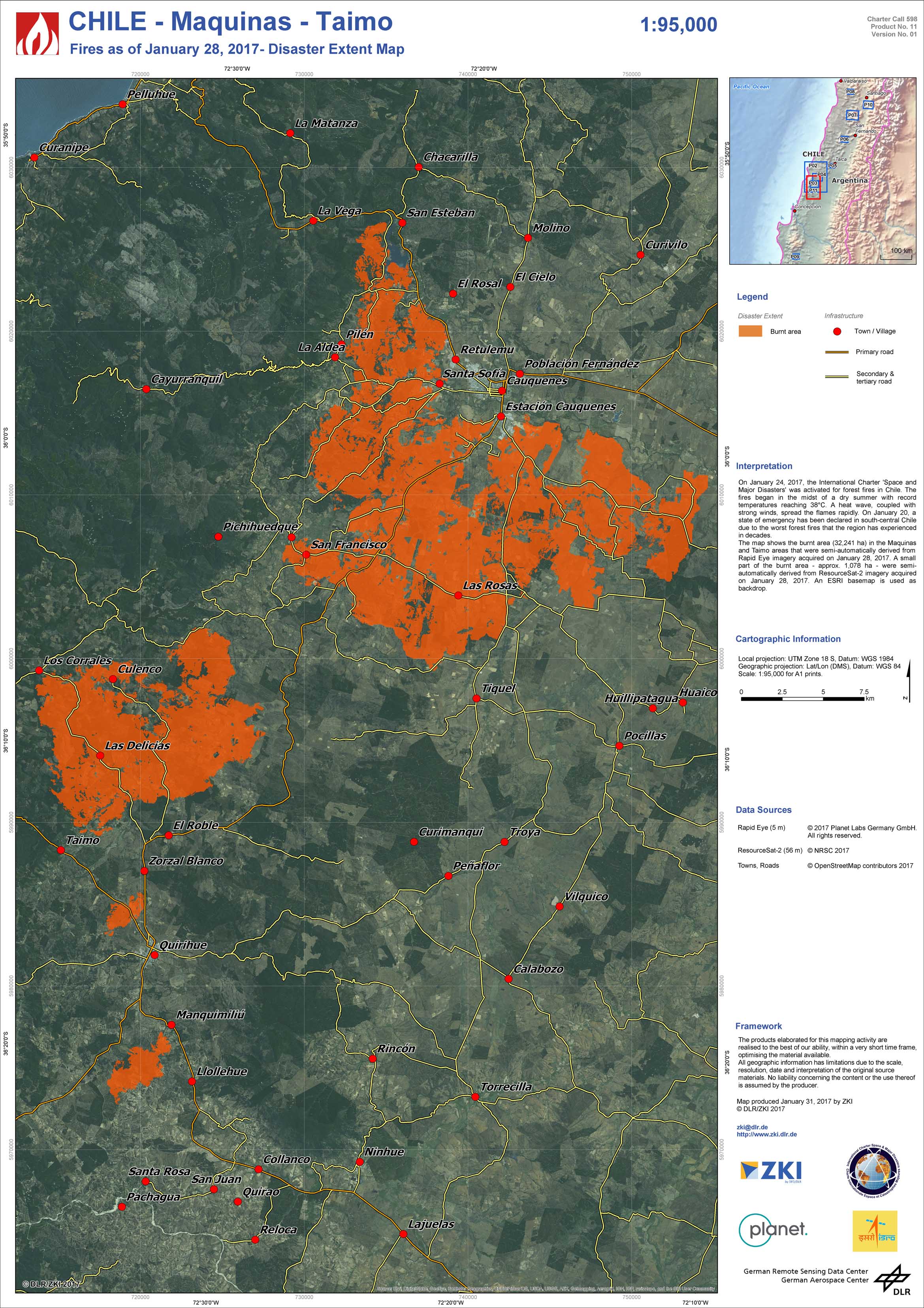
Chile - Maquinas - Taimo - P01 - Fires as of January 28, 2017 - Disaster Extent Map
Creation Date 31. January 2017
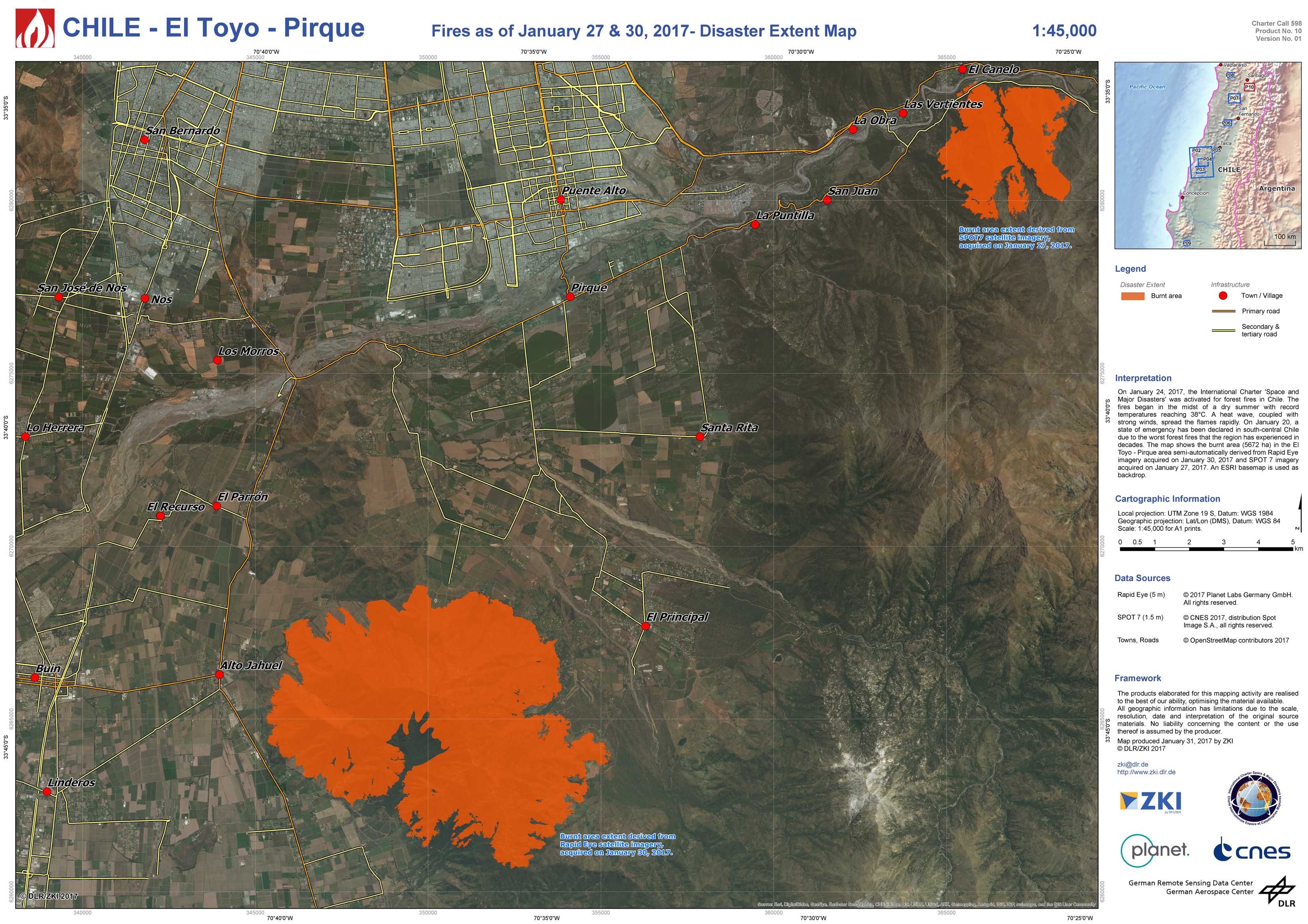
Chile - El Toyo - Pirque - P10 - Fires as of January 27 and 30, 2017 - Disaster Extent Map
Creation Date 31. January 2017
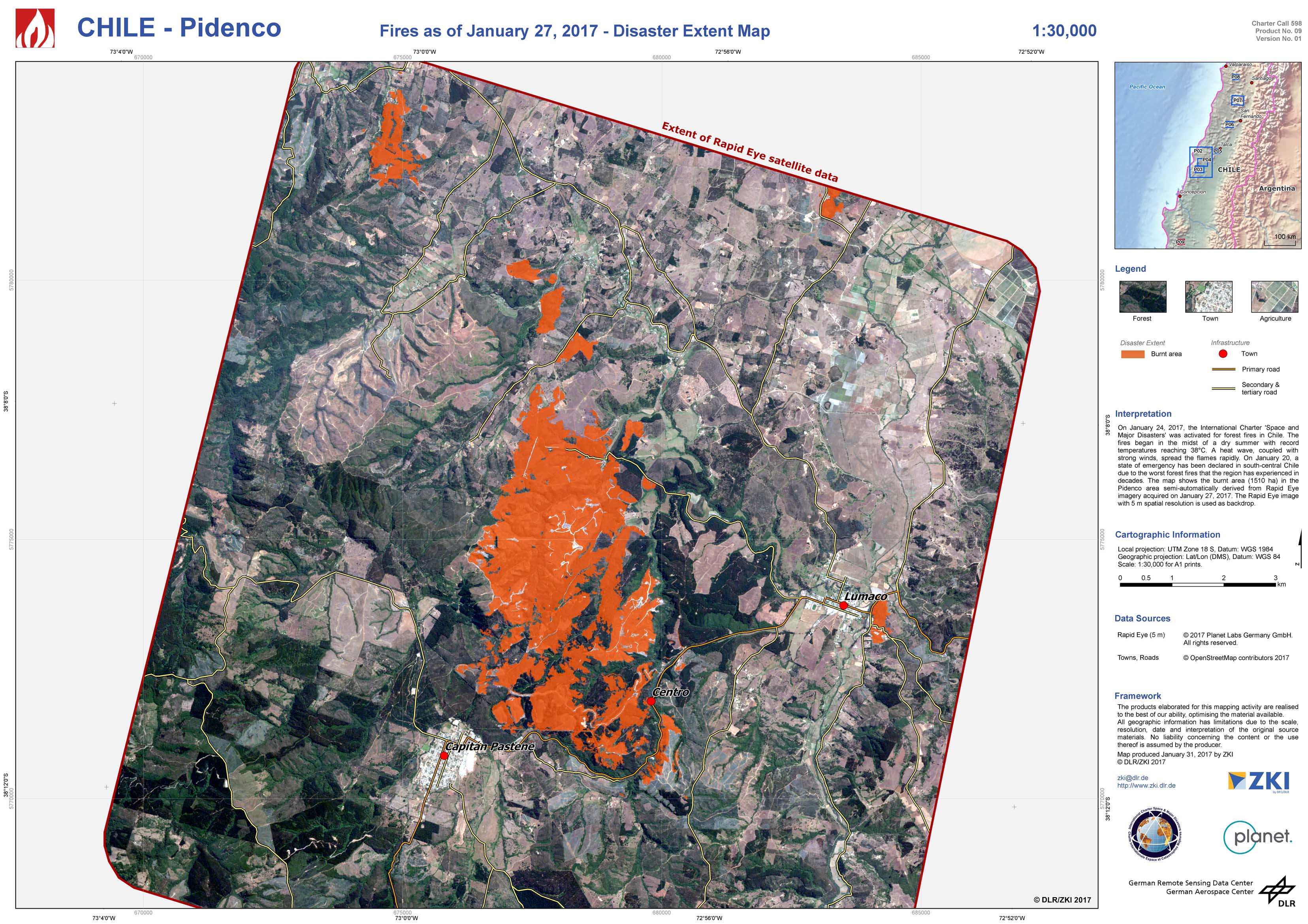
Chile - Pidenco - P09 - Fires as of January 27, 2017 - Disaster Extent Map
Creation Date 31. January 2017

Chile - El Naranjo - P08 - Fires as of January 27, 2017 - Disaster Extent Map
Creation Date 30. January 2017
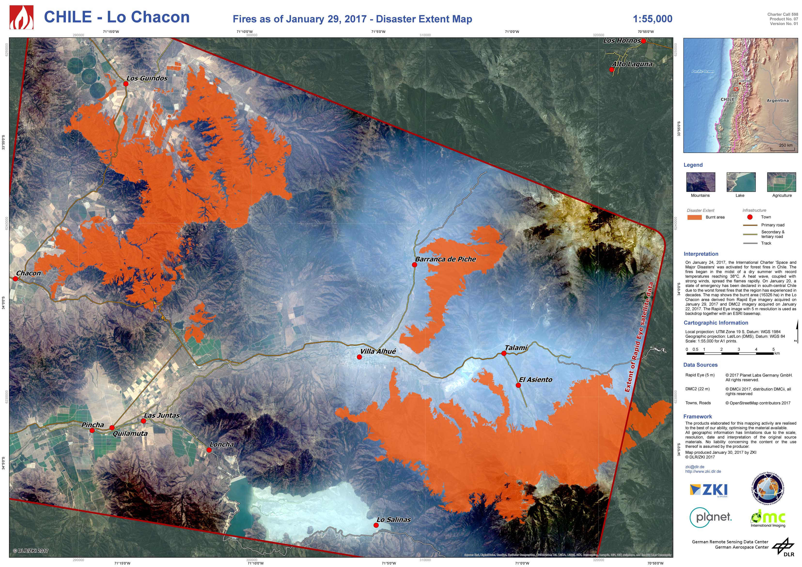
Chile - Lo Chacon - P07 - Fires as of January 29, 2017 - Disaster Extent Map
Creation Date 30. January 2017
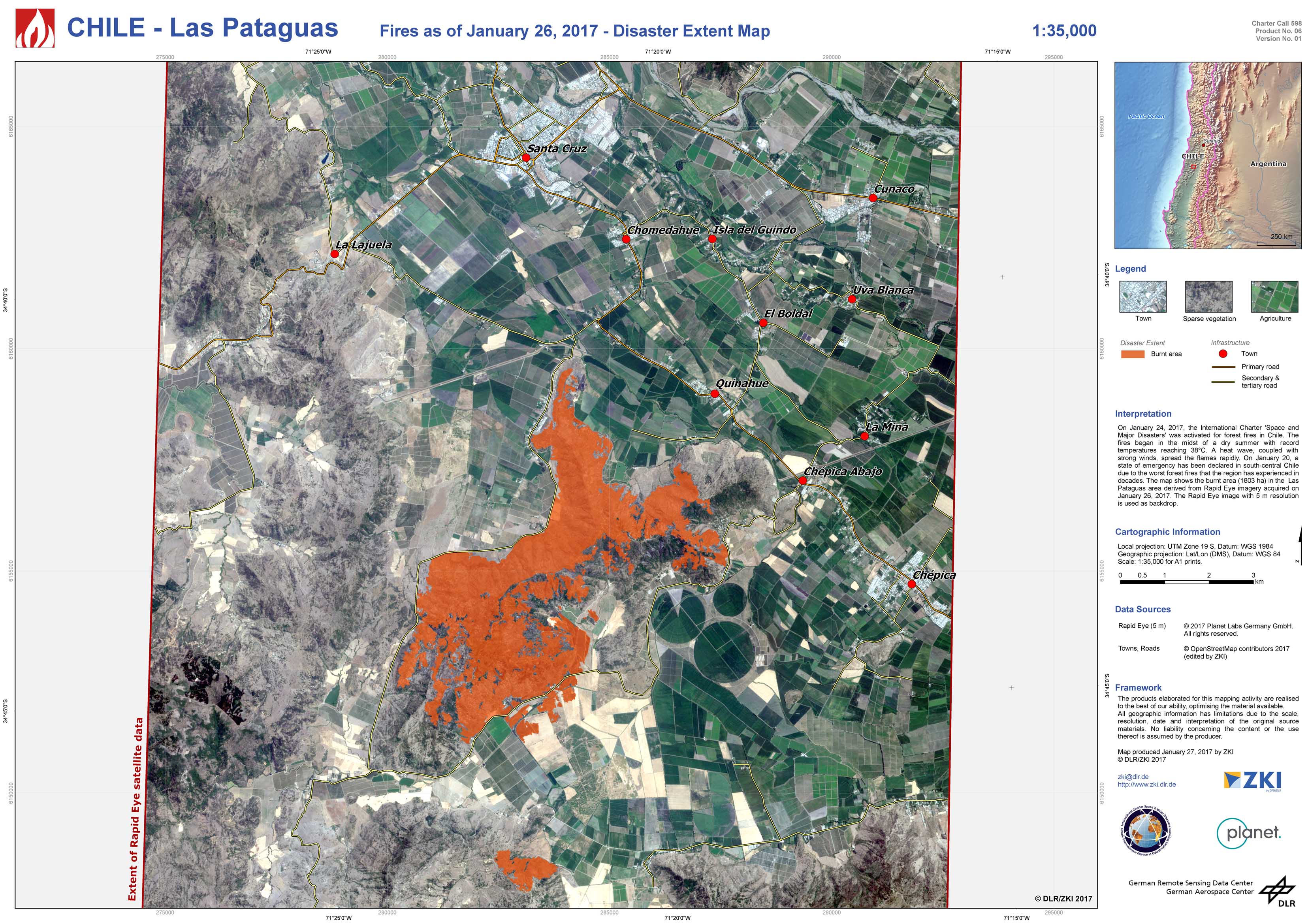
Chile - Las Pataguas - P06 - Fires as of January 26, 2017 - Disaster Extent Map
Creation Date 30. January 2017

Chile - Cerro Maule - P05 - Fires as of January 26, 2017 - Disaster Extent Map
Creation Date 30. January 2017
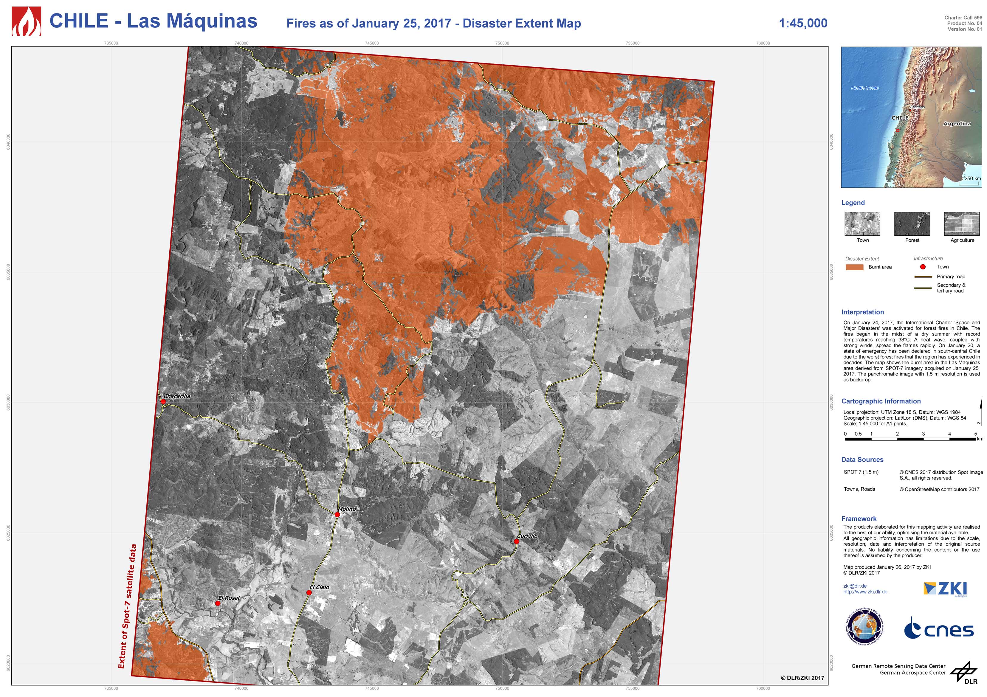
Chile - Las Máquinas - P04 - Fires as of January 25, 2017 - Disaster Extent Map
Creation Date 30. January 2017
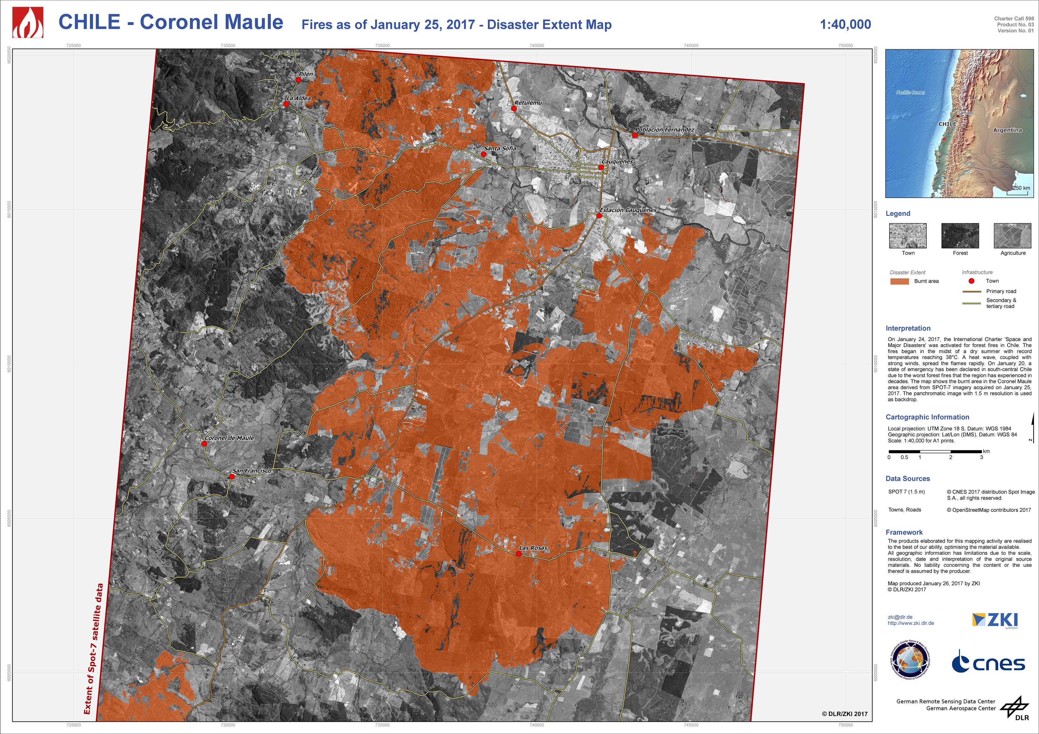
Chile - Coronel Maule - P03 - Fires as of January 25, 2017 - Disaster Extent Map
Creation Date 30. January 2017
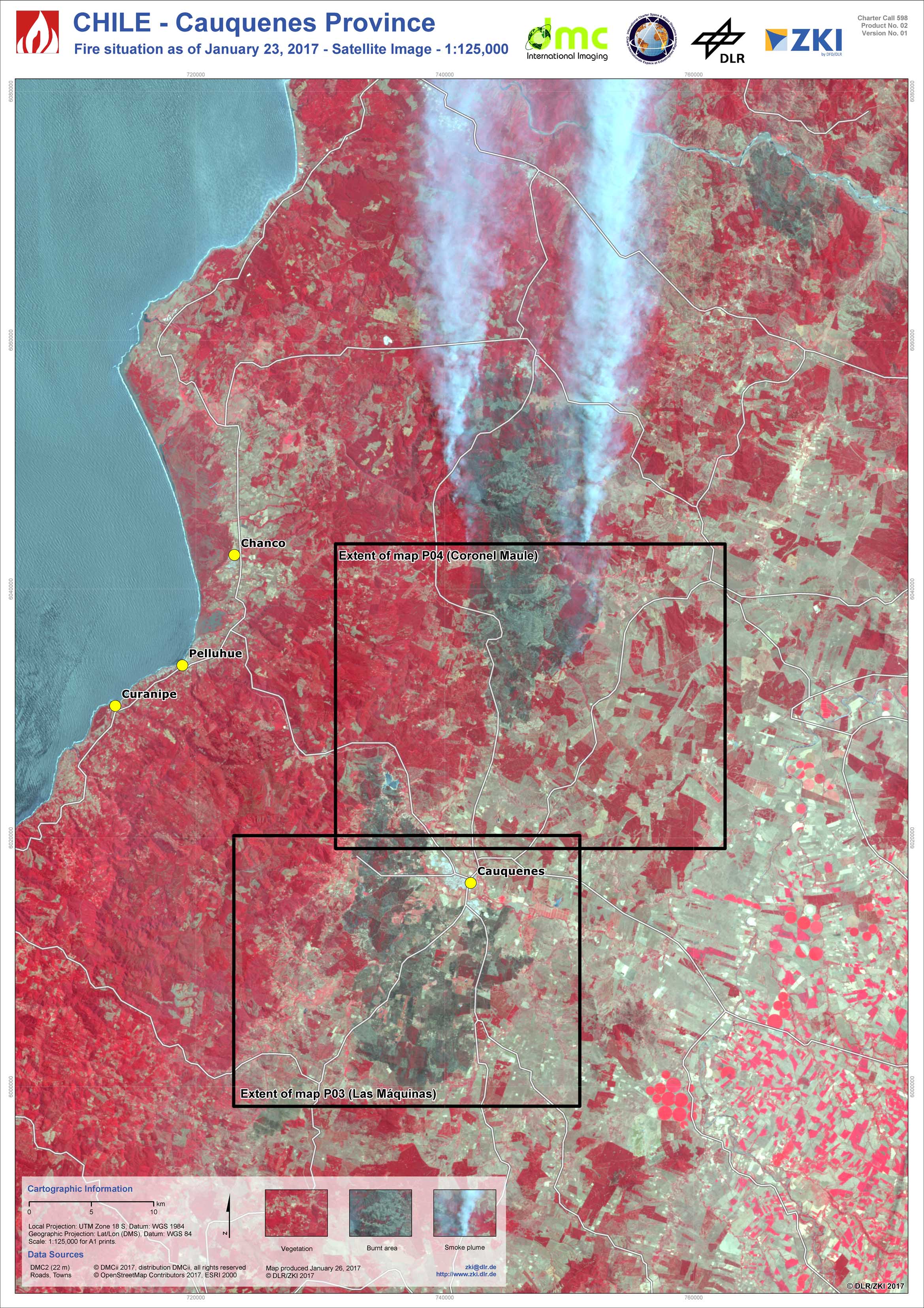
Chile - Cauquenes Province - P02 - Fire situation as of January 23, 2017 - Satellite Image
Creation Date 26. January 2017
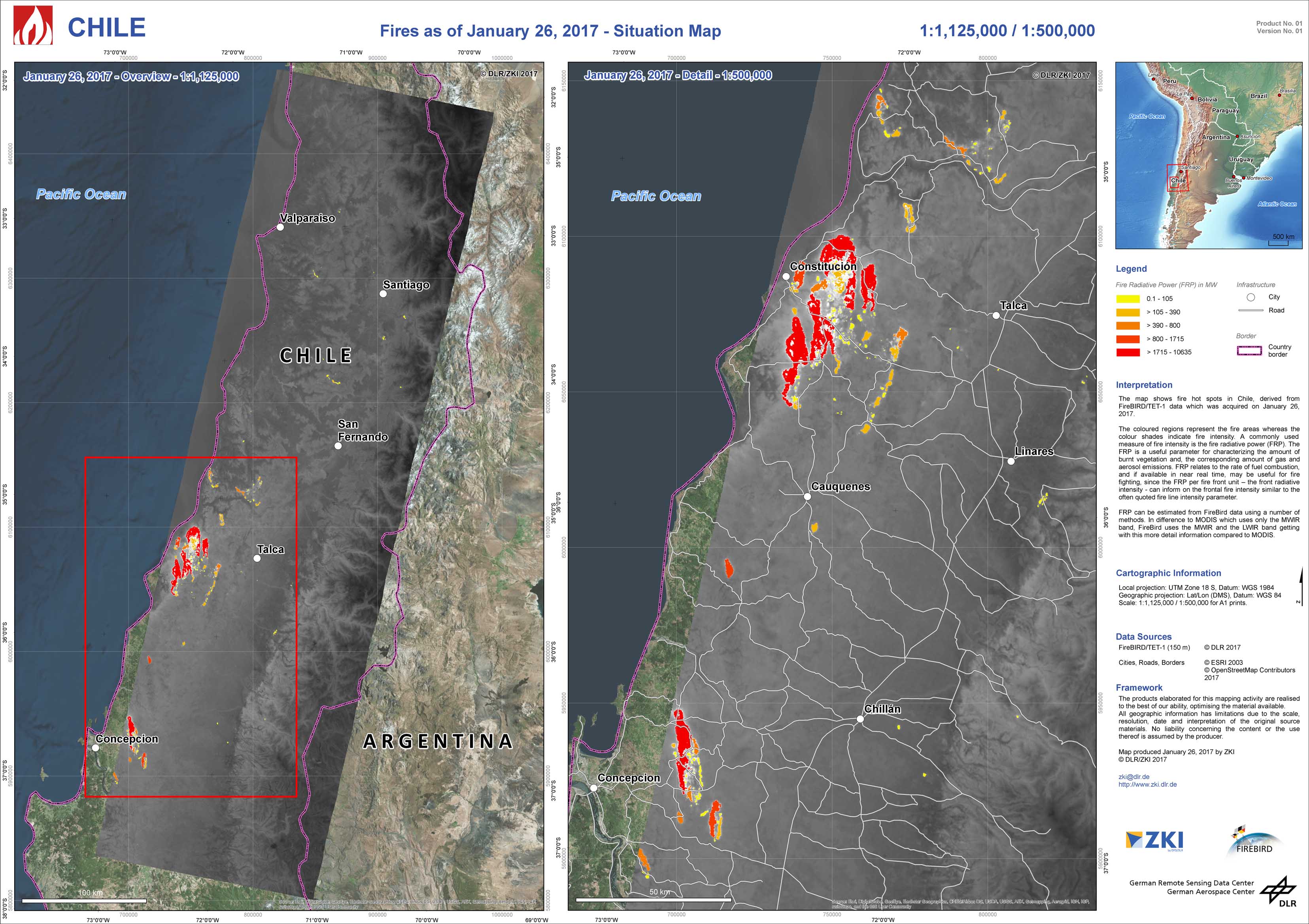
Chile - P01 - Fires as of January 26, 2017 - Situation Map
Creation Date 26. January 2017