
Floods in Germany: National Service ZKI-DE activated

Germany - P49 - Elbe / Saale - Breitenhagen - Flood situation as of June 12 / 18, 2013 - Change analysis - Overview
Creation Date 19. June 2013
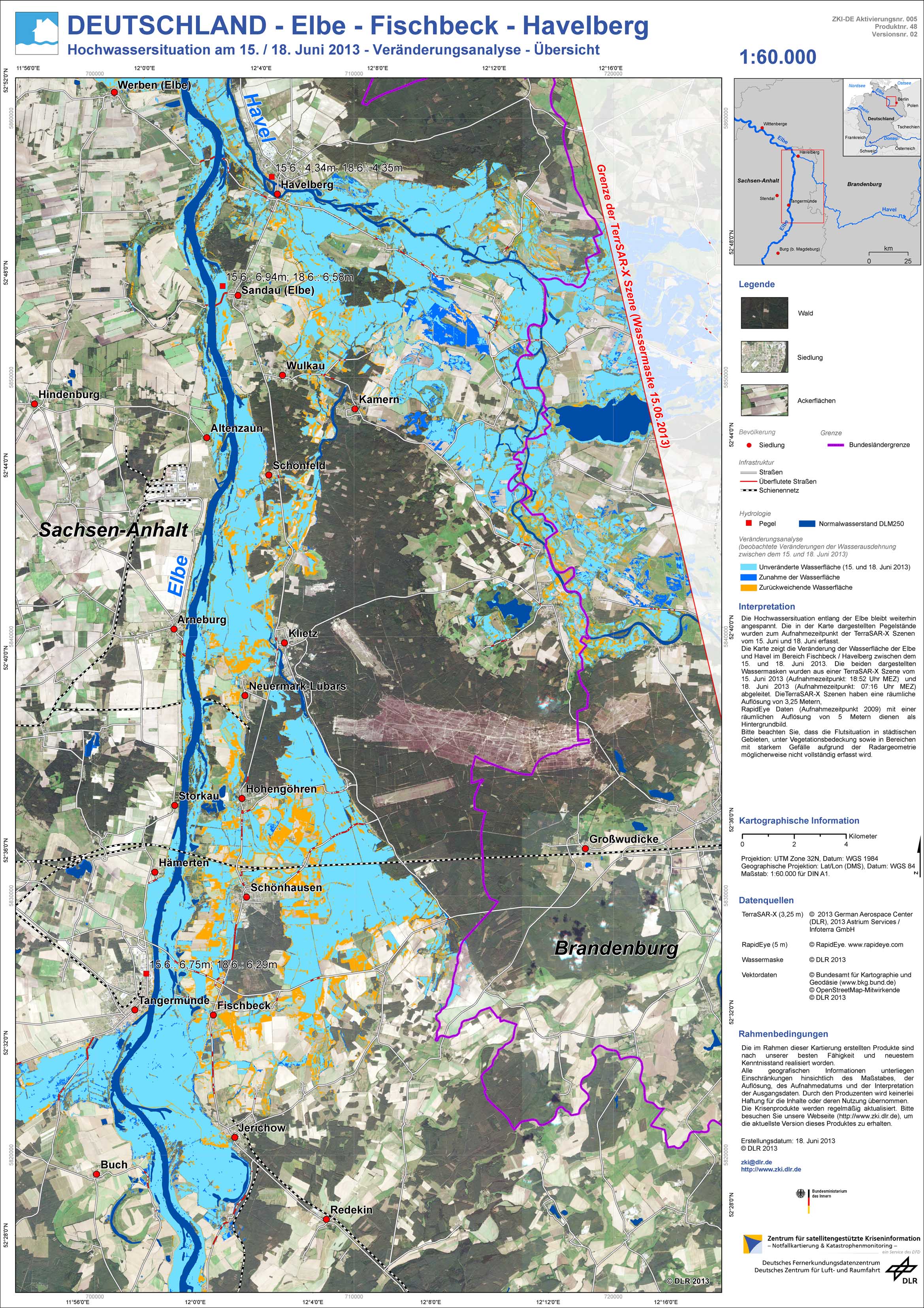
Germany - P48 - Elbe - Fischbeck - Havelberg - Flood situation as of June 15 / 18, 2013 - Change analysis - Overview
Creation Date 19. June 2013
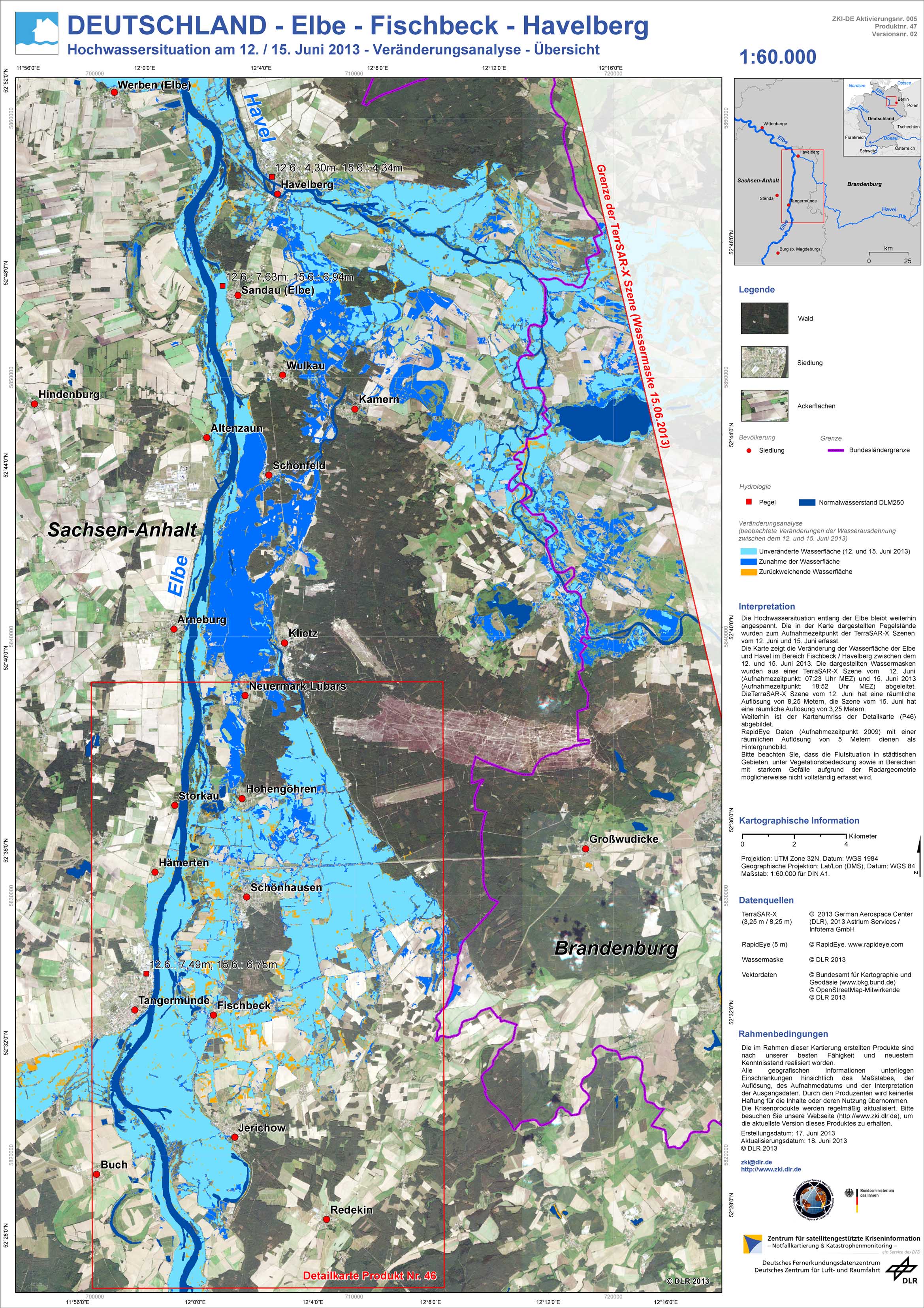
Germany - P47 - Elbe - Fischbeck - Havelberg - Flood situation as of June 12 / 15, 2013 - Change analysis - Overview
Creation Date 18. June 2013
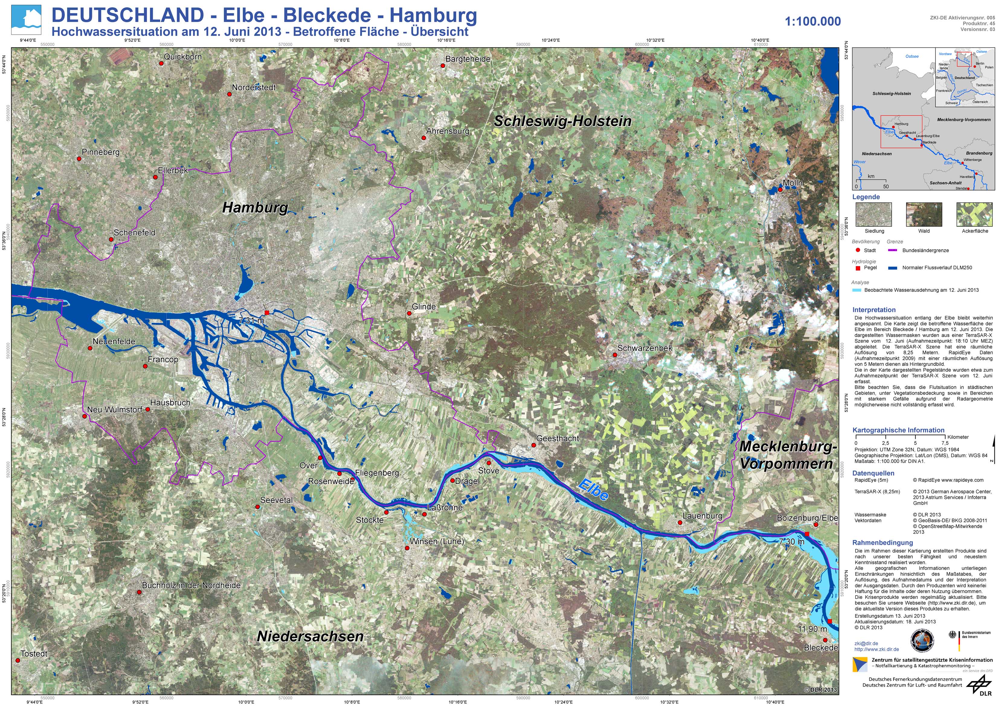
Germany - P45 - Elbe - Bleckede - Hamburg - Flood situation as of June 12, 2013 - Affected Area - Overview
Creation Date 18. June 2013
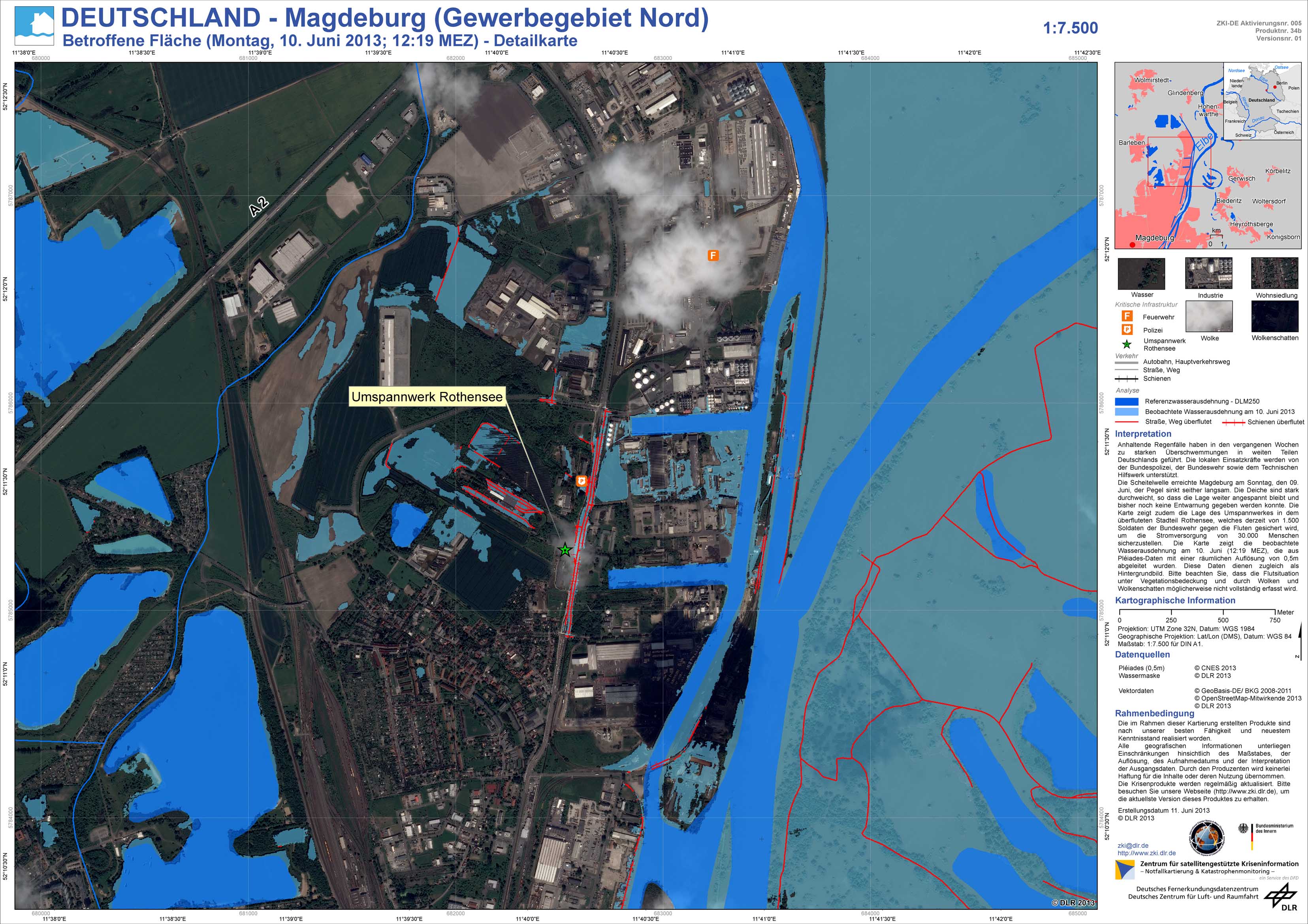
Germany - P34b - Magdeburg (Industrial park north) - Affected Area as of Monday, June 10, 2013, 12:19 MEZ - Detail
Creation Date 18. June 2013
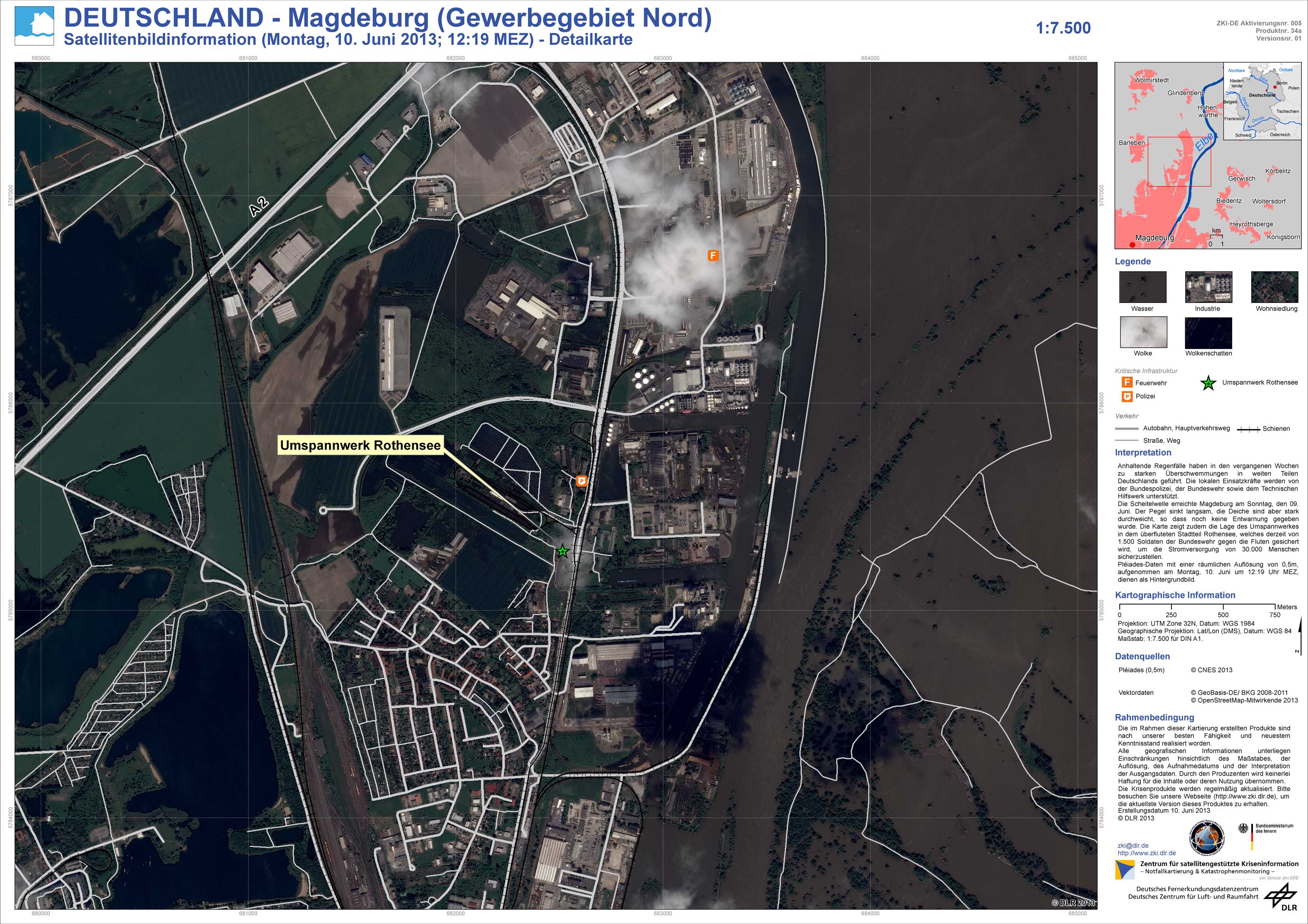
Germany - P34a - Magdeburg (Industrial park north) - Satellite Image Information as of Monday June 10, 2013, 12:19 MEZ - Detail
Creation Date 18. June 2013
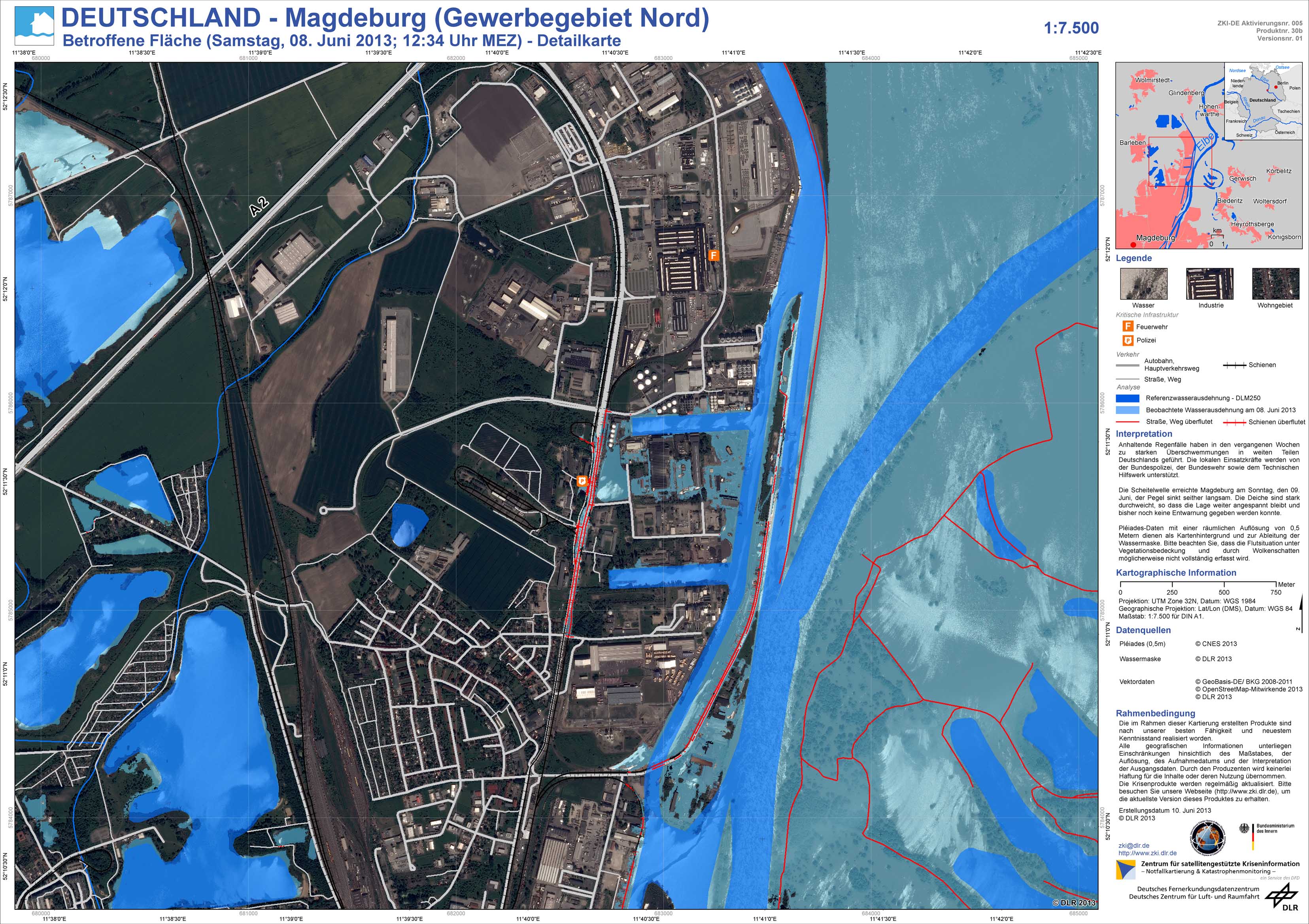
Germany - P30b - Magdeburg (Industrial park north) - Affected Area as of Saturday, June 8, 2013, 12:34 Uhr MEZ - Detail
Creation Date 18. June 2013
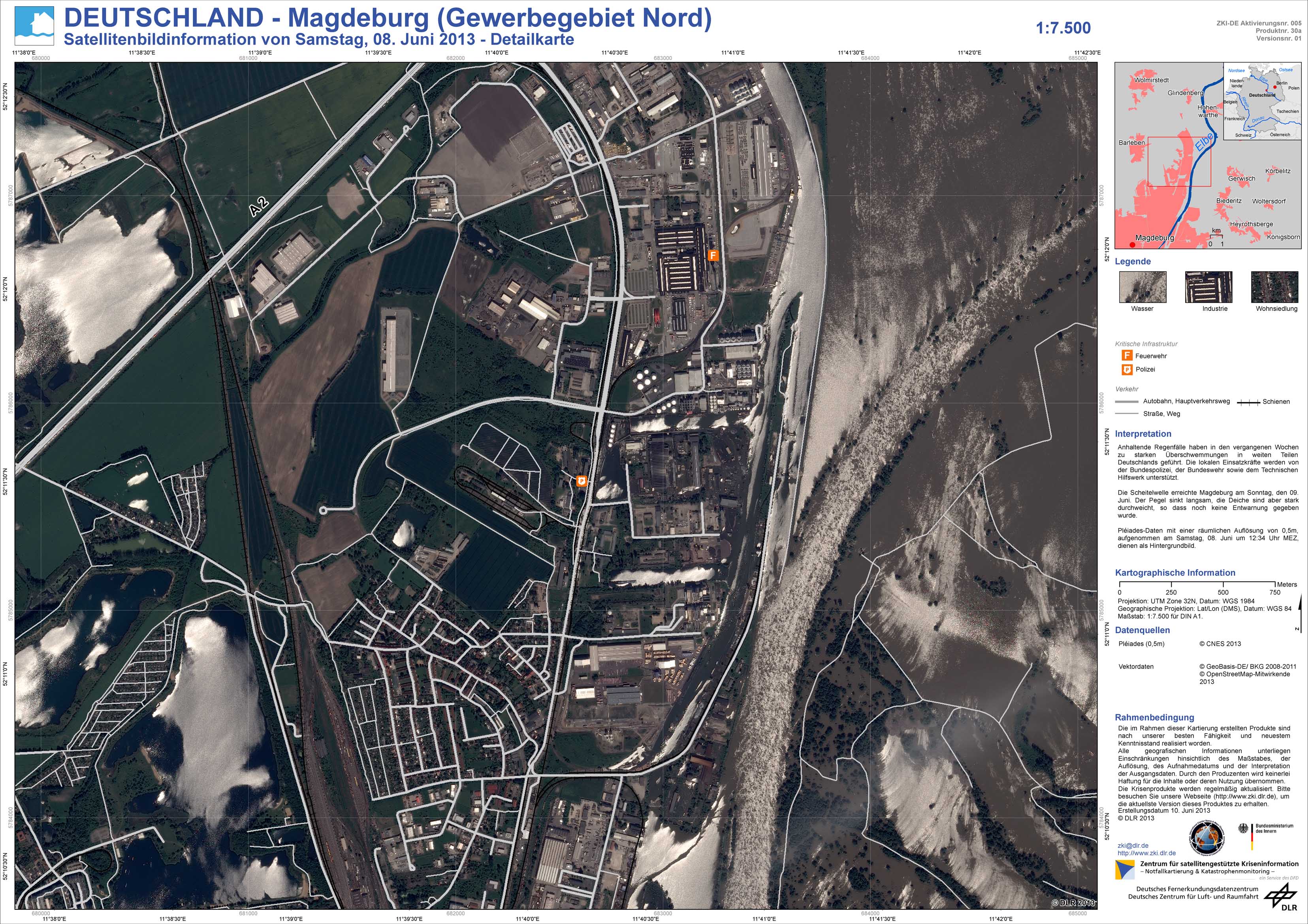
Germany - P30a - Magdeburg (Industrial park north) - Satellite Image Information as of Saturday, June 8, 2013 - Detail
Creation Date 18. June 2013
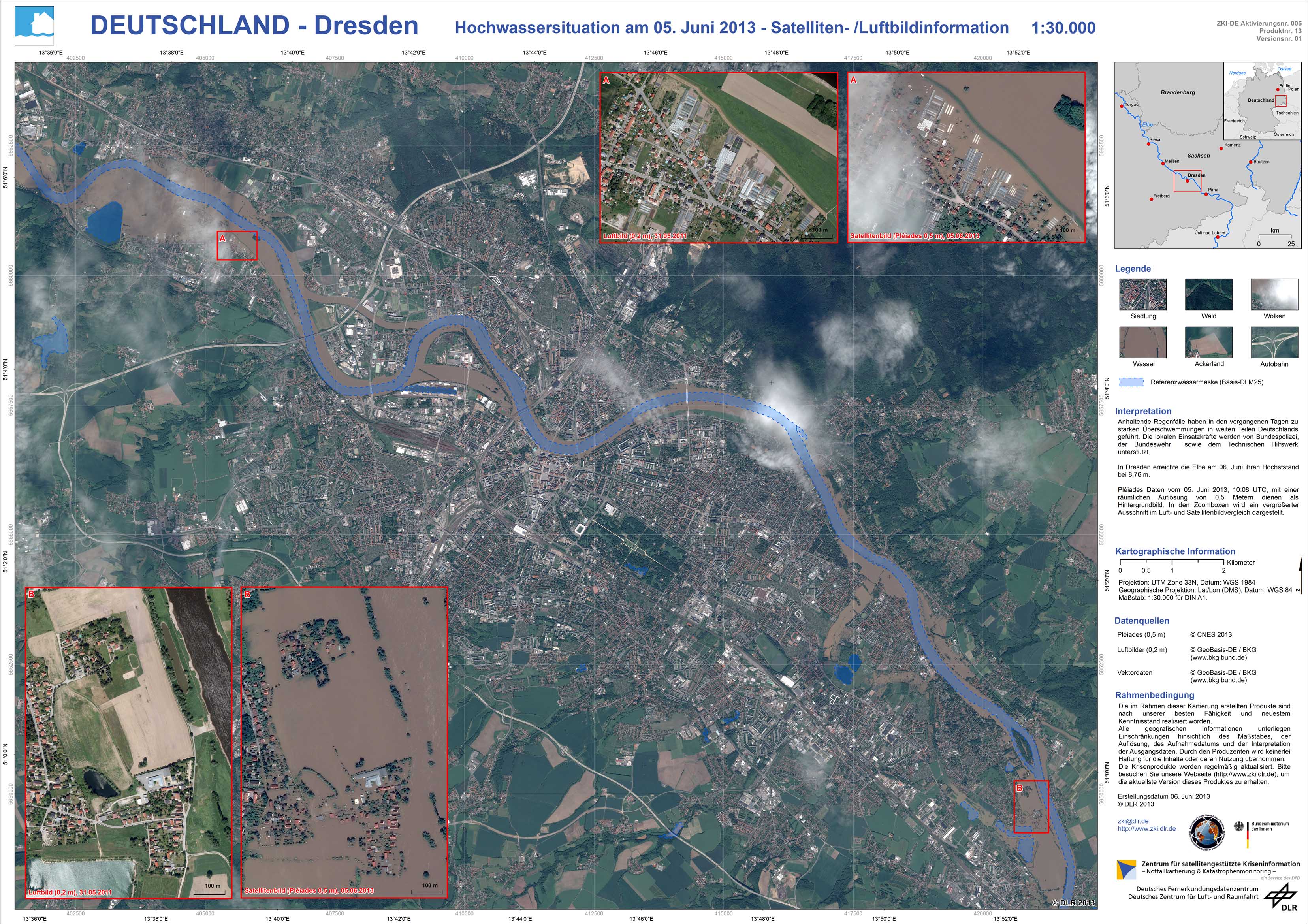
Germany - P13 - Dresden - Flood situation as of June 5, 2013 - Satellite / Aerial Image Information
Creation Date 18. June 2013
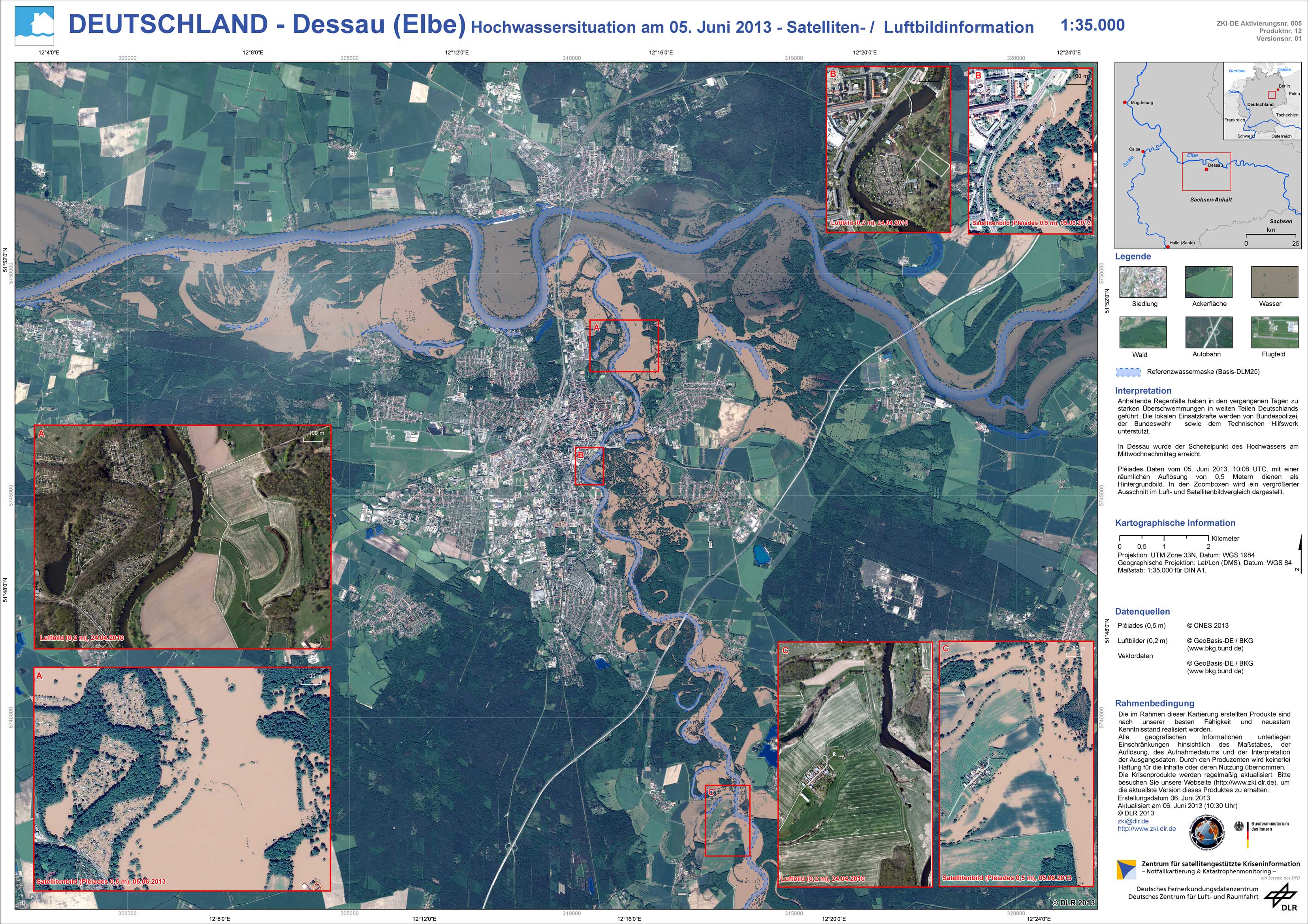
Germany - P12 - Dessau (Elbe) - Flood situation as of June 5, 2013 - Satellite / Aerial Image Information
Creation Date 18. June 2013
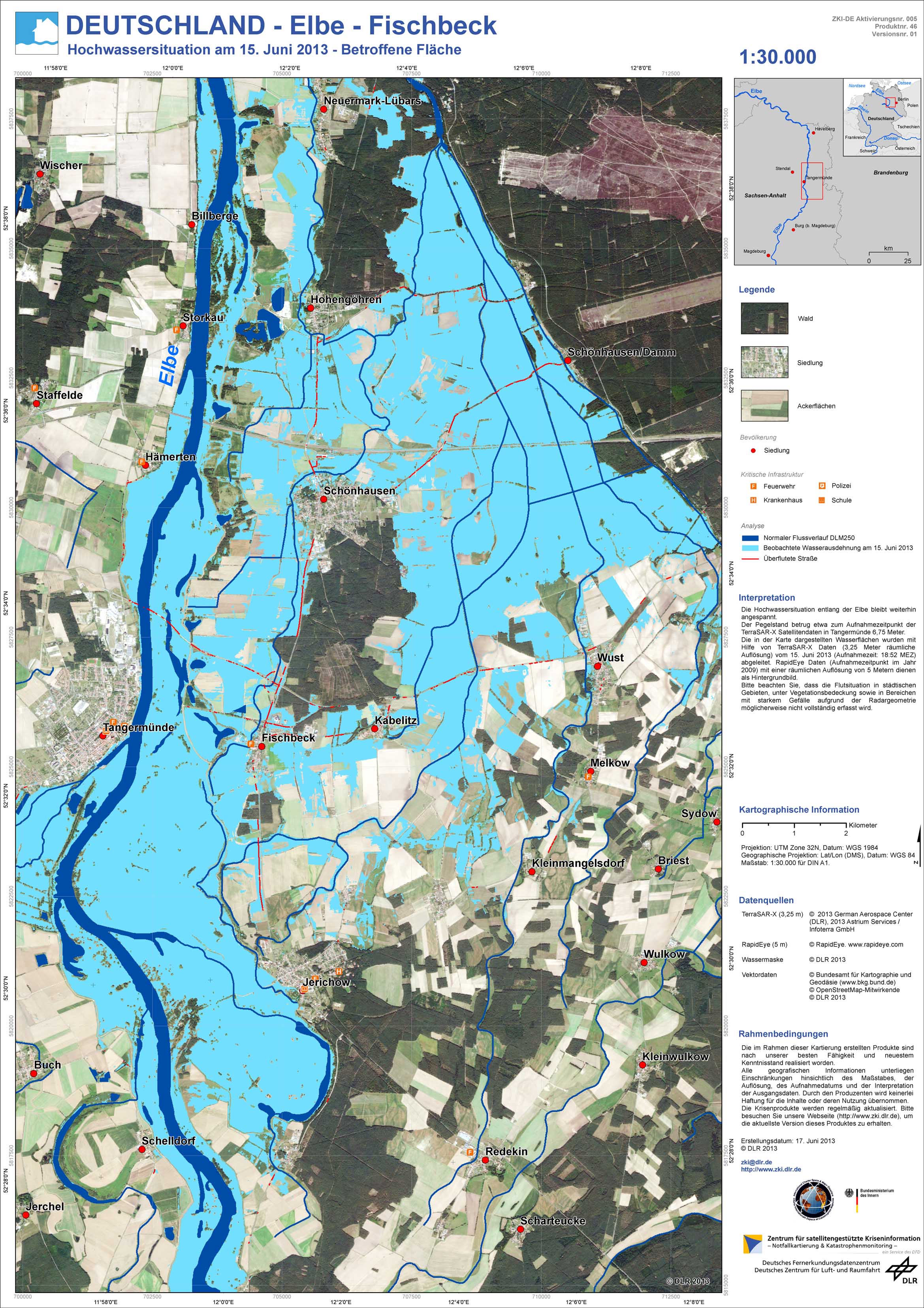
Germany - P46 - Elbe - Fischbeck - Flood situation as of June 15, 2013 - Affected Area
Creation Date 17. June 2013
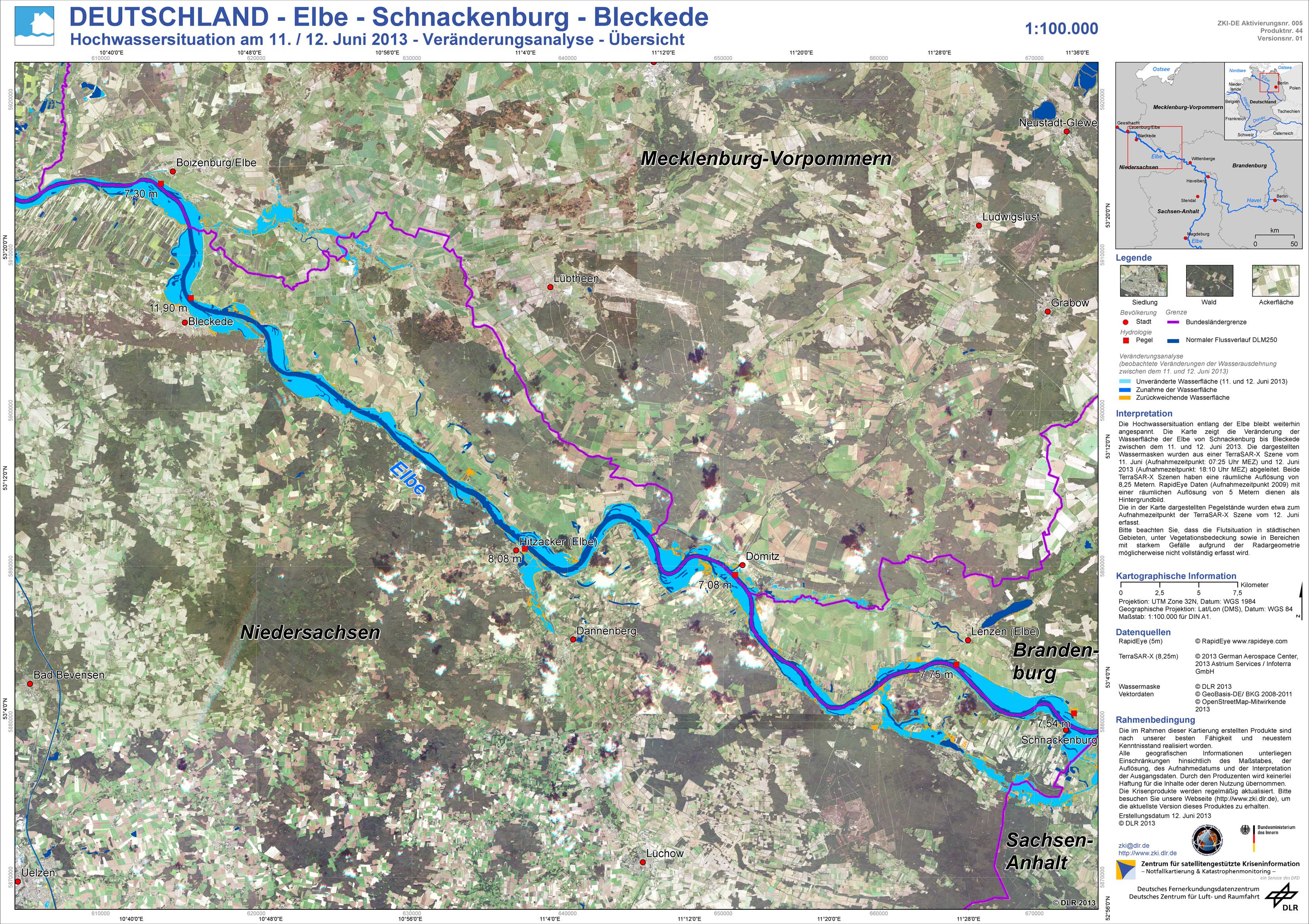
Germany - P44 - Elbe - Schnackenburg - Bleckede - Flood situation as of June 11 / 12, 2013 - Change analysis - Overview
Creation Date 14. June 2013
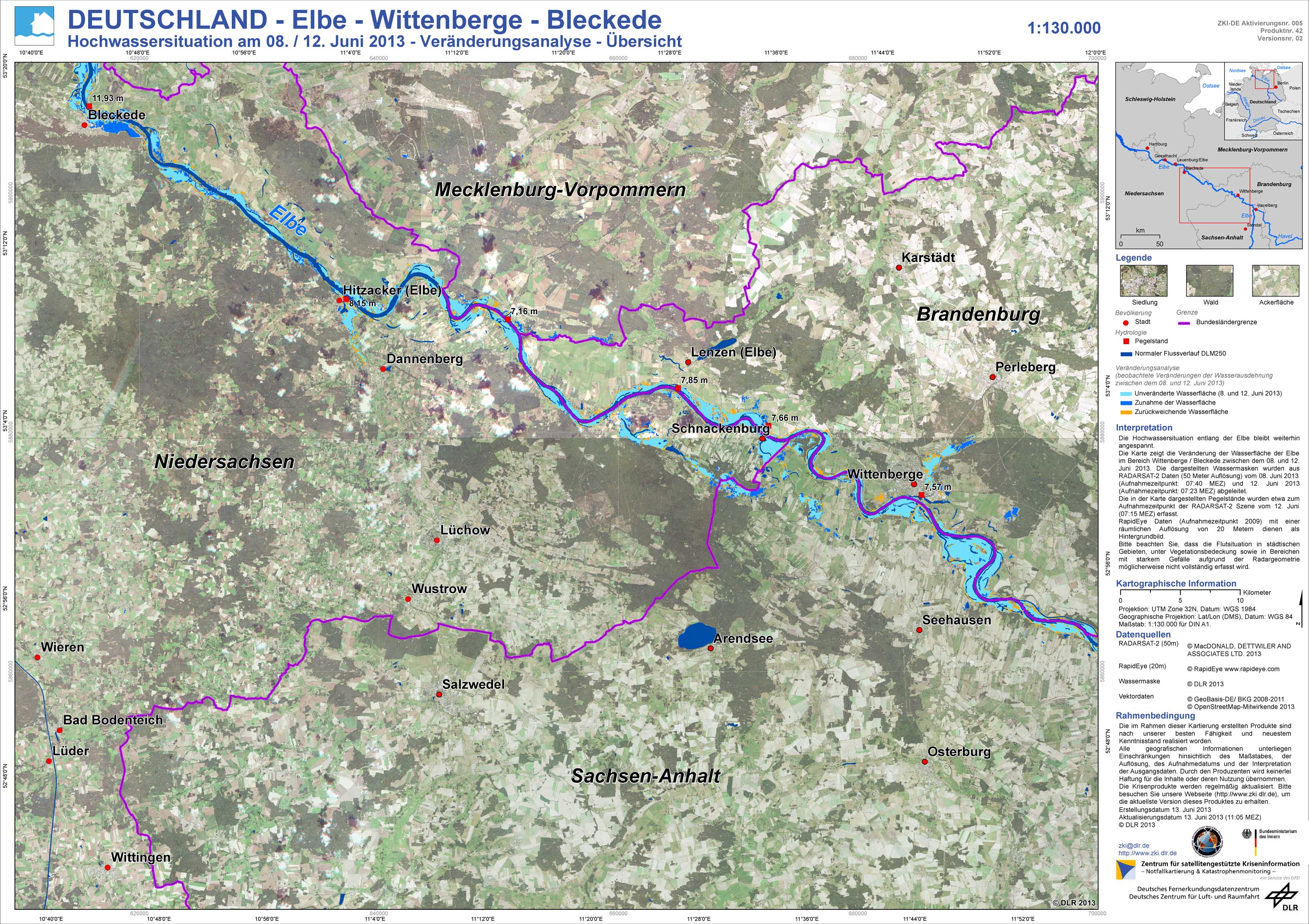
Germany - P42 - Elbe - Wittenberge - Bleckede - Flood situation as of June 8 / 11, 2013 - Change analysis - Overview
Creation Date 14. June 2013
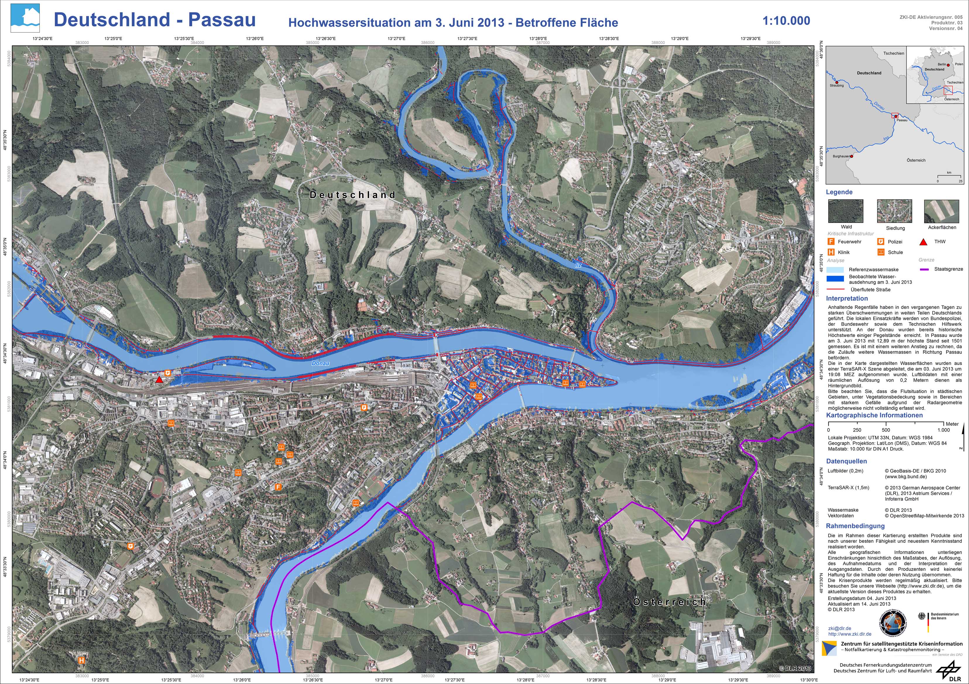
Germany - P03 - Passau - Flood situation as of June 3, 2013 - Affected Area
Creation Date 14. June 2013
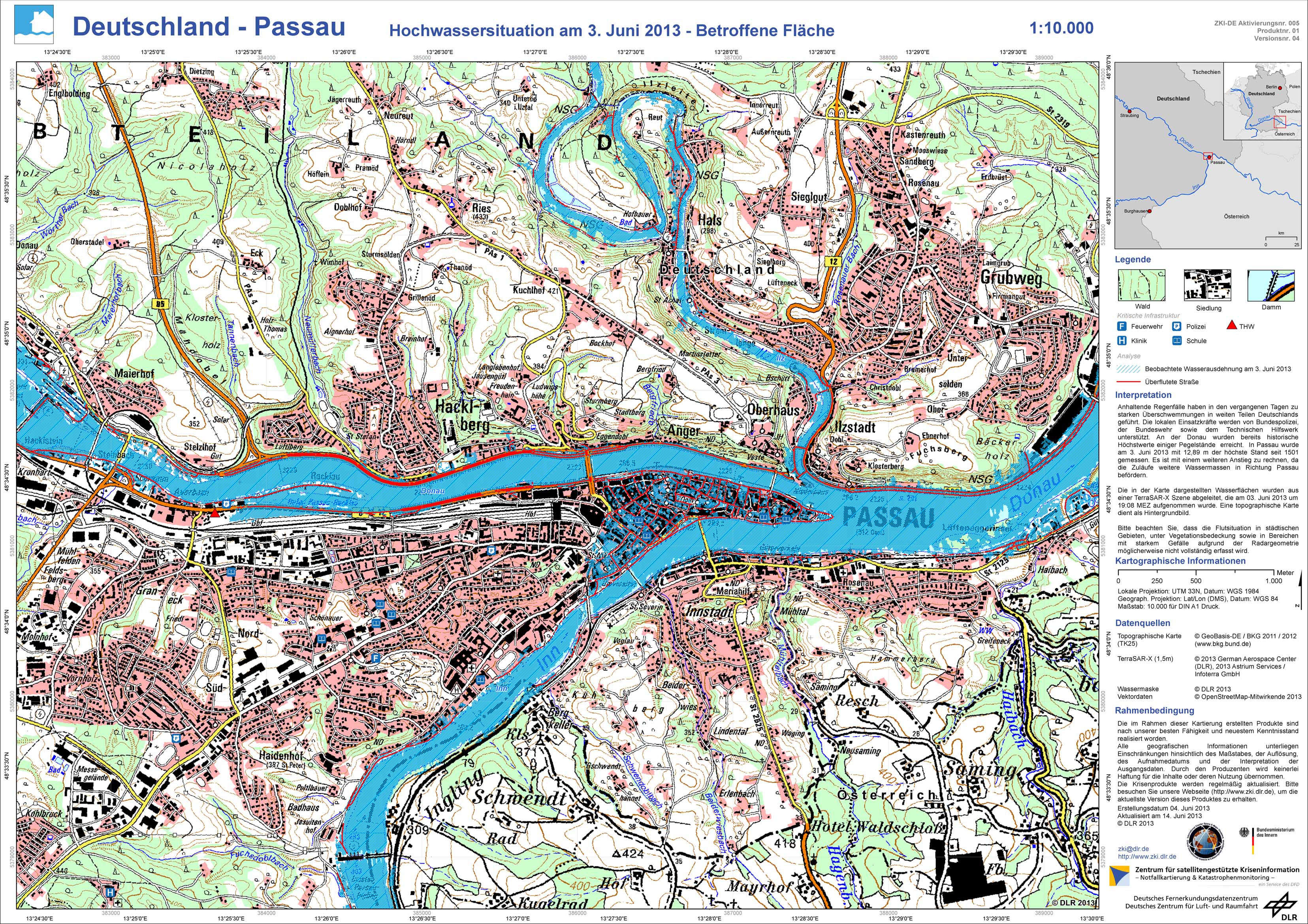
Germany - P01 - Passau - Flood situation as of June 3, 2013 - Affected Area
Creation Date 14. June 2013
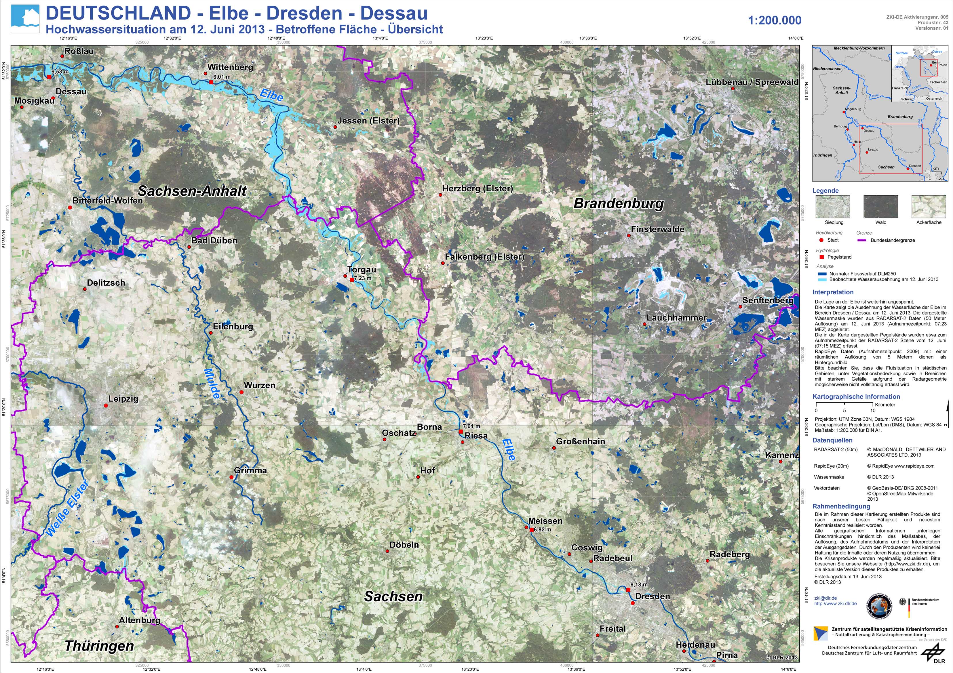
Germany - P43 - Elbe - Dresden - Dessau - Flood situation as of June 12, 2013 - Affected Area - Overview
Creation Date 13. June 2013
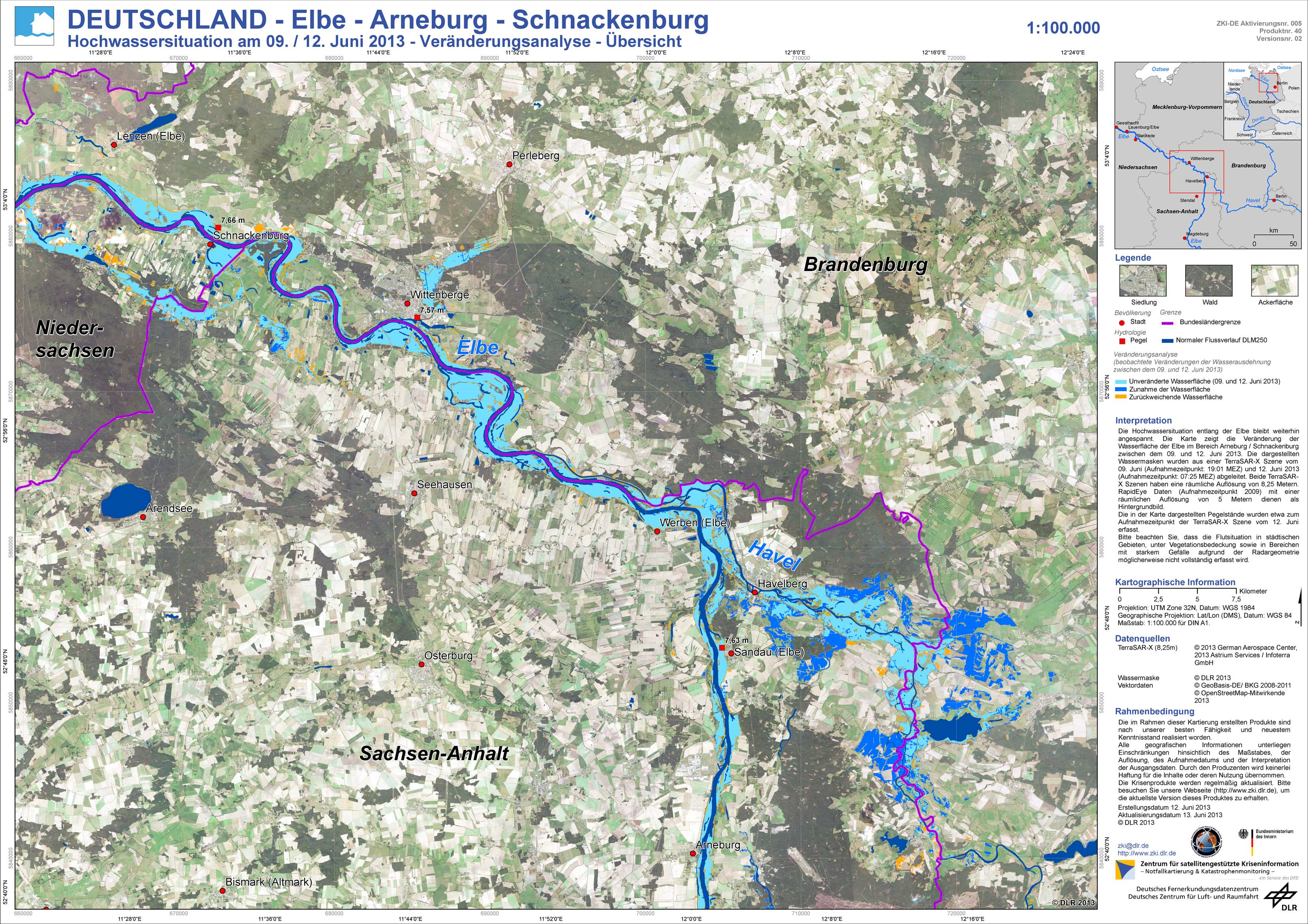
Germany - P40 - Elbe - Arneburg - Schnackenburg - Flood situation as of June 9 / 11, 2013 - Change analysis - Overview
Creation Date 13. June 2013
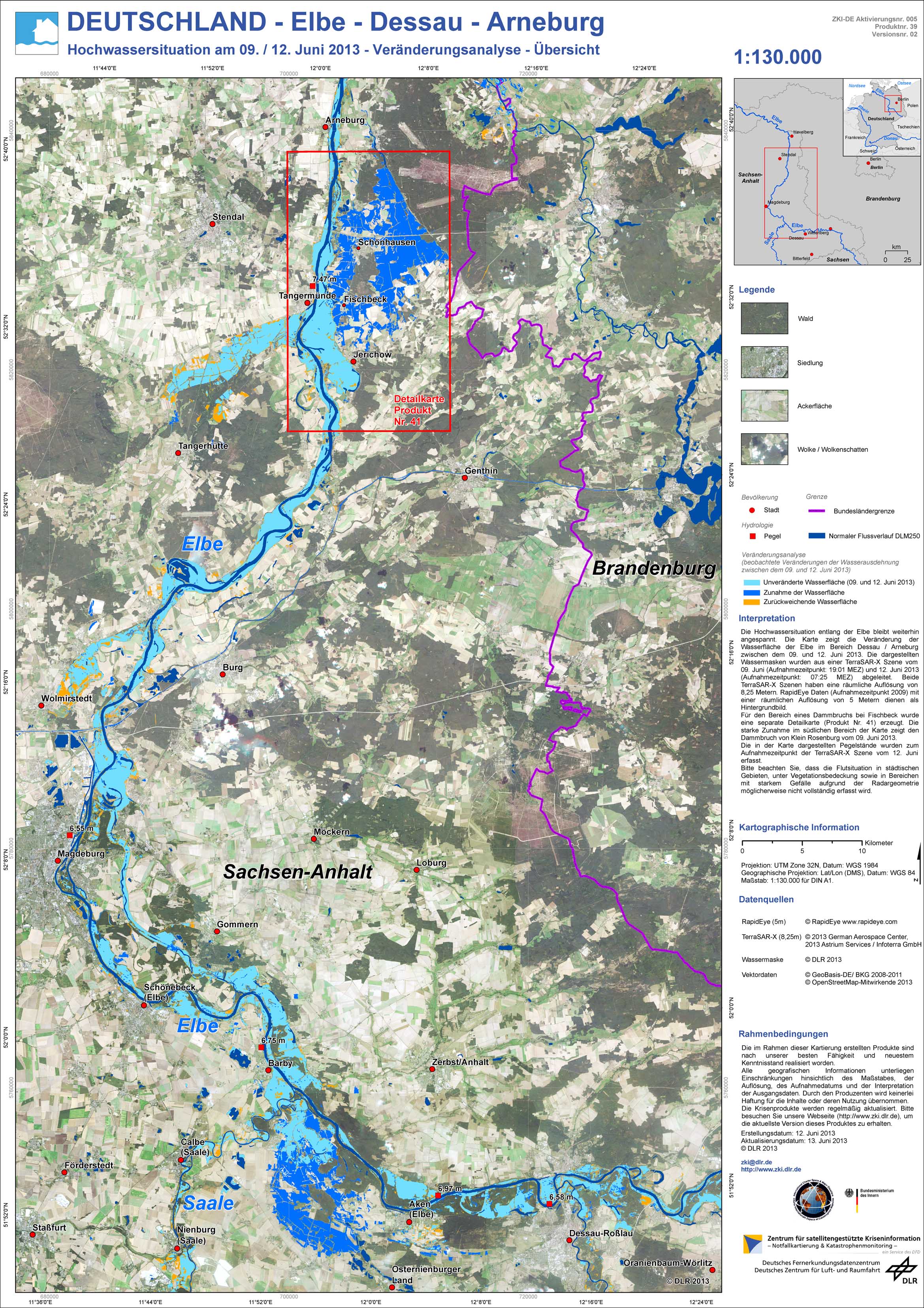
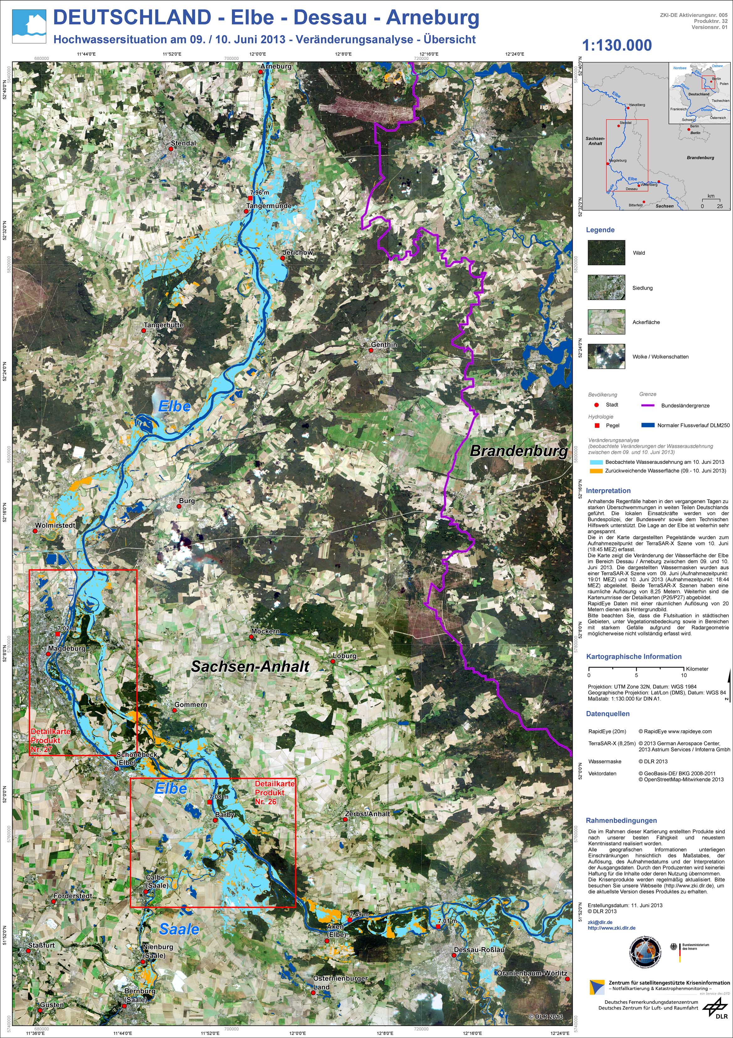
Germany - P39 - Elbe - Dessau - Arneburg - Flood situation as of June 9 / 11, 2013 - Change analysis - Overview
Creation Date 13. June 2013

Germany - P35 - Elbe - Wittenberge - Hitzacker - Flood situation as of 11. June 2013 - Affected Area - Overview
Creation Date 13. June 2013
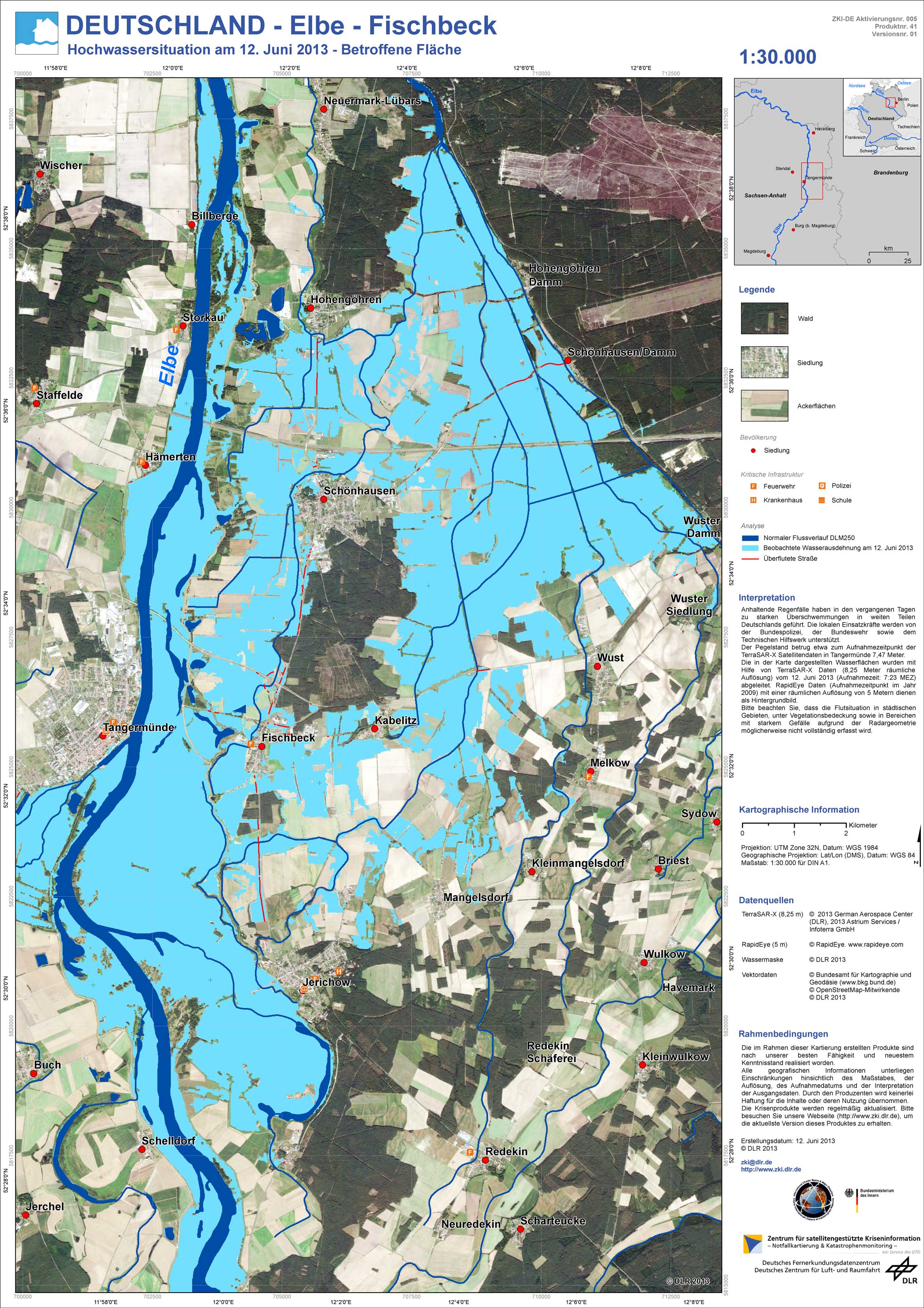
Germany - P41 - Elbe - Fischbeck - Flood situation as of June 12, 2013 - Affected Area
Creation Date 12. June 2013
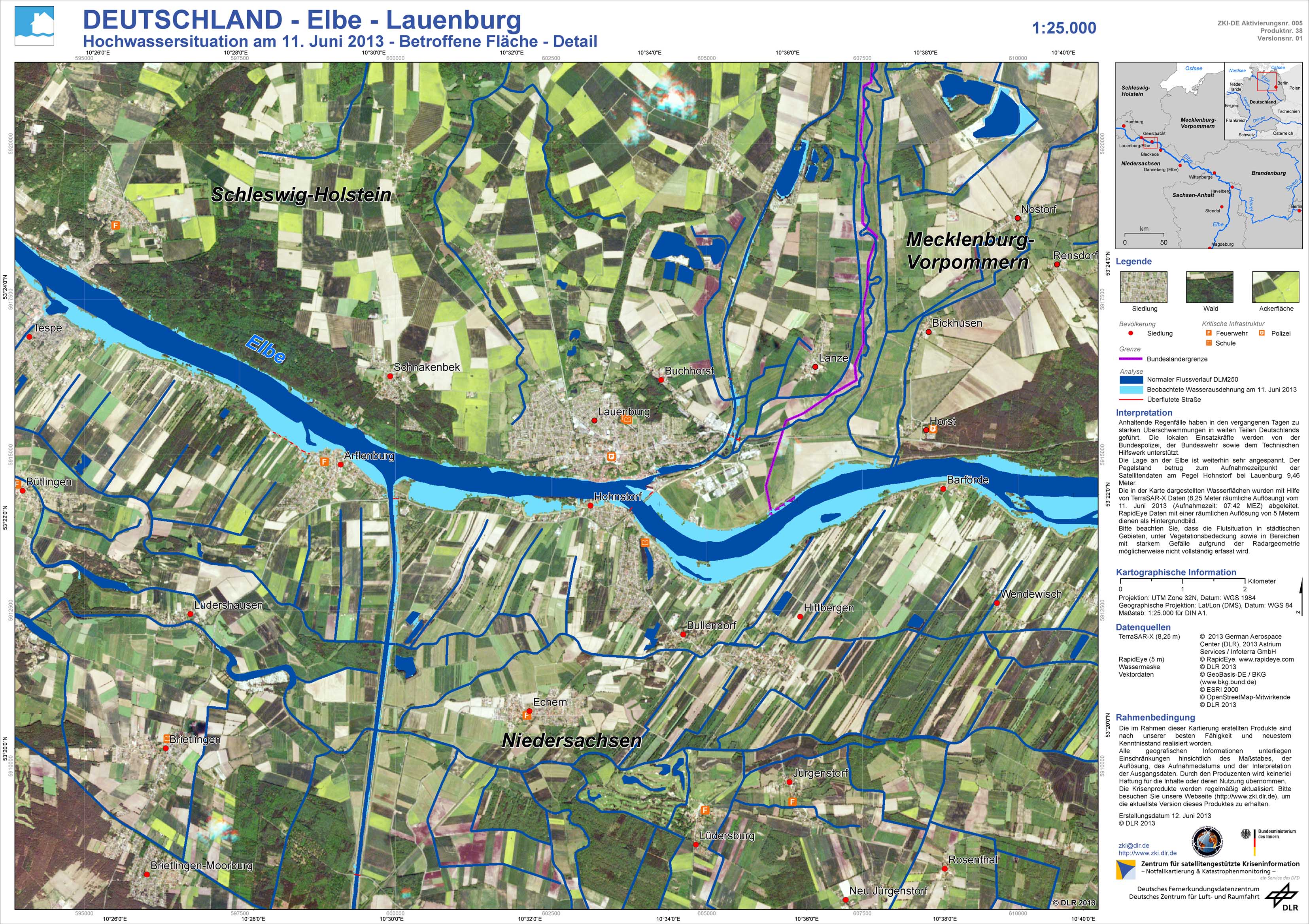
Germany - P38 - Elbe - Lauenburg - Flood situation as of 11. June 2013 - Affected Area - Detail
Creation Date 12. June 2013
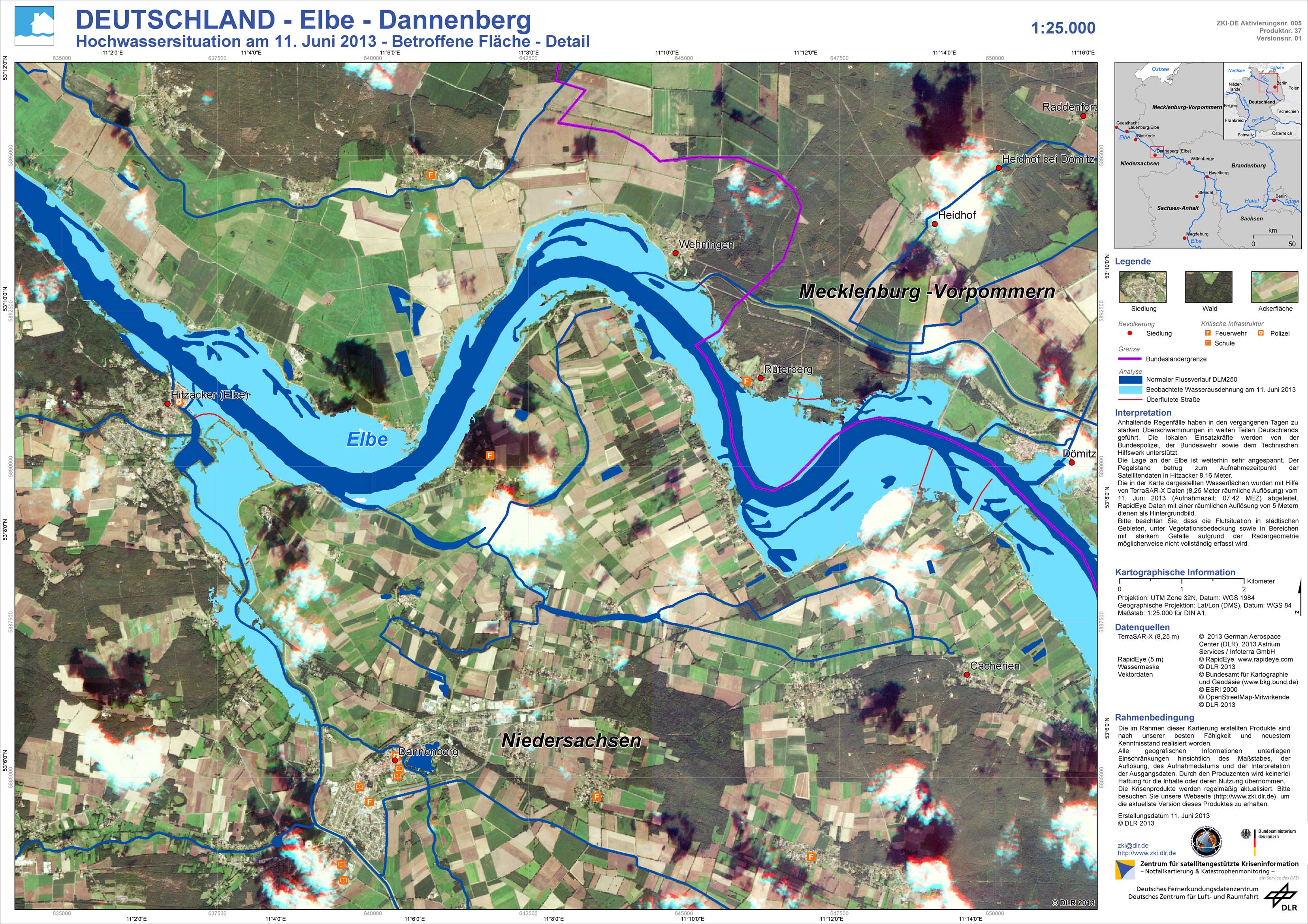
Germany - P37 - Elbe - Dannenberg - Flood situation as of 11. June 2013 - Affected Area - Detail
Creation Date 12. June 2013
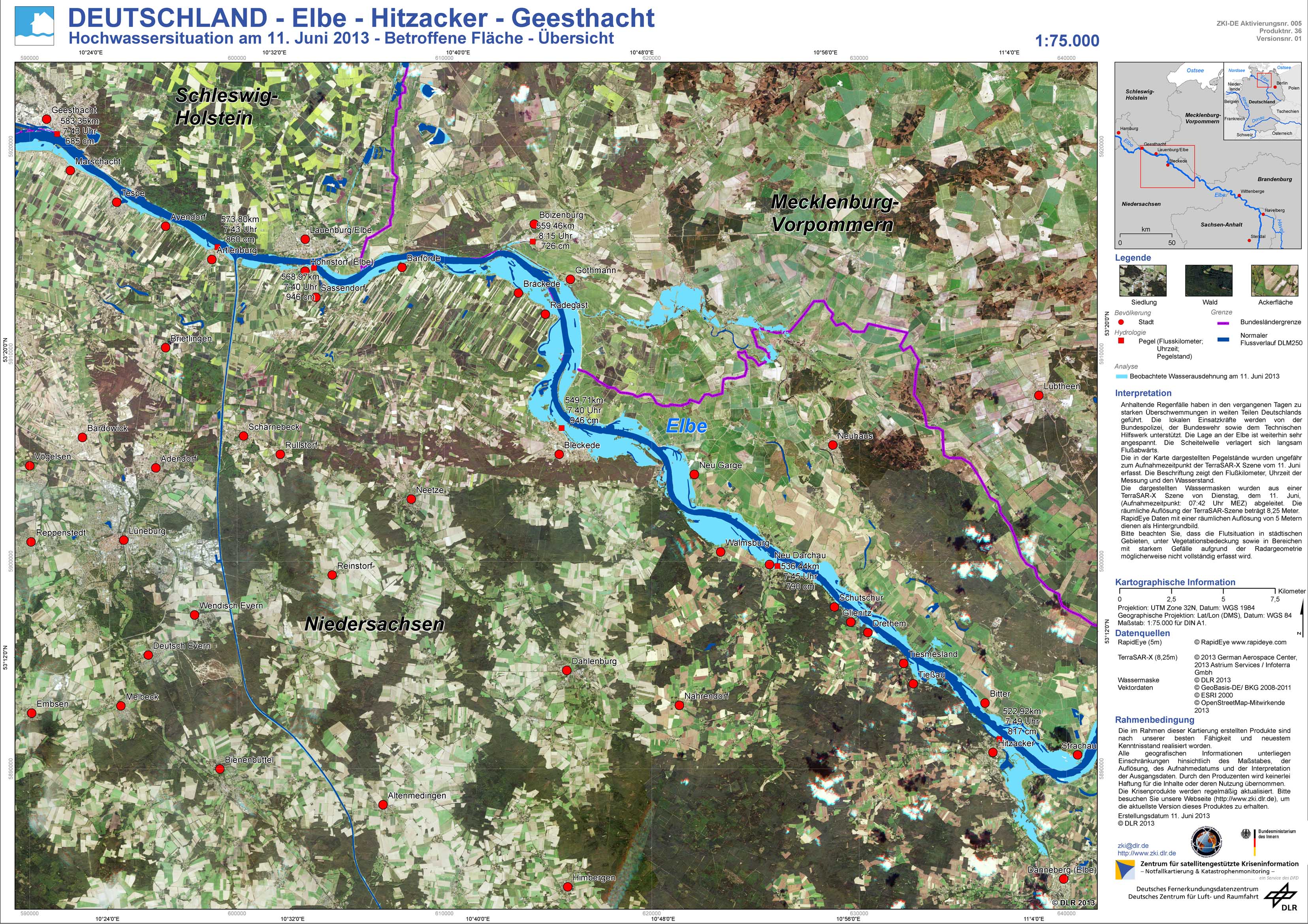
Germany - P36 - Elbe - Hitzacker - Geesthacht - Flood situation as of 11. June 2013 - Affected Area - Overview
Creation Date 11. June 2013
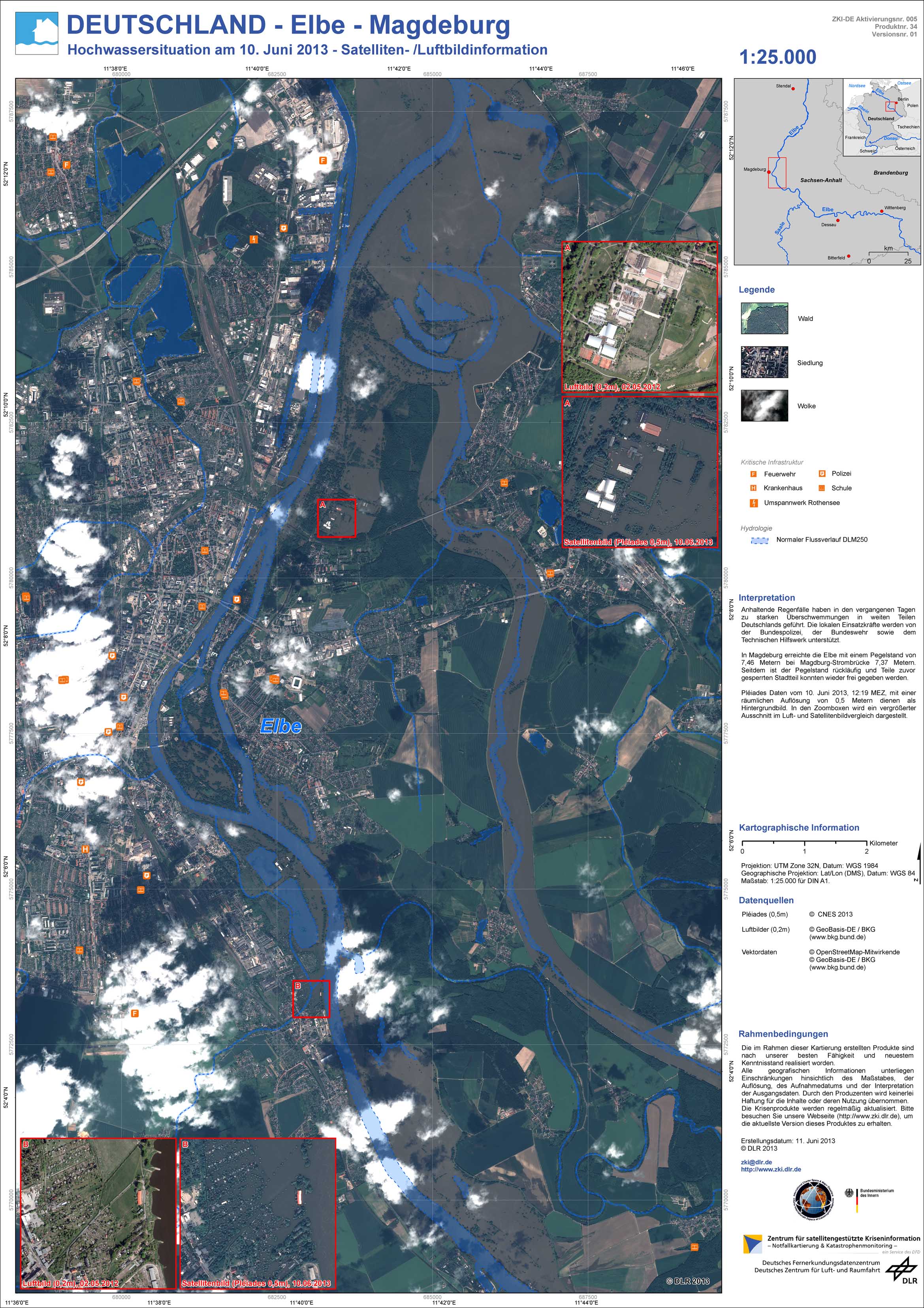
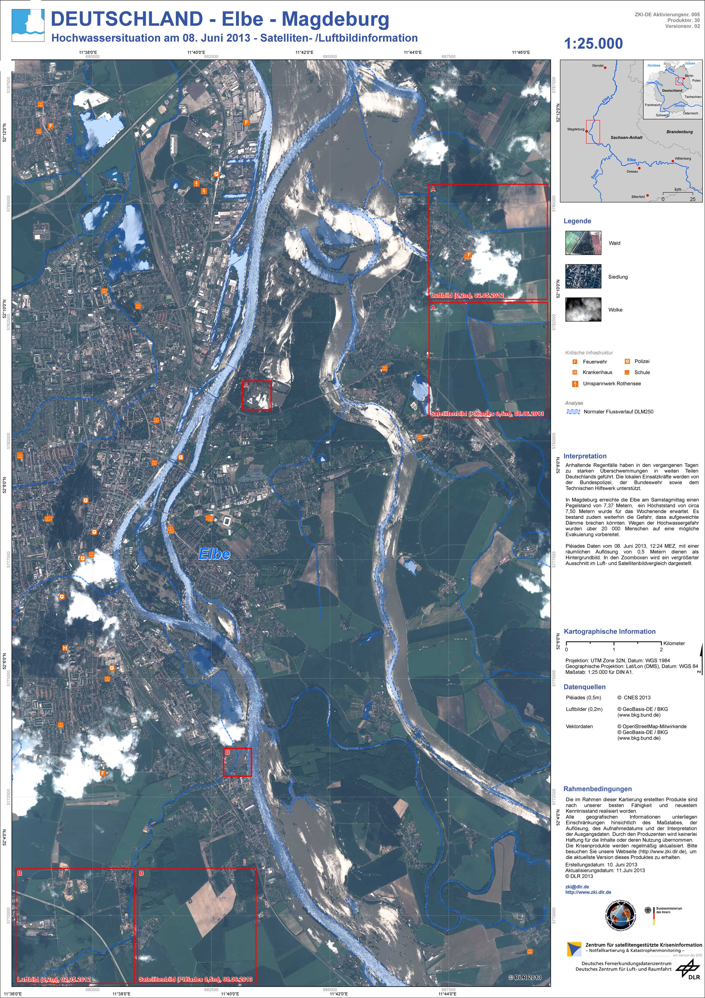
Germany - P34 - Elbe - Magdeburg - Flood situation as of June 10, 2013 - Satellite / Aerial Image Information
Creation Date 11. June 2013
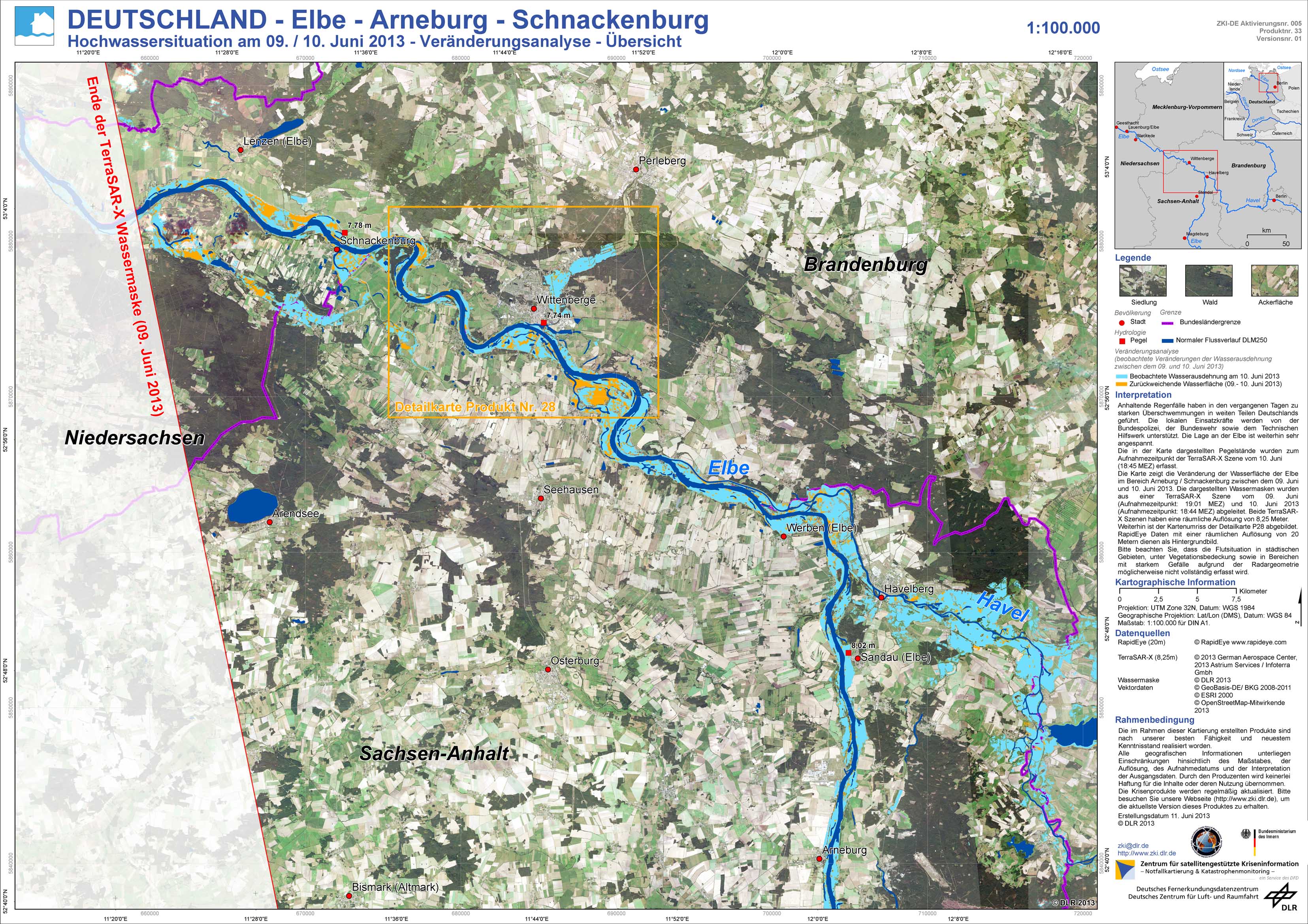
Germany - P33 - Elbe - Arneburg - Schnackenburg - Flood situation as of June 9 / 10, 2013 - Change analysis - Overview
Creation Date 11. June 2013
Germany - P32 - Elbe - Dessau - Arneburg - Flood situation as of June 9 / 10, 2013 - Change analysis - Overview
Creation Date 11. June 2013
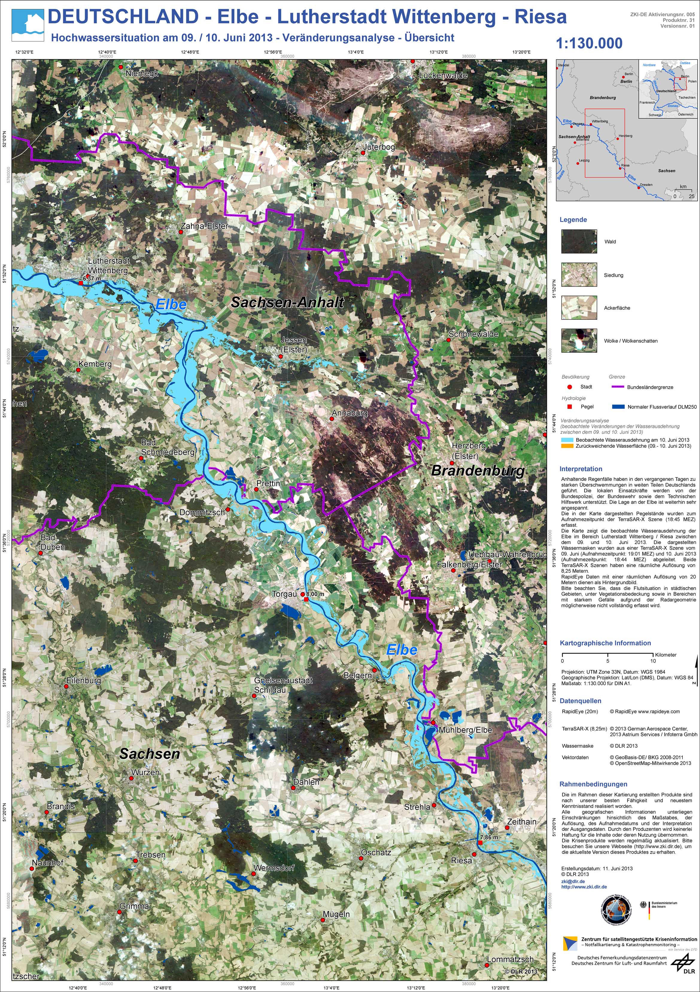
Germany - P31 - Elbe - Lutherstadt Wittenberg - Riesa - Flood situation as of June 9 / 10, 2013 - Change analysis - Overview
Creation Date 11. June 2013
Germany - P30 - Elbe - Magdeburg - Flood situation as of June 8, 2013 - Satellite / Aerial Image Information
Creation Date 11. June 2013

Germany - P29 - Elbe - Lutherstadt Wittenberg - Riesa - Flood situation as of June 9, 2013 - Affected Area - Overview
Creation Date 10. June 2013
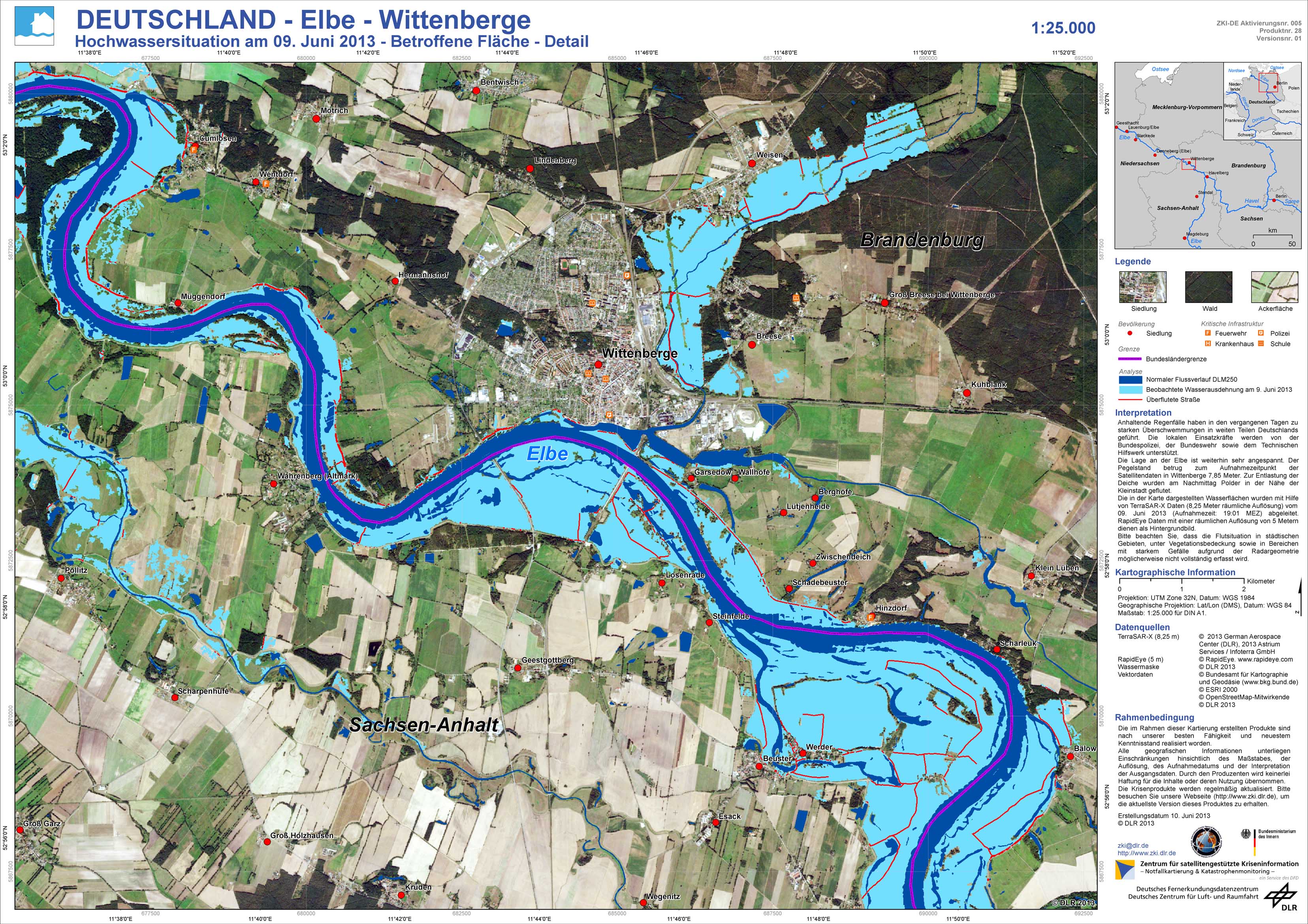
Germany - P28 - Elbe - Wittenberge - Flood situation as of June 9, 2013 - Affected Area - Detail
Creation Date 10. June 2013
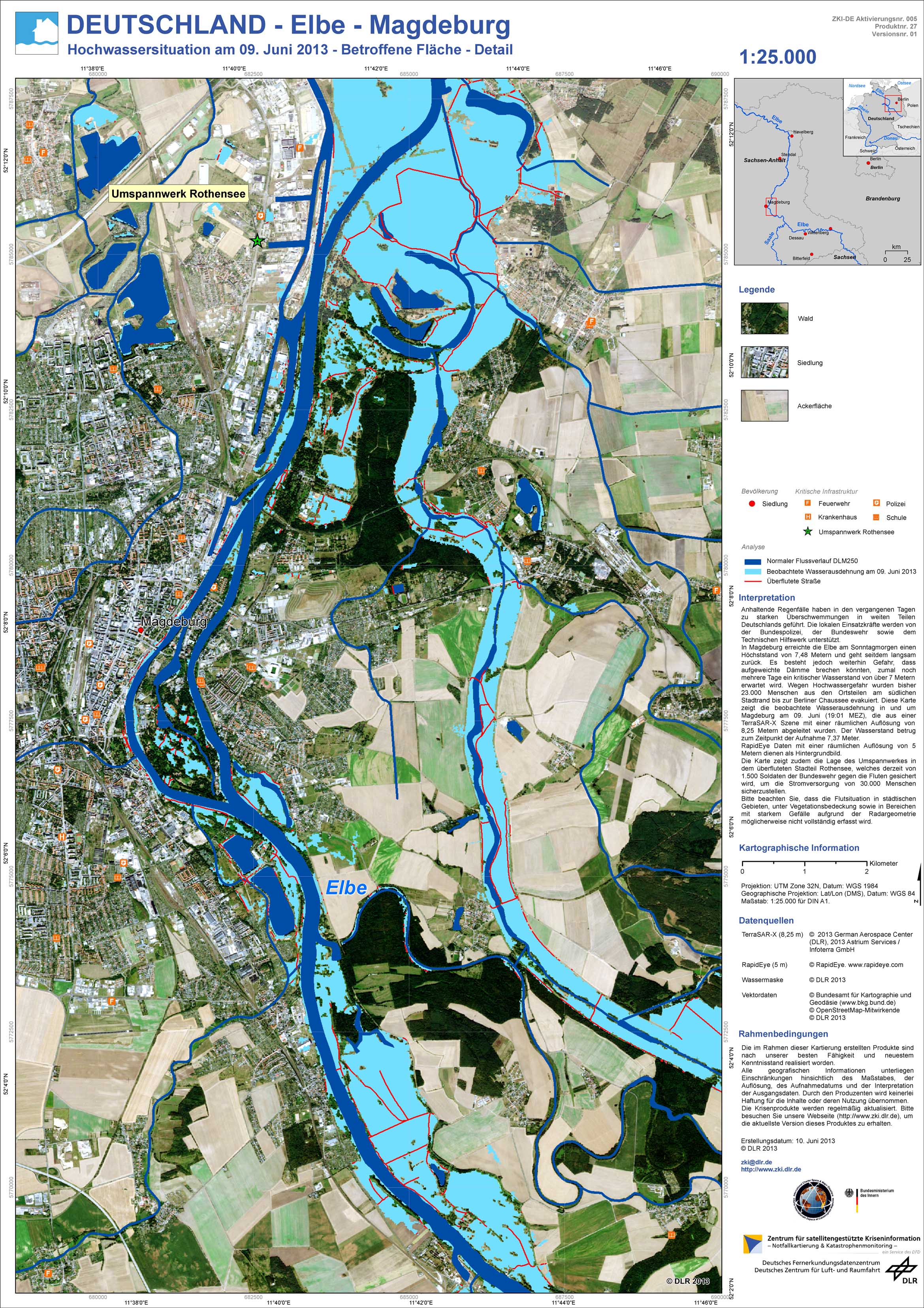
Germany - P27 - Elbe - Magdeburg - Flood situation as of June 9, 2013 - Affected Area - Detail
Creation Date 10. June 2013
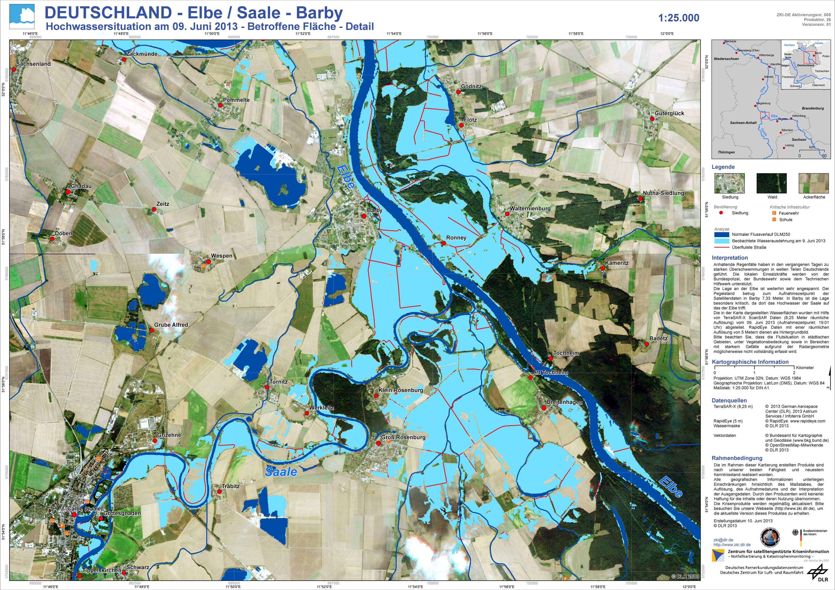
Germany - P26 - Elbe / Saale - Barby - Flood situation as of June 9, 2013 - Affected Area - Detail
Creation Date 10. June 2013
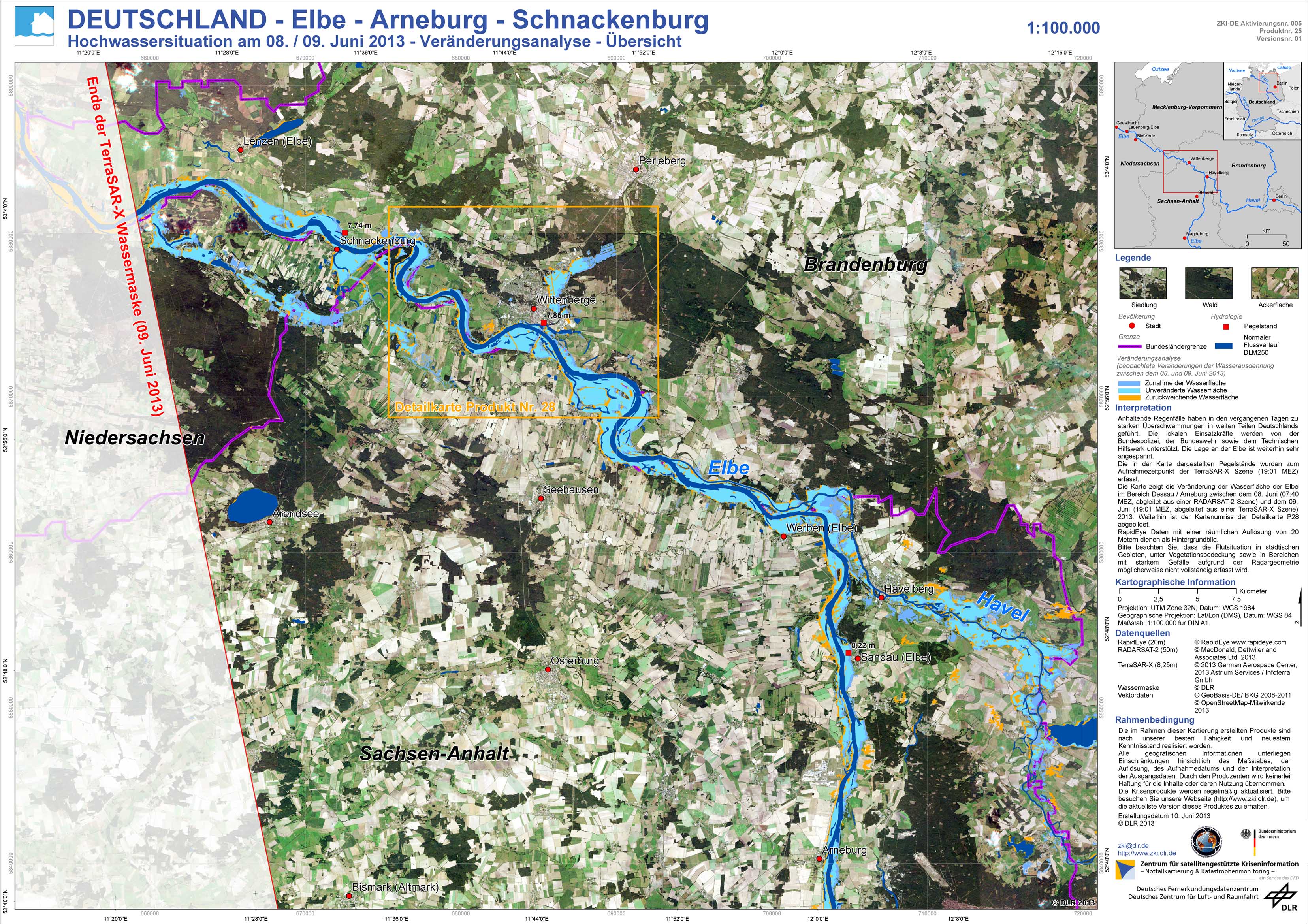
Germany - P25 - Elbe - Arneburg - Schnackenburg - Flood situation as of June 8 / 9, 2013 - Change analysis - Overview
Creation Date 10. June 2013
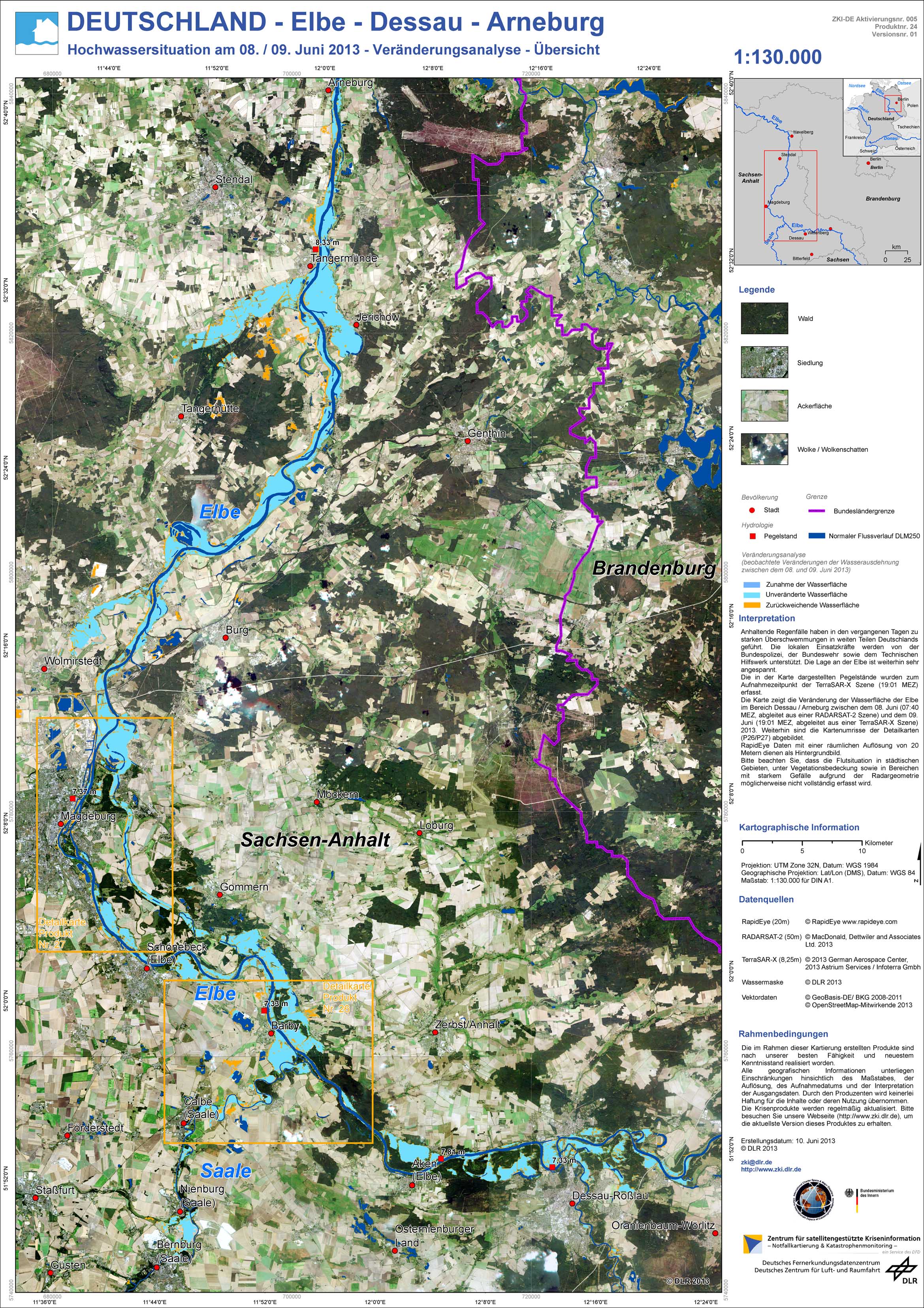
Germany - P24 - Elbe - Dessau - Arneburg - Flood situation as of June 8 / 9, 2013 - Change analysis - Overview
Creation Date 10. June 2013
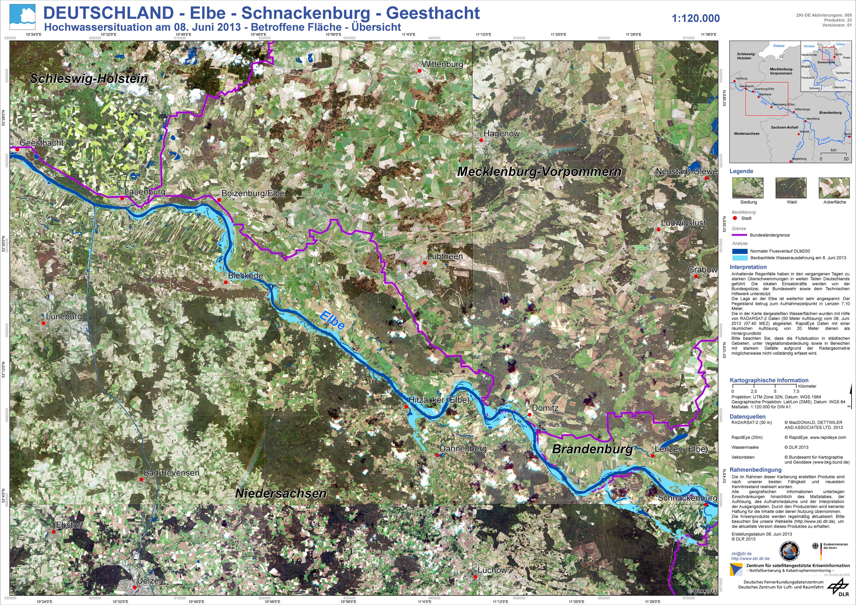
Germany - P23 - Elbe - Schnackenburg - Geesthacht - Flood situation as of June 8, 2013 - Affected Area - Overview
Creation Date 08. June 2013
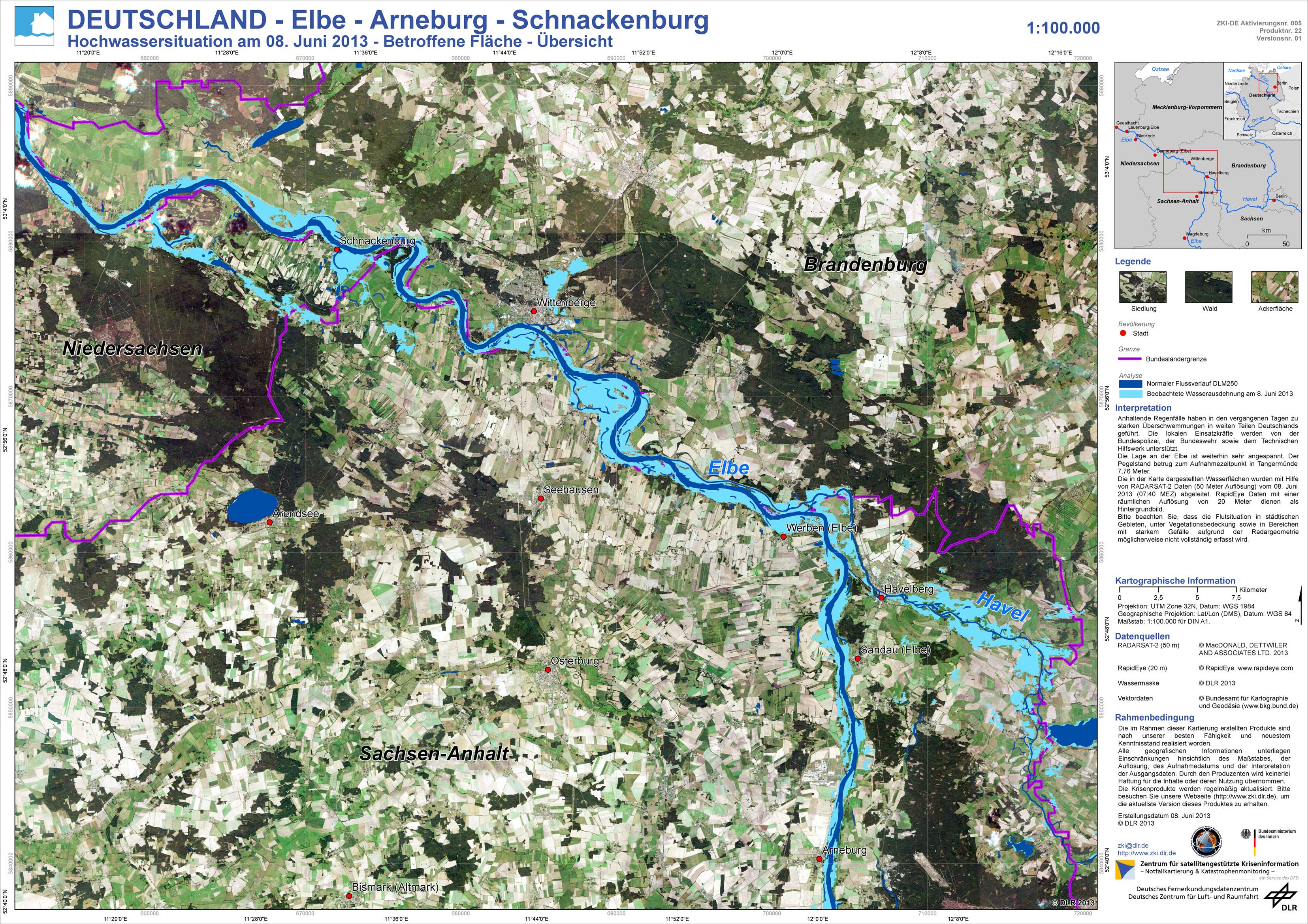
Germany - P22 - Elbe - Arneburg - Schnackenburg - Flood situation as of June 8, 2013 - Affected Area - Overview
Creation Date 08. June 2013
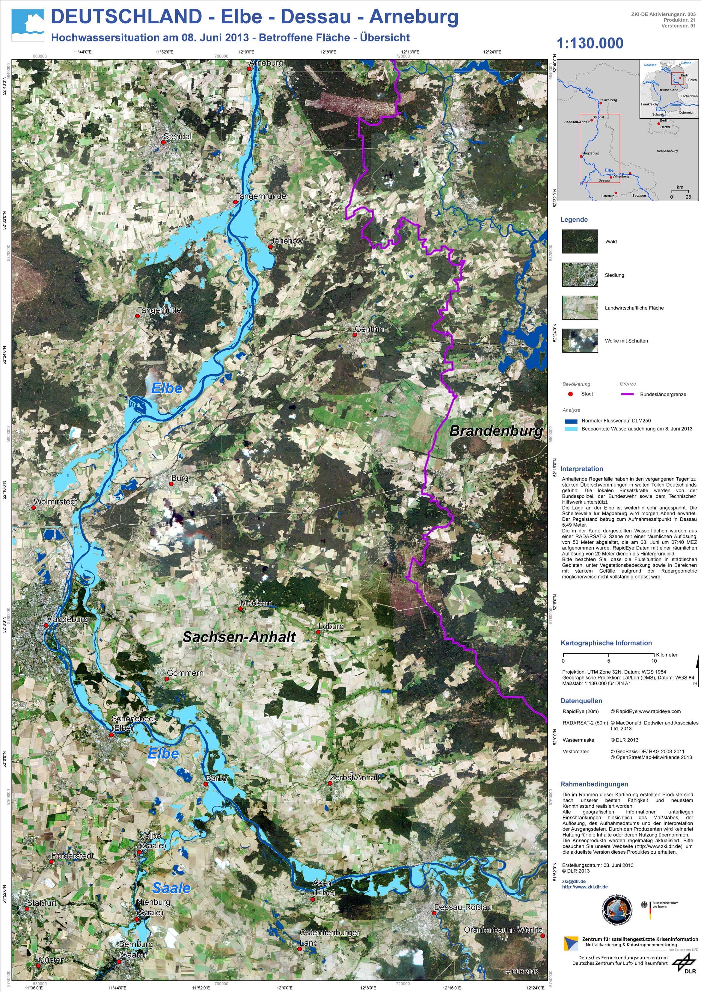
Germany - P21 - Elbe - Dessau - Arneburg - Flood situation as of June 8, 2013 - Affected Area - Overview
Creation Date 08. June 2013
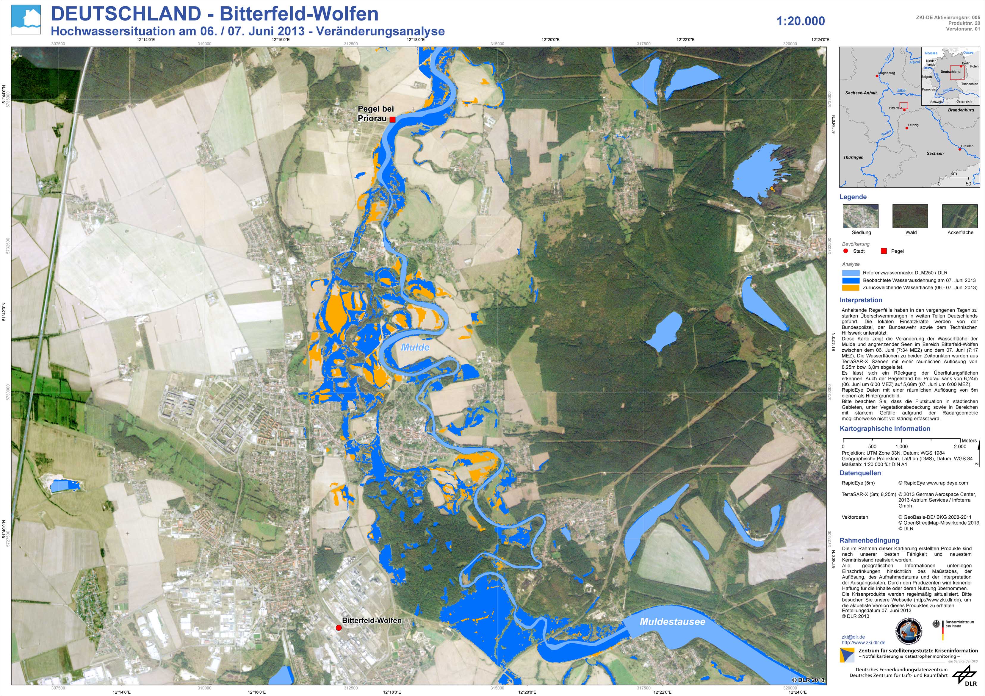
Germany - P20 - Bitterfeld-Wolfen - Flood situation as of June 6 / 7, 2013 - Change analysis
Creation Date 07. June 2013
Germany - P19 - Bitterfeld / Dessau - Flood situation as of June 7, 2013 - Affected Area - Overview
Creation Date 07. June 2013
Germany - P18 - Deggendorf - Flood situation as of June 7, 2013 - Affected Area - Overview
Creation Date 07. June 2013
Germany - P17 - Elbe / Saale / Mulde - Geographic Reference Information - Overview
Creation Date 07. June 2013
Germany - P16 - Deggendorf / Straubing - Flood situation as of 5. June 2013 - Affected Area - Overview
Creation Date 07. June 2013
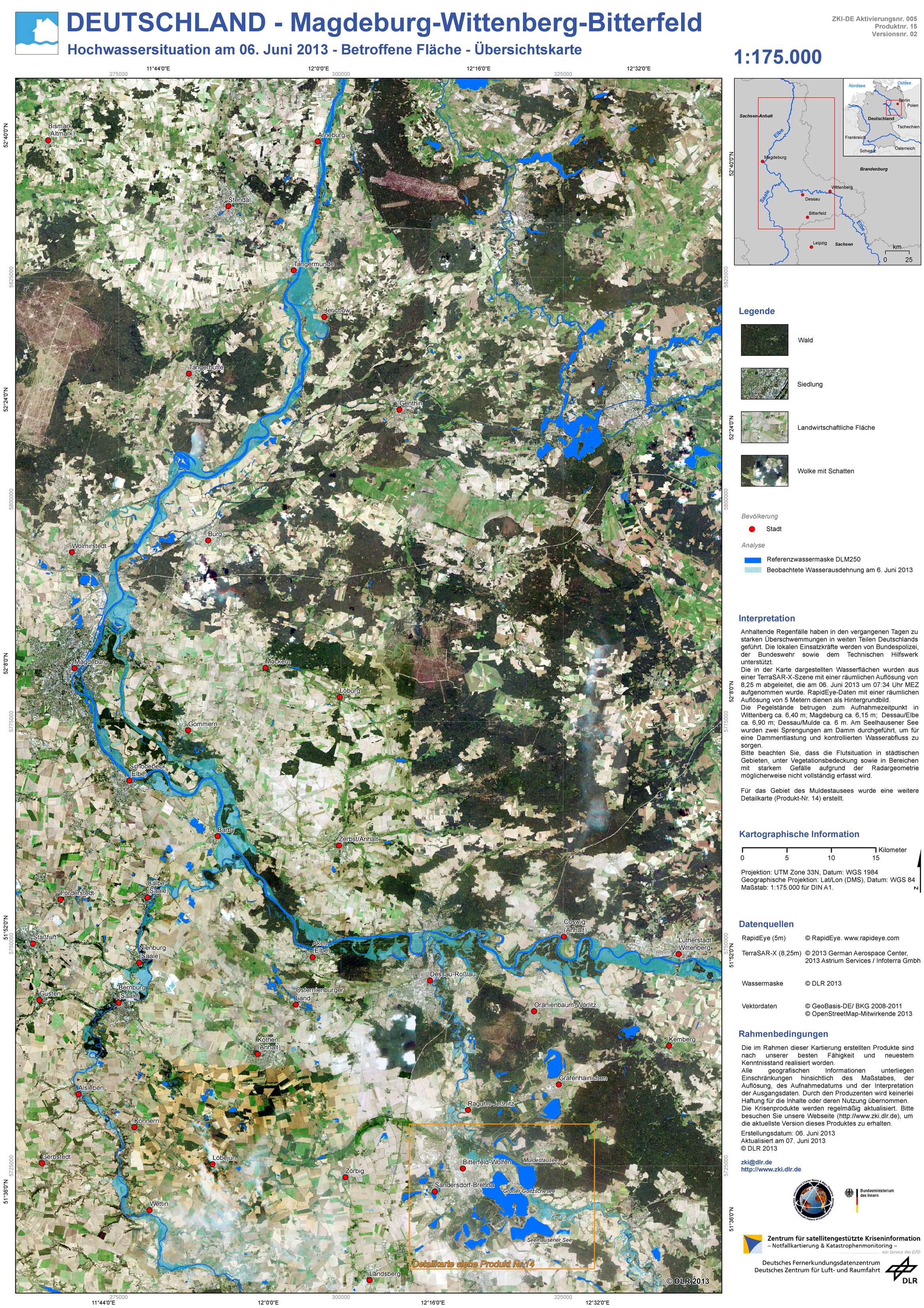
Germany - P15 - Magdeburg-Wittenberg-Bitterfeld - Flood situation as of June 6, 2013 - Affected Area - Overview
Creation Date 07. June 2013
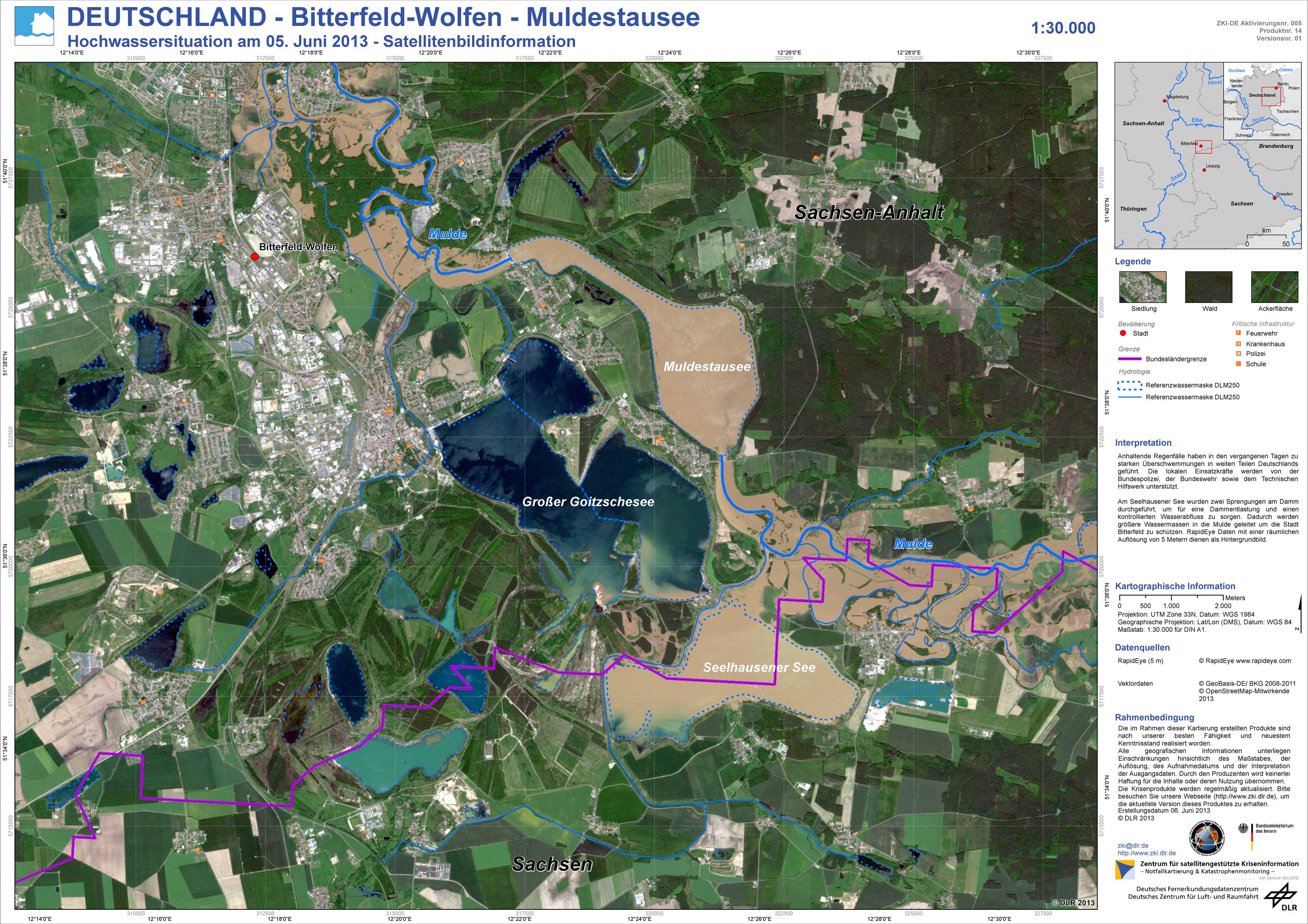
Germany - P14 - Bitterfeld-Wolfen - Muldestausee - Flood situation as of June 5, 2013 - Satellite Image Information
Creation Date 06. June 2013
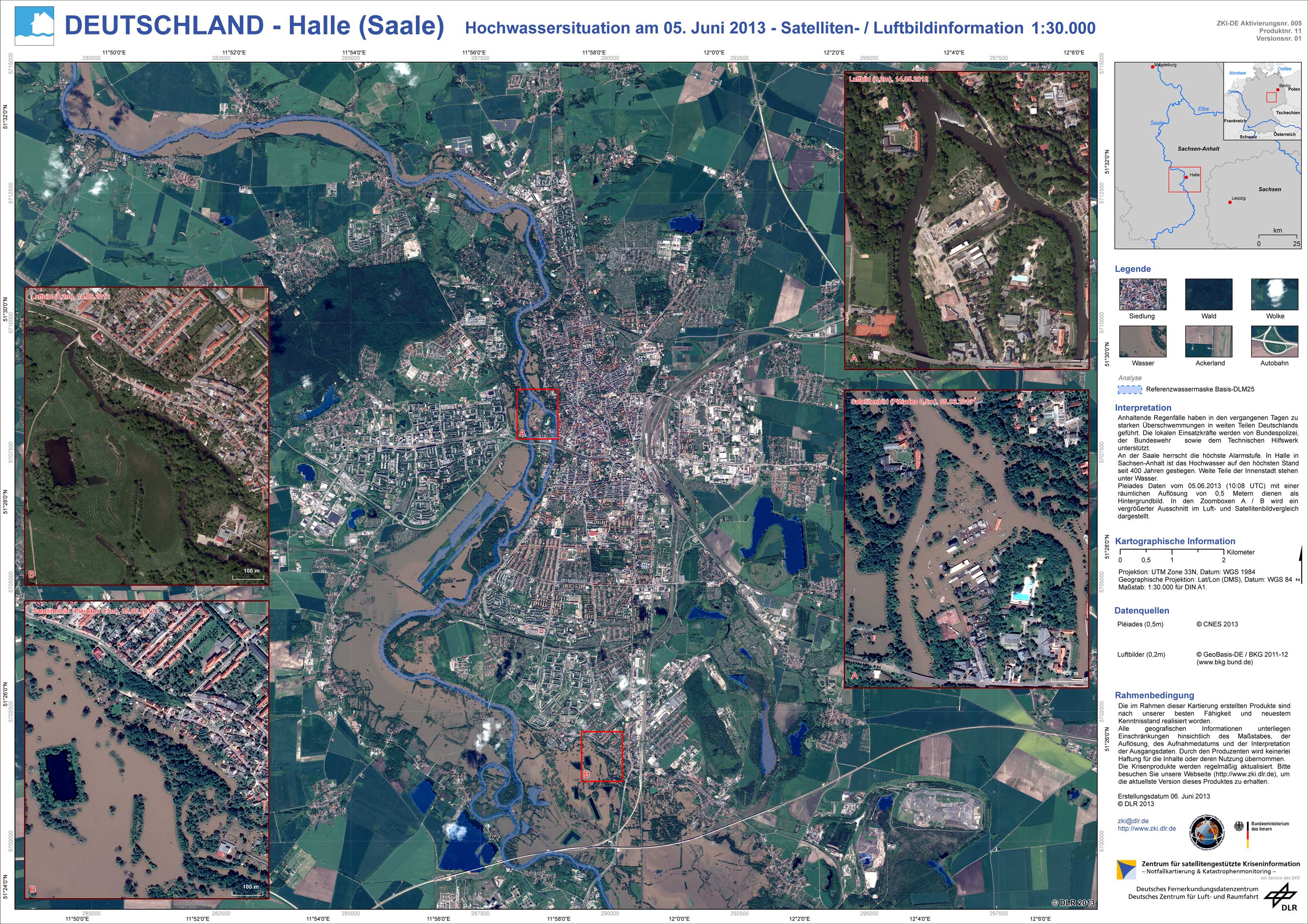
Germany - P11 - Halle (Saale) - Flood situation as of June 5, 2013 - Satellite / Aerial Image Information
Creation Date 06. June 2013
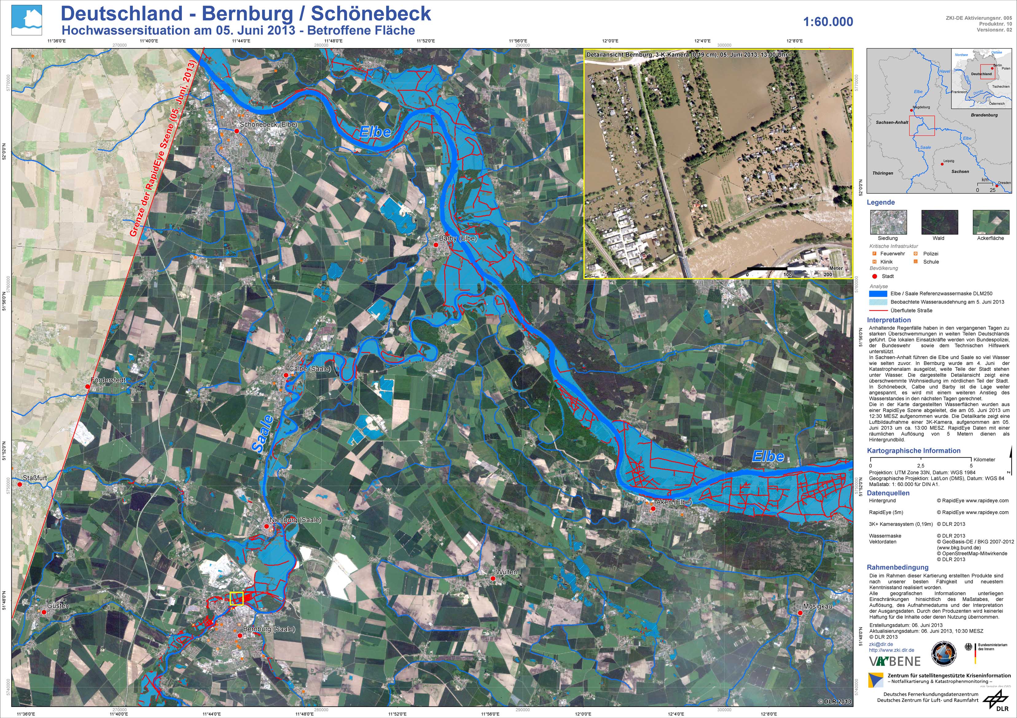
Germany - P10 - Bernburg / Schönebeck - Flood situation as of June 5, 2013 - Affected Area
Creation Date 06. June 2013
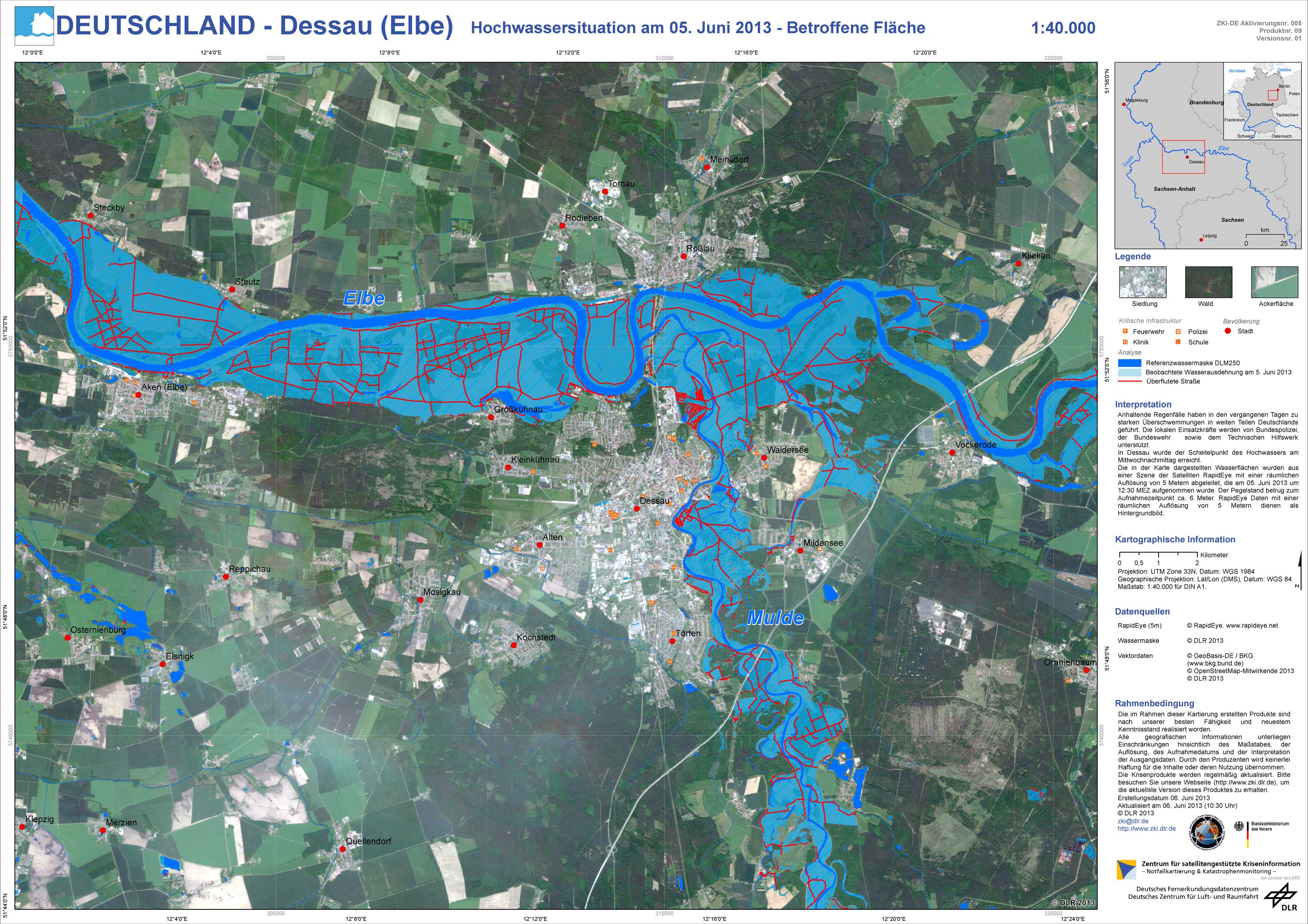
Germany - P09 - Dessau (Elbe) - Flood situation as of June 5, 2013 - Affected Area
Creation Date 06. June 2013
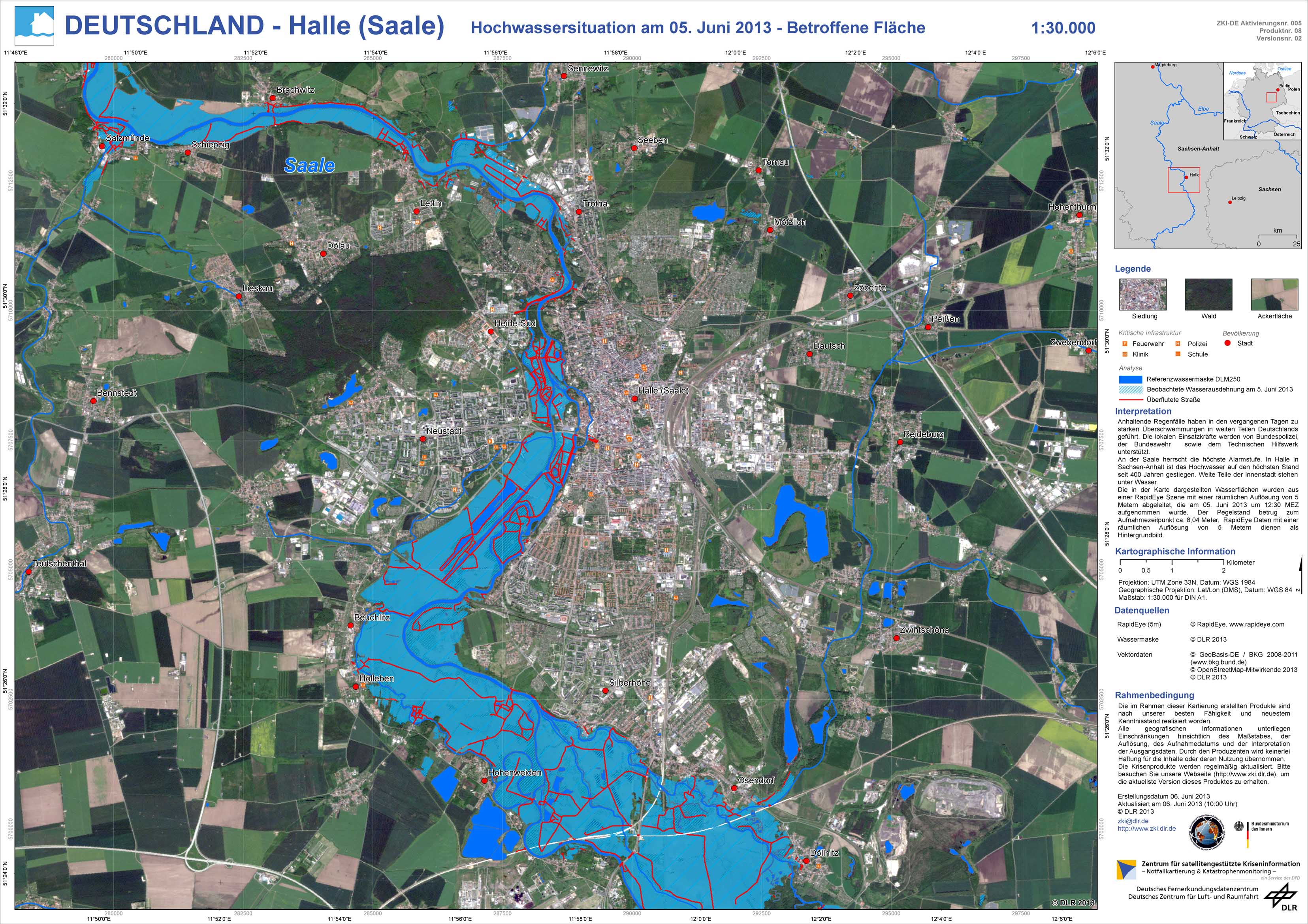
Germany - P08 - Halle (Saale) - Flood situation as of June 5, 2013 - Affected Area
Creation Date 06. June 2013
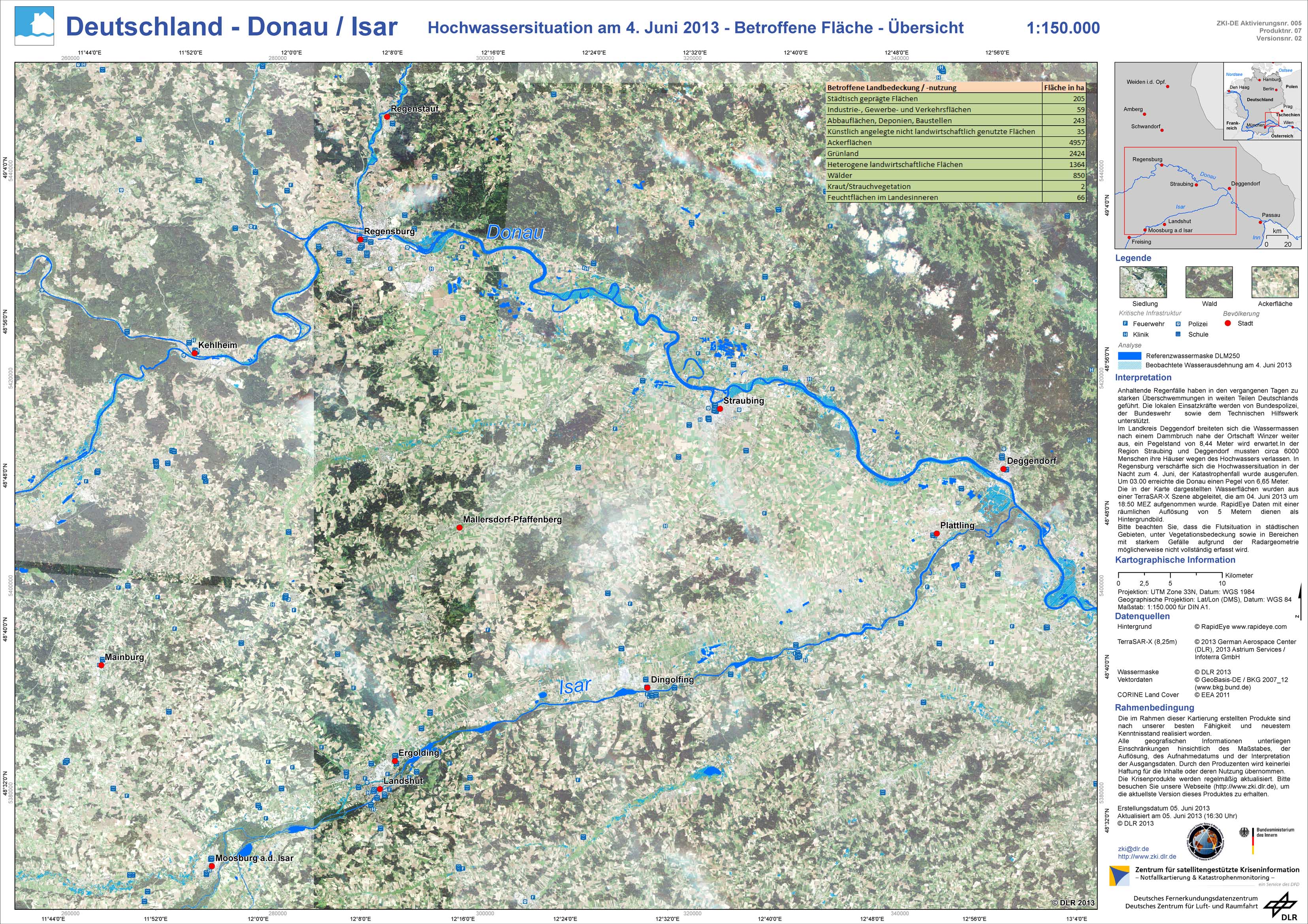
Germany - P07 - Donau / Isar - Flood situation as of June 4, 2013 - Affected Area - Overview
Creation Date 06. June 2013
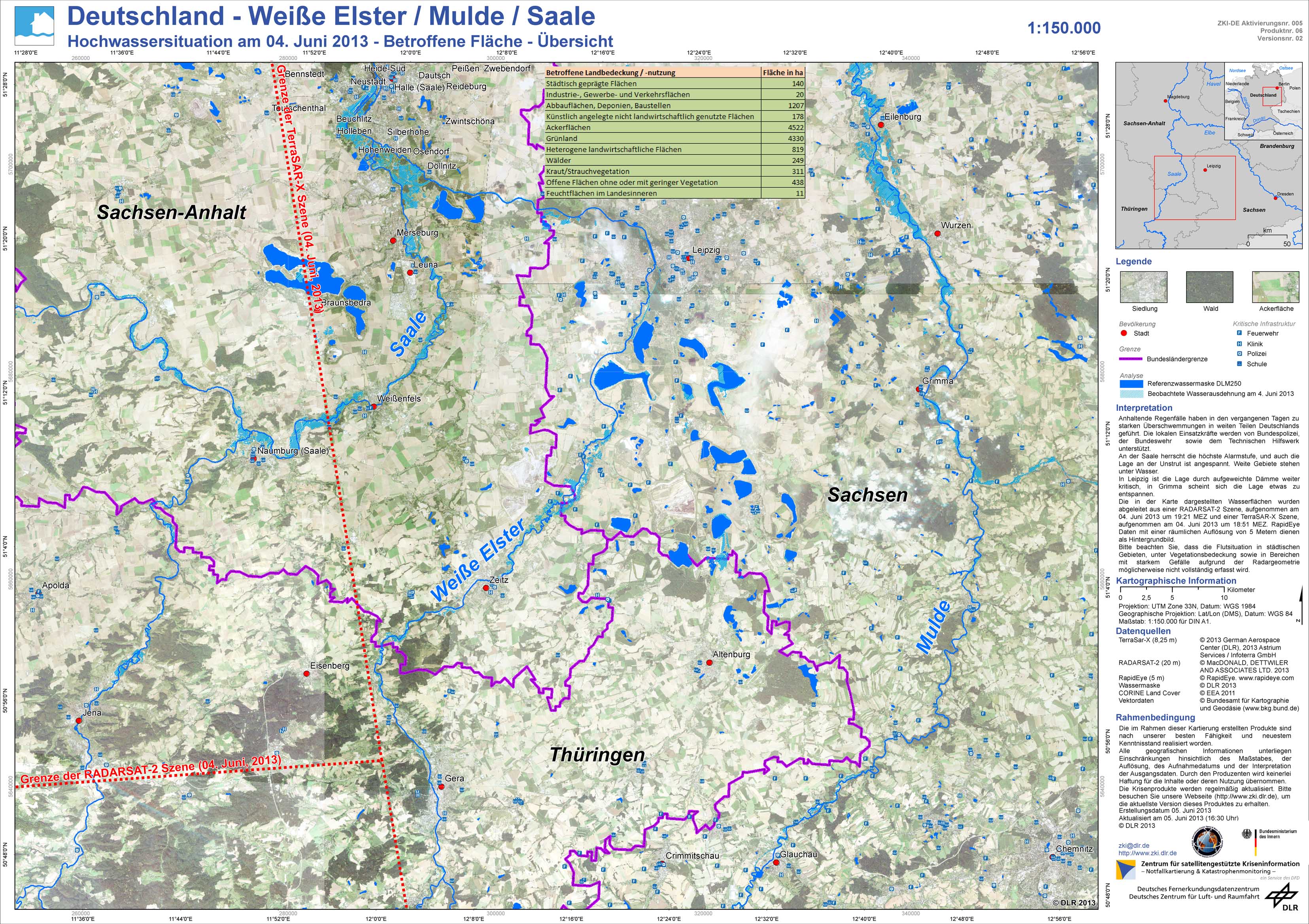
Germany - P06 - Weisse Elster / Mulde / Saale - Flood situation as of June 4, 2013 - Affected Area - Overview
Creation Date 06. June 2013
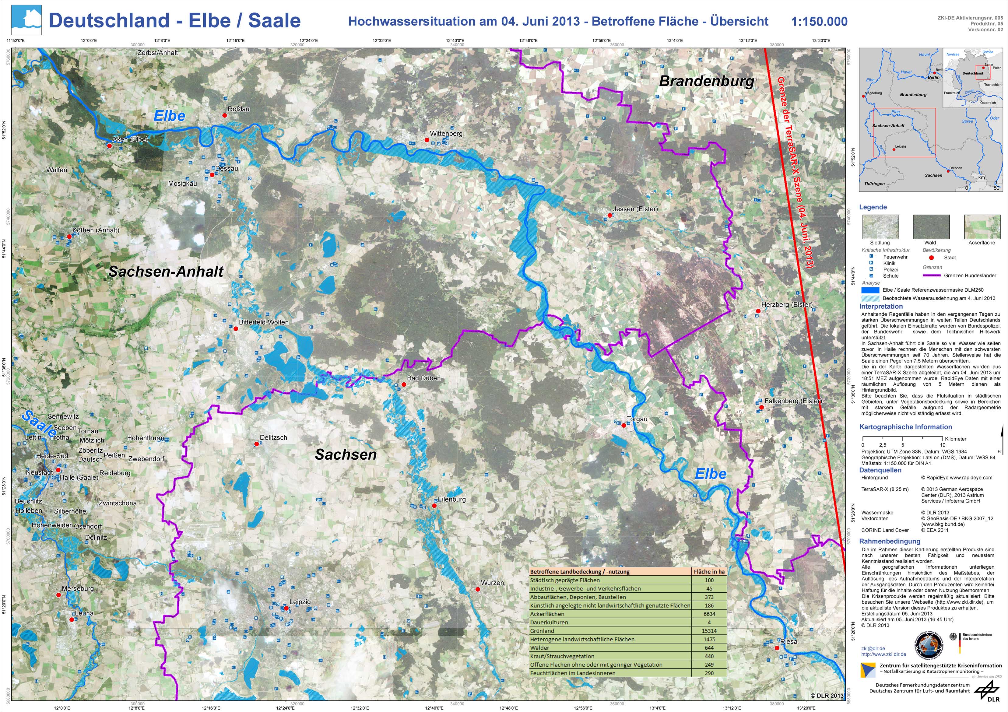
Germany - P05 - Elbe / Saale - Flood situation as of June 4, 2013 - Affected Area - Overview
Creation Date 06. June 2013
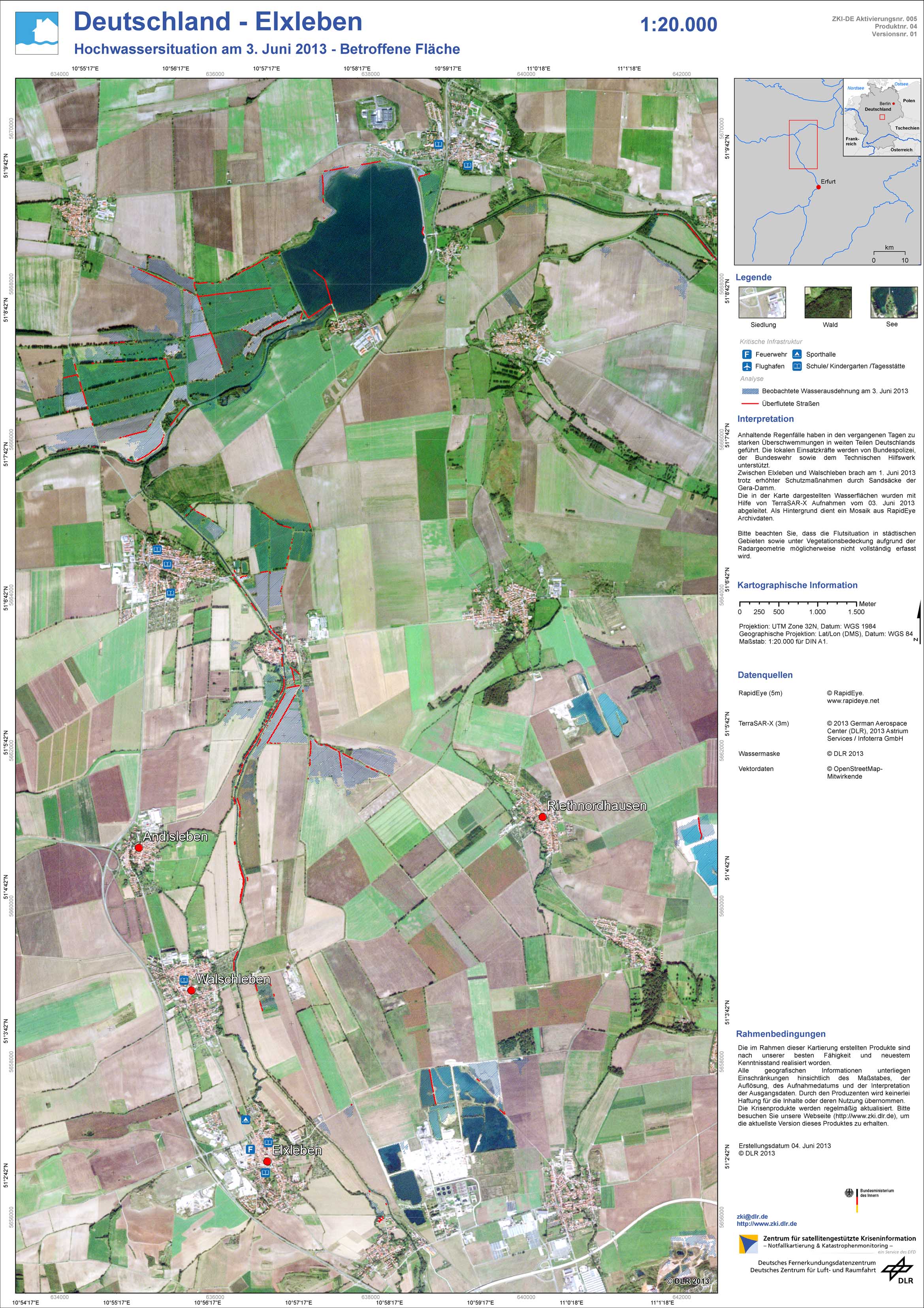
Germany - P04 - Elxleben - Flood situation as of June 3, 2013 - Affected Area
Creation Date 04. June 2013
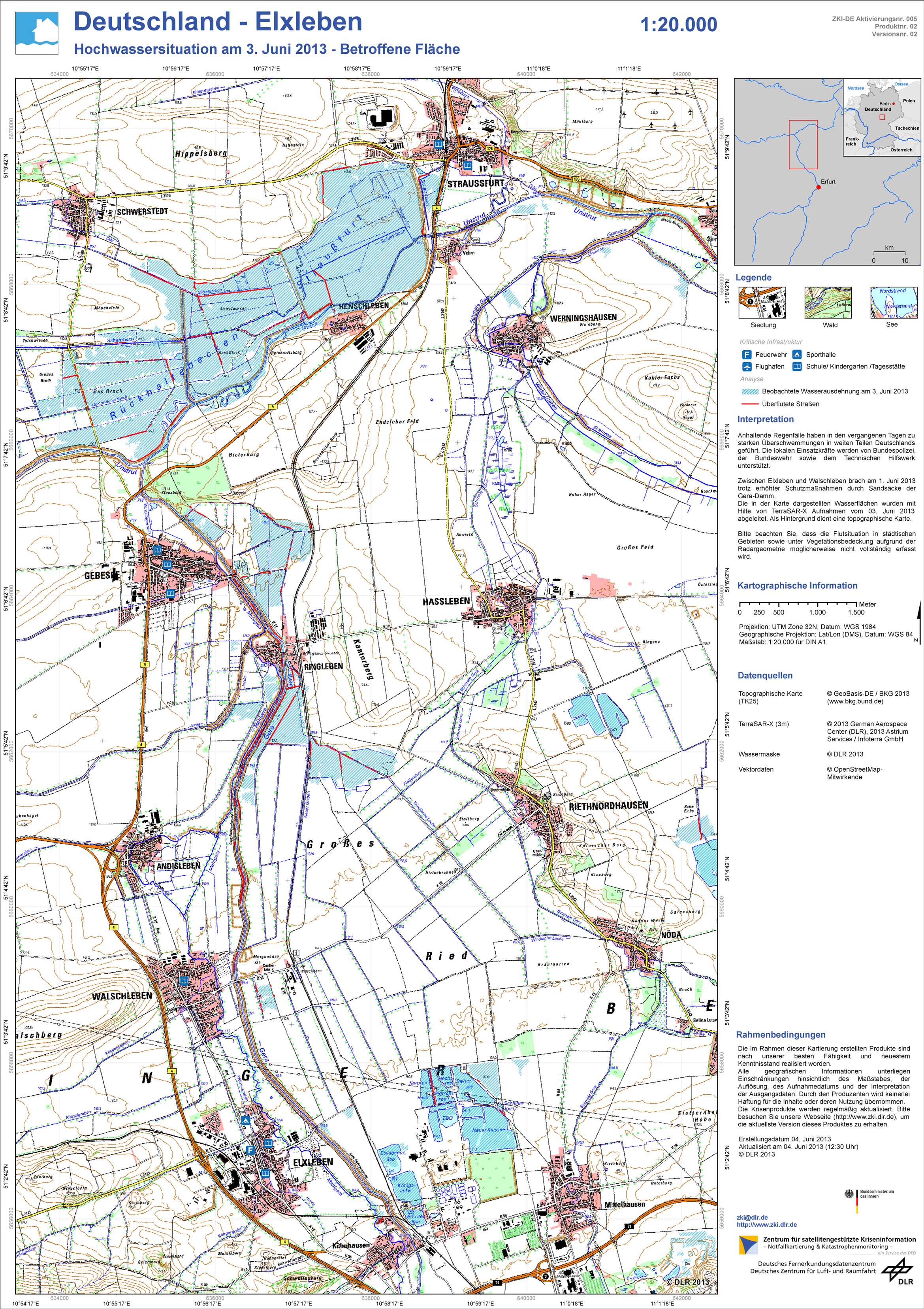
Germany - P02 - Elxleben - Flood situation as of June 3, 2013 - Affected Area
Creation Date 04. June 2013