
Floods in Germany
undefined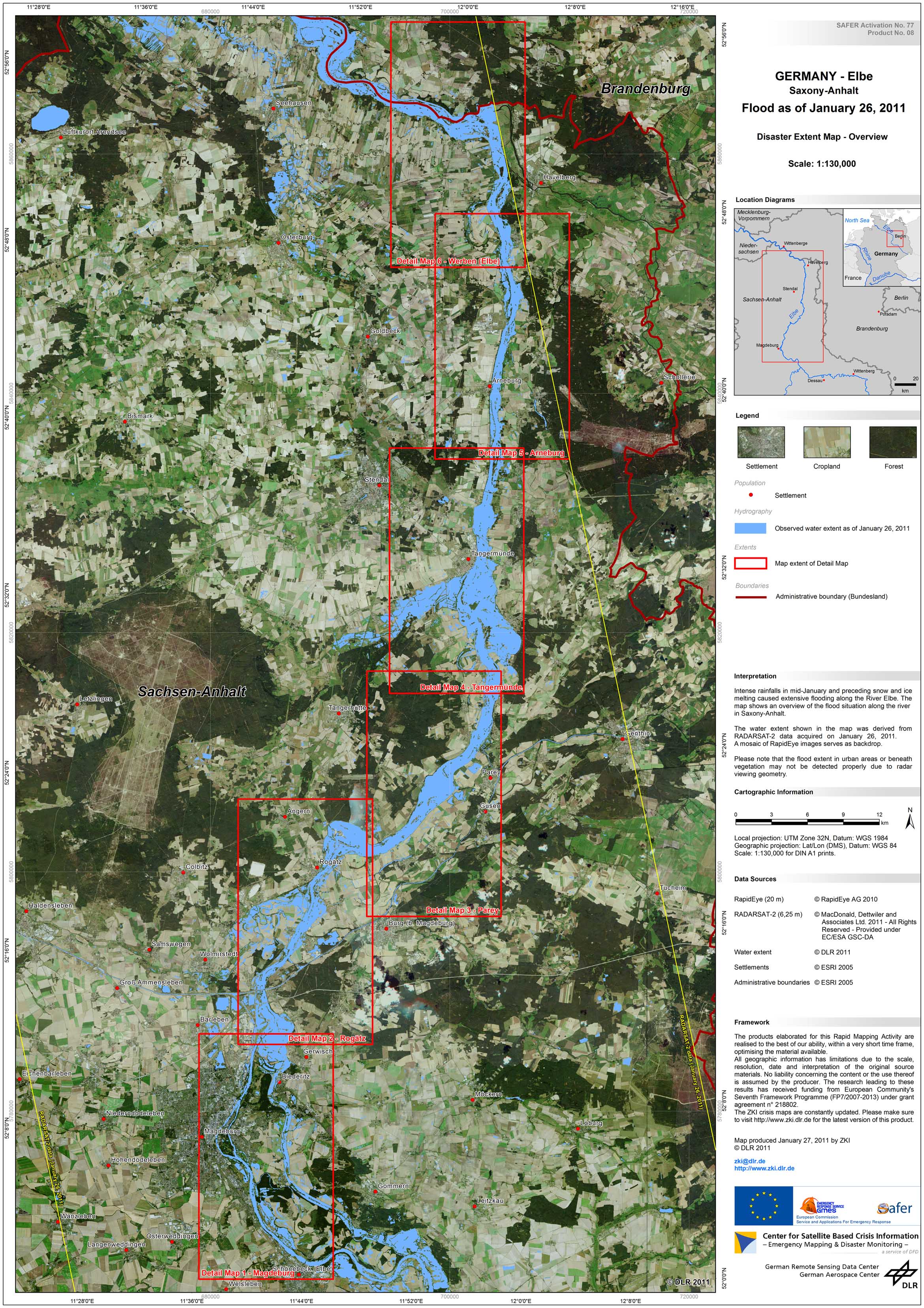
Germany - Elbe - P21 - Disaster Extent Map - Overview - Saxony-Anhalt
Creation Date 27. January 2011
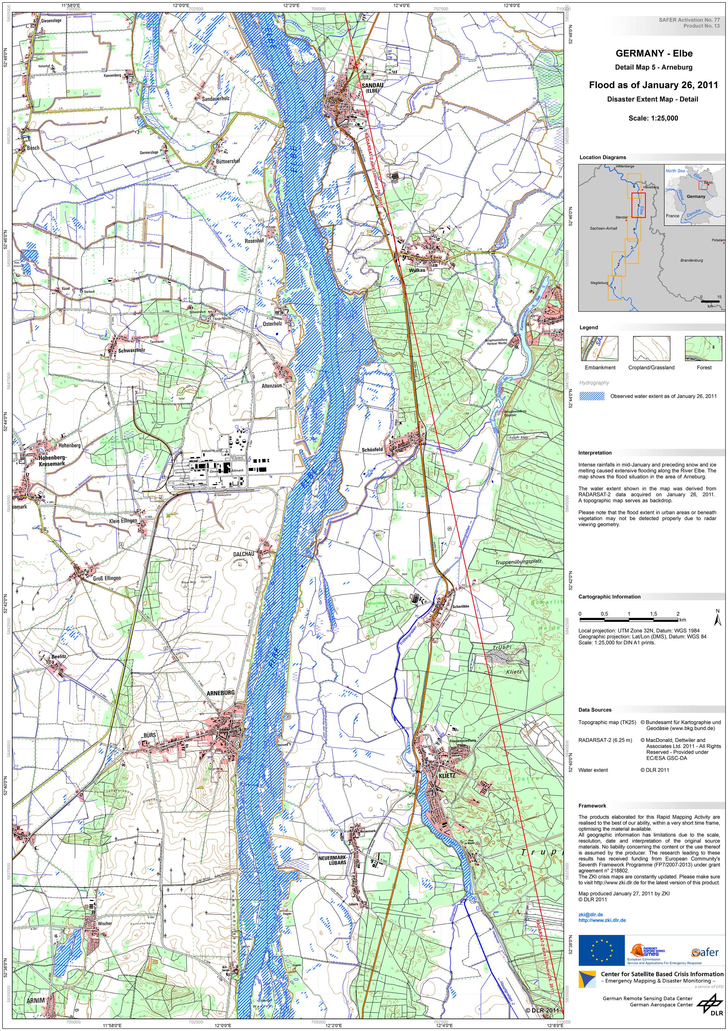
Germany - Elbe - P26 - Disaster Extent Map - Detail 5 - Arneburg
Creation Date 27. January 2011
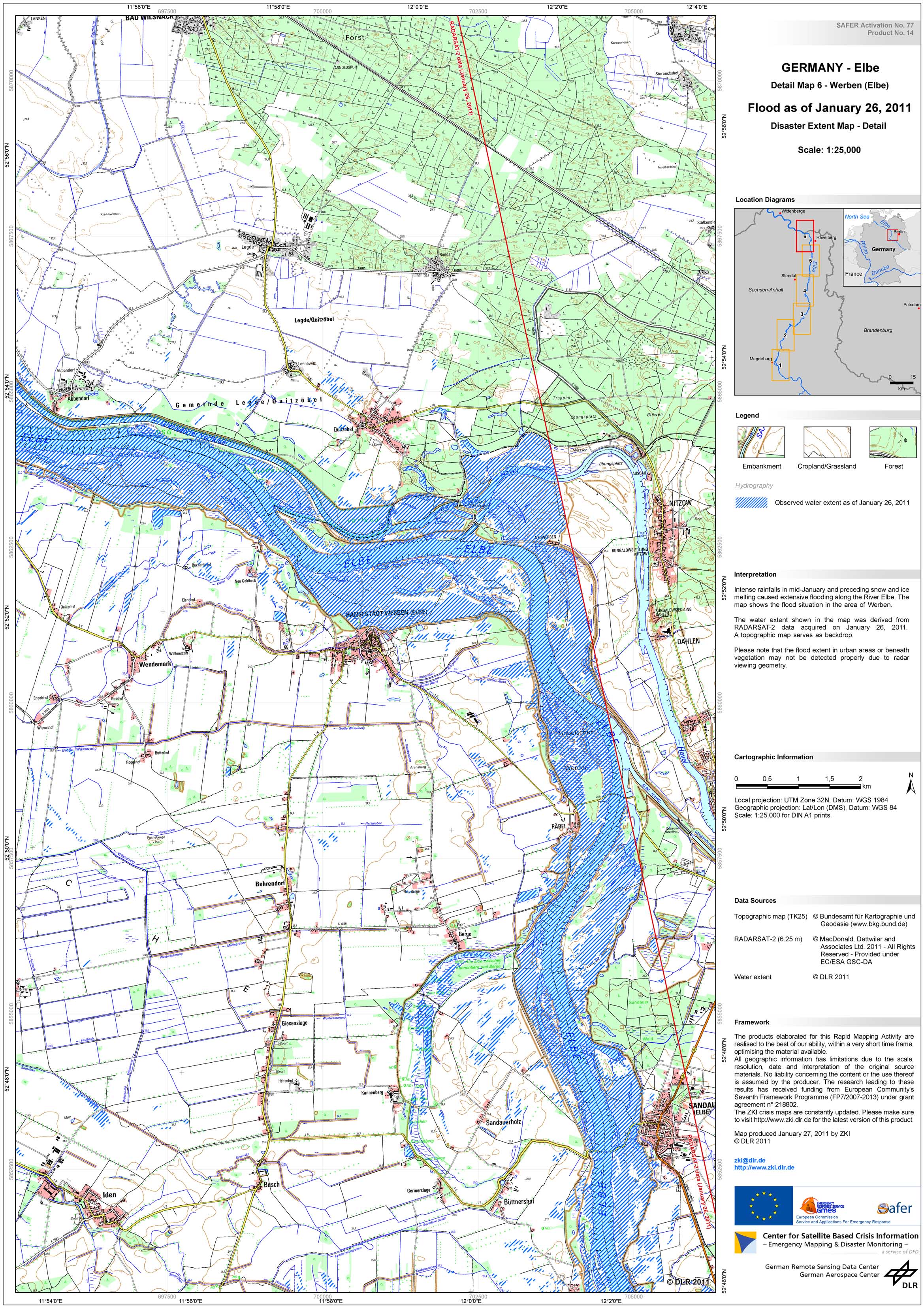
Germany - Elbe - P27 - Disaster Extent Map - Detail 6 - Werben
Creation Date 27. January 2011

Germany - Elbe - P29 - Disaster Extent Map - Detail 2 - Lauenburg
Creation Date 27. January 2011
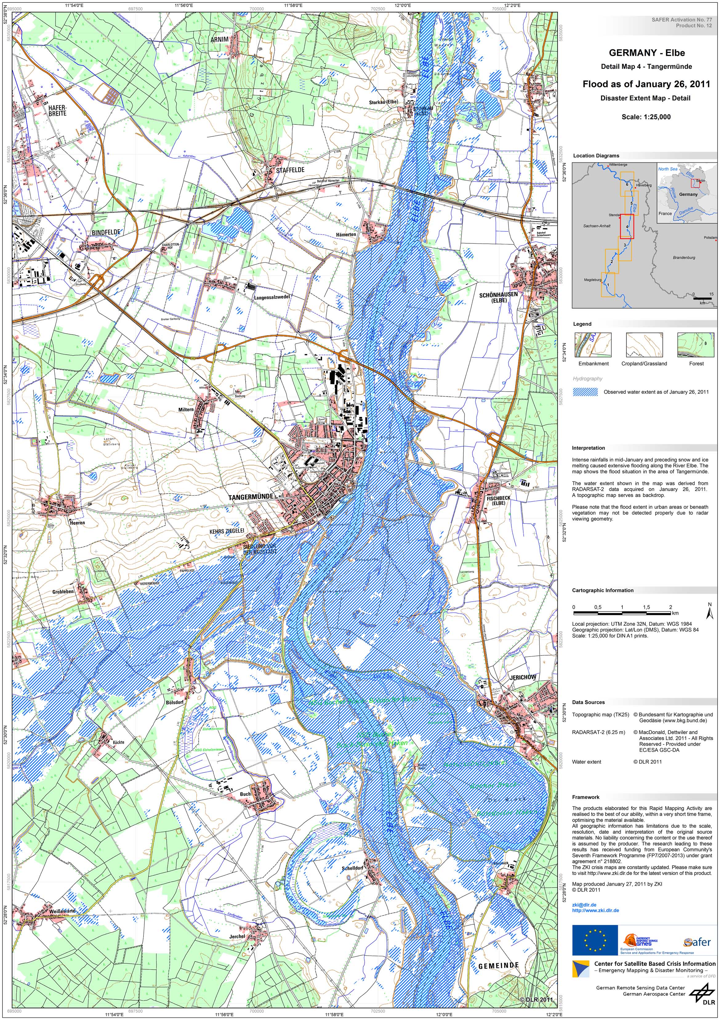
Germany - Elbe - P25 - Disaster Extent Map - Detail 4 - Tangermuende
Creation Date 27. January 2011
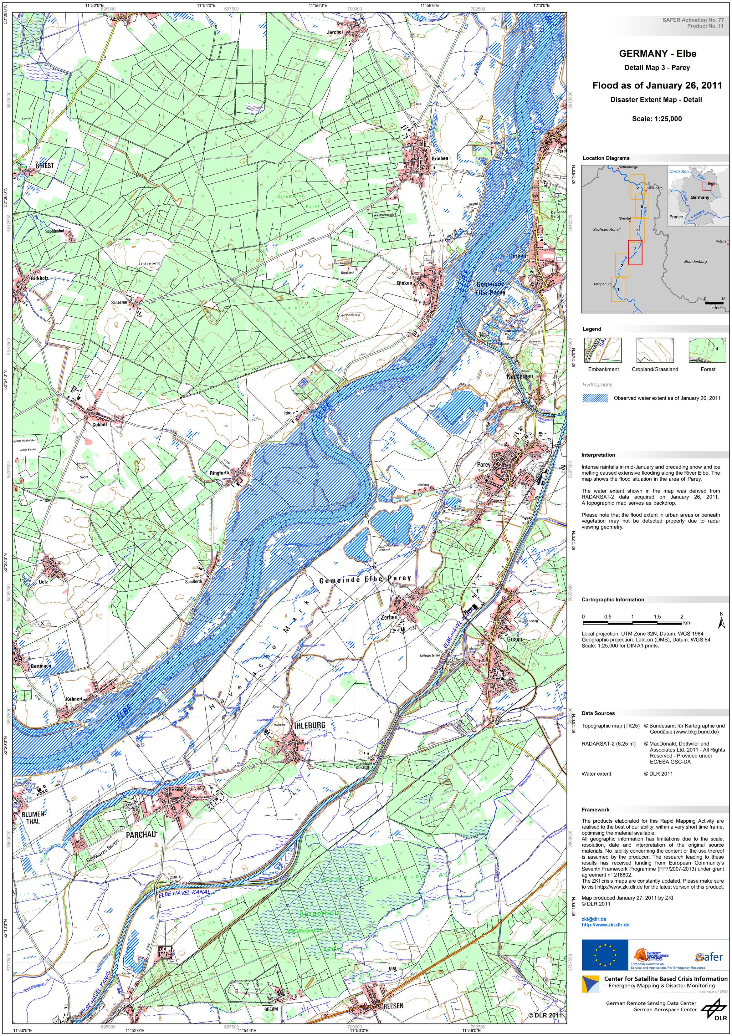
Germany - Elbe - P24 - Disaster Extent Map - Detail 3 - Parey
Creation Date 27. January 2011
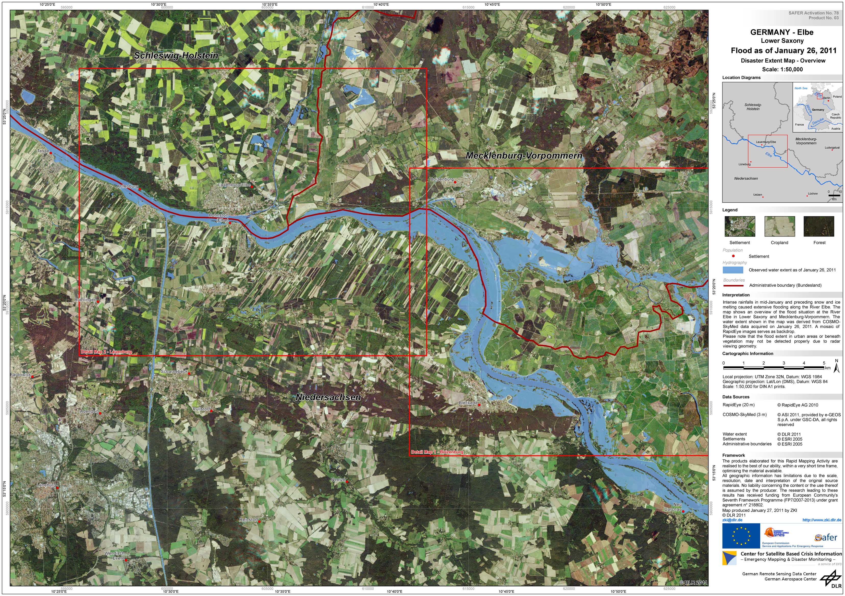
Germany - Elbe - P28 - Disaster Extent Map - Overview - Lower Saxony
Creation Date 27. January 2011
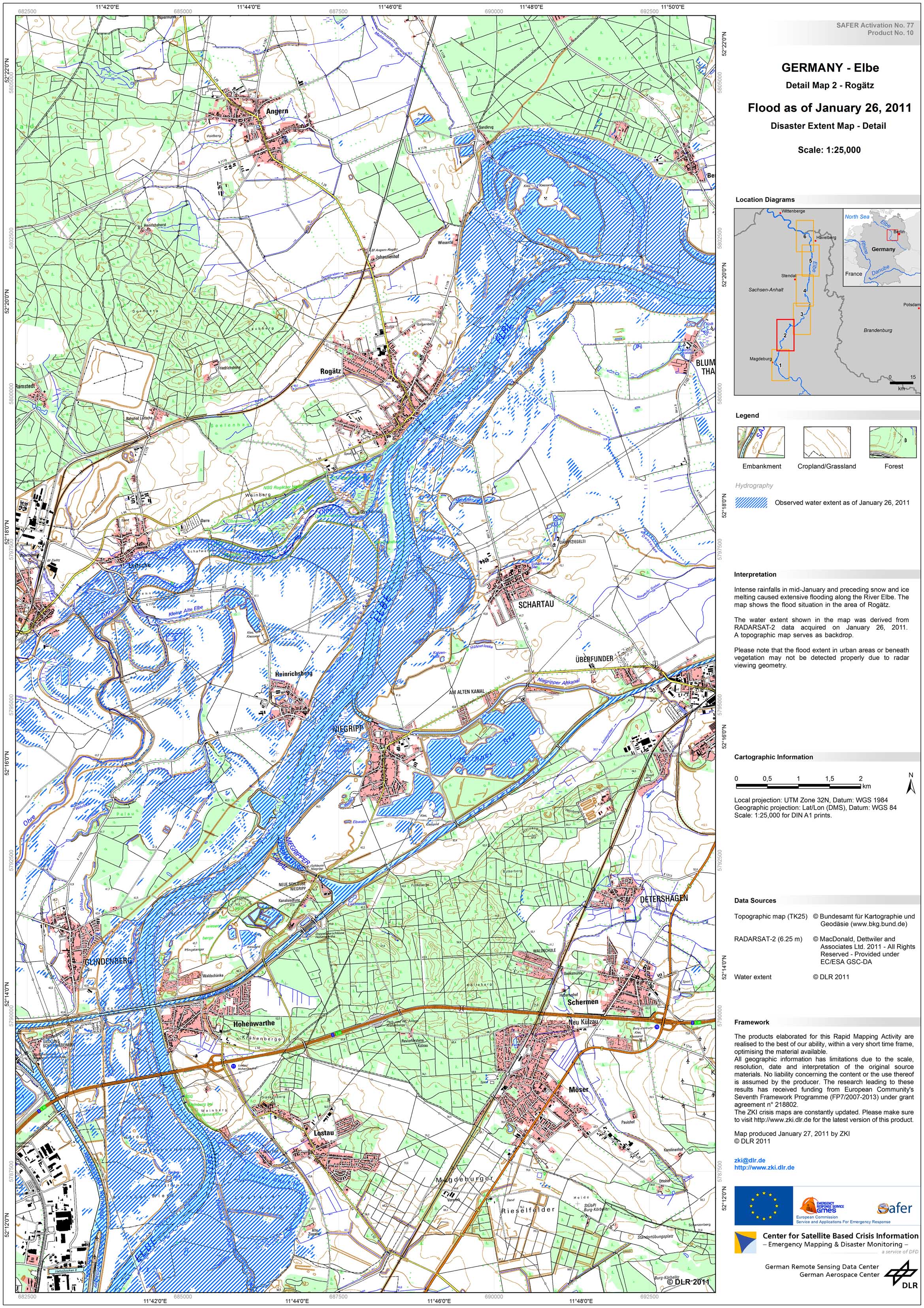
Germany - Elbe - P23 - Disaster Extent Map - Detail 2 - Rogaetz
Creation Date 27. January 2011

Germany - Elbe - P22 - Disaster Extent Map - Detail 1 - Magdeburg
Creation Date 27. January 2011
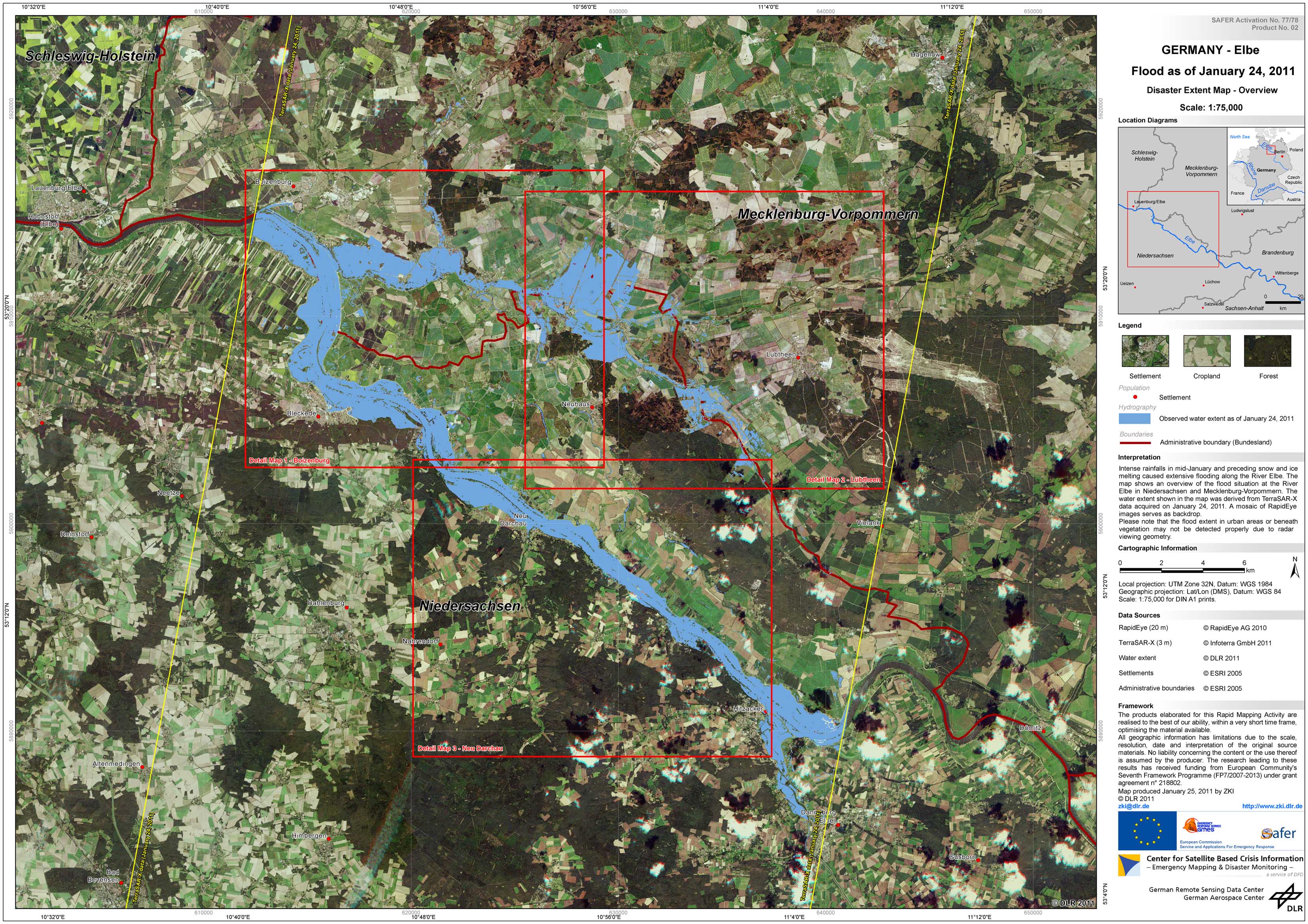
Germany - Elbe - P17 - Disaster Extent Map - Overview
Creation Date 26. January 2011

Germany - Elbe - P20 - Disaster Extent Map -Detail 3 - Neu Darchau
Creation Date 25. January 2011

Germany - Sude - P19 - Disaster Extent Map -Detail 2 - Luebtheen
Creation Date 25. January 2011
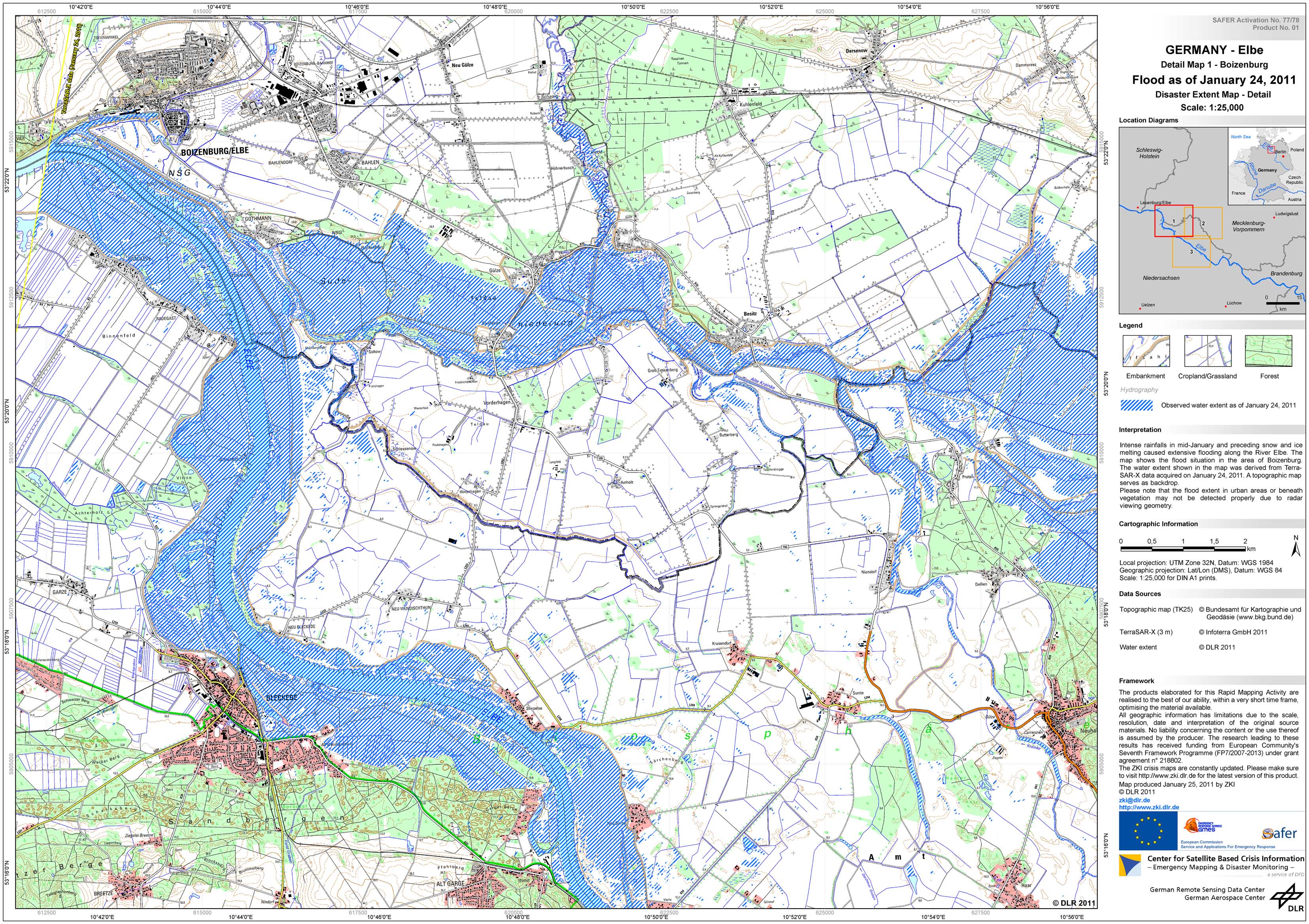
Germany - Elbe - P18 - Disaster Extent Map -Detail 1 - Boizenburg
Creation Date 25. January 2011

Germany - Elbe - P16 - Disaster Extent Map -Detail 4 - Wittenberge
Creation Date 23. January 2011
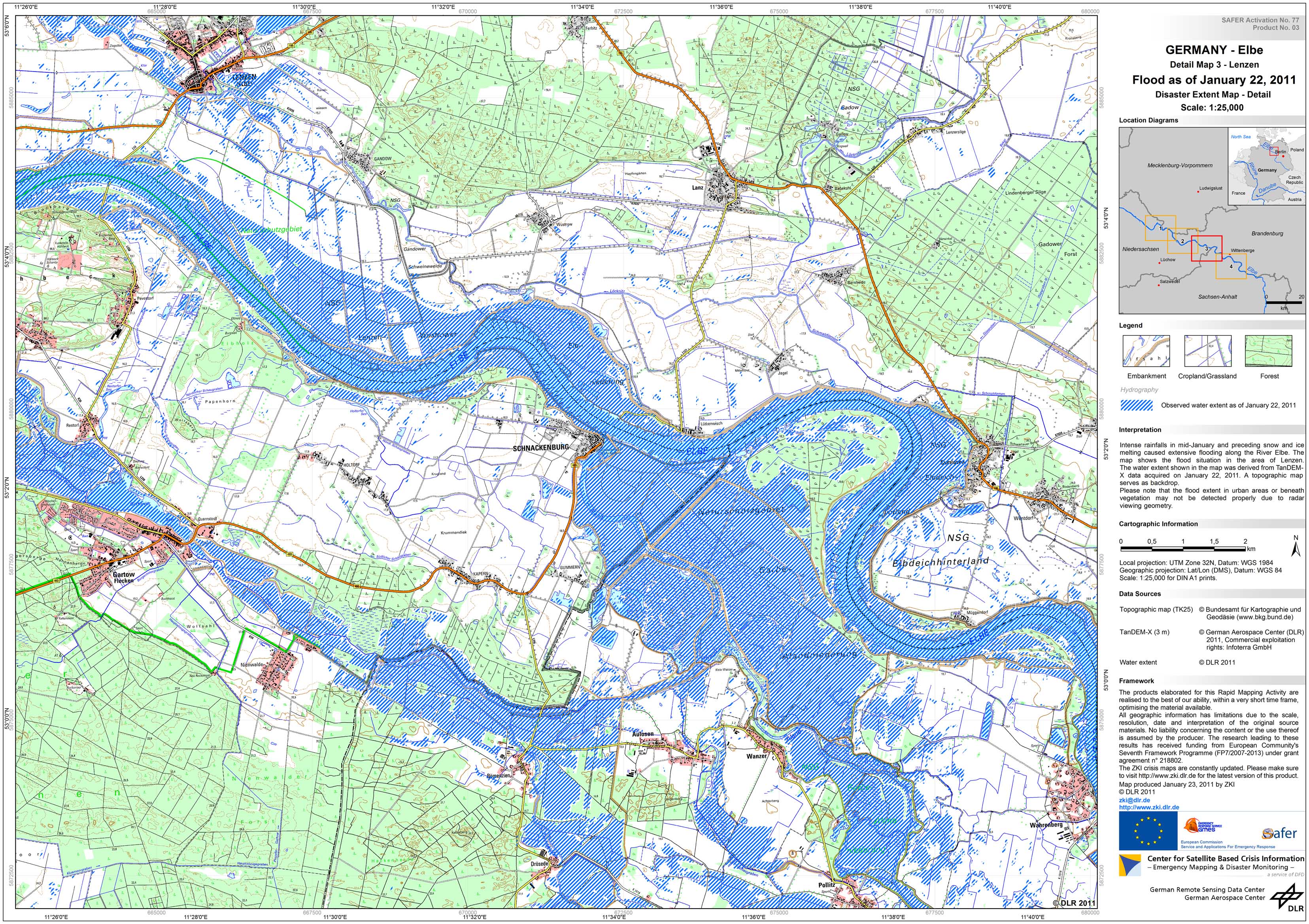
Germany - Elbe - P15 - Disaster Extent Map -Detail 3 - Lenzen
Creation Date 23. January 2011
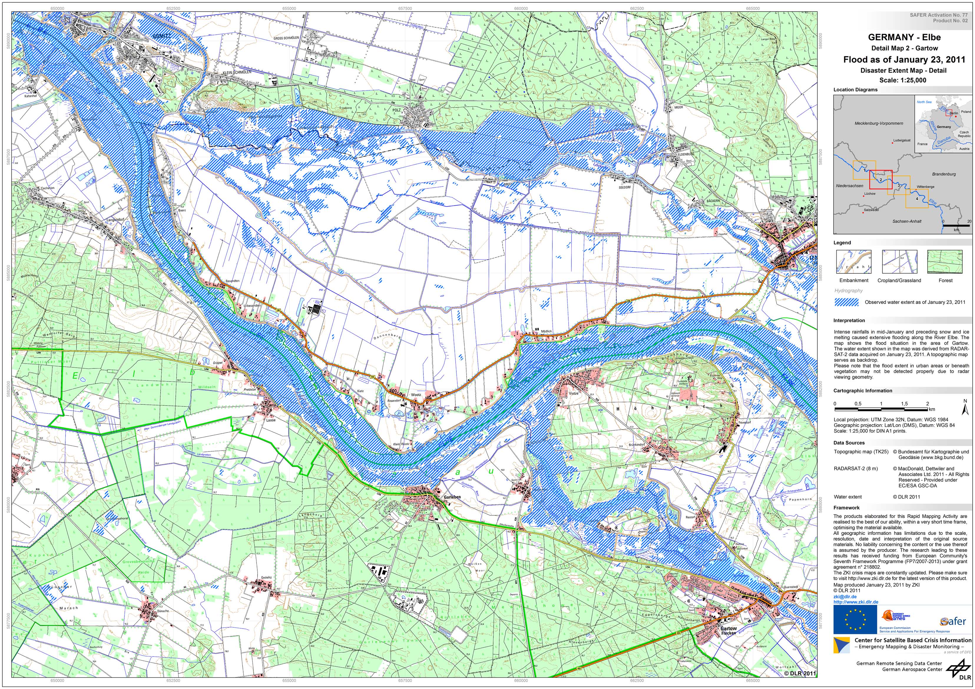
Germany - Elbe - P14 - Disaster Extent Map -Detail 2 - Gartow
Creation Date 23. January 2011
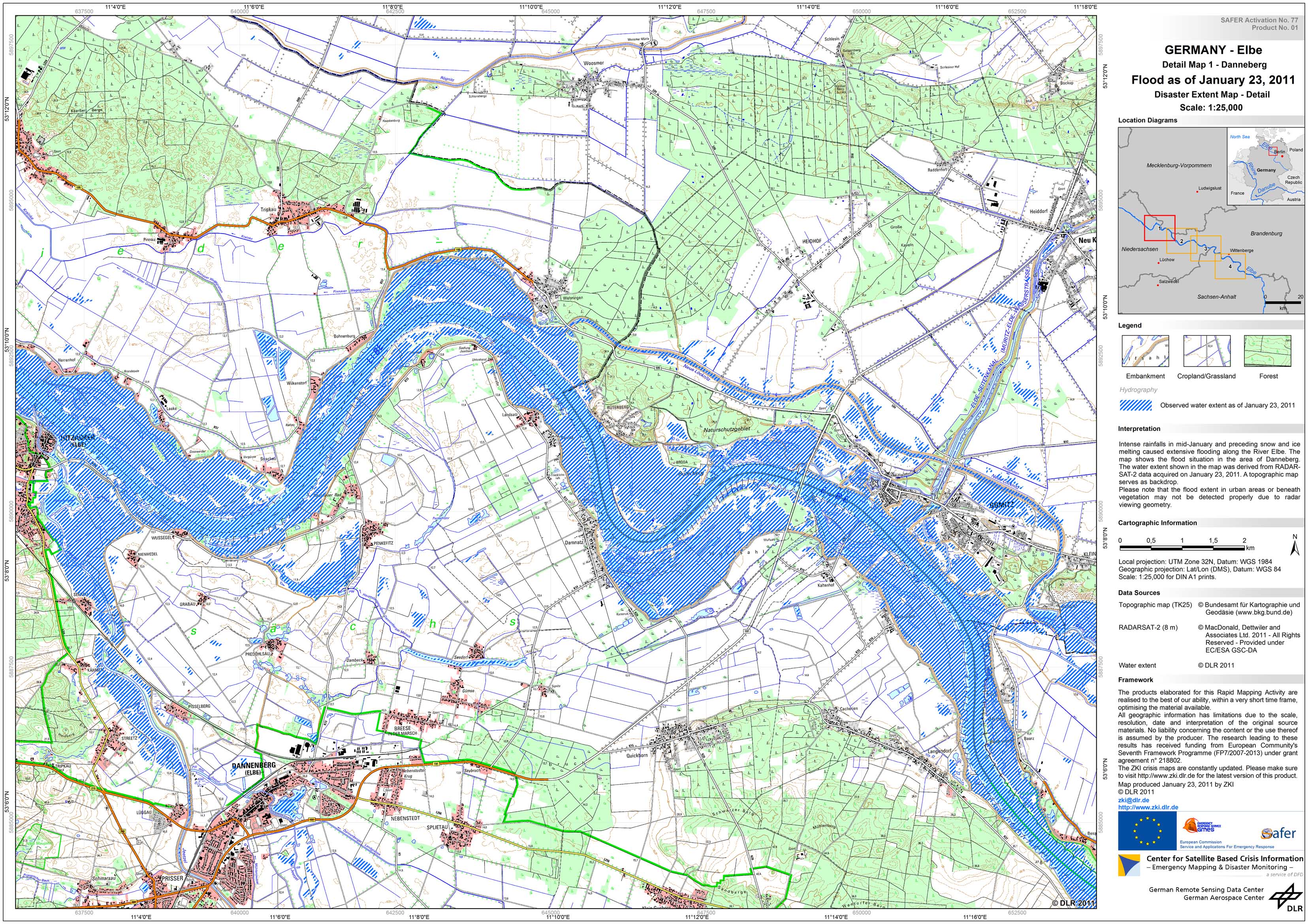
Germany - Elbe - P13 - Disaster Extent Map -Detail 1 - Danneberg
Creation Date 23. January 2011
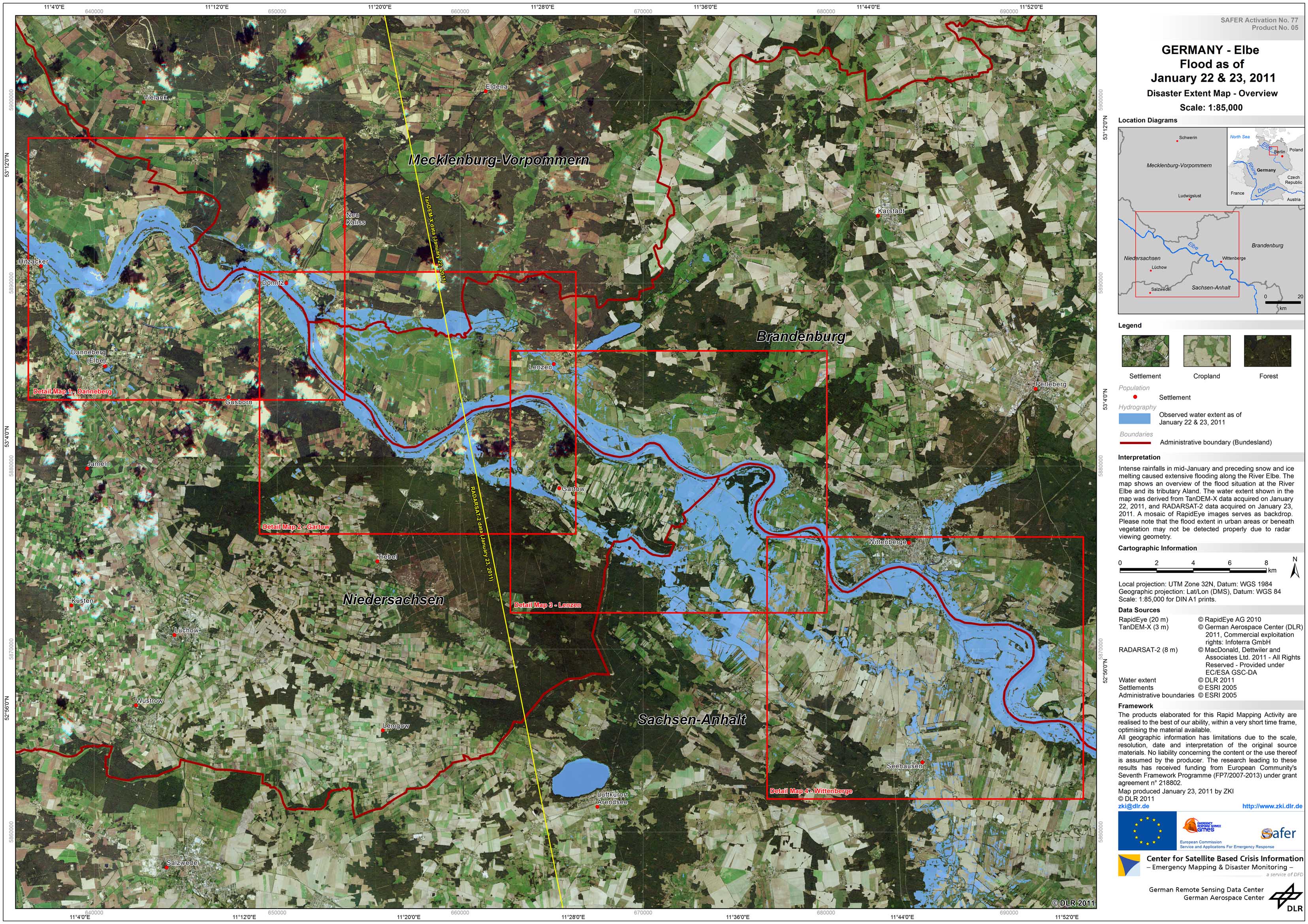
Germany - Elbe - P12 - Disaster Extent Map - Overview
Creation Date 23. January 2011
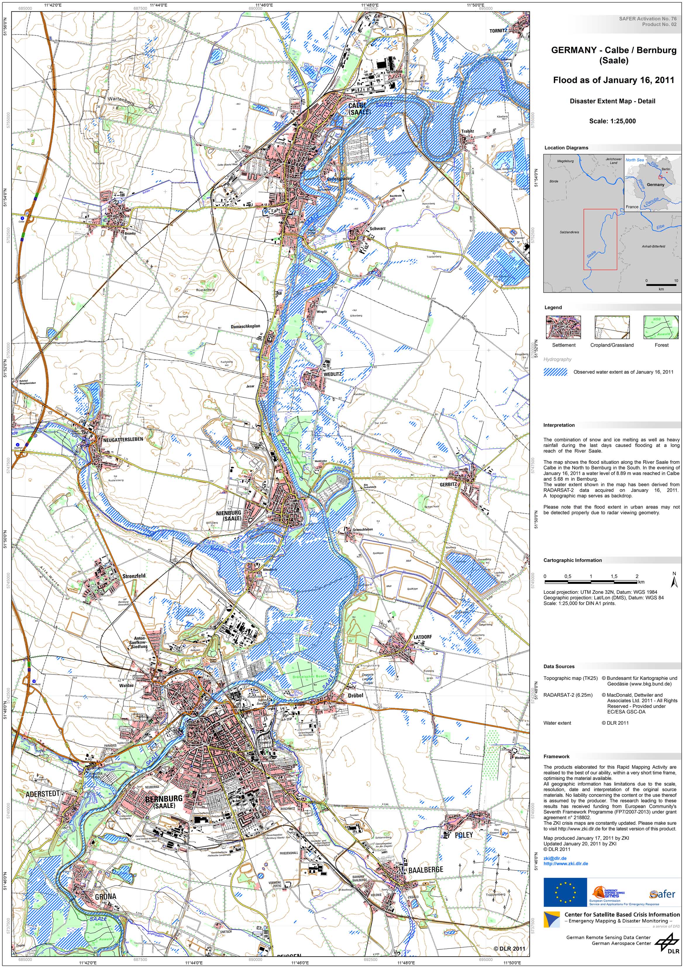
Germany - Saale - P06 - Disaster Extent Map -Detail - Calbe / Bernburg
Creation Date 20. January 2011

Germany - Saale - P05 - Disaster Extent Map - Overview - Saxony-Anhalt
Creation Date 20. January 2011
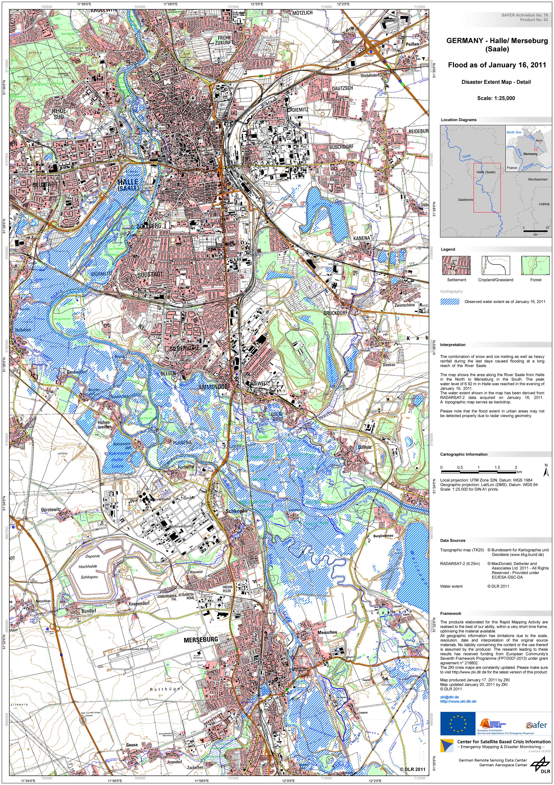
Germany - Saale - P07 - Disaster Extent Map -Detail - Halle / Merseburg
Creation Date 20. January 2011
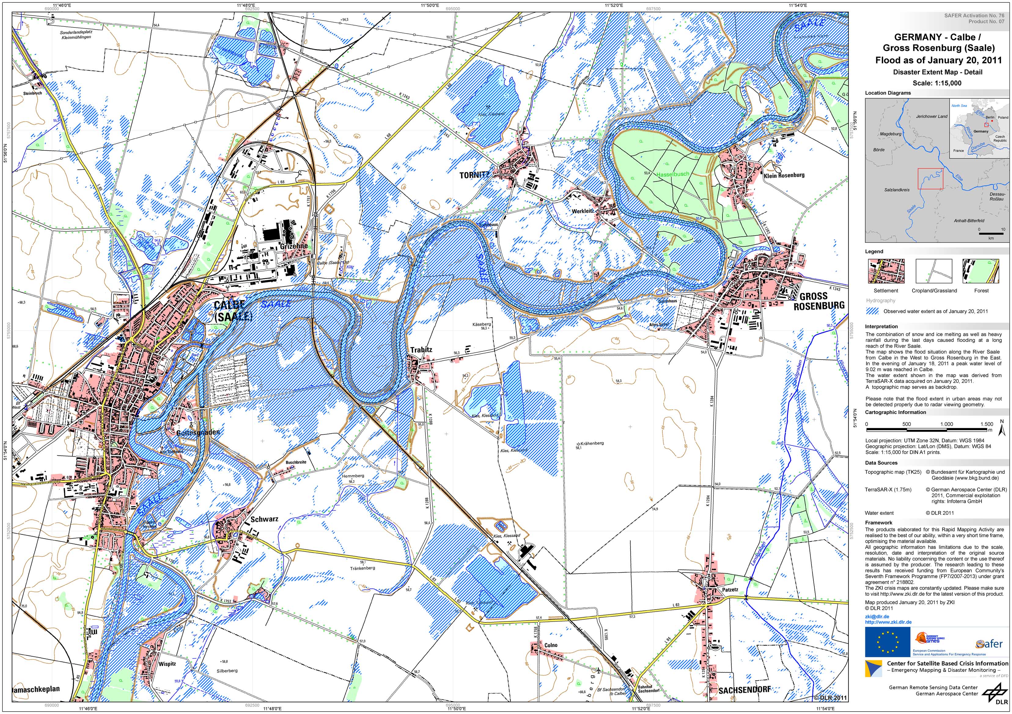
Germany - Saale - P11 - Disaster Extent Map - Detail - Calbe / Gross Rosenburg
Creation Date 20. January 2011
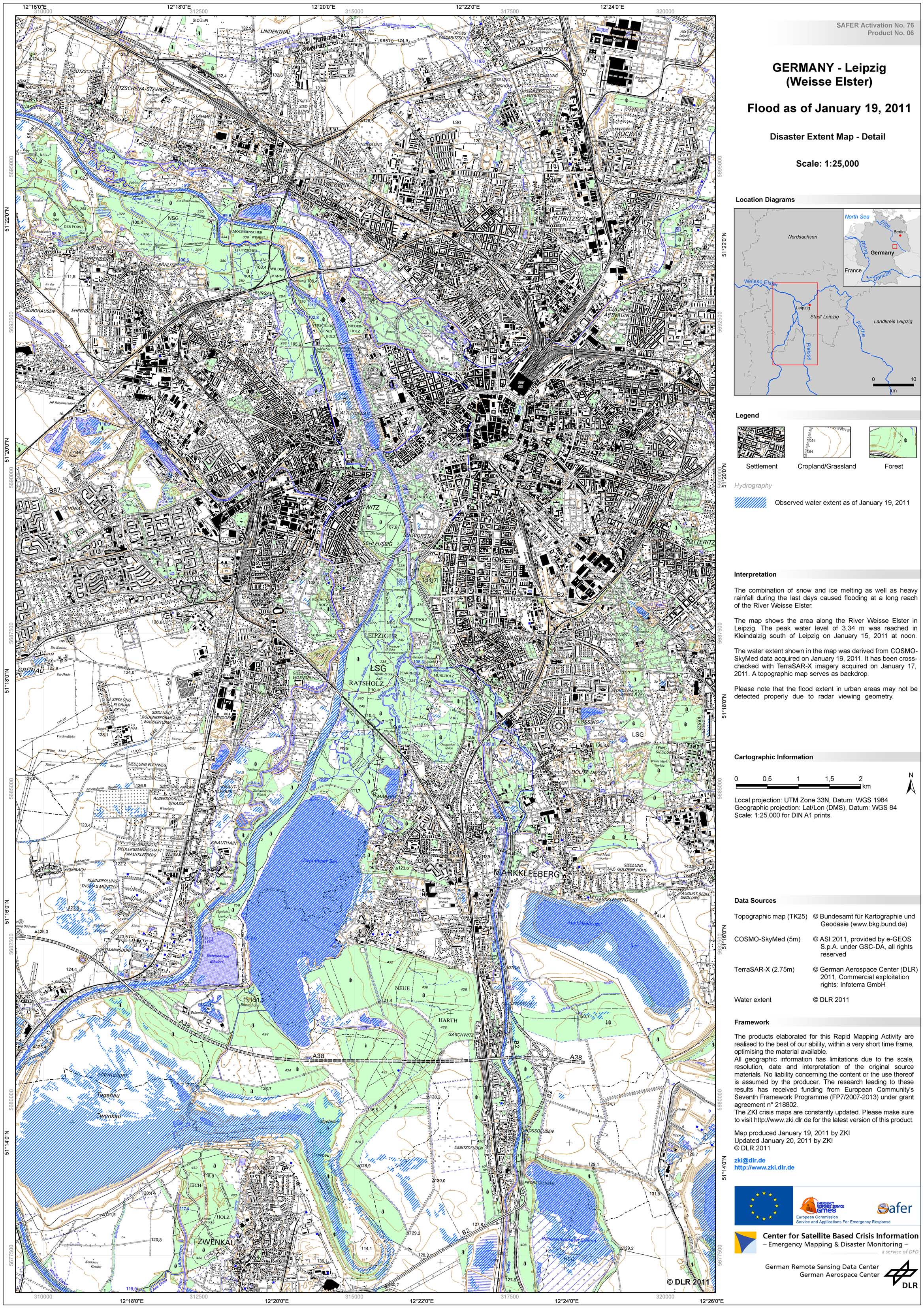
Germany - Weisse Elster - P10 - Disaster Extent Map - Detail - Leipzig
Creation Date 20. January 2011
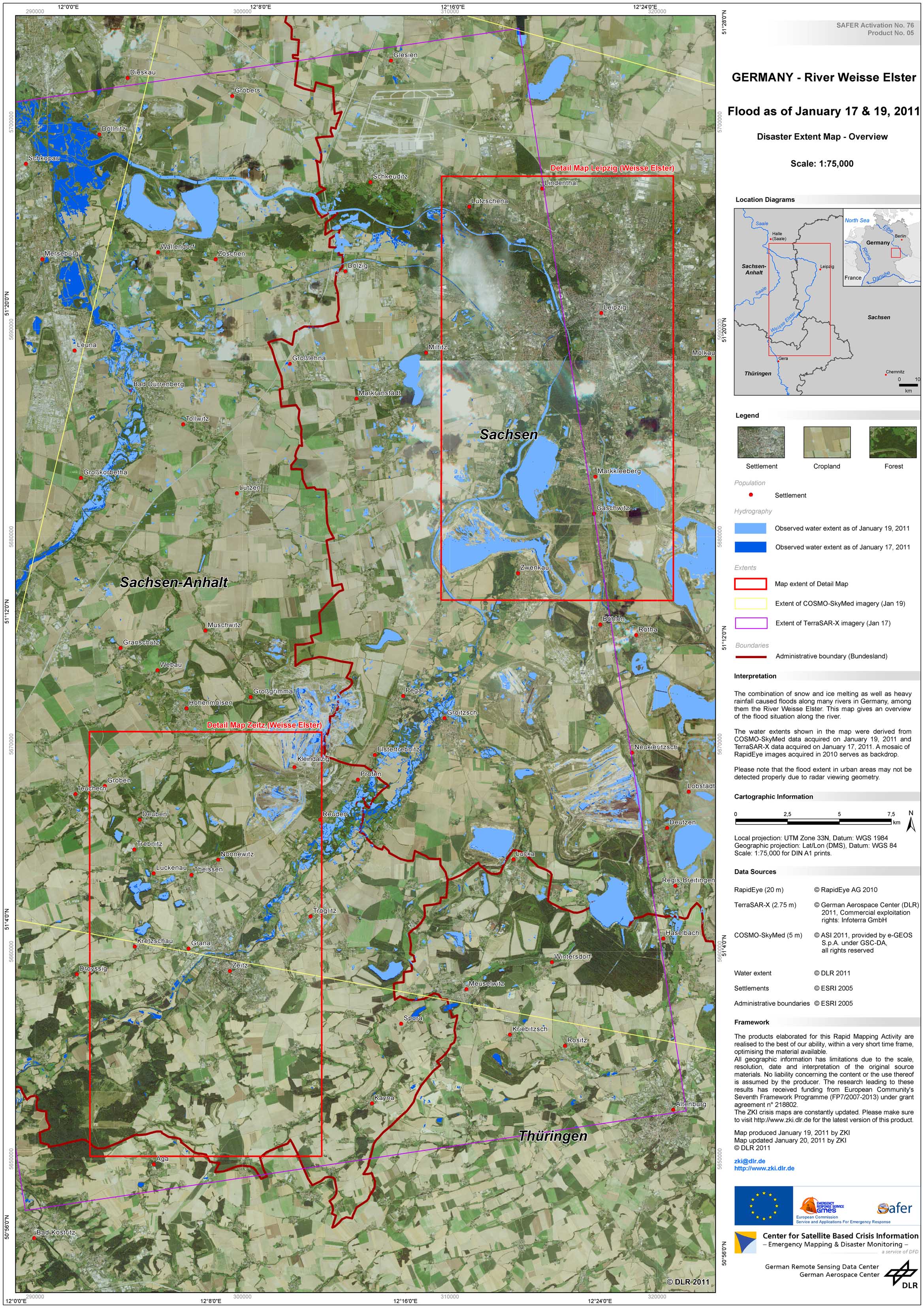
Germany - Weisse Elster - P09 - Disaster Extent Map - Overview -
Creation Date 20. January 2011
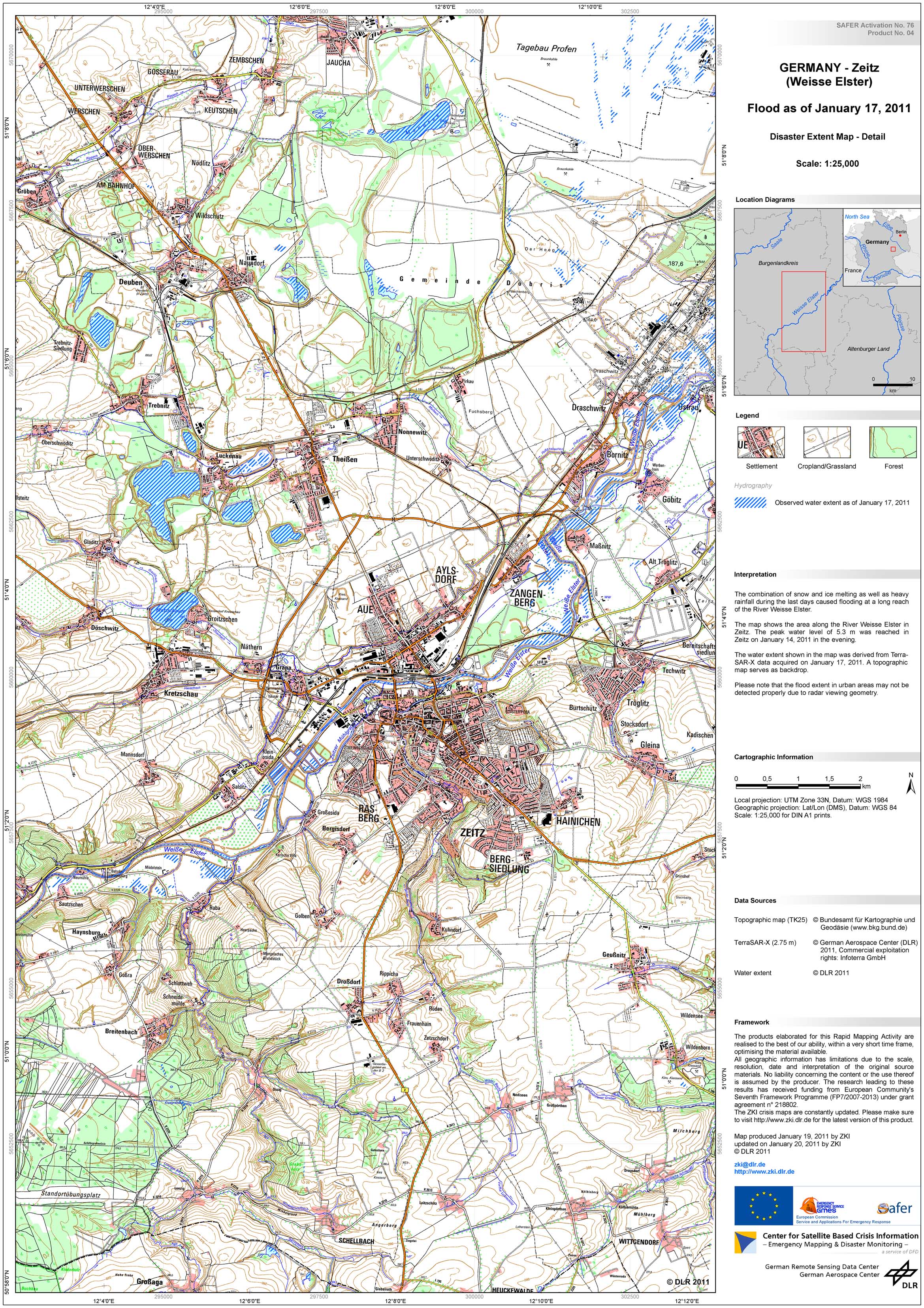
Germany - Weisse Elster - P08 - Disaster Extent Map - Detail - Zeitz
Creation Date 20. January 2011
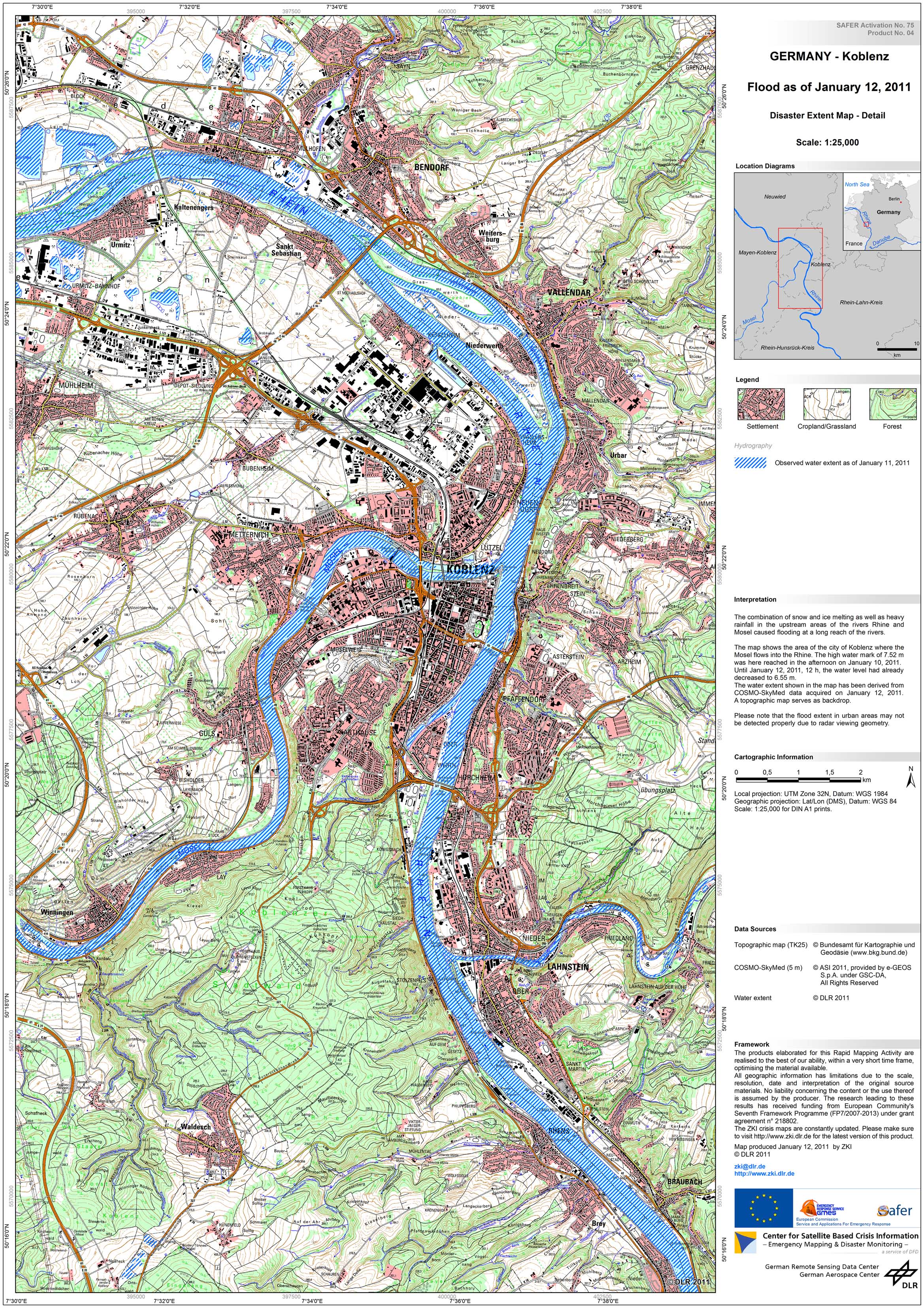
Germany - P04 - Disaster Extent Map -Detail - Koblenz
Creation Date 12. January 2011
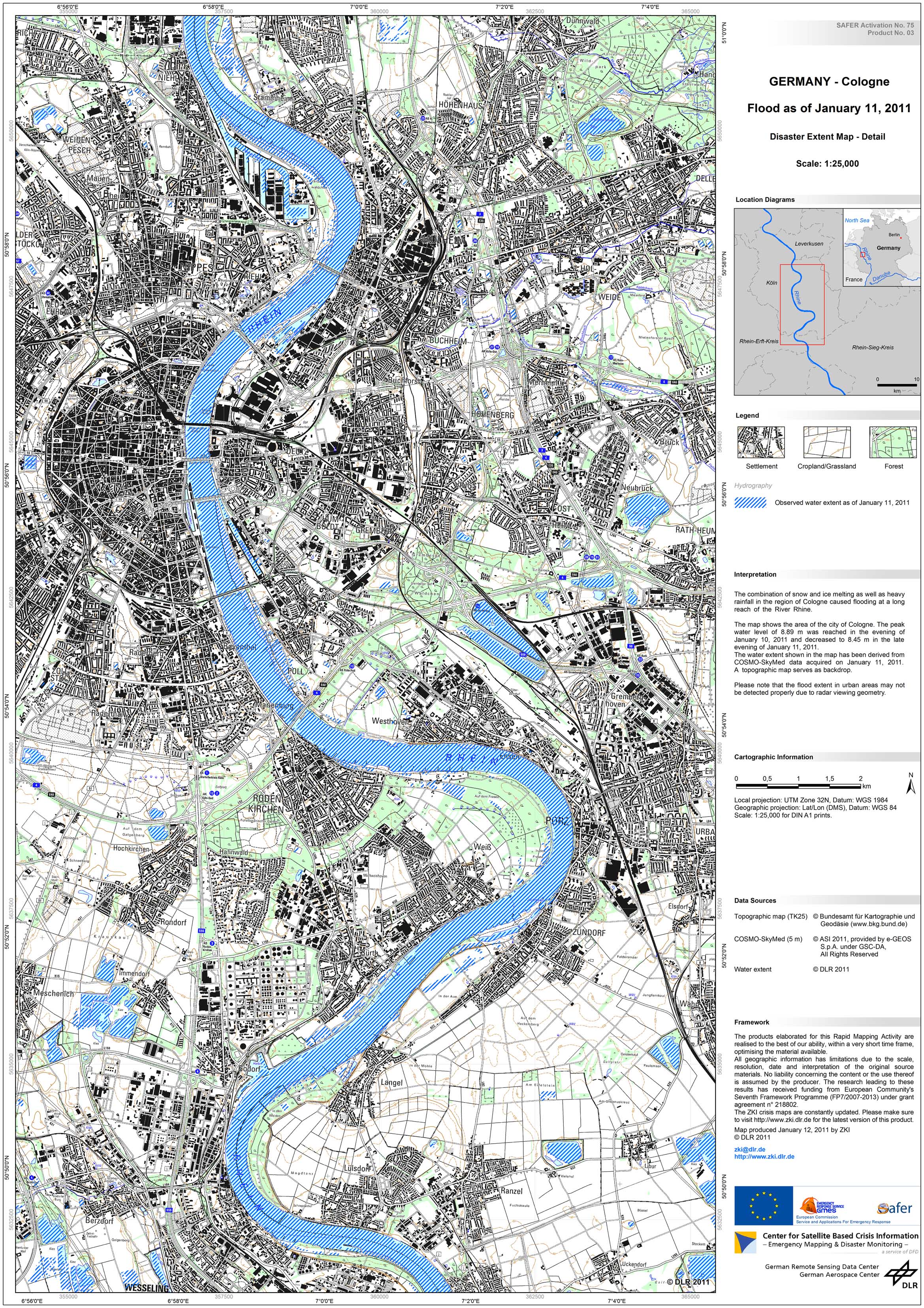
Germany - P03 - Disaster Extent Map -Detail - Cologne
Creation Date 12. January 2011
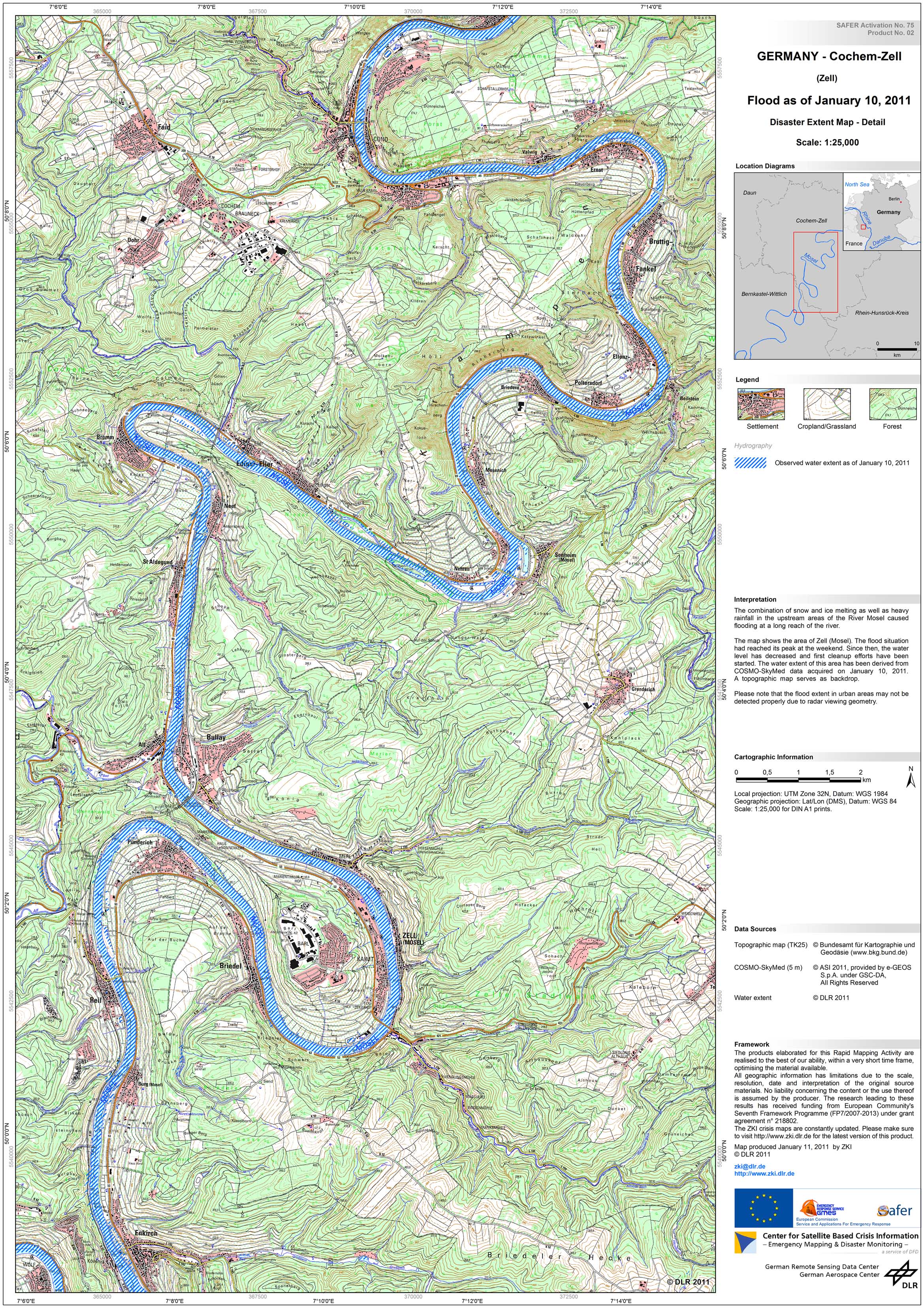
Germany - P02 - Disaster Extent Map -Detail - Cochem-Zell
Creation Date 11. January 2011
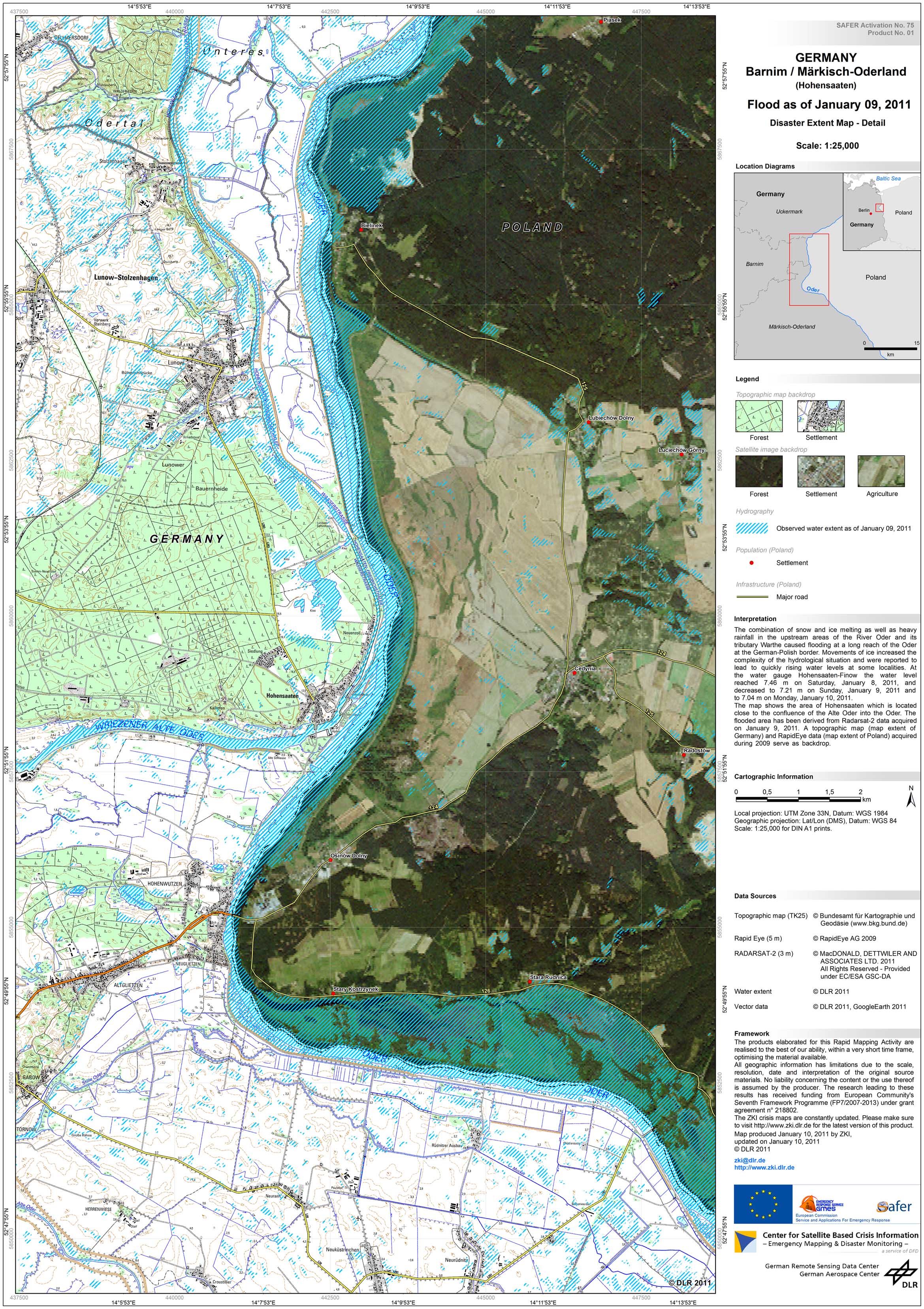
Germany - P01 - Disaster Extent Map -Detail - Barnim / Maerkisch-Oderland
Creation Date 10. January 2011