
Famine in East Africa
undefined
Somalia - P32 - Jowhar - Refugee / IDP Camp - Location Mapping - Sheet 2
Creation Date 23. March 2012
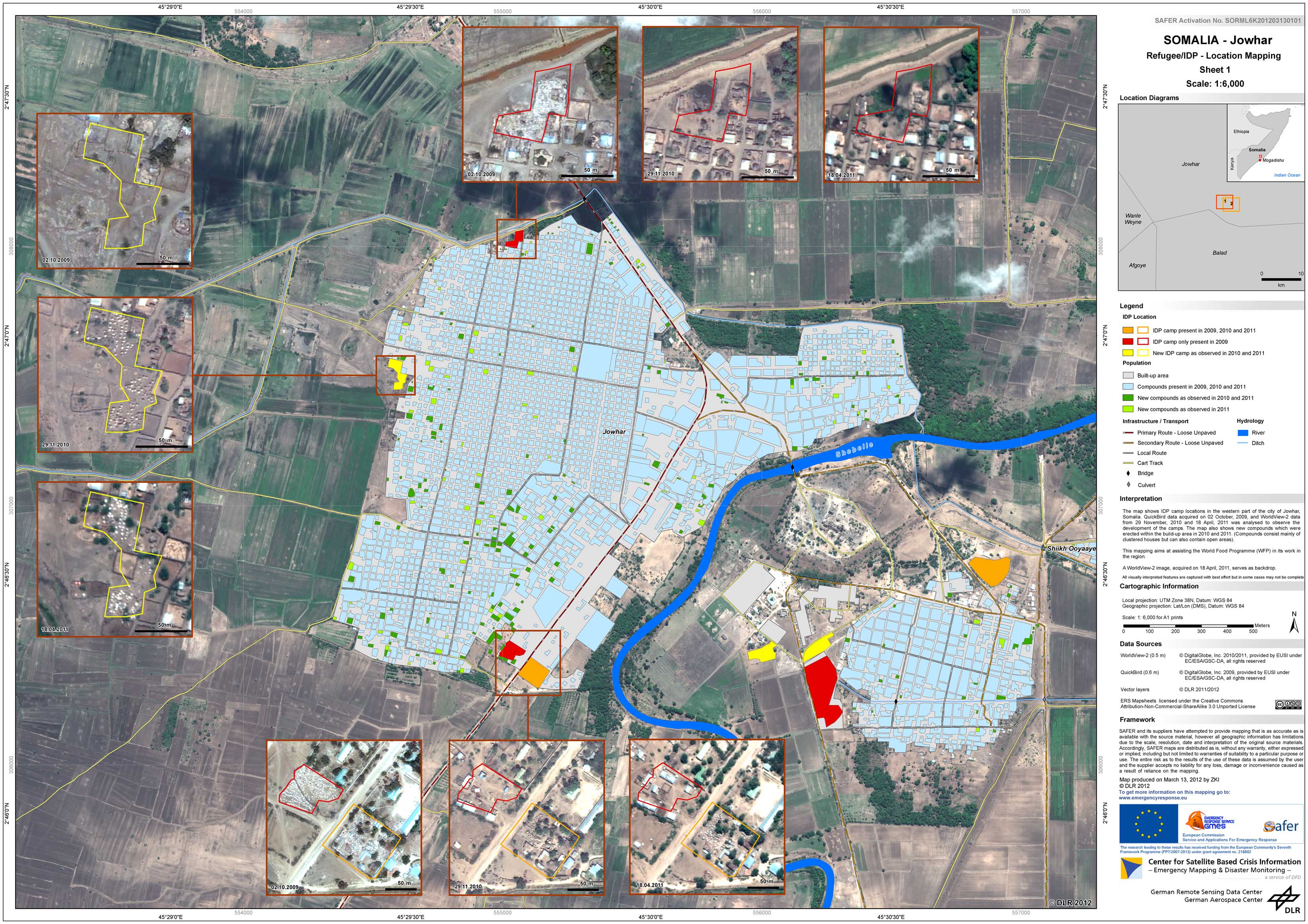
Somalia - P31 - Jowhar - Refugee / IDP Camp - Location Mapping - Sheet 1
Creation Date 23. March 2012
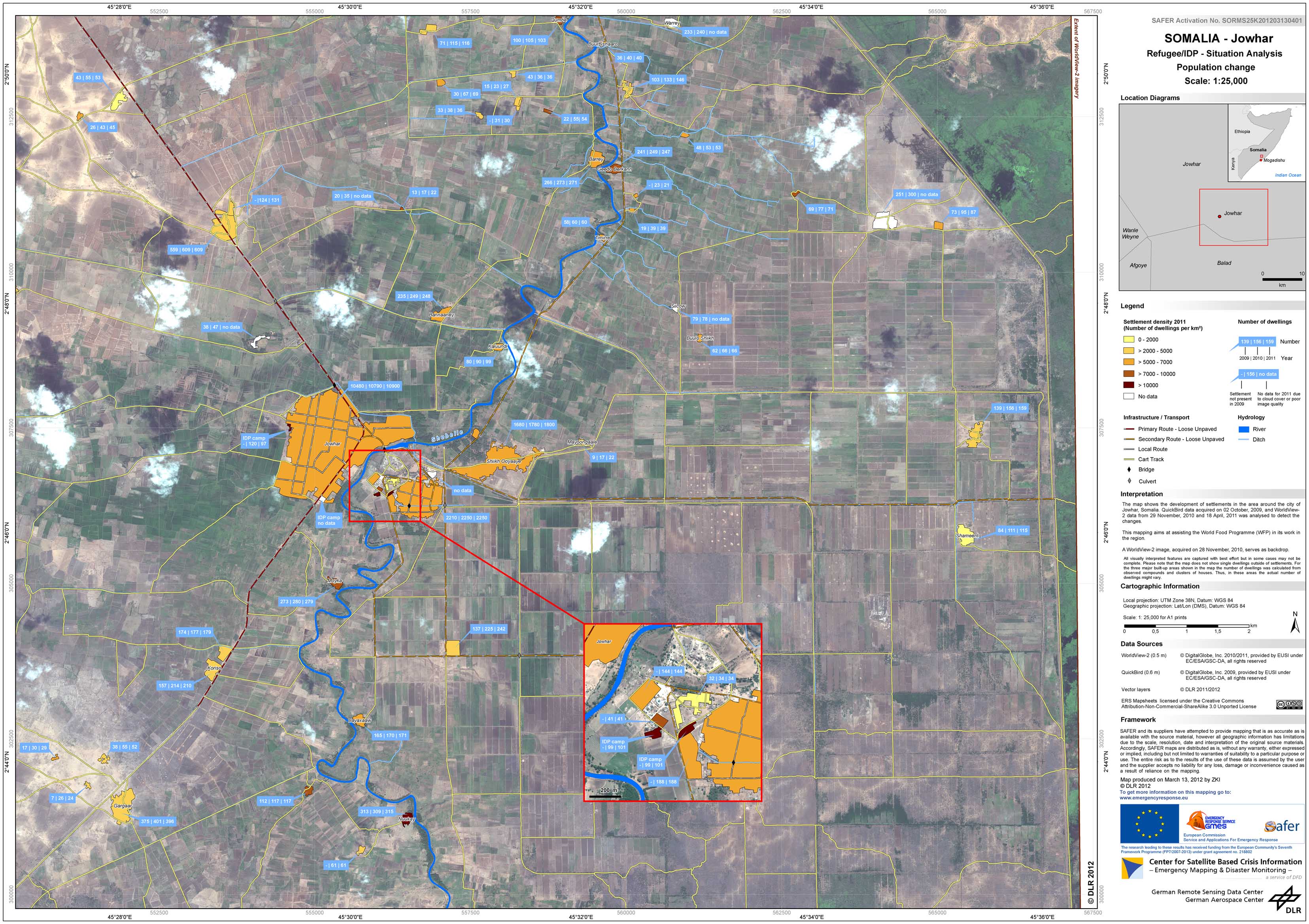
Somalia - P30 - Jowhar - Refugee / IDP Camp - Situation Analysis - Population change
Creation Date 23. March 2012
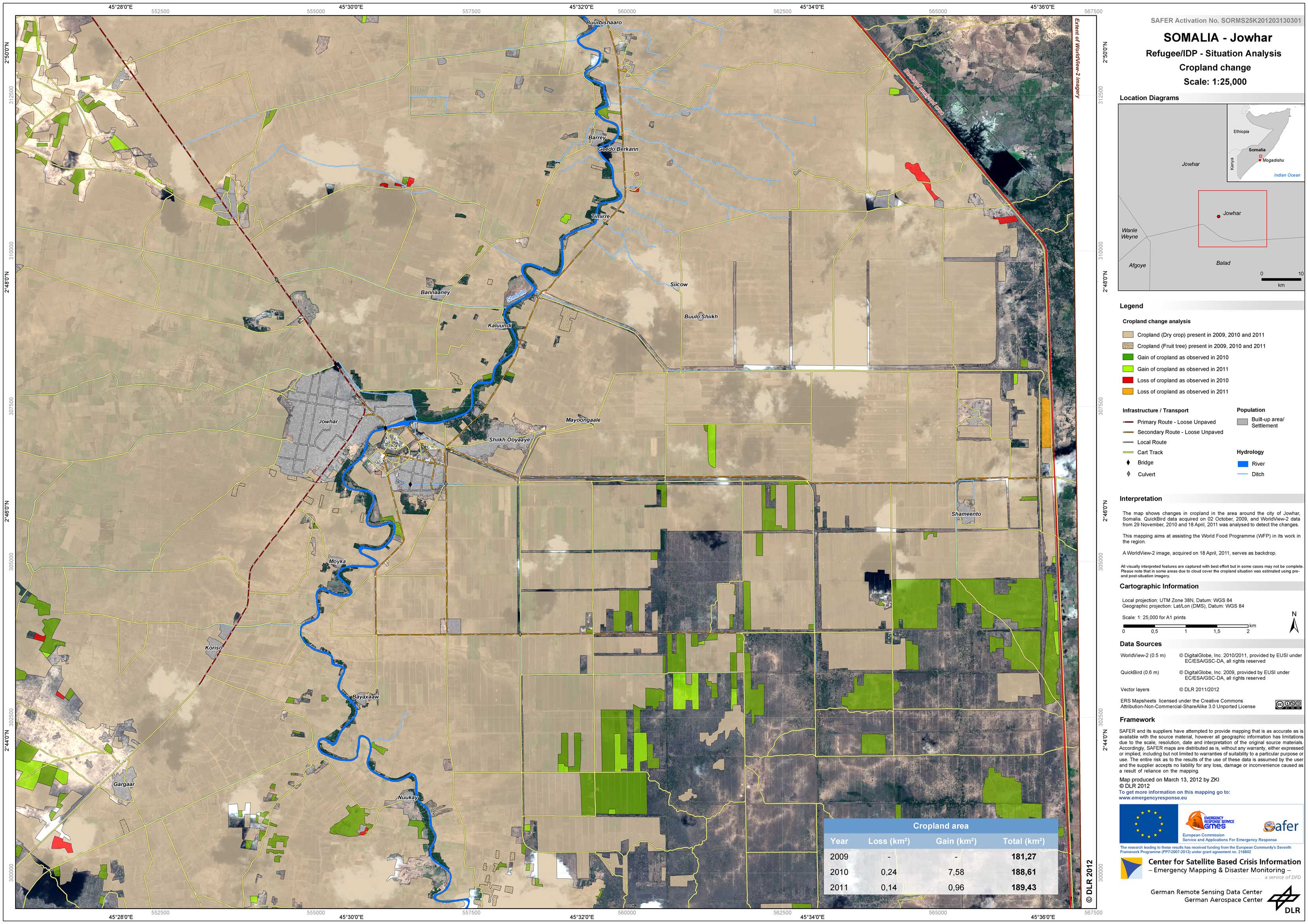
Somalia - P29 - Jowhar - Refugee / IDP Camp - Situation Analysis - Land use change assessment
Creation Date 23. March 2012
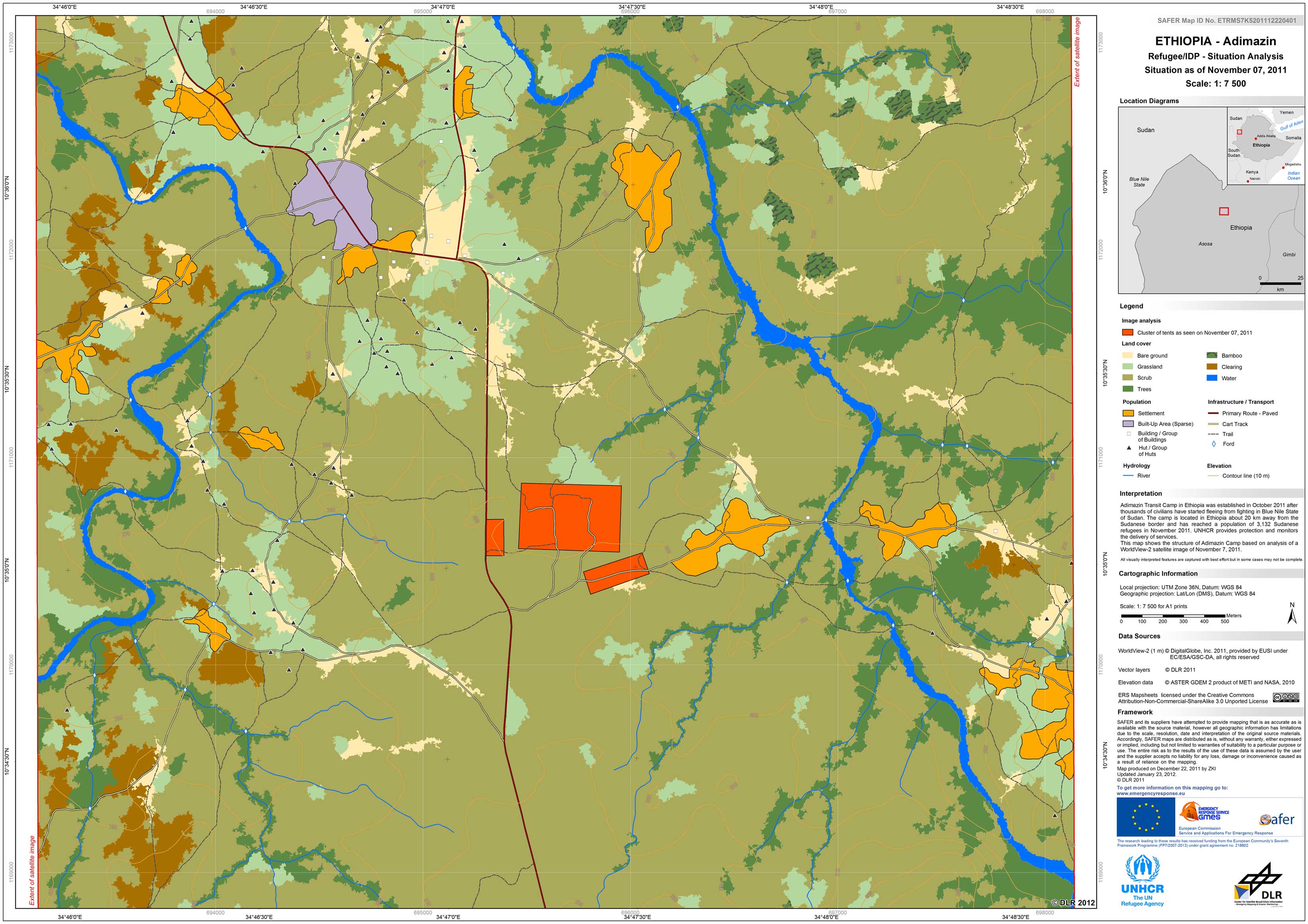
Ethopia - P27 - Adimazin - Refugee/IDP Camp Map - Land Use - Detail
Creation Date 23. January 2012
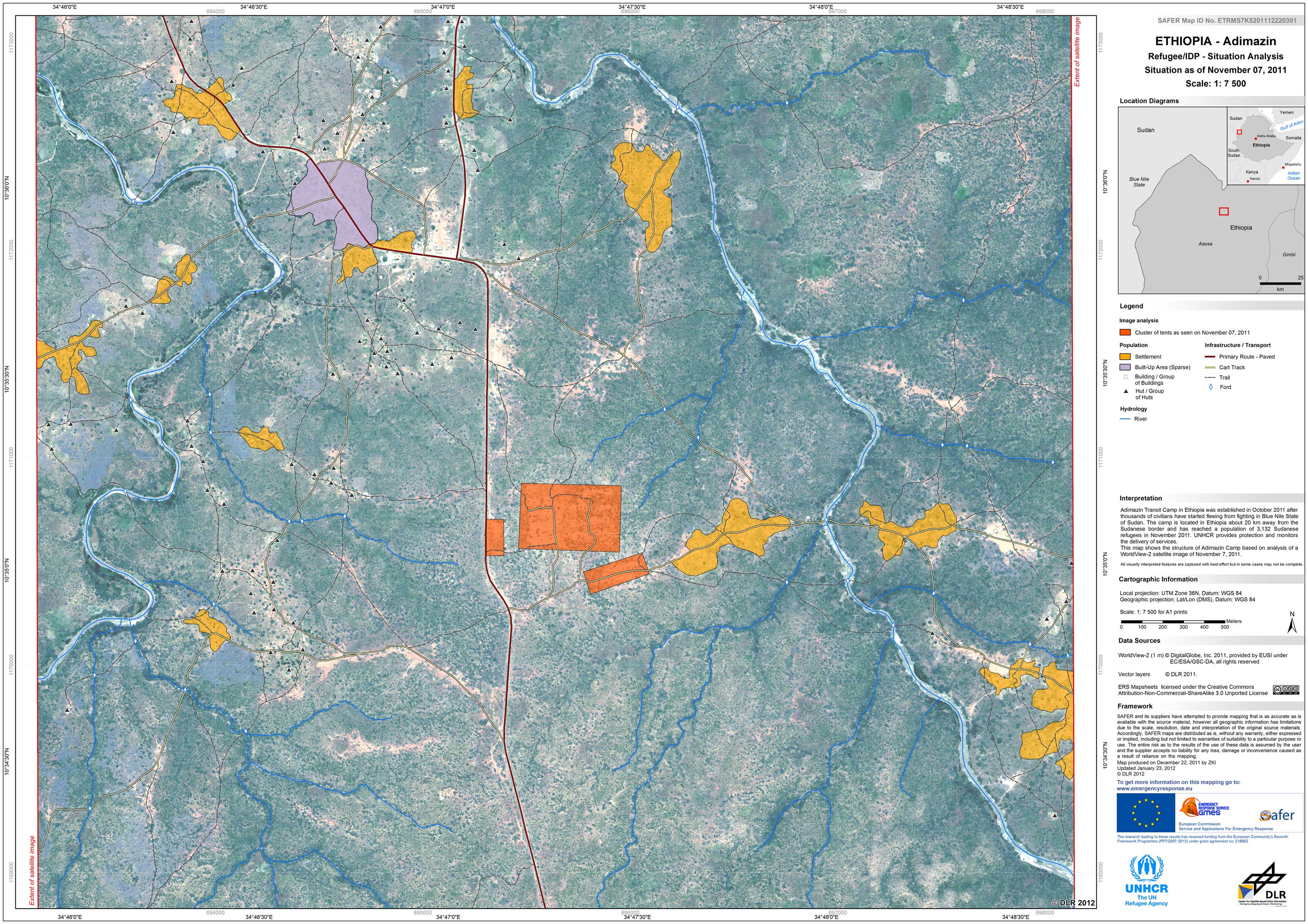
Ethopia - P26 - Adimazin - Refugee/IDP Camp Map - Detail
Creation Date 23. January 2012

Ethopia - P25 - Sherkole - Refugee/IDP Camp Map - Land Use - Detail
Creation Date 23. January 2012

Ethopia - P24 - Sherkole - Refugee/IDP Camp Map - Detail
Creation Date 23. January 2012
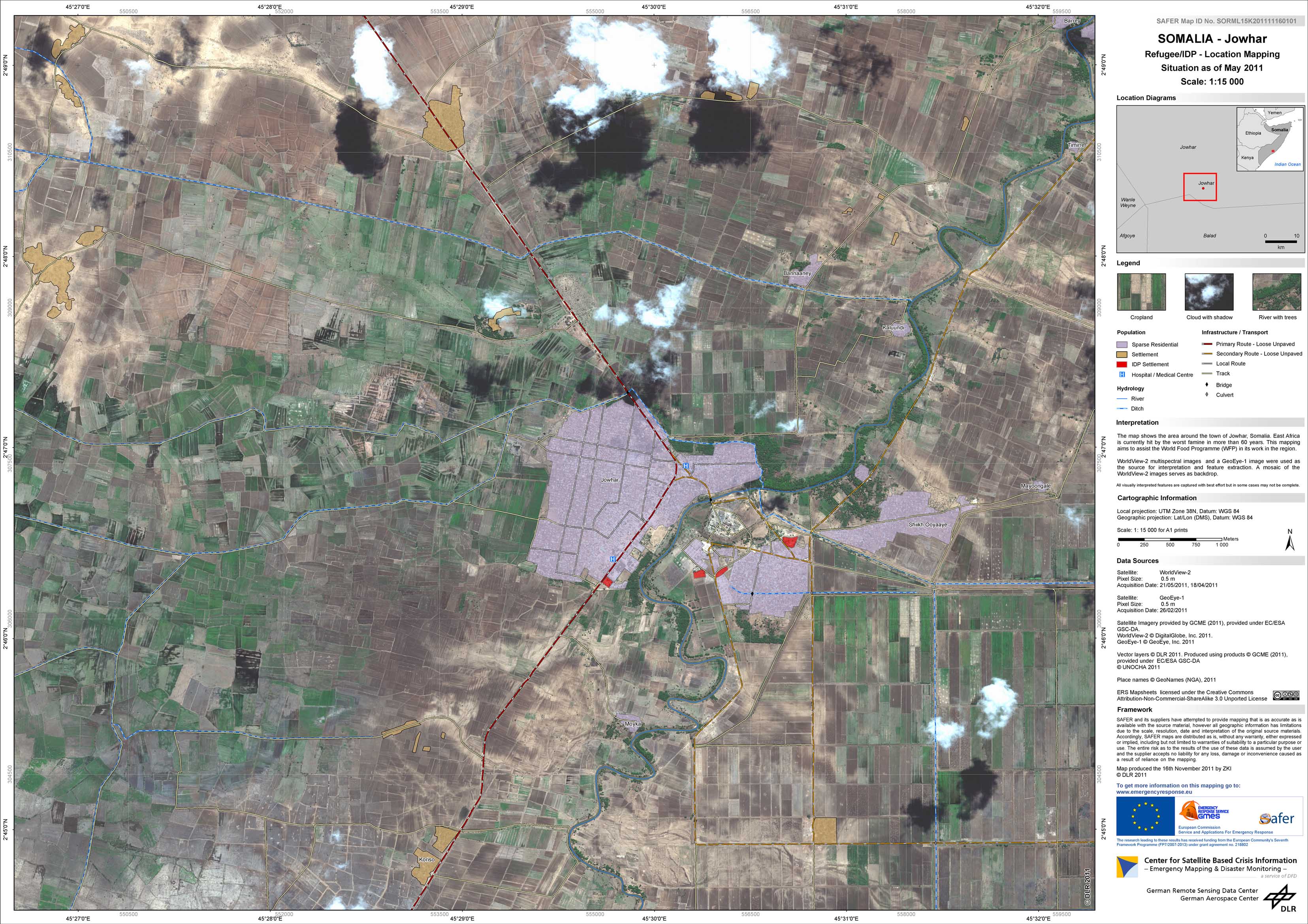
Somalia - P28 - Jowhar - Refugee/IDP Camp Map - Detail
Creation Date 23. November 2011
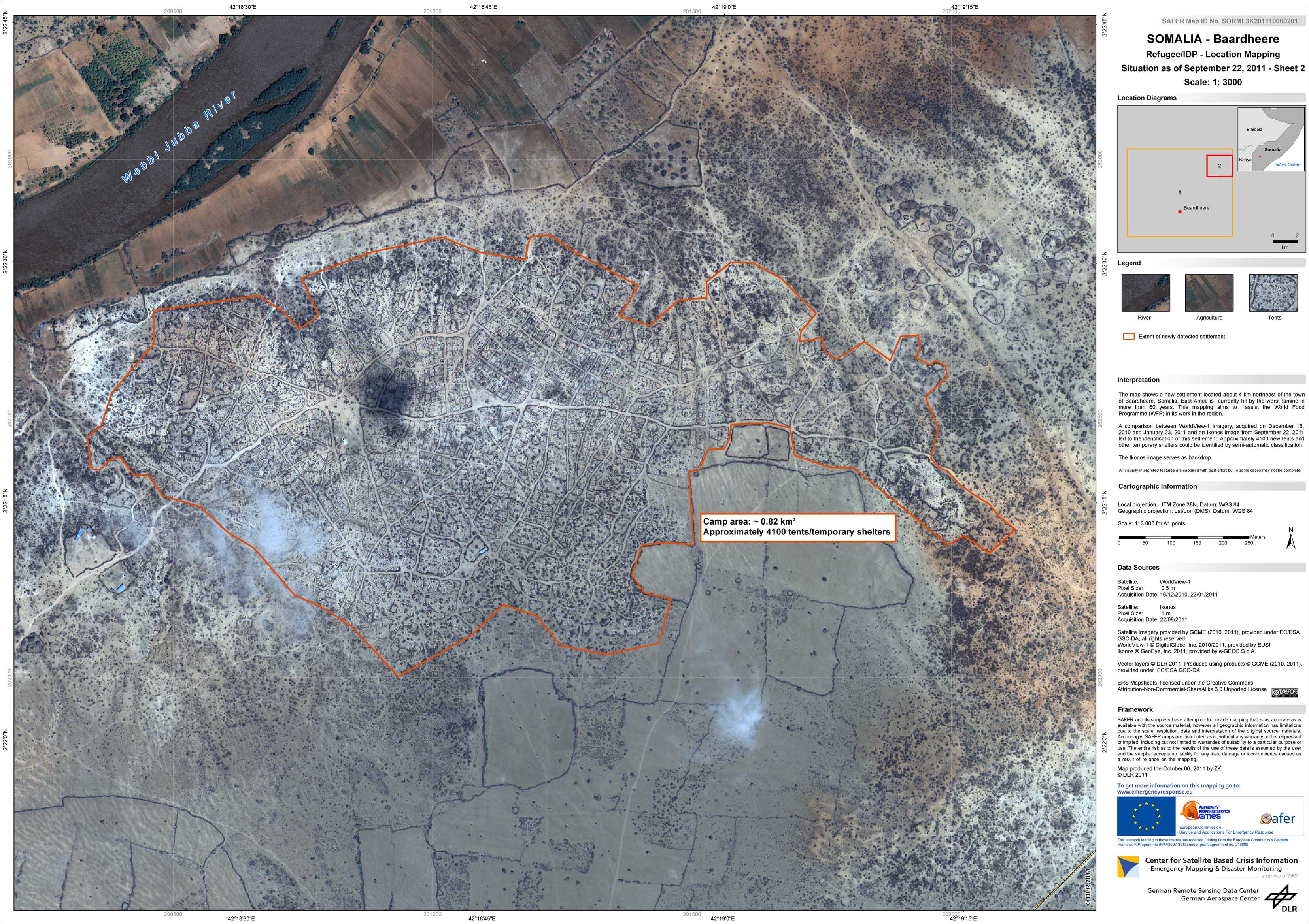
Somalia - P23 - Baardheere - Refugee/IDP Camp Map - Detail - Sheet 2
Creation Date 06. October 2011
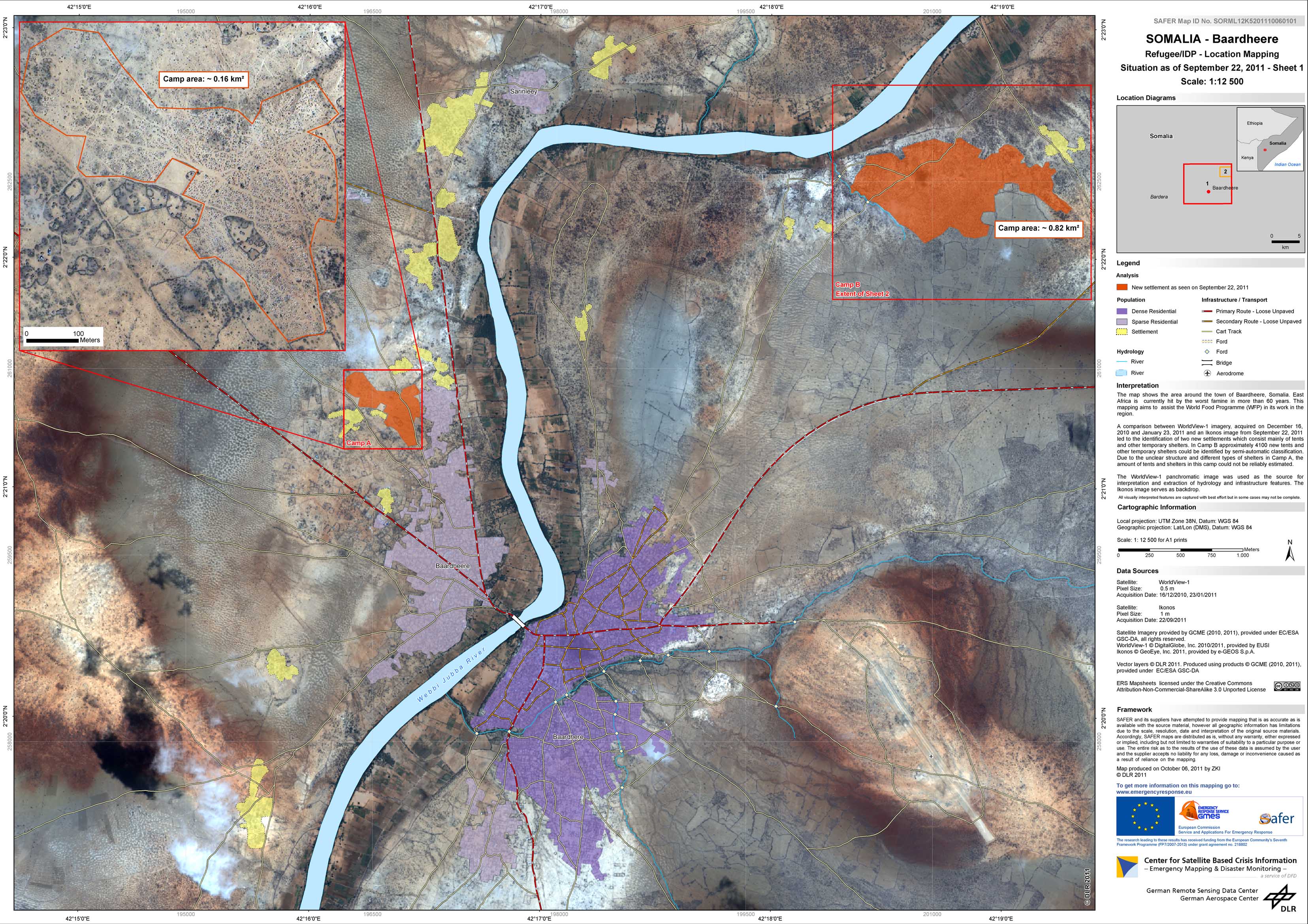
Somalia - P22 - Baardheere - Refugee/IDP Camp Map - Detail - Sheet 1
Creation Date 06. October 2011
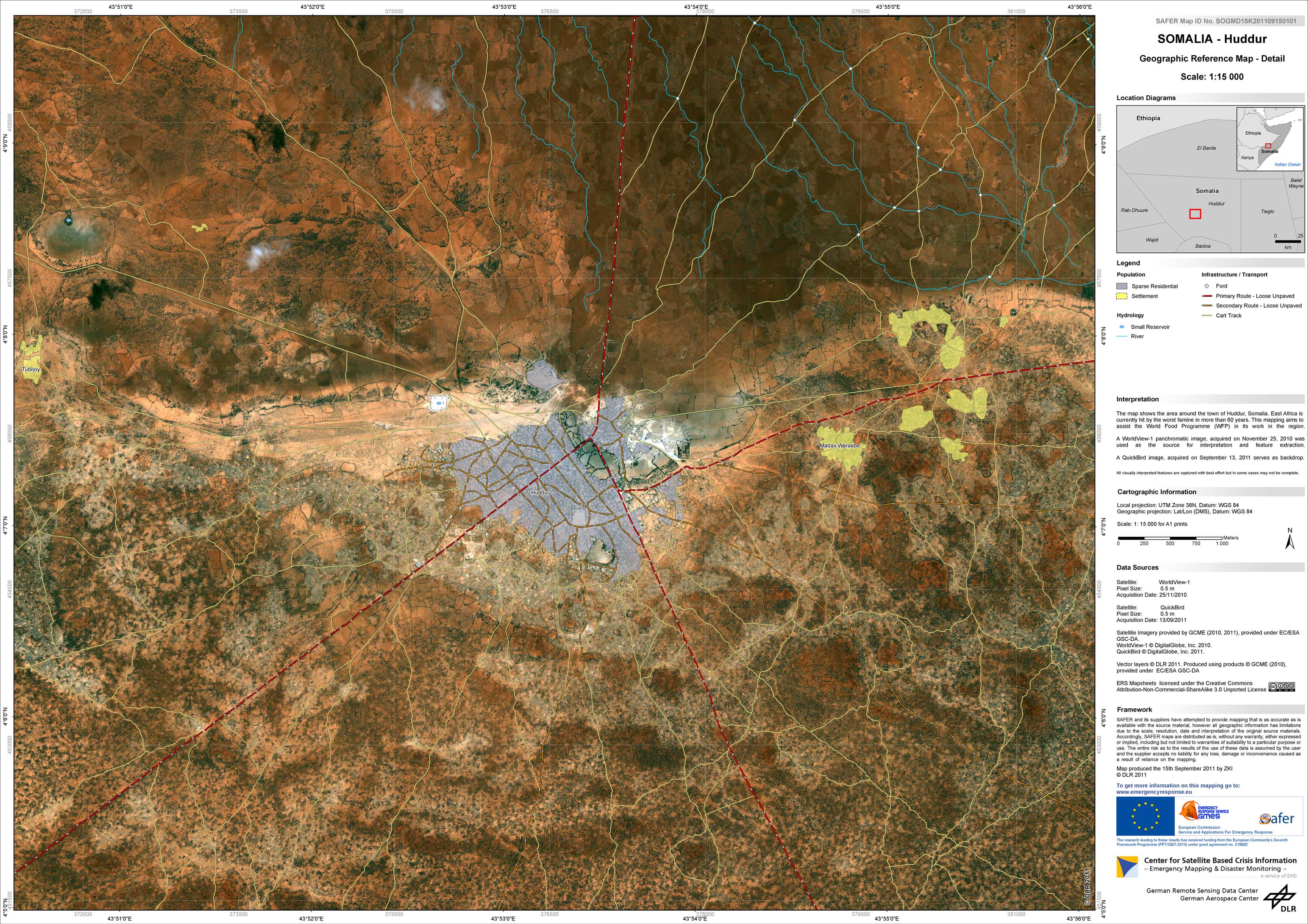
Somalia - P21 - Huddur - Geographic Reference Map - Detail
Creation Date 21. September 2011
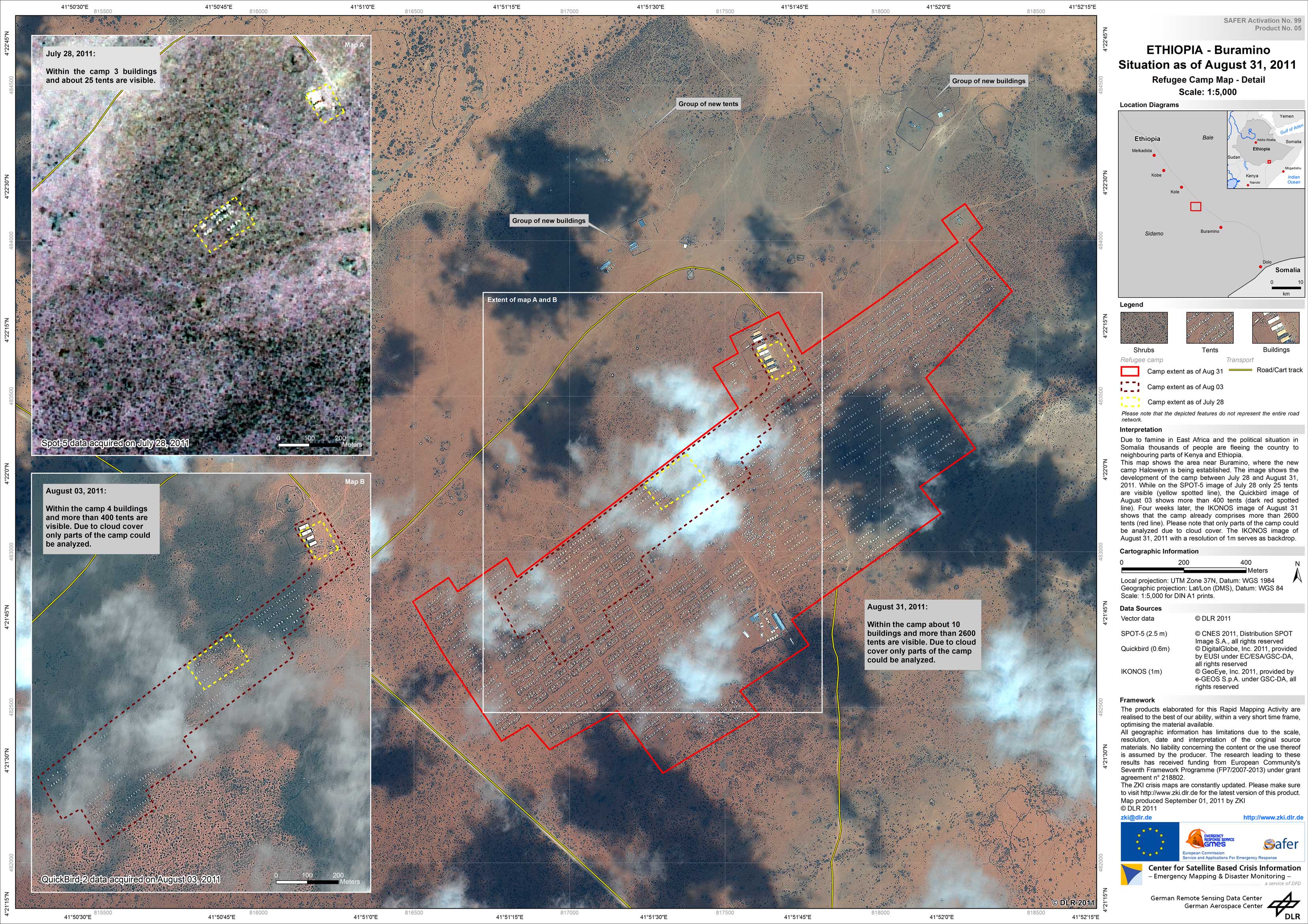
Ethopia - P20 - Buramino - Refugee Camp Map - Detail
Creation Date 01. September 2011

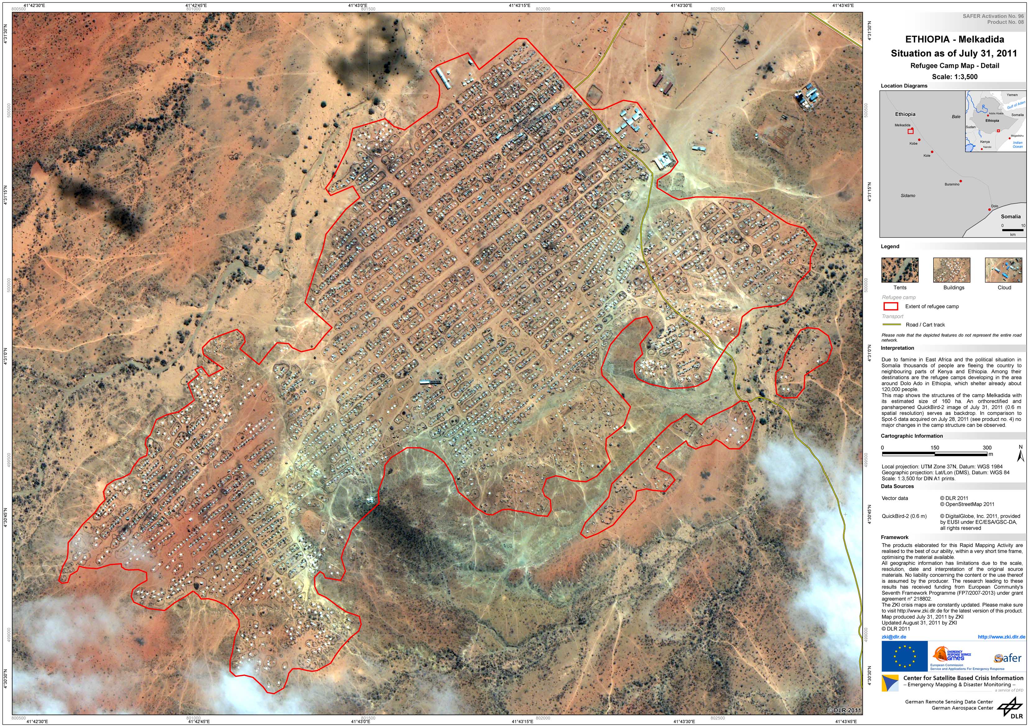
Ethopia - P18 - Melkadida - Refugee Camp Map - Detail
Creation Date 31. August 2011
Ethopia - P17 - Kobe - Refugee Camp Map - Detail
Creation Date 31. August 2011
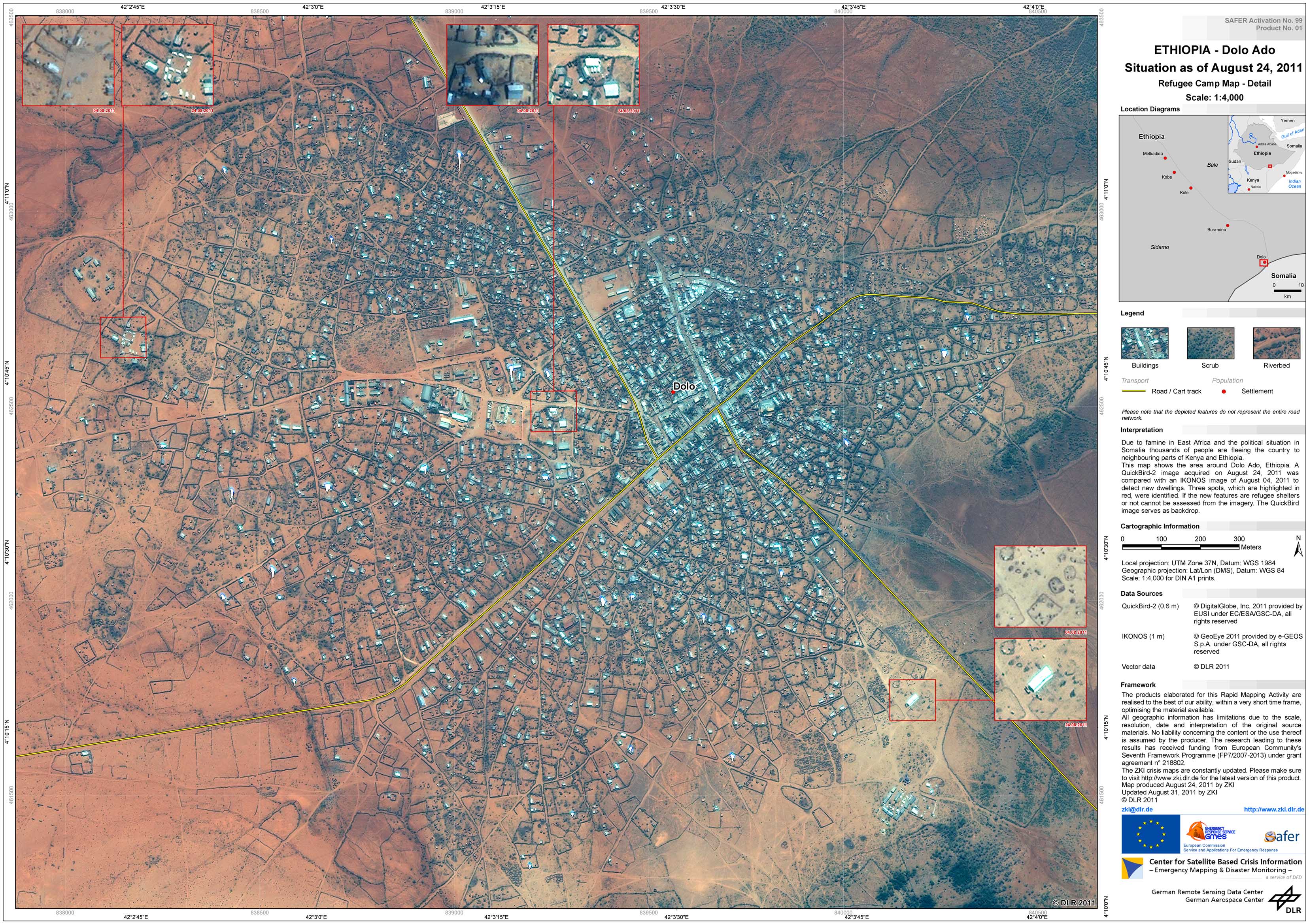
Ethopia - P16 - Dolo Ado - Refugee Camp Map - Detail
Creation Date 31. August 2011
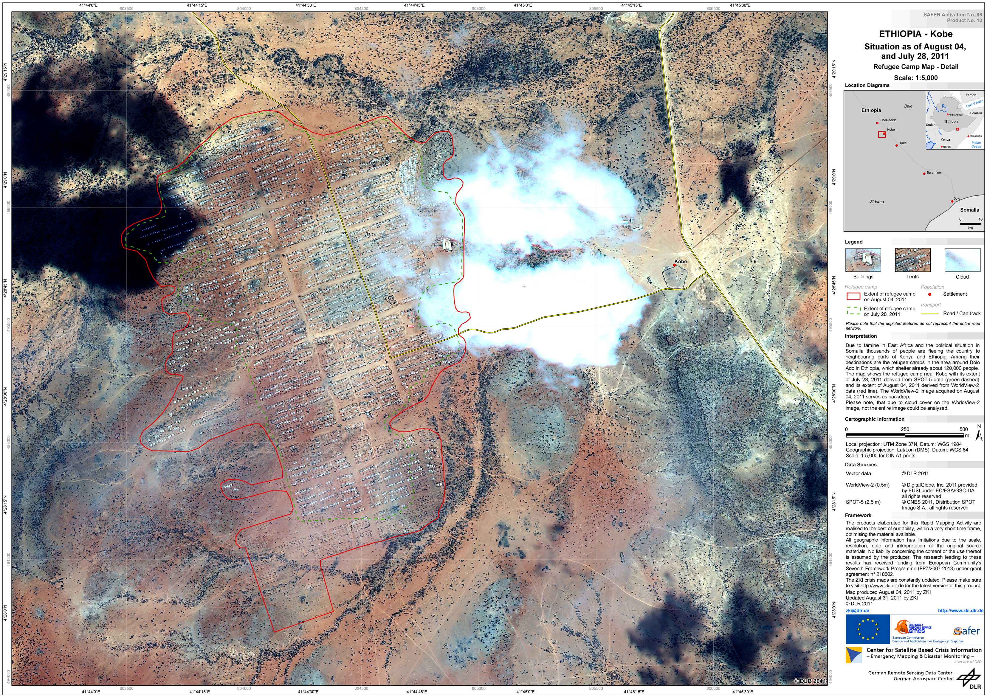
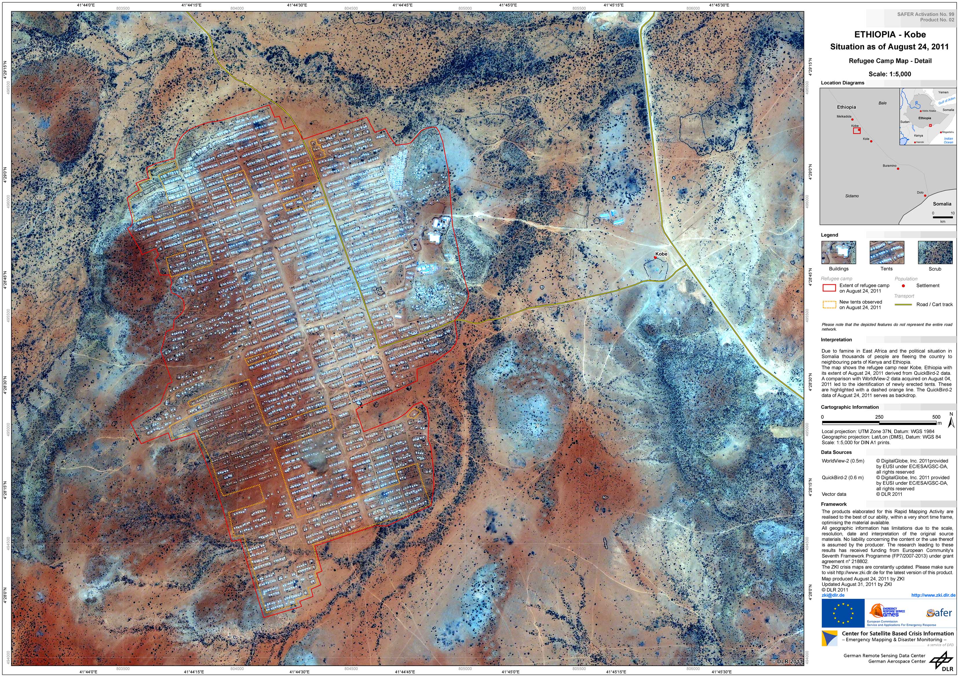
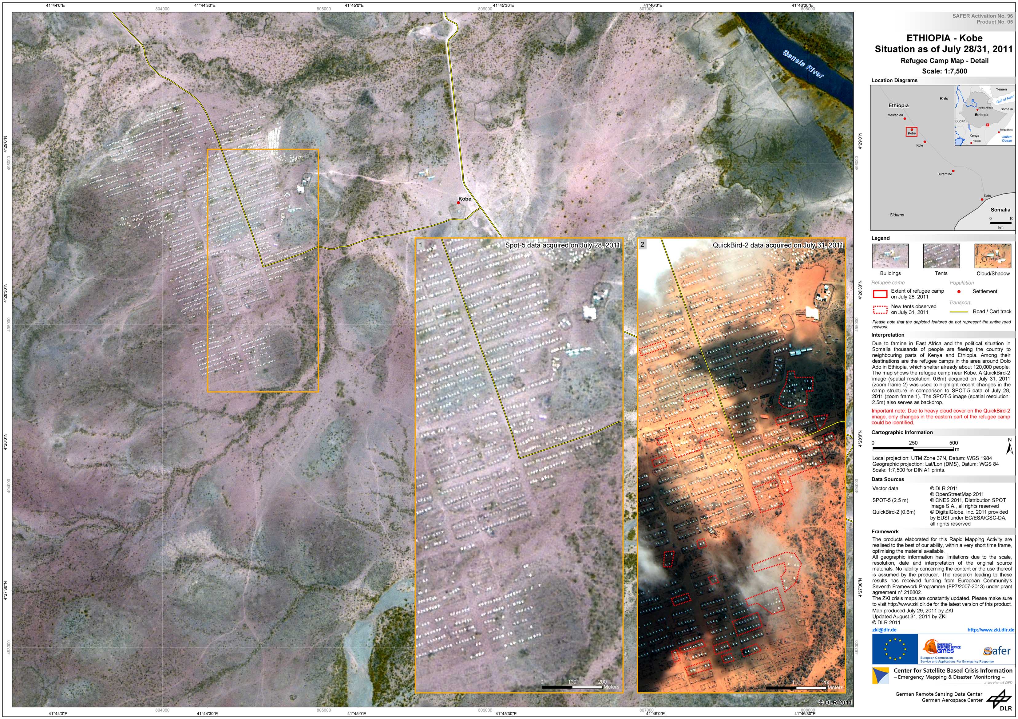
Ethopia - P15 - Kobe - Refugee Camp Map - Detail
Creation Date 31. August 2011
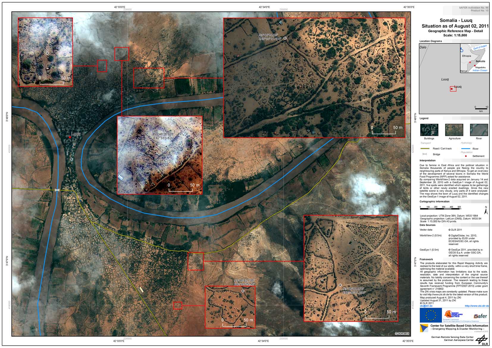
Somalia - P12 - Luuq - Geographic Reference Map - Detail
Creation Date 31. August 2011
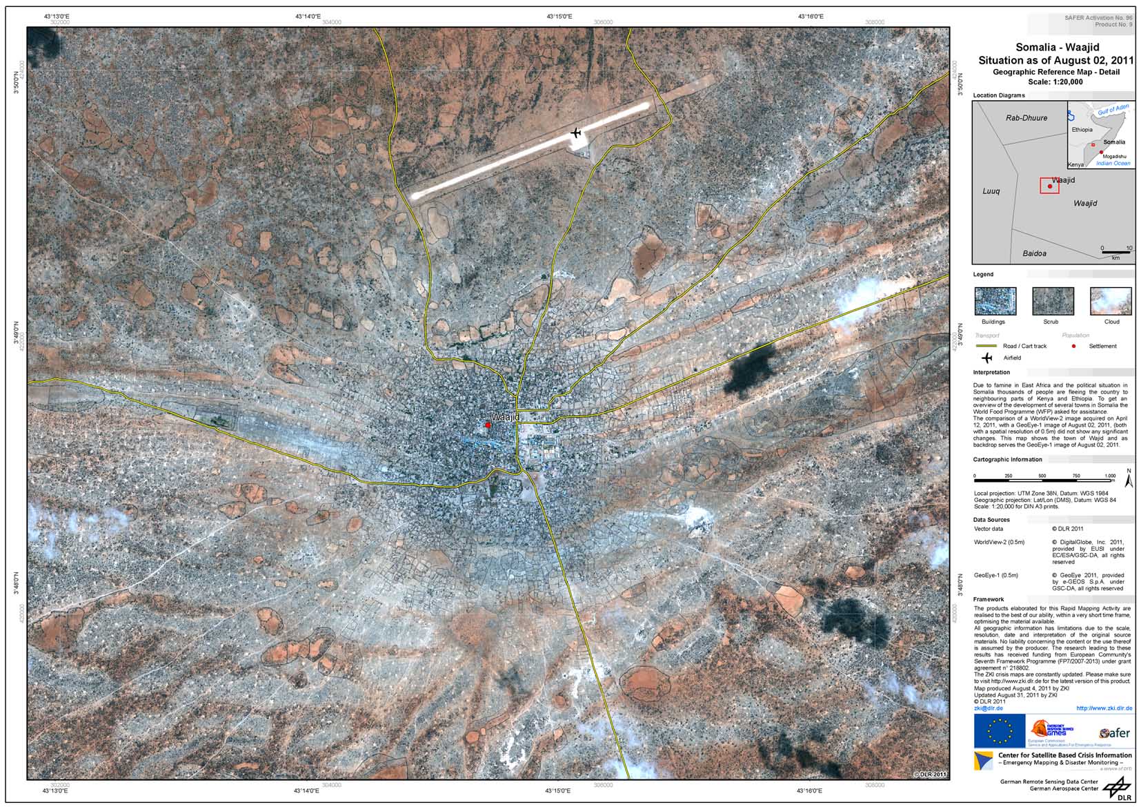
Somalia - P11 - Waajid - Geographic Reference Map - Detail
Creation Date 31. August 2011
Ethopia - P10 - Melkadida - Refugee Camp Map - Detail
Creation Date 31. August 2011
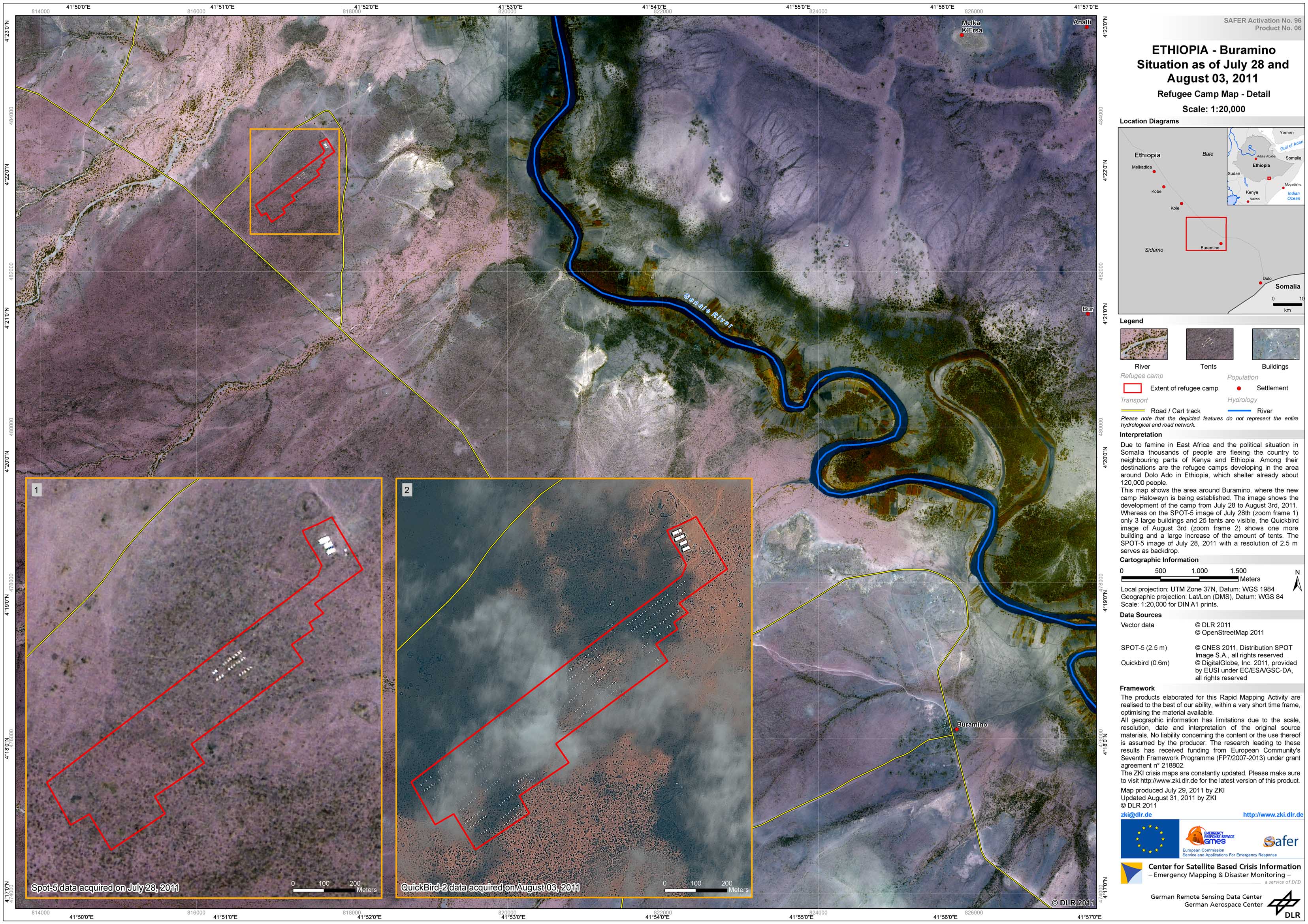
Ethopia - P08 - Haloweyn / Buramino - Refugee Camp Map - Detail
Creation Date 31. August 2011
Ethopia - P07 - Kobe - Refugee Camp Map - Detail
Creation Date 31. August 2011
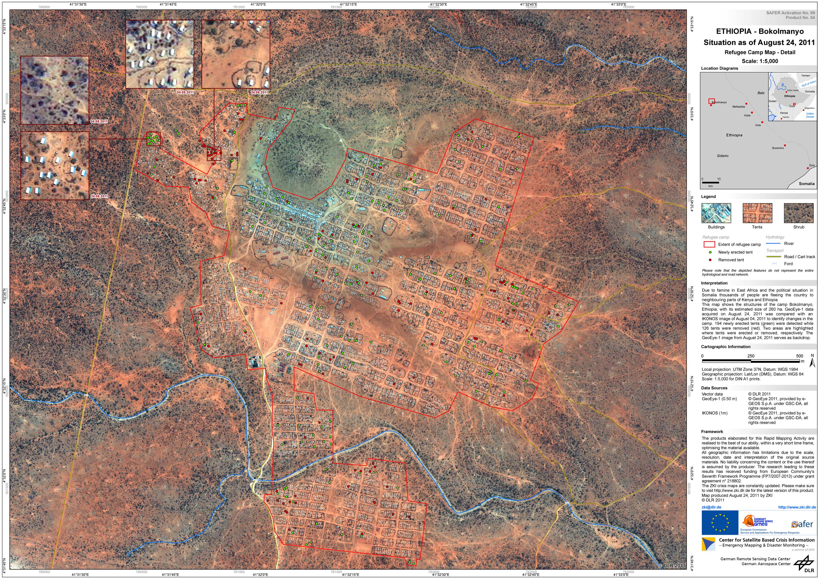
Ethopia - P19 - Bokolmanyo - Refugee Camp Map - Detail
Creation Date 25. August 2011
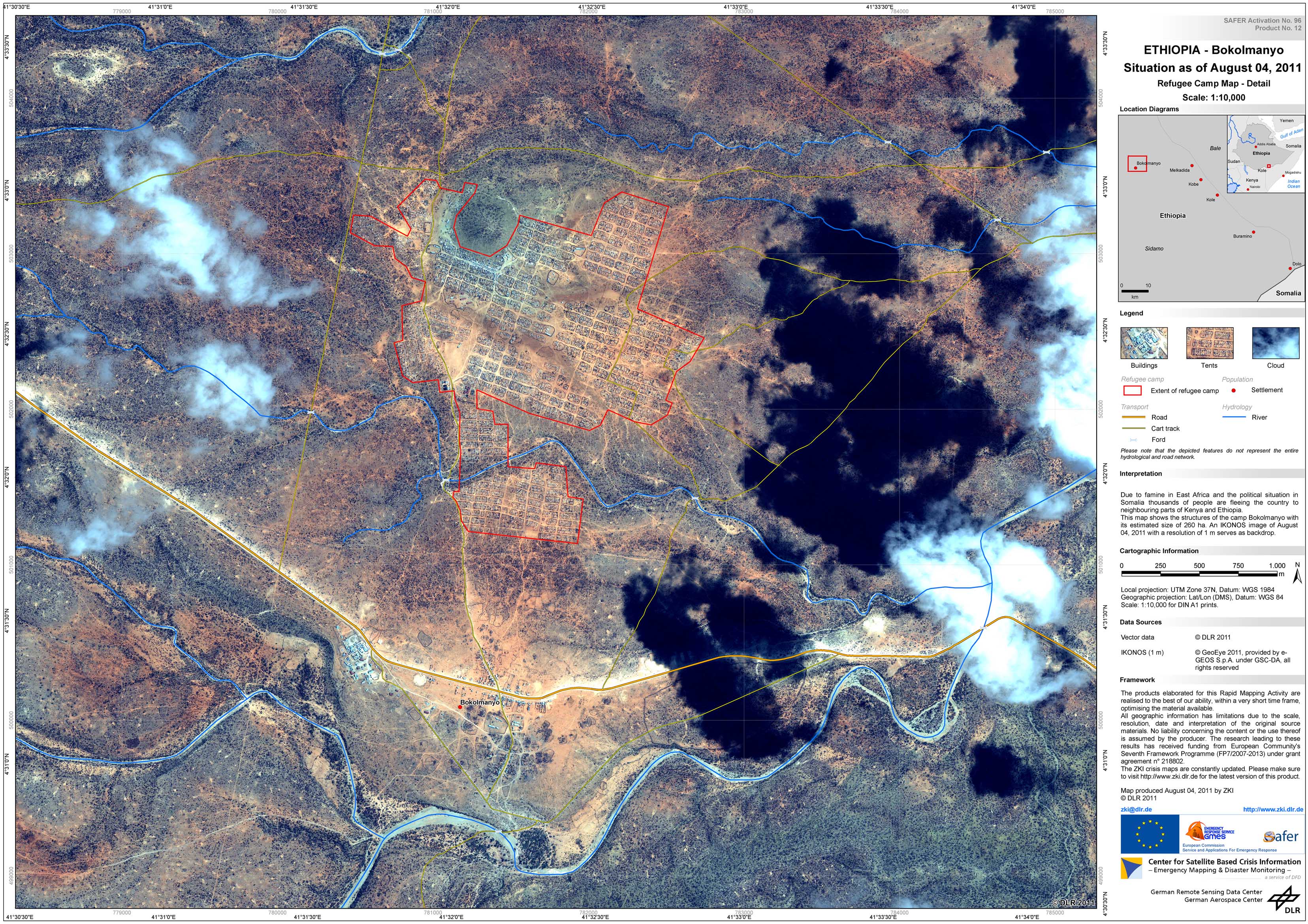
Ethopia - P14 - Bokolmanyo - Refugee Camp Map - Detail
Creation Date 04. August 2011
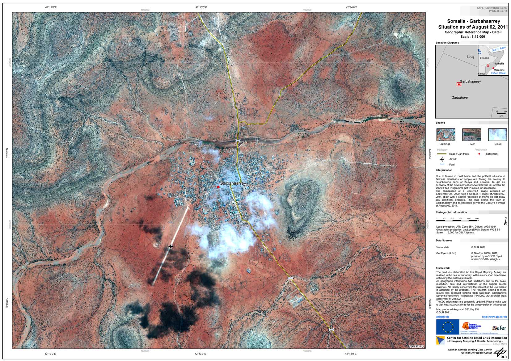
Somalia - P13 - Garbahaarrey - Geographic Reference Map - Detail
Creation Date 04. August 2011
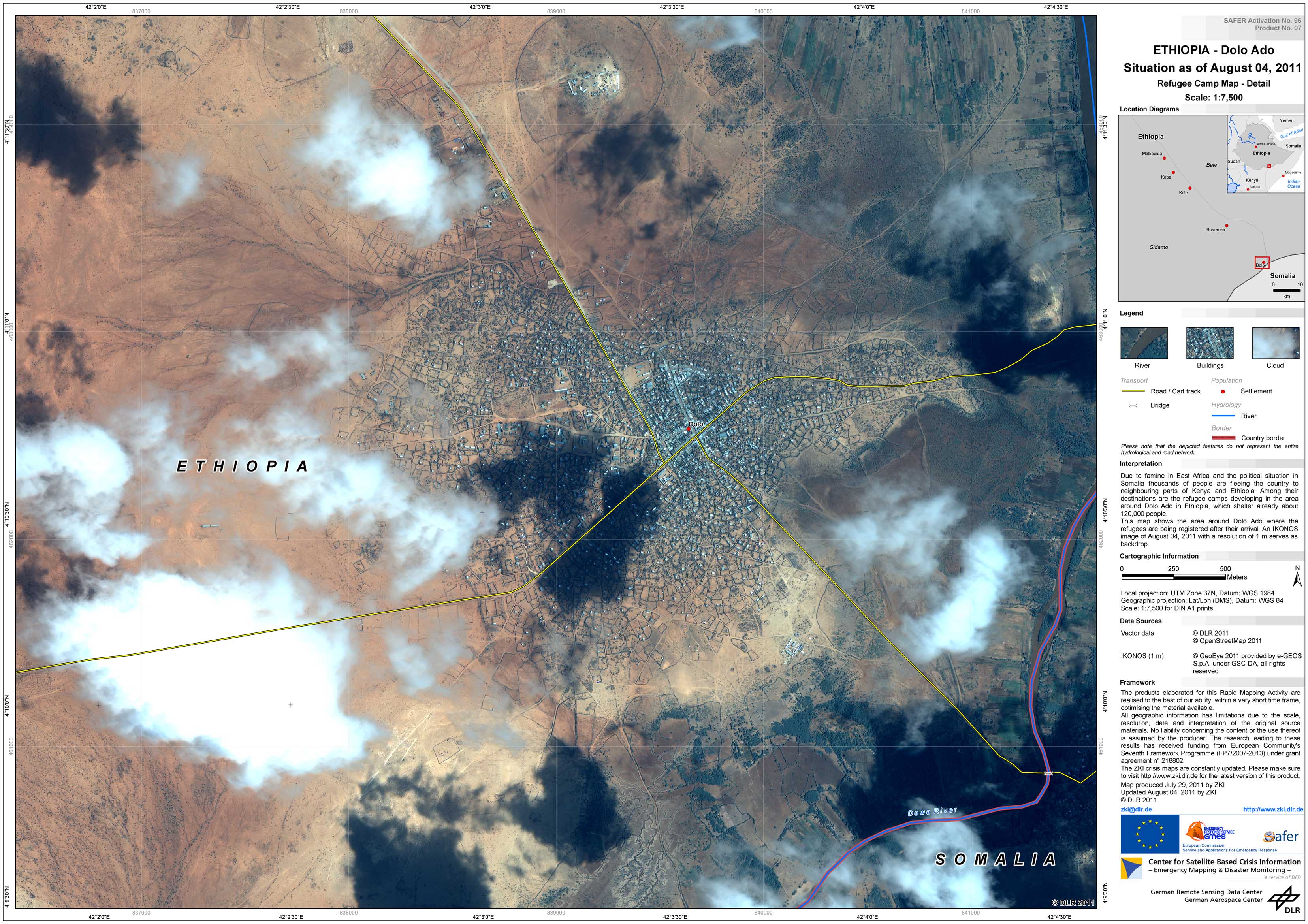
Ethopia - P09 - Dolo Ado - Refugee Camp Map - Detail
Creation Date 04. August 2011
Ethopia - P05 - Dolo Ado Region - Refugee Camp Map - Overview
Creation Date 02. August 2011
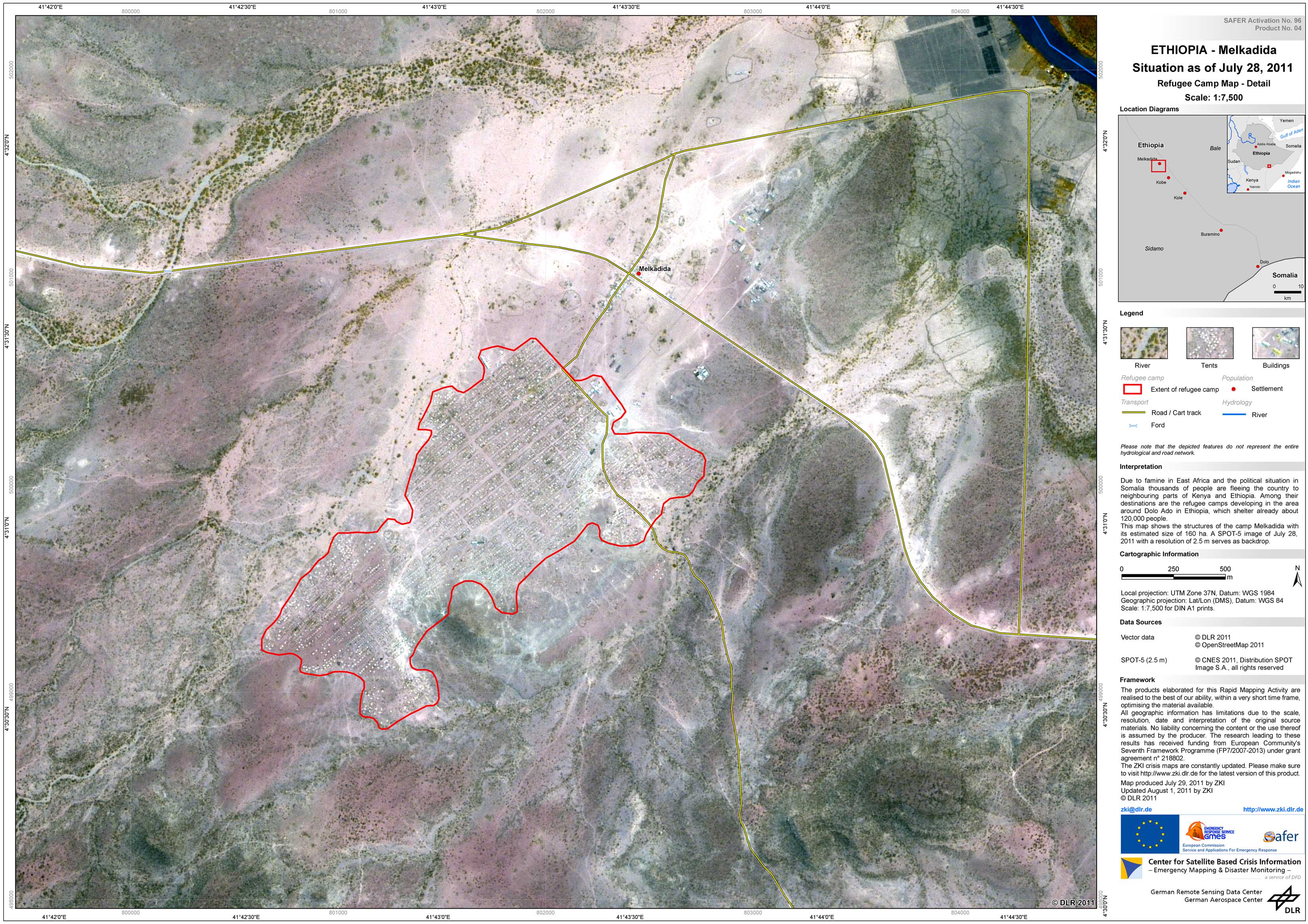
Ethopia - P06 - Melkadida - Refugee Camp Map - Detail
Creation Date 01. August 2011
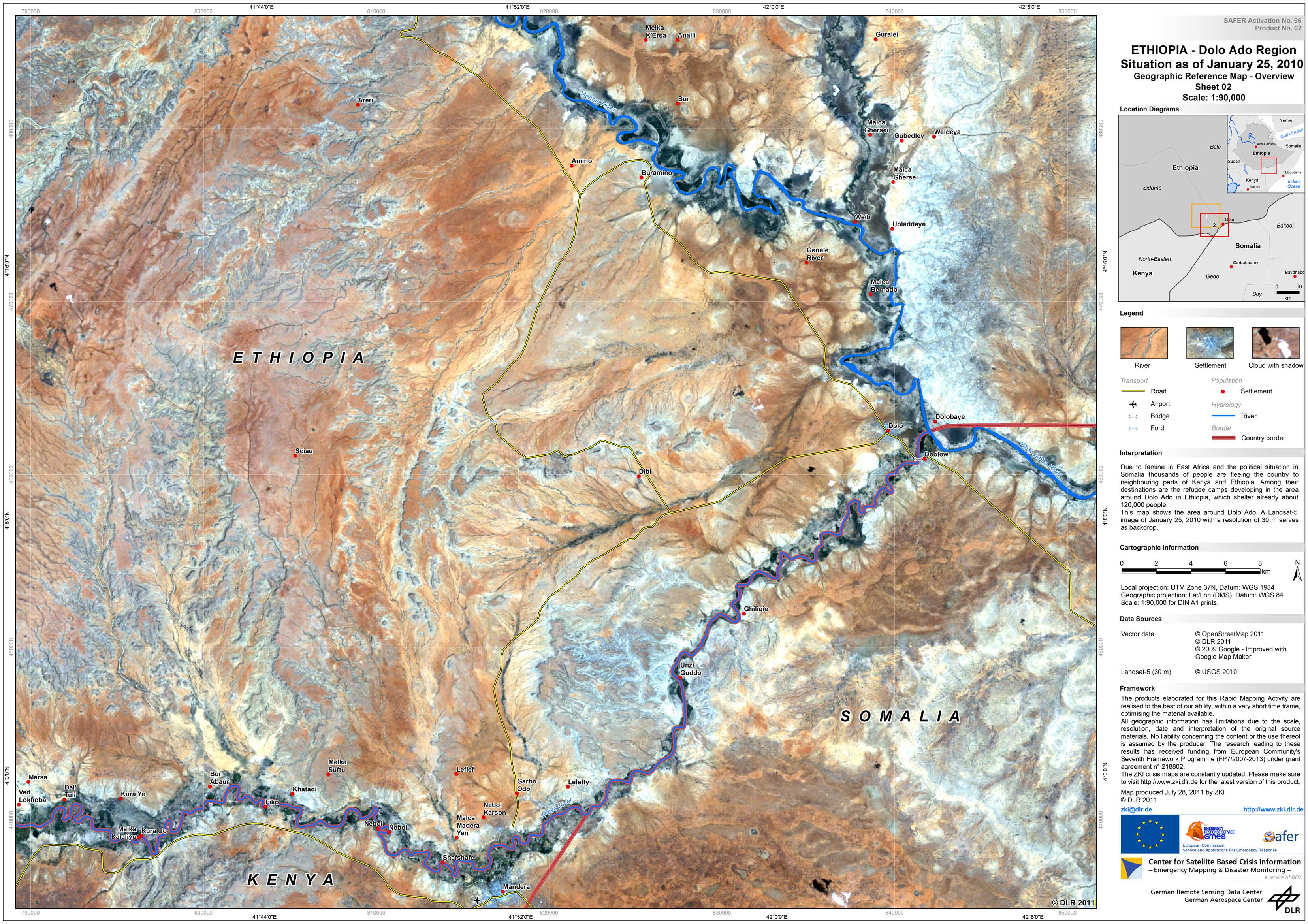
Ethopia - P04 - Dolo Ado Region - Geographic Reference Map - Overview - Sheet 2
Creation Date 28. July 2011
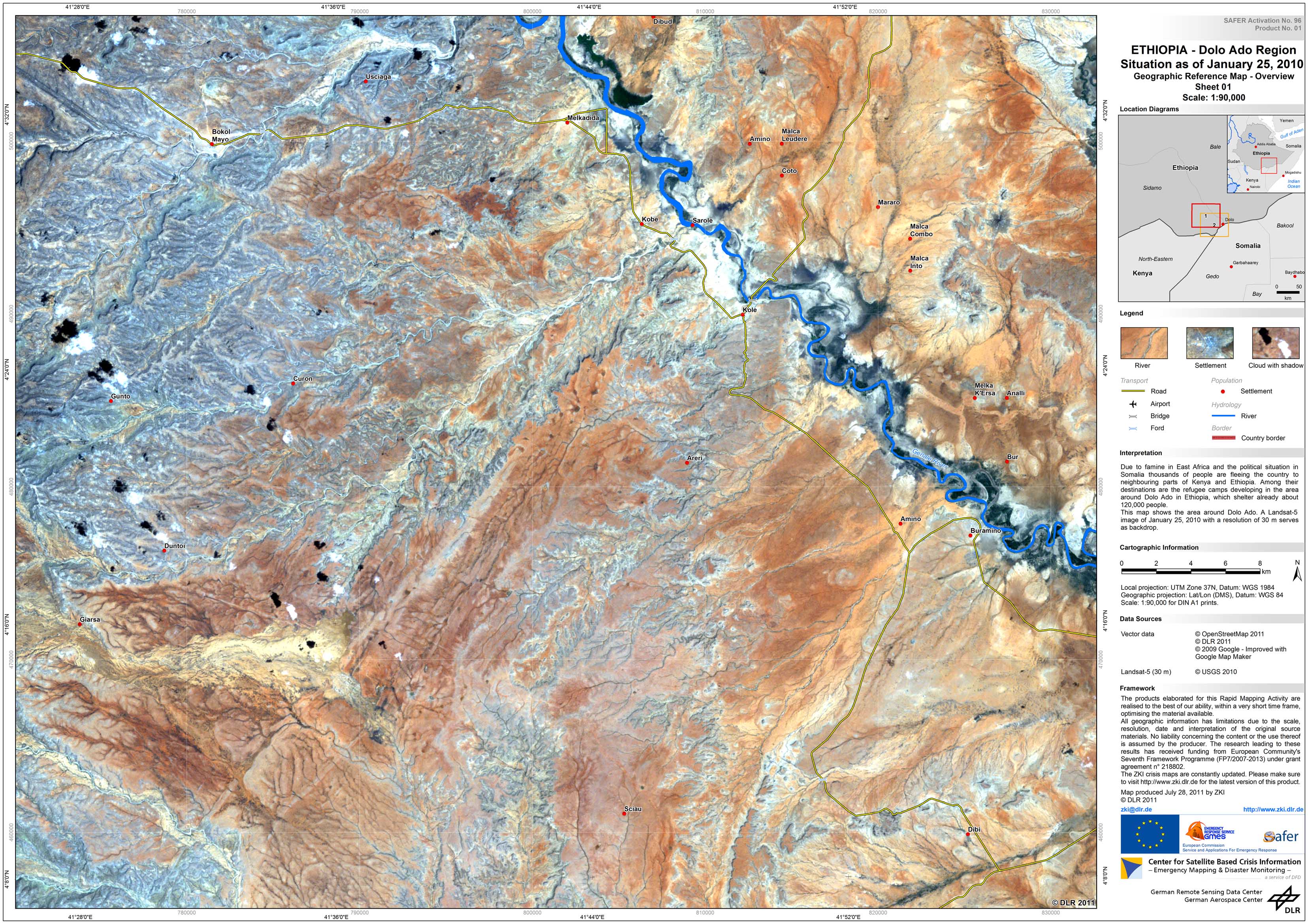
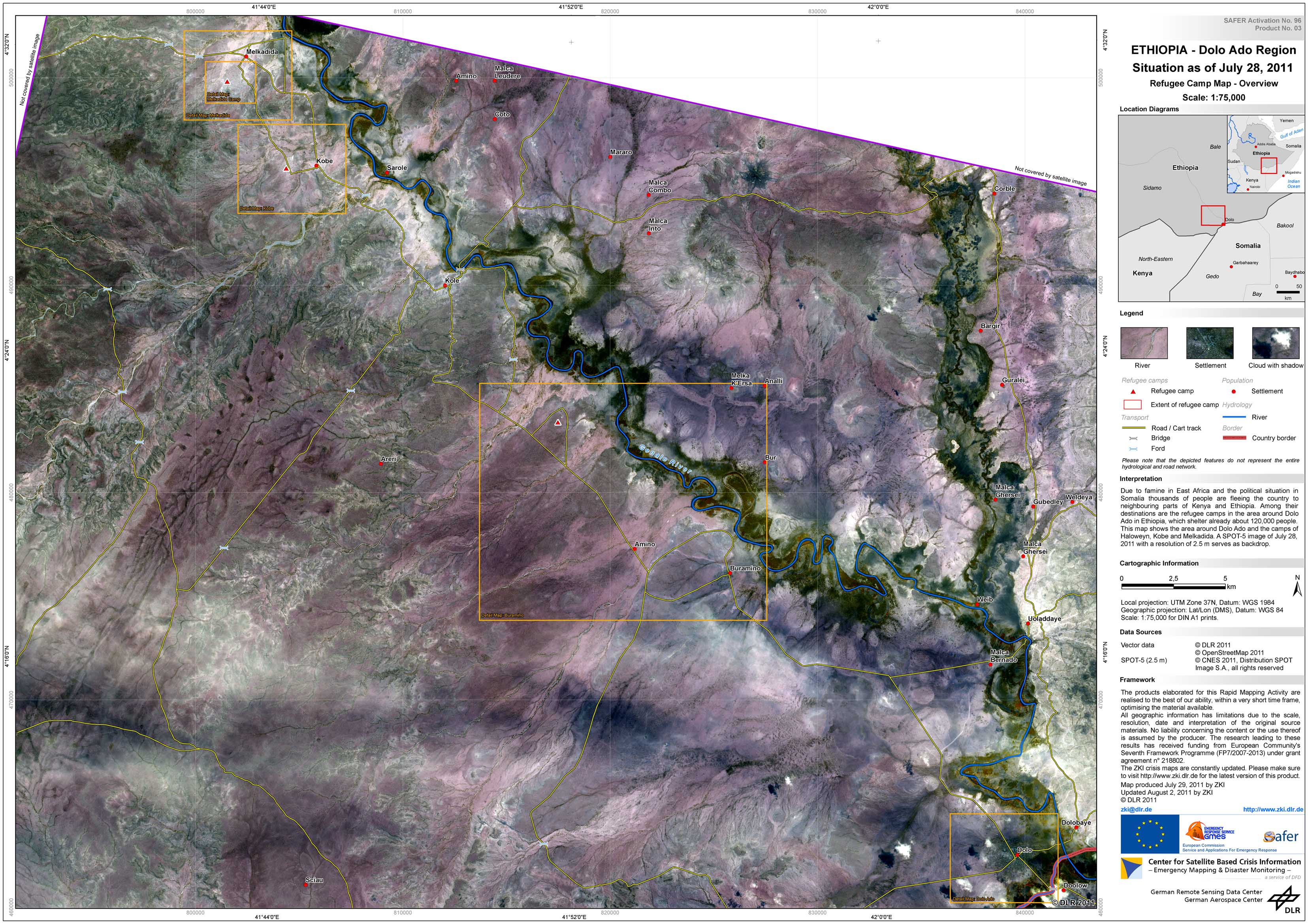
Ethopia - P03 - Dolo Ado Region - Geographic Reference Map - Overview - Sheet 1
Creation Date 28. July 2011
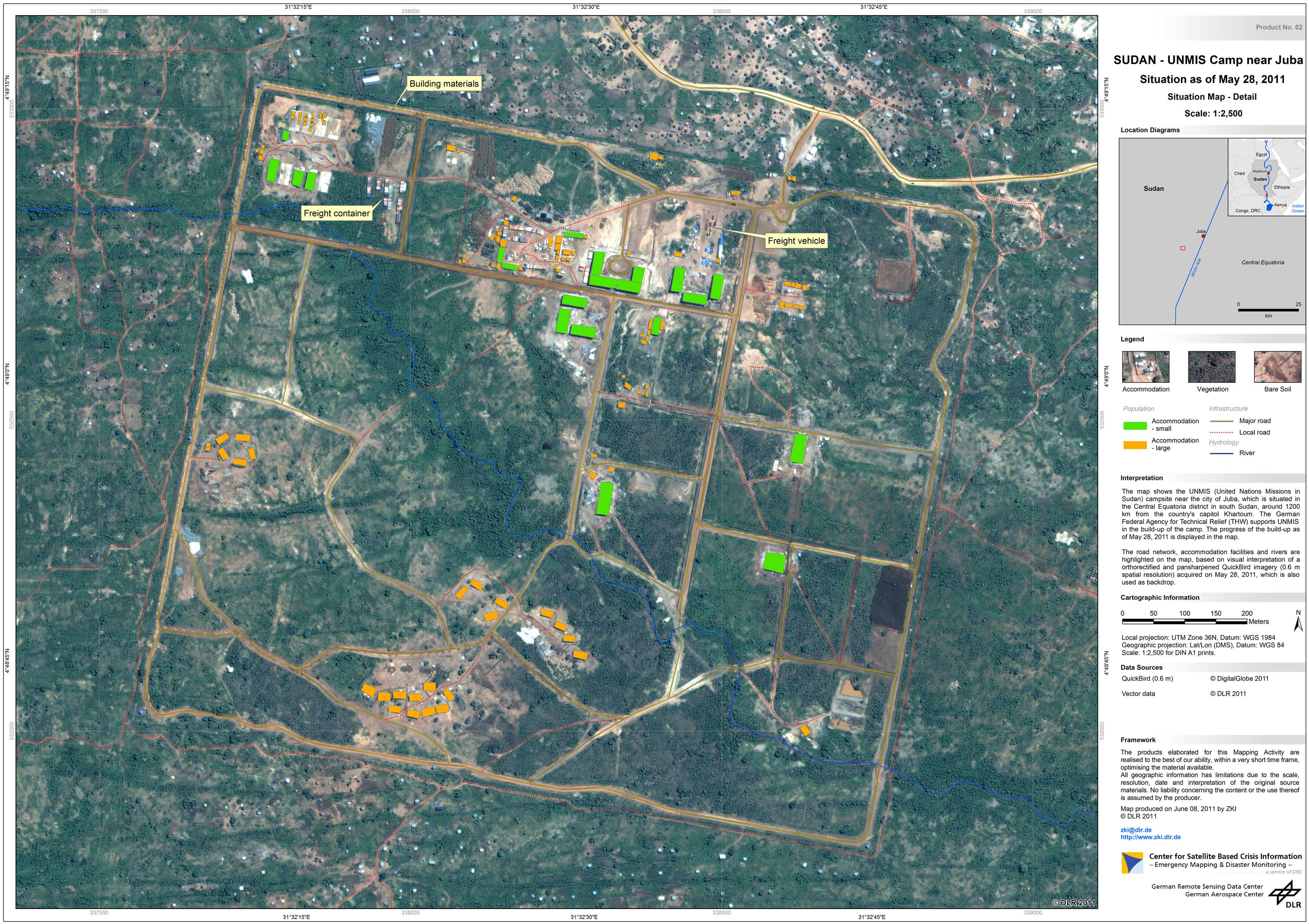
Sudan - P02 - Juba - UNMIS Camp near Juba - Detail Map
Creation Date 09. June 2011
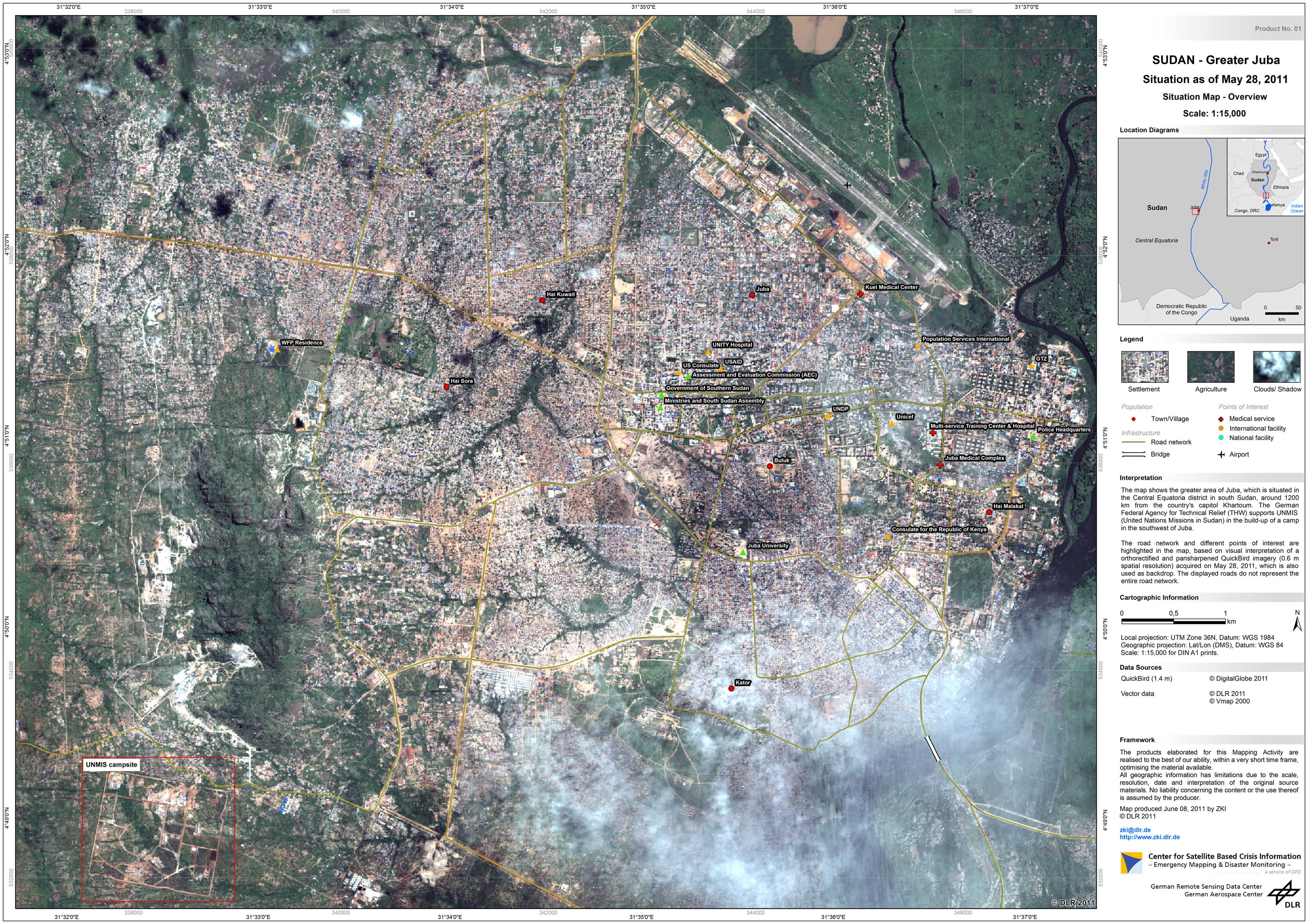
Sudan - P01 - Juba - Detail Map
Creation Date 09. June 2011